KTM’s new TFT touchscreen display includes advanced technological features and connectivity possibilities to improve the riding experience.
KTM continues implementing advanced technology on its motorcycles with its latest announcement of a new touchscreen TFT display with higher-quality graphics, more functionality, and better connectivity possibilities. This announcement comes on the heels of recent news about KTM’s new Automated Manual Transmission.
KTM’s new TFT dashboard has a 1,280×720-degree resolution and Anti-Reflex, Anti-Fingerprint, and Anti-Glare screen coatings. Impressively, the display now includes 256,000 colors compared to the previous TFT’s 65,000, and it’s more visible from all angles. Its touchscreen function is useable with or without gloves, and touchscreen shortcut buttons on the main screen eliminate the need for auxiliary switches for things like switching on heated grips or seat or turning on fog lights.
The new TFT has a split-screen function with five layout options. Now integrated into the connectivity is Offline Map Navigation to provide real-time navigation without needing to sync the motorcycle to a mobile phone.
The upgraded CCU3.0 connectivity unit has 32 GB of storage and 3 GB of RAM to run the Android Automative operating system. It allows for IoT connectivity with eSim, a GPS Antenna, Bluetooth, and wi-fi, which will make updates easier. For now, all updates must be done through a KTM dealer, but the unit will allow for over-the-air updates directly to the motorcycle in the future, extending the lifespan of this technology.
Additionally, the backlit switchgear has been revised to further enhance the riding experience. There is now a dedicated Ride Mode button, a new five-way joystick and back button, new cruise control buttons, a new automatic/manual button for models equipped with KTM’s Automated Manual Transmission, and new paddle buttons that are customizable for models without AMT.
The new TFT dashboard will first be available on premium KTM models, and KTM plans to add it to other models in the range in upcoming years.
In 2024, we tested Triumph’s new Speed 400 and Scrambler 400 X powered by a single-cylinder engine and priced at $4,995 and $5,595 respectively, so the Triumph Speed Twin 900 is no longer the entry-level option in the Modern Classics lineup. For 2025, the Speed Twin 900 is updated with freshened styling, improved suspension and brakes, and more technology, providing a sophisticated step up from the 400s.
2025 Triumph Speed Twin 900 in Pure White
Styling updates include a more sculpted tank, chiseled side panels, and updated throttle-body covers. The muffler is now shorter, and the headlight unit is more compact. The bike gets a new aluminum flip-up filler cap and a simpler design for the footpegs.
The Speed Twin 900 features a new aluminum flip-up fuel cap.
Updates to the chassis start with the suspension. Replacing the previous conventional fork is a Marzocchi inverted fork, and in the rear are twin Marzocchi shocks with piggyback reservoirs. Adjustment is limited to rear preload, and rear wheel travel has been slightly reduced from 4.7 inches to 4.3 inches. Also new is a stiffer and lighter aluminum swingarm.
The Speed Twin 900’s brakes also get updated for 2025. The previous axial-mounted front caliper is replaced by a Triumph-branded 4-piston radial caliper pinching a 320mm disc. In the rear is a Nissin 2-piston floating caliper biting a 255mm disc. The bike is fitted with Michelin Road Classic tires on the 18-inch front and 17-inch rear cast-aluminum wheels.
The Speed Twin 900’s new cast-aluminum wheels are wrapped in Michelin Road Classic tires.
The riding position has been updated with more available legroom, and the bench seat has a new shape to go with the narrower rear frame. Seat height is 30.7 inches, and an accessory low seat can lower the height to 29.9 inches.
The Speed Twin 900’s bench seat gets a new shape for 2025, which Triumph says provides more legroom and easier stand-over.
Regarding the Speed Twin’s tech updates, the bike now includes lean-sensitive ABS and traction control. It comes with two riding modes: Road and Rain, with the latter providing softer throttle response. New instrumentation includes an LCD display to show speed, rpm, and gear, paired with an integrated TFT display for extra info like riding modes. A USB-C socket on the side of the instrumentation allows charging devices while riding.
Instrumentation is updated with an LCD screen paired with an inset TFT display.
The TFT screen is compatible with the accessory heated grips and the Bluetooth Connectivity module. Cruise control is also available as an accessory.
A USB-C charging port on the side of the instrument allows riders to charge their devices on the go.
The Speed Twin 900’s engine remains the same, a liquid-cooled 900cc Bonneville parallel-Twin with a 270-degree firing order. It makes a claimed 63 hp at 7,500 rpm and 59 lb-ft of torque at 3,800 rpm. It comes with a slip/assist clutch and a 5-speed gearbox. The bike has a claimed wet weight of 476 lb and a fuel capacity of 3.17 gallons.
2025 Triumph Speed Twin 900 in Phantom Black
The 2025 Triumph Speed Twin 900 will be available in Pure White with blue and orange stripes, Phantom Black with dark gray stripes and gold accents, or Aluminum Silver with a splash of red. Pricing starts at $9,995, and bikes will begin arriving in dealerships in February 2025.
In Rider Rewind, a special section in 2024 issues that celebrates moments in Rider’s 50-year history, we showcased Motorcycles of the Year for 1990-2006 in the October issue and for 2007-2023 in the November issue.
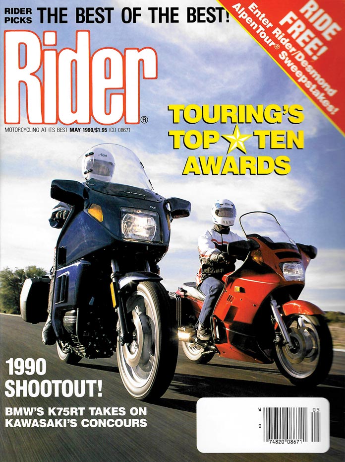
Our May 1990 issue included our Touring’s Top Ten Awards, the precursor of the Motorcycle of the Year award.
For the past 35 years, Rider’s editors have reviewed the annual batch of new and significantly updated motorcycles and narrowed them down to a handful of finalists. The Motorcycle of the Year is the bike we believe best fulfills its intended purpose and advances the state of motorcycle design, performance, and function.
Our May 1990 issue states “Among the eight motorcycle and two miscellaneous categories, there will be no ties, no honorable mentions. Just Touring’s Top Ten as determined by the Rider staff.”
In the early days, we published the Touring Top Ten, which included the best seven motorcycles in various categories, two general categories (such as Top Innovation), and a Motorcycle of the Year. We limited motorcycles to those in the current model year, and production timing used to be so early that we published the Touring Top Ten in the May issue.
As the magazine’s mission expanded, our annual awards evolved. In 1999 – our 25th anniversary – they became Rider’s Top Ten. In 2003, we adopted our current format of selecting a top tier of finalists and one winner. Production timing has changed such that the MOTY selection was pushed later into the year, and we began to include current and upcoming model years because they now often overlap.
The 1990 Bike of the Year was the BMW K1: “And even if the K1’s sizzling paint and aerodynamic bodywork fails to impress, with its unique Motronic ignition/fuel injection, Paralever rear suspension/swingarm that eliminates shaft-drive jacking and innovative approach to various rider conveniences – not to mention ABS – the K1 is truly a technological achievement for BMW, if not the motorcycle industry.”
For the 2024 Motorcycle of the Year, there were nearly 100 eligible contenders. We narrowed them down to 10 finalists and one winner.
Re-entering the motorcycle market after a decades-long hiatus, Can-Am has embraced the electric future with the Origin dual-sport and the Pulse roadster, which are propelled by a 11-kW Rotax E-Power motor with an 8.9-kWh battery, producing 47 hp and 53 lb-ft of torque. The bikes have innovative features like active regeneration and an enclosed drive chain in an oil bath with an automatic tensioning system.
CFMOTO has been selling motorcycles in the U.S. for only a few years, and it continues to expand its lineup. Its new Ibex 450 is a highly capable rally-style adventure bike powered by a 449cc parallel-Twin that makes 44 hp and 32.5 lb-ft of torque. Priced at just $6,499, it’s equipped with tubeless spoked wheels, switchable ABS and TC, adjustable suspension and seat height, and more.
Honda’s CB650R naked bike and CBR650R sportbike received expected updates like new styling, a TFT display, and revised switchgear. Unexpected was the new E-Clutch, which enables riders to start, stop, and change gears without using the clutch lever. Riders can switch between automatic and manual clutch operation, giving newbies a helping hand and veterans more flexibility.
In the evolution of the Husqvarna Svartpilen from 701 to 801, its 673cc Single was replaced with the 799cc LC8c parallel-Twin also found in KTM’s 790 Duke and 790 Adventure. Compared to the 701, the 801 has more horsepower (105), more torque (64.2 lb-ft), and a higher power-to-weight ratio. The “Black Arrow” is brimming with useful tech, is a full-tilt backroad bomber, and won’t break the bank at $10,899.
A decade after its 2015 debut, Indian’s Scout platform got a full makeover. The cast-aluminum frame was replaced with a tubular-steel unit, and the entire lineup is now powered by the SpeedPlus 1250 V-Twin, which produces 105 hp (110 on the 101 Scout) and 82 lb-ft of torque. Five models – Scout Bobber, Sport Scout, Scout Classic, Super Scout, and 101 Scout – are available in three trim levels.
SMT stands for “Supermoto Touring,” two words not normally used together to describe one motorcycle. The original 2010-2013 KTM 990 SMT was a touring variant of a big-bore Supermoto platform, while the new 890 SMT is a sport-touring variant of the 890 Adventure R mixed with some 890 Duke bits. With 17-inch wheels shod with sticky tires, it’s a hooligan’s dream with enough comfort for weekend getaways.
When Royal Enfield’s Himalayan adventure bike debuted in 2016, it was a solid but low-power, low-tech machine. It got a major overhaul this year, with a new liquid-cooled 452cc Single that makes more power (39.5 hp, up from 24) and torque (29.5 lb-ft, up from 24), a new chassis, and more modern features and styling. We were impressed with its capabilities when we tested it in the Himalayas.
The Suzuki GSX-S1000GT+, Rider’s 2022 MOTY, delivered “all the performance a street rider needs in a refined, comfortable, sophisticated package at a reasonable [price].” The new GX+ version is taller with a more upright riding position, blending sport-touring with attributes of an ADV to be the “supreme sport crossover.” It also has a 6-axis IMU and Suzuki’s first electronic suspension system.
Known for its 675cc-and-up sportbikes, ADVs, roadsters, and neo-classics, Triumph expanded its lineup with the Speed 400 roadster and Scrambler 400 X, both powered by a 398cc Single. They’re fun, stylish bikes that are beginner- and budget-friendly – just $4,995 for the Speed 400 and $5,595 for the Scrambler 400 X. If we’re going to attract the next generation, we need more bikes like these.
The MT-09 is a hugely popular bike for Yamaha, so much so that it is now in its fourth generation since being introduced in 2014. We’ve always been big fans of its rowdy inline-Triple. Updated for 2024, the bike is a riot to ride yet offers a high level of refinement and sophistication for $10,599. The SP version, which gets up-spec suspension and brakes, is even better.
Thousands of street-legal motorcycles have been released over the past 50 years, and we’ve ridden and evaluated as many of them as we could get our hands on. Most have been good, some have been great, but only a few have achieved icon status.
Two such motorcycles – Honda’s Gold Wing and BMW’s R-series GS – certainly qualify as icons, and both have won Rider’s Motorcycle of the Year award twice. The Gold Wing won in 2001 and 2018, and the BMW R-GS won in 1995 and 2005.
With the introduction of the R 1300 GS for 2024, BMW’s R-series GS can add a third Rider MOTY title to its long list of awards and accolades.
BMW R 1300 GS
Over the past two decades, the adventure-bike segment has exploded, and nearly every manufacturer offers multiple adventure models, ranging in size from less than 400cc to well over 1,200cc. The genesis of this trend – one of the few bright spots in the motorcycle industry since the Great Recession of 2008 – can be traced back to 1980, when BMW launched the R 80 G/S. It was the first motorcycle that delivered on-road comfort and performance and genuine off-road capability in equal measure.
The R-series GS evolved steadily over time, with engine displacement increasing, new features and technology being added, and market share growing. The R-series GS is BMW’s bestselling model, and the one-millionth boxer-powered GS was built in mid-2023. Last September, on the 100th anniversary of BMW Motorrad’s first production motorcycle, the new R 1300 GS was unveiled.
BMW R 1300 GS
Development of the R 1300 GS started seven years ago – two years before the R 1250 GS was introduced. Having squeezed as much as possible out of the existing platform, which started with the R 1200 GS introduced in 2004, BMW knew that taking the R-series GS into the future and maintaining its position in the market required a clean-sheet design. Only the butterfly valves and a few bolts and connectors carry over from the R 1250 GS.
The design objectives were to make the R 1300 GS lighter, more compact, more powerful, and more capable than its predecessor. The new GS weighs 26 lb less than the R 1250 GS. Displacement increased from 1,254cc to 1,300cc, peak horsepower was boosted from 136 to 145, and peak torque increased from 105 to 110 lb-ft.
BMW R 1300 GS
The R 1300 GS has new electronic rider aids, a completely new frame, and upgraded EVO Telelever and EVO Paralever suspension with optional adaptive vehicle height control. The GS’s new styling has been somewhat controversial, particularly its more aerodynamic bodywork and X-shaped matrix headlight, but BMW designers wanted to set the R 1300 GS apart from its predecessors.
After test riding the R 1300 GS on- and off-road at its global launch, we had this to say: “Hands down, the R 1300 GS is the best GS yet. The traits that the boxer-powered GS are known for – engine character, balance, comfort, and versatility – are better than ever. It looks and feels much slimmer than before, and the increased power and torque are impressive.”
Congratulations to BMW for the R 1300 GS, Rider’s 2024 Motorcycle of the Year!
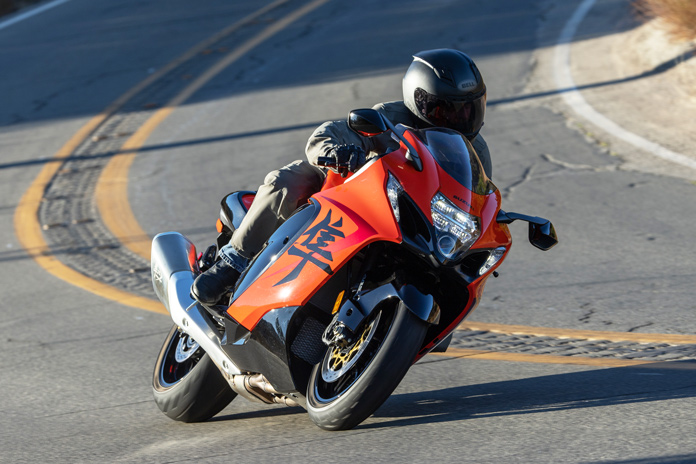
The Hayabusa has been burning up roadways for a quarter century and has become a sportbike icon. Speed comes easy for the Busa, so whether your destination is the end of a dragstrip or another state, it can get there quicker than almost anything else on wheels. (Photos by Kevin Wing and courtesy Suzuki.)
There are countless excellent motorcycles in the world, but there are just a few veritable icons. Of all the Japanese bikes launched in the last 25 years, the Suzuki Hayabusa is perhaps most worthy of icon status.
The Hayabusa is globally renowned for major-league power, seen here in its third generation.
The sportbike paradigm shifted in 1999 when Suzuki introduced the GSX1300R Hayabusa. It had the most powerful engine in a production motorcycle and aerodynamic bodywork that looked like nothing else on the road.
The Suzuki Hayabusa celebrates 25 years with a special-edition 25th Anniversary Edition model.
For a quarter century, the Hayabusa has defined what an ultra-fast motorcycle should be. More than 200,000 Busas have found their way into the hands of speed-addled enthusiasts, from lightning-quick dragracers to sport-touring mavens who strap on luggage and blaze highways at blurring speeds.
Fast Design | Suzuki Hayabusa
There’s always been a need for speed, and velocities ramped up in 1990 with the introduction of Kawasaki’s ZX-11, which could exceed 170 mph. Honda retaliated in 1996 with its CBR1100XX Super Blackbird, which could hit 174 mph.
An early design sketch shows more conventional styling than the bulbous bodywork and stacked headlights that became Suzuki Hayabusa hallmarks.
Suzuki wanted in on this high-speed action and began developing a monumental motorcycle, with the goal of being “the most powerful production bike in the world, but at the same time have usable, rider-friendly performance.” We weren’t quite prepared for the groundbreaking machine that emerged from Suzuki’s drawing boards.
Over three model generations, wind-tunnel testing has ensured the Busa is as slippery as possible.
Big speed requires keen attention to aerodynamics, so Suzuki’s new flagship would need to slip cleanly through the air to become the king of speed. The fastest animal in the world is the peregrine falcon, a bird renowned for its ability to hit 200 mph during a steep dive.
Suzuki drew inspiration for the Hayabusa’s design from the peregrine falcon, the fastest animal on earth.
The Japanese word for the falcon is “hayabusa,” and the kanji character for the word was emblazoned on the bike. Peregrine falcons sometimes eat blackbirds for lunch, and so would the motorcycle that shares its Japanese name.
At the bike’s launch in 1999, Suzuki proclaimed class-leading aero. The Busa’s bullet-shaped nose featured a stacked headlight arrangement to narrow the bike’s frontal area. The front turnsignals were integrated into the nose to help funnel air to the pressurized airbox to boost power at high speeds.
With sculpted bodywork, integrated front turnsignals, and stacked headlights, the Hayabusa’s styling broke new ground.
The Busa’s chassis was more conventional: a twin-spar aluminum frame with an inverted fork and a monoshock, both fully adjustable. Offsetting the bike’s 550-lb curb weight was a 24.2-degree rake (the steepest in the category) and a mere 3.9 inches of trail. A 58.5-inch wheelbase and a steering damper helped provide high-speed stability. The front brakes featured 6-piston Tokico calipers biting on 320mm discs.
The kanji character on the bodywork is the Busa’s calling card.
Fast and Furious | Suzuki Hayabusa
Suzuki used lessons learned in developing its GSX-R motors, using 81mm forged-aluminum pistons reciprocating over a 63mm stroke to yield 1,299cc. The Busa also featured fuel injection, a novelty in that era, and an air injection system minimized emissions without hurting performance. A 4-2-1-2 exhaust included a catalytic converter to keep it EPA-legal. A gear-driven counterbalancer reduced vibration.
In 2003, a limited-edition Suzuki Hayabusa with metallic orange paint and special badging celebrated the 40th anniversary of American Suzuki.
Suzuki blew us away with an unprecedented 173 crankshaft horsepower. That number dwarfed the GSX-R1100W’s output by 20 horses and easily outgunned Honda’s Blackbird. Put it all together, and the Busa was able to reach an astounding 194 mph when tested by Cycle World.
The Hayabusa’s engine architecture has stayed essentially the same for 25 years. Displacement increased from 1,299cc to 1,340cc in its second generation.
I got my first crack at the Busa in 1999 and was thrust into hyperspace. “It’s mind-bendingly fast,” I wrote, “and the explosions inside the engine feel like little sticks of dynamite are being fed through the intake valves, igniting the mixture with greater force than what had been considered possible from a production streetbike.”
The three model generations – Gen 1 on the left, Gen 2 on the right, and Gen 3 in the middle – show the evolution of styling yet all are unmistakably Hayabusas.
During dyno testing, the motor piled on at least 20 hp every 1,000 rpm from 2,500 to 7,500 rpm! Additionally, it generated 73 lb-ft at just 2,500 rpm, the same torque as Yamaha’s 1999 YZF-R1 made at its peak. Describing the Busa as “fast” is like calling the Sistine Chapel “pretty.”
Also impressive was the bike’s finish quality, which exceeded most other Suzukis of the era. Its 10-disc back-torque limiting slipper clutch was stout, and its 6-speed gearbox shifted precisely.
The three model generations – Gen 1 on the left, Gen 2 on the right, and Gen 3 in the middle – show the evolution of styling yet all are unmistakably Hayabusas.
Fast Limit | Suzuki Hayabusa
Kawasaki didn’t like Suzuki stealing the top-speed throne and retaliated in 2000 with the 178-hp ZX-12R. Surprisingly, it could only reach a top speed of 186 mph. That’s when we learned that manufacturers had voluntarily agreed to an arbitrary speed limit of 300 kph (186 mph) to avoid potential regulations on sportbikes. The top-speed wars ended by unofficial decree.
The Hayabusa graced the cover of Rider’s March 2008 issue when we compared it to Kawasaki’s Ninja ZX-14.
The Hayabusa again graced our cover in September 2021 with the launch of the third generation.
Meanwhile, the Hayabusa kept on rolling as the poster child for motorcycle excess. Wild custom paint jobs covered the Busa’s distinctive bodywork, turbos and nitrous kits were added, and extended swingarms with fat tires became all the rage.
But it wasn’t just sportbike jockeys who appreciated the Hayabusa’s effortless speed. Travelers who needed to get to faraway places in a hurry often chose Busas as sport-touring rigs, creating the hypersport-touring niche.
Outfitted with a tankbag and a tailbag, the Hayabusa becomes a hypersport-tourer.
The Busa’s rivals were vastly overshadowed by its massive impact on this market – more than 115,000 Gen 1s were sold. The Blackbird’s run ended in 2002. Kawasaki revamped its 1,198cc ZX-12R in 2002, but it wasn’t able to elbow its way into the Busa’s dominance among speed freaks.
Fast Reignition: Gen 2 | Suzuki Hayabusa
Kawasaki killed off the 12R and replaced it in 2006 with the ZX-14. It was a worthy challenger but lacked the Busa’s rowdiness and street cred. The slugfest escalated in 2008 when Kawasaki introduced the ZX-14R and Suzuki gave the Busa its first significant makeover.
The engine’s displacement was bumped to 1,340cc by increasing its stroke 2mm. Lighter and stronger forged pistons bumped compression up to 12.5:1, and a forged crank spun chromoly rods shot-peened for extra strength. Up top were 16 titanium valves, and new camshafts offered greater lift and revised timing. Cam-chain tension was switched over to a hydraulic system.
Suzuki claimed a 12% improvement in horsepower, stretching to 194 hp at the crankshaft, a 21-horse boost. Torque was bumped 8.5% to 114 lb-ft. Harnessing the bigger power was a revised clutch that offered better feedback and employed the Suzuki Clutch Assist System.
The ultimate speedy commuter.
Modest chassis tweaks included fork sliders with a DLC coating to minimize stiction, a stiffer swingarm, and upgraded Brembo 4-piston radial calipers. Refreshed bodywork featured smoother body panel joints with hidden fasteners and a tailsection with integrated turnsignals that were said to evoke a jet-engine exhaust.
The bike looked sharper and more modern without losing its distinctive appearance, but it was saddled with a pair of ungainly triangular mufflers – a product of new emissions standards. Curb weight went up by 7 lb, and so did sales of aftermarket exhaust systems.
Ergonomic tweaks consisted of a lower fuel tank so riders could better tuck behind the taller windscreen and a lowered rear subframe with a plusher rear seat. The tailsection included attachment points for securing luggage, and the area under the solo-seat hump offered additional storage.
The revised Busa was faster, handled better, and stopped with more authority, and it offered steering that was more neutral and direct than the formidable ZX-14R. As usual, the Busa impressed with its effortless power output. In Rider’s 2008 comparison test, Bill Stermer quipped: “Being in a dither about whether they make more power is like wondering if Jennifer Lopez would be more attractive if she parted her hair differently.”
Fast Money | Suzuki Hayabusa
Motorcycle sales had been on an unprecedented upward surge during the 2000s. Hayabusas were soaring off showroom floors, and aftermarket support was robust.
The Hayabusa’s fluid curves and shapes not only enhance aerodynamics but also convey a sense of speed.
But then the Great Recession hit, and motorcycle sales dropped by more than half almost overnight. The battles for hyperbike supremacy took a hiatus until 2012 when Kawi unveiled a new ZX-14R, which packed 1,441cc of heat that trumped the Busa on the dyno by 17 hp. But the Suzuki was 11 lb lighter and was able to give its rival a run for the money. I logged a blistering 9.8-second E.T. on the Busa at the dragstrip, just a tenth behind the Kawi.
As recessionary forces continued to depress the moto market, the colorful hyperbike scene faded.
Fast Gen 3 | Suzuki Hayabusa
The Busa’s third generation was introduced in May 2021 and labeled “The Refined Beast.” Billed as a 2022 model, it received a styling update yet was unmistakably a Hayabusa. Suzuki slathered its new hyperbike with the latest technology and priced it at $18,599.
The Hayabusa entered its third generation with the 2022 model.
Never before could you get a Busa with TFT instrumentation, cruise control, a bi-directional quickshifter, or traction control, but those all became standard equipment. Brakes got an upgrade with the addition of Brembo’s vaunted Stylema calipers paired with 320mm discs and cornering ABS. The Busa’s IMU-based electronics package includes six riding modes and adjustable traction control, engine braking, and wheelie control, along with launch control and hill-hold control.
In homage to the original, the new Busa’s instrument panel includes analog gauges that, as in 1999, use stepper motors to ratchet up the needles to their max values when the ignition is switched on. A small TFT display sits in the center.
Analog gauges are augmented by a central TFT panel.
The engine architecture and displacement carried over into Gen 3, but most internal components were lightened, strengthened, or refined for less friction. Cam profiles were revised to reduce valve lift overlap and help achieve Euro 5 emissions standards. A new exhaust system shaved 4.5 lb, bringing the bike’s curb weight to 582 lb.
Suzuki rates the 1,340cc inline-Four at 188 hp, down 6 ponies from previous but with additional low- and midrange power. When we tested the Busa on Jett Tuning’s dyno, it generated a vigorous 173 hp and 106 lb-ft of torque at its rear tire.
Fast 25 | Suzuki Hayabusa
It’s exceedingly rare when a motorcycle model endures for a quarter century, so Suzuki celebrated the milestone with a special 25th Anniversary Edition Hayabusa in 2024. It features a special Glass Blaze Orange / Glass Sparkle Black paint scheme, a 25th-anniversary emblem atop the fuel tank, and anniversary logos etched on each muffler.
The Hayabusa’s third generation debuted in 2021 as “The Refined Beast,” updated with IMU-based electronics, a TFT instrument display, and cruise control.
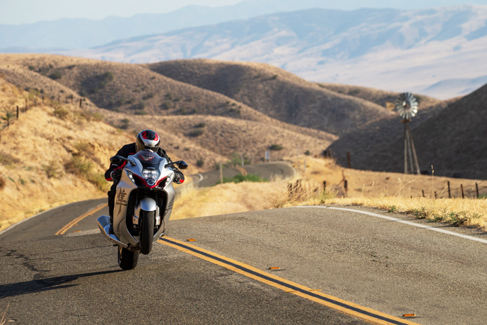
I had the honor of putting some miles on one and revisiting the majesty of the venerable Busa. As usual, the engine is so omnipotent that it makes the numbers on the speedo seem like they’re in kilometers per hour rather than mph. Traveling at 100 mph is absolutely effortless, so riders need to keep a watchful eye on the speedo or risk running afoul of speed limits. First gear alone will take you to 85 mph.
The 25th Anniversary Edition’s color scheme harkens back to a Gen 2 favorite.
The bike exhibits confident and stable handling, and the stiff chassis responds immediately without any flex. The KYB suspension is well-dialed, and the 31.5-inch seat retains the cushiness of previous Busas, but there’s not much room between the saddle and the high footpegs. The reach for the bars is relatively long, but the fairing offers excellent wind protection for a sportbike. Its 5.3-gallon tank offers a touring-worthy 200 miles of range.
The mufflers are etched with the anniversary logo.
Fast Legacy | Suzuki Hayabusa
The Hayabusa’s 25-year run proves that nothing exceeds like excess. The Busa’s legendary lump of an engine continues to thrill riders today, and it has proven to be almost unkillable – some owners have racked up six-figure mileage on the odometer.
But the Busa is more than just one of the fastest earth-bound missiles ever created. Its bulbous and smooth styling, which previously looked almost cartoonish, has become a staple of sportbike design and continues to impress passersby. While the Hayabusa is overkill for tight twisty roads, its cocktail of speed and style makes for high levels of excitement on wide-open asphalt from coast to coast.
We are wary of using the term “icon” to describe a motorcycle, but the word certainly fits when it comes to Suzuki’s incredible Hayabusa. The king still reigns.
The kanji character on the side fairings is set off with a red graphic.
The 2025 Ducati Scrambler Full Throttle (left) and Icon Dark (right) are the latest variants to join the Scrambler platform.
Unveiled at the 2025 Ducati World Première, the Icon Dark and Full Throttle variants of the Ducati Scrambler give customers more options to choose a bike that best suits their preferences. Other than styling updates, the Scrambler platform remains mostly unchanged since its update in 2023.
2025 Ducati Scrambler Icon Dark
The Icon Dark is a black-on-black model with minimalist styling that opens the door for customization. It includes a teardrop tank with a Scrambler logo on it and a rear mudguard.
Icon Dark
The Full Throttle’s styling helps it stand out from the crowd with gold wheels, a Termignoni exhaust, a lower handlebar, a more prominent logo on the tank, and side panels with inscribed number 62 for the year the Ducati Scrambler debuted, 1962. It also includes a short front mudguard, a tail without a rear mudguard, Ducati Performance LED turnsignals, and an up/down quickshifter.
The Scrambler platform was revamped in 2023. It’s powered by an air-cooled 803cc V-Twin with a desmodromic valve system making a claimed 73 hp at 8,250 rpm and 48 lb-ft of torque at 7,000 rpm. It has a 6-speed gearbox, a slip-assist clutch, and chain final drive.
2025 Ducati Scrambler Full Throttle
The Scrambler rides on a steel-tube trellis frame and a cast-aluminum swingarm. Wheelbase is 57 inches, rake is 24.0 degrees, and trail is 4.3 inches. A 41mm inverted Kayaba fork and a preload-adjustable Kayaba shock both provide 5.9 inches of travel. A single 330mm disc with Brembo radial 4-piston caliper slows things down up front, while the rear has a 245mm disc with a floating single-piston caliper.
Full Throttle
Pirelli MT 60 RS tires are wrapped around 18-inch front and 17-inch rear wheels. The bike’s seat height is 31.3 inches, wet weight without fuel is 388 lb, and fuel capacity is 3.8 gallons.
2025 Ducati Scrambler Icon Dark
The 2025 Ducati Scrambler Icon Dark has an MSRP of $9,995, and the Full Throttle is priced at $12,395. Both models will begin arriving at U.S. dealerships in March 2025.
The Husqvarna Norden 901 Expedition adventure-tourer receives minor updates for 2025, including an extra level of traction control and revised exhaust system.
The Husqvarna Norden 901 Expedition, a more feature-rich and off-road-ready version of the Norden 901, receives minor updates for 2025. While the bike remains the same mechanically, it benefits from changes to traction control, the exhaust system, and a few smaller features.
The Expedition’s lean-sensitive traction control has been revised for 2025. The system includes an updated slip adjuster and offers 10 levels of intervention to allow riders to select their preferences based on ability and the terrain. The adventure-tourer also gets a revised exhaust system to allow the parallel-Twin to breathe more freely while meeting emissions standards.
Convenience-based updates for 2025 include a new USB-C charging port on the left side of the dashboard and new hazard warning lights with an integrated handlebar switch. The bike also receives new mirrors.
Everything else remains the same, including the liquid-cooled 889cc parallel-Twin with DOHC. The bike has a chromoly-steel frame that uses the engine as a stressed member. Suspension includes a 48mm WP XPLOR fork and monoshock, both offering 9.4 inches of travel and adjustable for compression, rebound, and preload.
Braking is provided by J.Juan and includes two 320mm front discs paired with 4-piston radial-mounted calipers and a 260mm rear disc with a 2-piston floating caliper. It rides on tubeless spoked 21-inch front and 18-inch rear wheels shod in Pirelli Scorpion Rally STR tires. Wheelbase is 60.1 inches, ground clearance is 10.6 inches, seat height is 34.4-35.2 inches, fuel capacity is 5.0 gallons, and wet weight is 472.8 lb.
The bike also includes a touring windshield, heated grips and rider seat, side bags with 36 liters of storage, a centerstand, and a skid plate as standard.
Technology and rider aids on the 2025 Husqvarna Norden 901 Expedition includes cornering ABS with Off-road mode, four ride modes (Street, Rain, Offroad, Explorer), traction control, the Easy Shift up/down quickshifter, and a 5-inch TFT display with Bluetooth connectivity for turn-by-turn navigation, music, and phone calls.
Pricing for the 2025 Husqvarna Norden 901 Expedition has not yet been announced, but it will begin arriving in dealerships in November 2024.
The Big Bend BDR-X 600-mile loop premiers in a live YouTube broadcast on Oct. 26.
The latest off-road route by the nonprofit Backcountry Discovery Routes will be unveiled Oct. 26 in a special YouTube broadcast. The Big Bend BDR-X in west Texas will become the 19th BDR route and the fifth BDR-X, which are shorter, loop-style routes.
The broadcast will feature a 40-minute documentary film screening and the release of GPS tracks, a waterproof route map, and route resources. Also included will be exclusive behind-the-scenes looks at the route’s development and its first expedition. It’ll be hosted from the TouraTexas Rally, and members of the expedition film team will join the broadcast.
The Big Bend BDR-X is 600 miles in length and travels through the rugged terrain of Big Bend national Park, Big Bend Ranch State Park, and surrounding areas. Enjoy desert landscapes, natural beauty, hidden-gem historical sites, and an optional foot crossing into Mexico at the Rio Grande.
“We’re excited to bring this route to life in West Texas,” says Michael Bielecki, BDR routes manager and route co-architect. “Big Bend is one of the most remote and iconic regions in the U.S. The blend of the expansive Chihuahuan Desert, the lush banks of the Rio Grande, and the majesty of the Chisos Mountains offers a perfect backdrop for riders seeking a real desert adventure.”
The Big Bend BDR-X will be open immediately after the release, and all information about the route will be available on the BDR website.
We got the chance to sit down with members of Backcountry Discover Routes for a chat about the organization and the 940-mile Northern California route for Episode 70 of the Rider Magazine Insider Podcast. Listen to the episode to learn more, and check out our other podcast episodes for more conversations with important and inspiring people within the world of motorcycling.
The new KTM Automated Manual Transmission simplifies shifting gears by automatically managing the clutch. Riders can choose between fully automated Auto mode or a quickshifter-like Manual mode.
Motorcycle technology is changing rapidly. Advanced rider aids are being added as options or as standard on new models, and motorcycles powered by electric motors are emerging onto the market. Motorcycle tech is taking an additional step forward as OEMs are developing clutchless transmissions, like the KTM Automated Manual Transmission announced here.
See Johnny Aubert steer a prototype KTM AMT up the Iron Road Prologue at the Red Bull Erzbergrodeo in the video below.
The KTM Automated Manual Transmission allows riders the choice between changing gears manually (although without a clutch lever) or letting the motorcycle do it for them. The AMT gearbox is set up as P-N-1-2-3-4-5-6, with Park at the bottom to prevent the bike from rolling when parked.
According to KTM, “Once 1st gear is engaged, forward drive is initiated by raising the engine speed, at which point the centrifugal clutch engages and sets the motorcycle in motion.” With this system, riders can start on a slope, stop, and manage slow-speed maneuvers more simply than with a traditional manual transmission.
In Manual mode, riders can shift gears using the foot gear lever or the paddle shifters on the left side of the handlebar. However, Park and Neutral can only be selected with the paddle shifters. The front or rear brake must be applied in order to engage 1st gear.
On the bottom of the switchgear, the UP paddle shifter can be seen below the throttle grip.
In Auto mode, shifting is fully automated and executed based on parameters such as gear position, engine speed, engine torque, lean angle, acceleration, vehicle speed, pitch angle, and rider inputs. Riders can select their shift preference via shift modes titled Comfort, Street, or Sport.
The DOWN paddle shifter is located on the forward part of the left switchgear.
The gearbox is controlled electronically via the ECU and Transmission Control Unit. Each shift is started by the electromechanical shift actuator. KTM claims shifting gears takes 50 milliseconds.
Like the new E-Clutch system found on Honda’s CB650R and CBR650R or BMW’s Automated Shift Assistant available as an option on R-series Boxer models, the KTM AMT could be beneficial for a range of riders. Eliminating the requirement to learn clutch control will remove a steep learning curve for new riders, and it allows riders of all experience levels to pay more attention to the ride and the road.
KTM has yet to announce which models will receive the AMT, but this illustration indicates it will be fitted to one or more of its V-Twin engined bikes.
The KTM Automated Manual Transmission will be available on select upcoming KTM models, and KTM says more options will be added in upcoming years. Visit the KTM website for more information.
We test out the 2024 Yamaha MT-09 SP in western North Carolina. (Photo by Dave Schelske)
The 2024 Yamaha MT-09 SP is the “Sports Production” version of the MT-09, which is now in its fourth generation since it debuted 10 years ago. The SP ups the performance with better suspension and brakes, plus a few extras.
High-quality components on the SP include a higher-spec KYB fork with DLC-coated tubes and full adjustability, a fully adjustable Öhlins shock with remote reservoir, Brembo Stylema brakes, a wireless key system, and special settings in the electronics suite.
We traveled to western North Carolina to try out the SP on some of the area’s most famous motorcycling roads – including the Tail of the Dragon, Moonshiner 28, and the Cherohala Skyway – and to find out if the higher-spec SP is truly worth its $1,700 premium over the base model.
Bringing you the Best Motorcycle News from Around the Web!
We use cookies to ensure that we give you the best experience on our website. If you continue to use this site we will assume that you are happy with it.Ok