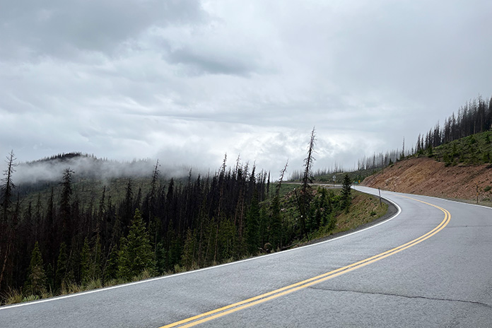
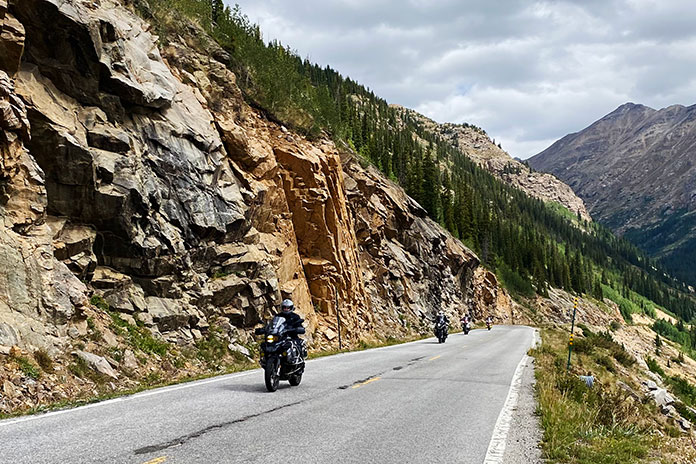
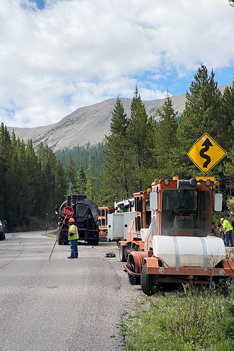
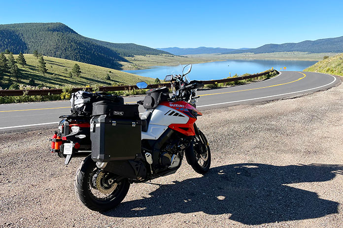
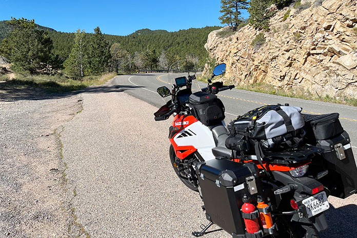
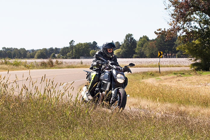
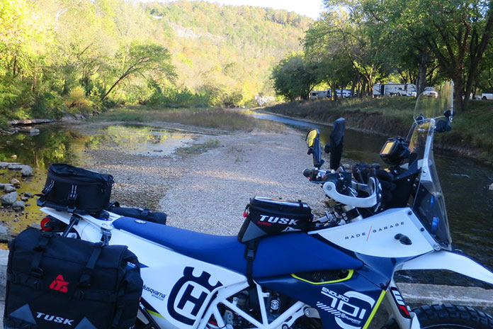
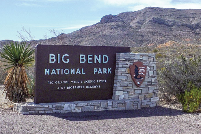
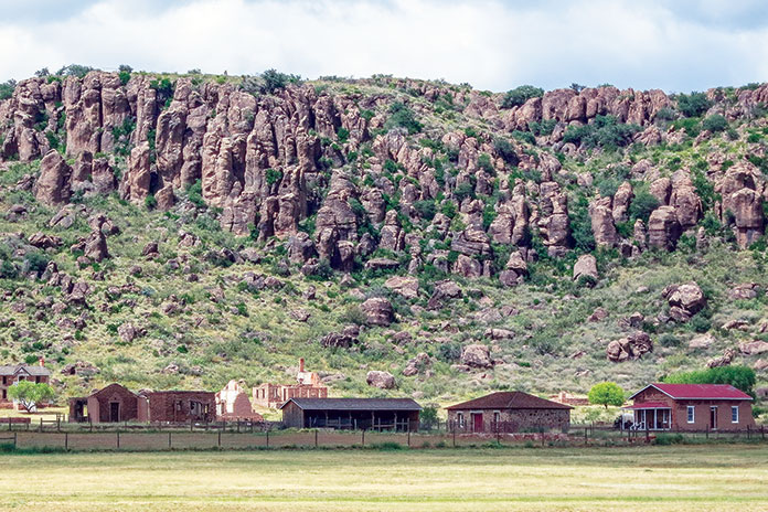
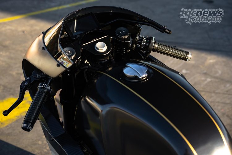
The Big Bend BDR-X 600-mile loop premiers in a live YouTube broadcast on Oct. 26.
The latest off-road route by the nonprofit Backcountry Discovery Routes will be unveiled Oct. 26 in a special YouTube broadcast. The Big Bend BDR-X in west Texas will become the 19th BDR route and the fifth BDR-X, which are shorter, loop-style routes.
The broadcast will feature a 40-minute documentary film screening and the release of GPS tracks, a waterproof route map, and route resources. Also included will be exclusive behind-the-scenes looks at the route’s development and its first expedition. It’ll be hosted from the TouraTexas Rally, and members of the expedition film team will join the broadcast.
The Big Bend BDR-X is 600 miles in length and travels through the rugged terrain of Big Bend national Park, Big Bend Ranch State Park, and surrounding areas. Enjoy desert landscapes, natural beauty, hidden-gem historical sites, and an optional foot crossing into Mexico at the Rio Grande.
“We’re excited to bring this route to life in West Texas,” says Michael Bielecki, BDR routes manager and route co-architect. “Big Bend is one of the most remote and iconic regions in the U.S. The blend of the expansive Chihuahuan Desert, the lush banks of the Rio Grande, and the majesty of the Chisos Mountains offers a perfect backdrop for riders seeking a real desert adventure.”
The Big Bend BDR-X will be open immediately after the release, and all information about the route will be available on the BDR website.
We got the chance to sit down with members of Backcountry Discover Routes for a chat about the organization and the 940-mile Northern California route for Episode 70 of the Rider Magazine Insider Podcast. Listen to the episode to learn more, and check out our other podcast episodes for more conversations with important and inspiring people within the world of motorcycling.
The Route 66 Interpretive Center, one of several interesting stops on this Route 66 motorcycle ride, uses audio-visual exhibits to immerse visitors in the history of the Mother Road. The building was built in 1937 and served as an armory until 1971. Photos by the author and Steve Skinner.
U.S. Route 66 was established in 1926 and was billed as the shortest, fastest, and most scenic all-weather route connecting Chicago, St. Louis, and Los Angeles. Dubbed the “Mother Road” by John Steinbeck in his novel The Grapes of Wrath, Route 66 was used in the 1930s by migrants fleeing the Dust Bowl in search of a better life out West. During World War II, it facilitated the movement of troops and equipment. And during the post-war economic boom of the 1950s and 1960s, Route 66 became indelibly linked to the Great American Road Trip.
My home state of Oklahoma boasts about 400 miles of the historic highway – the most of any of the eight states touched by Route 66. The Mother Road played a central role in my budding love affair with riding. In 1977, at the age of 14, I rode a 100cc 2-stroke Kawasaki along one of the best stretches of Route 66 in the state – the 100 miles between Oklahoma City and Tulsa. The 200-mile round trip was my first long motorcycle journey. It took me all day and cost about $2 in gas, and my long-suffering parents had no idea what I was up to.
Forty-six years after that formative adventure, I retraced my route, only this time I allowed time to take in the roadside attractions and small-town charms that make Route 66 such an iconic piece of Americana. Once again, I felt right at home on the Mother Road.
Not far from my home, I hopped on Route 66 at its junction with Interstate 35 in Edmond. I headed east through wooded terrain and past sprawling Arcadia Lake before stopping at the Arcadia Round Barn. Listed in the National Register of Historic Places, it was built in 1898 by a local farmer who thought its round design would make it tornado-proof. Science may not support that belief, but the Round Barn has survived in the middle of Tornado Alley for 126 years. It’s now a museum, gift shop, and live music venue.
The Arcadia Round Barn, built in 1898, was designed to be tornado-proof and still stands in the heart of Tornado Alley.
Continuing east, the countryside along this stretch is a mix of woods, farmland, and grazing pasture. Although not the transcontinental artery it once was, Route 66 remains important to the communities it passes through. The tarmac is mostly in great shape, and the occasional sweeping turns are enough to get you off the center of your tires.
In Wellston, I stopped at The Butcher BBQ Stand, one of the best barbecue restaurants around. The award-winning flavors were developed during eight years on the competitive barbecue circuit, including more than 400 1st-place finishes. One of my riding buddies calls this barbecue “meat candy,” and he’s not wrong. Thirty minutes before The Butcher opened, the line was already out the door.
The Butcher BBQ Stand offers award-winning smoked meats on Route 66 near Wellston.
Just a few miles down the road in Warwick is the Seaba Station Motorcycle Museum, which was originally a Route 66 service station named after the proprietor back in the 1920s. The building was purchased in 2007 by Jerry Reis, and he opened the museum in 2010. It’s not only a great place to see a bunch of classic motorcycles, but it also has great Route 66 swag.
Seaba Station in Warwick has an impressive collection of vintage bikes and memorabilia as well as a great gift shop for some Mother Road swag.
I next headed east-northeast toward the town of Chandler, where roadside attractions include the Route 66 Interpretive Center and Route 66 Bowl, a bowling alley with dozens of authentic vintage oil company signs lining the parking lot.
Route 66 Bowl in Chandler with its collection of authentic oil company signs is one of the many Mother Road landmarks to visit on this ride.
Another 14 miles up the road, we stopped for lunch in Stroud at the Rock Cafe, another Route 66 institution. Opened in 1939, it’s named after the local sandstone used in its construction, and over the years it has been a trusted stop for long-haul truckers, a high school watering hole, and even a makeshift Greyhound bus station for soldiers shipping out during World War II. Pixar executives made stops at the cafe when developing the hit movie Cars and based the character “Sally Carrera” on proprietor Dawn Welch. The burger I had there was outstanding – and it was cooked on “Betsy,” the original 1939 grill.
The iconic Rock Cafe in Stroud gets its name from the sandstone used for its construction in 1939. The delicious food served up there is still cooked on the restaurant’s original 85-year-old grill, “Betsy.”
The final stop on my Mother Road reunion tour was Buck Atom’s Cosmic Curios on Route 66 in Tulsa to see “Muffler Man” Buck Atom, Space Cowboy. Few authentic Muffler Men – giant statues used by businesses for eye-catching advertising – remain. Buck Atom was created using a mold from a salvaged 1960s Muffler Man cowboy. Christened in 2019, Buck is 20 feet tall, and he now holds a silver rocket instead of a muffler. He stands guard over a gift shop at the site of an old Route 66 gas station in the heart of Tulsa. The new, old-time Muffler Man fits right in on the Mother Road.
A reimagined Muffler Man stands tall at Buck Atom’s Cosmic Curios in Tulsa.
Headed back to my home in Oklahoma City with daylight fading fast, I hopped on the interstate to make time – the very interstate that marked the end of Route 66’s prominence in Oklahoma, bypassing many of the communities stitched together by the Mother Road. True, the ride home was faster, but it was far less interesting. Just like during my first highway riding adventure back in 1977, I’m more at home on the Mother Road.
Tim DeGiusti lives and works in Oklahoma City, Oklahoma. Tim returned to motorcycling in 2012 after a long break, and since has ridden throughout Oklahoma and 38 other states (and counting).
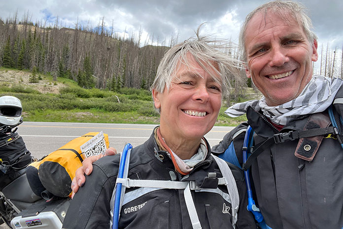
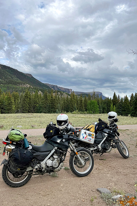
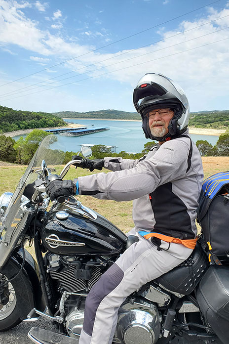
C. Jane Taylor’s moto memoir Spirit Traffic was published in 2022. That summer, she and her husband embarked on a 97‑day cross‑country book tour on their BMW F 650s. She said her book tour was characterized by deeply rewarding and completely exhausting work. It also featured great roads. During her vacation from what some might already consider a vacation, she enjoyed many memorable rides. The leg from Gunnison, Colorado, to Hovenweep National Monument in Utah was a favorite. –Ed.
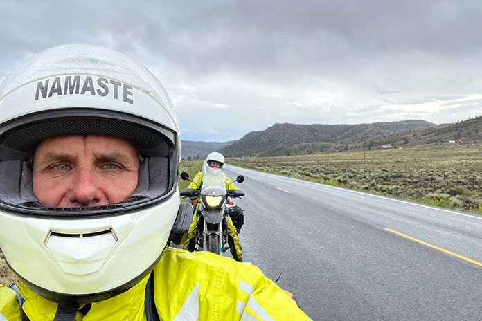
My husband, John, and I rode for 97 days – from Maine to California and back to Vermont – on a national book tour in the summer of 2022. We snapped this selfie at 10,856-foot Wolf Creek Pass in Colorado.
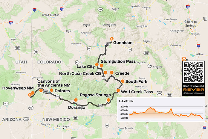
West of Gunnison, Colorodo, U.S. Route 50 was closed. We’d seen signs about the closure for at least 100 miles. Those signs were for other people, right? We’d planned to stay on the famous Colorado byway through the Grand Mesa, Uncompahgre and Gunnison National Forests as long as we could. But as we approached Gunnison, our shoulders slumped with the reality that the signs were for us. We’d have to rethink our whole route. And the weather was starting to look iffy.
At the Gunnison County Chamber of Commerce, a note taped to the door underscored the closure. We went inside, paper roadmap in hand. At the desk, the clerk proffered her own map, opening it in front of us. She and John pored over it like kids seeking clues to lost treasure.
She confirmed that U.S. 50 was closed and suggested State Route 149 instead. It had less traffic and was more beautiful, she assured us. We compared her map to the Butler map for the region. (Butler Motorcycle Maps highlight the best roads, rating them on twisties, traffic, road surface, etc.) SR‑149 was G1 (gold), Butler’s highest rating – perfect!
After filling our water bottles, we headed to the gas station. SR‑149 is quite rural, so we wanted to be prepared. As John filled our tanks and I surveyed the darkening skies, a bolt of lightning ripped through the clouds. Thunder crackled. A guy next to us gassing up his pickup was watching too.
“Hope you’re not going that way,” he said, nodding toward the storm.
“Not anymore,” I said.
We paid for our gas as the storm clouds gathered closer and closer. Thunder rumbled, and lightning struck from cloud to ground in the near distance. We sped back to the park next to the Chamber and ran for the cover of a gazebo. Just as we stepped under, buckets of rain dumped from the sky, and lightning dashed all around us. The thunder was so loud that we ducked our heads each time it clapped.
John snaps another selfie on SR-149 along the Lake Fork River. As two cross-country-and-back trips have taught us, body temperature management in variable conditions demands a good rainsuit – and a good attitude.
Celebrating our excellent timing, we stretched out to nap on top of the picnic tables just as two vans arrived and disgorged two dozen kids. It was the local mountain‑biking camp escaping the weather. We were instantly surrounded by kids eating popsicles and playing a raucous game of tag. Now each thunderclap was accompanied by the ear‑piercing screams of prepubescent mountain bikers. One of the camp counselors checked in on our welfare, asked about the bikes, and offered popsicles, which we accepted.
The lightning eventually abated, though the rain drizzled on. The camp counselors packed their charges and drove away. We wrestled into rainsuits and got back on the road.
SR‑149 was as wonderful as described: a narrow, almost abandoned two‑lane road snaking seductively through the San Juan Mountains and the Rio Grande National Forest. The weather was cold and drizzling, but the road was curvy, and the air smelled like earth and springtime in New England. We were in motorcycle heaven.
Ten miles down the road, oncoming cars flashed their headlights, gesturing to slow down. Thinking they were trying to warn us about a cop, I laughed. It had taken me five years to get up to the speed limit. We continued with caution until a mudslide stopped us in our tracks. If we hadn’t been wearing helmets, we would have scratched our heads in a “Now what?” gesture. Like U.S. 50, it seemed SR‑149 would soon be closed too, but we gingerly traversed the shallow edge of the slide at the far‑left side of the road. Alert to the changes in road surface and rambunctious streams in the gullies flanking the road, we pushed forward like children anticipating candy at Halloween.
SR-149 near Powderhorn, Colorado.
Instead of candy, we sought groceries as we rolled into Lake City and its tiny country store whose proprietors seemed to be a badly mismatched couple. The woman in long braids glared at us as if we’d tracked mud onto her freshly mopped floor, while the man – handsome in a Willie Nelson kind of way, if Willie Nelson could be considered handsome – happily greeted us, teasing about our florescent green rainsuits. “We are not men, we are Devo,” he joked in a robotic voice referencing the ’70s New Wave band famous for their quirky spaceman costumes. We bought vegetables, tortillas, and cheese for quesadillas we would cook once we found a campsite for the night.
Lake City is an eye‑blink of an old mining town with the down‑at‑heel aspect of a climate-change ski resort in shoulder season. The cold, damp weather did not bring any charm to the Grizzly Adams cabins lining the road.
I attributed the town’s creepiness to its horror‑movie sepia tones and bad weather, but I later learned that Lake City gained notoriety in 1875 when Alferd Packer, the “Colorado Cannibal,” was charged with killing and eating the prospectors he’d been hired to guide through the San Juan Mountains after the group had become snowbound. In the spring, five bodies with human teeth marks were found at the foot of Slumgullion Pass. Lake City’s Hinsdale County Museum has an extensive collection of Packer memorabilia, including a skull fragment from one of his victims and several buttons from the clothes of the five men he ate. The area where the bodies were discovered is now known as Cannibal Plateau. Odder still, the area hosts an annual Alferd Packer Jeep Tour and Barbecue.
As we approached the peak of Slumgullion Pass near Lake City, Colorado, the rain abated, and the skies cleared.
My unease was supplanted by the fear and exhilaration of climbing out of town along steep, wet switchbacks to Windy Point Observation Site and Slumgullion Pass. As we climbed, I chimed into the headset, “Don’t look right, Johnny.” The narrow two‑lane highway had no guardrail, and the drop-off induced a vertigo that made me tighten my grip on my handlebar and tank. At Windy Point, we stopped to look back at the long narrow valley thousands of feet below us.
Evening was approaching, and we were still in the middle of a sheer climb on our way to North Clear Creek Campground, a destination we were not sure even existed, but the sky finally opened, and the tight switchbacks loosened as we topped 11,530‑foot Slumgullion Pass.
The map we consulted – and re‑consulted – showed the campground within 50 miles. Trying to keep from being swept up in the National Geographic beauty of the broadening landscape, I kept my eyes peeled for a Forest Service campground sign. We were hungry and cold, and it was getting late. We’d passed so little traffic, I was game to pitch the tent at the side of the road, but John persisted.
North Clear Creek Campground in Colorado’s Rio Grande National Forest was our home for the night after an eventful ride.
We finally turned off SR‑149 and crossed a cattle guard onto Forest Road 510, which fell away to vertiginous Class‑IV switchbacks. I groaned but also laughed. It was the “dropping hour.” We have a joke that on extended motorcycle trips, we often face the most challenging miles of the day right before arriving at our destination exhausted and hungry. The road toyed with us. I inched down its sharp gravel turns, determined but cautious given the hour. As I eased down one hill, a young woman on a dirtbike blasted up it. Encouraged that there might be an actual campground ahead and inspired by another woman on a bike, I sped all the way up to 2nd gear!
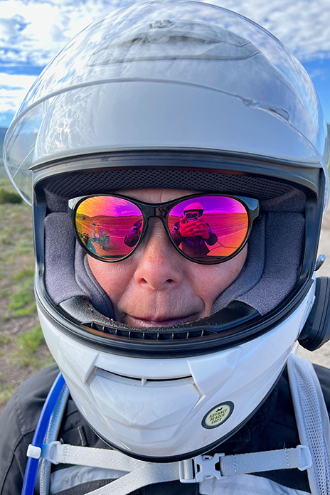
Pink sunglasses reflect the expansive valley near Creede.
After almost missing the 70‑degree turn into the campground at the bottom of the hill and duck‑walking the bikes back over sandy gravel ruts, we casually rolled into the nearly vacant campground and found a suitable spot with a picnic table, breathtaking panoramic views, and a glorious sunset reflected off the peaks of the Rio Grande National Forest.
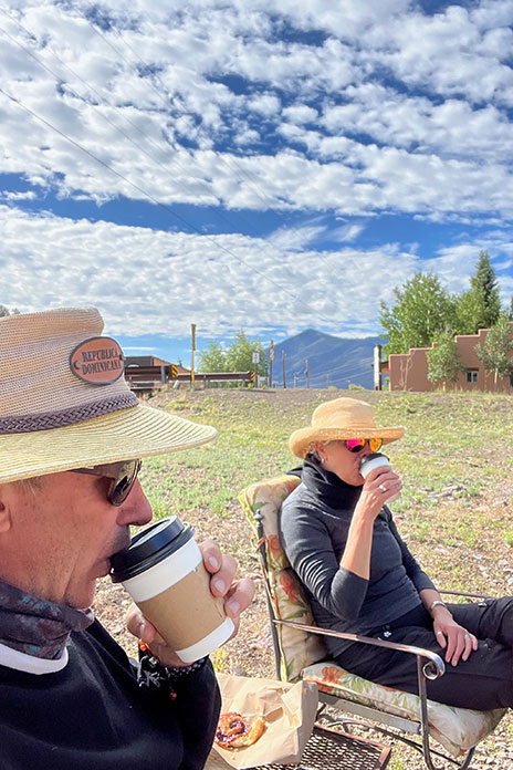
The next morning was cold and clear. With visions of coffee and pastries dancing in our helmets, we headed toward Creede, home to an underground mining museum, the Mineral County Landfill, a cemetery, a chapel, and an excellent little food truck/coffee shop that appeared to be set up during the pandemic like a one‑way street, with one entrance and one exit. The pastry case was filled with buttery French confections, the air with the scent of espresso. Bon appétit! We took our pastries to a table outside where we lounged, sipping cappuccinos in the sun.
The population of Creede, Colorado, swells from 300 to 10,000 on July 4th. After a cold, wet, challenging ride the day before, it was an oasis. We found a mobile coffee shop where we enjoyed the company of locals, pain au chocolat, and cappuccinos in the sun.
The road along the Rio Grande – which far downstream serves as the border between Texas and Mexico – was as good as the croissants. At South Fork, we headed south on U.S. Route 160 and climbed to 10,856‑foot Wolf Creek Pass. It was cold at elevation, and we encountered traffic and threatening weather, but the road was smooth, wide, and curvy through Pagosa Springs and Chimney Rock. We lunched in Durango after a torrential downpour trapped us under a busy highway underpass.
U.S. 160 through the mountains near Hesperus Ski Area was fabulous despite the cold and wet. Things got warmer as we descended out of the mountains, and by the time we got to Mancos, we were sweltering in the heat of the desert. We took off as much as we could and poured cold water down the backs of our armored jackets. Body temperature management was a challenge we had improved at over time.
South of Creede, the Rio Grande snakes along SR-149 on the way to South Fork.
In the blazing heat, we headed west on State Route 184 toward Dolores, then north on U.S. Route 491 past Yellow Jacket and into Canyons of the Ancients National Monument, administered by the Bureau of Land Management and inhabited almost solely by spirits. The road narrowed and then narrowed again. There is something gritty and fundamental about these small roads, something secret and unspoken like the second indents of an outline of one’s life or the dark side of the moon.
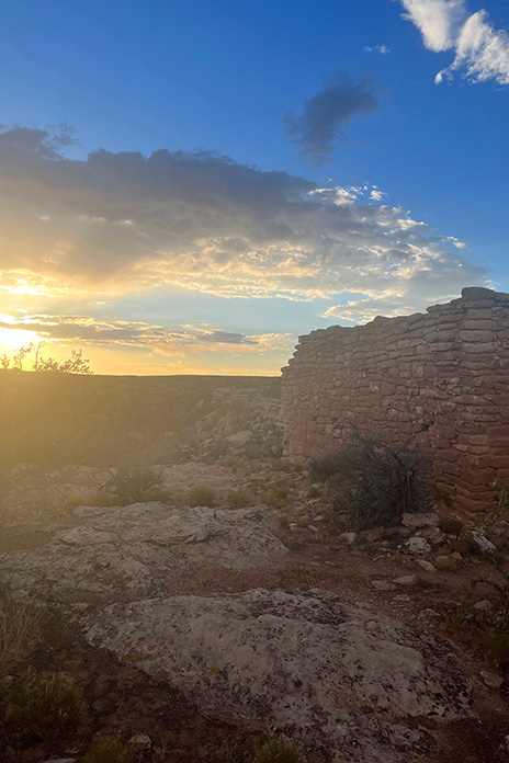
The heat kept building. As we crossed into Utah, the landscape gave way to a barren, flat emptiness without trees or buildings. We traveled in silent awe, feeling exposed in the heat but excited about the ruins of Hovenweep National Monument.
Our day took us from cold rain and high passes to sweltering heat and desert valleys. The sunset at Hovenweep was a just reward.
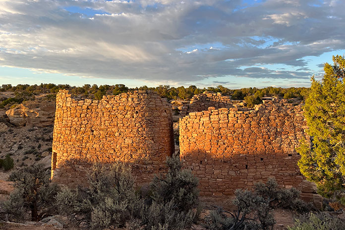
Known for six groups of Ancestral Puebloan villages, Hovenweep contains evidence of occupation by hunter‑gatherers from 8,000 B.C. until AD 200. We were finally going to visit the spirits we’d been sensing on this hot road.
We turned into what seemed the middle of nowhere, but John assured me this was the way. I saw only shrubs, grasses, and sage until I glimpsed a sign the size of a sheet of paper with an arrow proving him right: Hovenweep National Monument. We traversed a lunar landscape of sand, craters, dead volcanoes, and lava flows until we happened upon a herd of wild horses in the middle of the road. We stopped to gape. Shy and beautiful, they paused in their grazing to examine us. Though I wanted to join these beasts on a romanticized journey out of a dream, we had to keep moving. Standing still in the late afternoon heat was a torture neither of us wanted to endure – magical, wild horses notwithstanding.
Sunset on the ruins at Hovenweep National Monument in Utah.
Reminiscent of Death Valley with its lethal sun, long straightaways, and distant bluffs, Hovenweep Road also reminded me of the song by America “A Horse with No Name.” I started to understand the line “In the desert, you can’t remember your name.” In the heat and arid sameness of the landscape, time seemed to stop. I could tell we were moving, if only for the visual cue of the scenery receding in my mirror. I became flooded with the eerie sensation of being watched. It felt as if the ghosts of millennia were hovering just above the heat waves upwelling from the macadam.
“Hovenweep” is a Paiute/Ute word meaning “deserted valley.” As we rode into the scorched campground, I sensed that the ancestors were still there. A clan of attentive ravens seemed to be protectors – or just eager to see what food they could liberate from us.
Hovenweep is a special place, and we had the distinct feeling that the ancestors were still there.
After pouring rationed water onto our heads and down our backs, we hiked off to see the ruins, following a faint path between rock walls leading to a dry creek bed. Walking fast to beat the setting sun, we climbed down into the creek bed then up the other side until we saw what looked like a crumbling brick silo. Hovenweep at last! As we gazed in silence at the majestic ruins of a once‑lively community, a rainbow broke through distant storm clouds. Back at our campsite, we cooked dinner in the waning light as a million stars began to wink.
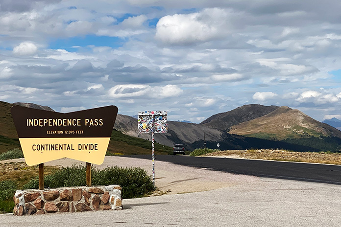
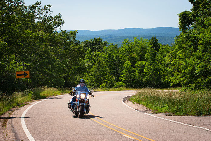
Independence Pass is one of the truly iconic motorcycle roads in the Southwest and a great reason to take a Colorado motorcycle trip.
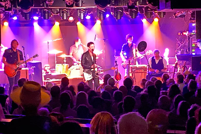
As I sat in the fantastic Belly Up Aspen concert venue in Colorado listening to a great performance by The Wallflowers, I did not imagine that “belly up” was a condition I was going to have to actively avoid the next day. You see, the following morning I was going to ride Independence Pass, one of my favorite stretches of pavement in the Southwest that I had taken some months previous in the fall.
That night in Aspen, Wallflowers front man Jakob Dylan was on top of his vocal game and filled the intimate venue with all of his best work. Ironically, the band’s song Angel on my Bike chronicles salvation from either a real or figurative motorcycle crash. Turns out I was going to need that angel on my pillion seat.
The Wallflowers offer up a lyrical reminder for safe riding,
The crisp Colorado mountain air had me zipping up my jacket vents as I started the ascent out of Aspen. The early ride was just what I had hoped for. Smooth pavement traced through the evergreens, and traffic was light. I quickly fell into that perfect groove as I slalomed up toward the pass.
I was only a handful of miles into the climb when I got the first hint that this would not be a normal ride. Just after a blind curve, a mother moose and her offspring bounded in front of me. The mother was quick and agile as she leapt to safety. The little one was confused and halting, and I was forced into an abrupt evasive swerve. As my heart settled, the two disappeared into the forested depths.
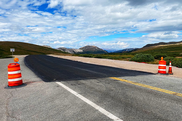
As I continued my climb, that smooth blacktop transformed into recently applied chipseal. The tar-coated gravel began the telltale cacophony of sounds as it flung from my tires onto my fenders and bodywork – a far cry from the melodic offerings of The Wallflowers the night before. I cut my speed in half and made the requisite adjustments to my cornering technique.
The crest of the pass marks the dividing line between fresh roadwork and weathered tarmac.
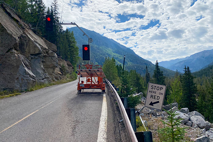
I rode up to one of the two stop lights on the pass that control traffic in the one-lane Narrows sections of Independence Pass. The light was just changing to red, and I slowed to a stop in anticipation of the oncoming traffic taking its turn in the Narrows. In my mirrors, I saw an SUV barreling toward me. I was already planning my escape maneuver in what little room I had on the side of the road. Without any slowing, the Range Rover barreled into the oncoming lane and passed me, pelting me with gravel as he ran the red light and endangered me and all of the potential oncoming traffic. Close call No. 2, plus challenging riding conditions.
Narrow road conditions on the pass require metered traffic flow for the law-abiding drivers.
After continuing on when the light turned green, I came upon the crew applying the chipseal. At this point, the road became even more challenging as the surface was newly applied. One lane was gravel and the other was fresh tar. The combination of this variable surface with the twisty, guardrail-less pass made for tricky riding. Accelerating, braking, and turning all had to be muted and modulated. The road remained like this all the way to the 12,000-foot apex of the pass.
These warning signs mean business in the Colorado mountains.
Fresh tar and fresh chipseal make for unpredictable riding surface conditions.
After stopping for the views – and the bathroom – at the top, I started the descent on the other side of the pass on established pavement with actual markings and no gravel or fresh tar. It was not, however, the end of the challenge.
Independence Pass has some of the best views in Colorado, so slow down and make it there.
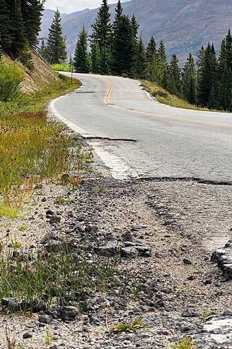
It became clear that the prior winter had taken a toll on the pass, which had been much more intact only months before in the fall. While not as challenging as the way up, the frayed and crumbling margins of the tarmac and the potholes made the descent worthy of extreme vigilance.
The descent down the mountain pass shows why there is a need for summer maintenance.
Extreme winter conditions in the Rockies make vigilant road maintenance a necessity.
In the end, I made it unscathed (other than tar on my boots and a few chips on my BMW bodywork). I did not end up belly up, maybe due in part to an angel on my bike. Now that I’m on the other side of this particular Colorado motorcycle trip, I highly recommend catching a concert at Belly Up Aspen, attending a show by The Wallflowers wherever they might be playing, and avoiding assumptions about a favorite road based on the last time you rode it.
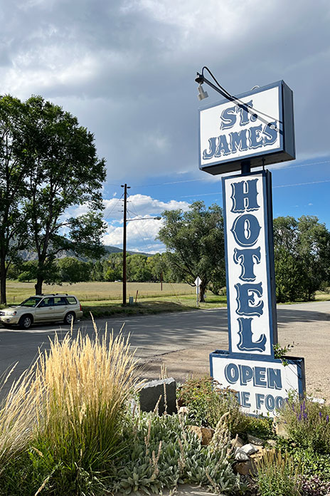
After a long, hot day riding through Oklahoma and Texas, I arrived at the St. James Hotel in Cimarron, New Mexico, the first stop on my motorcycle tour of haunted hotels. Built in 1872 by Henri Lambert near the Santa Fe Trail, it had a saloon, a restaurant, and guest rooms where many famous – and infamous – people stayed over the years.
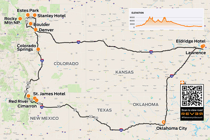
It’s always fun to have a theme for a motorcycle tour, and my plan for a late August ride was a four-day loop from my home in Oklahoma to visit three historic hotels that are widely purported to be haunted. The first would be the St. James Hotel in Cimarron, New Mexico, followed by the Stanley Hotel in Estes Park, Colorado, and finally the Eldridge Hotel in Lawrence, Kansas. Between the fright nights, I’d ride first-class mountain roads on a nearly 1,900-mile route through five states.
To make time, I rode west on Interstate 40 for the first 150 miles or so. Wind turbines were spinning at a good clip, and flags at roadside businesses whipped around in the hot wind. I rode in what my buddies and I call “the I-40 lean” – riding with the bike pitched a few degrees to the left to counteract the constant gale.
It was nearly 100 degrees when I crossed into the panhandle of Texas, and the empty landscape was dotted with cattle and oil wells. When I stopped in Dalhart to refuel, a guy with long hair and a shaggy beard pulling two Harleys on a trailer behind a pickup asked where I was heading. After I shared my plan, he said he was heading home after riding many of the same roads.
Eyeing my Suzuki V-Strom 1050XT, he said he still owns a KTM he bought back in the ’90s when he was in Germany. “I spent three years there myself,” I said, “when I was in the Army.” Turns out we were stationed in some of the same places, decades ago, on the other side of the world. And here we were, on a sweltering afternoon in small-town Texas, talking motorcycles and swapping memories.
St. James Hotel
The site of at least 26 killings, the St. James Hotel has a reputation for being haunted.
The temperature subsided a bit after crossing into New Mexico, where I rode through high plains grassland. North of Springer, I continued west on State Route 58, climbing into the foothills of the Rockies. Once in Cimarron, I parked in front of the St. James Hotel. Walking into the lobby felt like going back in time to the Old West of the late 1800s.
Built in 1872 near the Santa Fe Trail and originally known as Lambert’s Inn, this hotel was a favorite of Old West legends such as Wyatt Earp, Doc Holliday, Buffalo Bill Cody, Annie Oakley, Jesse James, and Billy the Kid.
During the lawless days of the Wild West, the hotel was the site of at least 26 murders; bullet holes are still visible over the bar in the hotel’s main dining room. Today, the St. James has 12 restored rooms in the original building, each named for a famous guest who stayed in the room, and 10 more rooms in a modern annex.
Several ghosts have been identified by paranormal experts in the St. James. Room 18 is off-limits because it is believed to house the malevolent ghost of Thomas James Wright, who was murdered after he won rights to the hotel in a poker game. The spirit of Mary Elizabeth Lambert, wife of the hotel’s founder, is said to be a protector of the hotel. She died there in 1926, and some say her rose-scented perfume still wafts through the hallways. There have been reports of a persistent tapping sound in Room 17, the mysterious smell of cigar smoke even though the hotel is nonsmoking, and sightings of a mischievous ghost resembling a little old man, nicknamed the “Little Imp,” who supposedly steals and relocates objects.
I stayed in the Pancho Griego room in the old building. Griego, a card dealer and local enforcer, picked a fight in the hotel’s saloon with gunslinger Clay Allison over the killing of Griego’s nephew. Unfortunately for Griego, he was a little (or a lot) drunk and took a bullet to the head from Allison’s gun. Would Griego’s restless spirit pay me a visit?
After a nice dinner in the hotel restaurant, I turned in. I’ve stayed in supposedly haunted hotels all over the country going back at least 20 years, and I’ve never had a paranormal experience. But at the St. James, I was awakened at 3 a.m. – the so-called “witching hour” when the spirit world is said to be most active – by an unidentifiable foul odor that defied explanation (no, it wasn’t me).
A Motorcycle Tour on the Enchanted Circle
Welcome to New Mexico’s Enchanted Circle Scenic Byway. Just outside Cimarron Canyon at 8,200 feet, picturesque Eagle Nest Lake is an introduction to the beauty of the New Mexico Rockies.
Continuing west on U.S. Route 64, I enjoyed flowing curves and yellow wildflowers as I rode through Cimarron Canyon State Park. Climbing out of the canyon revealed Eagle Nest Lake, an alpine lake above 8,000 feet near the Enchanted Circle Scenic Byway.
Turning north on State Route 38, I followed the byway toward the ski town of Red River. I knew this stretch of highway from many ski trips there with my wife and kids. The road meanders through the mountains, winding its way up to 9,820-foot Bobcat Pass and into Carson National Forest. Memories of those family trips rushed back – the cabins we stayed in, our favorite ski lifts and runs, the restaurants we liked, and the fun we had.
Crossing into Colorado, I rode over 9,426-foot La Veta Pass on U.S. Route 160 and then up through Colorado Springs and Denver. At Loveland, I turned west on U.S. Route 34 and enjoyed a winding ride through Big Thompson Canyon and Roosevelt National Forest to Estes Park.
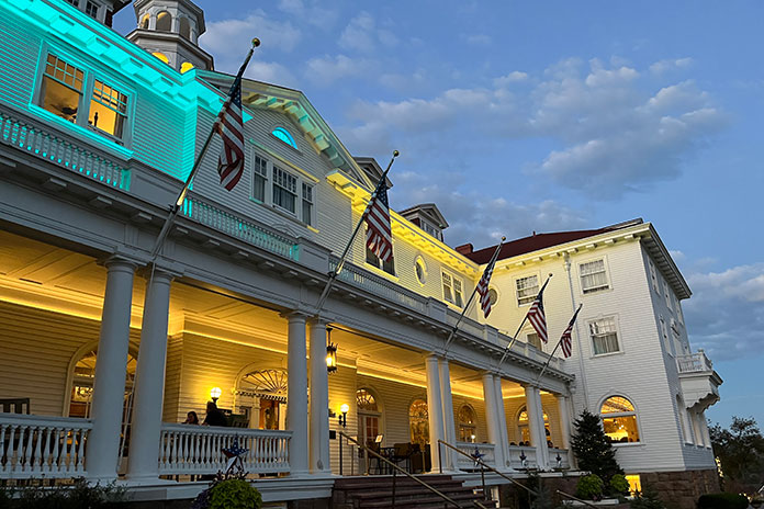
After a 400-mile day, I arrived at the Stanley Hotel, which sits on a sprawling property with views of the city that serves as the gateway to Rocky Mountain National Park. When it opened in 1909, it rivaled the finest hotels in America. It was established by Freelan Stanley, who, along with twin brother Francis, co-founded the Stanley Motor Carriage Company, which manufactured steam-powered automobiles from 1897-1924. Freelan fell in love with the Estes Valley, in part because he believed the area helped restore his previously failing health. Early hotel guests were impressed by features such as electric lights, telephones, modern bathrooms, a uniformed staff, and a fleet of Stanley Steamers.
By the 1970s, the hotel was struggling but got a shot in the arm when it became known as the inspiration for Stephen King’s bestseller The Shining. The book may be fiction, but there are plenty of real-life ghost stories swirling around the Stanley.
Darkness gathers at the Stanley Hotel. Opened in 1909, it famously served as the inspiration for Stephen King’s “The Shining.” At twilight, the hotel takes on an air of spookiness.
After checking in, I took the vintage Otis elevator to my fourth-floor room, which was hot as hell – fitting. The front desk dispatched a service technician, and as he worked on the air conditioner, I quizzed him about the hotel’s ghostly reputation.
“Is there anything to the ghost stuff?”
“Yep, they’re here,” he said. “I had my first experience after I’d been here a few months – tapped me right on the shoulder, but there was nobody there.”
“Interesting…” I replied, feeling a little chill down my spine.
At twilight, I walked out front to admire the Stanley’s beautiful facade against the darkening sky and visit the mildly creepy hedge maze, disappointed that a frozen Jack Nicholson was nowhere to be found. Back inside, I peeked in the séance room. The place certainly looked haunted.
Although Stephen King’s frightful night was in Room 217, the fourth floor where I was staying is thought to be the most haunted part of the hotel. Guests in Room 407 have reported being tucked into bed by an invisible force, and the apparition of a cowboy has been reported in Room 428. But Room 401 is the creepiest – female guests have reported inappropriate “touching” by what is thought to be an unfriendly male ghost. After my unsettling experience at the St. James, learning about the paranormal activity that has occurred just down the hall from my room had my eyes wide open as I turned off the bedside lamp.
However, after a restful sleep undisturbed by the spirit world, I packed up and headed south on the Peak-to-Peak Scenic Byway, a beautiful, curvy mountain road that reminded me why I’m a motorcyclist. Thinking it couldn’t get any better, I was proven wrong on State Route 119 toward Boulder, which follows a burbling stream with high rock cliffs on both sides for 16 glorious miles.
The lovely, flowing curves of Colorado’s Peak-to-Peak Scenic Byway.
The fun soon came to an end, and I steeled myself for a long, hot slog on Interstate 70 into Kansas. It was well after dark and I had clocked 652 miles for the day when I arrived in Lawrence for the last stop on my ghost tour.
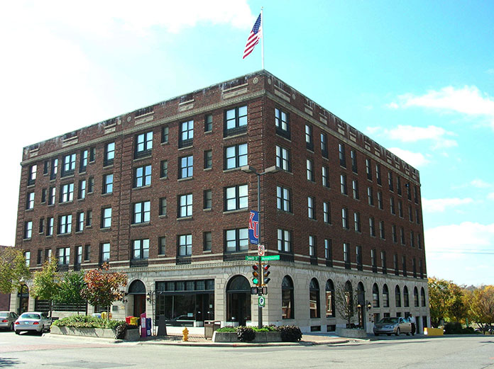
Eldridge Hotel
Originally built in 1855 under the name Free State Hotel, the Eldridge Hotel was burned down twice because of its role as a focal point of anti-slavery sentiment. Each time it was burned, the hotel’s founder, Col. Shalor Eldridge, rebuilt it at the same site. In 1867, it was renamed the Eldridge Hotel, and through the turn of the 20th century, it was considered one of the finest hotels west of the Mississippi River.
The Eldridge Hotel was built in 1855. It was burned down twice and rebuilt each time. Its troubled past is believed to fuel the paranormal. (Photo by Jackpendry via Wikimedia Commons)
The Eldridge Hotel also has a long history of paranormal activity. The fifth floor is thought to have a direct connection to the spirit world, with Room 506 at the epicenter. Guests have reported seeing apparitions, breath marks on mirrors, doors opening and closing by themselves, and lights mysteriously turning themselves on and off. The elevator is said to have its own ghost who erratically opens and closes the elevator doors.
I checked into Room 305, which is spacious with modern amenities, and got cleaned up. Later, I wandered downstairs and explored the lobby, bar, and basement. The Eldridge is a beautiful old hotel, and I felt the weight of its history. With that history in mind – some of it painful – I can see how the energy of the past may still be imprinted on this place.
I once again slept peacefully in the comfy bed and woke up early, anxious to get on the road home. The only possible evidence of mischievous spirits was that my television was stuck on the Hallmark Murders & Mysteries channel.
Some of the roads and stops on my Old West motorcycle tour could certainly be considered supernatural, but did the experience make a believer out of me? Until I can find a logical explanation for what happened to me at the St. James Hotel, the jury is out.
On top of Crowley’s Ridge you will find a variety of roads running past farms and through wooded landscapes. It’s a different kind of Arkansas motorcycle ride.
Pancake flat. That’s an accurate description for most of Arkansas’ Mississippi River Delta. The delta contains historically interesting and culturally significant places to visit, but it’s also home to a unique geological feature that offers a great Arkansas motorcycle ride through beautiful, heavily forested landscapes. This geological feature is called Crowley’s Ridge, and it rises as much as 550 feet above the fertile delta farmland.
Toward the end of the last ice age, the confluence of the Mississippi and Ohio rivers shifted 190 miles north into Illinois. This change left a 150-mile-long, 15-mile-wide motorcycle playground in the middle of an otherwise flat delta, 110 miles of which is in Arkansas.
To most travelers on Interstate 40 between Little Rock and Memphis, Crowley’s Ridge is an easy-to-miss rise in elevation. But for those looking for an enjoyable Arkansas motorcycle ride, you can find serpentine pavement by traveling the length of the ridge. Mix in the delta’s historic and cultural sites, and a tour of Crowley’s Ridge becomes an attractive proposition.
Roads with broad sweepers wind their way along the top of Crowley’s Ridge.
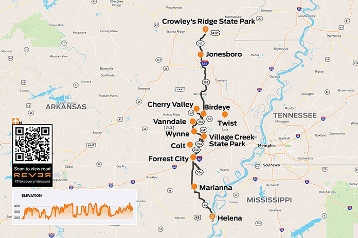
A riding buddy visiting from Florida, Matt Terry, and I began our tour of Crowley’s Ridge on its southern end, in Helena. Here, the ridge begins in dramatic fashion, overlooking the city’s riverfront on the Mississippi.
Helena was an important site during the Civil War. Fort Curtis is located halfway up the ridge above Helena’s downtown. It was coveted – and occupied at different times – by both Confederate troops and Union soldiers. The fort could effectively control boat traffic up and down the river for whomever held this important high ground.
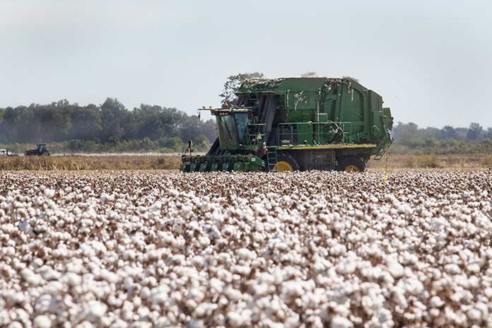
Crowley’s Ridge goes through the Arkansas Delta, and cotton is one of the main crops farmed there.
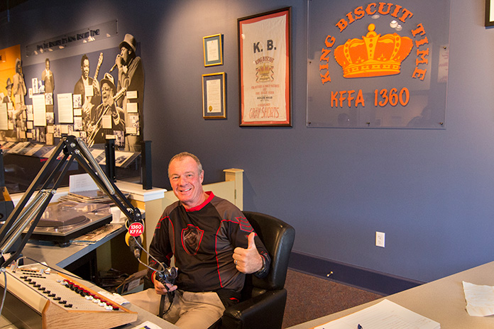
On Cherry Street in downtown Helena is the Delta Cultural Center, which celebrates the rich history of the delta and is home to the KFFA King Biscuit Time studio, where the daily 12:15 p.m. broadcast is made. King Biscuit Time began in 1941 and became an important venue in the development of the delta’s many African American blues musicians. It also happens to be the longest-running broadcast program in the nation, and blues fans from around the world travel to Helena to attend live broadcasts of this historic show.
ADV rider Bill Dragoo traded his BMW’s saddle for a seat at the KFAA studio at the Delta Cultural Center in Helena.
From Helena, we rode north along the eastern edge of the ridge on Arkansas Highway 44. If you’re a fan of Food Network, then you probably know that winning the culinary world’s prestigious James Beard Award is akin to winning an Oscar or a Grammy. Arkansas’ first James Beard Award winner was Harold Jones, and his family restaurant is in Marianna.
The Jones family started the Hole-in-the-Wall around 1910. The name was changed to Jones Bar-B-Q Diner in 1964, when it moved from downtown to its current location on West Louisiana Street. The small dining room has only one large table and one small table, so takeout is popular.
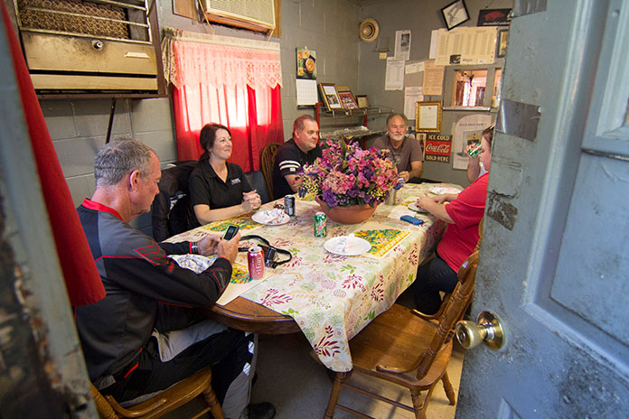
Riders relaxing after chowing down on pulled pork in the tiny dining room at Jones Bar-B-Q Diner in Marianna. Below
“Mr. Harold,” as locals call him, serves any kind of barbecue you want – as long as it’s pulled pork, either in a sandwich or by the pound. His great-grandmother’s sauce recipe, which dates to Civil War times, is a thin, sweet vinegar-based sauce that’s delicious on their sandwiches, which are served on white bread with or without coleslaw.
We continued north on AR 1 and 1B. Just south of Forrest City, we enjoyed a twisty out-and-back spur on AR 334. North of Forrest City on AR 1 is Colt, birthplace of the “Silver Fox,” Grammy Award-winning singer Charlie Rich. We bypassed Colt, curving and cornering our way northeast on AR 284. The road runs through a landscape reminiscent of my home in the Ozarks, with nice sweepers and scenic, heavily wooded terrain.
Matt enjoys one of the ridge’s sweeping curves.
After riding along the western edge of Village Creek State Park, we jogged east on County Road 720 and then went north again on AR 163, a mostly winding and always scenic highway. We made our way northwest to Vanndale so we could enjoy the curves of AR 364 on our way back to AR 163.
From Birdeye, we rode west on AR 42 to Cherry Valley, bending around curves nearly the entire way. For another musical connection, you can take AR 42 east from Birdeye to the tiny delta community of Twist, where blues legend B.B. King first named his Gibson guitar “Lucille.”
King was playing a gig at a juke joint in Twist when two men began fighting and overturned a kerosene heater, setting the building ablaze. Two patrons were killed. King rushed back into the inferno to retrieve his Gibson and realized he, too, could have died.
From that point on, King named all his guitars Lucille to remind himself of two things: First, never go back into a burning building to save a guitar. Second, no woman is worth fighting over. (The two men were fighting over a woman named Lucille.) A commemorative plaque marks the spot.
A Honda PC800 tested the sport part of its sport-touring designation on a tight curve on top of the ridge.
We stayed on AR 163 for quite a while, eventually reconnecting with AR 1B just south of Jonesboro. We rode north out of Jonesboro on AR 141, which runs along the western side of the ridge. Though it’s not on the top of the ridge, it is a scenic ride along the seam between the delta and Crowley’s Ridge.
At Walcott, we turned northeast to Crowley’s Ridge State Park, the former homestead of Benjamin Crowley, an early settler in the area and namesake for the ridge. His property became an Arkansas state park in the 1930s, and it offers cabins, camping, hiking trails, picnic facilities, a swimming lake, and a native stone CCC-era pavilion.
The Wishing Well Flume runs into Lake Ponder at Crowley’s Ridge State Park.
Arkansas is one of those states where more famous riding areas in the Ozarks overshadow hidden gems like Crowley’s Ridge. The roads may not be as steep and the curves not as sharp, but they provide plenty of enjoyment. There are also numerous secondary roads, both paved and unpaved, which make the area great for adventure touring. Add in the rich cultural and musical history of the area and you’ve got a winning destination.
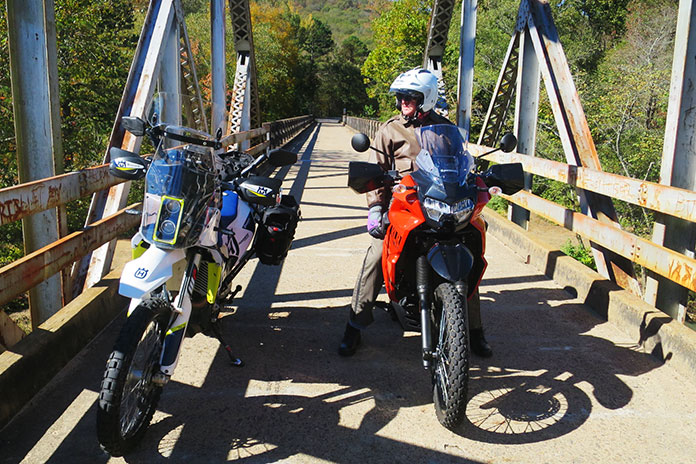
Our big Singles on a one-lane bridge over Little Piney Creek near Highway 123.
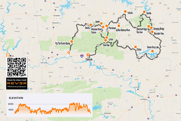
As the saying goes, it’s the journey and not the destination that makes the trip. But how does one describe a destination that is as good as it gets and an even better ride? With autumn upon us, it was the best time – and maybe our last chance – for riding the Ozarks before winter.
Big Singles are a great way to travel, especially if you’re not in a hurry. That made them perfect for our trip because the route I chose demands backing off the throttle to see the sights and make the corners.
Our counterclockwise route began in Clarksville, Arkansas, riding northbound briefly on Highway 21 and then turning east on Highway 292 to connect with Highway 123, a great road that climbs into the mountains through the Ozark-St. Francis National Forest. Highway 123 follows Little Piney Creek and then Hew Creek, and there are scenic waterfalls along the way.
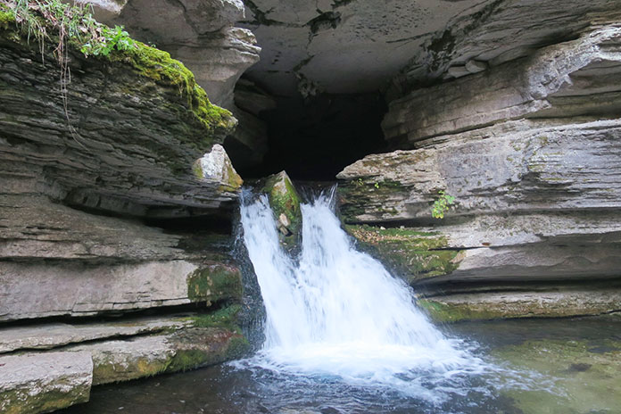
Water pouring out of Blanchard Springs Caverns near Mountain View, Arkansas, in the Ozark-St. Francis National Forest.
At Sand Gap, Highway 123 connects with Highways 7 and 16. We continued east on Highway 16, which is a pleasure to ride, with the kind of tarmac that offers confidence-inspiring traction in its many curves, even with our dual-sport tires.
At Clinton, we rode south on U.S. Route 65 and then followed Highways 92 and 16 around the south side of Greers Ferry Lake, turning north on Highway 5 near Heber Springs.
My adventure-kitted Husqvarna 701 Enduro near South Sylamore Creek, which is a popular trout-fishing stream.
Our first day’s destination was Mountain View, a small town of 2,900 people that’s surrounded by the Ozark Mountains and close to the gorgeous White River. It’s also known as the “Folk Music Capital of the World.” During the summer months, folk and country music groups gather in the city park, providing family entertainment well into the night, especially on Saturdays. In the spring and fall, when the nights are too cool for the musicians’ fingers to pluck their stringed instruments, they play in the afternoons. It’s a popular attraction, so make your hotel reservation well in advance. As you might expect, there’s not much pickin’ and grinnin’ in the winter.
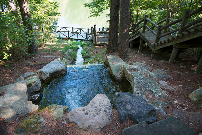
From Mountain View, we rode north on Highway 5, and just before the junction with Highways 9 and 14, we turned left on Swinging Bridge Road, named after the cable-suspended wooden bridge over the crystal-clear South Sylamore Creek. Just west of the bridge, mountainous Highway 14 took us to the Blanchard Springs Recreation Area with its springs, caverns, and cliffside hiking trails. Mirror Lake, popular for its rainbow trout, is fed by the cold water from Blanchard Springs. Near the lake, one can hike a wooden walkway and down stone steps to where the spring comes out of the caverns. Pretty cool. Below the Mirror Lake dam, another trail takes you to the remains of a corn mill built in the early 1900s and the bottom of Mirror Lake Falls.
Mist rises off Mirror Lake at sunrise.
On the map, Highway 87 looked like it would be fun, so we rode it back to Mountain View. It was a good choice!
From Mountain View, we again rode north on Highway 5 along the lovely White River and through charming places like Calico Rock, Old Joe, and Norfork. A short hop west on Highway 201 took us to the sweeping curves of Highway 341 (Push Mountain Road) into the Leatherwood Wilderness area.
Swinging a leg over the tall Husky on the cable-suspended wooden Swinging Bridge, which spans South Sylamore Creek just north of Mountain View.
At Highway 14, we turned west again and crossed Big Creek and the Buffalo River. If you ride through here during hot weather, the Buffalo is a great place to cool off, with parking and access at Dillard’s Ferry.
Just south of Yellville (if you cross Crooked Creek, you’ve gone too far), we turned west on Highway 235 and rode south until it ended at U.S. Route 65. We continued west, turning onto Highway 123 again near Western Grove and riding south. We crossed the Buffalo River again just before we got to Piercetown.
Located in the Blanchard Springs Recreation Area, Mirror Lake Waterfall pours over a dam built by the Civilian Conservation Corps in the 1930s.
Rather than ride a short 10 miles west on Highway 74 to Jasper, we continued south on Highway 123 through what’s known as the Arkansas Grand Canyon, taking the long way to Jasper via Highway 7. After only a few miles on Highway 123, my Husky’s low-fuel light lit up, but we were still some 45 miles from “good” gas in Jasper. I asked myself, Should I stop at the one gas station on 123 and put low octane in my thumper or chance it and go for the good stuff? I chose the latter – and ran out of gas just 7 miles south of Jasper. Next time I’ll know: A gallon of cheap gas is better than none at all! Bill’s KLR had just enough fuel left to get him to Jasper, and after a short roadside nap, we were off again.
Jasper is a lovely little town, and just north of it, after crossing the Buffalo again, is Highway 74, an often overlooked but fantastic motorcycling route. We rode it west to Highway 43 – famous for elk sightings – and then west on Highway 21 and south on 74 again.
What looks like a portrait on a stone wall is Mirror Lake Waterfall as seen through a window.
Highway 74 connected us to the famous Pig Trail Scenic Byway (Highway 23). Feeling bolder than I should have, I tried to use the Husky’s superior power to pull away from Bill’s KLR, but he stretched the KLR’s throttle cable and hung with me. As fast as we dared go, some guy on a multi-cylinder crotch rocket blew by us and out of sight. One good thing about riding a thumper is that you feel like you’re going fast when you really aren’t.
The Buffalo River and an adventure bike go together nicely, don’t ya think?
Highway 23 dropped us down out of the Ozarks onto Interstate 40 and then back home to Oklahoma.
Riding big Singles for 650 miles in two days wasn’t bad at all. In fact, in the mountains of Arkansas, it was big fun.
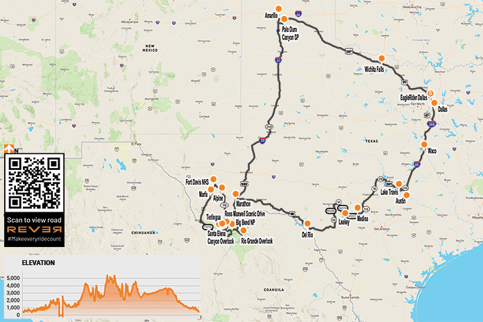
The seeds of this West Texas motorcycle ride were planted in December 2019 when my buddy Reed and I joined the EagleRider Club. Members pay monthly subscription fees for credits toward motorcycle rentals, which roll over month to month and offer significant discounts versus standalone rentals.
In addition to the discounts, being club members allows us to fly into a new area and rent motorcycles that are different from what we ride back home. We live in Connecticut, so flying into Dallas saved us a 3,200-mile roundtrip that would have taken several days on each end. Instead of grinding out miles just to get to Texas and back home, we spent that time leisurely exploring roads and sights.
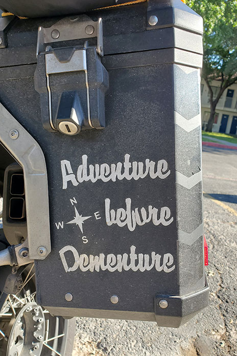
To beat the heat of the Texas summer, we planned our trip for mid-April. Reed and I are BMW riders, but for this trip we rented two late-model Harley-Davidsons: a Street Glide for me and a Heritage Softail Classic for him. There’s something special about riding the open road on a big American V-Twin. We’re older guys who were decked out in textile riding gear and modular helmets, so we’re hardly Easy Rider rebels. When we saw a BMW GS in a hotel parking lot with “Adventure Before Dementure” on one of its panniers, we could relate.
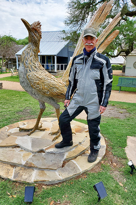
We did a clockwise loop of roughly 2,300 miles over nine days. From Dallas, we headed south to Texas’ funky state capital, Austin. The Harleys were stable and comfortable, the torque was intoxicating, and the horns were good and loud, but the transmissions were a bit clunky. After visiting the Texas Capitol, we rode east to Round Top, a small tourist town known for antiques. We were disappointed to find the antique markets closed when we got there, but I managed to get a photo with a roadrunner as tall as I am – things really are bigger in Texas!
West Texas is wide open.
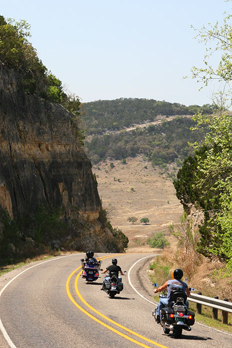
The riding improved west of Austin when we entered the legendary Texas Hill Country, an area well-known among motorcyclists. Endless hills turn the many rural FM (Farm-to-Market) and RM (Ranch-to-Market) roads into paved rollercoasters. We enjoyed nice twisties, light traffic, and pretty views along the shore of Lake Travis and through Inks Lake State Park. After riding through Llano, we dropped the sidestands and stretched our legs at Enchanted Rock State Natural Area. In Fredericksburg, a charming historic town surrounded by vineyards, we ate sausages and enjoyed live music during a courtyard dinner at a German restaurant.
Less than an hour from Fredericksburg and west of Medina, we rode the renowned Twisted Sisters. The three RM roads (335, 336, and 337) are full of fun curves and whoop-de-doos and are worthy of their reputation. The Twisted Sisters are so popular among motorcyclists that there are two-wheeled tourist stops in the area, like the Lone Star Motorcycle Museum in Vanderpool and the Frio Canyon Motorcycle Stop and The Hog Pen in Leakey. We passed many ranches; two of my favorite names were Big Bucks Ranch and Middle Age Spread.
Enjoying rolling curves through Texas Hill Country, home of the famous Twisted Sisters.
After a night in Del Rio, we followed U.S. Route 90 west along the southwestern border of the Texas Pecos Trail region and within a stone’s throw of the Rio Grande. Although our bikes had the same 107 engines, the Softail’s tank holds 5 gallons while the Street Glide’s holds 6 gallons. That 1-gallon difference became evident when we hit an 86-mile stretch with no services thinking we had enough gas. We were wrong.
Reed enjoyed riding his rented Harley-Davidson Heritage Classic.
Reducing speed and tucking in behind the windshield for the last 20 miles did the trick, but headwinds meant the Softail was running on fumes when we pulled into Sanderson. At the gas station, a lady with a ’50s-style bouffant told us that pickle juice is good for combating dehydration. We were intrigued, but we wondered if she was having fun at the expense of us Yankees.
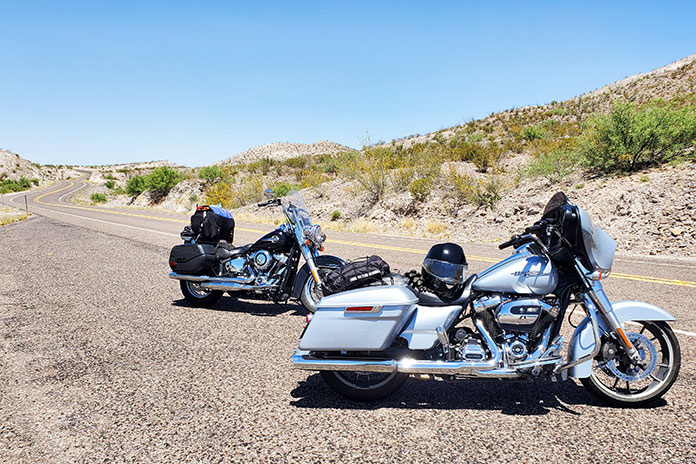
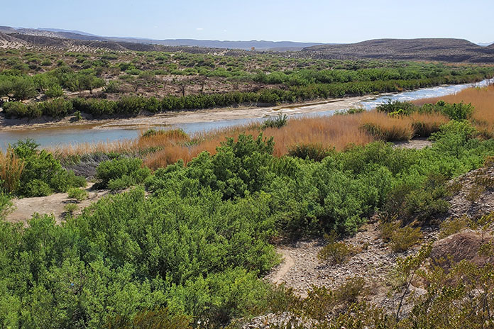
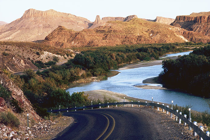
At Marathon, we turned south toward our next destination: Big Bend National Park. Situated in a pocket of West Texas where the Rio Grande’s southeasterly course makes a sharp bend to the north, Big Bend is enormous, covering more than 801,163 acres (1,252 square miles), making it the seventh largest national park outside of Alaska. In 1976, Big Bend was designated a UNESCO Biosphere Reserve. It contains the largest intact portion of the Chihuahuan Desert, one of the most biologically rich and diverse desert ecosystems in the world.
Located in West Texas where the Rio Grande turns sharply to the north, Big Bend National Park protects part of the Chihuahuan Desert.
Because Big Bend is far from major cities and the 118 miles of the Rio Grande along its southern boundary serves as the border between the U.S. and Mexico, it receives relatively few visitors compared to other national parks. That makes it the perfect destination for those who love wide-open spaces and don’t care for crowds.
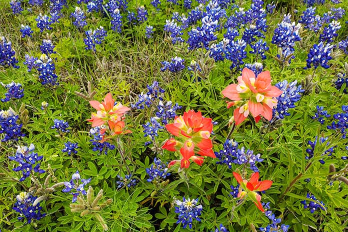
Wildflowers were blooming during our April ride.
That afternoon we enjoyed Big Bend in all its glory. Mountain peaks topping 7,000 feet competed with colorful desert blooms for beautiful scenery. In Rio Grande Village, we learned of a tramway system that transported lead and silver from Mexico across the Rio Grande to eventually connect with the railroad in Marathon. For migrants, crossing the Rio Grande would have been a matter of simply wading the low waters, but passing the Border Patrol checkpoint some miles inland (in open desert) is another story.
The U.S.-Mexico border.
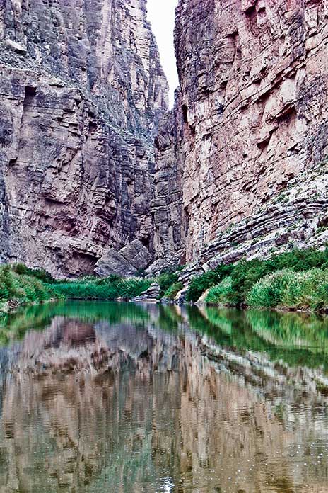
Highlights of Big Bend National Park include the winding road up to Chisos Basin, the Rio Grande Overlook, and Ross Maxwell Scenic Drive, which passes through Tuff Canyon on its way to Santa Elena Canyon Overlook. Of the 304 miles of roads in the park, 123 miles are paved, 45 miles are unpaved but improved, and 136 miles are unpaved and primitive, so there are plenty of miles to explore regardless of your preferred surface – or bike. That said, at our hotel in Alpine, located about 80 miles north of the park via State Route 118, another guest recounted how two Honda Africa Twins struggled in Big Bend’s sandy unpaved tracks, going down so often they gave up and had their bikes towed out.
The Rio Grande’s Santa Elena Canyon.
After spending the morning at Fort Davis, a national historic site north of Alpine with a well-preserved complex of buildings and visitor center, we embarked on our most challenging ride of the trip. We headed south on State Route 17 to Marfa and then took U.S. Route 67 to Presidio. From there, we rode east on FM 170, known as River Road. The 64 miles to Study Butte-Terlingua wind along the Rio Grande through Big Bend Ranch State Park. Except for the low water crossings, the road surface is generally good – and the views are fantastic – but riders need to stay frosty because there are sudden elevation changes, decreasing radius and off-camber blind curves, and sometimes wildlife on the road.
Fort Davis was a frontier military post from 1854-1891.
After getting our fill of mountains, canyons, rivers, and memorable Rio Grande scenery, we headed north through empty high desert to Fort Stockton, Odessa, Midland, and Lubbock, an area of Texas notable for the Permian Basin, an 86,000-square-mile area that’s home to some of the nation’s largest oil reserves. We rode for hours with oil wells scattered across the landscape in every direction. To our surprise, we also saw dozens of large wind turbines towering above some of the oil rigs, so some Texans are clearly hedging their bets.
Just south of Amarillo, we visited Palo Duro Canyon State Park, where we took in expansive views of America’s second largest canyon, which is 120 miles long, an average of 6 miles wide, and up to 1,000 feet deep. The sprawling canyon was the subject of paintings by Georgia O’Keefe, who lived nearby, and the site of a battle between Texas Rangers and Chief Kicking Wolf in Larry McMurtry’s novel Comanche Moon.
Located near Amarillo, Palo Duro Canyon is the second largest canyon in America.
Having completed much of our loop, we headed southeast toward Dallas. We took secondary roads through towns such as Turkey and Matador, the latter being the home of Bob’s Oil Well, a vestige of the days when bold roadside architecture attracted customers – in this case a wooden oil derrick towering above a gas station.
Everything is bigger in Texas. Words to live by.
The skies darkened as we rode east, and in Crowell, a lady pulled over to tell us there were tornados touching down near our next waypoint in Vernon. When an EMT reiterated the warning, we stayed put until the coast was clear. When we finally hit the road again that evening, it was a wet ride, but there was so much lightning arcing across the clouds in the distance that we had plenty of light to guide us. When we checked into our hotel in Wichita Falls, we learned they’d had heavy rain, wind, and golf ball-sized hail – one guest had a broken windshield to prove it.
FM 170, known as River Road, winds its way along the northern side of the Rio Grande between Presidio and Terlingua and forms the southern boundary of Big Bend Ranch State Park.
On our last day, we blasted along state highways to Dallas, and for long stretches, we enjoyed explosions of color from roadside wildflowers. Bluebonnet and Indian paintbrush were abundant, and mid-April was the perfect time to see them. We know better than to mess with Texas, but we sure do appreciate all the wonderful roads, sights, and beauty we experienced in the Lone Star State. And thanks, EagleRider, for renting us the Harleys – they were the perfect steeds for our journey.
One of the Green Country Oklahoma Adventure Tour’s (GOAT) most beautiful segments runs along a dirt road east of the Illinois River, accessed via Combs Bridge. Photos by Susan Dragoo.
If you’re planning a motorcycle tour in Eastern Oklahoma and you want to find the best roads and the most scenic and historic sites, take a ride with Oklahoma locals Bill and Susan Dragoo in this feature, “Riding the Territory,” from the pages of Rider magazine’s October issue. Scroll down for a route map and a link to the route on REVER.
Red skies silhouette the towering sandstone spires of Monument Valley. A six-horse team gallops across the movie screen in the foreground, pulling a stagecoach trailing a cloud of dust as the occupants desperately try to escape a band of mounted Plains Indians shooting arrows and sending up war whoops. It’s an exciting scene and an image that easily comes to mind when we try to picture life in the 1800s west of the Mississippi. The “Wild West,” in other words.
While that iconic scene may have occurred at some moment in time, a depiction of Western adventure somewhat closer to reality is the story of True Grit, in which aging U.S. Marshal Rooster Cogburn is recruited by a teenage girl to track down her father’s killer in the dangerous, outlaw-ridden Indian Territory during the days of “Hanging Judge” Isaac Parker.
Smooth asphalt winds through lush tree canopies in Eastern Oklahoma, illustrating how Green Country got its name.
The Indian Territory – what is now Eastern Oklahoma – truly had its share of outlaws in the days after the Civil War. Cattle rustlers, horse thieves, whiskey peddlers, and bandits sought refuge in the untamed territory. For many years, the only court with jurisdiction over white men in Indian Territory was the U.S. District Court for the Western District of Arkansas located in Fort Smith, where Judge Parker held the bench for 21 years and handed down 160 death sentences.
Those outlaw days left a colorful legacy still recognizable in places like Horsethief Springs, Robbers Cave State Park, and the Fort Smith National Historic Site. And thanks to its hilly topography, Eastern Oklahoma is not only full of historical riches but also rife with great motorcycle roads. The Ozark Plateau stretches over from Arkansas into northeastern Oklahoma, and farther south, the Ouachita Mountains provide an even craggier landscape. As a result, the roads – once foot trails, wagon roads, stagecoach routes, and military roads – are a playground for motorcyclists.
Wonderful paved twisties and miles of dirt and gravel backroads pervade the hills and hollows, flowing through this sparsely populated countryside. The feeling is one of remoteness, even if you’re never very far from a stretch of highway that will get you to an outpost of civilization.
We’ve spent much of our lives exploring Oklahoma. And while we live in the prairies farther west, the deep green forests and remote byways of the state’s eastern region keep drawing us back, time after time.
Limestone bluffs tower over twisty State Highway 10, the corridor to many of Eastern Oklahoma’s scenic delights.
For us, a perfect starting point for a multiday tour of Oklahoma’s “Green Country” is Tahlequah. Situated about 70 miles southeast of Tulsa, Tahlequah is the modern headquarters of the Cherokee Nation and the end point for the Cherokees’ forced removal from their homeland east of the Mississippi. This relocation took place during 1838 and 1839. Other eastern tribes affected by the forced-removal policy of the U.S. government that would later come to be known as the “Trail of Tears” included the Choctaws, Creeks (Muscogees), Seminoles, and Chickasaws. Along with the Cherokees, they were known as the “Five Civilized Tribes.”
For more information about Tahlequah and the surrounding area, visit TourTahlequah.com
Once re-settled in Indian Territory, they rebuilt their societies, governed themselves, and lived in relative peace and prosperity until the devastation of the Civil War, after which white settlers inundated the Territory. Oklahoma statehood in 1907 erased tribal sovereignty. In the 1970s, legislation restored the tribes’ ability to exercise powers of self-government, allowing entities such as the Cherokee Nation to thrive.
Tahlequah’s historic sites require a leisurely day or two to enjoy, so we recommend spending some time there seeing the Cherokee National History Museum, housed in the renovated Cherokee National Capitol. Also in downtown Tahlequah is the Cherokee National Supreme Court Museum, which was built in 1844 and housed the printing press of the Cherokee Advocate, the first newspaper in Oklahoma. This museum is the oldest government building in Oklahoma. Hunter’s Home in nearby Park Hill is the only remaining pre-Civil War plantation home in the state.
The Cherokee National Capitol in Tahlequah was completed in 1869. It now serves as the Cherokee Nation Courthouse. Photo courtesy Tour Tahlequah.
When you’re ready to get on the road, cruise north from Tahlequah on State Highway 10 along the Illinois River, one of Oklahoma’s few state-designated scenic rivers and a popular site for floating, fishing, and camping. Stay on Highway 10 or veer off at Combs Bridge, crossing the Illinois River to explore an easy dirt road squeezed between the river and the bluff. It winds through farmland and across an area of cascading water called Bathtub Rocks.
Bathtub Rocks is located in the JT Nickel Family Nature and Wildlife Preserve near Tahlequah.
At Combs Bridge, you can also pick up the Green Country Oklahoma Adventure Tour (GOAT), a route of about 500 miles almost entirely within the Cherokee Nation. The GOAT follows public roads with loose gravel, large rocks, mud, steep hills, and an abundance of water crossings, making for a lot of fun, especially after a good rain.
County Road 569 passes over Bathtub Rocks, offering a perpetual water crossing.
If you’re more into pavement, continue northeast on Highway 10 to U.S. Route 412 and detour to beautiful Natural Falls State Park, which offers a short hike to a 77-foot waterfall and dripping springs. Grab lunch in nearby Siloam Springs, Arkansas, and return west to Highway 10/U.S. Route 59 for a pavement ride north over Lake Eucha to State Highway 20, which takes you on a super-twisty route around Spavinaw Lake southwest to Salina, the oldest European-American settlement in Oklahoma. In 1796, Jean Pierre Chouteau encouraged several thousand Osage people to move from Missouri to what would become northeastern Oklahoma, establishing a trading post at present-day Salina. An old salt kettle in a city park along Highway 20 is all that remains of this rich history.
Clear, rushing brooks abound in the hills of Eastern Oklahoma; the one can be found tent-side in Tenkiller State Park.
From Salina, State Highway 82 returns you to Tahlequah, but if you have time, veer west on State Highway 51 and catch State Highway 80 for a jaunt south on a twisty paved road along the eastern shore of Fort Gibson Lake and continue to the Fort Gibson Historic Site.
Built in 1824, this was the first military post established in Indian Territory and was intended to maintain peace between the Osages and Cherokees. It figured prominently in the forced relocations of the 1830s and served as a base for military expeditions exploring the West. It was abandoned in 1857 but reactivated during the Civil War. The army stayed for some years after the war, dealing with outlaws and keeping the peace. Visitors can see a 1930s reconstruction of the early log fort and the stockade, as well as original buildings dating back to the 1840s.
Riding the GOAT after a good rain assures some adventure on low water crossings.
From Fort Gibson, loop back to Highway 82 and ride along the eastern shore of Lake Tenkiller, where Tenkiller State Park offers another good spot for camping, as well as lodging in cabins. Continuing south, a short detour out of Sallisaw brings you to Sequoyah’s Cabin Museum. Sequoyah created a system of writing for the Cherokee people and built this log cabin in 1829. It is enclosed by a stone structure built in 1936.
Camping and cabins at Tenkiller State Park offer beautiful sunset views.
Just north of Sequoyah’s Cabin is one of the more technical segments of the GOAT, the rough and rocky Old Stagecoach Road. Which stagecoach line used the road is unclear, but it is definitely old. The road shows up clear as day on a 1901 topographic map, following West Cedar Creek through a gap in the Brushy Mountains. With a moderate level of skill, an average rider can negotiate Old Stagecoach Road.
Continuing south takes you into the Choctaw Nation. At Red Oak, catch some twisty pavement over the mountains on Highway 82, ending up in Talihina. Or turn west at Red Oak on State Highway 270 and spend a day at Robbers Cave State Park just north of Wilburton, where Civil War deserters and outlaws – including the Youngers, the Dalton Gang, and Belle Starr – reportedly hid in the park’s namesake cave.
The colorful history and intriguing rock formations of Robbers Cave make it a popular destination.
Legend has it that the remote location and rugged terrain made the cave a nearly impregnable fortress, with the criminals able to escape through a secret back exit. We’ve been in the cave, and that “back exit” looks like a tight squeeze and a dead end. The park also features camping, lodging in vintage cabins built in the 1930s by the Civilian Conservation Corps (CCC), and some of the state’s best hiking.
Heading on toward Talihina, you enter the Ouachita National Forest and some of the most spectacular riding in Oklahoma, on or off pavement. The star of the show in this region is the Talimena Scenic Drive, which begins just northeast of Talihina. The serpentine 54-mile national scenic byway steeply ascends Winding Stair Mountains, staying on the crest as it crosses over into Arkansas. Across the state line atop Rich Mountain, Queen Wilhelmina State Park is a popular stop. At nearly 2,700 feet elevation, Rich Mountain is Arkansas’ second highest peak, and the spot offers breathtaking scenery when the clouds aren’t draped over the mountaintop.
A bird’s eye view of Talimena Scenic Drive, a national scenic byway that follows the crest of the Winding Stair Mountains through Oklahoma and Arkansas.
The Talimena Scenic Drive also boasts multiple offshoots for unpaved riding, and hiking trails abound. One popular footpath is Horsethief Springs, which follows a route horse thieves used in the 1800s, making their camps and corrals near the top of the mountain near a perennial spring. A stone structure built by the CCC in the 1930s now surrounds the spring, which had run dry the last time we passed through.
For hardcore hikers, the 223-mile Ouachita National Recreation Trail runs along this same ridge. We’ve backpacked the trail from Talimena State Park to Little Rock, Arkansas, in a series of section hikes and can affirm that steep, difficult climbing does not require high elevations. Nearby you can also pick up the Oklahoma Adventure Trail for more off-road two-wheeled exploration. This approximately 1,500-mile mostly unpaved trail circumnavigates Oklahoma and offers a huge variety of terrain.
The Ouachita Trail’s 223-mile path is a backpacker’s delight, especially in the fall.
The Talimena Scenic Drive drops you off in Mena, Arkansas, and from there you can follow U.S. Highway 71 to Fort Smith. The Fort Smith National Historic Site and its surroundings offer a glimpse into a spot that was once the westernmost military post in the United States and later became best known for the justice meted out by Judge Parker. A reproduction of the gallows and Parker’s restored courtroom are among the exhibits.
From Fort Smith, take a leisurely ride north on Arkansas Highway 59, a scenic paved road hugging the border between Oklahoma and Arkansas. Along the way, make a stop at Natural Dam Falls, a lovely waterfall just off the highway. Near Dutch Mills, Arkansas, take a short side trip to Cane Hill, where you’ll swear you just emerged from a time warp. Attracted by the area’s natural springs, Cane Hill’s first European settlers established a township there in 1829. A museum and walking trails help the visitor interpret and explore the community’s well-preserved historic sites.
Jog back to Highway 59 northbound to U.S. Highway 62, which crosses into Oklahoma at Westville, the easternmost point of the Trans-America Trail as it begins its Oklahoma segment across the state’s northern tier.
Back in Tahlequah, pick up where you left off with historical exploration, or take a break and float the Illinois. No matter what you choose, take a moment to contemplate the Western history you’ve just experienced. Then go watch True Grit again.
The rising sun typically burns off the fog in Eastern Oklahoma’s Illinois River valley. Photo courtesy Tour Tahlequah.
This article originally appeared in the October 2022 issue of Rider.
A lone rider cruises up to the highlands stretch of Arkansas Highway 16.
For motorcyclists, Arkansas Highway 16 is one of the top highways in the Ozarks that has the added virtue of being one of the least used highways in the state. It’s mostly known to local riders and some savvy visitors but is overlooked by most travelers because it doesn’t lead anywhere in particular.
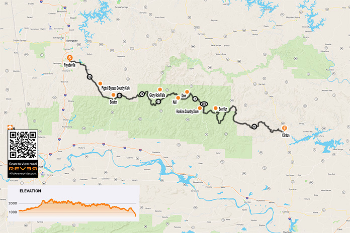
Another reason it’s mostly unknown is that it doesn’t have a cool moniker like the “Pig Trail” section of Arkansas Highway 23. So I propose that the 160-mile stretch from Fayetteville to Clinton henceforth be known as the “Ozarks Scenic Highlands Skyway.”
Arkansas Highway 16: ‘Your last route of choice’…by car at least
Highway 16 begins in the northeastern part of Arkansas at the Oklahoma border and runs southeasterly across about two-thirds of the width of the state. From Fayetteville to Greers Ferry, it winds from one little town to another through small communities with unique names like Swain, Nail, Deer, Lurton, Witts Springs, and my personal favorite, Ben Hur.
If you were traveling by car from Fayetteville to Greers Ferry, Highway 16 would be your last route of choice. That’s exactly what makes it fantastic for riders. From Fayetteville, the ride east on Highway 16 out of town is fairly pedestrian, but once you get past Elkins, the road parallels the upper portion of the 710-mile White River.
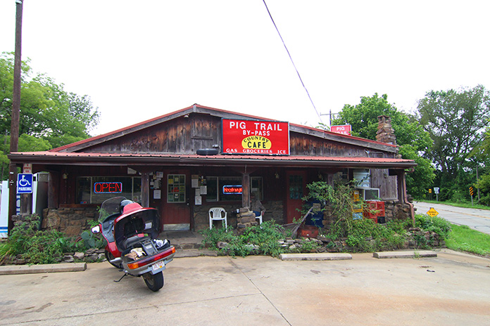
The highway becomes more serpentine as it climbs into the highlands of the Ozarks. At Brashears, Highway 16 intersects the Pig Trail Scenic Byway section of Highway 23 for about 4 miles until Hawkins Hollow and becomes very twisty.
Located near the junction with the Pig Trail Scenic Byway, the Pig Trail Bypass Country Cafe serves a mean “Hooshburger.”
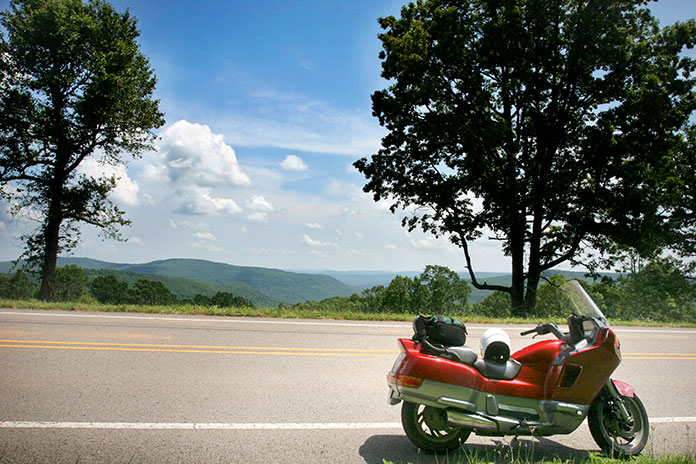
A look at the Arkansas State Highway map reveals that the highway has more than enough squiggly lines to delight the sport rider. And it has more than enough drop-dead gorgeous scenery to delight the cruising rider.
Riding high through the Ozark Mountains, Arkansas Highway 16 winds its way through beautiful scenery full of dense forests and lush pastures.
Just shy of 10 miles later at Boston, Highway 16 breaks out on the ridge tops and stays up there. The highway then defines what I call the “Ozarks Divide.” Creeks and rivers on the south side of the highway flow into the Arkansas River while those on the north side flow into the White River. The result of being up on the ridges on Highway 16 is that you often have spectacular vistas and views on both sides of the road at the same time – thus my suggestion to call it the Ozarks Scenic Highlands Skyway.
Views like this are why the author think Arkansas Highway 16 should be called the Ozarks Scenic Highlands Skyway.
Arkansas Highway 16: Watch for Deer…and Ben Hur?
The 161-mile ride from Fayetteville to Clinton takes up to four hours, depending on how many stops you make. But if you don’t stop along the way, you’ll miss out on interesting experiences with the locals in those unique places with unique names.
For example, there’s a tiny spot on Highway 16 called Fallsville. At the least, I like the town for the irony of its name as a stop on a top-tier motorcycling road, considering it contains a four-letter word for riders if there ever was one. Fallsville is located at the western junction of Highway 16 and Arkansas Highway 21, and despite the odd name, it’s a great spot for a break. Besides the wonderful roads, it’s places like Fallsville that make the Ozarks marvelous for riders who want to experience the local culture.
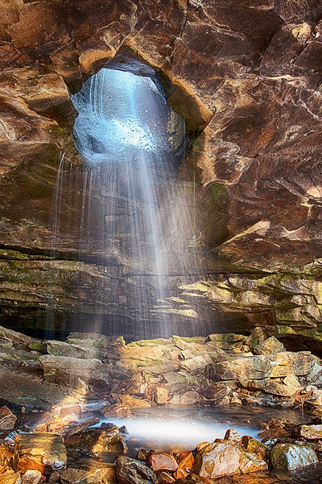
If you’re inclined to take a hike (not a good idea in July or August) you can go to Glory Hole Falls, 5.7 miles northeast of Fallsville on Highway 16/21. It’s beautiful, especially when the water is flowing fast. The hike is a mile each way, downhill to the falls and uphill on the way back.
Known as the “Glory Hole,” after a rainstorm, water rushes down the hillside from above and creates a beautiful waterfall. Photo by J.P. Bell.
Twenty miles east of Fallsville (and about 11 miles past where Highway 16 splits off Highway 21) is a veritable metropolis compared to Fallsville. The town of Deer has one convenience store and a public school whose mascot is cleverly named the Antlers. Only in the Ozarks!
A couple of miles past Deer, Highway 16 joins Arkansas Highway 7 heading south, where the roads occupy the same right-of-way and eventually join Arkansas Highway 123. This trifecta of outstanding Arkansas highways – 7, 16, and 123 – are all dynamite roads. Highway 7 is revered as “Scenic 7.” Highway 123, like 16, is a lesser-known road that should be on every rider’s bucket list.
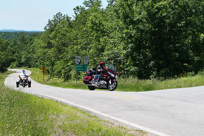
Freelance writer Teri Conrad takes a break at the junction of Arkansas highways 16 and 27. There are no bad riding roads in this area.
The roads go their separate ways at Sand Gap – formerly Grand Gap and Pelsor – where you’ll find the old-time Hankins Country Store. During peak riding season, hang around a while and you’re bound to meet riders from all over the country.
Don Hankins ran the 1922-era Hankins Country Store in Pelsor for years. It recently reopened under new ownership.
As much as I like Deer, my favorite place name along the way has got to be the dot on the map called Ben Hur, which has no store or businesses. It’s just a tiny community with a great name. According to an article in the Arkansas Times, the town was named in honor of actor Charlton Heston, presumably a nod to his 1959 movie of the same name. In Heston’s twilight years, he reportedly asked the town fathers to consider renaming it “Cold Dead Hand” but to no avail.
Between Fayetteville and Clinton, Arkansas Highway 16 intersects several other fantastic state highways, including 7, 21, 23, 27, and 123.
There are dirt roads winding off across the area on either side of Highway 16. One of my favorite routes is the Hurricane Wilderness Ramble, which begins in Deer. These are wonderful roads for ADV riders. But regardless of what you ride, you will enjoy traipsing across this twisty Ozarks Scenic Highlands Skyway.
Bringing you the Best Motorcycle News from Around the Web!
We use cookies to ensure that we give you the best experience on our website. If you continue to use this site we will assume that you are happy with it.Ok