Tag Archives: U.S. Tours

Tracing the Cascades on a Yamaha Tracer 900 GT

2019 Yamaha Tracer 900 GT
Road testing the 2019 Tracer 900 GT in Washington’s Klickitat River valley, with Mount Adams in the background. (Photos by the author & Brian J. Nelson)

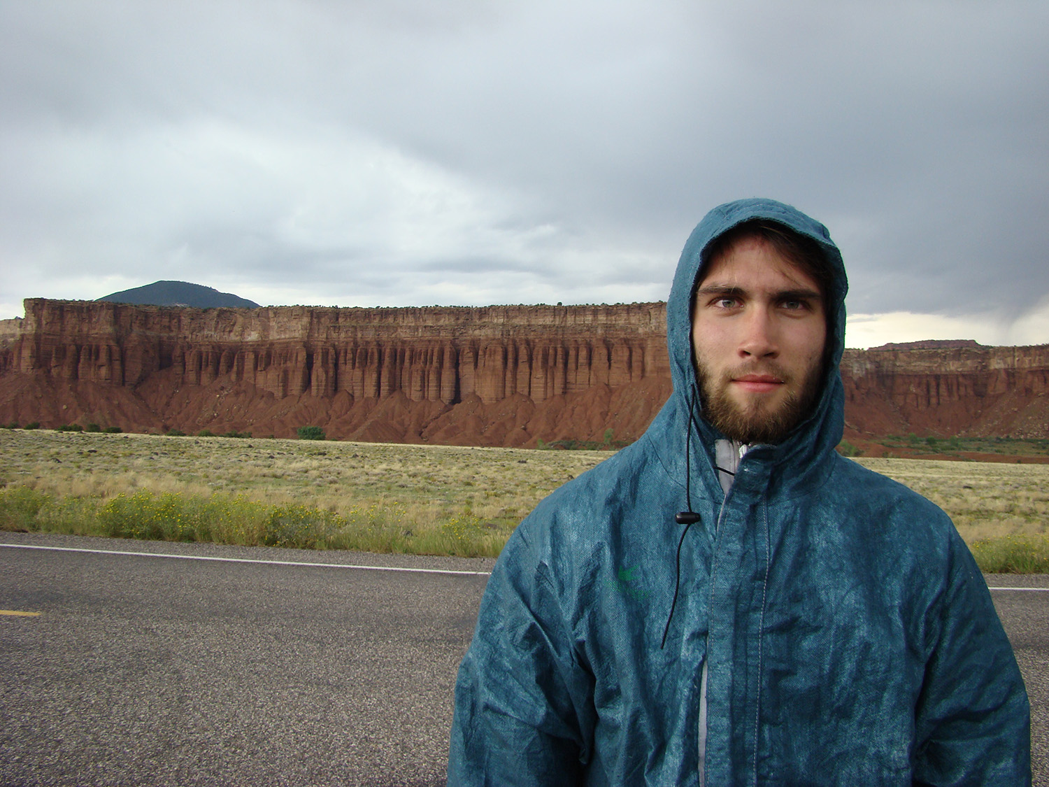
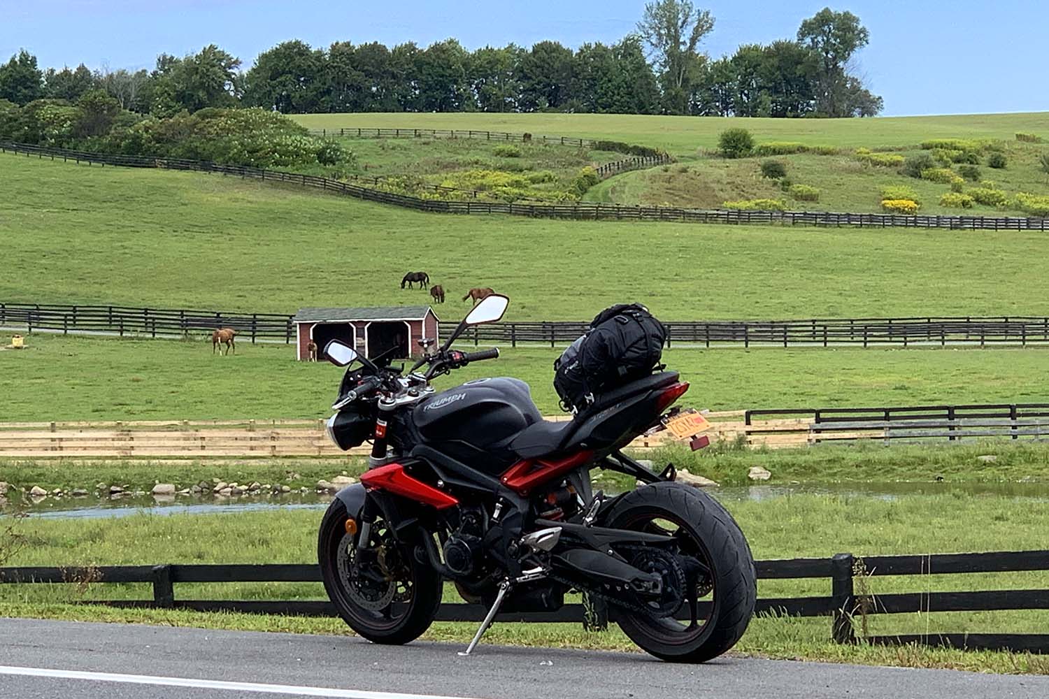
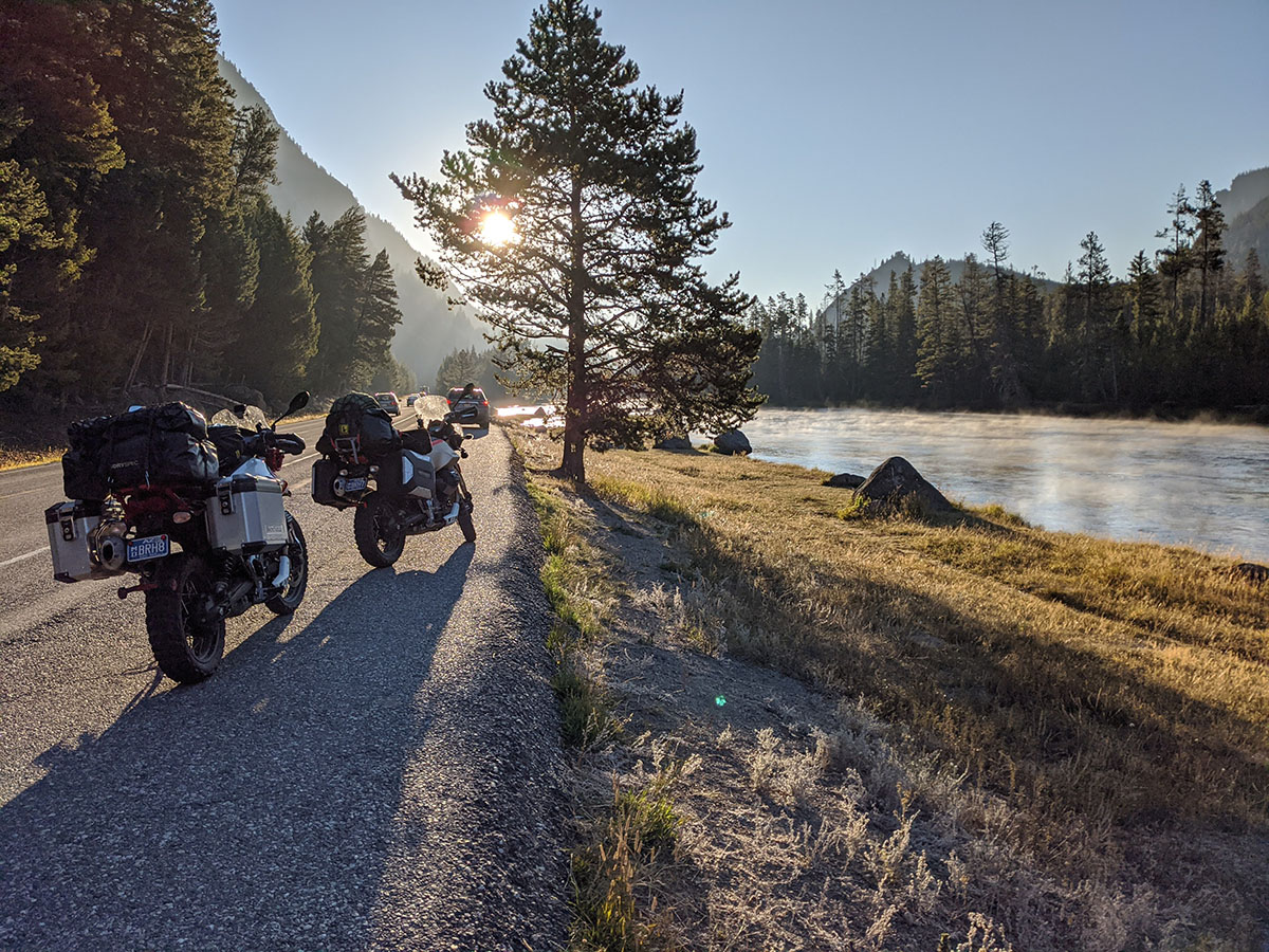
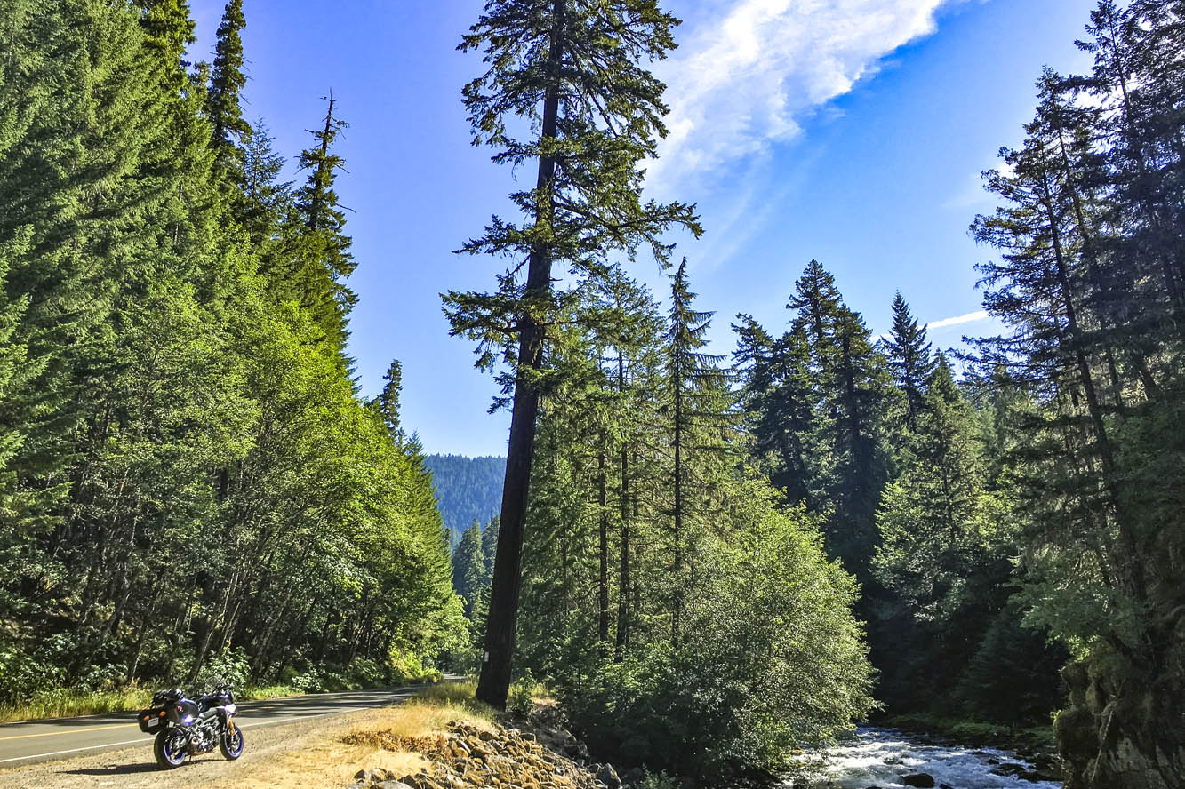
Winding through a dark canopy of evergreens, the road played hide-and-seek with the Clackamas River, offering a glimpse here and there of clear water pouring over rocks as it made its way downstream to the Willamette, then the Columbia, and finally the Pacific. A break in the canopy was like popping out of a tunnel and I set my eyes on a patch of gravel next to the road, just a few feet from where the river made a sharp turn. Down went the Yamaha Tracer 900 GT kickstand, off went the ignition. I hadn’t seen a car for miles. It was just me and the trees and the river. Just what I was looking for.

Emerging from a dark tunnel of trees on the West Cascades Scenic Byway, I found the perfect sunny spot to enjoy the sights and sounds of the Clackamas River.

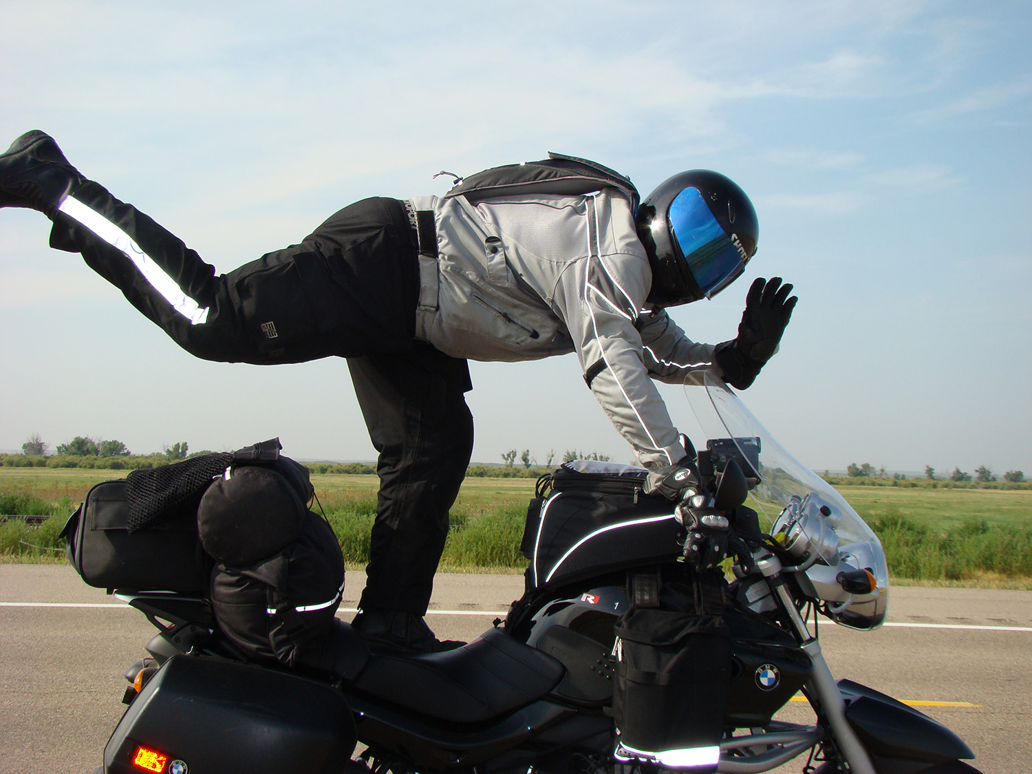
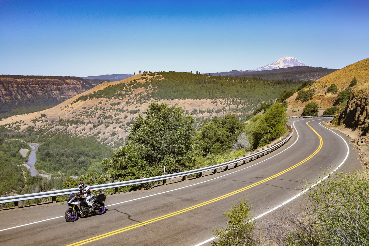
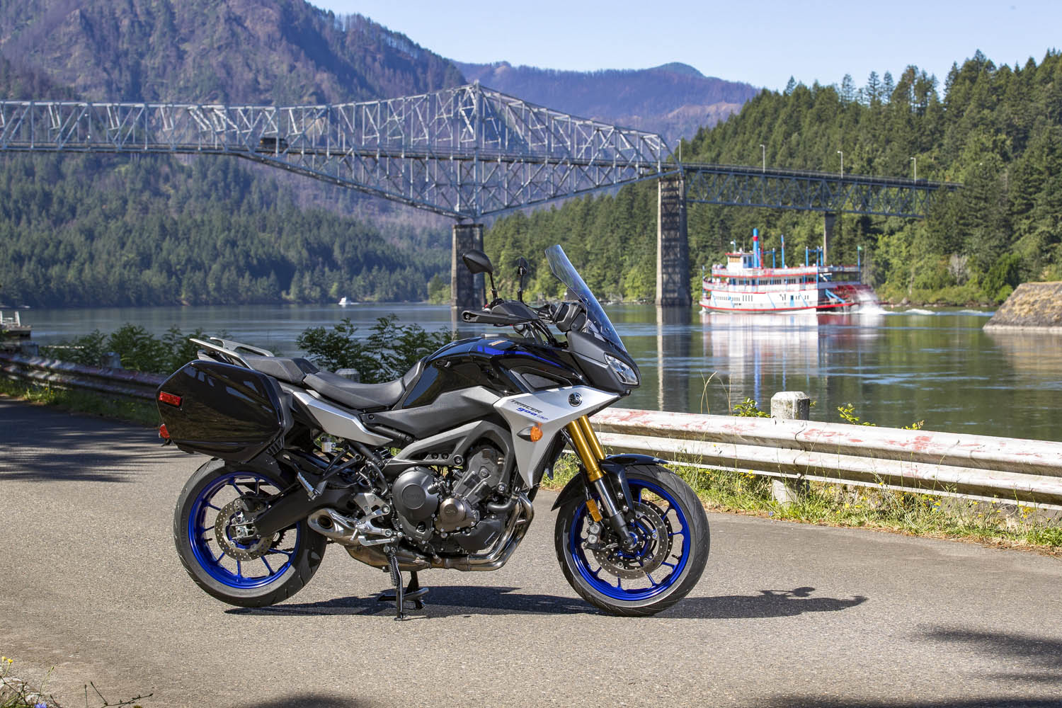
The previous day I logged 250 miles aboard the Yamaha at the bike’s press launch. The event was based in Stevenson, Washington, a small town in the heart of the Columbia River Gorge National Scenic Area, and I spent a long, hot day testing the GT on local backroads. Weighing just 500 pounds and packing a punch from its 847cc inline-Triple, the Tracer 900 GT is a light, agile, comfortable sport-tourer, perfect for a solo traveler. Yamaha entrusted me with the keys to one for the long ride home to Southern California.

With snow-capped volcanic peaks, wild and scenic rivers, dense evergreen forests, and countless roads that follow the contours of the land, the Cascade Range is a motorcyclist’s paradise.

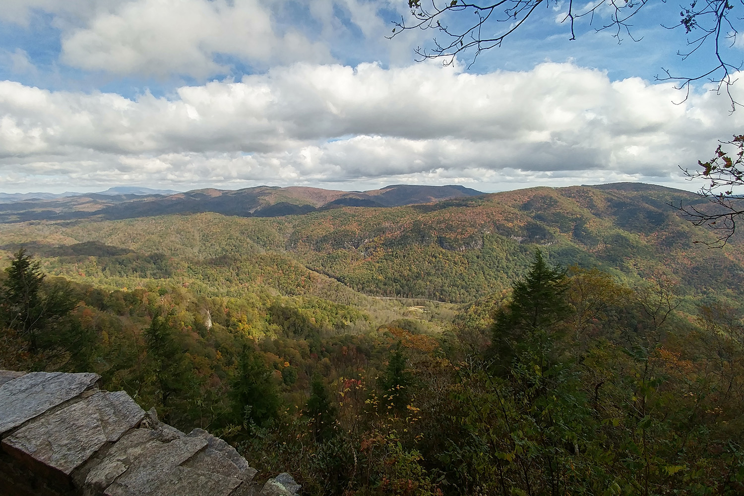
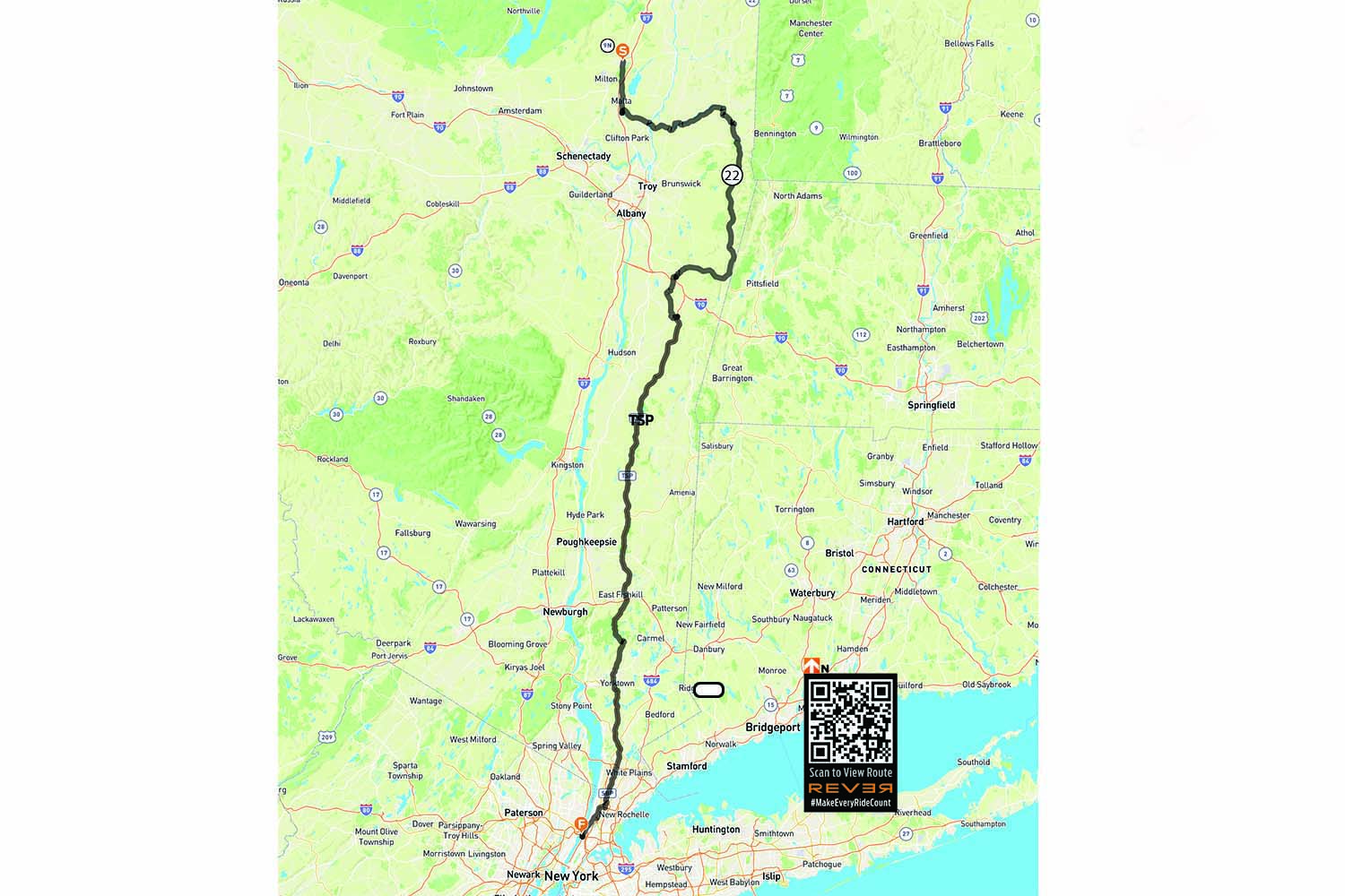
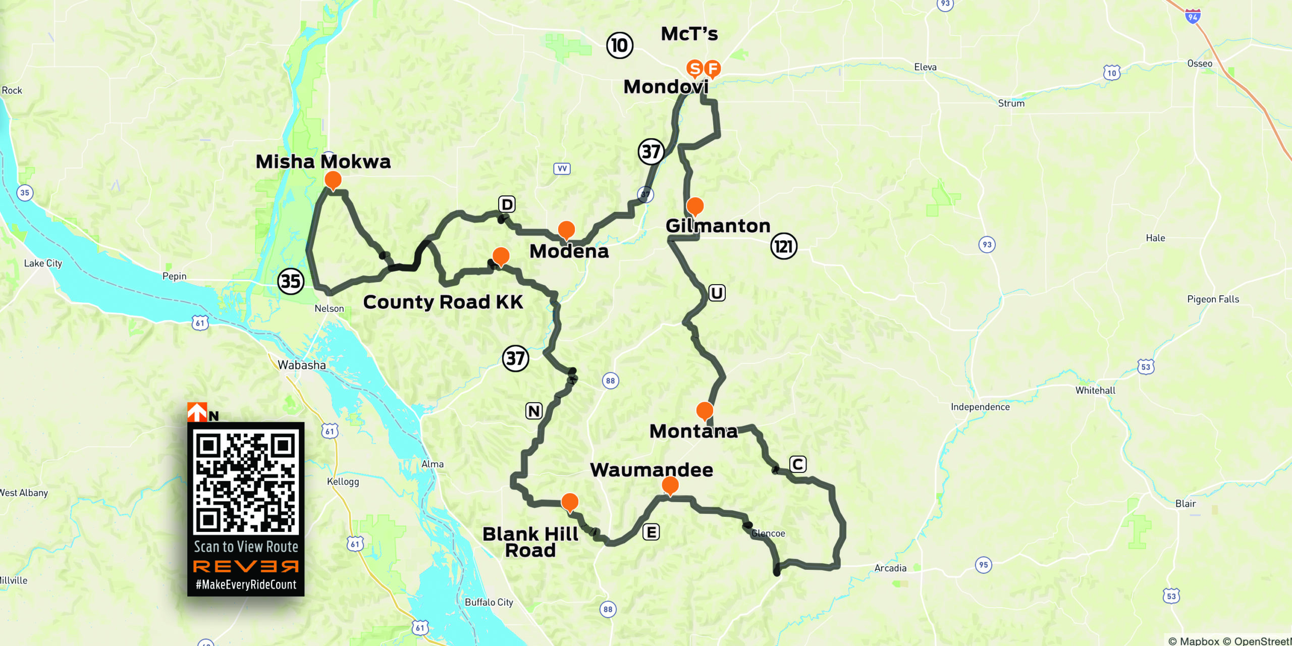
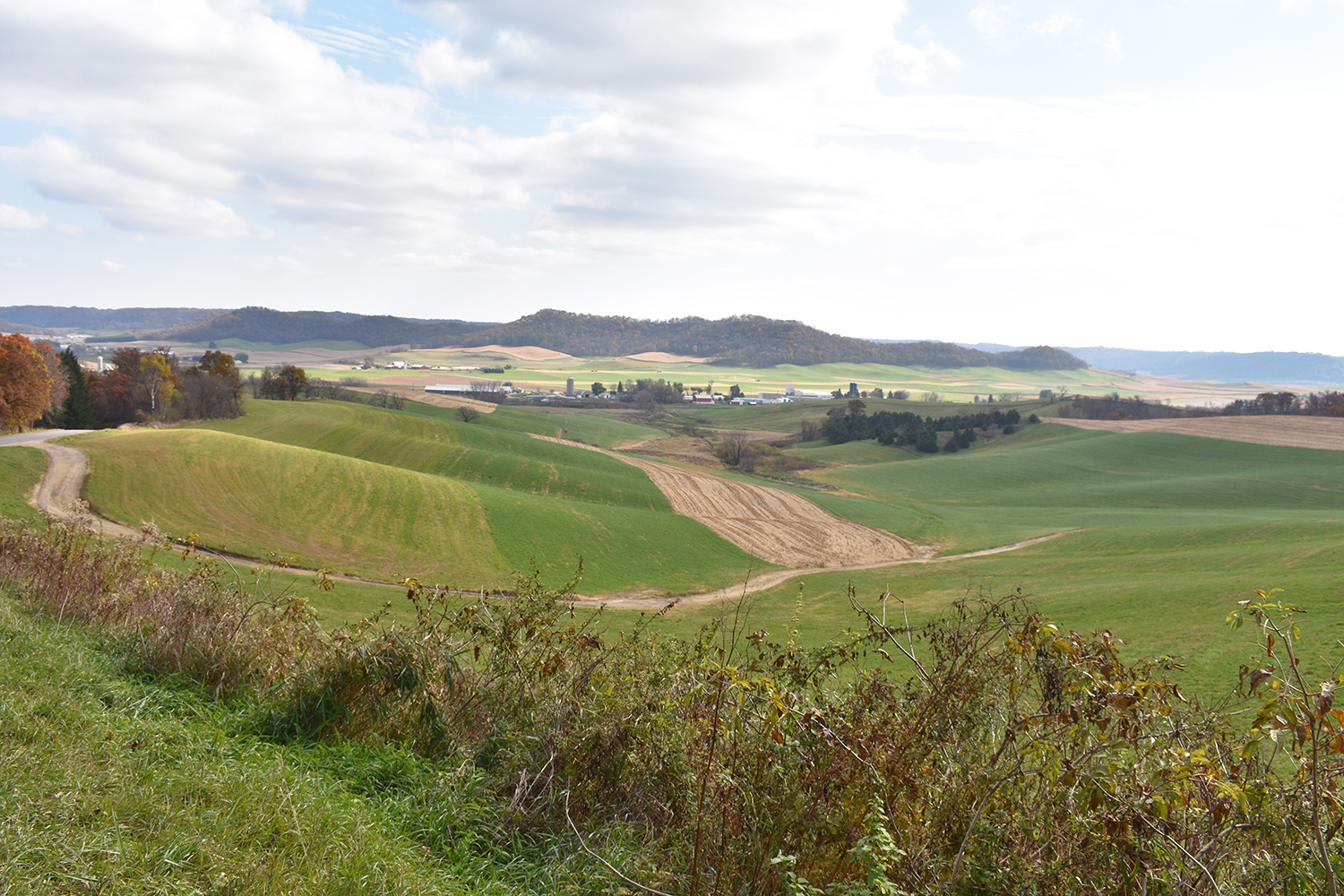
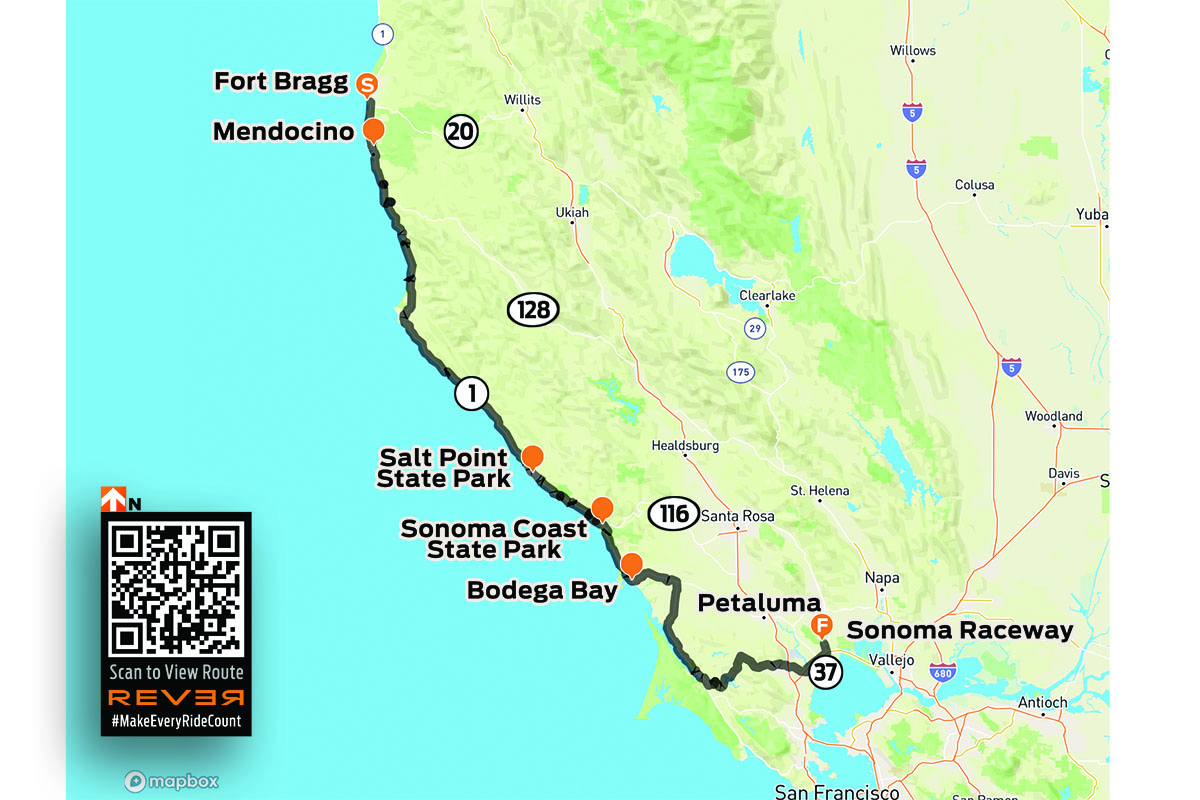
For years I’ve heard and read about how good the riding is in the Cascades, a mountain range that runs from British Columbia down through Washington and Oregon to Northern California. Whenever possible, I like to fill in the blank spots on my mental map –to experience first-hand what roads and scenery are really like. So I sketched out a route from the Columbia River to the California border that zigzags several times over the Cascades, winds its way through four national forests and one national park, and follows three designated scenic byways. Like any good motorcycle route, it would take at least twice as long as a more direct path.

2019 Yamaha Tracer 900 GT
The ride route from Stevenson, Washington, to Red Bluff, California.

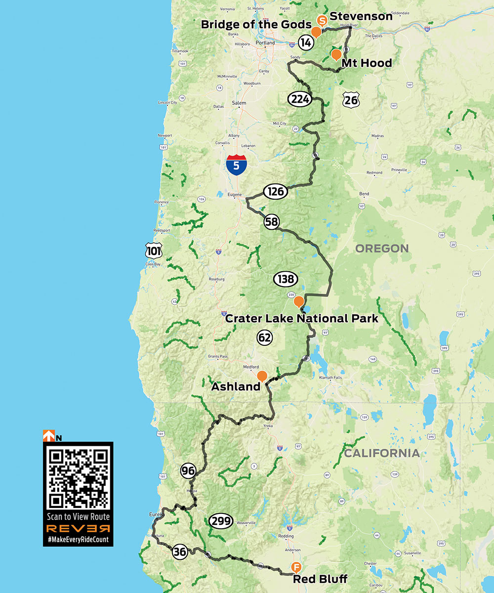
Click here to view the route above on the REVER app/website

With the GT’s saddlebags packed and a tailbag strapped to the passenger seat, I hit the road at 6 a.m., crossing the mighty Columbia – and into Oregon – on the Bridge of the Gods, a steel truss bridge named after a natural dam that was created by a landslide at the same location nearly 1,000 years ago. The narrow, 90-year-old bridge has no pedestrian walkway, but it’s where the Pacific Crest Trail crosses the river, so weary hikers with heavy packs must contend with cars and trucks.

The Bridge of the Gods spans the Columbia River, which forms the border between Washington and Oregon.

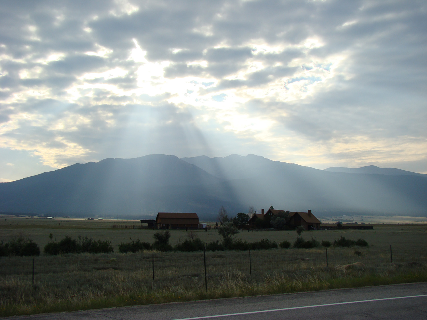
What makes the Cascades special is its many stratovolcanoes –the cone-shaped variety we learned about in grade school –that rise thousands of feet above the surrounding mountains. I’ve ridden along the eastern side of the Sierra Nevada in California dozens of times, and every time I pass through the town of Lone Pine, I struggle to pick out Mount Whitney – the tallest mountain in the lower 48 states – from the neighboring peaks that are nearly as tall. On the Tracer 900 GT press ride we saw several volcanic peaks, Mount Adams (12,281 feet) and Mount St. Helens (8,363 feet – before it blew its top in 1980, it was 1,300 feet taller) in Washington, and Mount Hood (11,249 feet) in Oregon, standing head and shoulders above the landscape, easily visible from miles away. They’re part of the Cascade Volcanic Arc, a series of 12 volcanoes stretching from Mount Silverthorne in British Columbia to Mount Lassen in California, which is part of the Pacific Ring of Fire –more than 450 volcanoes scattered along the outer edge of the Pacific Ocean.

When Washington’s Mount St. Helens erupted in 1980, it literally blew its top, erasing 1,300 feet from its peak. This view is from McClellan Overlook, off Curly Creek Road, in Gifford Pinchot National Forest.

Like a good omen, snow-covered Mount Hood greeted me as I turned south on State Route 35, the beginning of Mount Hood Scenic Byway, where I rode through apple farms on a sunny, cloudless July morning. The previous day topped out at 105 degrees, and the heat wave wasn’t done with me, but early in the morning the byway along the East Fork Hood River was still in deep shadow and my teeth began to chatter. On went the heated grips, and I tried to hold onto the physical memory ofbeing cold, hoping to recall that feeling during theheat of the day (it never works). With graceful curves and smooth pavement, the byway is a pleasure to ride, especially when the screen of trees falls away and Mount Hood takes center stage, framed perfectly in brilliant blue.

Mount Hood Scenic Byway, one of many scenic byways that meander through the Cascades, cuts a wide arc around its namesake peak.

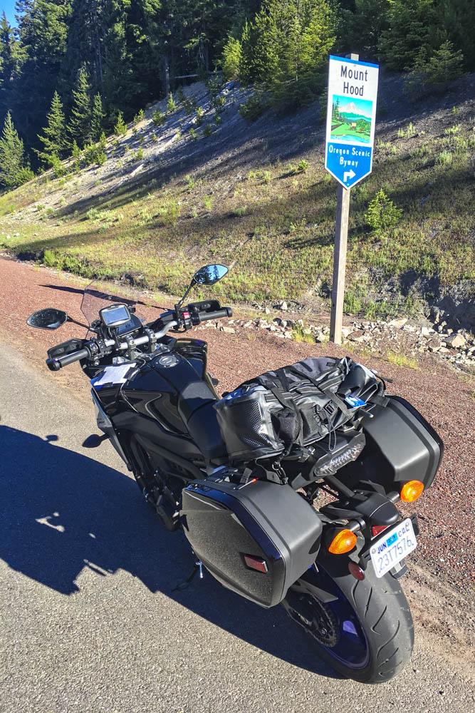
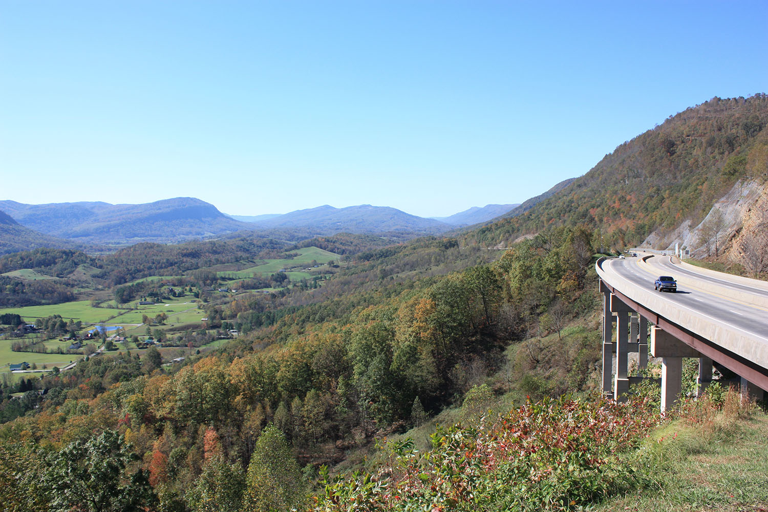
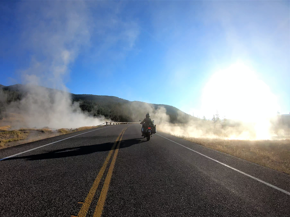
After cutting a wide arc around the eastern and southern sides of Mount Hood, my first crossing of the Cascades came to an end in Sandy. Turning south and then east on State Routes 211 and 224, I picked up the West Cascades Scenic Byway, heading southeast along Estacada Lake and North Fork Reservoir, two finger lakes created by dams on lower sections of the Clackamas River. As the byway crosses into Mount Hood National Forest, it enters a deep, narrow valley as it climbs up into the Cascades, where the Clackamas flows wild and free. The Tracer and I were in a groove, experiencing this road together for the first time –bends, kinks, dips, rises, bridges, blind corners, and fleeting views of the river, the contours of which give the road its character.

A postcard view of Oregon’s Mount Hood from Bennet Pass Trailhead, just off State Route 35 on the Mount Hood Scenic Byway.

With the low-fuel light on, I pulled into Detroit, a crossroads on the shore of Detroit Lake. Folks were starting their summer weekend early. Subarus laden with kayaks and pickups overflowing with camping gear were parked in lots, coolers were being filled with ice and beer. I refueled and scarfed an egg salad sandwich in the shadow of Rivers Run Deli, trying to stay cool while enjoying a view of the marina and the lake’s milky blue water. When traveling solo and covering a lot of miles in just a few days, I rarely stop for long. Just a few minutes here and there, then I’m back in the saddle, trying to cram 10 pounds of riding into a 5-pound sack.

Roads in the Cascades often carve their way through lush forests, with the curving pavement winding in and out of shadows.

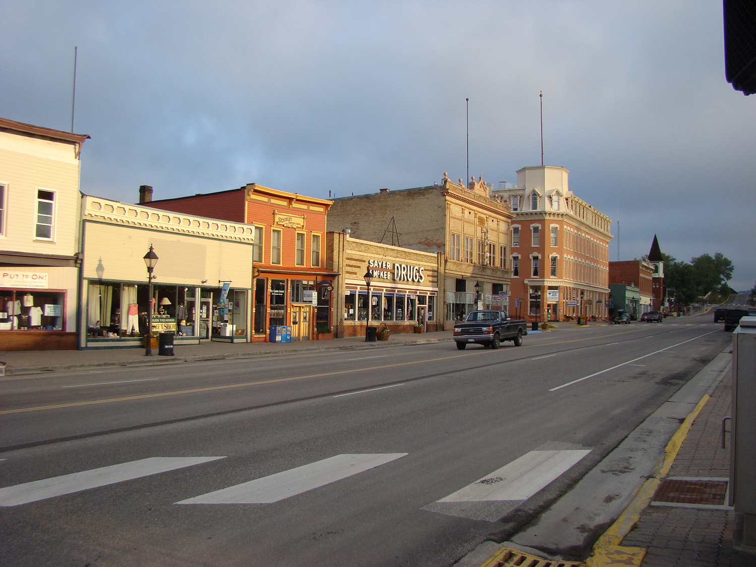
From Detroit to Chemult – south, zig west, zag east, back over the Cascades –all I remember are trees, and a cross-section of America. Stopping to use the bathroom at a McDonald’s, I had to negotiate my way through a crowd of boisterous kids wearing matching blue T-shirts bearing the name of their church summer camp, ready to fill their bellies with Happy Meals. Outside, two young women were sitting on the curb, holding a sign: Family in Need. And next door I topped off the Tracer’s tank after the flirtatious – not to mention bald and tattooed – gas station attendant handed me the nozzle. (In Oregon and New Jersey, you’re not allowed to pump your own gas, but attendants often let motorcyclists break the law.) I was just passing through, little more than an observer. Experiences like these give me something to mentally chew on while ticking off miles.

2019 Yamaha Tracer 900 GT
The 500-mile Volcanic Legacy Scenic Byway runs through Oregon and California, connecting volcanic peaks in the Cascades.

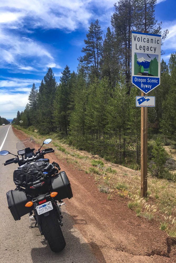
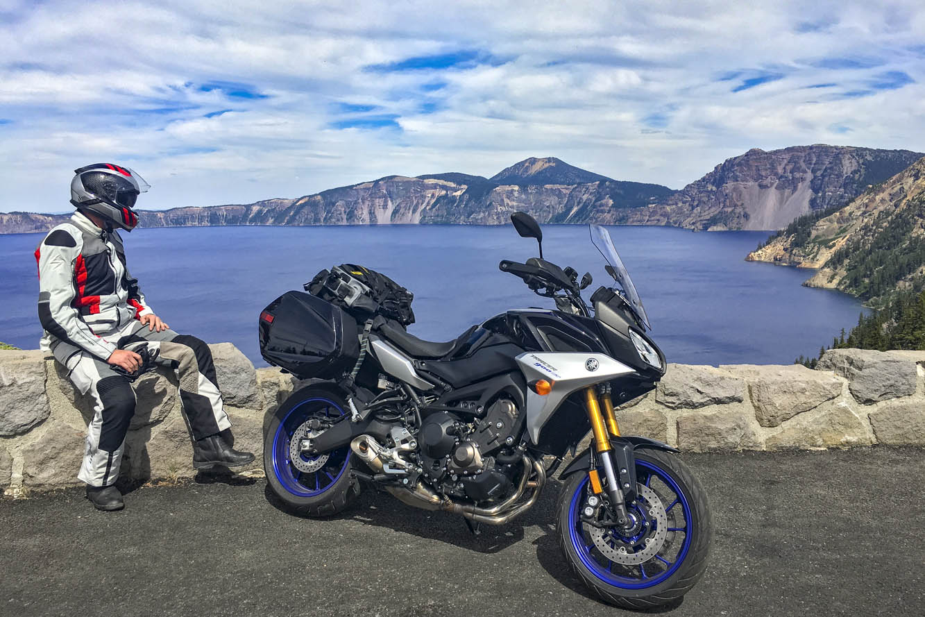
Passing through Chemult, a truck stop on U.S. Route 97 brought back memories of stopping there to refuel during my one and only SaddleSore 1000 ride back in 2013 – a very long day that I’m not likely to repeat. Turning west on State Route 138, the Volcanic Legacy Scenic Byway took me to Crater Lake National Park, where I queued up behind a rumbling Harley and a line of cars and RVs outside the northern gate, keeping my faceshield closed to prevent the army of mosquitos from waging war on my nose. Crater Lake was high on my list of must-see places, and it didn’t disappoint. Created thousands of years ago when a volcano collapsed, the caldera lake is nearly 2,000 feet deep – the deepest in the U.S. – and because it is filled only by rain and snow, the water is pure and a brilliant shade of blue. But I was pressed for time and there were construction delays on the East Rim Road, so I’ll have to go back to ride the full loop.

Taking in the brilliant blue of 2,000-foot-deep Crater Lake, a collapsed volcano filled with thousands of years’ worth of rain and snow.

On the not-politically-correct but wonderfully twisty Dead Indian Road, I descended from the green heaven of the Cascades into the dry, brown hell of Ashland. It’s actually a lovely little town, home to Southern Oregon University and the world-famous Oregon Shakespeare Festival, but it was over 100 degrees and I had been in the saddle for 12 hours. I was in desperate need of a cold shower, a colder beer, and some pizza.

The next day I left the Cascades, riding a few miles south on Interstate 5 into California, where I filled up at a Chevron in Hornbrook. On both sides of the interstate and all around the gas station, the ground and vegetation were charred black from the Klamathon Fire, which roared through just days earlier. It was one of many wildfires that would plague California and other western states in the weeks and months ahead.

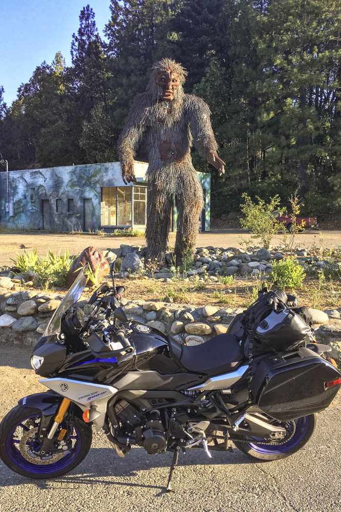
More blanks filled in on my mental map: State Route 96 along the Klamath and Trinity rivers, which cuts through rugged, remote country. In 1941, a group of armed men stopped traffic near the town of Yreka, handing out a Proclamation of Independence for the State of Jefferson, which was in “patriotic rebellion against the States of California and Oregon.” Although the new state never materialized, the movement is still active, and the State of Jefferson Scenic Byway runs along Route 96 from State Route 263 to Happy Camp. After that, 96 becomes the Bigfoot Scenic Byway. Regardless of one’s views on state politics or mythical forest dwellers, the riding along Route 96 is sublime and traffic is almost nonexistent.

Sasquatch sighting in Happy Camp, California, on State Route 96, where the State of Jefferson Scenic Byway turns into the Bigfoot Scenic Byway.

At Willow Creek, I turned west onto State Route 299, known as the Trinity Heritage Scenic Byway because it follows the path of 19th-century gold miners and pioneers. It snakes its way through the heavily wooded Trinity Alps and climbs over a pass before making a long descent to the coast. Even in mid-July, U.S. Route 101 through Arcata, Eureka, and Fortuna was socked in with chilly fog. At Alton, I turned east again, heading inland on State Route 36 –not a designated scenic byway, but known as Serpent to the Sea. Traveling west-to-east, it passes through a few rural communities before entering Grizzly Creek Redwoods State Park, where enormous coast redwoods rise hundreds of feet above the roadside.

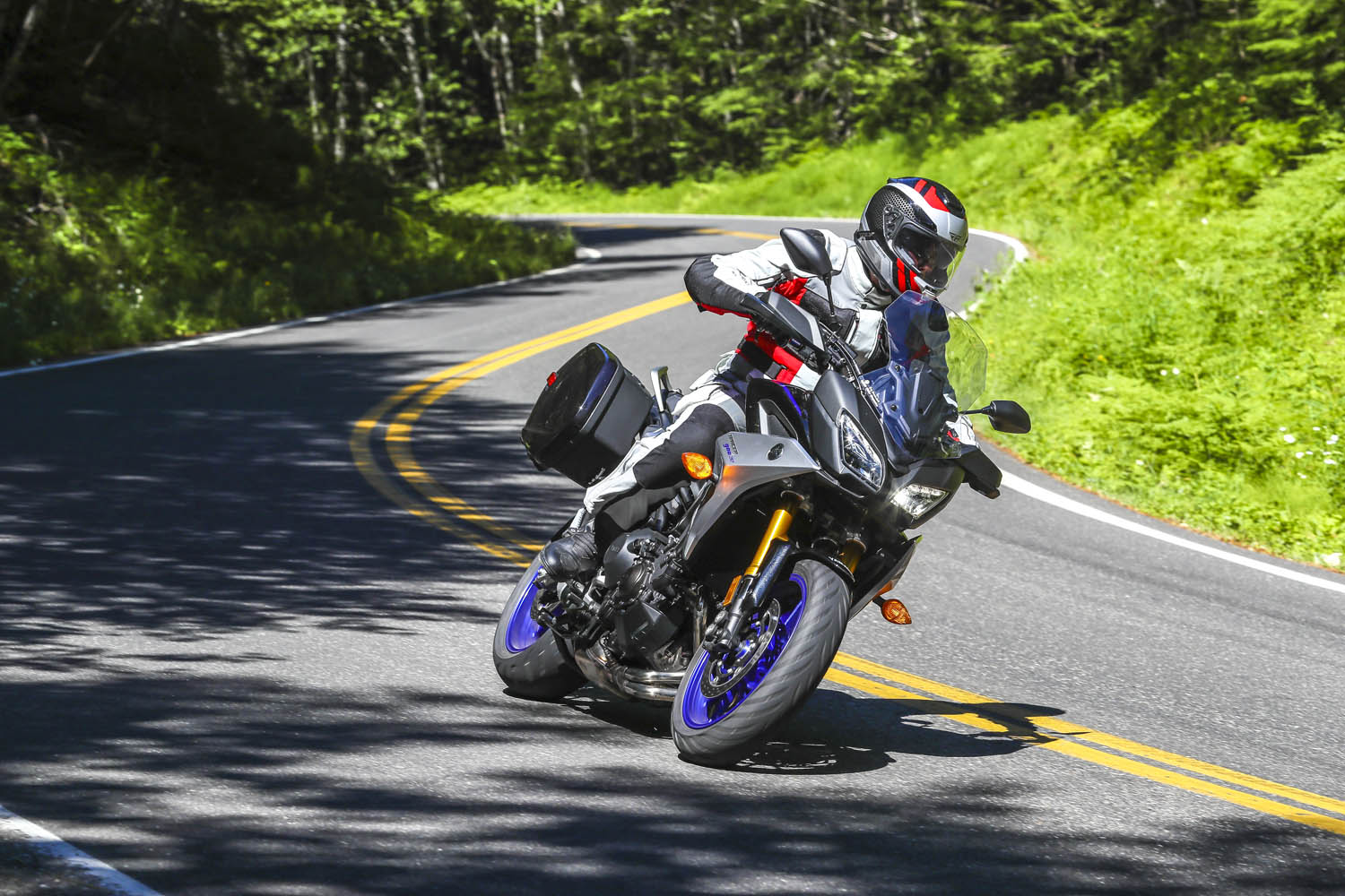
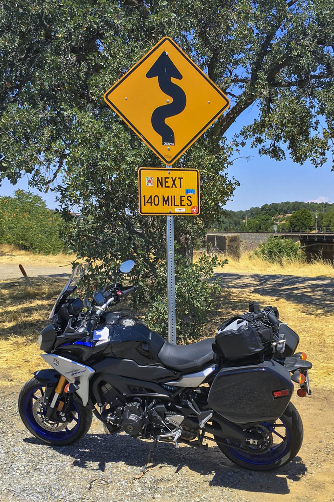
Beyond Bridgeville, Route 36 turns into a narrow goat path as it goes over a ridge, but it’s currently being straightened and widened to accommodate big trucks and RVs –an improvement for them but not for motorcyclists. East of Dinsmore, Route 36 was freshly paved, like having a racetrack all to myself, scraping the Tracer’s peg feelers in corner after corner. And on it goes, over more mountains with endless curves and finally roller-coastering its way through ranch land with blind crests and sudden drops and quick turns. As I approached the town of Red Bluff, just before Route 36 crosses I-5, I found the well-known sign that warns motorists and entices motorcyclists: curvy roads next 140 miles.

This sign tells motorcyclists everything they need to know. Good times ahead!

The thing about riding roads as good as these is that it becomes addictive. Now that I have experienced the Cascades and California Routes 96 and 36 for myself, all I want to do is go back for more.

The post Tracing the Cascades on a Yamaha Tracer 900 GT first appeared on Rider Magazine.
Source: RiderMagazine.com

Riding the Georgia Triangle

Riding the Georgia Triangle best motorcycle ride
This rider is enjoying the curves along State Route 60 on his way to Two Wheels of Suches, which is an ideal spot to stop for a cool drink and to see cool motorcycles. (Photos by the author)

Formed roughly 480 million years ago, the Appalachians are a chain of mountains that stretch from Newfoundland, Canada, down to central Alabama. Eons of erosion have rounded and softened their edges, and rivers and creeks have cut deep creases within their slopes. The result is a nearly endless variety of roads that follow the contours of the land, attracting motorcyclists from far and wide like moths to a flame.

The Appalachian Trail begins in North Georgia, on Springer Mountain, not far from one of the best riding loops in the Southeast. The three sides of the Georgia Triangle are anything but straight. In fact, the triangular loop made up of U.S. Route 19 and Georgia State Routes 60 and 180 has some of the most challenging curves and best scenery in a region known for both.

Riding the Georgia Triangle best motorcycle ride
The Georgia Triangle route (map by REVER)

View/download the Georgia Triangle route on REVER

The Georgia Triangle is located in the Blue Ridge Mountains just north of the charming, historic mountain town of Dahlonega. The three-road loop is located within the Chattahoochee National Forest, and there’s an abundance of streams, waterfalls, lush forests, and historic sites in the area. Add in numerous tourist attractions, activities, hotels, bed-and-breakfasts, campgrounds, and eateries, and you’ve got everything you need for a great day ride or a long weekend of exploration.

Riding the Georgia Triangle best motorcycle ride
Plying the curves on State Route 180.

Six miles north of Dahlonega, the triangle begins where U.S. 19 meets State Route 60 at Stonepile Gap. Within the junction’s roundabout is a mound of stones that is said to mark the burial spot of Cherokee Princess Trahlyta. According to legend, Trahlyta was a beautiful princess kidnapped by a Cherokee warrior she refused to marry. Her dying wish was to be buried near her home on the mountain, though she probably didn’t imagine her grave would be surrounded by a ring of asphalt.

Riding north on Route 60 toward the town of Suches is the first leg of the triangle. If you have not been practicing your cornering skills, be cautious. These roads are not for the faint of heart. They can either be exhilarating or nerve-wracking, depending on your motorcycle’s cornering clearance and your comfort with tight S-curves and decreasing-radius turns. For the alert, confident rider, these roads offer an unforgettable riding experience, with gorgeous scenery and well-maintained pavement.

Riding the Georgia Triangle best motorcycle ride
A shady spot on State Route 180.

About 5 miles up Route 60 is Woody Gap, and a look to the left reveals an expansive valley with Springer Mountain rising on the other side. The Appalachian Trail crosses the road nearby, and other stops on the road have signs and information about Civil War battles, gold mining sites, and hiking trails.

In the small town of Suches is a well-known motorcycle lodge and campground called Two Wheels of Suches, a popular meet-up spot. On weekends the parking lot is filled with bikes of all styles and vintages, and riders from all over. There’s an onsite restaurant that serves burgers, sandwiches, snacks, and drinks on Friday nights and weekends. The main lodge offers rooms for rent, and there are small cabins and campsites with a bathhouse on the property. A single-person campsite is $15/night, cabins are $65/night, and lodge rooms are $75/night.

Riding the Georgia Triangle best motorcycle ride
Two Wheels of Suches is a motorcyclists’ oasis.

A stone’s throw from Two Wheels of Suches is the junction with State Route 180, also known as Wolf Pen Gap Road. This segment of the ride is without a doubt the most challenging leg of the triangle, with more tight curves and steep grades per mile than any other paved road in Georgia. The first few miles are a sedate and primarily straight two-lane blacktop leading to Lake Winfield Scott Recreation Area. When the lake’s emerald-green water is calm, it acts as a large reflecting pool for the mountains that surround it. And it is a particularly scenic spot in the fall when the leaves change color.

Once past the lake, the roller-coaster ride begins with a sign that says “Sharp Curves and Grades Next 5 Miles.” Route 180 snakes through the Sosebee Cove Scenic Area with speed limit signs on some curves reading as low as 10 mph, with nary a straight section of road. Stay sharp and heed the caution signs. The great thing about this section of the Georgia Triangle is that it’s only 11 miles long – the same length as the Tail of the Dragon in Tennessee – so you can ride it back and forth to your heart’s content. 

Riding the Georgia Triangle best motorcycle ride
Canada Creek passes through the Two Wheels of Suches property.
Riding the Georgia Triangle best motorcycle ride
In Cherokee mythology, Blood Mountain, located within the Georgia Triangle, was home to the Nunnehi or Immortals. It was also the site of a fierce battle between the Cherokee and Creek tribes.

Just before Route 180 merges with U.S. Route 19, it passes by Lake Trahlyta, which is part of Vogel State Park. You can swim in the lake and stay in the park, which offers tent camping, RV sites, and rental cottages and yurts. Georgia is often hot and humid in the summer, even up in the mountains. I have stopped here on a hot day for a quick change and a swim, so pack your swimsuit.

Riding south on U.S. 19 is the last leg of the triangle. The road here is wider, with passing zones for easily and safely getting around slower traffic. Still, it has magnificent twisting sections of repeating S-curves and turns, great scenery, and worthwhile stops all the way back to the triangle’s starting point.

Riding the Georgia Triangle best motorcycle ride
Lake Trahlyta is part of Vogel State Park, located in the northeastern corner of the triangle.

Continuing to the junction with Route 60 yields total mileage around the triangle of about 36 miles. The travel time for a nonstop ride is about 90 minutes at a reasonable rate of speed, but why hurry? The beautiful forest ride and options for stops make a leisurely pace worthwhile. Or, follow the lead of many motorcyclists and repeat the loop or run it in reverse. You won’t be bored, I promise.

Part of what makes the Georgia Triangle such a target-rich destination is that it’s a hub for other great rides in the area. Route 60 is a joy to ride not just to Suches but beyond, all the way to Route 76. From there, head east to Hiawassee, the scenic town on Lake Chatuge, or west to Route 515, which becomes I-575 and takes you to Atlanta.

Riding the Georgia Triangle best motorcycle ride
A real estate investment opportunity on U.S. 19.

If you’re looking to explore further, taking Route 60S (also known as Murphy Highway) northeast at Mineral Bluff into North Carolina will lead you to U.S. Route 74 and the town of Murphy, North Carolina. Continuing east on U.S. Route 64 is a scenic ride through the Hiawassee River and Lake Chatuge areas, and several roads connect back to the Georgia Triangle area.

Continuing north on U.S. 19 past Vogel State Park, Route 180 breaks away again and continues east. A short hop on 180 takes you to State Route 348, also known as the Richard B. Russell Scenic Highway, another gem of a road. Or continue east on 180 to Brasstown Bald, the highest point in Georgia (4,784 feet), which on a clear day offers a 360-degree view of four states.

Riding the Georgia Triangle best motorcycle ride
Ride to eat, eat to ride. The Smith House in Dahlonega serves some of the best country cooking in the region. Don’t wear tight pants.

If you are planning a stay in the area, Dahlonega is a charming, historic town known for its history of gold exploration and mining. Legend has it that in the 1540s, Spanish explorer Hernando DeSoto searched this area for El Dorado, the legendary lost city of gold. Dahlonega was the site of the second major U.S. gold rush in the early 1800s and still has active mines where visitors can pan for gold and gemstones. For lunch or dinner, I highly recommend the Smith House, which serves fried chicken, ham, sides, and desserts family-style, with platter after platter passed around long tables. Just to the east of Dahlonega is Helen, a quaint alpine-style village. Both towns offer many choices for lodging, dining, and shopping.

If you’re undecided about which road to ride first, throw a dart at the map – chances are wherever it lands, you’ll find a winner. North Georgia offers hundreds of miles of great roads to ride, and the Georgia Triangle is just the beginning.

The post Riding the Georgia Triangle first appeared on Rider Magazine.
Source: RiderMagazine.com

Riding Ohio’s Triple Nickel

Riding Ohio's Triple Nickel
Ohio State Route 555, also known as the Triple Nickel, has for a long time been a beacon, calling single riders or large groups from all corners to experience its challenge. (Photos by the author)

No more than 10 miles from where I learned to ride a motorcycle is one of our country’s finest set of twists and turns. Prejudiced, you may be thinking, but these are not just my thoughts. They come straight from Car and Driver magazine, which in 2020 published a list of the dozen best driving (and riding!) roads in America. First on their list: Ohio State Route 555, also known as the Triple Nickel.

It’s a throwback, a two-lane highway built in another era, originally a gravel road for farmers and small-town folk to get to the big cities of Zanesville or Belpre, back in the Depression years when you might find a Hudson or Studebaker puttering along its 63 miles, the driver cursing every twist and turn that today make it a destination for car and motorcycle enthusiasts.

Riding Ohio's Triple Nickel
The Triple Nickel has the feel of a time long ago. Some may think it has a nostalgic charm, but don’t be deceived. There’s attitude-a-plenty along its miles. Photos by the author.

Nicholas Wallace introduced his Car and Driver piece by writing about the mystique of the best places to aim your car, or in our case, motorcycle: “Looking for an adventure – even if only in your mind? Let these treks take you away. Maybe it’s the fact that, despite constricting responsibilities and busy schedules, the car still stands as a beacon of freedom in our daily lives. It would take us hundreds of pages to list every great road, so instead we’ve brought you twelve of the best. Twisty, scenic, dangerous, and remote, these routes offer a lifetime’s supply of variety. So pack your stuff and head out – we promise it will be worth it.”  

Riding Ohio's Triple Nickel
Pick a direction and at some point the highway will take you there, but rarely in a straight line.

Our motorcycles offer us that same beacon of freedom. Starting just south of Zanesville, I’ve been down our great Ohio highway many times, always on something made for scraping footpegs, not that I still have that kind of nerve. But today was to be different. For this ride I’d be on three wheels, on my brother’s Can-Am Spyder. It was to be my maiden voyage, my first time on his trike, soon to be mine. Chuck had warned me about an adjustment period, the time it would take to get comfortable on a machine so different from the two-wheeled motorcycles that have carried me for over half a million miles.

Riding Ohio's Triple Nickel

Click here to view/download the Triple Nickel route on REVER

But my life had changed. Two vertigo attacks within three days had forced me to open my eyes to what might come next. The first bout had been when riding my Beemer on a western Ohio county road. In an instant I simply lost all sense of balance, going left of center and crashing in a farmer’s front yard. Luckily, I was unhurt and there was little damage to my bike. The second attack, when in my car, sealed the deal. For nearly a year since my crash, I’d been without a bike, until today.

The three-wheeled cycle, a 2014 model, had been Chuck’s pride and joy, the best bike he’d ever owned, he told me. Riding it that day was bittersweet. It should have been Chuck out on his Spyder. But his life had taken a turn of its own. For half of his 66 years he’d been plagued with muscular dystrophy, the disease slowly eating away at his ability to get around. It had finally gotten the upper hand, relegating Chuck to a walker and a wheelchair.

Riding Ohio's Triple Nickel
Dozens of American flags lined a long section of the highway, quickly out of view over the next hilltop. Around Halloween, there are small pumpkins on display.

But he had not gone quietly into his new solitude. Over the previous several years, Chuck had a single focus: to get his Spyder to 200,000 miles. He’d pushed hard, riding hundreds of miles every day. Only three years earlier he’d ridden over 43,000 miles in 12 months, with every year but the last tallying well over 30,000. But last June, at the height of the riding season, his body told him it was finished. It was done. (You can read more about Chuck’s high-mileage pursuits in “Chuck’s Race”.)

Riding Ohio's Triple Nickel
There are reminders along the highway of other eras, with Ohio’s famous highway having outlived them all.

Chuck had put up a valiant fight, but there are some things a human being simply can’t overcome. That last day, when he parked his trike, its odometer was frozen at 188,303 miles. But now, on this day – my day – it was to move again. It had fresh oil and a full tank of gas, so all I had to do was to check the tire pressure. Chuck had kept his Can-Am road-ready all winter, sometimes visiting and sipping a beer or two, reminiscing about the good old days, sometimes firing it up, simply to listen to the Spyder’s engine quietly humming along.

Riding Ohio's Triple Nickel
Farms, some owned by the Amish, thrive in the area, most found on hilly terrain, our motorcycles carving along their boundary lines.

The Spyder had been waiting, patiently, for nearly a year for its next adventure. It had waited long enough. Me too! For his trike, this was to be a new spring with a long summer ahead. There were miles to be ridden, new places to explore, with me holding the grips.

It was to be a careful ride. It was me that had to be broken in. Chuck watched as I rode up and down his rural road, getting my first feel of the Spyder. I couldn’t help but wonder what was going through his mind. He knew it would be my goal to get his Spyder’s odometer in motion once again, to get it past 200,000 miles. His trike was not meant to sit as a quiet monument to its past glory. What Chuck knew, in no uncertain terms, was that the road was where his Spyder was meant to be. And maybe, hopefully, this year it would take me along other top-ranked riding roads.  

Riding Ohio's Triple Nickel
Near the highway’s northern beginning, the Triple Nickel Saloon has a sign out front asking everyone to “Look Out For Motorcycles.”

With both Chuck’s and my limitations, this three-wheeled cycle was meant for where I was heading. True, on a road meant for many to be a test of their riding talents, maybe riding the Triple Nickel wasn’t my wisest decision. There would be a learning curve, that I knew. But what better road was there to get the feel for the Spyder, to accelerate that learning curve, than where others went to challenge themselves. And for my Sunday ride, this highway, one of Ohio’s least traveled, was perfect.  

Riding Ohio's Triple Nickel
The Triple Nickel Diner is in Chesterhill, the prettiest of the small communities along the highway. Some who ride the highway consider dining there mandatory.

“While not the most technical course,” Wallace wrote, “the Triple Nickel’s combination of high-speed sweepers and tight, low-speed corners means there’s something for everyone.” Granted, the other 11 highways in his story may have offered something more unique, a view of the Pacific, or the northern tundra along the Top of the World Highway, or the relentless craziness of the Tail of the Dragon. Of the nine highways on the list I’d ridden, the Triple Nickel, with its twists and turns, may have more closely resembled Mulholland Drive in California. But as I rode on, there was no question that Ohio State Route 555 fit right in.  

This ride offered me the solitude I needed. This was a reawakening for me, a bridge from my past to a new future, to again feel the wind and see the road surface blurring beneath me. But respect for the highway was in order. The riding rules had changed. The undulating highway surface beneath me, not my natural sense of balance when on two wheels, set all of the rules. There was an initial element of uncertainty, with me in an unsettled place, somewhere between riding on two wheels and driving a car.

Riding Ohio's Triple Nickel
Words to live by, found at the Pleasant Hill M.E. Church Cemetery, the church founded in 1889 but long ago abandoned.

At one of my stops, local resident Tom Collins, who had seen me ride by and knew of this highway’s history all too well, summed up its danger in only one sentence, reminding me that, “For every mile of highway, there are two miles of ditches.” Riding buddy Mac Swinford added, “The 555, especially between Ringgold and Chesterhill, resembles a paved footpath constructed by a drunk who hated people.” 

Cannelville, then Deavertown and Portersville, were first in line, three tiny towns forgotten as soon as I rode beyond them, reminded of their names only by looking at my map. Then Chesterhill, a quaint and attractive community, and Bartlett, where you can find lunch if you know where to look. You can get gas just north of Chesterhill on Ohio Route 377, and in Bartlett a half mile to the east on Ohio 550, another great ride by the way, but nowhere else

Riding Ohio's Triple Nickel
Judy Pletcher’s front porch message in Deavertown, something I had to stop and ask about. It was something she had seen and liked, and a gift from her daughter, Martha.
Riding Ohio's Triple Nickel
Russell Pletcher, a Vietnam veteran, with one of his pride and joys, a ’64 Chevrolet Impala SS. Russell scored 15 points for the York Tigers basketball team in their February 12, 1965, 171-point record performance, a record that still stands today.

The highway draws you in, encompassing you in a unique way. Then all too suddenly, once after little Decaturville, then into Fillmore and near Little Hocking, the highway ends. One minute you’re on the highway, and then the next it’s over, finished. There’s not even a sign. Every time I ride this road there’s an immediate sense of disappointment, wishing there was more.

Riding Ohio's Triple Nickel
A new chapter opens for Chuck, from two wheels to three and now on four, where he can still feel the breeze against his face. He installed a GPS unit in his new golf cart to keep track of his speed, and naturally his miles driven. What else would you expect? Chuck’s race continues.

If it hadn’t been for my brother’s Spyder, I doubt I’d ever have ridden again. At 72 years of age, I might have simply allowed myself to leave behind the joy of riding I’ve known from before my adult years. Chuck sensed it too. He wanted me to ride toward a sunset he could no longer enjoy. There are always new highways, singular places we need to find, known and unknown to us. This day I was being introduced to the Spyder that would take me to many of them.  

This highway is worthy of its #1 ranking, with its endless array of ups and downs and arounds, where not long ago I might have stretched my limits. But that was not my purpose this first day on the Spyder. By the end of my ride, I knew Chuck’s trike a lot better. I knew after the Triple Nickel’s 63 miles it was something I could get used to. I should know better by the time the odometer rolls over 200,000 miles.  

Ride on! 

Riding Ohio's Triple Nickel
The Can-Am felt right at home. It had been here before. But for me, on my first Spyder ride, it was slower going, calling for caution and patience

The post Riding Ohio’s Triple Nickel first appeared on Rider Magazine.
Source: RiderMagazine.com

Riding For Warriors Raises Over $100,000

Riding For Warriors Raises Over $100,000
Riding For Warriors 7th annual tour riders. From left: Michael Nehlsen, Jim Kessler, James McQueen, Jim McQueen, Sr., Tom Stein, and Joey Mac Dizon.

The seventh annual Riding For Warriors event recently completed its six-day motorcycle ride to commemorate the 20th anniversary of 9/11, raising over $100,000 for Hope For The Warriors and its Warrior’s Wish program. Air Force veteran Michael Nehlsen led six of his fellow riders from his home state of New Jersey on a 900-mile journey ending in New York, visiting 9/11 memorials and related locations to remember and honor the victims of the attacks.

Hope For The Warriors is a 15-year-old nonprofit serving the warrior community — active-duty, veterans, military families, caregivers, and families of the fallen. Through one of its first established programs, Warrior’s Wish, Hope For The Warriors fulfills a desire for a better quality of life and works to provide rewarding experiences for those who have sacrificed their physical and psychological health in the line of duty.

Riding For Warriors Raises Over $100,000
Front row behind flag: Jim Kessler, Matt Smith, Michael Nehlsen, James McQueen. Second row: Jim McQueen, Sr., Debbie Kessler, Rebecca Nehlsen, Frank Prigmore. Back row: Tom Stein, Anna Hillmann, Joey Mac Dizon

“Being the 20th Anniversary of 9/11 and being able to support our veteran community with Hope For The Warriors through the Warriors Wish program has been an honor and a privilege over the past seven years,” said Nehlsen. “The team of riders and support staff that accompanied me this year made the importance and impact of the journey from the NYC Ground Zero Memorial to the Flight 93 Memorial and finally to the Pentagon memorial a lifetime memory of brotherhood and sisterhood. We also met a lot of wonderful people along the way that have made a lifetime impact on me and I am sure all the others on the ride. 2021 solidified the very reason I started this journey seven years ago and will continue in the future. God Bless America and all our brothers and sisters who have served our great nation’s military past and present.”   

This was the seventh year Nehlsen has led the tour and given his time to the charity, traveling over 30,000 miles on his motorcycle and raising over $253,000 for Warrior’s Wish, providing wounded veterans with woodworking and farm equipment, family trips, a horse trailer, a bass boat, bicycles and more.

“Every day we are reminded why Hope For The Warriors was born from the tragedies that took place on 9/11.” said Robin Kelleher, co-founder and president of Hope For The Warriors “The need to care for military families has not waned in the 20 years since the 9/11 attacks and it is with deep appreciation of Michael, Hillmann Consulting and the many supporters for sharing HOPE’s mission along the ride and raising critical funds to support our clients that need assistance”

Riding For Warriors Raises Over $100,000
The 9/11 Memorial and Museum in New York City.

About Hope For The Warriors: Founded in 2006, Hope For The Warriors is a national nonprofit dedicated to restoring a sense of self, family, and hope for post-9/11 veterans, service members, and military families. Since its inception, Hope For The Warriors has served over 36,000 through a variety of support programs focused on clinical health and wellness, sports and recreation, and transition. One of the nonprofit’s first programs, Military Spouse and Caregiver Scholarships, has awarded over 170 scholarships to caregivers and families of the fallen.

For more information and to make a donation to Hope For The Warriors or its Warriors Wish program, visit: hopeforthewarriors.org


The post Riding For Warriors Raises Over $100,000 first appeared on Rider Magazine.
Source: RiderMagazine.com

Parker Discovers America

Parker Discovers America
This feature was published in the August 2021 issue of Rider. (Photos by Eric Trow)

I was doing a valve adjustment on a vintage BMW at home in southwestern Pennsylvania as my then 13-year-old son Parker looked on. “You know, Park, 20 years ago I rode a bike like this one across the country.” Pause. “Maybe I should take a 20th anniversary ride to the West Coast and back.” Without hesitation, Parker replied, “Make it the 25th anniversary and I’ll go with you!”   

The thought of traveling across the country by motorcycle with my son was a fabulous notion. But, while such an adventure with Dad might seem fantastical to a kid, surely new priorities would squeeze out this plan by the time he turned 18. Yet, Parker continued to research the trip, propose routes, and suggest must-see attractions. We pored over maps and travel books. We read Blue Highways – him for the first time and me for the third – about the wonders of traveling America’s two-lane highways. This whimsical idea was evolving from abstract to absolute. 

Parker Discovers America
After five years of planning, father and son are ready to embark on their epic journey to discover America.

Click here to view the REVER map of Eric and Parker’s route

We still had his mother to convince. I reassured her Parker would first get the requisite training and emphasized how this trip would allow the boy to develop his skills while under my constant observation. I would avoid setting firm daily destinations and, instead, we would stop when we got tired. Or sooner. We would send her updates from the road, and she could track our progress through the Spot satellite tracker software. Disapprovingly, she gave her approval. 

Parker Discovers America
Parker kept a journal to document the experience. It began on the first night of our journey after we set up camp in Indiana.
Parker Discovers America
After three days riding across the Great Plains, the mountains were a welcome sight.

After years of preparation, the faraway date arrived. Family, friends, and a couple neighbors I don’t think I’d ever met gathered to give us a proper send-off. Parker and I slipped the bikes – him on a Triumph Bonneville Thunderbird and me on a BMW R 1150 R, both heavily laden with luggage – into gear and eased onto the road, leaving family and friends waving in the mirrors. The made-for-TV moment was made a little less dramatic when I had to ride back for my wallet, but it was still pretty cool. 

Parker Discovers America
Eric and Parker Trow, as they cross into Colorado.
Parker Discovers America
Blue highways took us through small-town America.

Escaping the familiar landscape of Pittsburgh, we picked up U.S. Route 50 west heading into unknown territories for Parker. After nagging technology issues, we abandoned the bike-to-bike radio comms and went old-school. Although we were traveling just a few bike lengths apart, we would experience the road individually. Later, when we stopped for gas or food, or at the end of the day, we would recall what we saw and thought about. I’d nearly forgotten how special such conversations can be. It was satisfying to see how much Parker was enjoying the experience and connecting with the magic of back roads and small-town America. 

Parker Discovers America
We always though of West Virginia as “almost heaven.” Colorado provides some tough competition for that claim.

A pivotal moment was when we stopped in historic Madison, Indiana, for a bite. As we strolled the sidewalk in search of a coffee shop, an older gentleman approached from the opposite direction. “Good morning!” he said joyfully. It was a standard social exchange except for one thing: instead of continuing to walk on by after the polite acknowledgement, the man stopped. We stopped. And right there, we began an impromptu conversation. 

Parker Discovers America
Silhouetted cowboys on horseback welcomed Eric and Parker to Dodge City, Kansas.

I think the scene threw Parker off for a moment, but he quickly embraced it. The man asked about our journey and listened with interest. He told us about his town and his life there. And, as we paused to engage with each other, strangers became acquaintances. The gentleman undoubtedly went on to tell others the story of the father-and-son two-wheel travelers he’d met, and Parker and I have shared the story of this kind and interesting man as well. This is the small-town friendliness and hospitality I was drawn to as a young solo traveler, and it was wonderful to see Parker discovering it as well.

Parker Discovers America
Carrying a tremendous sense of responsibility, I devoted a good bit of my attention to making sure all was well with Parker behind me.
Parker Discovers America
In each town we would eat local and order what the locals ate. In Syracuse, Kansas, the favorite was lengua tacos. That’s cow tongue, for the unfamiliar.

That brings to mind another encounter. A man on his riding mower waved enthusiastically to Parker and me from his front yard as we rode by. We waved back with matched enthusiasm. About a mile ahead, Parker and I made a U-turn, deciding to circle back to explore an interesting store we’d passed. As we rode back by the mowing man, he was waving just as fervently as before. We waved again. Following our store visit, we traveled past the man and his mower for a third time. Sure enough, his arm was high in the air. That’s when Parker and I realized our new friend was a mannequin that had been placed on the riding mower, its arm propped in a permanent welcoming wave to passersby. 

Parker Discovers America
We waved to this guy each of the three times we passed by the property. By the third time we recognized it was a mannequin placed to welcome travelers.

I’d ridden the interstate through Missouri and Kansas in the past and have little to recall – the super slab isolates travelers from the local culture. Parker and I rode into the heartland instead of past it. No rest-stop plazas for us; we visited family-owned restaurants and sampled the local flavors, like lengua (tongue) tacos at El Rancho in Syracuse, Kansas.  

Traveling across the endless Great Plains gives one abundant time to think. Or get mischievous. Recognizing it was time to update Parker’s mother, we paused to take photos of each other performing “stunts,” including standing on the seat and riding without hands on the controls. We texted her the pictures with greetings from Kansas. In reality, the bikes were parked securely on their centerstands at the shoulder of the road, but the camera cropped out that little detail. Mom was not as amused as we were.  

Parker Discovers America
Kansas left us abundant time to be creative. We posed for pictures to send as travel updates to Parker’s mother. For the record, the bike was parked on its centerstand along the shoulder of the road.
Parker Discovers America
When the landscape goes unchanged for hours, one gets silly ideas when something fresh and different pops up.
Parker Discovers America

Eventually, the Rocky Mountains rose before us, and Parker had an opportunity to apply his training as we took to the demanding mountain passes of Colorado. I threw in a favorite 36-mile scenic dirt stretch known as Colorado River Road to show Parker the joys that can be found down a dirt road and to build his confidence riding unpaved surfaces on a loaded streetbike. We went on to conquer Independence Pass and, from there, got every penny out of the Million Dollar Highway, as we negotiated its daunting twists, turns, and drop-offs in the rain.

Parker Discovers America
Out West, dark skies like this can linger for hours and present the rider with intense weather and tough decisions.

Just beyond Four Corners (the juncture of Arizona, Utah, Colorado, and New Mexico) an ominous black cloud loomed overhead. Afternoon Western storms can be severe and sometimes move slowly, an  d, in this open territory, there is no place to duck for cover. I knew such storms were often isolated and this one appeared to be small, so with just one path available to get us to where we needed to go, we leaned toward the darkness and into an intense, blinding downpour. We emerged just a couple minutes later into sunny skies. I pulled over to make sure Parker was okay and to talk about the experience. He asked if I’d seen the other rider who had pulled over in the downpour to wait it out. With such a slow-moving storm, the guy was likely to get pelted for another hour or more.  

Parker Discovers America
They call it the Great American Desert. Yet this little patch is the only sand we saw.

Our path took us to the South Rim of the Grand Canyon and then over to America’s Mother Road, old U.S. Route 66. We wheeled into Seligman, Arizona,  as night fell where an abundance of neon signs and classic American roadside attractions were abuzz. The next day, our kicks continued on Route 66 over to Kingman. Thinking Parker would enjoy seeing Las Vegas, we detoured north. 

Unfortunately, my gamble on Vegas was a bust. Bumper-to-bumper traffic on the Strip plus 110-degree heat dealt us a bad hand. With no air movement, the heat inside our riding gear was unbearable. My air-cooled BMW’s valves rattled in protest each time I twisted the throttle. It wanted out, Parker wanted out, and I was more than willing to oblige. Without exploring a single casino, we fought our way back to the desert highway. We had taken a four-hour detour just to sit in Vegas traffic in sweltering heat. That’s when I learned just how much my son dislikes being hot.  

Parker Discovers America
After days of straightline riding across the Plains, the curves and elevation were a welcome sight.

It was 114 degrees in the desert. At 70 mph I opened my faceshield to get some relief from the heat inside my helmet only to meet a blast furnace of even hotter air. At a stop, I paid a fortune for two large bottles of water. After drinking a couple swigs of mine, I poured the rest onto my shirt to soak it down for evaporative cooling. Good idea had I not been wearing a moisture-wicking shirt. The water sluiced off the shirt and onto the hot pavement where it evaporated instantly. Parker laughed, and that was all it took to lighten the mood.

Parker Discovers America
Years ago I had taken the same photo with my brother when I arrived in California. I was thrilled to emulate the pic with my son 25 years later.

In contrast to the open desert highway, we went on to navigate the frenzied L.A. freeways and then we surfed the rad canyons of the Santa Monica Mountains above Malibu, ultimately winding our way back to U.S. Route 101. A right turn and we were tracing the coastline northward. 

One night, with limited lodging options along a remote stretch of Highway 1 and daylight gone, we set up camp in the pitch blackness at a roadside pull-off. We could hear the ocean, so it must have been a prime spot. Come daylight, we found we’d pitched our tent less than 10 feet from the edge of a sheer cliff with a hundred-foot drop to the rocks below. Thankfully, neither of us stepped out to relieve ourselves in the middle of the night. 

Parker Discovers America
We set up camp in the blackness of night. By morning we realized we’d pitched our tent less than 10 feet from a cliff high above the rocky ocean shore.

We stumbled upon Laguna Seca Raceway in Monterey and watched vintage sports cars practicing for the weekend’s races. We had the best eggs benedict breakfast ever in Carmel (Katy’s Place), rode on to San Francisco, did the Golden Gate Bridge thing, and then worked our way east away from the hustle and bustle into the serenity of the Eldorado National Forest and Lake Tahoe region. We’d seen countless small towns by this point, but none as small as Kyburz. A sign outside an old hotel read, “Welcome to Kyburz. Now leaving Kyburz.”  

From Reno, we ventured onto “The Loneliest Road in America,” the endless stretch of U.S. Route 50 extending forward to the ends of the earth. No traffic. No animals. No gas stations – a disconcerting notion when the fuel light comes on and there is no sign of civilization for miles ahead and at least 120 miles to the rear.

Parker Discovers America
With no vehicles or people for miles in any direction, U.S. Route 50 through Nevada is aptly named The Loneliest Road in America.

Some 400 miles later, the wide-open nothingness eventually transitioned to the otherworldly landscape of Utah as we rode State Route 24 to Hanksville, where we established camp. A friendly dog warmed up to Parker and followed him everywhere he went, even tailing our bikes for a quarter-mile as we rolled out the next morning toward Moab.  

Paralleling Interstate 70 on the more relaxed U.S. Route 6 back through Colorado was our blue highway choice. It’s amazing how different the experience is even a hundred yards off the interstate. We then crossed I-70, took a few more mountain passes to the north, and rose to 12,000 feet at Rocky Mountain National Park, ultimately wrapping the day in Cheyenne, Wyoming.  

Parker Discovers America
From the moment they arrived at the campground in Hanksville, Utah, a dog attached itself to Parker and followed him everywhere he went.
Parker Discovers America
This is what 700 miles on I-80 can do to you. And all he could recall seeing were trucks, cornfields, and rest stops. It was a sharp contrast to the sensory-rich experience of America’s back roads.

The casual travel and spontaneous side trips made for an unforgettable experience, but the time window of our journey was closing. Somewhere around Ogallala, Nebraska, we shifted from lazy blue highways to the frenzied Interstate 80 for the return stretch across Iowa, Illinois, and points east. Although we logged more than 700 miles one particular day, when asked what he saw throughout that day’s ride, Parker could only list cars, cornfields, and truck stops. A sharp contrast to the sensory-rich secondary roads we’d been enjoying previously.

In one giant protracted real-world riding session, Parker discovered an America unknown to many. An America that is still kind, compassionate, welcoming, and helpful. He also discovered more about himself, his values, and his character. As a traveler, Parker discovered how to handle a wide variety of riding and weather conditions and successfully navigate a traveler’s challenges. The experience made him an infinitely better rider, a more passionate traveler, and a true lover of small-town America.   

Parker Discovers America
Heading into Arches National Park.

Over our roughly 9,000-mile ride, we also learned a great deal about each other. We bonded over discovery and adventure. When we weren’t talking about bikes or travel, we talked about life. We discovered new aspects of each other and grew our mutual respect. Motorcycles have a way of bringing people closer – even those who are already quite close.

Parker’s Perspective

A month on the road with your dad isn’t what most 18-year-olds have in mind for the gap between high school and adult life, but for me this was like a second graduation. It was the nod from my dad that I was ready to dive into the unknown. It was a sign of trust, but also an invitation to share in a lifelong passion. A welcoming to the club of discovery and the joys of no set plans, time for reflection, and seeing how much diversity this country has to offer while simultaneously learning what ties us all together.

Parker Discovers America
A little dampness couldn’t dampen the spirits of riders discovering incredible new terrain and spectacular vistas.

There’s no way I could have known at age 13 that a few weeks after graduating high school was the perfect time for a trip like this. At the intersection of “my house, my rules” and total freedom was an opportunity to force a perspective shift. To reflect on who I wanted to become as an adult. To evolve my relationship with my dad. To put into perspective the sheer scale of this country I’d lived in for 18 years but had yet to experience. And to challenge myself, testing newly learned skills, and building my confidence to move from the passenger seat to the saddle, in more ways than one. 

Over the course of this trip, I finished reading Zen and the Art of Motorcycle Maintenance, a classic book about a father-and-son motorcycle journey. I was incredibly lucky to have the opportunity to do a trip like this and am grateful that my dad had the gumption to follow through and make it all happen. I had no clue the impact this trip would have on me as a rider, a son, and a person. Fourteen years later, Dad and I could still spend all day talking about the things we experienced together on this trip – leaving enough time, of course, to plan where we will go next. — Parker Trow

The post Parker Discovers America first appeared on Rider Magazine.
Source: RiderMagazine.com

Favorite Ride: Lapping the Appalachians

A Father and Son Tour the Appalachians
Father and son on the the Tail of the Dragon, Tennessee. (Above photo by 129photos.com; other photos by the author)

Dad’s first sojourn through the Appalachian Mountains of Virginia, North Carolina, Tennessee, Kentucky, and West Virginia needed to be grand. Dad is a desert dweller from southern Arizona and has never ridden east of Texas. We agreed on a short list of must-haves: Blue Ridge Parkway, Great Smoky Mountains National Park, and Tail of the Dragon. Everything else – the fall foliage, the swollen creeks and runs, the rural country roads, the morning fog – would be an added bonus.

There would also be pancakes. Lots of pancakes.

We picked up Dad’s Triumph Tiger Explorer at a motorcycle dealership in northern Virginia, where he had it shipped from Arizona. We rode south and entered the Blue Ridge Parkway west  of Lynchburg. The parkway is aptly named, with smooth, graceful curves, well-manicured roadsides, and plenty of parking areas to admire the view. A word to the wise, as I learned as point man: pay attention to mile markers. I missed the country road that the kind ladies at Explore Park said would lead us to Mount Airy, North Carolina, our first stop for the night and the birthplace of actor Andy Griffith.

A Father and Son Tour the Appalachians
Lush valleys provide a stunning backdrop to the Blue Ridge Parkway, Virginia.

Dad’s Explorer has heated grips and a larger fairing than my Triumph Sprint GT, so he was better prepared for the chilly 40-degree temperatures during our ride. For most of the morning, we enjoyed relative seclusion, clear skies, autumn colors, and beautiful farm country. In one short span, the view of the valley below on my left was stolen by a patch of trees and granite outcroppings only to be returned over my right shoulder. It was a literal tennis match of competing landscapes – valleys of farm country on one side and ridgelines stretching to the horizon on the other.

Traffic increased the farther south we traveled, and overflowing pullouts often prevented us from stopping, so, we leaned back and enjoyed the ride. We left the parkway at Asheville, having decided on Maggie Valley for our overnight stay.

A Father and Son Tour the Appalachians
The author’s father posing with their motorcycles on the Blue Ridge Parkway.

A steady downpour and tornado warnings nixed riding the second day, so we covered the bikes and took a taxi to Wheels Through Time. While walking through the museum – home to more than 300 interesting and rare motorcycles – Dad shared stories of his older brother’s 1950 Harley Panhead and their shenanigans on it back on the farm in Iowa. One involved the bike, loaded with three riders, being chased by a dog that gave up the hunt after my uncle retarded the spark for a spectacular backfire. Dad hunted the base of many a cylinder barrel, searching for a stamp that would identify the same year as his brother’s, but to no avail.

Tourist traffic in the lush Great Smoky Mountains National Park slowed our progress. We found a place to park the bikes at Newfound Gap, a 5,049-foot pass on U.S. Route 441, allowing us to stretch our legs. Traffic in the park paled in comparison to the carnival of tourism we saw in Gatlinburg, where we found the Little House of Pancakes.

Dad tucked into a stack of blueberry pancakes, and I gorged on sweet-and-spicy apple pancakes. Between bites – and doing our best not to drip syrup on our map – we sketched out an alternate route back to Maggie Valley. We tested our pioneering skills on Tennessee State Route 32 in search of secluded switchbacks. Any concern about traffic was dispelled by a large red diamond-shaped sign that warned “Do Not Enter, Your GPS is Wrong” a few miles into the alternate route.

Littered with wet leaves and twigs from the previous day’s storms, Route 32’s pucker factor was off the scale, especially when I felt the front wheel push over some wet leaves at the apex of a turn. I rarely engaged 3rd gear after that. Pavement turned to hard gravel at Davenport Gap, where we crossed back into North Carolina on Mount Sterling Road. We found blacktop again at Waterville Road along Big Creek, and after a few miles, under cavernous trees and crags, we came upon Interstate 40 and our path back to Maggie Valley.

Compared to Route 32, the Tail of the Dragon’s 318 curves in 11 miles were not as technical, nor as precarious. The roads in this part of Tennessee, which arc around the southern side of Great Smoky Mountains National Park, plunge into valleys, rise to bluffs overlooking man-made lakes and hydroelectric dams, and hug the steep sides of tree-blanketed mountains. After a full day of Appalachian curves, we stopped for the night in Middlesboro, Kentucky, just a stone’s throw west of Cumberland Gap.

A Father and Son Tour the Appalachians
Another sweeping view along the Blue Ridge Parkway.

With our bellies full of pancakes, we rode east on U.S. Route 58 through southwestern Virginia under crisp, blue autumn skies, with ridgelines on our left marking the border with Kentucky. We continued northeast on U.S. Route 19 for our next overnight in Princeton, West Virginia, and we awoke the next morning to find frost on our bikes. Despite the cold, the scenery from Princeton to Elkins on U.S. Route 219 was a moving feast of fields, pastures, valleys, woodland, creeks, rivers, and quaint towns.

A Father and Son Tour the Appalachians
This route map is available on the REVER app in the Rider Magazine community.

Link to Appalachian tour route on REVER

A section of U.S. 219 we traveled along is known as Seneca Trail. A pleasant surprise around one bend was Indian Creek Covered Bridge, which was completed in 1903 at a cost of $400. The rest of the morning was spent passing farm after farm, including writer Pearl S. Buck’s birthplace in Hillsboro, West Virginia. For pancakes, we recommend Greenbrier Grille and Lodge, overlooking its namesake river in Marlinton.

Our last day involved riding from valley to ridge to valley. We followed curves along various creeks and branches of the Potomac River that snaked their way through the Appalachians. Eventually we had to leave the winding roads behind and hop on Interstate 66 to complete our multi-day loop. For Dad’s first ride east of the Mississippi, he was proud to see his tripmeter roll over 1,504 memorable miles.

A Father and Son Tour the Appalachians
The Indian Creek Covered Bridge on West Virginia Route 219.

The post Favorite Ride: Lapping the Appalachians first appeared on Rider Magazine.
Source: RiderMagazine.com

Hudson Valley Scenic Ride: IMS Outdoors New York Ride

Open Road to IMS Outdoors New York City scenic ride
Upstate New York is rife with bucolic scenery. (Photos by the author)

The two Northeastern stops of the 2021 Progressive IMS Outdoors tour are on consecutive weekends in September. The New York City event will be at the Brooklyn Army Terminal, September 3-5 (Labor Day is the 6th), and the Pennsylvania event will be at the Carlisle Fairgrounds, September 10-12.

This 281-mile route begins in Saratoga Springs, in the heart of upstate New York’s farm and horse country. The town is home to the Saratoga Race Course, one of the oldest horse tracks in the country, dating back to 1863. The annual meet runs from mid-July to Labor Day, but there is harness racing year-round. Saratoga is famous for its mineral springs and bath houses, and there are plenty of excellent restaurants and vibrant nightlife to enjoy.

Open Road to IMS Outdoors New York City scenic ride
Saratoga Springs and the surrounding area make for a great escape from the city, or a worthy destination in their own right. You’ll find arts and culture, gambling, gourmet dining, outdoor adventures, and more.

The route leaves Saratoga Springs to the south, on U.S. Route 9, and passes through Malta. It turns east onto State Route 67 and crosses the Hudson River at Mechanicville. Continuing east, Route 67 passes through Schaghticoke and follows the Hoosic River. At Eagle Bridge, the route turns south, and it picks up State Route 22 at the town of Hoosic Falls. At Lebanon Springs, it turns west on U.S. Route 20, then southwest on State Route 66. After crossing Interstate 90 and passing through Chatham, it continues on the Taconic State Parkway.

Open Road to IMS Outdoors New York City scenic ride REVER route map

Click here to view the REVER route shown above

The 104-mile parkway took 40 years to build, from the mid-1920s until its completion in 1963. Parts of the road were designed by Franklin D. Roosevelt during his tenure as head of the Taconic State Park Commission, and we can thank him for insisting those sections follow the natural landscape instead of powering through in a straight line. Built in a simpler time, the Taconic has narrow lanes, minimal shoulders, and plenty of gentle curves, but do be on the lookout for accidents and state troopers.

The route ends at the George Washington Bridge in Manhattan. From there, many options are available to get to the Brooklyn Army Terminal, which is off the Belt Parkway (Interstate 287) on the edge of Upper Bay. Enjoy the show!

For more information about Progressive IMS Outdoors and to buy tickets, visit motorcycleshows.com. Rider is the media partner for the Adventure Out! area at IMS Outdoors.

The post Hudson Valley Scenic Ride: IMS Outdoors New York Ride first appeared on Rider Magazine.
Source: RiderMagazine.com

Riding Wisconsin’s Waumandee Valley River Roads

Where Motorcyclists Roam
Riding Highway 88, aka Black Lightning. Photos by Kathleen Currie

Buffalo County, Wisconsin, is a hidden gem for motorcyclists. Located in the northwest part of the state, its southern border is the Mississippi River, which is the dividing line between Wisconsin and Minnesota. This is rural farm country, and the entire county has only one traffic light.

Buffalo County boasts dozens of fantastic motorcycling roads that twist along river banks, climb steep bluffs, dive into coulees and steep ravines, and cling to the edges of sandstone ridges. Numerous creeks and small rivers flow through the Waumandee Valley on their way to join the Mississippi, and they influence the shape and slope of these roads.

Where Motorcyclists Roam
Buffalo County appears to have the most curvy road signs in Wisconsin.

The best starting point is the town of Mondovi, located in the northeastern corner of Buffalo County. A quick fuel and food stop is recommended, as gasoline stations, restaurants, and other amenities are sparse as you head south. After a bite at McT’s Diner we follow County Roads (CR) H and ZZ south to a hook up with State Highway 88 at the Buffalo River.

Known as “Black Lightning,” Highway 88 has approximately 130 corners and curves in 40 miles as it runs from Gilmanton to the Mississippi River, making it one of Wisconsin’s highest-rated biker roads. It gives riders — and their brakes — a real workout as they ride the ridges and slash through a sandstone cut north of Praag.

Where Motorcyclists Roam
This tour route is available on the REVER app in the Rider Magazine community.

Link to Waumandee Valley River Roads tour on REVER

At CR U, we head east until we reach CR C at a crossroads just north of the village of Montana. CR C dishes up a variety of steep climbs and hairpin curves as we work our way south along Swinns Valley Creek, on our way to State Highway 95 just west of Arcadia. A short jog going west on 95 takes us to CR E, which heads northeast through Pansy Pass and Glencoe to Waumandee. CR E east of Waumandee has such steep hills that many homeowners have large angled mirrors mounted on posts at the foot of their driveways to help provide a view of any hidden oncoming traffic.

The village of Waumandee — Chippewa for “clear and sparkling water” — is worth a stop. It dates back to the 1850s, and Waumandee House, which was built in 1879, is still an active inn and restaurant. Every September the village hosts the Waumandee Hillclimb, a unique event for sports car enthusiasts. A two-mile stretch of Blank Hill Road west of Highway 88 is closed for a day of timed runs up an 18-turn hillclimb road course.

Where Motorcyclists Roam
J & J BBQ in downtown Nelson is a favorite biker stop.

Crossing Highway 88 we take a shot at Blank Hill Road, which is as challenging as advertised. Take care along the section of road that clings to the side of a cliff and has no guardrail. At CR N, we head north along Alma Ridge, which has some white-knuckle descents on its way to the Buffalo River at State Highway 37. A short jog up Highway 37 takes us to Highway KK on the west side of the Buffalo River.

Where Motorcyclists Roam
The lunch crowd heading down Great River Road (Highway 35) to Nelson.

Want a taste of riding the Isle of Man TT? Much like the famed road circuit, the CR KK south of Modena has climbs and descents chiseled into the sides of ridges with few guardrails, testing our binders and our nerves as we plunge down to CR D.

CR D winds west through rolling farm country to its junction with State Highway 35, which is known as the Great River Road and hugs the northern shore of the Mississippi. Overlooking the river, the town of Nelson has several recommended dining stops. On the day of our visit, J & J Barbeque and Nelson Creamery are overwhelmed with two-wheeled customers. We find an empty table at Beth’s Twin Bluff Café, and enjoy the best lemon pie we’ve ever tasted.

Where Motorcyclists Roam
Picturesque farms are everywhere in Buffalo County.

We headed north on State Highway 25 along the eastern edge of the Tiffany Bottoms Natural Area. At the village of Misha Mokwa, we turn east onto CR KK and complete the circle at the junction with CR D. Twists and turns command our full attention on our way to the village of Modena. Visit the general store in Modena to see two large motorcycle sculptures made from scrap metal, and pick up some cheese curds for a snack. We continue east on D until it dead-ends at Highway 37, then we follow the Buffalo River north and return to Mondovi.

The roads on this 110-mile loop are challenging, but most of the pavement is in good condition (be mindful of gravel in some corners). Part of what makes Buffalo County a great riding destination is the traffic — except for Highway 35, there is none! On a full day of weekend riding we encountered two tractors, two pickups, seven motorcycles, and one corn picker, which was blocking a narrow farm road. The only thing missing for a perfect riding weekend is a motorcycle class at the Waumandee Hillclimb so we can clock our time going up Blank Hill Road!

Where Motorcyclists Roam
Snaking roads and incredible scenery in the Waumandee Valley.

The post Riding Wisconsin’s Waumandee Valley River Roads first appeared on Rider Magazine.
Source: RiderMagazine.com

Fort Bragg to Sonoma Raceway: IMS Outdoors Northern California Ride

Open Road to Progressive IMS Outdoors Northern California Ride Sonoma Raceway
Taking in the view from Duncans Point on a cold, foggy summer day.
(Photo by Kevin Wing)

For 2021, the Progressive International Motorcycle Shows tour has been rebranded as Progressive IMS Outdoors and events will be held outside, like open-air powersports festivals. The tour will visit nine major markets around the U.S. between July and November (see the full schedule at motorcycleshows.com). Each stop will be a three-day event for powersports enthusiasts and potential riders of all ages and skill levels, with motorcycle demo rides and hands-on experiences unique to each venue. 

The first stop is in Northern California, at Sonoma Raceway over the weekend of July 16-18. We’re providing suggested scenic rides to or near each tour stop, with routes available on the REVER app. The Northern California ride is a 165-mile paved route that starts in the coastal town of Fort Bragg and ends at Sonoma Raceway, which is located north of San Francisco. Most of the route follows California State Route 1 south along the scenic, rugged Pacific Coast. 

Open Road to Progressive IMS Outdoors Northern California Ride Sonoma Raceway REVER map

Click here to view the REVER route shown above

Fort Bragg is a charming burg that’s home to the Sea Glass Museum, the Skunk Train, and North Coast Brewing Company. Heading south through town on Route 1 (Main Street), the ride begins on the Noyo River Bridge. Known in this area as Shoreline Highway, Route 1 is a scenic two-lane road that winds along the contours of the coast. Despite being just 165 miles long, this route typically takes four to five hours, not including stops. 

Open Road to Progressive IMS Outdoors Northern California Ride Sonoma Raceway
The route starts on the Noyo River Bridge in Fort Bragg. (Photo by Clement Salvadori)

You’ll want to stop often at the many towns, natural areas, scenic overlooks, and state parks along the way, such as the Navarro River Bridge, where Route 128 goes inland to the Navarro River Redwoods State Park. Other highlights include Mendocino, Point Arena Lighthouse, Stewarts Point, Salt Point State Park, Fort Ross, Jenner, Sonoma Coast State Park, Duncans Point, and Bodega Bay. 

Open Road to Progressive IMS Outdoors Northern California Ride Sonoma Raceway
Jenner is a charming village near where the Russian River flows into the Pacific. (Photo by Clement Salvadori)

After riding along the eastern edge of Tomales Bay, you’ll arrive in the town of Point Reyes Station. Turn onto Point Reyes-Petaluma Road, which follows Lagunitas Creek and passes along the Nicasio Reservoir. The route continues east, crosses U.S. Route 101, and follows State Route 37 (Sears Point Road) and State Route 121 (Arnold Drive) to Sonoma Raceway. Enjoy the ride and enjoy the show!

For more information about Progressive IMS Outdoors and to buy tickets, visit motorcycleshows.com.

Open Road to Progressive IMS Outdoors Northern California Ride Sonoma Raceway
Sonoma Raceway is located northern of San Pablo Bay.

The post Fort Bragg to Sonoma Raceway: IMS Outdoors Northern California Ride first appeared on Rider Magazine.
Source: RiderMagazine.com

Two Buddies Tour the Rocky Mountains

A Dream Come True - Two Buddies Tour the Rocky Mountains Moto Guzzi Spirit of the Eagle Rideaway V85 TT
Kit (on left), Guy, and the Moto Guzzi V85 TTs in Kanisku National Forest, ready to take on the resplendent Rocky Mountains. (Photos by Guy Pickrell)

“You’ve got to enter this!” said my touring mate, Marco, when he called me about Moto Guzzi’s Spirit of the Eagle Rideaway competition.

Describe your dream tour, anywhere in the USA. Win the use of a V85 TT adventure bike for 14 days and a $2,500 travel budget.

I threw down a route. Start in Seattle, ride east to Glacier National Park, then follow the Rocky Mountains south through Yellowstone, Grand Teton, Flaming Gorge, Capitol Reef, Grand Staircase-Escalante, and finish in Las Vegas. Eight days, seven states, six national parks and monuments, 2,600 miles. Epic!

Click here for the REVER route shown above

When the Piaggio Group called me last August to tell me I had won, it didn’t leave much time to prep and hit the road to beat the cold weather in Glacier National Park. My buddy Kit agreed to join me, and Moto Guzzi generously offered us a second bike. The adventure/dual-sport market isn’t Guzzi’s typical realm, so when I read that the TT stands for tutto terreno (all-terrain), I figured the least we could do is put them through a genuine off-road test. Part of the budget went toward Michelin Anakee Wild tires; billed as 50/50 on-/off-road, they have a surprisingly aggressive tread pattern. At 500-plus pounds, the V85 TT is no dirt bike, but if adventure is your goal, sooner or later you’re going to find yourself off the beaten path, and that’s exactly where we planned to be.

Our Chariots Await

We flew to Seattle and first saw our V85 TTs parked outside at Optimum Performance Motorsports. Their styling reminded me of old Paris-Dakar bikes. I took the Adventure edition, sporty in bright red and white livery, with only a gesture of a windscreen. Kit took the Travel edition, with a sophisticated metallic sand color and a larger windscreen, auxiliary lights and heated grips. Both bikes were fitted with excellent panniers, and the Adventure also included a top box, which I removed to allow more room for my DrySpec soft bags. After a chat with Alan Kwang, the dealership owner, he handed us the keys and wished us well. It was surreal riding away on brand new bikes without having exchanged anything more than a conversation.

A Dash Across an Apocalyptic Plain

It was nearly noon by the time we packed everything on the bikes and rode east out of Seattle. U.S. Route 2 climbs into rugged, pine-strewn mountains and goes over Stevens Pass (4,061 feet) before descending along the floor of a dramatic, glacial valley. During a late lunch in Leavenworth, the smell of smoke reminded us there were wildfires still burning across Washington State. After crossing the Columbia River, a steep ascent took us out of the rocky canyon onto a vast, windswept plain. Rolling grassland swept off to the horizon in all directions. Huge areas, scorched black by the recent flames, were still smoldering. It was like riding through the wake of a recent battle. We raced across the plateau for 140 miles, and then descended into Spokane and made quick time to our hotel in Ponderay, Idaho.

Two Buddies, Two Bikes, One Big Adventure
Going-to-the-Sun Road provides panoramic views of the dramatic arêtes, cascading valleys and ribbon lakes that make up Glacier National Park.

Majestic Glacier National Park and Deer in the Headlights

Still refining the bike-packing process, we began the first of 440 miles much later than planned. Just shy of the Canadian border, Route 2 turns east near Bonners Ferry, into the dense fir and spruce forests of Montana. Entering Glacier National Park, crystal-clear Lake McDonald sweeps up the valley alongside Going-to-the-Sun Road, a narrow strip of asphalt (and an engineering marvel) carved into the side of a mountain range. Logan Pass (6,647 feet) offered awesome views, as sheer valleys tumbled down to the lakes below and knife-edged arêtes towered above us. The light was fading by the time we got on the deserted forest road to Missoula. Kit spotted a mule deer, her almond eyes reflecting brightly in the Travel’s auxiliary lights. She was the first of many, and it was 10 p.m. when we finally walked into the Missoula Club bar, famous for its burgers and beer.

The Glorious Mountain Roads of Montana

After refueling in Hamilton, we turned east into the Sapphire Mountains on a steep gravel track and climbed up to Skalkaho Pass (7,257 feet). It was our first off-road test for the bikes and tires, and we quickly found our confidence on the hard-packed gravel. Abundant torque served us well, especially in 2nd and 3rd gears. By afternoon, the towering canyons had relented to reveal panoramic views of the dramatic scenery. We swept up another pass, riding into Virginia City, a marvelous authentic gold-rush town established in 1863. Following the Madison River south from Ennis, we had a breathtaking sight as the setting sun lit up a colossal rift running along the western bank. Eventually, we made it to our hotel in the dark, tired and hungry, only to discover the nearest restaurant was eight miles away, in West Yellowstone.

Two Buddies, Two Bikes, One Big Adventure
Clouds of sulphur-smelling steam billow up from boiling pools along the road through Yellowstone.

Enchanting Yellowstone and Towering Grand Teton

As the sun came up, we brushed the ice off our seats and rode into Wyoming and Yellowstone National Park. We rode a clockwise loop around the park, passing steaming geysers, volcanic hot springs that belched scorching, sulfurous gas, and bison that grazed the roadside meadows, eventually coming upon enormous Yellowstone Lake. We made a quick stop at the amazing Old Faithful Inn, just as its namesake geyser erupted.

Two Buddies, Two Bikes, One Big Adventure
The Tetons looming over Jackson Lake

The road exiting Yellowstone’s southern entrance runs along the edge of a sheer canyon, ending at Jackson Lake, where the Tetons, a series of three spectacular peaks, soar up from the western bank to over 13,500 feet like giant fossilized teeth. It was late afternoon when we stopped at Alpine to buy supplies. The Guzzis always drew a small crowd and a flurry of questions. I discovered our next leg, a 95-mile dirt track through Bridger-Teton National Forest, was only graded for the first 40. Undeterred (somewhat), we proceeded anyway and soon found an idyllic spot to make camp by the river.

Scarlet Sockeye and the Stunning Beauty of Flaming Gorge

After a chilly, restless night, we rejoined the track running along Greys River, a ribbon of blue and lush green framed by rocky bluffs. As predicted, the track became steep and challenging, but the V85 TTs’ suspension capably soaked up the abuse, while their V-twins churned out torque with a lovely, distinctive rumble. We savored awesome view after awesome view as our fifth day’s route took us out of Wyoming’s forested mountains and into the painted desert canyons of Utah.

Two Buddies, Two Bikes, One Big Adventure
Steaming in the early chill, bucolic Madison River flows into Yellowstone National Park

Desolate plateau roads delivered us to a series of tight corners cut into the red rock, descending hundreds of feet into Flaming Gorge. At the bottom, we stopped at Sheep Creek, where the shallow, limpid water was teeming with sockeye salmon. A series of thrilling sweepers and twisties climbed out of the gorge, providing a spectacular view of the sheer, banded cliffs of crimson and terracotta strata and the reservoir below. The plateau finally ended with a dramatic zig-zagging 3,000-foot descent to the town of Vernal, Utah. We used every electrical socket in the room to charge the crap out of everything — cameras, phones, drone — making the most of our last night in a hotel.

Ridge Riding on Top of the World and A Steer Standoff

After a dash across the vast Uinta Basin, we descended into Scofield (pop. 23), home to Snack & Pack, a quirky gas station where customers broil their own burgers. With us and the Guzzis refueled, we climbed into the mighty Manti-La Sal Mountains and onto Skyline Drive Scenic Backway, a rough unpaved road that follows a knife-edged ridge at over 10,000 feet, with sheer drops down both sides to the valleys below. I tried to focus on the riding, despite the arresting views at every turn. This was not a good place to screw up.

Two Buddies, Two Bikes, One Big Adventure
Skyline Drive can test the nerves, but at 10,000 feet the views are worth the effort

With one eye on the clock, we reluctantly turned off Skyline, riding down into the valley, where we found our route blocked by a herd of belligerent bovine. Stores are scarce in this remote part of Utah, and we were forced to ride 20 miles past our exit to buy supplies, starting the last leg as the sun began to set — a steep, 18-mile dirt track that provided plenty of butt-clenching moments in the dusk. We pitched our tents on patches of sand among boulders and stunted juniper. There was no moon, and when the last of the firewood burnt out, we could see the Milky Way painted across the night sky, with shades of purple, blue and red in an ocean of stars.

We Max Out the V85 TTs and Reluctantly Ride to Vegas

The morning sun blazed across the desert as we tore off down the rocky trail and into Cathedral Valley, where a group of distinctive striped mesas rise up from the plain like a village hewn from rock. Capitol Reef National Park is amazingly varied. Terracotta cliffs are the backdrop to white and yellow hoodoos, vivid green yuccas and gnarly juniper, as well as a formidable mix of sand-and-rubble tracks. Our pace had increased, and at times we asked more from the Guzzis than they were designed for, but what a ride! Inevitably, a deep sandy section proved too much of an ask, and I dumped my Adventure — scuza amore.

Two Buddies, Two Bikes, One Big Adventure
The Milky Way, spanning the sky on a moonless night at our camp in Capitol Reef National Park’s Cathedral Valley

As we neared its end, the trail entered a dense line of trees and abruptly ended at the Fremont River. The fast running water was muddy, and Kit was the first to ford with little notion of depth and no idea what lay below. A breathtaking narrow road perched atop a meandering ridge separated by two yawning canyons delivered us to Grand Staircase-Escalante National Monument. Completely exhausted, we began looking for a campsite along Cottonwood Canyon Road. I found a ledge with a panoramic view across the valley. A series of sheer, striped ridges ran across the horizon, and towering above these, the giant mesa we had traversed all afternoon. We toasted our last night as the last of the sun’s rays set alight Escalante’s vivid strata. It had all gone so fast, and yet Seattle seemed like a lifetime ago. The view from my tent the following morning was worthy of its own trip.

Two Buddies, Two Bikes, One Big Adventure
Our last campsite, overlooking a majestic valley in Utah’s Grand Staircase-Escalante National Monument, was in itself worthy of riding 2,600 miles

On our final day, we thundered down a deserted, undulating track running along the floor of Cottonwood Canyon, a dust cloud in our wake and rocks pinging off the sump guards. With the road through Zion National Park closed, we had to take a southern loop through Arizona before starting the last, searing leg down to Las Vegas.

The Moto Guzzi V85 TT, È Tutto Terreno?

After riding hundreds of miles on dirt tracks, some seriously challenging, the V85 TT has convinced this skeptic that it will handle anything you can reasonably expect to throw at it. Overall build quality is excellent. Even with its handsomely sculpted 5.6-gallon tank full of gas, the V85’s center of gravity feels surprisingly low, and coupled with the Michelin Anakee Wild tires, inspired the kind of off-road confidence usually associated with lighter bikes. On the road, more midrange power would make fast overtaking maneuvers less of an exercise in physics, but otherwise, the V85 TT was a superb ride.

Two Buddies, Two Bikes, One Big Adventure
A new day in Cathedral Valley, and the most challenging terrain yet

Both Kit and I are over six feet tall, and I’d figured we’d be folded up like a couple of deckchairs, but with some huge miles undertaken, we appreciated the excellent ergonomics and supremely comfortable seat. In terms of range, comfort, durability and handling on- and off-road, the V85 TT is a credible contender at a competitive price, and the folks in Mandello del Lario deserve credit for also making it so very beautiful. We were reluctant to hand back the keys. Arrivederci bellissima! Thanks for the good times!

Two Buddies, Two Bikes, One Big Adventure
Thundering down the deserted Cottonwood Canyon Road in Grand Staircase-Escalante National Monument

The post Two Buddies Tour the Rocky Mountains first appeared on Rider Magazine.
Source: RiderMagazine.com