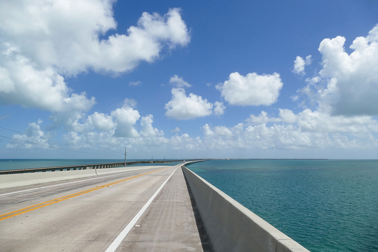
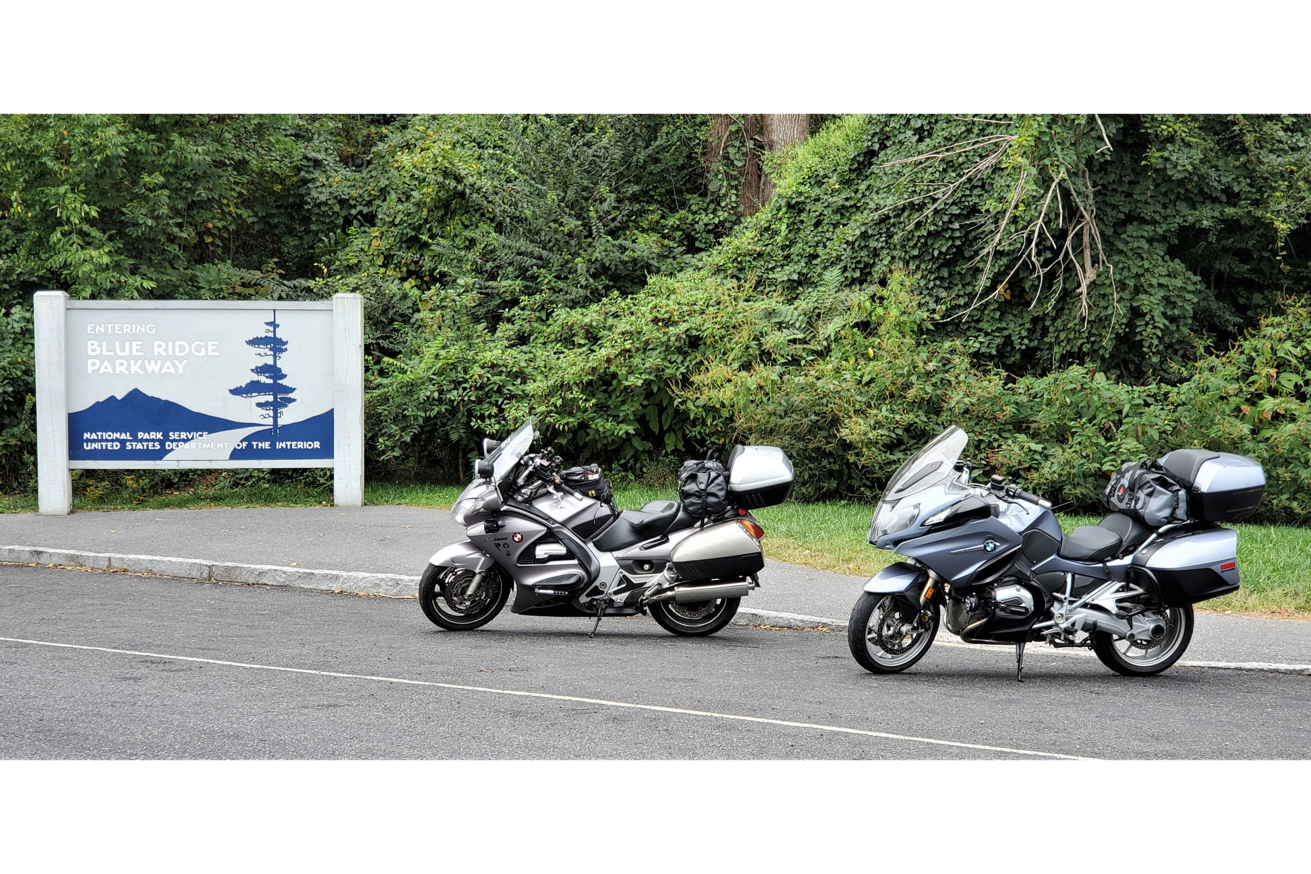
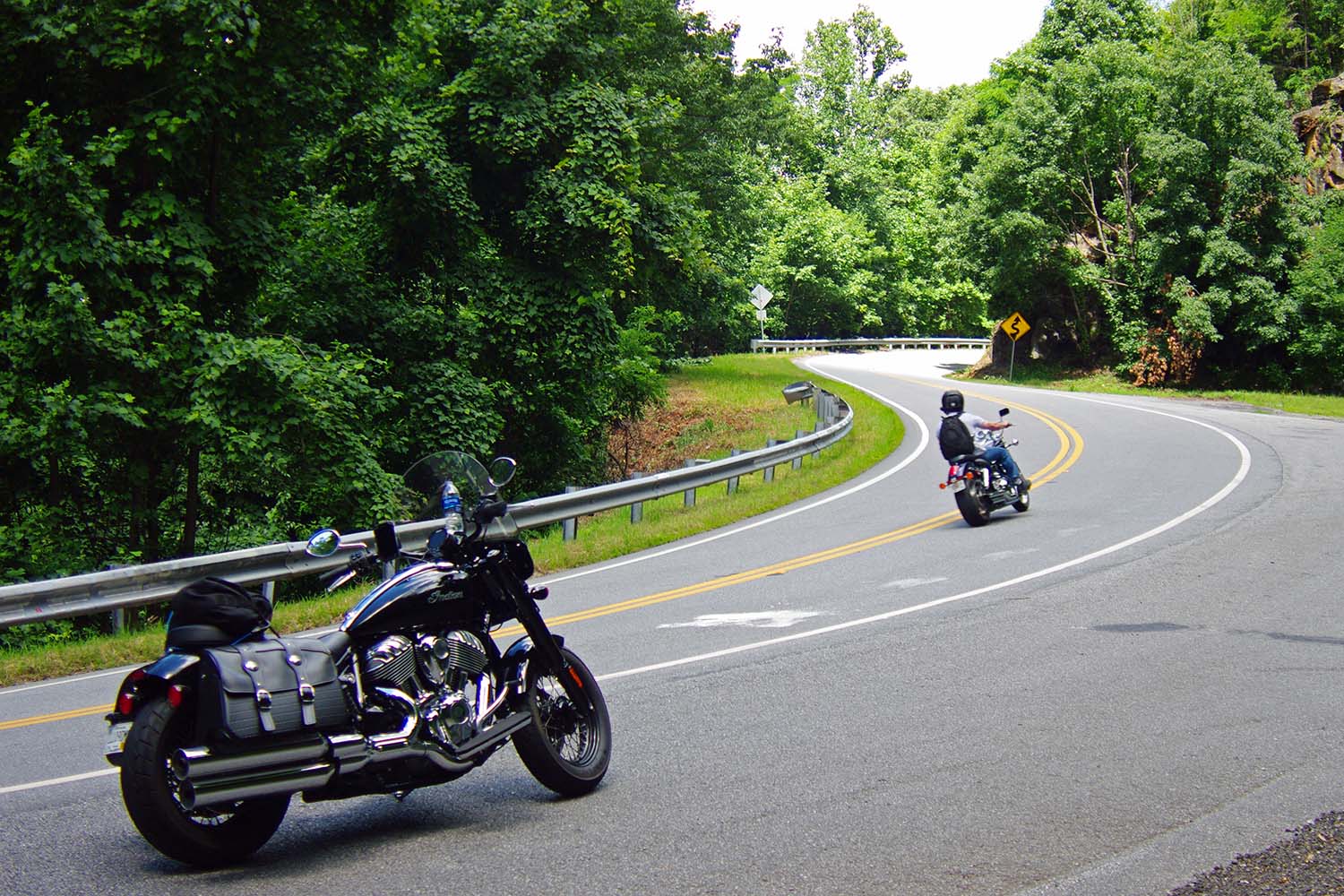
Wide lanes and stunning views make the Arthur Ravenel Jr. Bridge over the Cooper River a rider’s dream.
Charleston, South Carolina, is a true Southern belle. She turns 352 years old this year and has quite a past. In America’s early days, her importance rivaled New York and Boston. Shipping, as well as rice and cotton production, created extreme wealth. Hurricanes, wars, and bondage brought great despair. Like Scarlet O’Hara, Charleston has persevered, and today she wins “Best City” awards for her food, culture, and history.
One of the best ways to experience Charleston is from the seat of a motorcycle, flying over her many bridges. Charleston’s bridges link more than land and water. They link past and present, problems and answers, people and places. These days, twisting the throttle over Charleston’s bridges provides reflection and hope.
Since Charleston is located an hour off the I-95 superslab, many riders miss her charms. That’s a shame, as Charleston hits the redline on the motorcycle smile-to-mile dial. For you Northern bikers on a Florida run, this is a fantastic stop-over spot. I’ll bet you a flounder sandwich it will be a highlight of your journey. Lodging is plentiful at all price levels, and the local cuisine is world renowned, bringing together farm, ocean, Southern, and soul.
This ride can be done any time of year, but beware: Charleston is in the Deep South. Summers can be stifling and rainstorms can be intense. Wearing mesh apparel, keeping raingear handy, and avoiding afternoon traffic are highly recommended during summer months.
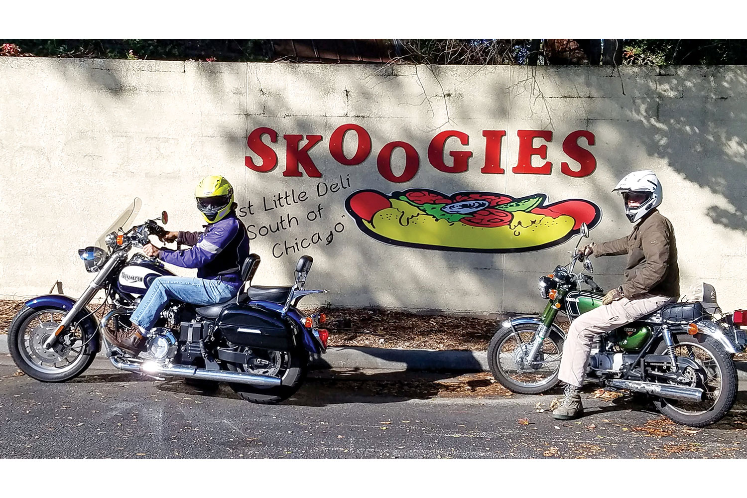
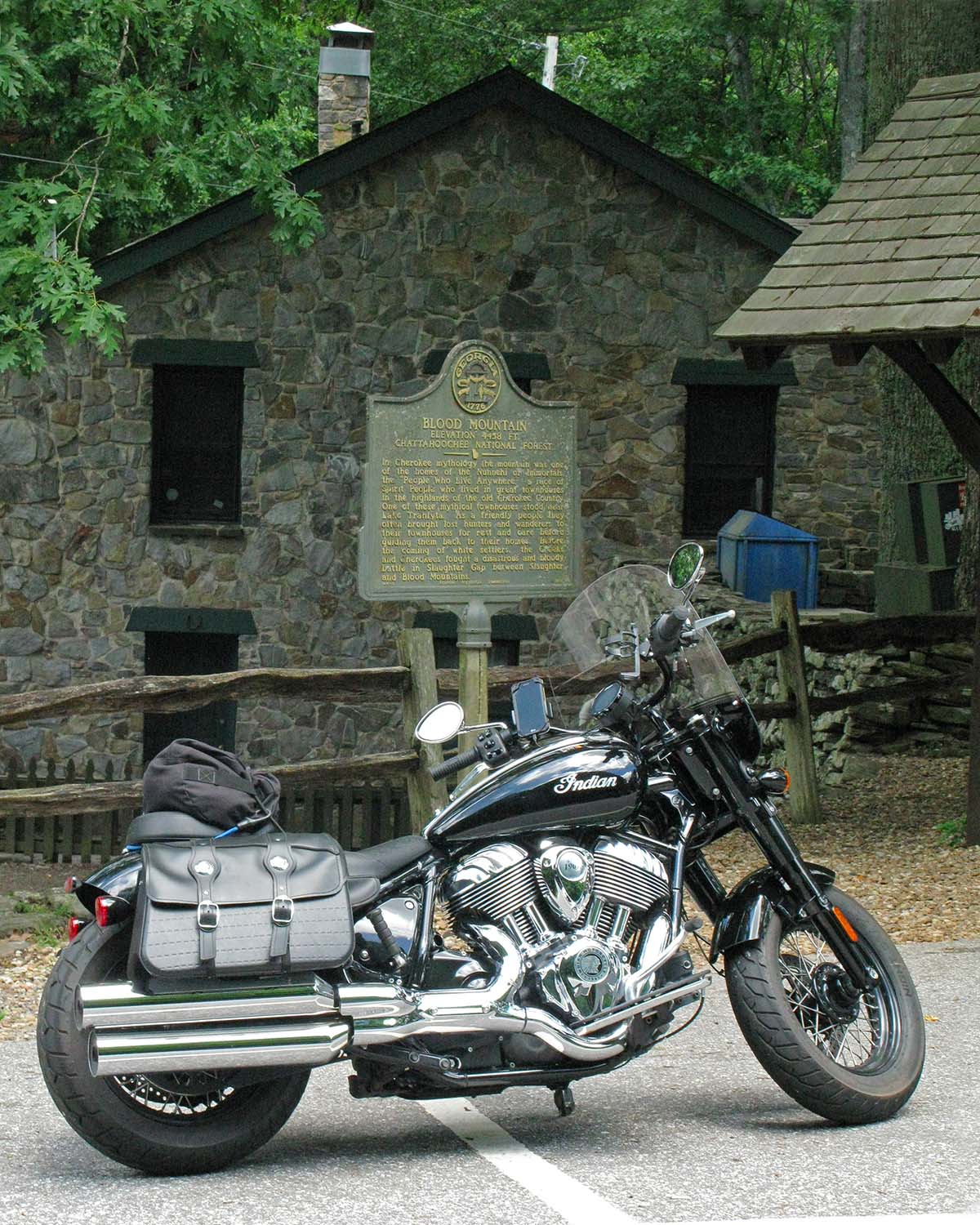
The author and his son, Luke, on a hot dog quest in Mount Pleasant.
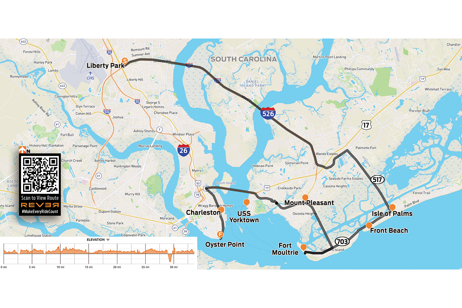
From I-95, head southeast on I-26 for an hour. Take the ramp for I-526 East to Mount Pleasant. Cruising high above the salty marsh, in the first 15 minutes you’ll glide over two major bridges – the Don N. Holt over the Cooper River, and the James B. Edwards over the Wando River. You’re riding over the Lowcountry, a sprawling coastal region that’s just above sea level. With the tides shifting four times a day, much of the marshy terrain spends half its time under water.
Take the exit for Hungry Neck Boulevard, then turn right onto the Isle of Palms Connector (State Route 517). Cruising over the estuary, flip up your visor and enjoy the salty air and coastal views. At low tide, you’ll see mounds of “rocks” in the marsh, which are actually wild oysters. Raw, roasted, or in a Bloody Mary shot, they’re delicious.
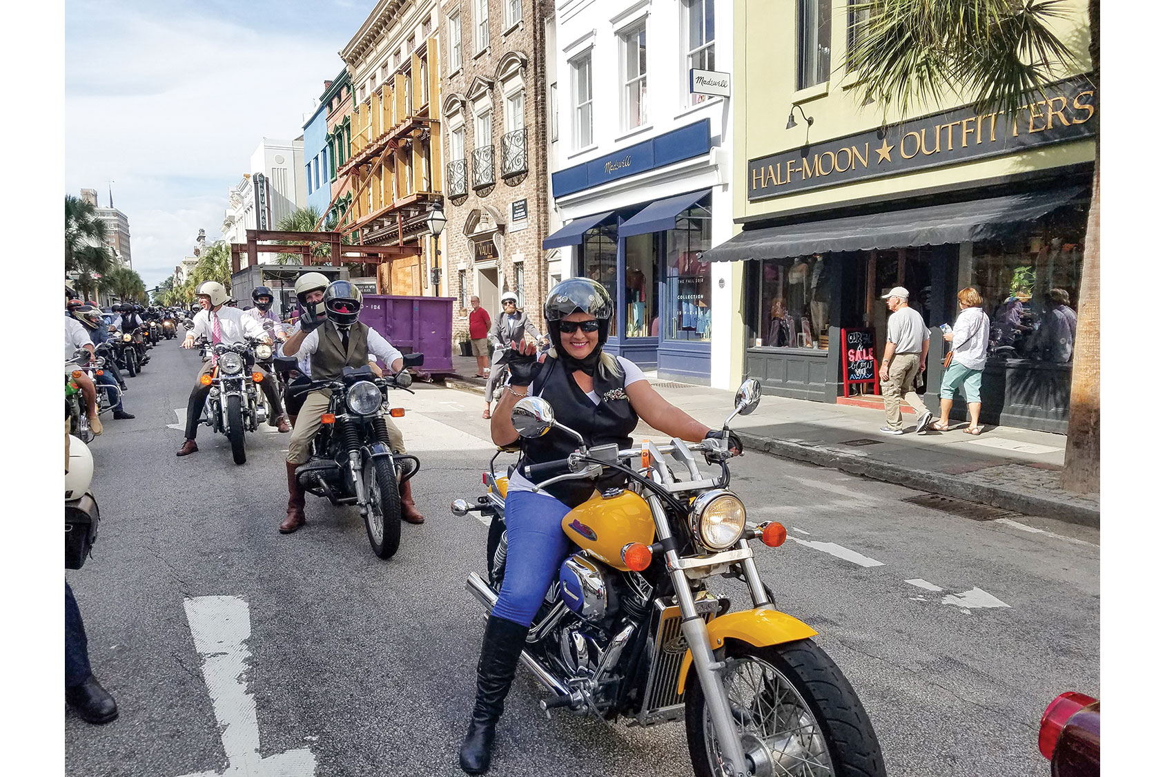
Nattily dressed motorcyclists cruise down King Street during the Distinguished Gentleman’s Ride.
You’ll cross two more bridges before reaching Isle of Palms. When the Connector ends, keep going straight to Front Beach. Biker law says you can’t get this close and not get in the ocean, so this is a great place to kick off your boots and get your toes wet.
Continue southwest on Palm Boulevard (State Route 703). Ride with the breeze along the Intracoastal Waterway until you cross Breach Inlet on the H.L. Hunley Bridge, named after the first submarine to sink a ship in battle. In 1864, the hand-cranked Hunley sank a Yankee ship but then disappeared off the coast of Sullivan’s Island, along with its crew of eight men. It wasn’t found until 1995. Stop at Thomson Park to enjoy the views and learn more about this historic location.
The Ben Sawyer swing bridge rotates to allow tall boats to pass on the Intracoastal Waterway.
From the park, hang a left on Middle Street. You’re now riding through “shabby chic” Sullivan’s Island, South Carolina’s wealthiest zip code, and you’ll see bars and restaurants. All are good, but the crispy/spicy Bangin’ Shrimp tacos at Mex 1 Coastal Cantina are my go-to. Salt in the air, beach on your boots, shrimp tacos in your hand, and your faithful steed parked under a palmetto tree. Life is good!
Continuing southwest on Middle Street takes you to Fort Moultrie National Historical Park. This high ground has a long history as a military post, going as far back as the Revolutionary War. The self-guided tour and harbor views are interesting, inspiring, and a great way to stretch your legs.
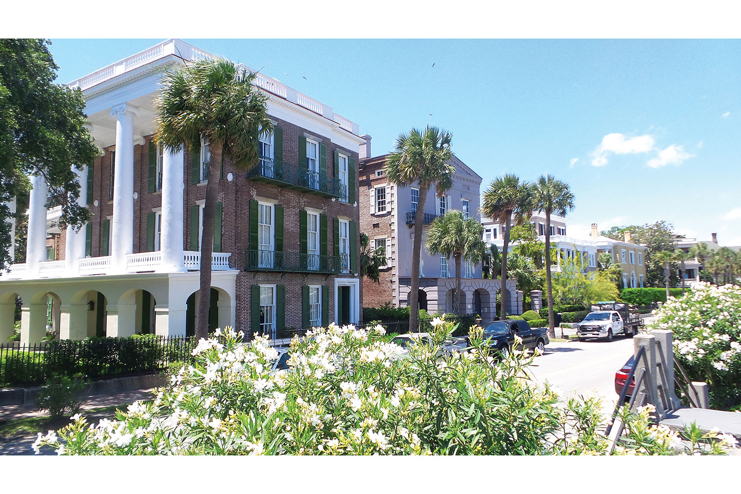
Colonial-era homes along the Battery, a seawall and promenade near downtown Charleston.
Backtrack to where Route 703 turns north and becomes Ben Sawyer Boulevard, a causeway that cuts back across the marsh. Take in the scent of salt, oysters, and tidal “pluff” mud. The Ben Sawyer Bridge is a swing bridge that rotates to allow tall boats to pass through. First opened to traffic in 1945, it was heavily damaged by Hurricane Hugo in 1989. When the islands evacuated, the tender left the bridge unlocked. When hurricane-force winds hit the bridge, it spun like a top, and one end plunged into the water.
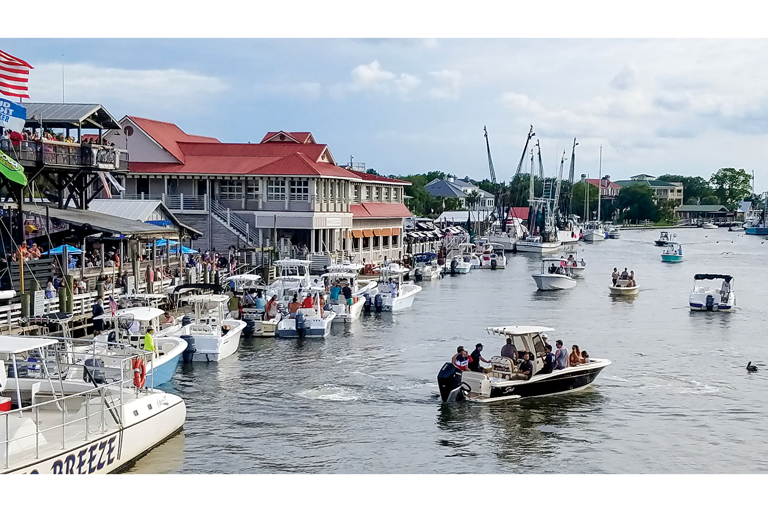
Crossing the Ben Sawyer takes you into Mount Pleasant. Traffic increases through this vibrant area, with plenty of good restaurants and bars attracting the hungry and thirsty. Another bridge on Route 703 crosses over Shem Creek, with boats, kayaks, and bars below jammed with folks having a good time. Fresh local seafood is sold right on the docks. For a closer look, make a left and visit Shem Creek Park.
The party never ends on Shem Creek.
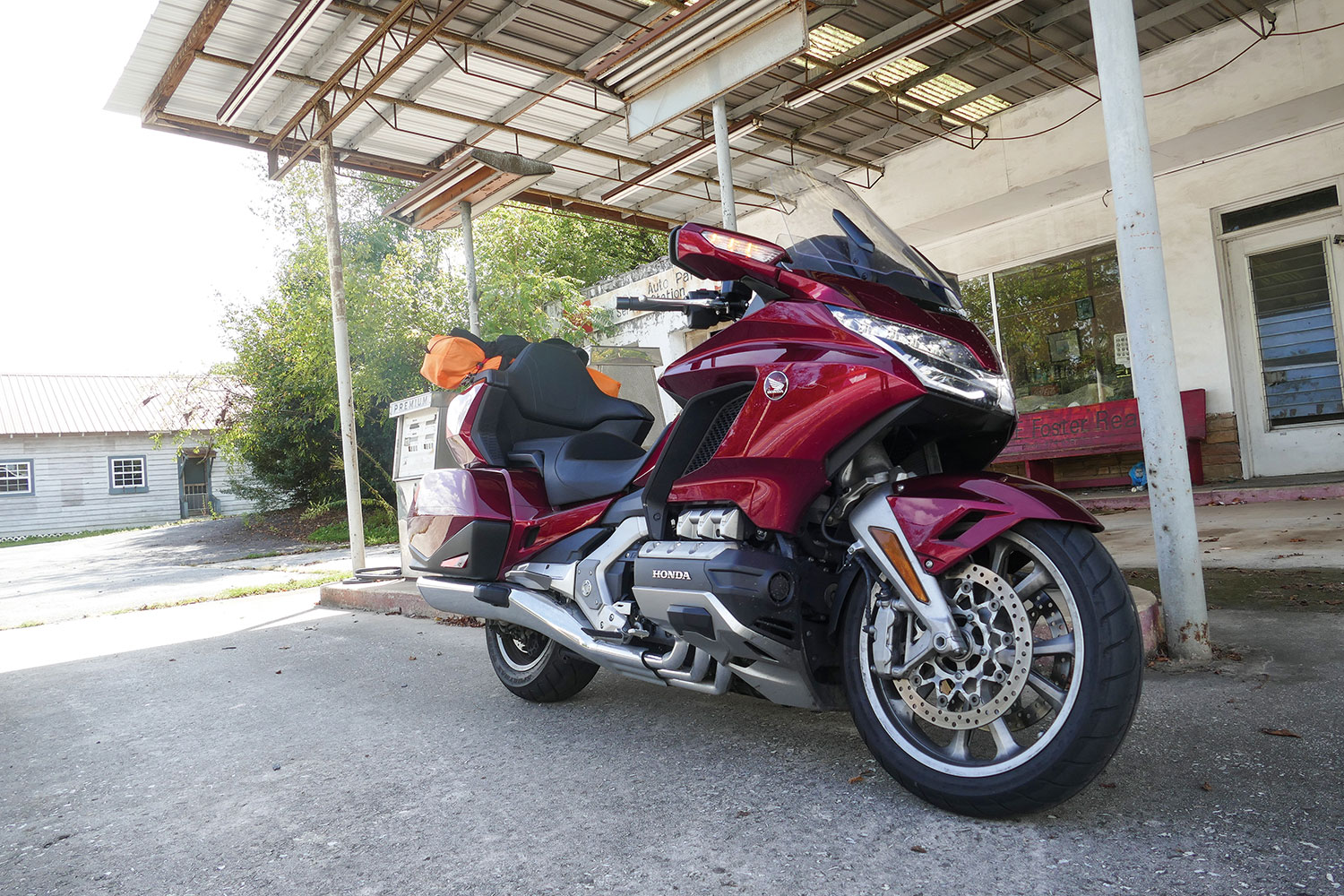
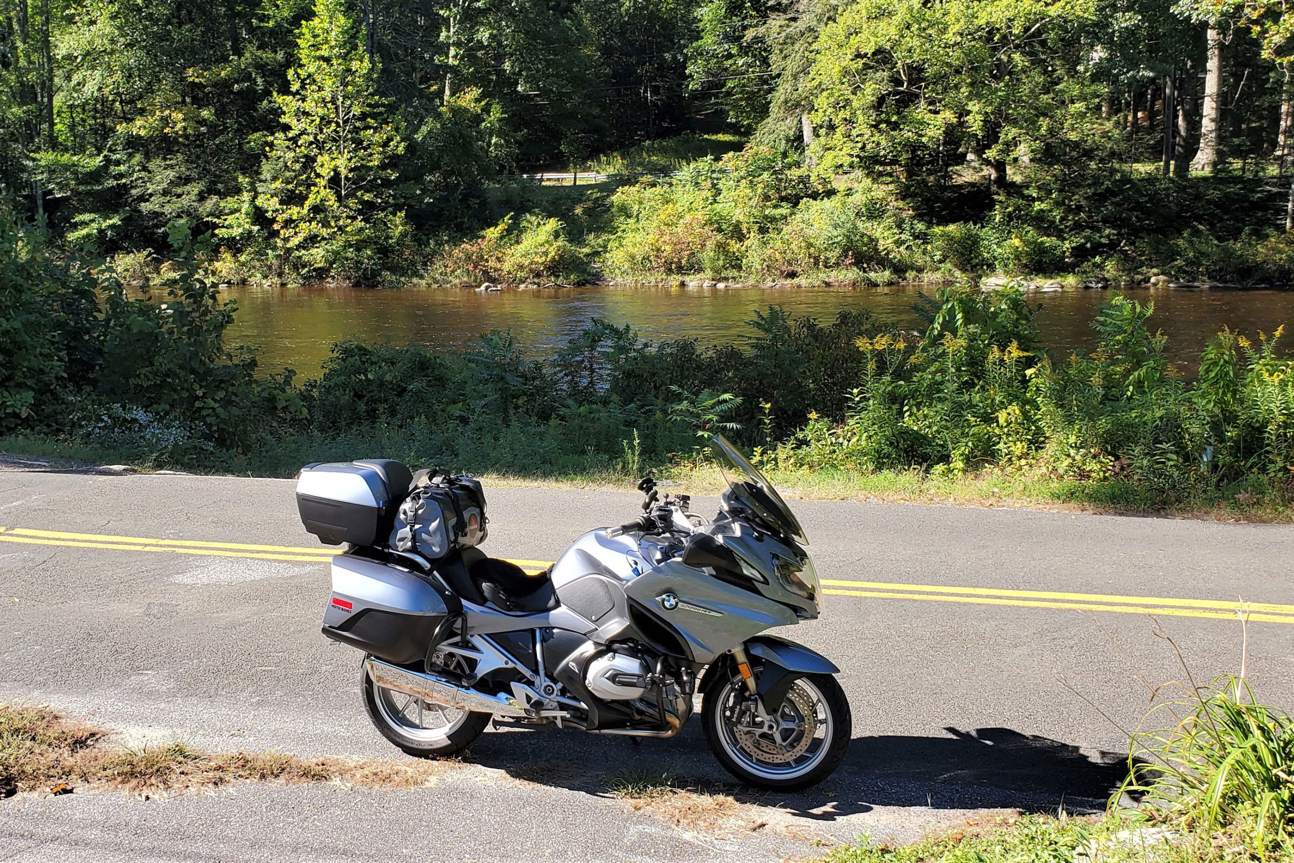
Continuing west on Route 703 (Coleman Boulevard), the road merges with U.S. Route 17 before crossing Charleston’s most prominent span, the Arthur Ravenel Jr. Bridge over the Cooper River. Riding over the Ravenel, you’re at the highest point in the Lowcountry, with inspiring views of Charleston Harbor and the USS Yorktown, a WW2-era aircraft carrier anchored near Patriots Point. The Yorktown is now part of the Patriots Point Naval & Maritime Museum, and military buffs can easily spend a full day touring the ship, imagining or remembering the challenging days of our Greatest Generation.
The USS Yorktown aircraft carrier and USS Laffey destroyer are part of the Patriots Point Naval & Maritime Museum.
After crossing the Ravenel, follow signs for U.S. 17 South to Savannah and take the King Street exit. Turn right onto King Street for a fun, sweeping ride through history, from modern hipster hotels to perfectly preserved colonial-era homes. It’s a great time to reflect on our nation’s past, present, and potential.
Take King Street until it ends at Oyster Point overlooking the harbor. The views are spectacular, but Charleston is more than just her pretty petticoat and parasol. She’s beautiful and strong, old and new, happy and sad. Like America, she’s not perfect, but she’s authentic and awesome. This ride makes me proud, and hopeful for what’s over the next bridge.
A gathering of bikes at Oyster Point overlooking Charleston Harbor.
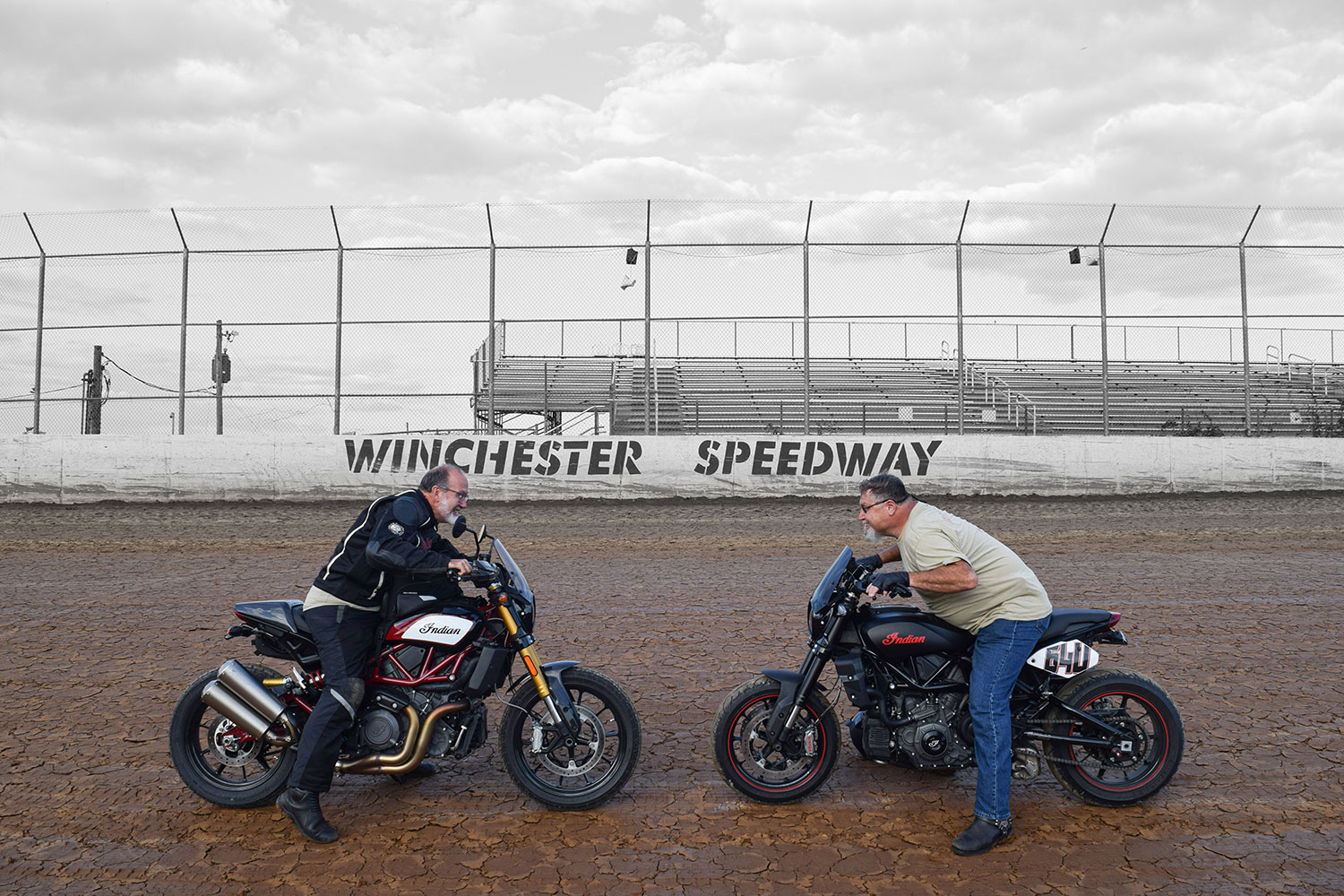
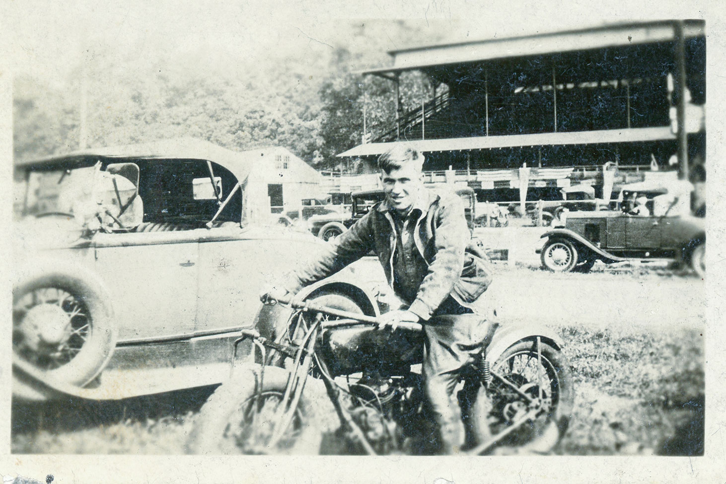
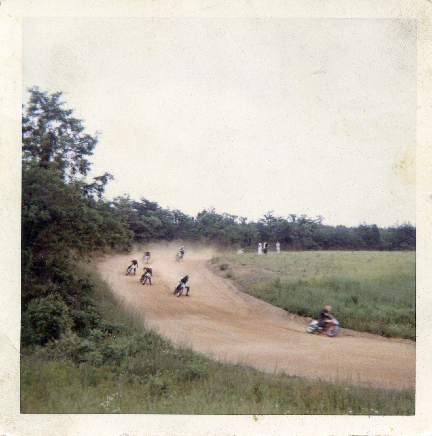
Eric Trow and Ron Washabaugh face off on the same clay their grandfathers raced on more than 70 years earlier (below). Contemporary photos by Hal Deily, archival photos courtesy of the author.
At a time when American riders were fighting the Harley and Indian wars, Gene Townsend and Floyd “Washie” Washabaugh were unflinchingly Indian men. It was rumored their blood flowed a bit more maroon than the rest of us, having the distinct deep shade of the brand’s signature Indian Red color.
Over the years, the two men defended the Indian brand on dirt tracks across Pennsylvania, Maryland, and Virginia. Gene, my grandfather, born in 1908, spent most of his racing years on an Indian 101 Scout sporting the #9 plate. He was a top regional amateur racer from the mid-1920s on into the war years, only to retire when a brush with a #6 bike sent them both through a fence.
Gene Townsend before a race on his highly tuned Indian 101 Scout.
The radio announcer covering the event mistook the upside down #6 machine as the #9 and mistakenly reported that Gene Townsend had been rushed to the hospital with serious injuries. My grandmother and her young daughter (my mother) were beside themselves when they heard the broadcast. Gene promised to never worry them again and quit racing on the spot. Washie, five years his junior, competed successfully on Indian Sport Scouts through the mid-1950s, and even had a short stint as a professional racer with Gene’s backing.
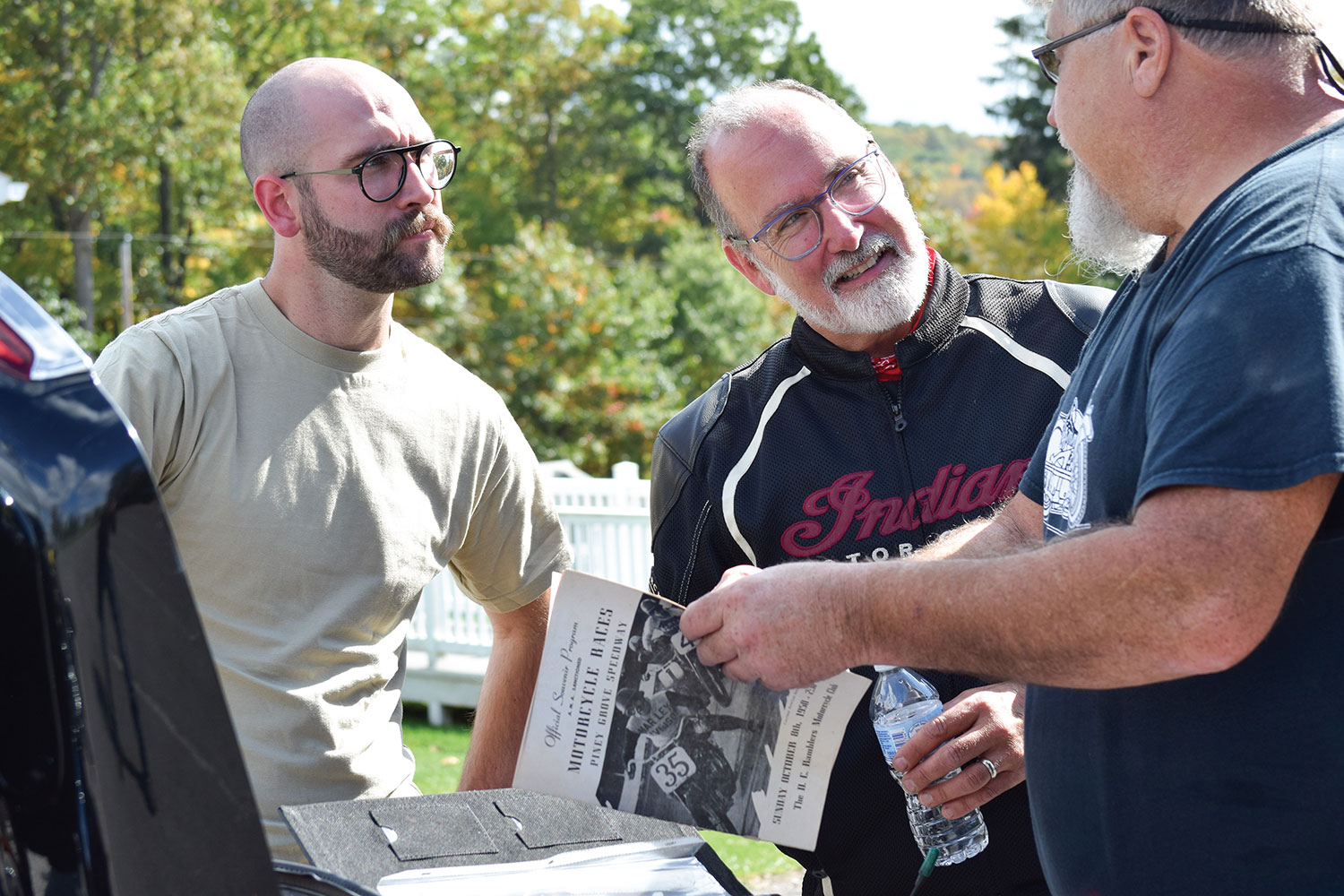
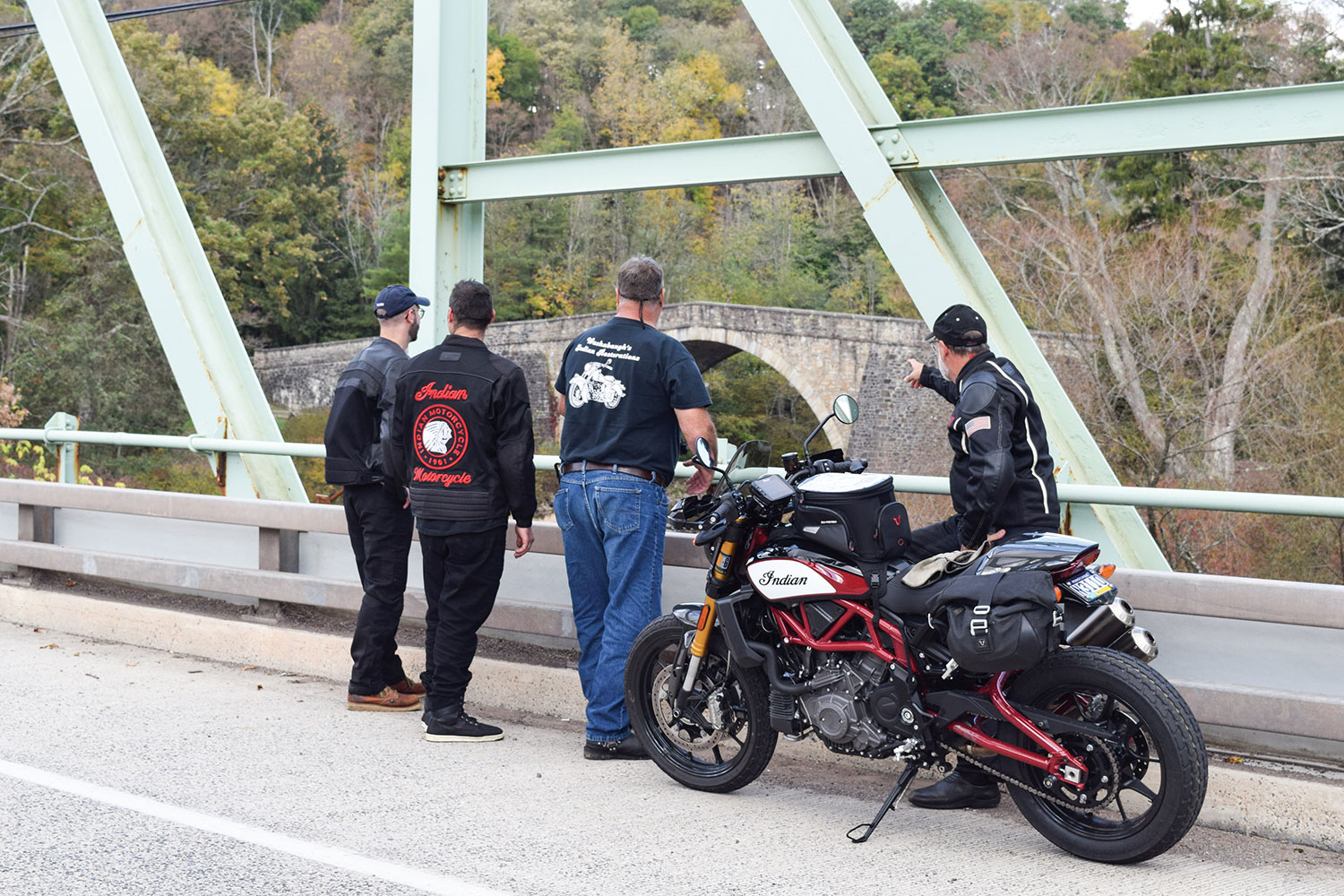
Parker, Eric, and Ron leaf through a period racing program along the road to Winchester.
By 1948, Gene had owned his southwestern Pennsylvania Indian agency (what dealerships were called back then) for about 20 years. He had built his reputation as an exceptional rider and racer as well as an expert tuner. If Indian riders wanted the hot setup, Gene was the guy to see. Washie was granddad’s close friend, a fellow racer, and a fixture at the old shop. They shared a passion for three things: Indian motorcycles, racing, and storytelling.
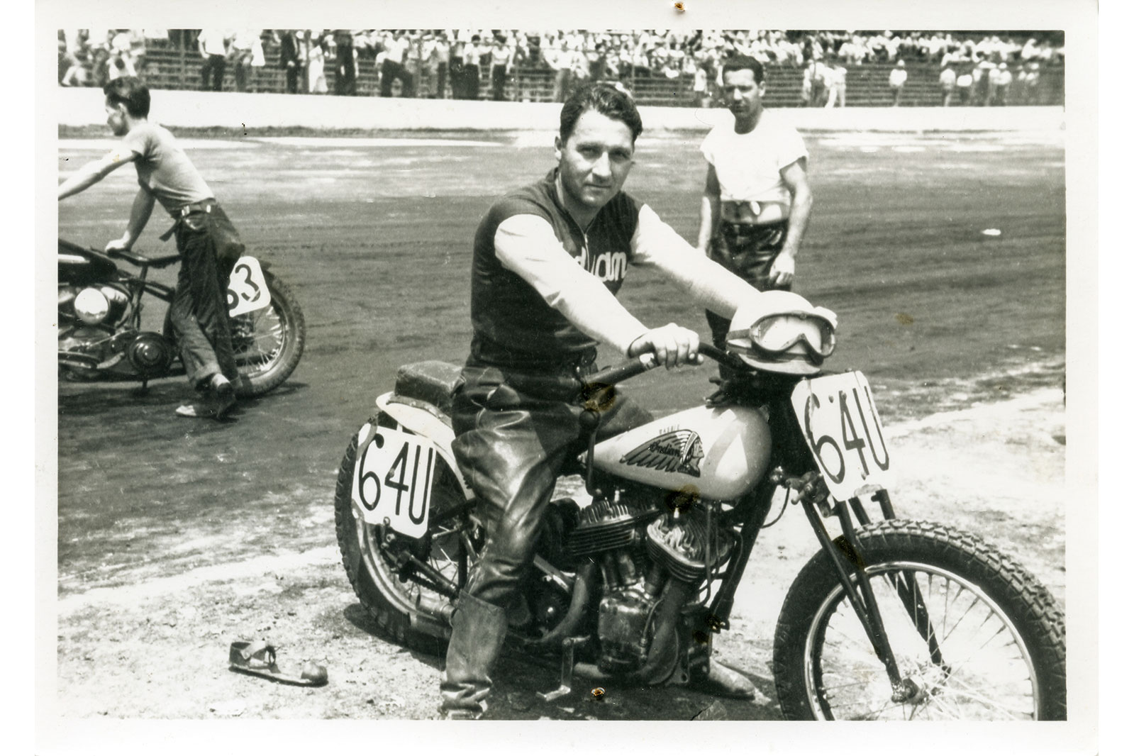
Floyd “Washie” Washabaugh aboard his #64U Indian Sport Scout racer in 1948.
I only knew Washie as an older man who rode his flashy old Indian Chief to my granddad’s shop. But I envisioned him and Gene as the vibrant and courageous young dirt-track racers in the old, dog-eared photographs taken in their racing days. The deep connection I developed with these older men was something I thought only my brother and I knew. Then I heard about Washie’s grandson, Ron.
We may have met at some point at the shop when we were kids, but Ron Washabaugh and I didn’t know each other. About three years ago, we met while attending the American Flat Track races at Williams Grove near Harrisburg. We immediately hit it off and began swapping stories of that magical old motorcycle shop and the deep appreciation and fondness we had for our grandfathers.
Some sections of the old National Pike haven’t changed much since Gene and Washie rode them.
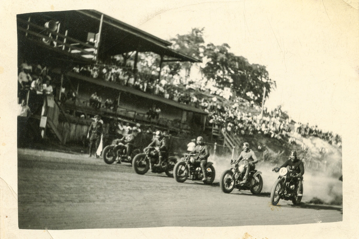
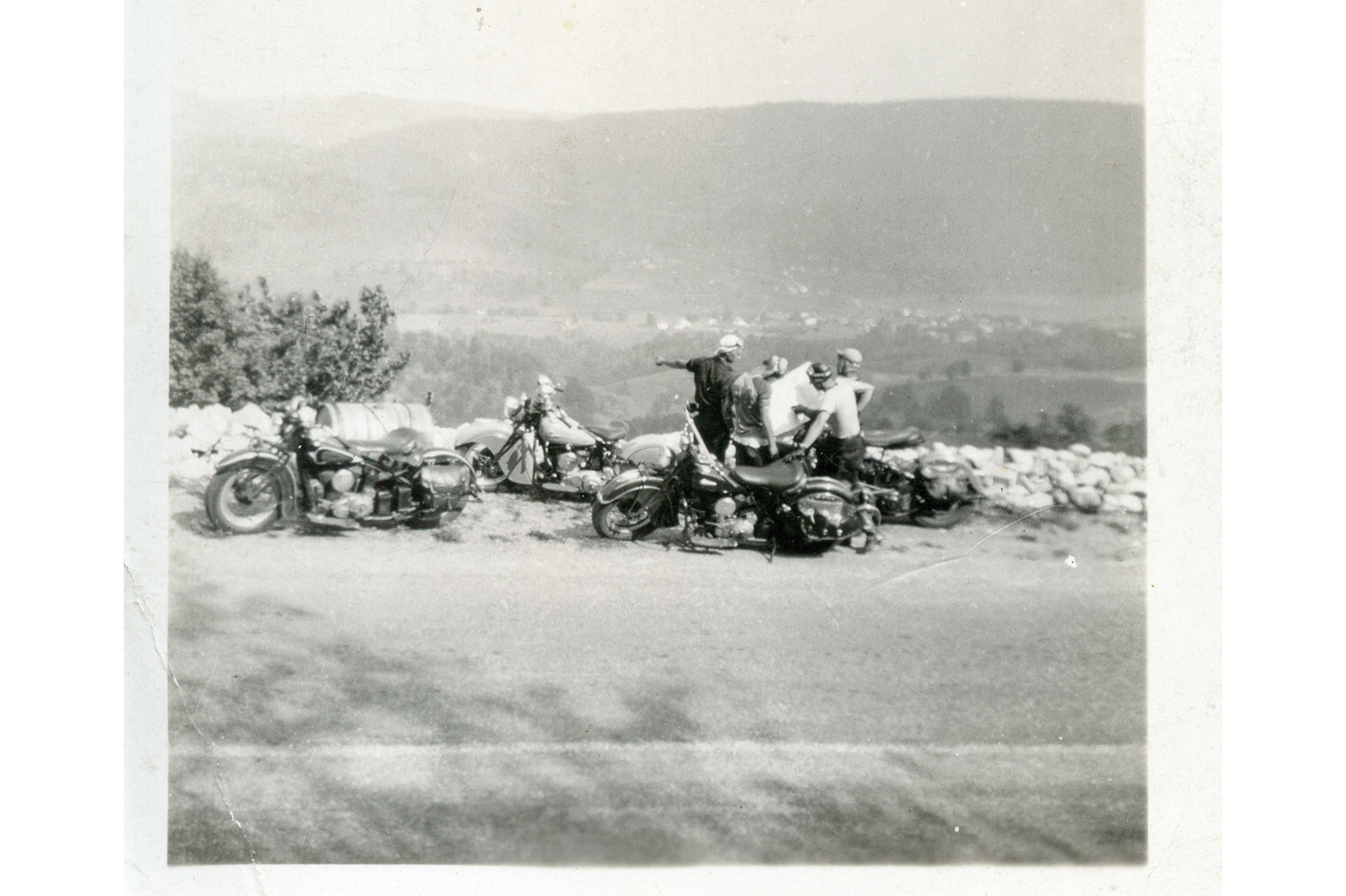
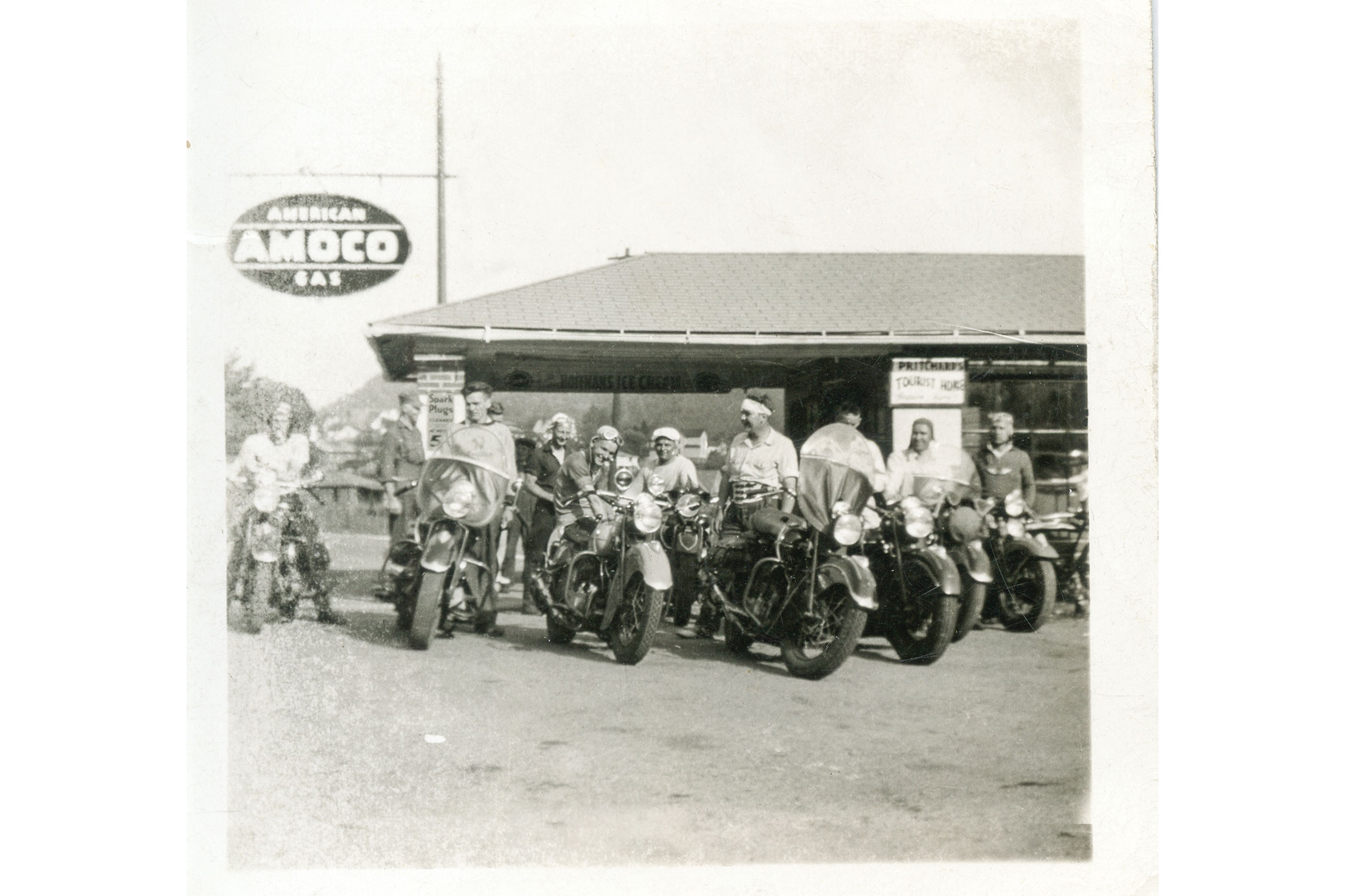
The most powerful memories for Ron and me were the racing tales told so passionately by old Gene and Washie. Through their words they painted vivid pictures of handlebar-to-handlebar racing adventures aboard their Indians on myriad local dirt tracks, as well as more distant venues such as Cumberland, Maryland, and Winchester, Virginia. They would either stuff a bike into the back of a sedan or ride their Indian Scouts to a track, remove the headlights and fenders to race, and then reassemble everything for the ride back home afterward. If they weren’t racing, they were organizing rides to watch others compete, like legendary AMA Hall of Famer “Iron Man” Ed Kretz at the Langhorne, Pennsylvania, track where he dominated the mile oval.
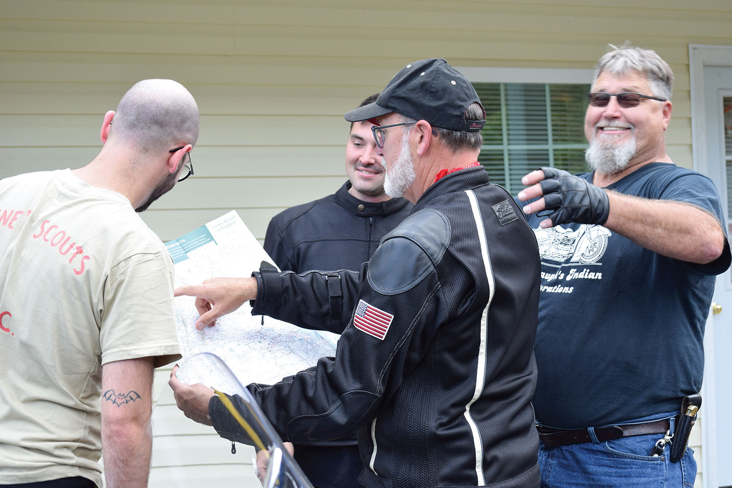
Stepping away from the digital GPS and iPhones, a vintage paper roadmap is used to chart the path the way their grandfathers (and great-grandfathers) would have done (below). It was a bit easier for the two older guys in the group.
Ron and I decided to retrace Gene and Washie’s path to one of the legendary tracks they rode to back in the late 1940s and early 1950s.
Ron and his son, Steven, and me and my son, Parker, conspired to chase Gene and Washie into the past on a journey to the old Winchester Speedway. As grandsons and great-grandsons, we would emulate the experience the two elders had back in the day. We would ride the National Road (U.S. Route 40) and other two-lane roads, stop where they might have stopped, eat at family-owned diners along the way, and find classic roadside motor lodges where they might have stayed. At every opportunity, we would celebrate their story and, at the same time, get to know each other and forge another generation of bonding around a common passion for motorcycles.
After a sprint up the mountain, the overlook atop Summit Mountain on Route 40 was a popular stop for the old boys.
Ron and I both have vintage Indians, but for this excursion Ron was aboard his modern Indian Roadmaster, and I piloted my Indian FTR 1200 S Race Replica. Stephen rode his new FTR 1200 as well, complete with a number plate bearing his great-grandfather’s racing number, #64U. Parker rode a 2018 Harley, just for a little tension in the spirit of that old brand rivalry. (The H-D Heritage 114 is mine, and so is the kid; both are terrific, and any ribbing was in good-spirited fun.)
Eric shows the kids proper tuck technique for flat track.
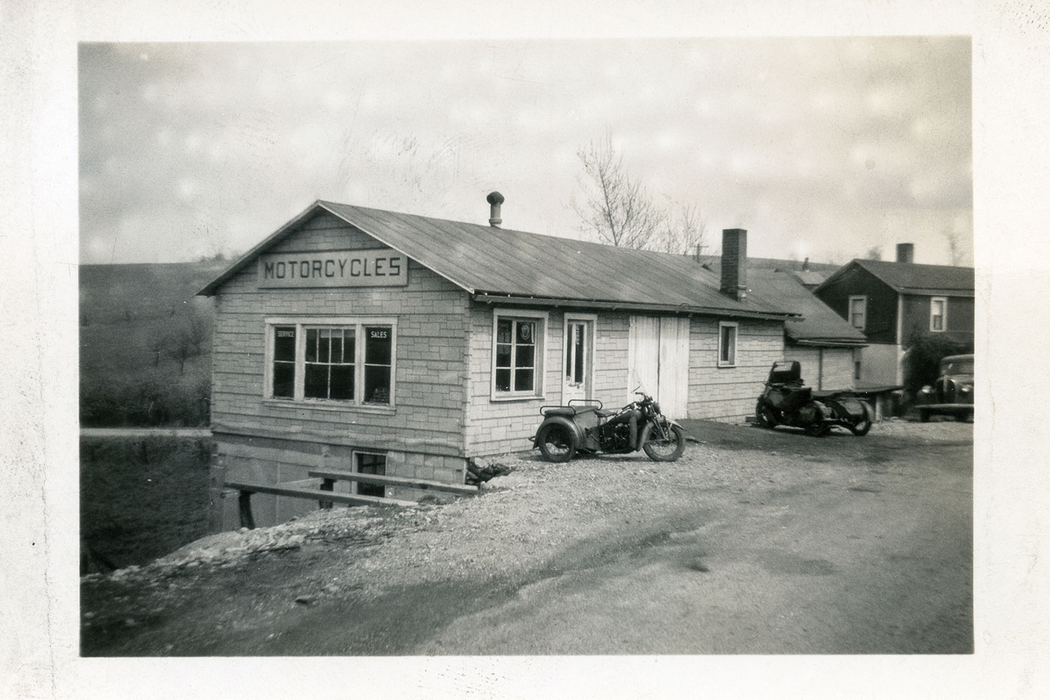
Last October, the Washabaugh boys met my son and me at a diner not far from the old shop. We ordered breakfast and gobbled up the vintage photo albums Ron brought with him. Although the food and conversation were delicious, we needed to get our planned adventure rolling. There would be more time to talk along the road, so we paid the tab and headed to the old Townsend cycle shop. The unexceptional building still stands (barely) just off the National Road, three miles east of Brownsville, Pennsylvania.
Washie straddles a sidecar-mounted drum of fuel used as a rolling gas station.
The modest shop was a hub of activity in its day, a gathering place where riders regularly came and went. Some visited to see what new machines and accessories had arrived. Others stopped by for a set of points, a condenser, and maybe a pair of spark plugs on their way through town. Most wheeled in for the conversation and the stories.
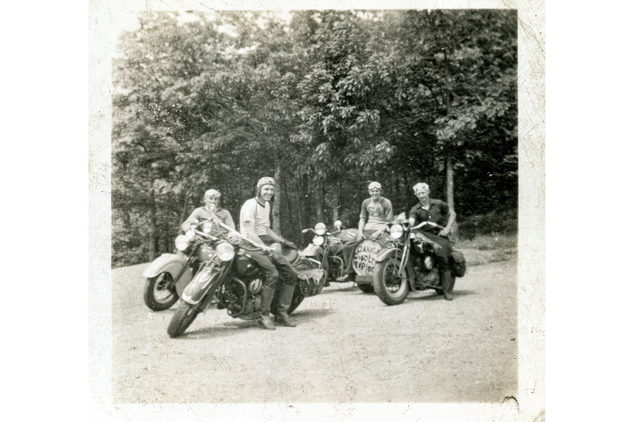
It was also the headquarters and ride origination point for members of Gene’s Scouts Motorcycle Club, an AMA-sanctioned club that served as the local riders’ social group and the sponsoring organization for motorcycle competitions. Washie raced as an AMA pro for one year under the Gene’s Scouts M.C. banner. Unfortunately, after just one season, the cost proved to be too steep, and he returned to amateur racing. Some things never change for aspiring racers.
Racing at Winchester included flat track and this TT race with hills and a jump.
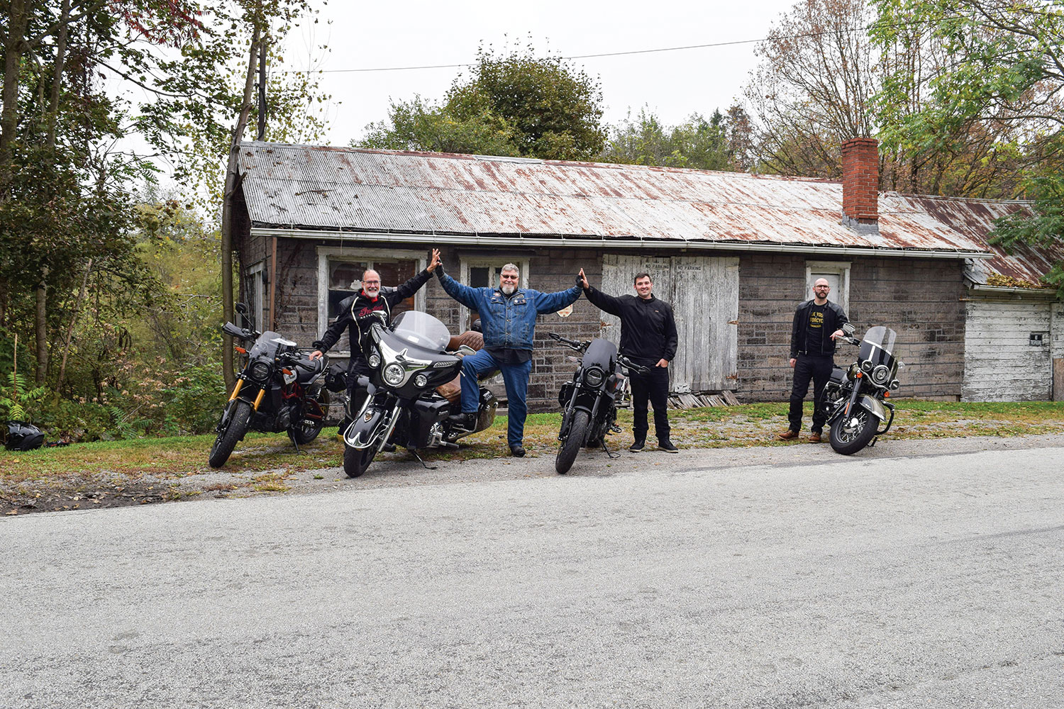
Soon, the engines of our Indians (and Harley) fired to life in front of the old shop, echoing the hundreds of Indians that had gone before from that same spot.
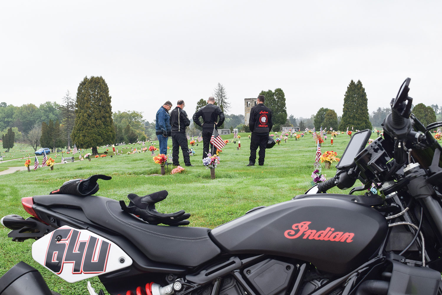
We rolled out of the parking lot and onto Route 40. The first planned stop was just up the road at LaFayette Memorial Park, where we paid our respects at Gene’s and Washie’s family plots. We thanked them for the tremendous influence they had on our lives, saluted their adventures, and invited them to ride along with us inspirit as we retraced the path they took seven decades earlier.
Gene’s Indian agency in the early 1940s.
Back on the road and heading east on the National Road, we approached Uniontown. I thought of the story Gene told me about a board-track motordrome speedway that was built there for motorcycle racing in the late teens of the last century. As a boy, he would climb a tall tree outside the grounds just to catch a glimpse of the racers flying by on the large, steeply banked wood-plank track.
Indians gather once again in front of the old Indian shop (apologies to the author’s son on the Harley).
Although the multilane highway now bypasses the towns, we took the old route that Gene and Washie would have followed through downtown Uniontown and Hopwood. We rejoined the highway on the other side where the pavement abruptly angled skyward, ascending Summit Mountain. Back in the day, this was a narrow two-lane ribbon that wound tightly up the steep hill – a rider’s dream. This stretch was the subject of many of the old timers’ stories as they recounted how they raced each other up the steep, twisting curves to the crest of the hill. They heeled their Scouts and Chiefs over so far into these corners that the frames would drag, levering the rear wheels off the ground momentarily. The trick, they said, was to hold the throttle open and let the bike reestablish traction without upsetting the chassis. Easier said than done!
Members of Gene’s Scouts M.C. at a gas stop during one of their organized rides.
Today, the road is a four-lane divided highway tracing the original circuitous path. Ron, me, and our boys turned up the wick on our machines as we ascended the hill. It was a hoot to drop down a gear and put ourselves, at least mentally, alongside our grandfathers and great-grandfathers on a spirited sprint up the mountain.
The old crew would have likely crossed this stone arched bridge along Route 40 on their way to Winchester.
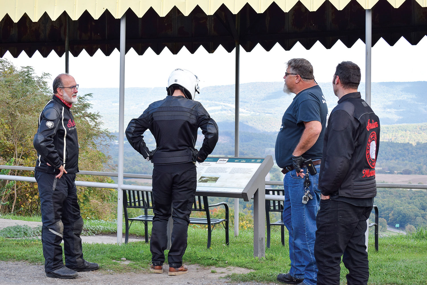
As we approached the summit, I signaled and the four of us wheeled off I-40 into the lookout at the peak of Summit Mountain. This was a spot where Gene, Washie, and the rest of their crowd regrouped countless times over the years. Summit Mountain was not just a road they took on the way to somewhere else, it was their local destination for sport riding. It’s where the guys tested their latest tuning and hop-up tricks. It’s where local Indian and Harley riders found out whose machine had the “soup” to capture the king-of-the-hill title for that week.
A typical overnight stay for the boys back in the day.
Ron and I used this pull-off to tell our sons stories we’d heard about this road and their great-grandfathers’ motorcycling adventures. We took turns contributing our own recollections, helping each other connect the dots where there had been gaps in our individual knowledge. Parker and Stephen stood by, soaking it all in.
Surely Gene and Washie would have stopped for the overlook at Town Hill.
Back on the road, we imagined the roadside stops the men might have made along their way. We proposed where they may have paused to stretch their legs, consult a map, check chain tension, or maybe add a quart of oil. Then we’d stop too. We took advantage of those roadside breaks to look through collections of old racing photos, racing publications, and pictures our grandfathers and their pals had taken along the road to different racing venues.
The Clarysville Motel in Frostburg, Maryland, has been operating for 100 years.
On occasion, we saw a turnoff to Old Route 40, most often a short spur of narrow two-lane that soon rejoined the newer main road. It was fun to ride a few of these old sections to capture the ride experience Gene and Washie had, but it was impractical to take each little detour. Other times we saw sections of Old Route 40 that were no longer accessible, including an area where an old stone arched bridge was once the path of the old National Pike. Gene and Washie probably traveled that same old stone bridge on their way to Winchester. We could only view it from the main road.
We paused at the old Clarysville Motel that looked like it might have been there when our grandfathers rode through. As it turns out, the place has been serving travelers for nearly 100 years. Other than the modern vehicles in the parking lot, it would be hard to distinguish 2021 from 1948 or earlier. Certainly, Gene and Washie rode by here many times, and may have even stayed on occasion when daylight expired.
The inn at Town Hill, Maryland, would have likely looked the same for the Gene’s Scouts crew in the 1940s.
In Maryland, the old highway began to rise, fall, and twist dramatically. This was the kind of road on which the boys surely had the old Indians dancing. They would have been intimately familiar with this fun section of road, knowing what lay ahead and anticipating it well in advance. After navigating a particularly enjoyable stretch, we crested a hill to discover the historic Town Hill Inn and overlook. This was a likely rest stop for Gene and Washie along their ride. It was a natural place to take a breather, check over the bikes, and enjoy the spectacular view across the wide valley below.
When not on the track, Gene’s Scouts were in the stands to watch their buddies race.
In Hancock, Maryland, we picked up Route 522 south and rode through quaint, historic Berkeley Springs, West Virginia, and on south into Virginia to our destination of Winchester.
Once in downtown Winchester, Ron led us to an iconic spot for a hot dog. Whether Gene and Washie ever stopped at this historic stand for a dog when they were in town, we’ll never know. But just in case, we thought we’d better have one since we were trying to capture the experience.
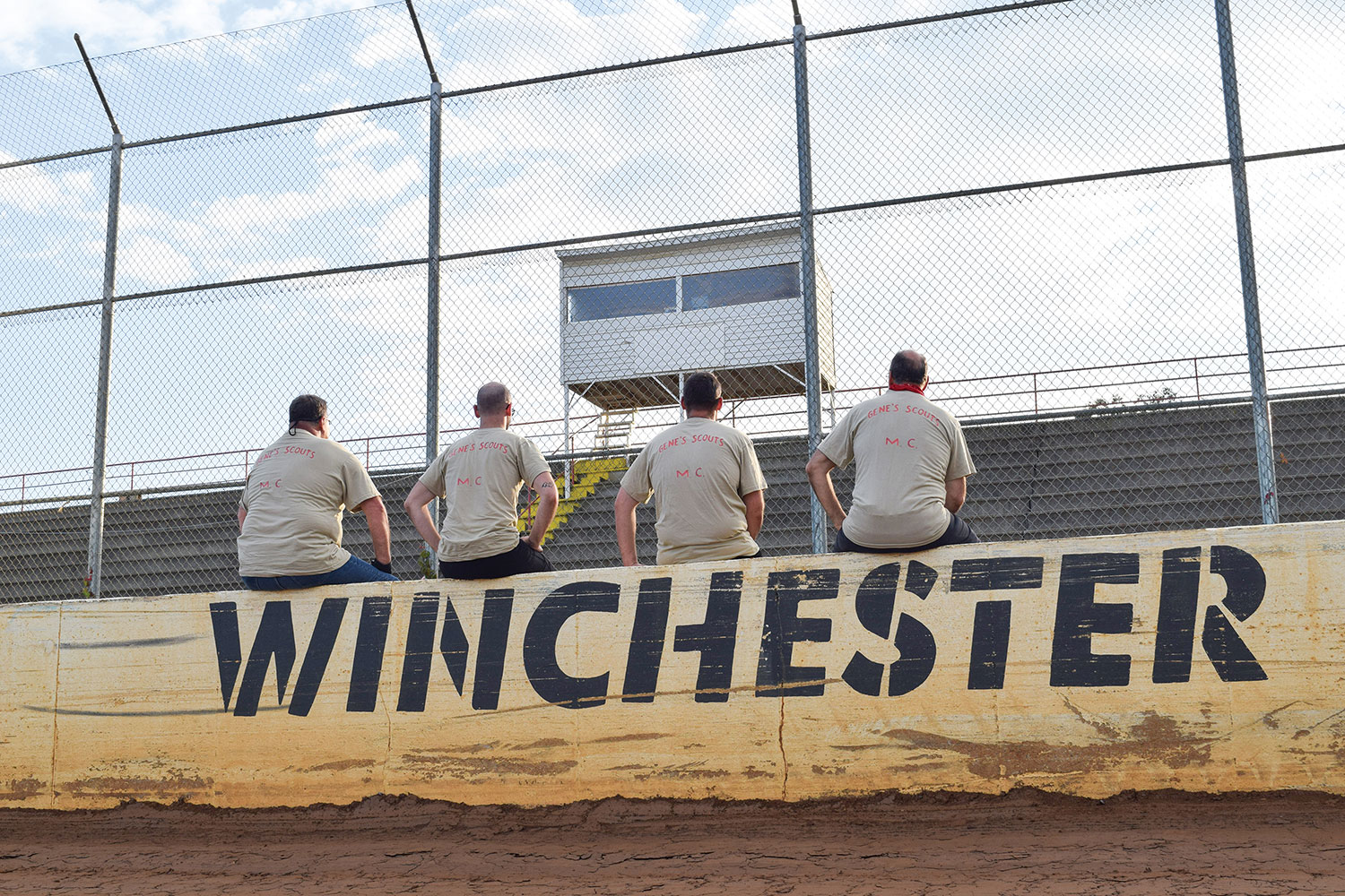
Grandsons and great-grandsons pause at the Winchester track to reflect on two diehard old racers.
Since the Winchester Speedway is sometimes referred to as the old airport speedway, we meandered through the town following directional signs for the airport. After working our way along narrow roads that wound around the airport property, we came to the end of the road and were unexpectedly at the back side of the racetrack. No big sign. No grand entrance. As a lot of these rural speedways were, it was simply a venue where people gathered. The raceway was probably not much different than it was when Gene and Washie were last here together, except now the old wooden grandstands are gone, replaced with concrete and metal.
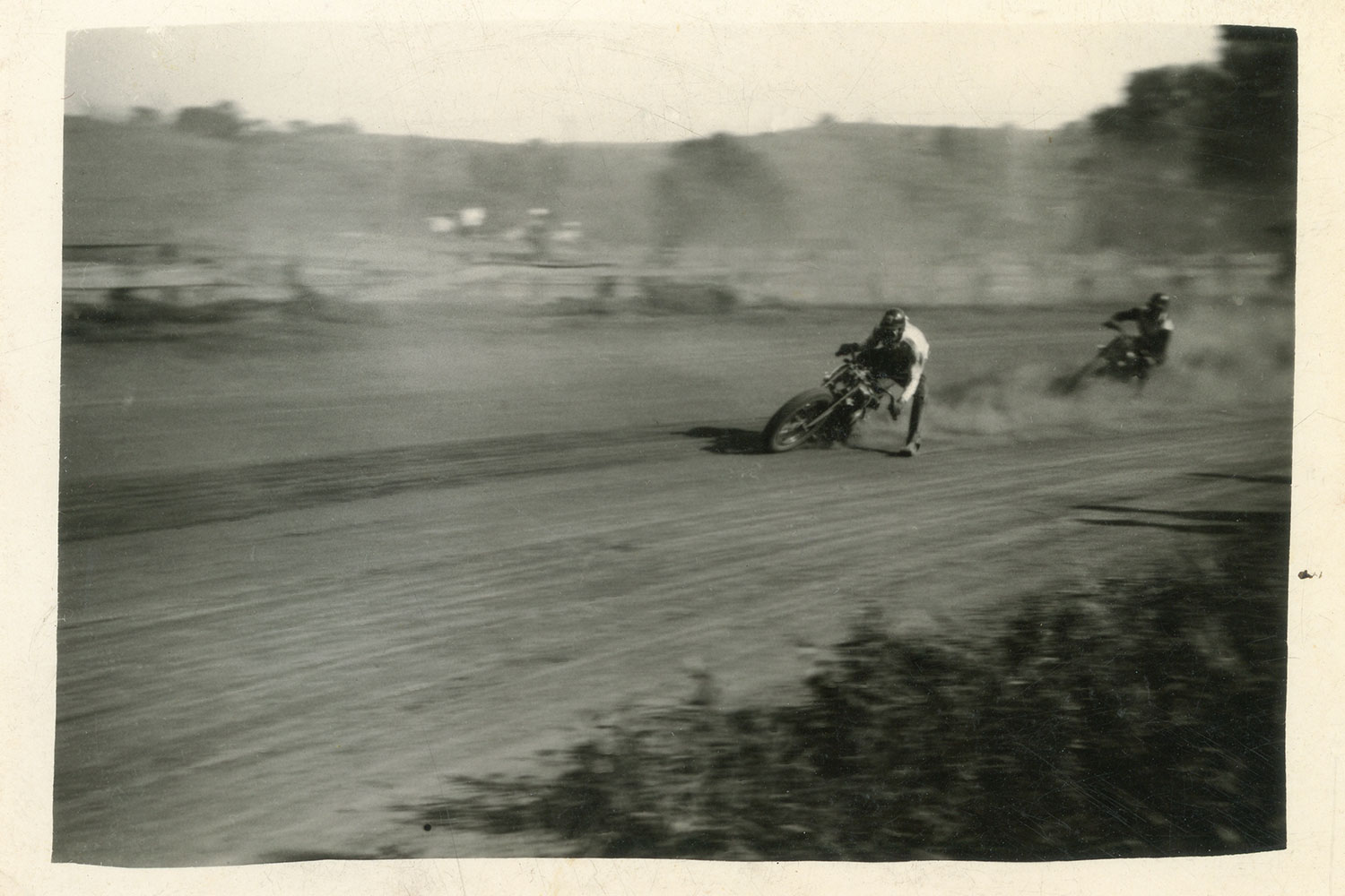
Gene carves up the clay on an Indian Scout.
The beauty of these local facilities is how approachable the track personnel can be. We arrived midweek in the middle of the day and told our story. Hoping to have a picture taken outside the track at the speedway sign, our plan was thwarted when we realized there was no such sign and no suitable backdrop. Fortunately, the track folks invited us to bring the bikes onto the track and position them in front of the wall on the back straight where “Winchester Speedway” was painted in bold lettering. It was perfect. Ron couldn’t resist the temptation to ride around the dirt track just to run tires on the same clay that his grandfather once tore up on the #64U Indian Sport Scout.
A lineage of Indian men chased their ancestors Gene and Washie to Winchester Speedway to rev up their legacy for another generation.
We were all having a great time and didn’t want the adventure to end, but the autumn sun was already sinking low in the sky. With our mission completed and an abundance of pictures taken to commemorate our expedition, it was time to say our goodbyes. Ron and Stephen had about a two-hour ride east to get back home. Parker and I needed a bit longer for our westward trek on modern interstate highways back toward Pittsburgh.
On the way home through the darkness, I replayed the ride over again. In my mind, I overlayed images of Gene and Washie from 70 years ago on today’s images of Ron, Stephen, Parker, and me riding the same roads to Winchester. It felt good to ride with other descendants. It felt even better to be together, chasing Gene and Washie.
The ride began with a visit to the resting places of Gene and Washie. They were then invited to ride along in spirit.
POSTSCRIPT
As much as the Indian boys would love to hear that the Harley broke down so often that we were forced to abandon our plans (or abandon Parker), the Heritage 114 did just fine. While it’s fun for us to see the old Harley and Indian wars heating up once again in this modern era (we can hear Gene and Washie piping in from the great beyond), the real benefit of that rivalry has been the development of better motorcycles from both brands. A little competition is a good thing, though Gene and Washie would still give Indian a slight edge. After all, it’s in their blood.
Though rarely on my bike these days, Hannah’s always along for the ride. Photo by Tristan Willey; other photos by the author.
The room is dirt cheap and smells it. I’ve been on the road for five weeks now, mostly camping to save money, and as I lay on the squeaky bed counting flies on the ceiling, I’m suddenly sick for fresh air. But nothing feels fresh in this part of Philly. The only thing I can think to do is pack up the bike and ride.
Though it’s not even 4 a.m., I find a young guy in work clothes sitting on the curb between our rooms, undoubtedly waiting to be picked up for some ass-kicking shift. He watches as I load up my BMW R 1200 RT test bike. Beyond “Hi” we don’t share a language, and it’s clear he’s baffled by the middle-aged lady with the big motorcycle, but I get a double thumbs up as I throttle away.
The Gold Wing Tour DCT devours backroads as eagerly as it does interstates.
My first task of the day is riding 200 miles north to swap the RT for a Honda Gold Wing Tour DCT. I’ve been testing bikes as I slowly crawl around America searching for its best roads. I tell people that when I return to the West Coast, I’ll write a book about what I’ve found, but really, it’s all an excuse to run. And yeah, we all know it’s not always the answer, but if you’re on the right bike, it sure can put some distance between you and dissatisfaction.
I’ve just returned from New Hampshire, Vermont, and Maine on the RT, and am not quite sure where to point the Gold Wing. The one thing I know for certain is I want to be somewhere memorable on my birthday, and I have just one day to get there.
THE KEYS TO A PLAN
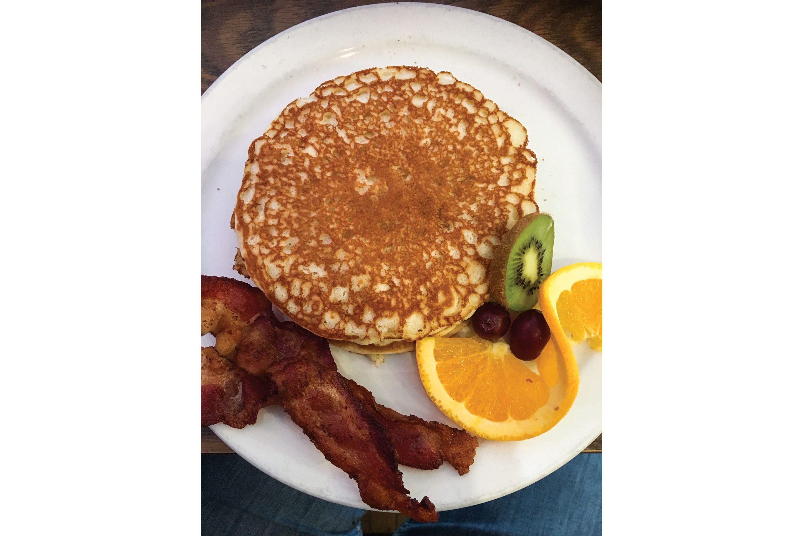
Pancakes embody my love of the road. I never eat them at home, but boy how I love to tuck into a full stack with a side of bacon when I’m traveling by bike.
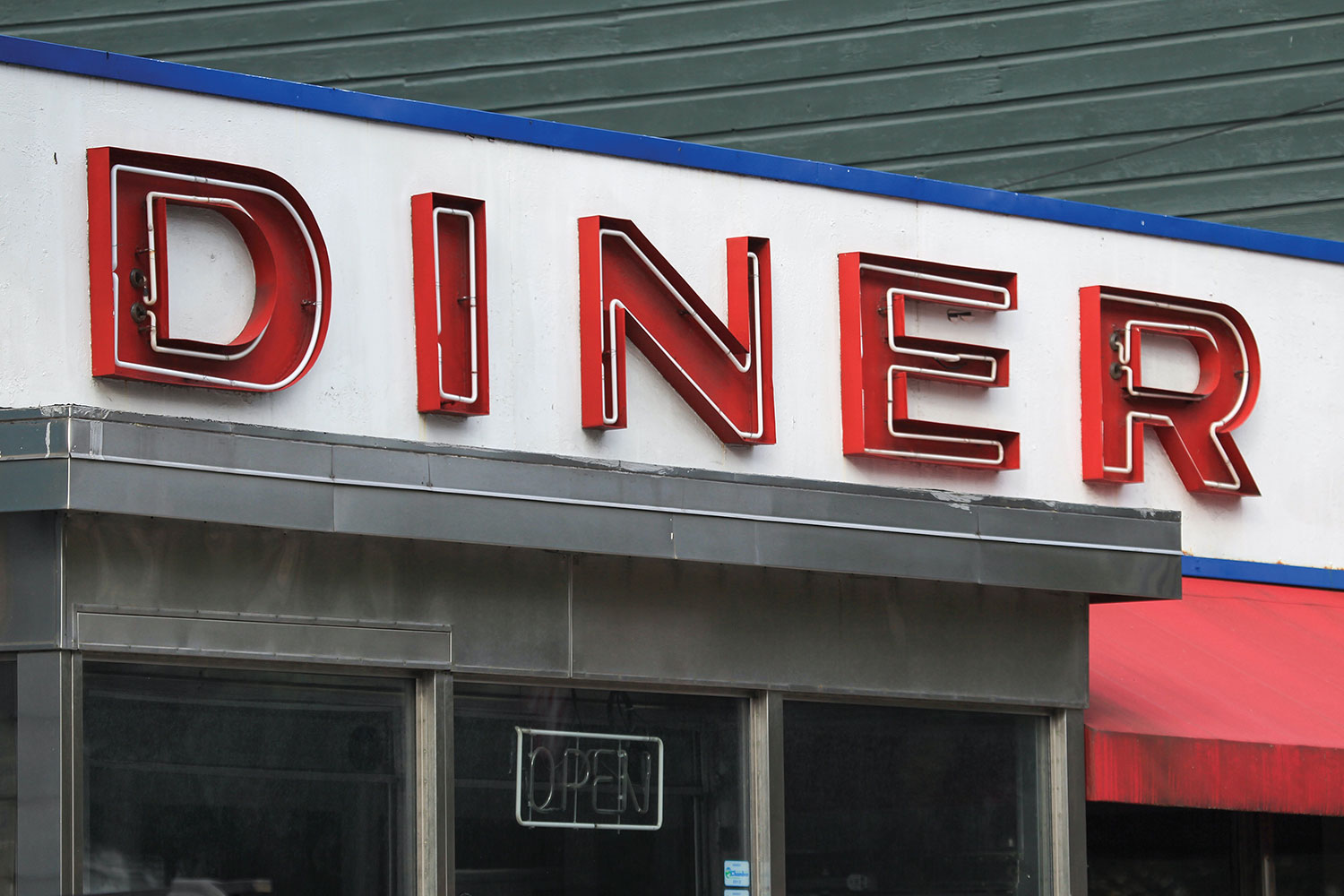
Does anything say road trip better than a hot breakfast in an old-school diner?
As I wait in a kitschy diner in upstate New York for a Honda rep and the fob to my fresh ride, I surf my notes, woven like a fragile net intended to encase what’s been meaningful about my trip so far. Everything is about the roads: their surface quality, the number of twists and undulations, surrounding scenery, traffic density, the character of the towns on either end. I feel taxed. Like rating so many roads has taken the fun out of riding.
I zoom in and out on my map, frustrated. Where to splurge on a birthday layover? And then I feel that familiar tickle. A wild hair. This time in the shape of the Florida Keys, with Key West a formidable 1,502 miles from my current location, and the start of my birthday just 36 hours away.
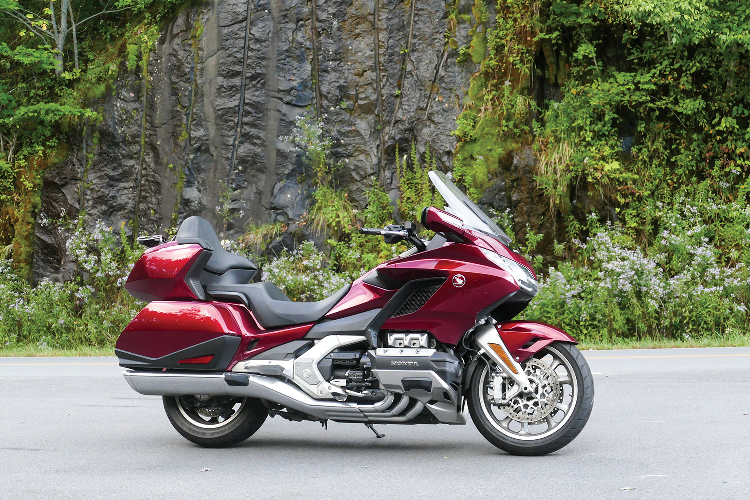
The Honda Gold Wing is brilliant on long, straight roads and tight, twisty ones.
Just before noon, I’m shooting onto I-95 South aboard a candy red Gold Wing Tour. The bike, one of my perennial favorites, feels familiar, even in its modern, more lean and athletic form. The first time I tested a Gold Wing, it was a 1987 GL1500SE for Rider. I remember being transfixed by the way its enormity disappeared once it was moving. That sleight of hand has only become more pronounced over the years as Honda oh-so-slowly refined its Wing, especially in this sporty sixth-generation version, with its state-of-the-art rider aids and electronics.
CAT’S IN THE CRADLE
As the afternoon air thickens, I remember the poison ivy. Both of my ankles and shins are covered in an angry rash, punishment for getting a peek through the window of an overgrown church near Chesterhill, Ohio, a couple weeks back while I was checking out the famous Triple Nickel, Highway 555.
The price for a quick peek inside this abandoned church was a raging case of poison ivy that lasted for weeks. Luckily, my Facebook friends have lots of advice on curatives. The most popular suggestion is ocean water. The one that actually works is a steroid injection.
While trying to curb thoughts of ramming a hairbrush down my Sidi boots, I notice I’m buzzing New York City for the second time today. So close to the most important person in my life, my adult daughter, Hannah, who’s living in Brooklyn. You’d think I’d spend my birthday there, but the hard truth is, my kid just moved into a one-bedroom with a guy she’s super serious about, and I’ve already popped in and out too many times over the last couple weeks. It makes me feel all “Cat’s in the Cradle,” but I get it, and it feels right to give her space.
As a huge thunderhead slowly walks its way across the horizon, I shuffle through memories of rides a younger Hannah had taken behind me. Countless trips in the U.S., but also adventures to places like Namibia, Greece, Scotland, and South Africa. A couple days ago, I did manage to get her on the back of the RT for a little run up into the Catskills. Once away from the city, I felt her relax against the top case and sink into her love of being on the bike.
How satisfying it is to have someone in your life who understands the deeper value of motorcycles, who gets what it means to be called to the road. Because it’s not just about machines and transportation. A motorcycle is an open window, a free ticket to a fully immersive experience. Not a lifestyle. A way of living.
GOOD NIGHT
It’s pouring rain all the way from D.C. to Richmond, and I’m happy for the stability of the big Wing. I’ve signaled to the Tour model’s electronic suspension that I’m one-up with luggage and toggled to Rain mode in case there’s a slow down or emergency, but generally, the gyroscopic effect is the science I trust, and despite occasional hydroplaning and people in cars staring like I’m a wack job, I’m finding this part of the ride weirdly relaxing. Concentration and meditation are the same thing, after all, and as the day fades into a long, dark night, I realize I’m no longer ruminating over negative crap. Not even the itch of poison ivy is breaking through.
Once traffic lightens, it’s time to hit up a playlist via the Honda’s Apple CarPlay app. The intuitive infotainment system on the Gen 6 GL is easy to navigate, and smart features like LED lighting, multiple ride modes, traction control, walking reverse, and hill-start assist prove worthy accoutrements. It’s not my first tour with Honda’s automatic Dual Clutch Transmission, however, and it has yet to grow on me. Even in manual mode, I just don’t find it as satisfying as letting my highly trained left hand work its muscle memory magic.
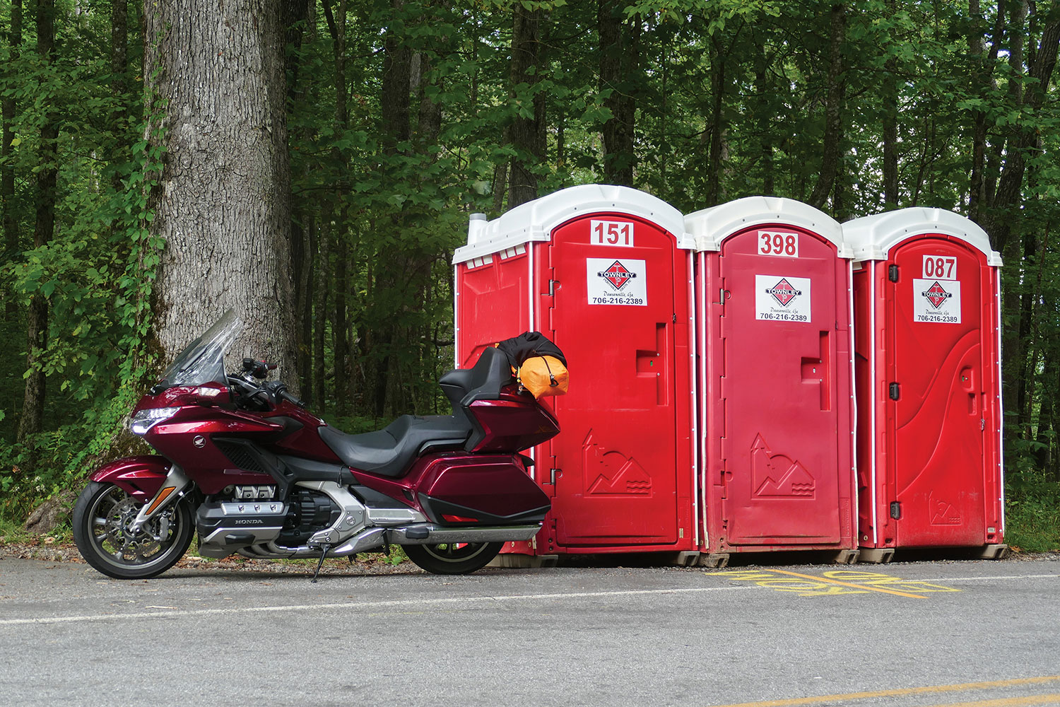
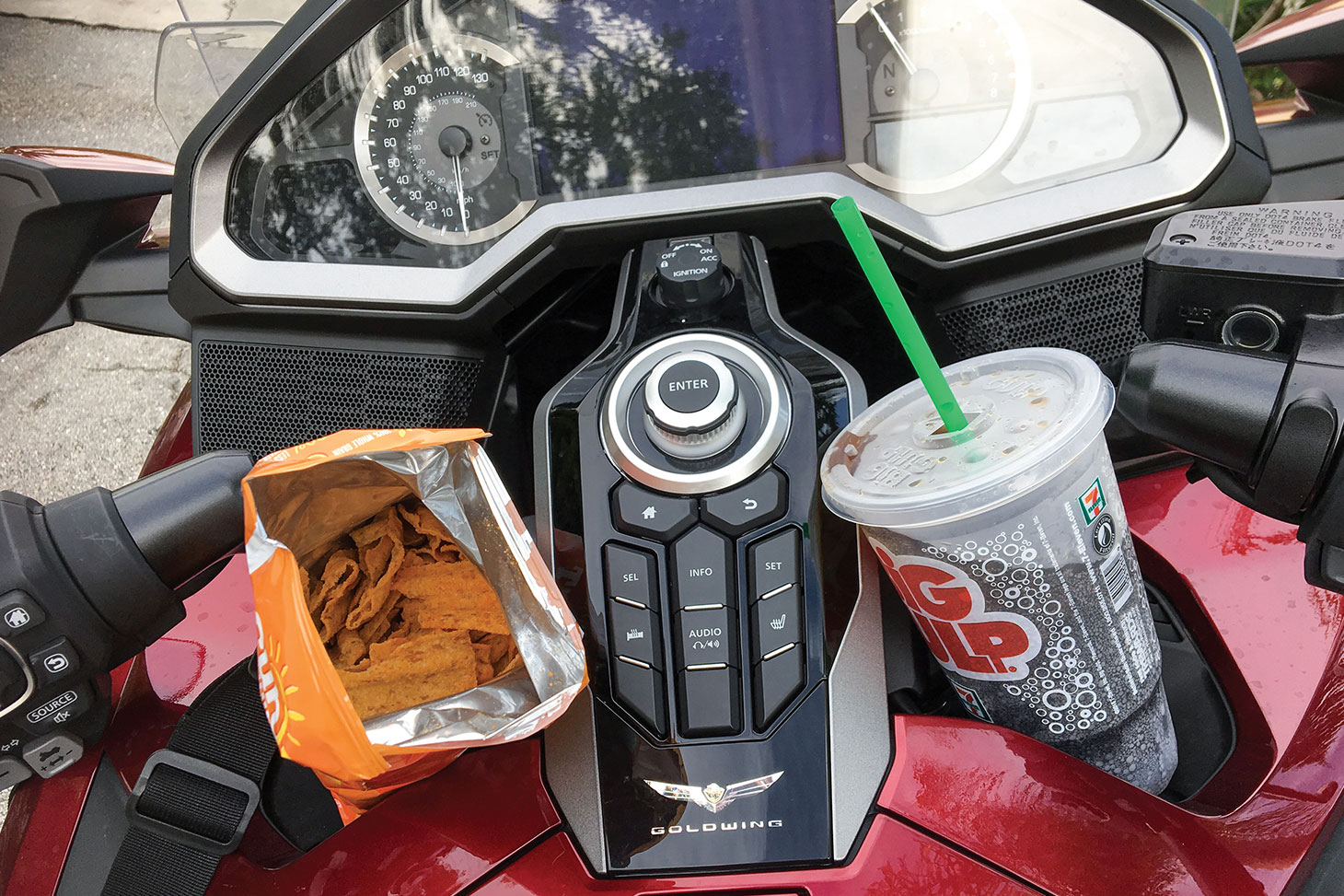
My ride from Upstate New York to Key West takes exactly 36 hours, an accidental Iron Butt Bun Burner, complete with gas station junk food (thanks Honda, for the built-in cup holders) and emergency roadside pit stops.
My buzz flickers around 1 a.m. and I duck into a brightly lit Best Western in Florence, South Carolina. I don’t bother to unpack the bike. So far, I’ve knocked only 700 miles off my quest for Key West, but that’s on top of 200 pre-dawn miles to get the Wing and that sad, sleepless night in the dirty motel. I hit the pillow hard, my head empty for the first time in weeks. No route to choose for tomorrow, just jump back on the asphalt river and row south until the road ends.
THE ONLY ROAD THAT MATTERS
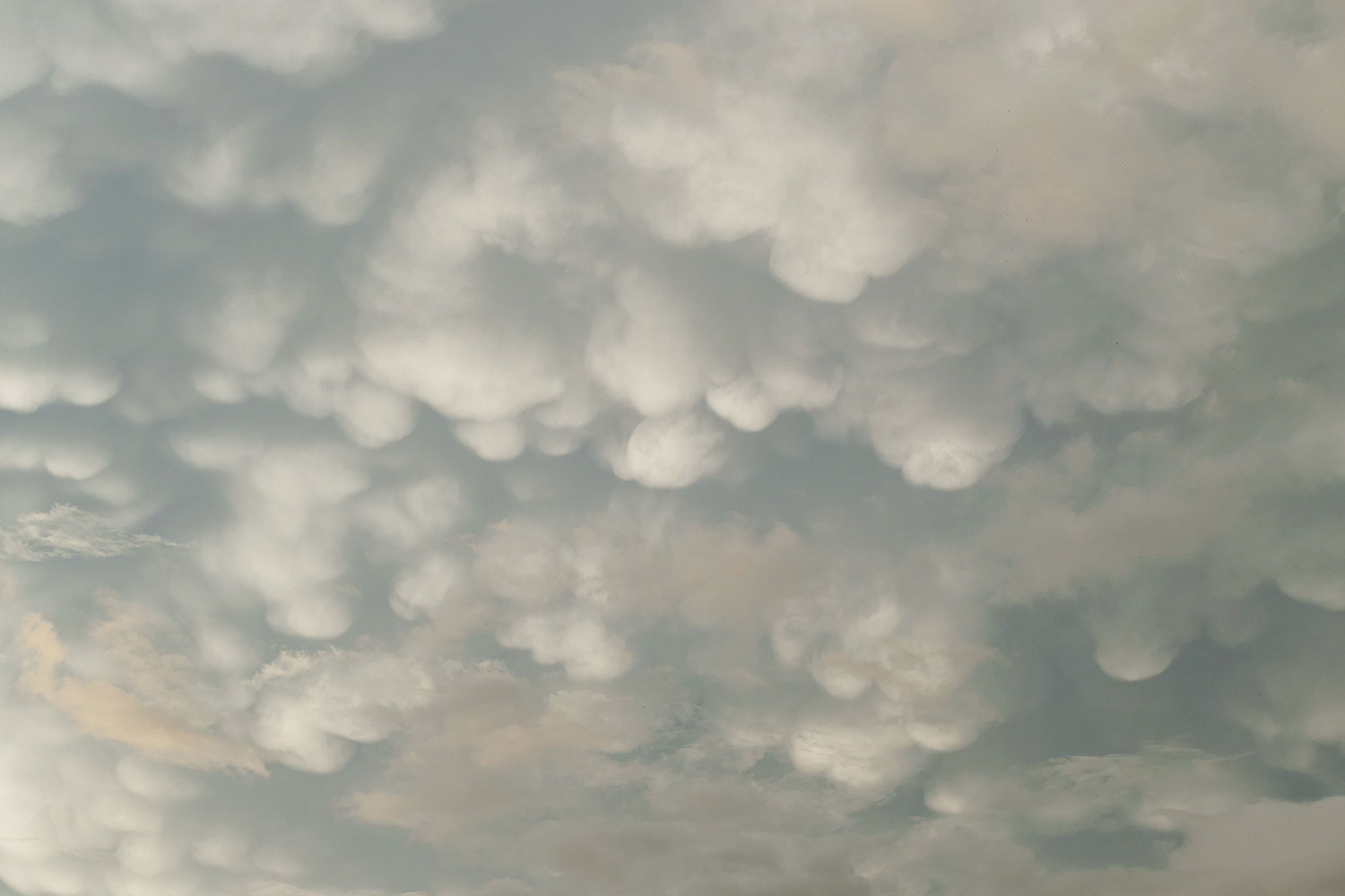
In the morning, I’m greeted by an unusual cotton-ball-strewn sky of mammatus clouds that warn me to get a move on. Georgia flies by, and with it goes any chance of riding twisty roads today. I take solace in knowing I have two weeks to ride and rank the mountain roads of Georgia, both Carolinas, and Virginia on my way to return the GL in New York.
In South Carolina, soft mammatus clouds hint at more unsettled weather, not a huge concern thanks to the Gold Wing’s inherent stability and available electronic interventions.
And besides, it’s all too apparent this is exactly what I need right now. Tedium. Just a straight road, an empty head, and a comfortable motorcycle.
It’s just past 9 p.m. when I finally touch down on the famous Overseas Highway with 122 miles to go. It’s dark, but I’ve ridden this unique road and its 42 bridges so many times I can sense the bright color gradations of the surrounding waters. There is a familiar smell, too, a penetrating humidity that lingers in these islands like a briny musk.
While the straight, miles-long bridges of Florida’s Overseas Highway provide a unique and pleasurable experience, two days later I’m jonesing for the tight corners and less crowded spaces to the north.
Instead of feeling wrung out from the long ride, I’m wide awake. The miles from Big Pine Key to Key West are quiet and slow: dreamlike. Forgotten are complaints about the flies in my room in Philly, the rash on my ankles, my disillusionments back home, the baby girl who grew up.
Finally, at midnight, I arrive at The Paradise Inn feeling deeply tired yet completely cleansed by the long hours in the saddle.
In fact, I get a text from Hannah at 11:47 p.m., just as I’m crunching into the gravel parking lot of the historic inn I booked from a rest stop in Virginia. “Is this where you’re staying?” she asks. I’m moved that she’s followed my ride online, and I’ll cry tomorrow when balloons and a bouquet of birthday flowers arrive at my room.
It’s an awesome day of celebration. I ride a bicycle to a swimming beach, see my first six-toed Hemingway cat, eat seafood stew, and take in the sunset from Mallory Square. There’s a burlesque show, and finally, cake from a dimly lit dessert shop called Better Than Sex.
I laugh every time I see this photo of me posing at the Southernmost Point marker. We’ve all been there: intangibly compelled to secure “must-have” touristy keepsakes, often at great cost. For this one, it is a 45-minute queue in sweltering humidity in a black Aerostich while surrounded by inquisitive tourists in beachwear. Who can relate?
But the real gift of being in Key West is feeling cleansed by the long miles that brought me here. A reminder that an awesome ride isn’t always about a curvy road, scenery, or even the people with whom you share the ride.
Sometimes the best ride is as close as the seat of your motorcycle. And as far as a fast road will take you.
Key West is a treasure that must be experienced to be understood. Sure, it’s blessed to be surrounded by inviting Gulf waters and typically pleasant weather, but the island is so much more about a vibe – about history and food and music and doing whatever feels right, at whatever time of day.
In my favor, I do not spend money on fancy tropical drinks or conch shells.
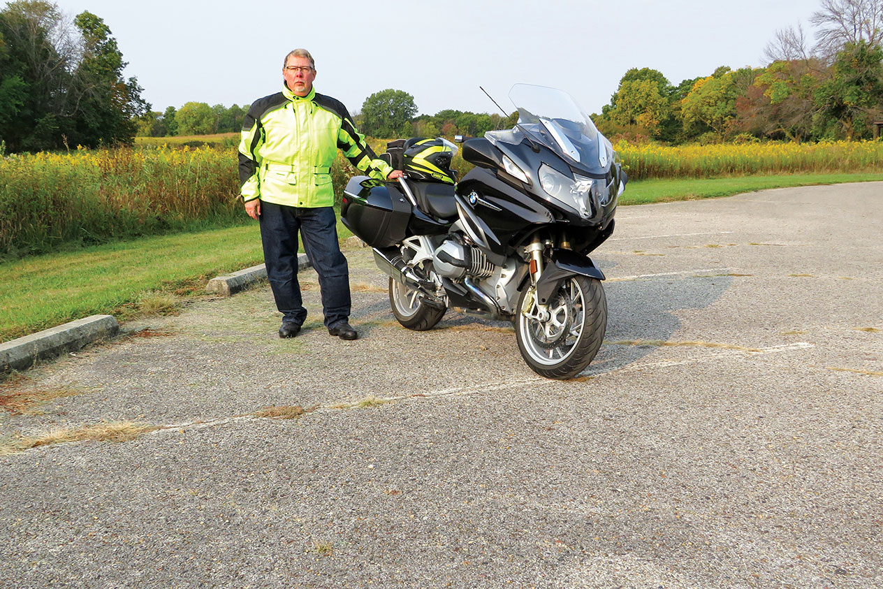
The author and his BMW R 1200 RT at Ledges State Park.
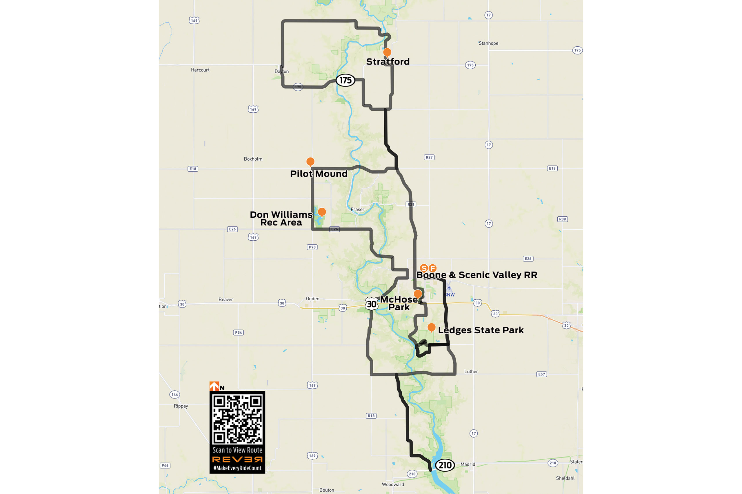
There are some great roads in central Iowa around the town of Boone, which is about 45 miles north of Des Moines. This ride crisscrosses the Des Moines River on a series of county highways and backroads, offering a nice selection of curves and scenery. I’m on a BMW R 1200 RT today, but these roads are friendly for just about any kind of motorcycle. This 124-mile loop minimizes straight sections and takes a few hours, so let’s go!
First things first: this ride is in rural farm country, so be alert for deer, farm equipment, and debris on the road. Our starting point is in downtown Boone. We follow Mamie Eisenhower Avenue (the former First Lady was born here) east to the junction with Highway R27, where we turn south and ride along the west side of Boone Municipal Airport. Like all the roads on this ride, the pavement is in good condition and meanders easily; you can see through the curves, so they’re fun to ride at any pace.
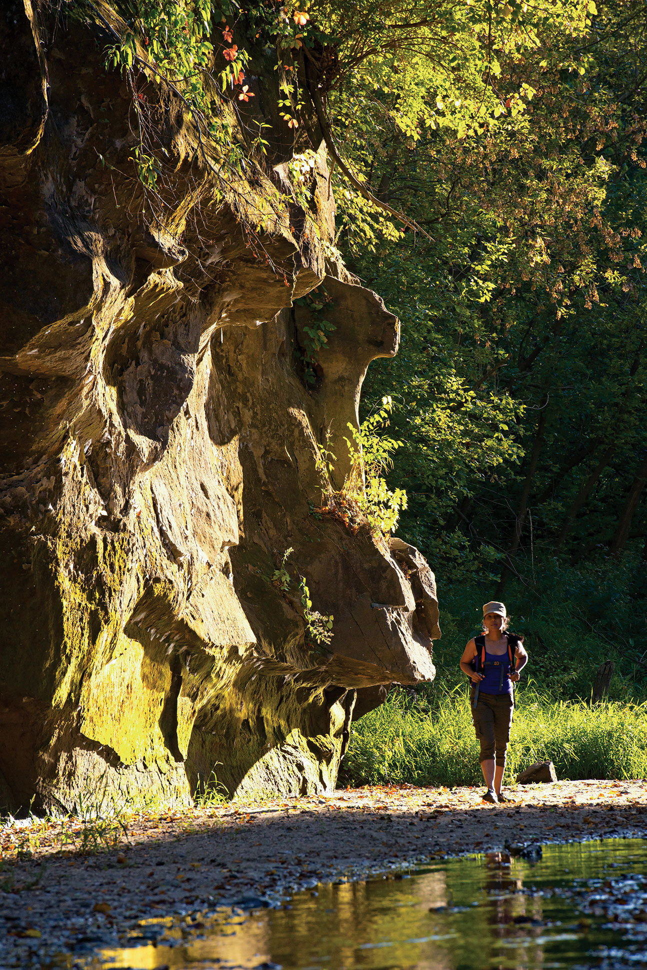
Ledges State Park is named after the sandstone bluffs that run along the Des Moines River. Photo courtesy of Iowa Tourism Office.
We cross U.S. Route 30 and continue south to Highway E52 (250th Street). Turning right (west), we continue to the upper entrance of Ledges State Park, where sandstone ledges tower 100 feet above the Des Moines River. The scenic park offers hiking, picnicking, and camping, and we’ll return to it at the end of the ride.
We backtrack to R27, turn right, and head south again until R27 ends at the junction with Highway E57 (270th Street). We turn right (west) and cross the Des Moines River, enjoying the first of many scenic river views. Past the river is a sign for Camp Mitigwa, and we turn left (south) on R26, also known as Magnolia Road. We follow the twists and turns on excellent pavement down into the Des Moines River valley, and then turn left (east) on Highway E62 (325th Street) and soon arrive at the junction with State Highway 210.
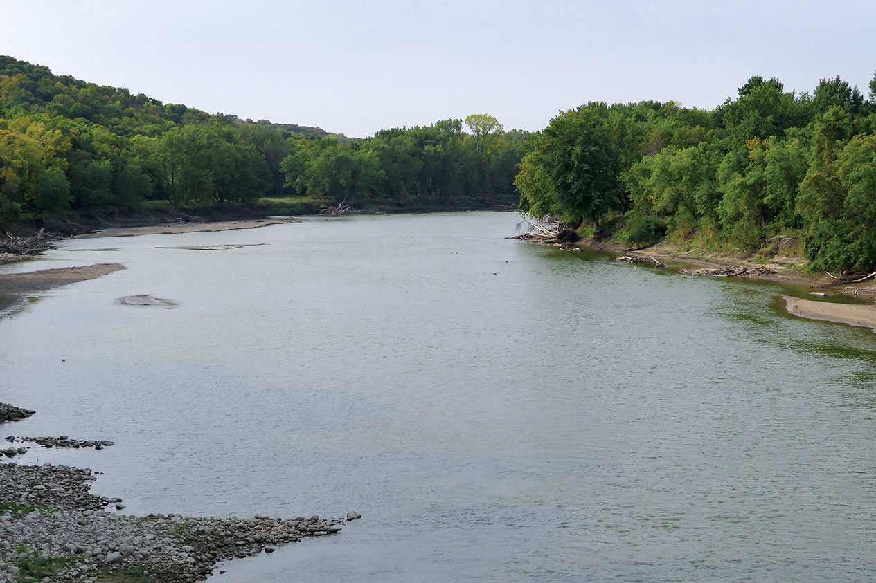
The Des Moines River is a 525-mile tributary of the Mississippi that runs through the heart of Iowa and its namesake city. Crossing and riding along the river gives this ride a curvy character most people don’t associate with the Hawkeye State.
Looking straight ahead, you’ll see the High Trestle Trail Bridge, a former railroad bridge over the Des Moines River that’s now a biking and walking trail. After enjoying the view, we turn around and ride E62 and R26 north again to E57. We turn left (west) on E57, then right (north) on R18 (L Avenue) toward the small town of Moingona.
We cross U.S. Route 30 and turn right (east) on Highway E41 (216th Drive), which is part of the Lincoln Highway Heritage Byway and crosses the Des Moines River. After a twisting climb out of the river valley, we see a strange-looking shale mound on the left, a reminder of Iowa’s once-booming coal industry. We enter Boone again from the west, picking up Mamie Eisenhower Avenue and then turning north on Marion Street.
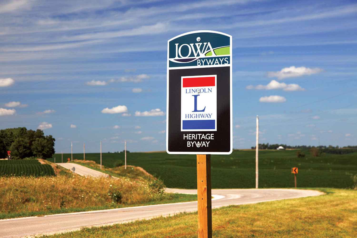
Part of the route follows the Lincoln Highway Heritage Byway.
After crossing the train tracks, we turn left on Highway E26 (12th Street) and make a few more turns as we follow E26 along curvy pavement and cross back over the Des Moines River. We exit the river valley on a wonderfully smooth and winding stretch of road followed by a short straight section.
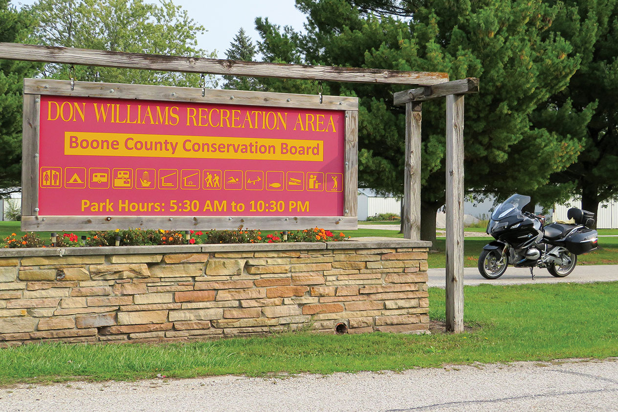
We turn right (north) on Highway P70 (H Avenue), which runs along the western edge of Don Williams Recreation Area, which has a lake, camping facilities, and a golf course. We continue north to the junction with Highway E18 (130th Street), and turn right (east) toward Pilot Mound, a small town with a sense of humor that you’ll notice as you ride by. We cross the Des Moines River once again on E18, and then turn left (north) on Highway R21 (Nature Road).
In addition to the scenic, wooded areas along the Des Moines River, there are several nice parks on this route that offer recreational opportunities.
We pass through another very small town, Ridgeport, which isn’t on most maps. We stay on R21, which twists and turns a few times until it becomes first Chase Avenue, then Stagecoach Road, and arrive in Stratford. We turn left (west) on State Highway 175, and quickly turn right (north) onto Highway D54 (Bellville Road), a real treat that heads steeply down into – you guessed it – the Des Moines River valley. There can be a lot of gravel at the bottom of this road, so stay sharp.
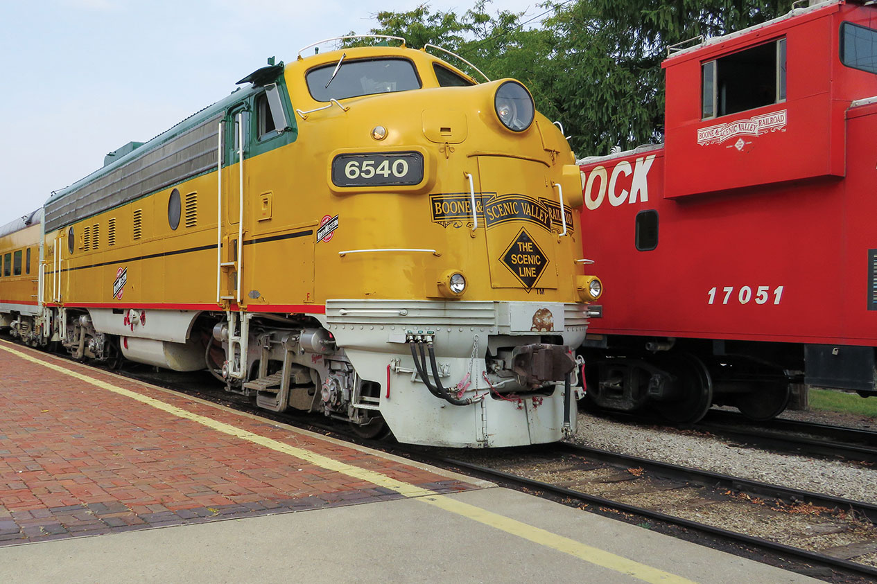
A Boone and Scenic Valley Railroad locomotive painted in old Chicago North Western livery. This excursion train and museum is a must-see for railway buffs.
Exiting the river area, the road straightens (and becomes 330th Street) until we take a sweeping left (onto Racine Avenue) into Dayton, a small town with fuel, eateries, and rodeo grounds we see on our right as we leave town heading south. We’re back on Highway 175, which curves to the east and takes us over the Des Moines River, our sixth crossing! When Highway 175 curves north, we continue straight ahead and turn right (south) on Washington Avenue. After an interesting set of curves, we return to R21 (Chase Avenue/Nature Road) and continue south to Boone on Division Street.
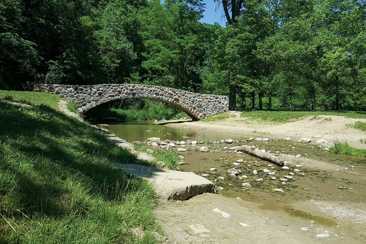
A trail bridge in McHose Park on the south side of Boone.
At 10th Street, you can turn left (east) to visit the Boone and Scenic Valley Railroad. This excursion train was started by volunteers and has grown into a fine attraction with an excellent museum. We continue south on Division Street, crossing 3rd Street (Lincoln Highway) and coming to a four-way stop at Park Avenue.
We turn left (east) on Park Avenue and ride through the Honey Creek ravine and enter McHose Park, a great place to stop and stretch your legs. We turn right on Francis Mason Drive and wind our way south through the park, exiting near U.S. Route 30.
A stone bridge built by the Civilian Conservation Corps in Ledges State Park. Photo courtesy of Iowa Tourism Office.
We head east briefly on U.S. 30, then turn right (south) on Oriole Road toward the Boone Speedway. Oriole Road meanders its way toward the Des Moines River and the lower entrance of Ledges State Park. The road is smooth and deceptively fast because, before you know it, the speed limit drops and there’s a chicane to slow you down before entering the park. Check out the sandstone ledges, enjoy the park, and then head back to Boone for fuel, food, or a hotel room. Me? I’m ready to gas up and ride another 120 miles to get back home.
Connecticut Route 43 has new tar, which encourages a pace Muriel would not have preferred. Photos by the author.
She’s taking her first ride on a motorcycle. Posthumously, as it turns out, but my Aunt Muriel is along for the ride, her ashes secretly stowed in my top case.
Muriel had not been a fan of motorcycles. She found them too fast and noisy and their riders too careless and selfish. For decades she lived near the coast in south Florida where a grid of congested, multi-lane streets put motorcycles right next to her. The ones she encountered, at least the fast and loud ones that stood out in her mind, didn’t give her much to like.
East River Road in Riverton, Connecticut, winds along the Farmington River through People’s State Forest. Muriel’s ashes are along for the ride, stowed in my top case.
While she enjoyed hearing stories of my long-distance adventures on motorcycles, she always made one thing quite clear: “You will never get me on a motorcycle!”
Now, as the miles are adding up, a thought keeps bouncing through my brain: Would Muriel have found this ride okay?
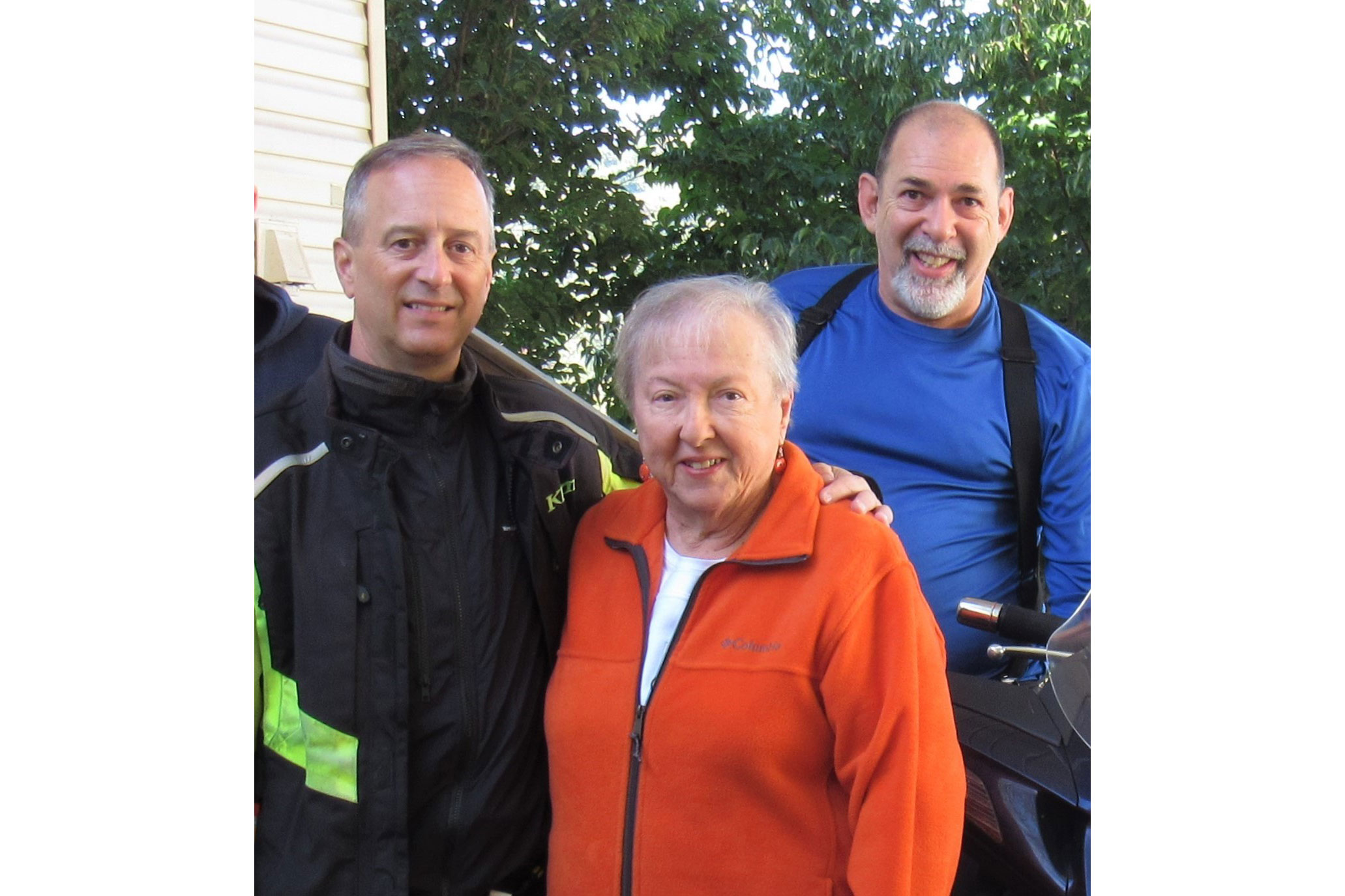
Muriel with Steve Efthyvoulou (right) and your humble scribe on one of our two-wheeled visits to her home in the North Carolina mountains.
Her attitude about motorcycles and their riders evolved after she retired and moved to the mountains of western North Carolina – one of the best motorcycling regions anywhere. When Muriel first took up residence in the town of Franklin, my wife, Sheila, and I drove down for a visit. Muriel drove us to lunch at a barbecue place she liked in the town of Highlands.
As we motored south on State Route 28, the road became tremendous, with baby’s-bottom-smooth tar and continuous tight turns, nicely banked. On one side of the road were jagged outcroppings, and on the other a fast-moving river in a rocky ravine. She pulled her car into a lay-by and drove us behind a waterfall.
On U.S. Route 221 west of Blowing Rock, North Carolina, a face seems to be emerging from the mountain.
Muriel was not what you’d call an expert driver, but to her credit, she stayed in her own lane on this intensely curvy road. Sheila was pregnant at the time and sat nervously in the back seat, clutching her rounded belly and hoping our destination was close. In stark contrast, I was thinking how fantastic this road would be on a motorcycle. I mentioned this to Muriel, and she suggested I come back riding one. “Bring a friend,” she said. “More than one if you like.”
This invitation, I later learned, was despite a homeowner association rule that did not allow motorcycles in Muriel’s neighborhood. “I don’t have a motorcycle,” she explained, “but if visitors come to see me and arrive on their cycles, there’s not much I can do about that, is there?” Muriel believed that it is easier to ask for forgiveness than permission.
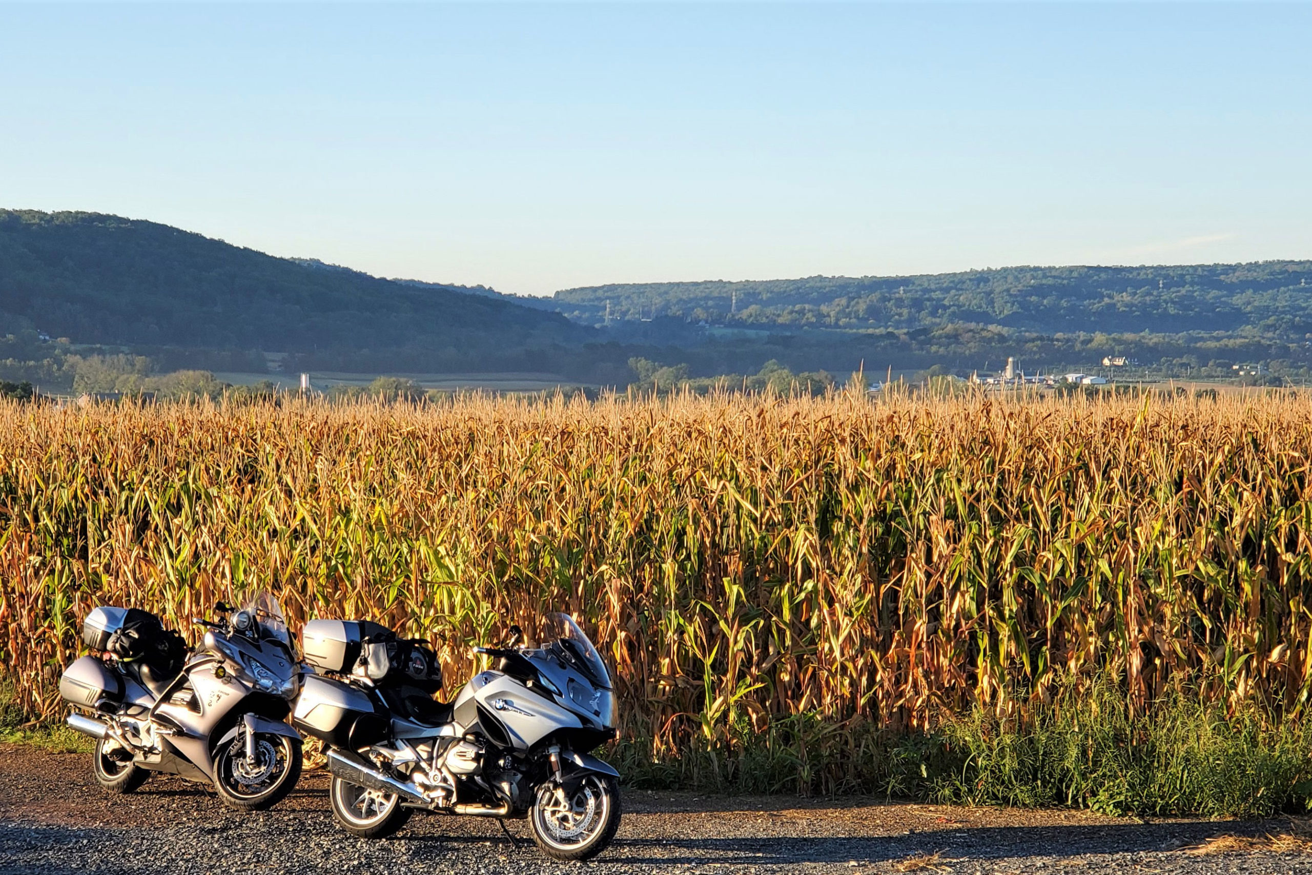
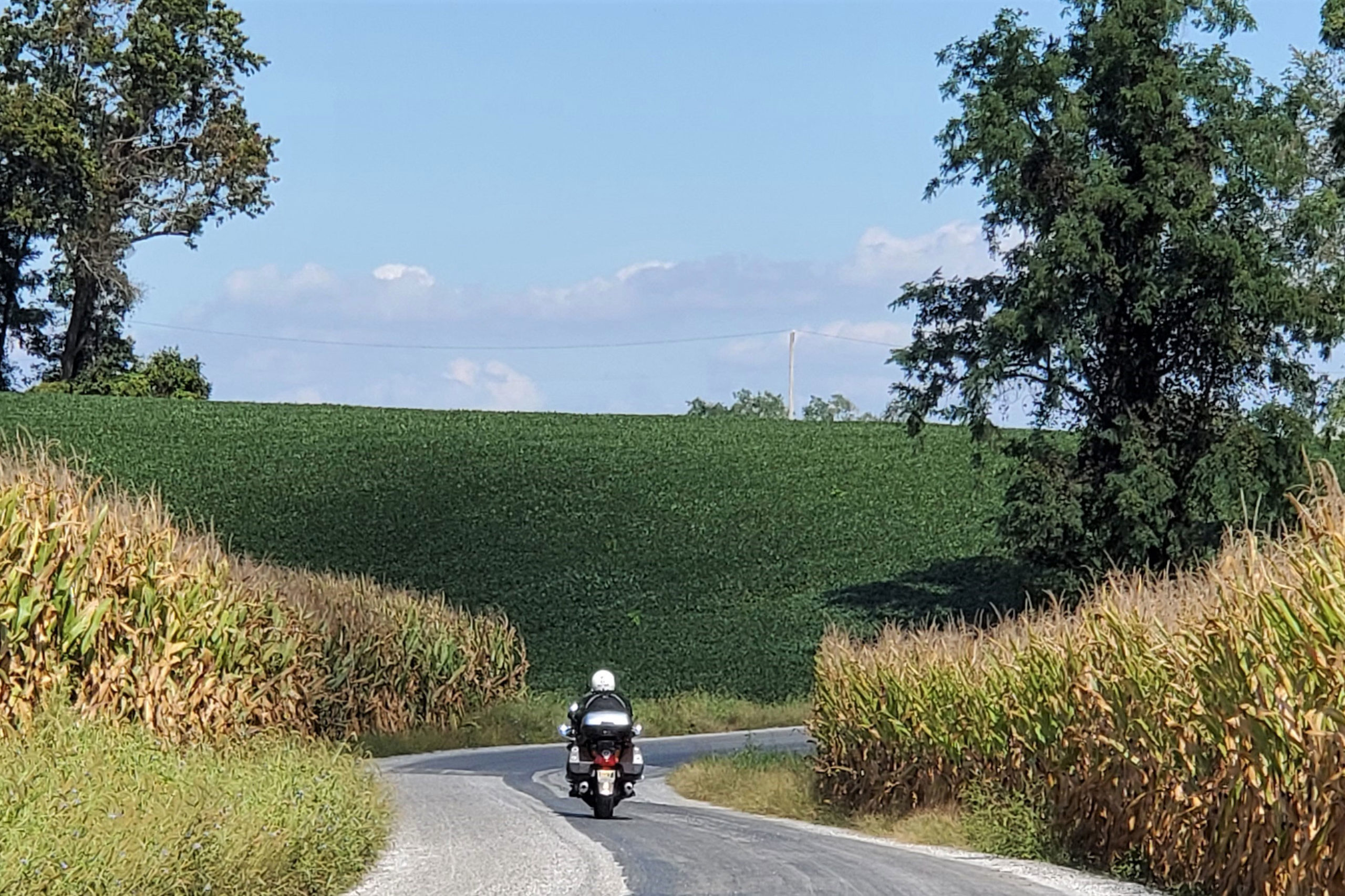
Our bikes cast early morning shadows on corn ready for harvest in Franklin Township, New Jersey.
Over the next 15 years, I took every opportunity to visit her with one, two, or three friends on motorcycles. We would arrive on quiet Hondas and BMWs, ride slowly through her neighborhood, and offer a friendly wave to anyone we encountered. Forgiveness was never required.
Muriel’s home was on a hilltop, providing an impressive view of the mountains where those roads we came to ride lay waiting. Her neighborhood emptied onto Route 28 (aka Moonshiner 28), and gems like Wayah Road, the Cherohala Skyway, U.S. Route 129 (Tail of the Dragon), and the Blue Ridge Parkway were there to be enjoyed. On every visit we discovered new roads.
Where the Skyline Drive ends, the Blue Ridge Parkway begins.
We’d return from a day’s ride excited and full of stories, then take Muriel out for dinner. Over these meals, she got to know an orthopedic surgeon, a military logistician, a powerplant engineer, a metal fabricator, a warehouse manager, and a truck driver – each a gentleman, a gracious guest, and a motorcyclist.
Steve pilots his Honda ST1300 through a corridor of corn.
One time Muriel casually asked if we’d help her change out the storm windows for screens. “You’ll keep an old lady off a stepladder,” she explained. We installed those screens, and on every subsequent visit we asked for her honey-do list. Leaky faucets, wobbly towel bars, and uncooperative wi-fi never stood a chance. Muriel came to appreciate that not every motorcycle was too fast and noisy, nor every rider too careless and selfish. When talking with her church lady friends, she referred to us as her gentlemen friends on motorcycles.
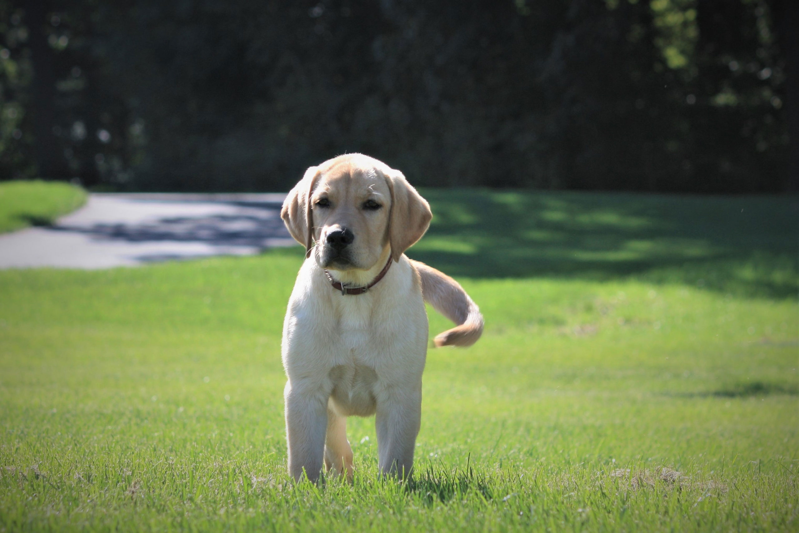
This Lancaster County, Pennsylvania, Labrador pup approached us in full wag mode but was quickly corralled by his protective mother. (Good dog.)
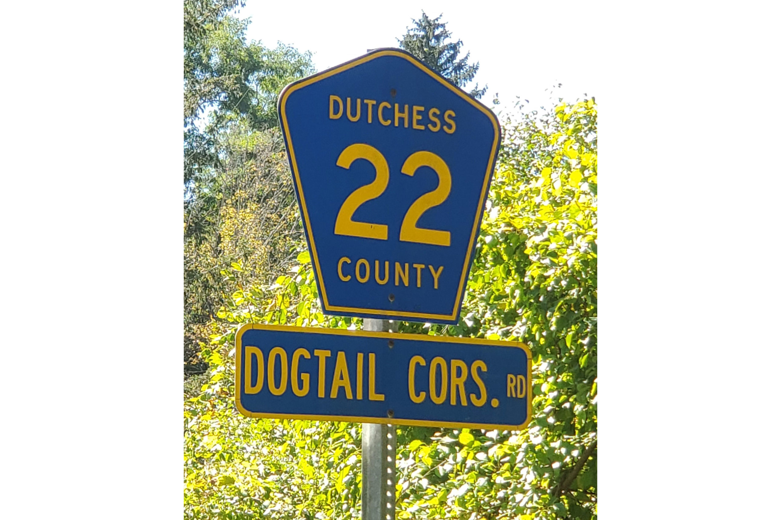
Now, on a warm Sunday at summer’s end, I depart my home in western Massachusetts and point my BMWR 1200 RT south and west. Weaving through the Berkshire Hills of Connecticut, I seek out places Muriel would have liked: Saville Dam in Barkhamsted, East River Road overlooking the Farmington River, and historic covered Bull’s Bridge across the Housatonic River. At the New York border, the road becomes Dogtail Corners Road … Muriel would have chuckled at the name. She would have been less amused by the 10-mph hairpin turns on Dutchess County Route 22 east of Pleasant Ridge Road, but I lean in to savor them.
Muriel would have chuckled at the other name of Dutchess County Route 22 in New York State.
I curve through the Bear Mountain and Harriman State Parks into scenic northern New Jersey, where Steve Efthyvoulou joins the ride. Over the years, Steve arrived at Muriel’s on a motorcycle more often than anyone except me, and on this ride, he is helping me to fulfill a request: Muriel had directed that her ashes be “scattered in the North Carolina mountains.” No specific location was indicated, so I asked Steve to join me in seeing this through appropriately. He agreed without hesitation.
Amish farms like these present a pastoral landscape in Lancaster County, Pennsylvania.
The next morning, we are rolling at first light. Steve has plotted a route to keep us off main roads, so we’re riding through small New Jersey towns, past fields of corn ready for harvest. We cross into Pennsylvania, and in Lancaster County the distinct sights of Pennsylvania Dutch country abound. Amish farmers with a team of four mules are harvesting the first row of corn, right next to the road. A bonnet-clad teacher is holding class outside as children dressed in homespun clothes sit attentively. Farther on, an older group of boys enjoys recess on a baseball diamond. I’ve been told Monday is laundry day for Amish families, and countless clotheslines brimming with union suits and long-legged underpants offer anecdotal evidence. At an intersection, a young buggy operator struggles with her charge. Steve points out that teenagers aren’t typically the best drivers – even when driving a horse.
As we return north through Virginia, this Blue Ridge Parkway lay-by at 3,700 feet elevation affords a panoramic view of the Arnold Valley.
On Pennsylvania Route 372 we cross the expansive Muddy Run hydro power project, which uses excess power from the grid to pump water from the dammed Susquehanna River into a lake. During peak power demand, water flows down from the lake through turbines that generate electricity. The lake, essentially, is a battery. It’s also the center of an area operated as a park.
Midday finds us in Maryland, and what would a lunch stop in the Free State be without crab cakes? Muriel would have given two claws up. After a brief run through the state of West Virginia, we continue through western Virginia to Harrisonburg for the night.
My bike’s reflection reveals steady rain during a break on the BRP.
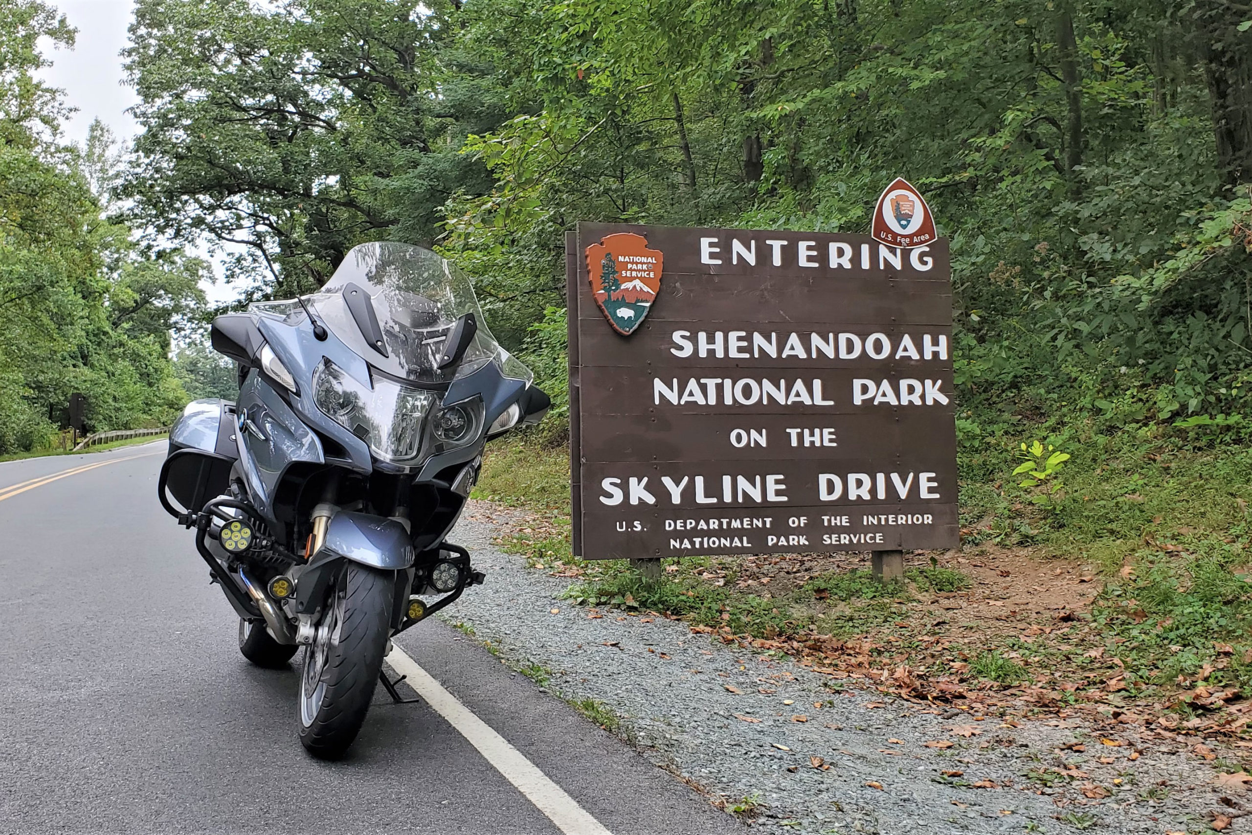
In the morning we hop on Skyline Drive to curve through Shenandoah National Park. On a dreary weekday after Labor Day, the few vehicles we encounter are noticeably disregarding the painfully slow 35-mph speed limit. After we join the Blue Ridge Parkway, the rain begins. Beyond Roanoke we shift to U.S. Route 221, and the rain continues to fall hard and steady, but as Steve reminds me, a great road in the rain is still a great road. In the town of Boone, North Carolina, we call it a day. Torrential rain and flash flood warnings will continue through the next 36 hours, so we opt for a rest day in this happening college town in the mountains.
The 35-mph speed limit on Skyline Drive provides all kinds of time to take in the scenery. Muriel would have liked that more than we do!
A day later, morning arrives with brilliant sun and temperatures in the low 40s. With heated gear plugged in, we make an early start. Branches and limbs litter the roads in a testament to the fierce storms that had rolled through. Steve shares warnings of road hazards ahead, a great benefit of bike-to-bike intercom. Especially in this region of Appalachia, the mountains form a creased and crumpled landscape, and the roads built into it twist and turn like a roller-coaster ride that you control. Rock outcroppings are common, and some are fascinating, such as one on U.S. 221, west of Blowing Rock, that looks like a face emerging from the mountain. Beyond North Cove we turn right on State Route 226 and left on State Route 226A to partake in another asphalt masterpiece.
Then, somewhere beyond Little Switzerland, an appropriate spot in the North Carolina mountains reveals itself and Muriel’s final request is fulfilled.
Dense gray clouds signal impending rain on Skyline Drive in Shenandoah National Park, Virginia.
Professionally, Muriel had been a city clerk, certifying elections, officiating weddings, and serving as president of the municipal clerks’ international association. She traveled extensively for work and in retirement. A simple church-going lady, she loved conversation, voiced strongly held opinions, and agreed to disagree (agreeably). One thing Muriel and I disagreed about was motorcycles, though curiously they brought us closer together. She knew how much motorcycles matter to me and that she lived in a special place to enjoy them, so of course I should come visit with friends.
On this trip, I gained the satisfaction of ensuring that Muriel’s wish to find rest in the mountains of North Carolina was met, and in the process Steve and I enjoyed some amazing roads. But there’s no escaping the irony that Muriel’s final ride was also her first ride on a motorcycle.
The Rocky Mountain Front Range is a rider’s paradise. Photos by the author.
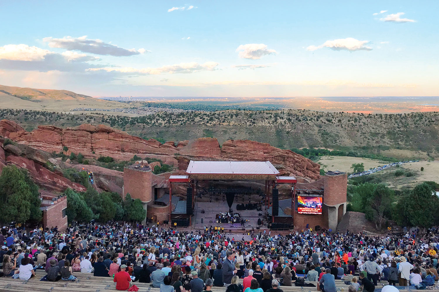
As we sat in the crimson hue of the Colorado Front Range sunset, the stone walls of the iconic Red Rocks Amphitheatre echoed with familiar lyrics. David Crosby’s face was laced with as many crevices as the surrounding sandstone spires, but his vocals gave no evidence of the octogenarian’s age. As he was joined onstage by Jason Isbell for an incredible version of “Wooden Ships,” the last lines sparked anticipation for the next day’s ride: And it’s a fair wind blowin’ warm out of the south over my shoulder / Guess I’ll set a course and go.
Red Rocks Amphitheatre in Morrison, Colorado, offers amazing views.
The next morning, that course was indeed set. Our route would be a figure-8 exploration of the eastern slope of the Rockies, flanking the Denver urban corridor. As we packed the side boxes on the Yamaha Super Ténéré with water and a few extra clothing layers, that fair wind rustled the leaves in the trees around our vacation rental in Golden. Thumbing the starter, the big parallel-Twin quickly settled into a smooth idle. I shifted into gear, and my wife, Cheryl, and I were off.
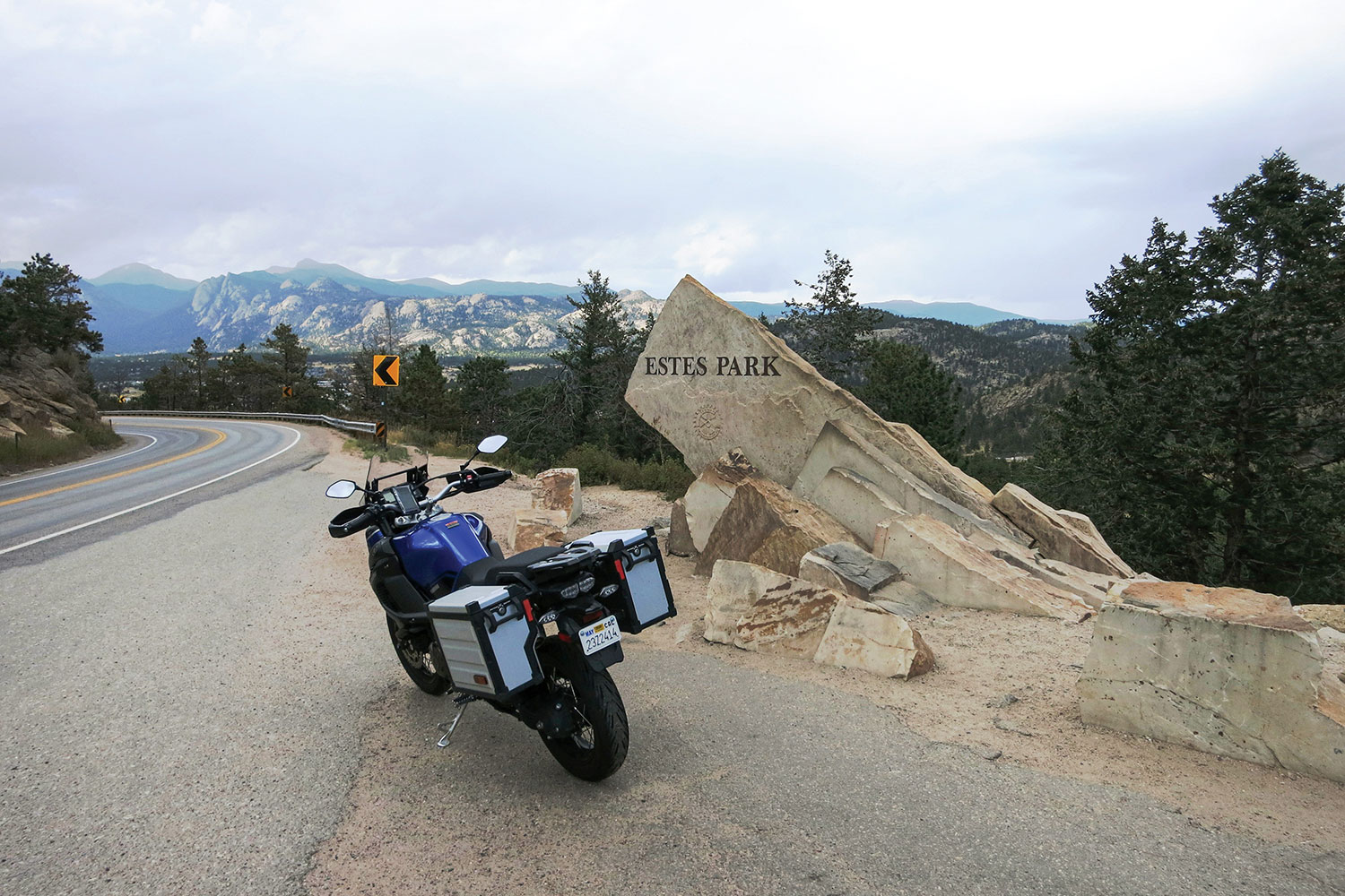
GOLDEN TO ESTES PARK
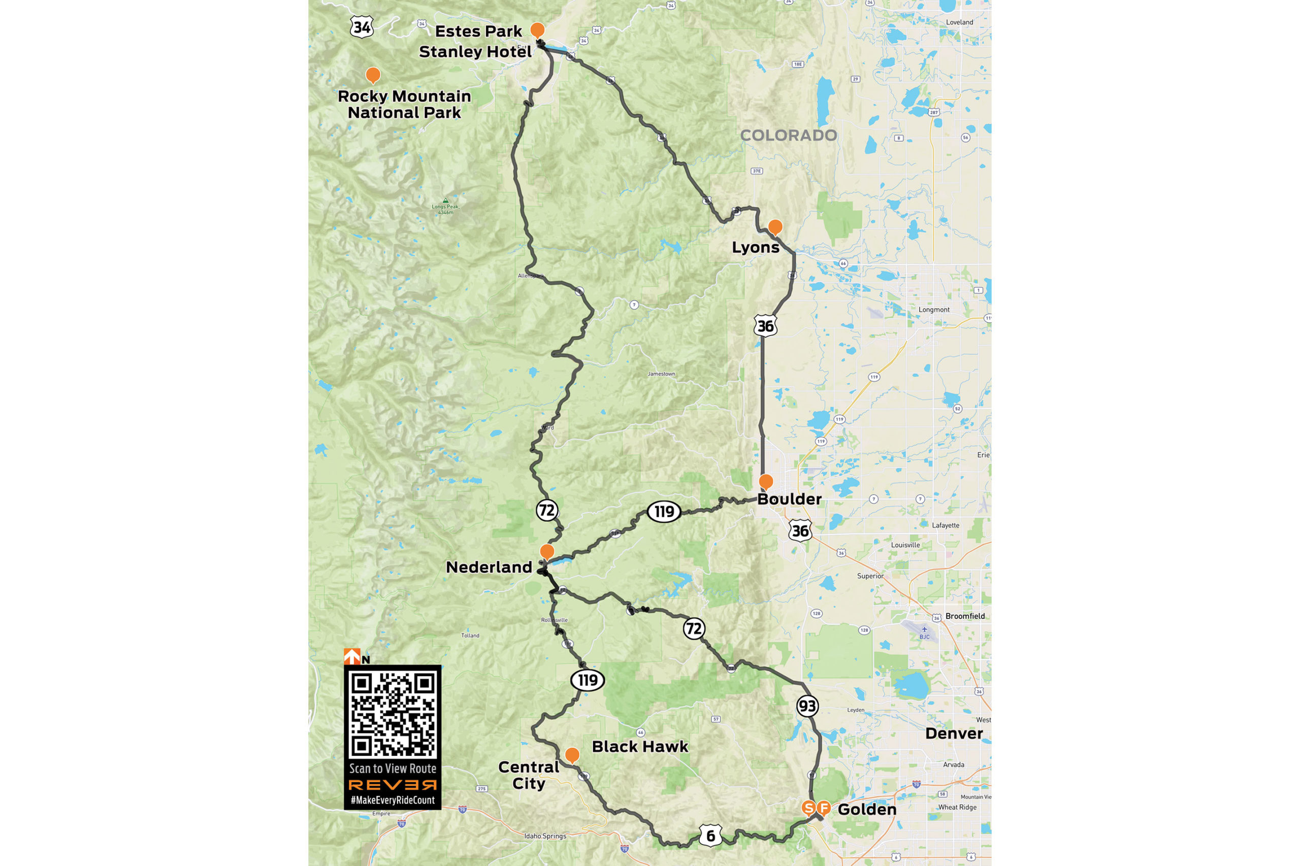
Figure-8 routes have always intrigued me. It may well go back to my youth watching the insane style of racing at the state fair. Anyway, I mapped a ride leaving Golden to the northwest and tracing that general direction to Estes Park, the northernmost point on our planned ride. The return route would traverse different roads intersecting that path on the way back south.
After a little GPS-assisted navigation out of Golden, Coal Creek Canyon Road (State Route 72) was a relaxed warm up. Wide sweepers cut through treeless grassland at the lower elevation, and with the rise in elevation came a gradual increase in vegetation. Soon, it was clear that this was truly going to be a mountain ride. Near the tiny community of Pinecliffe, the ever-tightening corners coiled into a beautiful series of cliff-lined hairpins at an elevation of 8,000 feet. The fun had really begun.
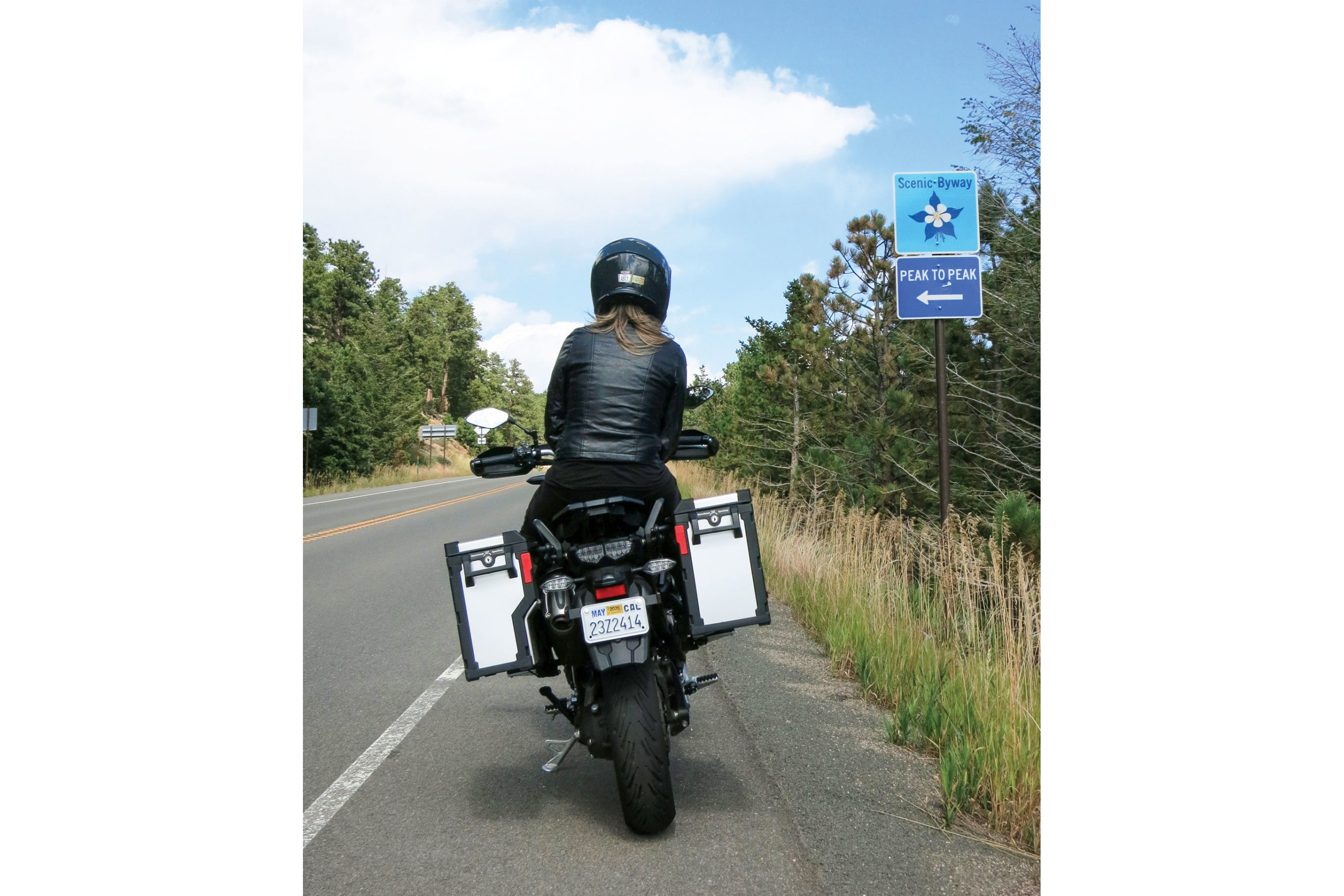
We approached Nederland, which marked the intersection of our figure-8 route. The quaint town is due west of Boulder and sits near the picturesque Barker Meadow Reservoir. After rolling through the town, we resumed our northern trek on the Peak to Peak Scenic Byway (State Route 72). The Peak to Peak is a famous ride in the Front Range of the Rocky Mountains that is considered one of the most beautiful stretches of road in the state.
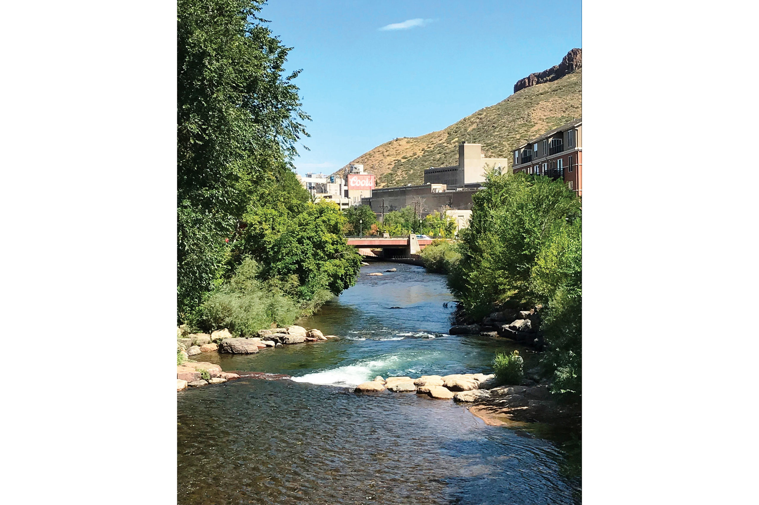
Golden is a bustling Colorado town just west of Denver with a clear emphasis on outdoor adventures. It’s also home to Coors Brewing Company.
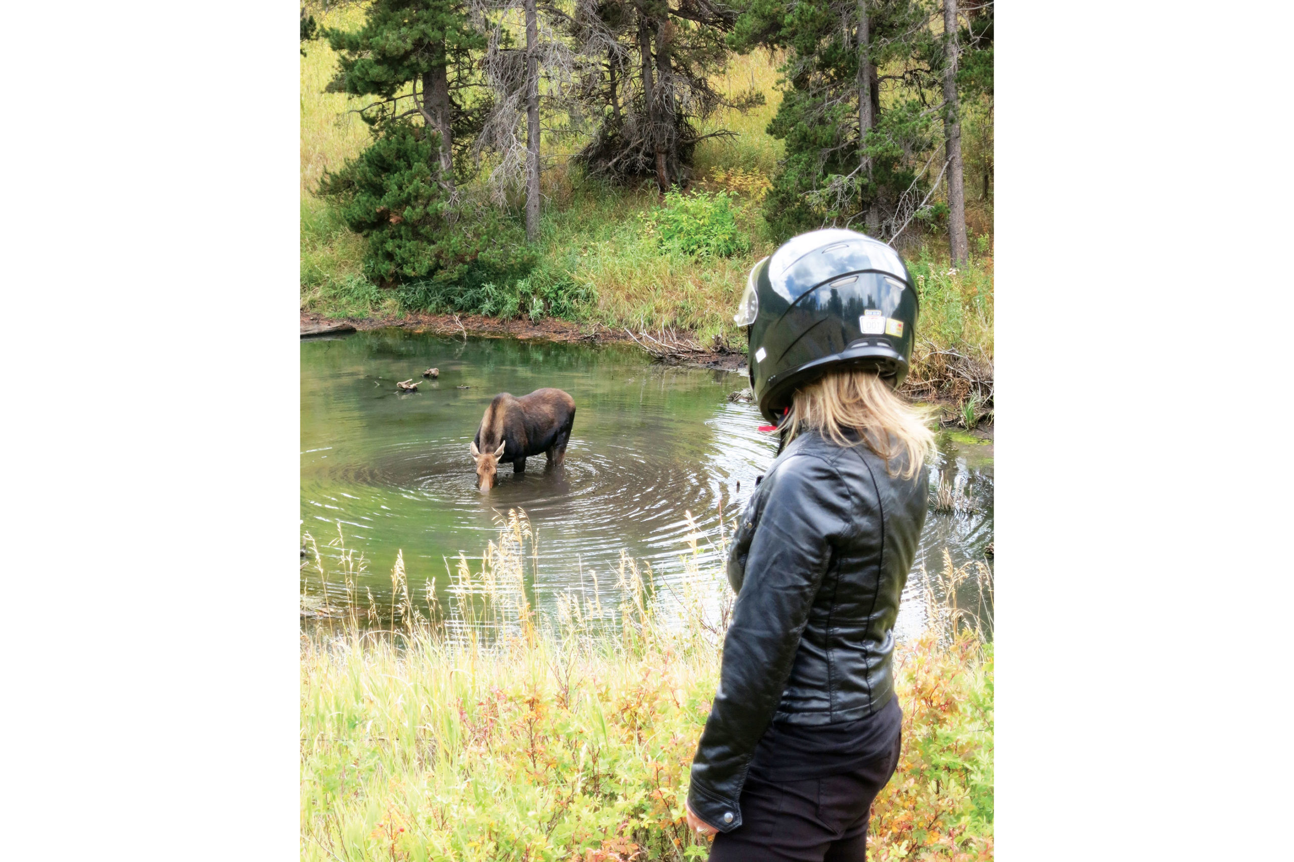
Not a dozen miles into this leg, I spotted something moving in the woods to my right. A moose was standing in the middle of a tiny pond drinking. As we parked the Yamaha and strolled to get a better vantage point, the creature raised its broad, dripping snout and regarded us with supreme disinterest. I did not blame her. After more motorists discovered what we were watching, the shoulder became an impromptu parking lot. It was time to head out.
Cheryl is of no concern to a hydrating moose.
Back on the bike, we continued the curvaceous route on the Peak to Peak toward Estes Park. Intermittent sprinkles met us along the way. There were patches of very wet tarmac, indicating that we had the good fortune of arriving just after a few downpours. It was becoming clear that, despite the rough winters in this region, the road condition was remarkably smooth and consistent.
The Peak to Peak Scenic Byway lived up to its majestic reputation, and every mile was a joy. Mountain peaks flanked the road on both the near and far horizon. The long morning of riding had us more than ready for lunch as we rolled into the outskirts of Estes Park, which is the gateway to Rocky Mountain National Park and was bustling with tourist activity.
Spanning 55 miles from Central City/Black Hawk at the southern end to Estes Park at the northern end, the Peak to Peak Scenic Byway runs through the Front Range and is one of many on the list of great Colorado roads.
We pulled into the first diner we saw. After our patty melts arrived, the owner stopped by for a chat. When we told him about the moose sighting, he was genuinely impressed. He said we were in the middle of the elk rut, so seeing those behemoths butting heads would not be that unusual. However, he said that folks who had lived in the area for years have not seen the elusive moose. We felt uniquely lucky.
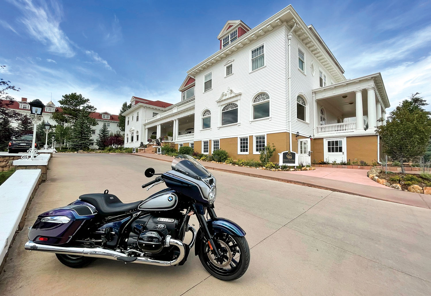
The historic Stanley Hotel in Estes Park is an intriguing place to spend an hour or two or a long weekend.
After finishing our lunch, we made a brief stop at the Stanley Hotel, a stately 140-room Colonial Revival hotel built in 1909. It was the inspiration for the Overlook Hotel in Stephen King’s 1977 novel The Shining and the 1980 film, and it served as a filming location for the 1997 TV miniseries. The Stanley was also the setting for the fictional Danbury Hotel in the 1994 film Dumb and Dumber. You can stay in the hotel, drop in for a tour, or pick up a variety of “REDRUM” souvenirs from the gift shop.
We could have spent the rest of the day in the Stanley’s historic lounge, which has an elegant carved wooden bar, a pressed-tin ceiling, and an impressive selection of whiskeys. But the road was calling, and it was time to finish our figure-8.
The Whiskey Bar & Lounge in the Stanley Hotel.
ESTES PARK TO BLACK HAWK
We rolled southeast out of Estes Park past a few golf courses and lush green hills. U.S. Route 36 proved to be another fantastic motorcycling road in the Front Range. Gray granite outcroppings laced with a variety of conifers lined the winding road. The riding was enjoyably devoid of traffic, and the threat of rain had thankfully subsided.
At the town of Lyons, U.S. 36 started the southern curve back toward the intersection of our figure-8. We were back in the grasslands and rolling hills for several beautiful miles, and then 36 straightened out on its southern line toward Boulder. Of course, the closer to the city that we got, the heavier the traffic became. When the 36 morphed into State Route 7, we were fully in the Boulder suburban area.
An impressive welcome to the gateway to Rocky Mountain National Park.
When we made the western turn onto Boulder Canyon Drive (State Route 119), we were more than ready to climb back into the foothills of the Rockies. When a motorcyclist hears the word “canyon” in a road’s name, it’s like music to ear-plugged ears. Again, the Front Range did not disappoint. The road snaked through tunnels, beside evergreen-lined rivers, and beneath gray rock formations on its route west. It is a truly spectacular motorcycle ride.
When we were approaching the now familiar town of Nederland, we rolled along the banks of the Barker Meadow Reservoir that we previously saw from a distance on the first half of the figure-8. South of Nederland, Route 119 took a decidedly southern bend toward our next planned stop. In our pre-ride mapping, we discovered a pair of historic gold mining towns that have since undergone a metamorphosis as gambling destinations.
Central City is a well-preserved remnant of the roaring past.
We were greeted in Central City by historic buildings and narrow streets. Saloons, shops, and restored hotels graced the brick architecture. We saw the quaint and colorful history, but not the gambling, and that was just fine with us. We stopped at a brewpub on the town’s main street and had a nice chat with the bartender. The gregarious barkeep graced us with a few painfully corny jokes before answering our myriad questions about the town.
The treasure trove of local knowledge told us that the town of Central City and its close neighbor Black Hawk were hotbeds of the Gold Rush after a huge local gold strike in 1859. Later in the 1800s, the towns were connected to Denver by rail, and the boom continued. However, as they say, all good things must end, and the towns both declined with the dwindling of the mineral wealth in the 1900s.
The Yamaha Super Ténéré proved a worthy mount for the Rocky Mountain ride.
After a few more wonderfully bad jokes, our raconteur brought us to the current state of the area. In the early 1990s, Colorado passed limited-stakes gaming in the state, and the tiny towns picked up on the idea. He said the towns have become the gambling heart of the state, accounting for nearly 90% of Colorado’s gaming revenue. Noticing our quizzical looks after scanning the small smattering of video poker machines and one-armed bandits in the pub, he said with a smile, “Wait until you ride south.”
The merry jokester was prophetic. As we left the quaint ambience of Central City, we rolled through a bit more history before it became clear. High-rise casinos and hotels rose like specters as we rounded a corner. The dichotomy that has been created in this area emerges most distinctly in the town of Black Hawk. Juxtaposed with 150-year-old brick buildings are massive, engineered tributes to modern man’s lust for a quick buck. The irony is more than evident. Gone are the starry-eyed miners, only to be replaced by glassy-eyed gamblers.
Clear Creek flows through Golden and is a magnet for anglers and water sports enthusiasts. The label of Coors beer says “Brewed with 100% Rocky Mountain Water,” and this creek is its source.
We motored out of the unlikely Rocky Mountain “Vegas” and back toward our starting point. The last portion of the ride was a great mix of all that we had experienced on the figure-8 ride into the Front Range. The road was smooth and well maintained, and the scenery was spectacular. We dropped from thick forest, to grassland, to the bustle of Golden.
While not a full exploration of the Colorado Rockies, our tour was a nice overview of the roads and ecosystems of the area. The 40-degree swing in temperatures and the varied precipitation on the ride made it clear that gear choice and preparedness is vital in the Rockies. Because of the elevation, this is strictly a late spring to early fall ride. That said, we would love to return for the spring bloom or the fall leaves to explore the Front Range further.
On this Spring Trifecta ride, Tim Kessel combined his three loves: a scenic motorcycle ride, baseball, and live music. Photos by the author.
I am not one to repeat most motorcycle rides, and I am certainly not one to revisit my old articles. However, there is a curious symmetry to this Spring Trifecta piece. Two years ago, virtually to the day, I wrote a web article for Rider titled, Spring Training: A Good Reason to Dust Off the Bike. I penned the piece after intertwining some great southern Arizona motorcycle rides, Cactus League spring training, and concerts at the appropriately named Innings Festival. It was a great time, but the precipitous onset of Covid-19 followed immediately cutting spring training short and rendering gatherings like music festivals a thing of the past.
This spring, with Covid loosening its talons on society, I was going to return to spring training to watch the boys of summer hone their skills and to the Innings Festival for more good music. I had already traced new southern Arizona motorcycle routes. This time, it was not a novel virus that interfered; it was a dispute between those same boys of summer and their bosses that silenced the baseball diamonds. With one leg of my trifecta of fun severed, I cancelled my spring riding and concert plans.
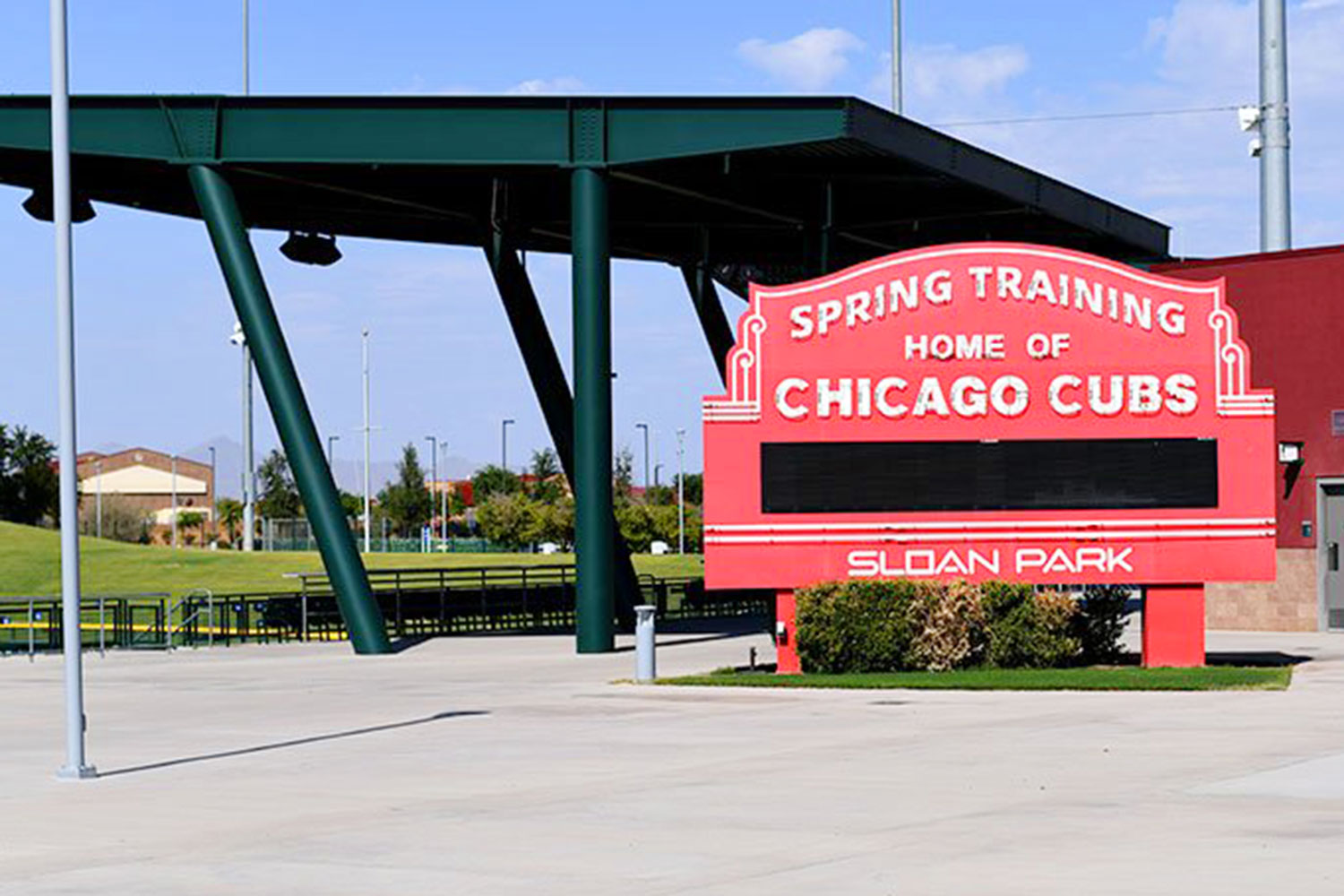
Sloan Park is home to the Cactus League spring training for the Chicago Cubs.
A few weeks later, the baseball owners and the players’ union agreed to an eleventh-hour deal, and spring training was green-lighted for a late start. My routes were already in place and bats were again going to crack. All I was missing was a musical component to complete my return to southern Arizona and some semblance of normalcy. An Internet search revealed that Roger Clyne, the rock balladeer of the Southwest, was to perform at the intimate and beautiful outdoor Mesa Amphitheatre, which is just a stone’s (or hardball’s) throw away from the Arizona training facility of the Chicago Cubs. Perfect!
Arizona’s Sonoran Desert is the perfect place for a scenic springtime ride.
As it turns out, it was perfect. My ride south of Phoenix was amazing. Towering cacti stood sentinel as I wound though Sonoran Desert National Monument. Blue skies and rugged mountains served as backdrop in my loop ride even further south through the Southwestern desert. Things like labor disputes, global viruses, and two years of missing many of my favorite things blurred in my rearview mirrors.
The night after my sojourn into the arid version of God’s country, I settled my saddle fatigued posterior into my seat at the Mesa Amphitheatre. Intermixed in the enthusiastic audience were Roger Clyne and the Peacemakers concert shirts and various iterations of baseball jerseys. Clearly I was not the only one enjoying a vibrant melding of spring activities. Under the Mesa, Arizona, stars, Clyne played his raucous mix of original songs, threw back shots of his proprietary tequila, and generally whipped his fans into a communal frenzy. I offer up a strong recommendation. Experience a Roger Clyne show as it is very easy to become a fan.
Enjoying a performance by Roger Clyne and the Peacemakers at the Mesa Amphitheatre in Mesa, Arizona.
In the couple of days that followed, I embarked on another much-needed and spirited desert ride through Arizona’s burgeoning wine country. The high grasslands of southeastern Arizona are fertile ground for both grapes and entertaining riding. I rode past isolated vineyards and unique small towns in the high desert expanse. My big BMW R 1200 GS seemed as happy to free from the stagnancy of winter, variants, and quarantines as I was.
I followed the riding with a bit of sun-warmed bleacher time watching the relaxed pace of an early Cactus League practice at the Cubs spring training facility. Listening to bats cracking and the banter of players returning to their diamond sanctuary was just what the doctor ordered.
So there you have it – one man’s return to some kind of normalcy. Baseball is back, concerts are returning, and riding is always there. There is a smile on my face. Trifecta complete.
Since 2010, the adventure motorcycling non-profit Backcountry Discovery Routes (BDR) has created 10 trans-state routes for dual-sport and adventure motorcycle travel. Now, BDR announces its eleventh route, the Wyoming Backcountry Discovery Route (WYBDR), produced in partnership with BMW Motorrad USA and Wyoming Office of Outdoor Recreation.
The BDR organization’s WYBDR release includes free GPS tracks, a digital map, professional photographs, and travel resources at RideBDR.com/WYBDR. This will be followed by a printed waterproof map, produced in collaboration with Butler Motorcycle Maps, and currently available for pre-order at Touratech-USA and Butler Maps. Additionally, a documentary film directed by Sterling Noren and produced by BDR Documentary Films will be available.
The WYBDR Route
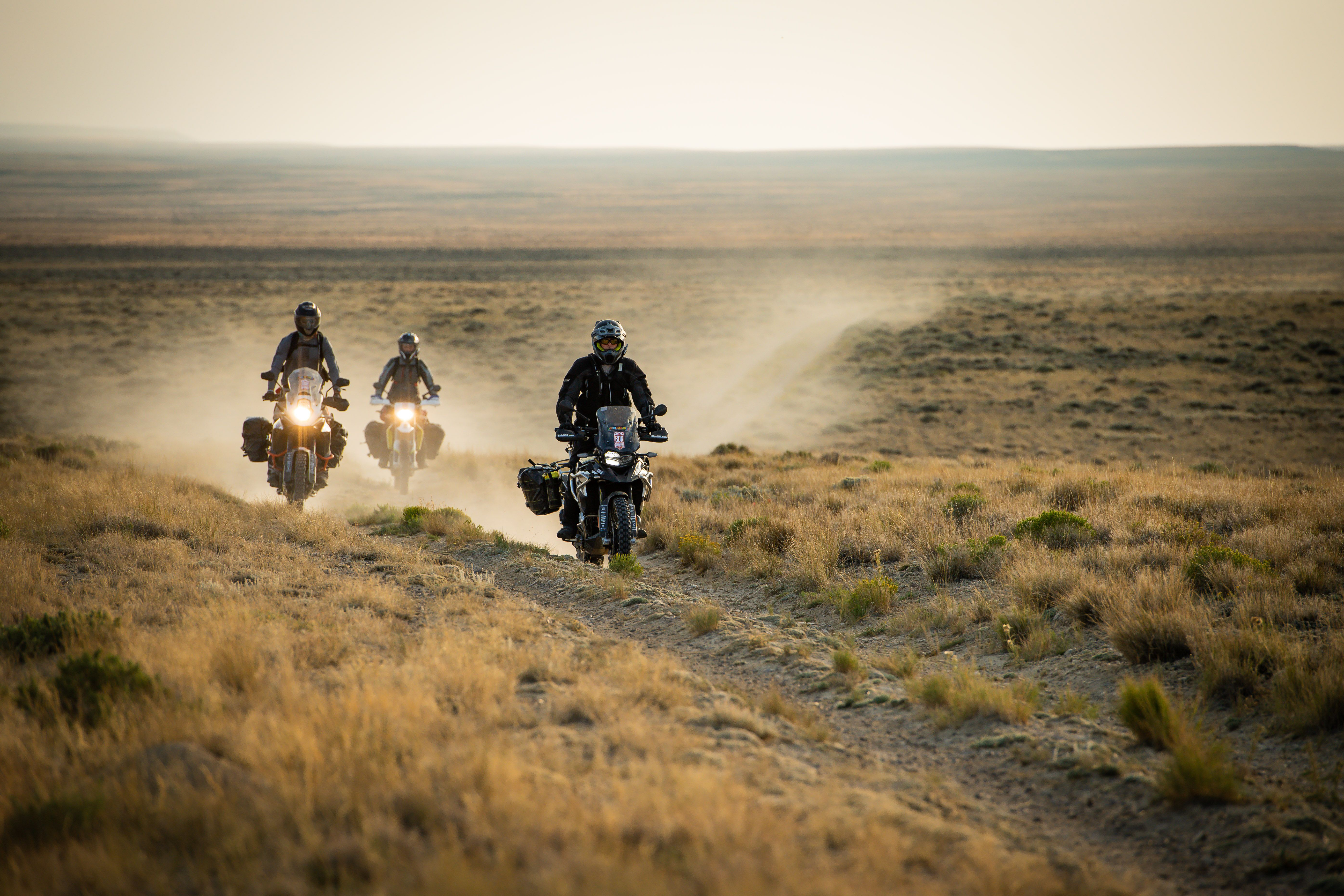
The Wyoming Backcountry Discovery Route is the eleventh route developed by the BDR organization for adventure motorcycle travel. Riders will test their skills and endurance on this epic 950-mile backcountry tour of Wyoming spanning from the border of Colorado to Montana. The tracks wind through five mountain ranges and explore vast high-desert regions on public dirt roads and primitive double-track. Expect scenic views, endless forest roads under a canopy of trees, high-desert terrain, flowing curves, rocky expert-only sections, and alpine elevations reaching 11,000 feet.
Riders will traverse two major rim escarpments and pass through many seldom visited areas and historic mining towns. This route regularly throws unexpected challenges at riders, and almost every section includes some technical riding. WYBDR is the most remote of all the BDRs, so preparedness is key to a successful WYBDR adventure.
“Riders will love the scenic diversity of the WYBDR. This route showcases the character of the state with forested mountain ranges, high-desert plains, rural valleys and so many different backcountry settings. The elevations frequently change and so does the scenery. The challenging sections were the most special to me and I think they will test even the most experienced of riders.” – Bryce Stevens, Wyoming Route Architect & BDR Co-Founder
WYBDR Film & Tour
The WYBDR expedition documentary film tour begins February 5th at dealerships and clubs across the country. Join fellow adventure enthusiasts for an exciting evening of film and adventure at one of the upcoming WYBDR film screenings, or help organize a film event near you.
The expedition documentary film features the BDR team and special guests Wendy Naessens of the BMW US Rider Academy, and Jocelin Snow, former AMA racer and BMW International GS Trophy competitor, taking a first run on the WYBDR. The team tests their skills and discovers the gems of the Wyoming backcountry, as they enjoy the rugged beauty of the wildlands and meet creatures that inhabit these remote and seldom visited regions of Wyoming.
“Having the opportunity to ride the entire 1,000-mile Wyoming Backcountry Discovery Route as part of the documentary film truly has been an awesome life experience. I have been fortunate enough to instruct others, new and old, on how to improve their motorcycle skills and broaden their riding horizons. This breathtaking route that BDR has put together will test your skills and leave you with memories that will last a lifetime.”- Wendy Naessens, BMW US Rider Academy
For listing of Backcounty Discovery Routes events and film screenings, visit RideBDR.com/Events
A film tour is being planned in over 50 cities across the country. Dealerships and motorcycle clubs interested in hosting a film event are encouraged to contact BDR to reserve their date on the tour.
Free Film Public Release
The BDR organization has decided to make its latest WYBDR film available for free on YouTube after the film tour is complete on May 1, 2022. This decision was made to help broaden the availability of the film to the community. Free distribution is a more environmentally friendly approach and also eliminates the costly process of producing, storing and distributing DVDs.
Wyoming Tourism Partners
The Wyoming BDR has been developed in partnership with the Wyoming Office of Outdoor Recreation. Local governments in seven different counties along the route supported the project and embraced BDR’s mission of helping to boost local economies with a sustainable new form of tourism. This BDR route is projected to bring riders from across the county and around the world to Wyoming in the coming years, and not just to the usual tourist hot spots, but to rural communities that will benefit from this positive economic impact.
“As participation in the outdoors continues to increase, Wyoming’s Office of Outdoor Recreation recognizes the importance of enhancing and developing outdoor recreation opportunities, promoting responsible and sustainable recreation, and the need for quality, accessible resources for recreationists. Partnering with Backcountry Discovery Routes has been the perfect opportunity to expose a reputable group of adventurers to the lesser-known treasures of Wyoming’s public lands while utilizing existing infrastructure and initiating a positive economic impact in rural communities along a route otherwise less traveled.”-Laurel Thompson, Outreach Coordinator, Wyoming Office of Outdoor Recreation
BDR-X: A New Backcountry Discovery Routes Concept
As BDR heads into its second decade, a big goal for the organization is to improve and expand on the experiences and resources it provides to the ADV community.
The BDR community has been asking for more routes, and, specifically, for routes that loop. So in addition to the classic BDR routes, in 2022 BDR is introducing the BDR-X. A shorter, BDR-style route that loops.
A BDR-X may be an excursion off of an existing route or something entirely new in an area where there’s yet to be a BDR route. BDR-X’s will be designed to only take a few days to ride and BDR plans to rollout multiple routes in the coming years, starting with the Red Desert, Wyoming BDR-X.
The Red Desert BDR-X tracks are available on the BDR website. A print-ready PDF of the Red Desert BDR-X map and a short video will be available following the route release.
Road testing the 2019 Tracer 900 GT in Washington’s Klickitat River valley, with Mount Adams in the background. (Photos by the author & Brian J. Nelson)
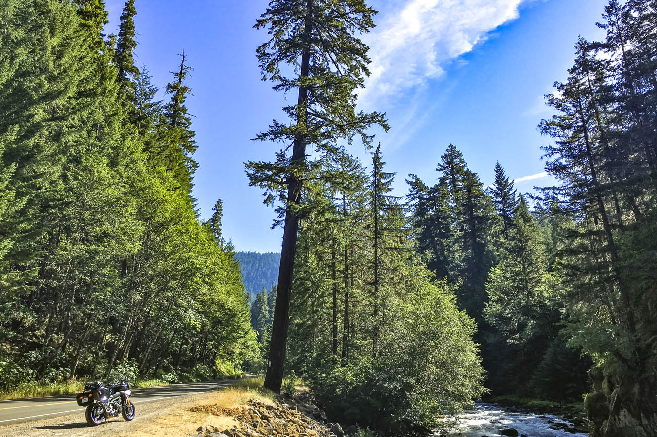
Winding through a dark canopy of evergreens, the road played hide-and-seek with the Clackamas River, offering a glimpse here and there of clear water pouring over rocks as it made its way downstream to the Willamette, then the Columbia, and finally the Pacific. A break in the canopy was like popping out of a tunnel and I set my eyes on a patch of gravel next to the road, just a few feet from where the river made a sharp turn. Down went the Yamaha Tracer 900 GT kickstand, off went the ignition. I hadn’t seen a car for miles. It was just me and the trees and the river. Just what I was looking for.
Emerging from a dark tunnel of trees on the West Cascades Scenic Byway, I found the perfect sunny spot to enjoy the sights and sounds of the Clackamas River.
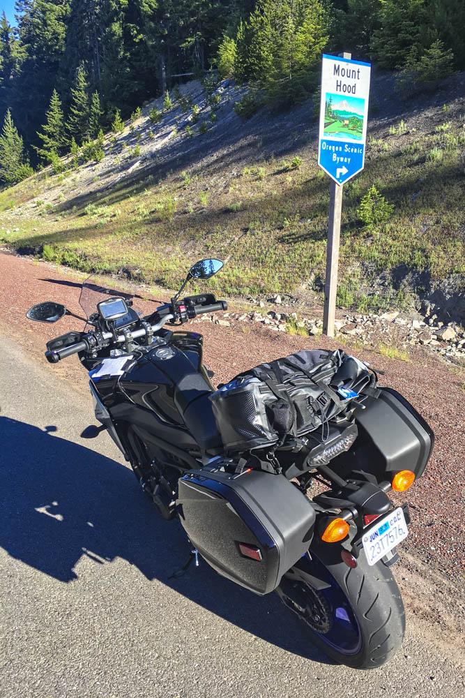
The previous day I logged 250 miles aboard the Yamaha at the bike’s press launch. The event was based in Stevenson, Washington, a small town in the heart of the Columbia River Gorge National Scenic Area, and I spent a long, hot day testing the GT on local backroads. Weighing just 500 pounds and packing a punch from its 847cc inline-Triple, the Tracer 900 GT is a light, agile, comfortable sport-tourer, perfect for a solo traveler. Yamaha entrusted me with the keys to one for the long ride home to Southern California.
With snow-capped volcanic peaks, wild and scenic rivers, dense evergreen forests, and countless roads that follow the contours of the land, the Cascade Range is a motorcyclist’s paradise.
For years I’ve heard and read about how good the riding is in the Cascades, a mountain range that runs from British Columbia down through Washington and Oregon to Northern California. Whenever possible, I like to fill in the blank spots on my mental map –to experience first-hand what roads and scenery are really like. So I sketched out a route from the Columbia River to the California border that zigzags several times over the Cascades, winds its way through four national forests and one national park, and follows three designated scenic byways. Like any good motorcycle route, it would take at least twice as long as a more direct path.
The ride route from Stevenson, Washington, to Red Bluff, California.
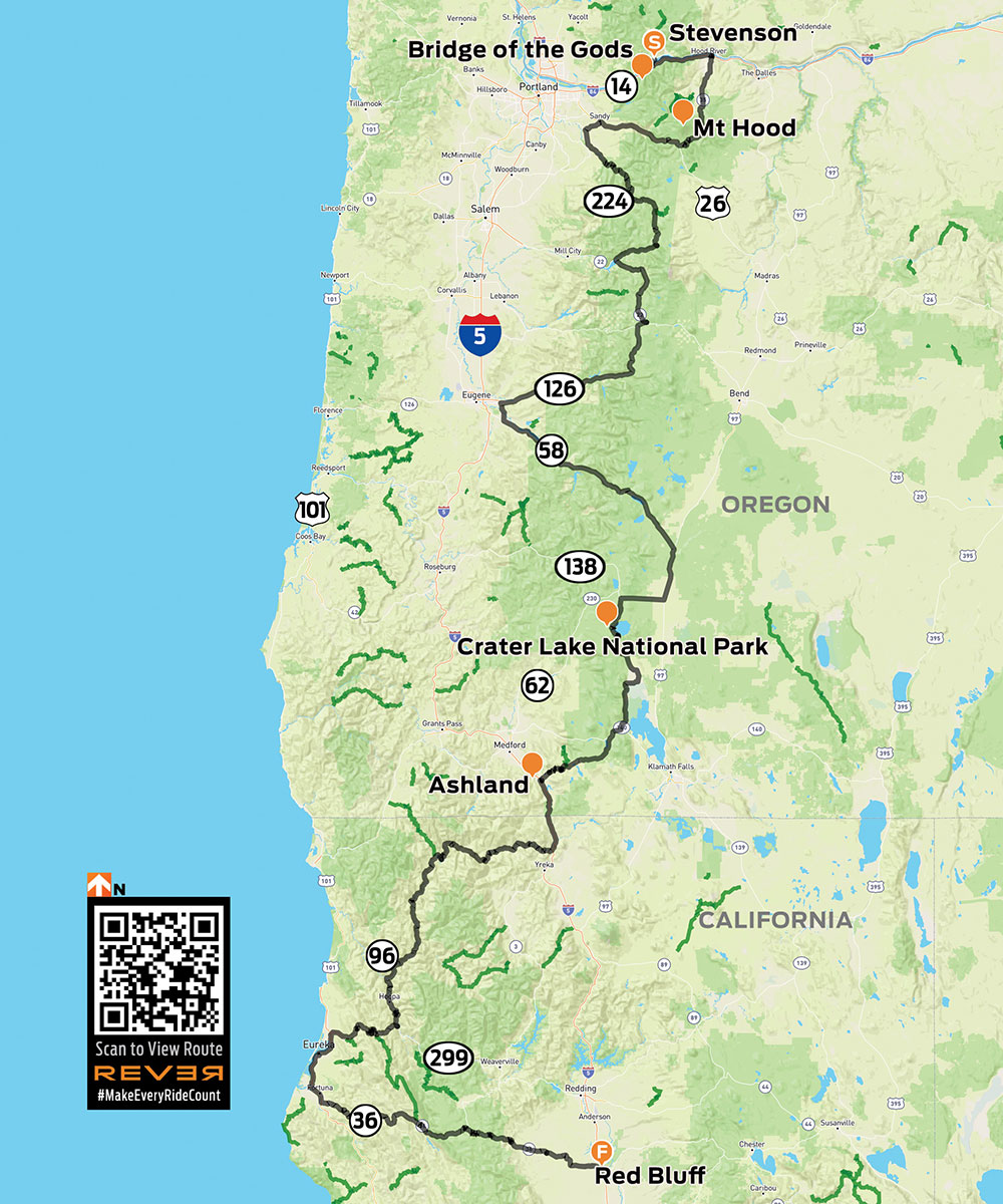
With the GT’s saddlebags packed and a tailbag strapped to the passenger seat, I hit the road at 6 a.m., crossing the mighty Columbia – and into Oregon – on the Bridge of the Gods, a steel truss bridge named after a natural dam that was created by a landslide at the same location nearly 1,000 years ago. The narrow, 90-year-old bridge has no pedestrian walkway, but it’s where the Pacific Crest Trail crosses the river, so weary hikers with heavy packs must contend with cars and trucks.
The Bridge of the Gods spans the Columbia River, which forms the border between Washington and Oregon.
What makes the Cascades special is its many stratovolcanoes –the cone-shaped variety we learned about in grade school –that rise thousands of feet above the surrounding mountains. I’ve ridden along the eastern side of the Sierra Nevada in California dozens of times, and every time I pass through the town of Lone Pine, I struggle to pick out Mount Whitney – the tallest mountain in the lower 48 states – from the neighboring peaks that are nearly as tall. On the Tracer 900 GT press ride we saw several volcanic peaks, Mount Adams (12,281 feet) and Mount St. Helens (8,363 feet – before it blew its top in 1980, it was 1,300 feet taller) in Washington, and Mount Hood (11,249 feet) in Oregon, standing head and shoulders above the landscape, easily visible from miles away. They’re part of the Cascade Volcanic Arc, a series of 12 volcanoes stretching from Mount Silverthorne in British Columbia to Mount Lassen in California, which is part of the Pacific Ring of Fire –more than 450 volcanoes scattered along the outer edge of the Pacific Ocean.
When Washington’s Mount St. Helens erupted in 1980, it literally blew its top, erasing 1,300 feet from its peak. This view is from McClellan Overlook, off Curly Creek Road, in Gifford Pinchot National Forest.
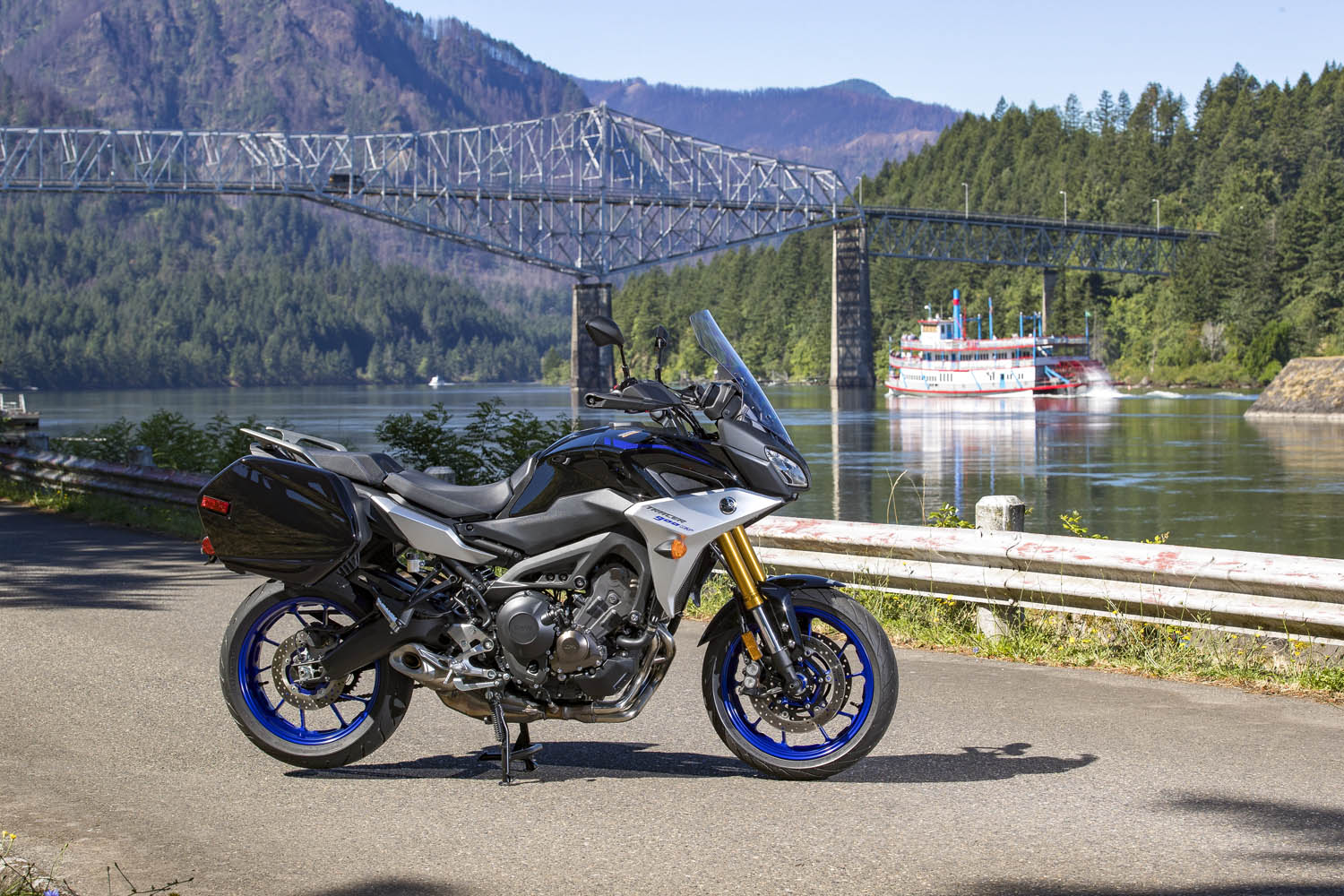
Like a good omen, snow-covered Mount Hood greeted me as I turned south on State Route 35, the beginning of Mount Hood Scenic Byway, where I rode through apple farms on a sunny, cloudless July morning. The previous day topped out at 105 degrees, and the heat wave wasn’t done with me, but early in the morning the byway along the East Fork Hood River was still in deep shadow and my teeth began to chatter. On went the heated grips, and I tried to hold onto the physical memory ofbeing cold, hoping to recall that feeling during theheat of the day (it never works). With graceful curves and smooth pavement, the byway is a pleasure to ride, especially when the screen of trees falls away and Mount Hood takes center stage, framed perfectly in brilliant blue.
Mount Hood Scenic Byway, one of many scenic byways that meander through the Cascades, cuts a wide arc around its namesake peak.
After cutting a wide arc around the eastern and southern sides of Mount Hood, my first crossing of the Cascades came to an end in Sandy. Turning south and then east on State Routes 211 and 224, I picked up the West Cascades Scenic Byway, heading southeast along Estacada Lake and North Fork Reservoir, two finger lakes created by dams on lower sections of the Clackamas River. As the byway crosses into Mount Hood National Forest, it enters a deep, narrow valley as it climbs up into the Cascades, where the Clackamas flows wild and free. The Tracer and I were in a groove, experiencing this road together for the first time –bends, kinks, dips, rises, bridges, blind corners, and fleeting views of the river, the contours of which give the road its character.
A postcard view of Oregon’s Mount Hood from Bennet Pass Trailhead, just off State Route 35 on the Mount Hood Scenic Byway.
With the low-fuel light on, I pulled into Detroit, a crossroads on the shore of Detroit Lake. Folks were starting their summer weekend early. Subarus laden with kayaks and pickups overflowing with camping gear were parked in lots, coolers were being filled with ice and beer. I refueled and scarfed an egg salad sandwich in the shadow of Rivers Run Deli, trying to stay cool while enjoying a view of the marina and the lake’s milky blue water. When traveling solo and covering a lot of miles in just a few days, I rarely stop for long. Just a few minutes here and there, then I’m back in the saddle, trying to cram 10 pounds of riding into a 5-pound sack.
Roads in the Cascades often carve their way through lush forests, with the curving pavement winding in and out of shadows.
From Detroit to Chemult – south, zig west, zag east, back over the Cascades –all I remember are trees, and a cross-section of America. Stopping to use the bathroom at a McDonald’s, I had to negotiate my way through a crowd of boisterous kids wearing matching blue T-shirts bearing the name of their church summer camp, ready to fill their bellies with Happy Meals. Outside, two young women were sitting on the curb, holding a sign: Family in Need. And next door I topped off the Tracer’s tank after the flirtatious – not to mention bald and tattooed – gas station attendant handed me the nozzle. (In Oregon and New Jersey, you’re not allowed to pump your own gas, but attendants often let motorcyclists break the law.) I was just passing through, little more than an observer. Experiences like these give me something to mentally chew on while ticking off miles.
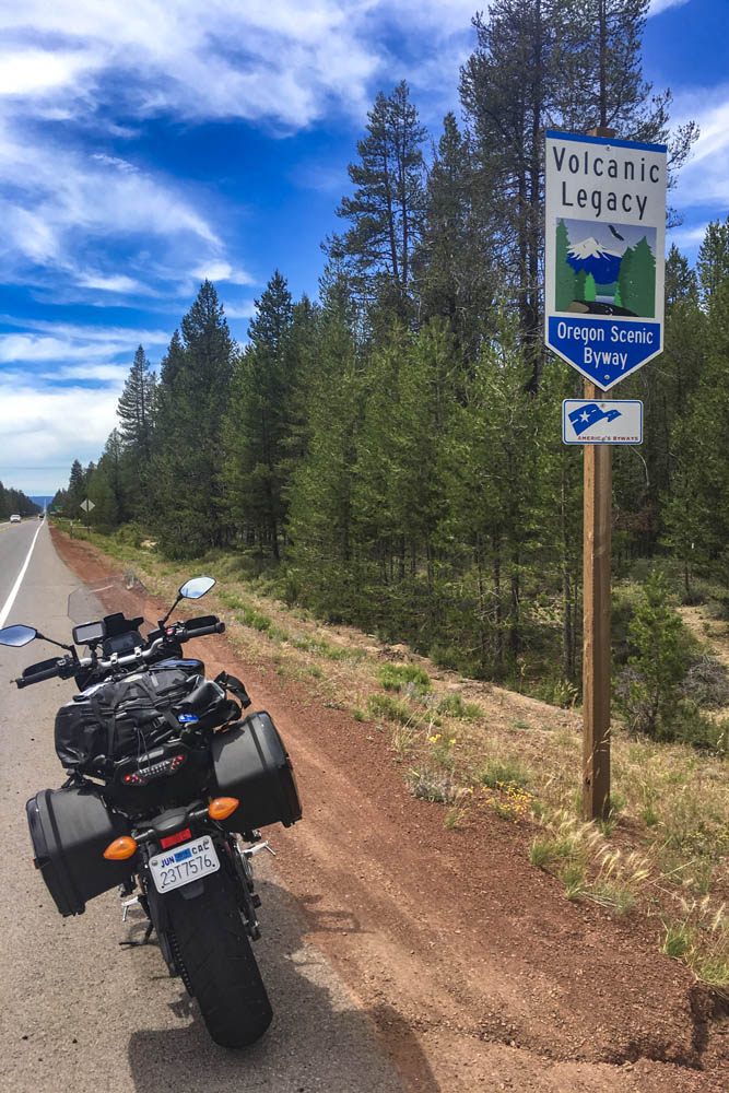
The 500-mile Volcanic Legacy Scenic Byway runs through Oregon and California, connecting volcanic peaks in the Cascades.
Passing through Chemult, a truck stop on U.S. Route 97 brought back memories of stopping there to refuel during my one and only SaddleSore 1000 ride back in 2013 – a very long day that I’m not likely to repeat. Turning west on State Route 138, the Volcanic Legacy Scenic Byway took me to Crater Lake National Park, where I queued up behind a rumbling Harley and a line of cars and RVs outside the northern gate, keeping my faceshield closed to prevent the army of mosquitos from waging war on my nose. Crater Lake was high on my list of must-see places, and it didn’t disappoint. Created thousands of years ago when a volcano collapsed, the caldera lake is nearly 2,000 feet deep – the deepest in the U.S. – and because it is filled only by rain and snow, the water is pure and a brilliant shade of blue. But I was pressed for time and there were construction delays on the East Rim Road, so I’ll have to go back to ride the full loop.
Taking in the brilliant blue of 2,000-foot-deep Crater Lake, a collapsed volcano filled with thousands of years’ worth of rain and snow.
On the not-politically-correct but wonderfully twisty Dead Indian Road, I descended from the green heaven of the Cascades into the dry, brown hell of Ashland. It’s actually a lovely little town, home to Southern Oregon University and the world-famous Oregon Shakespeare Festival, but it was over 100 degrees and I had been in the saddle for 12 hours. I was in desperate need of a cold shower, a colder beer, and some pizza.
The next day I left the Cascades, riding a few miles south on Interstate 5 into California, where I filled up at a Chevron in Hornbrook. On both sides of the interstate and all around the gas station, the ground and vegetation were charred black from the Klamathon Fire, which roared through just days earlier. It was one of many wildfires that would plague California and other western states in the weeks and months ahead.
More blanks filled in on my mental map: State Route 96 along the Klamath and Trinity rivers, which cuts through rugged, remote country. In 1941, a group of armed men stopped traffic near the town of Yreka, handing out a Proclamation of Independence for the State of Jefferson, which was in “patriotic rebellion against the States of California and Oregon.” Although the new state never materialized, the movement is still active, and the State of Jefferson Scenic Byway runs along Route 96 from State Route 263 to Happy Camp. After that, 96 becomes the Bigfoot Scenic Byway. Regardless of one’s views on state politics or mythical forest dwellers, the riding along Route 96 is sublime and traffic is almost nonexistent.
Sasquatch sighting in Happy Camp, California, on State Route 96, where the State of Jefferson Scenic Byway turns into the Bigfoot Scenic Byway.
At Willow Creek, I turned west onto State Route 299, known as the Trinity Heritage Scenic Byway because it follows the path of 19th-century gold miners and pioneers. It snakes its way through the heavily wooded Trinity Alps and climbs over a pass before making a long descent to the coast. Even in mid-July, U.S. Route 101 through Arcata, Eureka, and Fortuna was socked in with chilly fog. At Alton, I turned east again, heading inland on State Route 36 –not a designated scenic byway, but known as Serpent to the Sea. Traveling west-to-east, it passes through a few rural communities before entering Grizzly Creek Redwoods State Park, where enormous coast redwoods rise hundreds of feet above the roadside.
Beyond Bridgeville, Route 36 turns into a narrow goat path as it goes over a ridge, but it’s currently being straightened and widened to accommodate big trucks and RVs –an improvement for them but not for motorcyclists. East of Dinsmore, Route 36 was freshly paved, like having a racetrack all to myself, scraping the Tracer’s peg feelers in corner after corner. And on it goes, over more mountains with endless curves and finally roller-coastering its way through ranch land with blind crests and sudden drops and quick turns. As I approached the town of Red Bluff, just before Route 36 crosses I-5, I found the well-known sign that warns motorists and entices motorcyclists: curvy roads next 140 miles.
This sign tells motorcyclists everything they need to know. Good times ahead!
The thing about riding roads as good as these is that it becomes addictive. Now that I have experienced the Cascades and California Routes 96 and 36 for myself, all I want to do is go back for more.
This rider is enjoying the curves along State Route 60 on his way to Two Wheels of Suches, which is an ideal spot to stop for a cool drink and to see cool motorcycles. (Photos by the author)
Formed roughly 480 million years ago, the Appalachians are a chain of mountains that stretch from Newfoundland, Canada, down to central Alabama. Eons of erosion have rounded and softened their edges, and rivers and creeks have cut deep creases within their slopes. The result is a nearly endless variety of roads that follow the contours of the land, attracting motorcyclists from far and wide like moths to a flame.
The Appalachian Trail begins in North Georgia, on Springer Mountain, not far from one of the best riding loops in the Southeast. The three sides of the Georgia Triangle are anything but straight. In fact, the triangular loop made up of U.S. Route 19 and Georgia State Routes 60 and 180 has some of the most challenging curves and best scenery in a region known for both.
The Georgia Triangle is located in the Blue Ridge Mountains just north of the charming, historic mountain town of Dahlonega. The three-road loop is located within the Chattahoochee National Forest, and there’s an abundance of streams, waterfalls, lush forests, and historic sites in the area. Add in numerous tourist attractions, activities, hotels, bed-and-breakfasts, campgrounds, and eateries, and you’ve got everything you need for a great day ride or a long weekend of exploration.
Plying the curves on State Route 180.
Six miles north of Dahlonega, the triangle begins where U.S. 19 meets State Route 60 at Stonepile Gap. Within the junction’s roundabout is a mound of stones that is said to mark the burial spot of Cherokee Princess Trahlyta. According to legend, Trahlyta was a beautiful princess kidnapped by a Cherokee warrior she refused to marry. Her dying wish was to be buried near her home on the mountain, though she probably didn’t imagine her grave would be surrounded by a ring of asphalt.
Riding north on Route 60 toward the town of Suches is the first leg of the triangle. If you have not been practicing your cornering skills, be cautious. These roads are not for the faint of heart. They can either be exhilarating or nerve-wracking, depending on your motorcycle’s cornering clearance and your comfort with tight S-curves and decreasing-radius turns. For the alert, confident rider, these roads offer an unforgettable riding experience, with gorgeous scenery and well-maintained pavement.
A shady spot on State Route 180.
About 5 miles up Route 60 is Woody Gap, and a look to the left reveals an expansive valley with Springer Mountain rising on the other side. The Appalachian Trail crosses the road nearby, and other stops on the road have signs and information about Civil War battles, gold mining sites, and hiking trails.
In the small town of Suches is a well-known motorcycle lodge and campground called Two Wheels of Suches, a popular meet-up spot. On weekends the parking lot is filled with bikes of all styles and vintages, and riders from all over. There’s an onsite restaurant that serves burgers, sandwiches, snacks, and drinks on Friday nights and weekends. The main lodge offers rooms for rent, and there are small cabins and campsites with a bathhouse on the property. A single-person campsite is $15/night, cabins are $65/night, and lodge rooms are $75/night.
Two Wheels of Suches is a motorcyclists’ oasis.
A stone’s throw from Two Wheels of Suches is the junction with State Route 180, also known as Wolf Pen Gap Road. This segment of the ride is without a doubt the most challenging leg of the triangle, with more tight curves and steep grades per mile than any other paved road in Georgia. The first few miles are a sedate and primarily straight two-lane blacktop leading to Lake Winfield Scott Recreation Area. When the lake’s emerald-green water is calm, it acts as a large reflecting pool for the mountains that surround it. And it is a particularly scenic spot in the fall when the leaves change color.
Once past the lake, the roller-coaster ride begins with a sign that says “Sharp Curves and Grades Next 5 Miles.” Route 180 snakes through the Sosebee Cove Scenic Area with speed limit signs on some curves reading as low as 10 mph, with nary a straight section of road. Stay sharp and heed the caution signs. The great thing about this section of the Georgia Triangle is that it’s only 11 miles long – the same length as the Tail of the Dragon in Tennessee – so you can ride it back and forth to your heart’s content.
Canada Creek passes through the Two Wheels of Suches property.
In Cherokee mythology, Blood Mountain, located within the Georgia Triangle, was home to the Nunnehi or Immortals. It was also the site of a fierce battle between the Cherokee and Creek tribes.
Just before Route 180 merges with U.S. Route 19, it passes by Lake Trahlyta, which is part of Vogel State Park. You can swim in the lake and stay in the park, which offers tent camping, RV sites, and rental cottages and yurts. Georgia is often hot and humid in the summer, even up in the mountains. I have stopped here on a hot day for a quick change and a swim, so pack your swimsuit.
Riding south on U.S. 19 is the last leg of the triangle. The road here is wider, with passing zones for easily and safely getting around slower traffic. Still, it has magnificent twisting sections of repeating S-curves and turns, great scenery, and worthwhile stops all the way back to the triangle’s starting point.
Lake Trahlyta is part of Vogel State Park, located in the northeastern corner of the triangle.
Continuing to the junction with Route 60 yields total mileage around the triangle of about 36 miles. The travel time for a nonstop ride is about 90 minutes at a reasonable rate of speed, but why hurry? The beautiful forest ride and options for stops make a leisurely pace worthwhile. Or, follow the lead of many motorcyclists and repeat the loop or run it in reverse. You won’t be bored, I promise.
Part of what makes the Georgia Triangle such a target-rich destination is that it’s a hub for other great rides in the area. Route 60 is a joy to ride not just to Suches but beyond, all the way to Route 76. From there, head east to Hiawassee, the scenic town on Lake Chatuge, or west to Route 515, which becomes I-575 and takes you to Atlanta.
A real estate investment opportunity on U.S. 19.
If you’re looking to explore further, taking Route 60S (also known as Murphy Highway) northeast at Mineral Bluff into North Carolina will lead you to U.S. Route 74 and the town of Murphy, North Carolina. Continuing east on U.S. Route 64 is a scenic ride through the Hiawassee River and Lake Chatuge areas, and several roads connect back to the Georgia Triangle area.
Continuing north on U.S. 19 past Vogel State Park, Route 180 breaks away again and continues east. A short hop on 180 takes you to State Route 348, also known as the Richard B. Russell Scenic Highway, another gem of a road. Or continue east on 180 to Brasstown Bald, the highest point in Georgia (4,784 feet), which on a clear day offers a 360-degree view of four states.
Ride to eat, eat to ride. The Smith House in Dahlonega serves some of the best country cooking in the region. Don’t wear tight pants.
If you are planning a stay in the area, Dahlonega is a charming, historic town known for its history of gold exploration and mining. Legend has it that in the 1540s, Spanish explorer Hernando DeSoto searched this area for El Dorado, the legendary lost city of gold. Dahlonega was the site of the second major U.S. gold rush in the early 1800s and still has active mines where visitors can pan for gold and gemstones. For lunch or dinner, I highly recommend the Smith House, which serves fried chicken, ham, sides, and desserts family-style, with platter after platter passed around long tables. Just to the east of Dahlonega is Helen, a quaint alpine-style village. Both towns offer many choices for lodging, dining, and shopping.
If you’re undecided about which road to ride first, throw a dart at the map – chances are wherever it lands, you’ll find a winner. North Georgia offers hundreds of miles of great roads to ride, and the Georgia Triangle is just the beginning.