Tag Archives: North Central U.S.

Beauty in Bluff Country: A Southern Minnesota Motorcycle Ride

Southern Minnesota Motorcycle Ride Chuck Cochran Church Hill Overlook
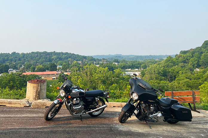
This Southern Minnesota motorcycle ride included an early morning stop at Church Hill Overlook on the Root River with a great view of the Lanesboro Stone Dam, constructed in 1868 with unmortared limestone blocks. (Photos by the author and Chad Cochran.)

Motorcyclists living in Minnesota experience long winters with plenty of time to think about roads we want to ride. It’s a sweet feeling when spring arrives and the bikes come out of hibernation.

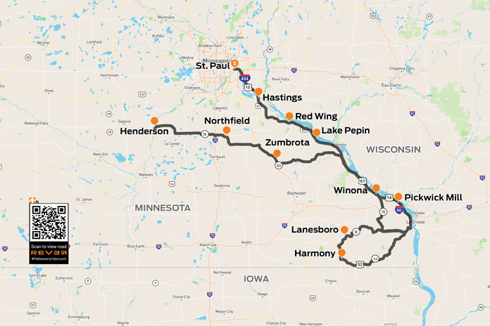
My son, Chad, feels the same way. We kicked off the riding season with an overnight Minnesota motorcycle ride down the Great River Road (U.S. Route 61) on the western bank of the Mississippi River, through what is often referred to as Bluff Country. The area’s complex hilly terrain has been carved out over eons by the Mississippi and other waterways large and small.

Southern Minnesota Motorcycle Ride Chuck Cochran

Scan QR code above or click here to view the route on REVER

Minnesota’s Great River Road is a popular motorcycle route that offers epic beauty and a chance to visit towns along one of America’s most vital corridors of commerce. Starting in April with the annual “Flood Run” charity ride, thousands of riders thunder up and down these roads and frequent the many small-town bars and restaurants along the way. I’ve been on many of these roads before, and I love riding old favorites and exploring new side routes.

Related: Exploring the Far North: A Northern Minnesota Motorcycle Ride

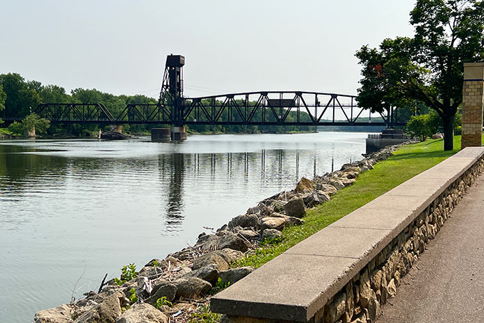
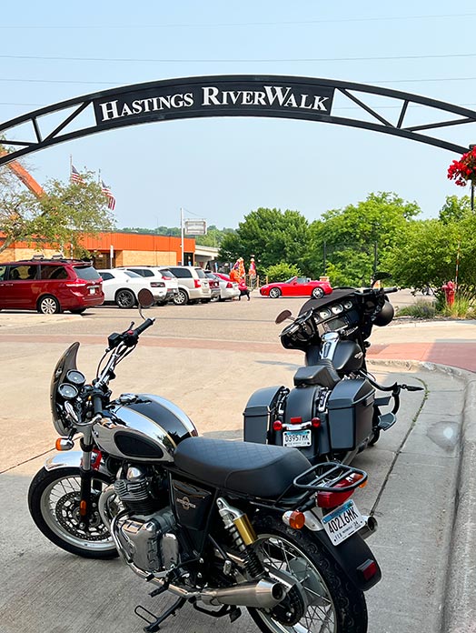
We left the Twin Cities early on a Saturday morning to beat traffic, and our first stop on this Minnesota motorcycle ride was the town of Hastings, which serves as a gateway to Bluff Country. The Hastings Riverwalk is a relatively new paved trail that connects to a 10-mile walking and biking loop along the Mississippi and Vermillion rivers. You can’t miss the towering Hastings Bridge, various sculptures along the waterfront, and the original footings of the Spiral Bridge, which was built in 1895 and dismantled in 1951.
Southern Minnesota Motorcycle Ride Chuck Cochran
The Hastings Riverwalk, with great views of bridges, boats, and scenery along the Mississippi, is a great place to stop.

East of Hastings, we continued south on the Ravenna Trail, one of the great lesser-traveled roads that tracks closely to the Mississippi River. We took the trail to the Prairie Island Indian Reservation and Treasure Island Casino, which boasts a 788-room hotel and Vegas-style casino attracting top entertainers. Resisting the temptation for easy money, we pushed on to rejoin U.S. 61.

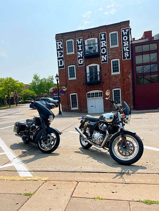
Our next stop was Red Wing, a town established in the 1850s to support steamboats moving up the Mississippi River toward vast available farmland. By 1873, Red Wing was a leading wheat producer, but it was eventually surpassed by Minneapolis where larger flour mills were built. Today the town is perhaps best known as the home of legendary boot maker Red Wing Shoes. The downtown St. James Hotel was founded in 1875 and has hosted U.S. presidents, Mark Twain, and other luminaries. Downhill from the hotel is the historic train station, which has old wooden benches and period signage on the walls. I could sit there all day watching the river roll by.

Southern Minnesota Motorcycle Ride Chuck Cochran

Continuing south, we visited Lake City, which sits on a wide stretch of the Mississippi called Lake Pepin, the birthplace of waterskiing. The lake was once a water highway used by Native Americans, and there are burial mounds and settlement ruins located nearby. Today, you’ll see raw materials being moved in barges and recreationists enjoying themselves in sailboats and ski boats.

Towering above both sides of Lake Pepin are distinctive limestone bluffs and tree-covered rock formations. With such unique scenery, it’s a challenge to keep your eyes on the road ahead. One minute you are feeling the heat from the tarmac and gazing up at high bluffs, and the next you’re ripping through dense maple forests enjoying the cool air and earthy smells. For golf lovers, the Lake Pepin Golf Course has 12 holes laid out atop the bluffs overlooking the Mississippi River Valley.
Southern Minnesota Motorcycle Ride Chuck Cochran Red Wing
The bustling river town of Red Wing has many historic buildings, including the St. James Hotel, the old iron works, and the train station.

We arrived at the next small town on our route, Reads Landing, just in time for lunch. This was once considered as a potential capital city for Minnesota due to its booming lumber trade and strategic location on the Mississippi and Chippewa rivers. Reads Landing Brewing Company occupies an old red-brick building with an outdoor patio overlooking the river. It has a full menu and was a great place to cool off and relax.

Adding to the Great River Road’s natural beauty is an abundance of birds soaring overhead. The National Eagle Center in Wabasha houses permanently injured bald eagles and provides an opportunity for people to see these majestic creatures up close.
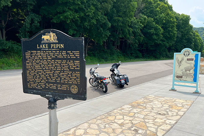
Southern Minnesota Motorcycle Ride Chuck Cochran
Lake Pepin has beautiful scenery and recreational opportunities, and it was the birthplace of water skiing.

As we continued south, we approached Winona, a vibrant college town that’s home to the Minnesota Marine Art Museum, which is located right on the river and exhibits artwork inspired by water. With a variety of dining and lodging options, recreational opportunities, live music, festivals, and shopping, Winona is a great destination for an overnight stay or weekend getaway.

Southeast of Winona, on County Road 7, is Pickwick Mill, one of the oldest flour mills in Minnesota, built in the mid-1850s. The mill was named by the area’s first postmaster, who was a fan of Charles Dickens and his novel The Pickwick Papers. During the Civil War, it produced 100 barrels of flour per day for the Union army.

See all of Rider‘s Minnesota motorcycle rides here.

After returning to U.S. 61 and riding along the Mississippi to La Crescent, we turned west on the Historic Bluff Country National Scenic Byway (State Route 16). Even away from the river, bluff topography continues with hills and cliffs creating the winding roads we all live for. Through the towns of Hokah, Houston, and Rushford, we paralleled the Root River and the Root River State Trail, a rails-to-trails bike path linking the towns of Houston and Fountain. 

After nearly 50 miles on the byway, we arrived in Lanesboro, an art, entertainment, and recreational hub where we spent the night. We stayed at the historic Hotel Lanesboro, which was built in 1872 from local limestone and is on the National Registry of Historic Places. Formerly a boarding house called Mrs. B’s, it once hosted Buffalo Bill and Doc Powell. The hotel is right on the main street with many good restaurants nearby. We had a tasty dinner at the Pedal Pushers Cafe, a nod to the many bicyclists who ride the state trail. 
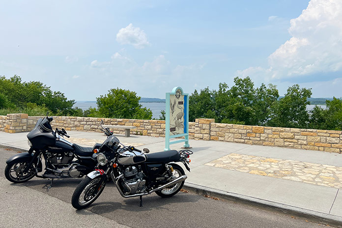
Southern Minnesota Motorcycle Ride Chuck Cochran
Overlooking Lake Pepin on the Mississippi River, one of many scenic stops on this southern Minnesota motorcycle ride.

My Harley is much louder than Chad’s Royal Enfield, and I felt guilty breaking the morning silence as we headed to the towns of Preston and Harmony. This area is Amish country, and it wasn’t long before we saw our first horse and buggy. Friendly and always good for a wave, the Amish are an interesting subculture. There are about 1,000 Amish in Harmony, and you can take tours to learn more about their way of life and visit shops with baked goods, furniture, and more. 

Seeing a horse with buggy tied up at a local convenience store, I pulled a quick turn to stop and take a picture. Soon two young ladies with bonnets saw me as I attempted to pocket my phone, not wanting to look like a gawking tourist. They wished me a good morning as they untied their horse and climbed aboard to clip-clop down the road. 

See all of Rider‘s Midwest U.S. touring stories here.

Harmony is also home to Niagara Cave, where you can take a tour 200 feet below the surface. It’s well worth it for this mile-long underground hike to see the various rock formations and even a subterranean wedding chapel.

We continued south on U.S. Route 52 to Prosper, a stone’s throw from Iowa, where we headed east and then north on State Route 44 to Caledonia, picking up State Route 76, which has twisties so enjoyable that we rode some sections twice. SR-76 took us north most of the way back to Winona, where we backtracked north on U.S. 61 to Wabasha. We then turned west on State Route 60 and joined a pack of bikers thundering in the same direction. Alongside the road is a lone sentinel, a skeleton biker that’s a reminder to keep the rubber side down.
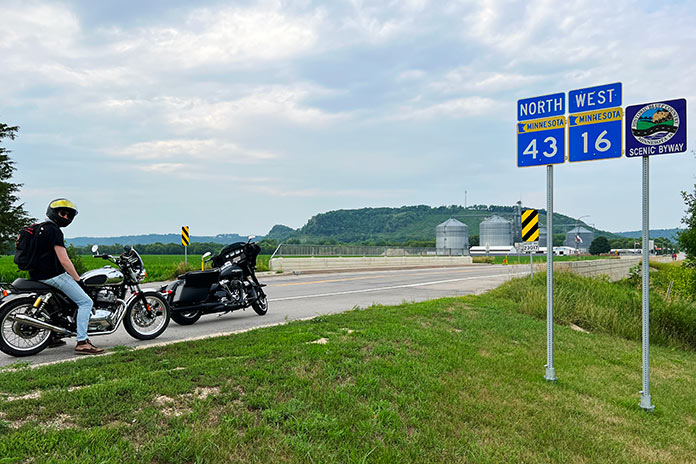
Southern Minnesota Motorcycle Ride Chuck Cochran Historic Bluff Country National Scenic Byway
The Historic Bluff Country National Scenic Byway (State Route 16) parallels the Root River and goes through small towns on its way from La Crescent to Lanesboro.

As we left the river and Bluff Country behind, the terrain flattened out as we made our way to Zumbrota, home of Minnesota’s last remaining functional covered bridge. Spanning the Zumbro River, the 116-feet-long, 15-feet-wide bridge was built in 1869 and looks like a long, red barn. 

We rode northwest to Northfield, where in 1876, Jesse James and the James-Younger gang rode into town to rob the First National Bank. Facing pistols, the bank clerk refused to open the safe and was shot to death. Townsfolk retaliated, resulting in a shootout that killed another resident and a couple of gang members. The gang was pursued for 400 miles over the following weeks, eventually being captured in Madelia, Minnesota. Jesse James escaped, but his luck ran out when he was killed in 1882 by one of his own men hoping to collect a $10,000 reward.

We rode west to Henderson, which sits along the Minnesota River Valley National Scenic Byway, another favorite road. Henderson is an old river town with a historic downtown district that’s a fun place to visit.

Our Minnesota motorcycle ride through Bluff Country and along the Great River Road and other scenic byways gave us a taste of the history, beauty, and variety of southern Minnesota. The roads showcase some of the best riding, relaxing, and motorcycle-friendly places the state has to offer.

See all of Rider‘s touring stories here.

Southern Minnesota Motorcycle Ride Resources

The post Beauty in Bluff Country: A Southern Minnesota Motorcycle Ride appeared first on Rider Magazine.

Source: RiderMagazine.com

Get Your Kickstart on Route 66

Get Your Kickstart on Route 66
John Alger rides the historic U.S. Route 66 from Chicago, Illinois, to Amarillo, Texas, on his kickstart-only 1978 Yamaha SR500.

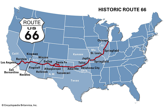
Dubbed the “Mother Road” by John Steinbeck in The Grapes of Wrath and known as “Main Street USA,” U.S. Route 66 will celebrate its 100th anniversary in 2026. No other road in America had such an impact on growth, migration, transportation, and popular culture. During the Great Depression and the horrific Dust Bowl of the 1930s, Route 66 was a paved pathway to a better life, transporting tens of thousands of people from the heartland to the West.

Get Your Kickstart on Route 66
Map of Route 66 courtesy of Encyclopedia Brytannica

Right after WWII, my Uncle Don traveled from California to his hometown of Springfield, Illinois, using much of Route 66 and riding a kickstart, air-cooled, single-cylinder AJS. As I pondered my own journey on the Mother Road, it seemed fitting to attempt it on my 1978 Yamaha SR500, which is also an air-cooled, kickstart Single. Over the years, I have owned several Yamahas, but the SR500 has been my preferred ride for its light weight, effortless cornering ability, competent disc brakes, and simple but elegant design. I like it so much, I own two.

Get Your Kickstart on Route 66
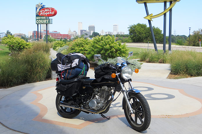
The author’s 1978 Yamaha SR500 on Route 66 in Tulsa, Oklahoma.

For my trip, I chose the one with 30,000 miles on the odometer. Except for upgraded brake hoses, it was bone stock. To get it ready for my Route 66 adventure, I gave it a complete engine and chassis overhaul, as well as a 535cc big bore kit, an oil cooler, and a SuperTrapp exhaust. I retained the stock air box and K&N air filter but re-jetted it as required. The new chain and sprockets were one tooth larger on the countershaft, which lowered cruising rpms and resulted in a mostly vibration-free ride.

Related: 2015 Yamaha SR400 Review | First Ride

The SR500 also has a no-frills CDI ignition system with a strong charging system, allowing me to keep my cellphone and Bluetooth full of juice, and a centerstand, a must-have for daily chain lubrication and fixing flat tires (I had one).

Get Your Kickstart on Route 66
U.S. Route 66 begins in Chicago, Illinois, within sight of the Willis Tower (formerly the Sears Tower).

Find out more about the First 100 Miles of Route 66

Since Route 66 starts in Chicago, I transported my bike from my hometown of Merritt Island, Florida, in my Chevy van. The first day of riding started in Chicago rush-hour traffic on the Kennedy Expressway, which was undergoing road construction, but after stop-and-go for two hours in record heat, I was rewarded with the U.S. 66 “Begin” sign at the corner of Adams Street and Michigan Avenue across from The Art Institute of Chicago. Just a few blocks away is the Willis Tower (formerly the Sears Tower), and a few blocks farther is the famous Lou Mitchell’s restaurant, which is over 100 years old and served a great breakfast to start my trip.

Get Your Kickstart on Route 66
Lou Mitchell’s is a legendary eatery in downtown Chicago.

Aside from the sweltering temperatures and humidity of August, Chicago’s beautiful residential areas and parks made the short trip to the suburbs quite pleasant. The first 100 miles of Route 66 is known as the Heritage Corridor, which also includes towns along the Illinois & Michigan Canal, which connected Lake Michigan to the Illinois River, and Starved Rock State Park. In Cicero, I stopped to see one of Al Capone’s houses. In Berwyn, I checked out the world’s largest laundromat, which is over 13,000 square feet and even has a bird aviary, and I also passed by one of the oldest-operating White Castle restaurants.

Get Your Kickstart on Route 66
Dick’s on 66 is located in Joliet, Illinois.

Traveling south, I found a neat roadside display in the town of Joliet called Dick’s on 66, an old towing shop decorated with several vintage vehicles and a patch of bricks purportedly from the original Route 66. Across the street is a restored gas pump and ice-cream shop. Joliet is also the home of the state prison and was featured in the 1980 movie The Blues Brothers.

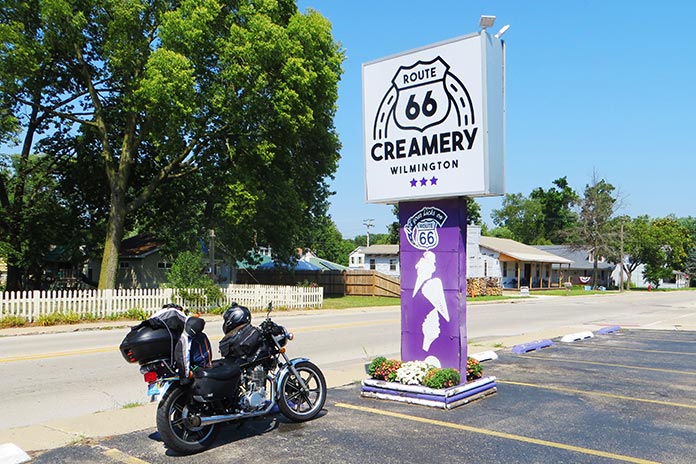
In Wilmington, Illinois, I cooled down with a sundae at the Route 66 Creamery and spotted the first of five “giants” I would see on my trip: a Sinclair dinosaur on the roof of G&D Tire Company.

Get Your Kickstart on Route 66
Route 66 Creamery is in Wilmington, Illinois.

For this trip, I tried to take the oldest sections possible of Route 66, and Illinois had them clearly marked. Some sections of road looked more like abandoned driveways, with weeds growing through cracks in the concrete. My little SR500 was perfect for this kind of duty.

Get Your Kickstart on Route 66
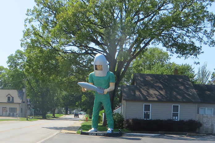
One of the few remaining Muffler Men is located in Wilmington, Illinois. The bright green Gemini Giant holds a silver rocket and was named in honor of the Gemini space program of the 1960s.

In Towanda is Dead Man’s Curve, a sharp curve that caught many drivers unaware and was the site of numerous accidents from the 1920s to the 1950s. There’s even a preserved series of Burma Shave signs that say: Around the curve / lickety-split / beautiful car / wasn’t it? I had a 25-plus mph headwind for most of that first day, and it felt as if I was riding into a blow drier. My first night was spent at the Ghost Hollow Lodge in Chandlerville, Illinois, where I fortified myself with a dinner of venison and fresh veggies.

On the second day, I stopped in Springfield to cool down with an iced tea at Route 66 Motorheads Bar & Grill, which also has a museum and gaming room. Just south of Springfield in Carlinville, my fun was interrupted by a flat tire. I had packed tools, tire irons, a portable compressor, and a tube patch kit, but my tube was too badly mangled by the nail. Scott McDaniels of S&S ATV came to the rescue by delivering a new tube (at no charge), a local resident across the street brought me ice water, and the local city hall allowed me to do the work on the north side of their office in the shade on the concrete. It just goes to show how kind strangers can be when you are in a bind.

Get Your Kickstart on Route 66
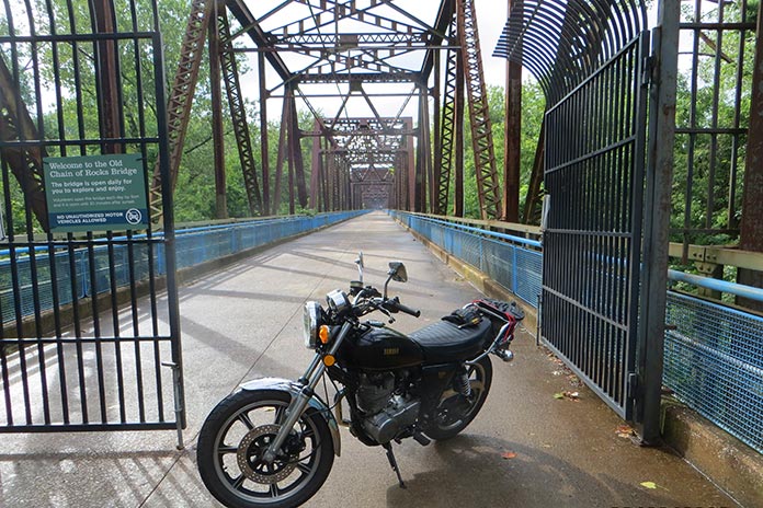
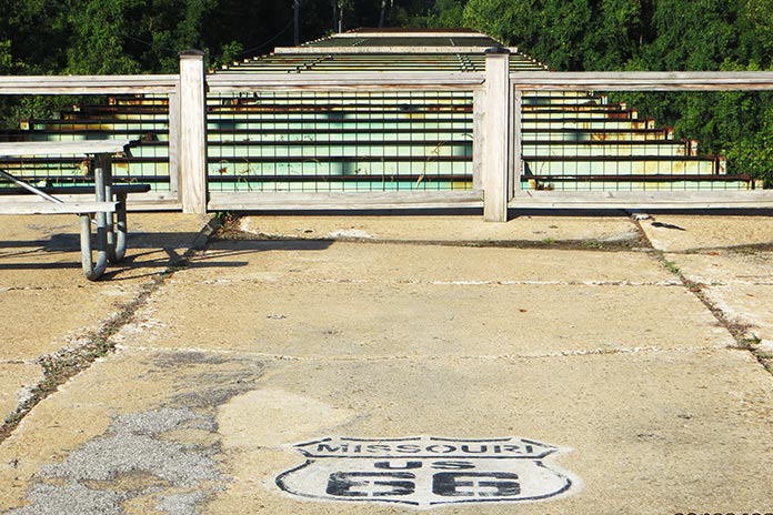
The Old Chain of Rocks Bridge is located in Granite City, Illinois.

The repair set me back almost four hours, and I had to bypass many of the Route 66 sights from Carlinville to St. Charles, Missouri, where I stayed with friends. The following day, I unloaded my luggage and backtracked to Granite City, Illinois, to see the Old Chain of Rocks Bridge. The mile-long bridge was part of the original Route 66 from 1936 to 1965 and allowed motor vehicles to cross the Mississippi River from Illinois to Missouri. It features a 30-degree turn partway through. I had gone over this bridge in a car as a kid before it was decommissioned in 1968. It is now only open to foot traffic and bicycles.

Get Your Kickstart on Route 66
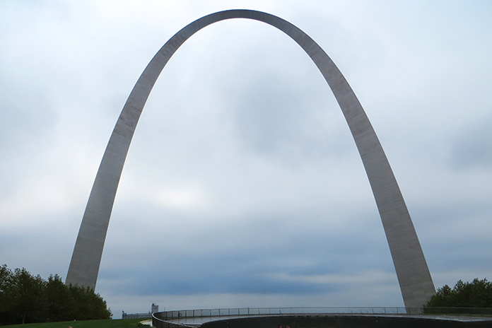
The 630-foot Gateway Arch in St. Louis, Missouri, was completed in 1965.

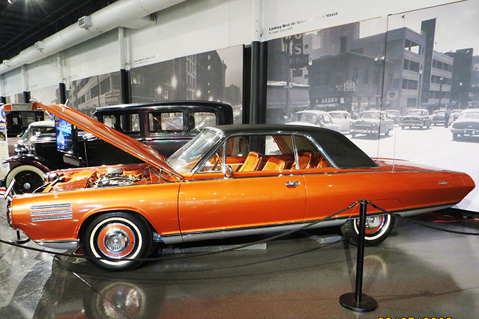
While in St. Louis, I also went up into the 630-foot Gateway Arch, which was completed in 1965. It is now part of the National Park Service, and with recent remodeling and upgrades, it’s a not-to-miss experience. I also visited the National Museum of Transportation on the west side of St. Louis. This may be one of the best transportation museums in the country and has the only remaining GM Aerotrains. It also has a running Chrysler Turbine Car like the one at the Henry Ford Museum in Michigan.

Get Your Kickstart on Route 66
A Chrysler Turbine Car at the National Museum of Transportation in St. Louis.

After getting my luggage loaded back on the SR500, my next stop was Times Beach, Missouri. Route 66 used to cross the Meramec River there, and the remnants of the bridge are still there, along with a Route 66 State Park. I met some folks from Europe riding Route 66 on rented Harleys, and they were aghast that I was attempting to make the same trip on my antique bike with no GPS navigation and only an EZ66 guide in my tankbag.

Get Your Kickstart on Route 66
Remnants of the Route 66 bridge in Times Beach, Missouri.

Times Beach was the site of the second largest EPA Superfund site due to a local contractor spraying dioxin on the dirt roads for dust control. All the buildings were bought by the EPA and leveled, and it’s currently considered a ghost town. West of Times Beach is the Meramec Caverns, where I ran into my new European friends again. My bike would do roughly 100 miles per tank of fuel, which coincided with my body’s need to stand up and stretch out a bit and suck down a cold beverage.

Get Your Kickstart on Route 66
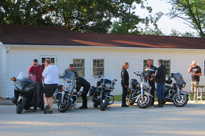
A group of Europeans riding Route 66 on rented Harleys stopped at the Route Route 66 State Park in Missouri.

I stayed at the KOA in Springfield, Missouri, that night and rented a cabin. I had planned on renting a primitive campsite, but for only about $40 more, I got an air-conditioned cabin, lights, electricity, a mattress, a table, and a TV. It was a bargain!

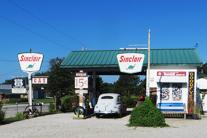
Along the way in Missouri are a few museums and stops such as a replica 1930s Sinclair station called Gary’s Gay Parita in Ash Grove, Missouri, where the sign reads “Gas Wars” and advertises fuel at 15 cents per gallon. Another sign reads “Kendal, your 2,000 mile oil!” We have certainly come a long way!

Get Your Kickstart on Route 66
A replica 1930s Sinclair gas station called Gary’s Gay Parita in Ash Grove, Missouri.

Shortly after the Sinclair station on the Old Route 66 trail, I crossed an old truss bridge that crossed over Johnson Creek in Spencer, Missouri. Like the old sections of Route 66 in Illinois, this section looked like an abandoned road going into the backwoods. It was beautiful.

Get Your Kickstart on Route 66
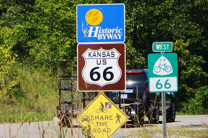
Only 13 miles of Route 66 pass through Kansas.

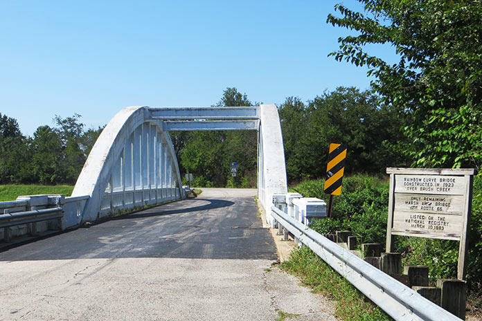
Kansas only has a very short 13-mile section of the Old Route 66 path, and if you take that, you are blessed with crossing one of the few remaining Marsh Arch bridges left in the country – and the only remaining one on Route 66, this one having been built in the early 1900s.

Get Your Kickstart on Route 66
The Rainbow Curve Bridge was built in 1923. It’s the only remaining Marsh Arch bridge on Route 66.

Oklahoma likely has the most Route 66 sites of any state. After the road was decommissioned by the federal government for use as a federal highway, Oklahoma named it State Road 66. It’s easy to follow, although I did manage to miss a sign and ride maybe 50 miles off course. The best Route 66 Museum is in Clinton, Oklahoma. It covers the initial planning and construction of the route, along with different scenes of Americana, a video of the Dust Bowl, and more.

Get Your Kickstart on Route 66
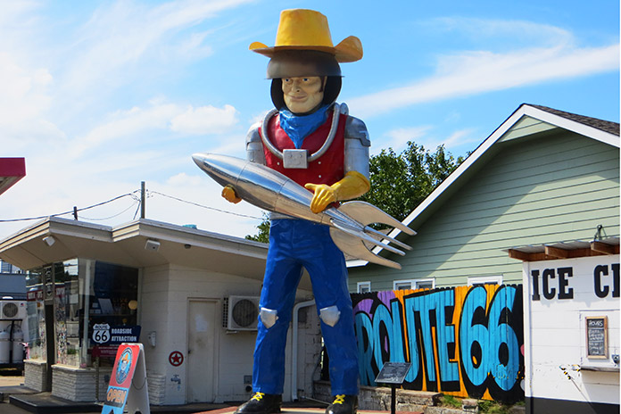
Buck Atom, a 21-foot-tall space cowboy in Tulsa, Oklahoma, is one of the iconic Muffler Men of Route 66.

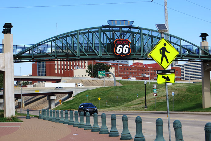
There are more giant statues to be seen as you pass through Oklahoma, including Buck Atom, the 21-foot-tall space cowboy in Tulsa holding a rocket. Tulsa also has a cool park downtown called the Cyrus Avery Centennial Plaza that has three tall old neon motel signs relocated there from the early days of Route 66. Further south is a Route 66 village with an old train, a gas station, and an oil derrick.

Get Your Kickstart on Route 66
Route 66 in Tulsa, Oklahoma.

The last section of Route 66 I rode in Oklahoma was a mostly abandoned concrete road that paralleled Interstate 40, but you could tell it was part of the original route. How many mostly abandoned four-lane concrete highways going into nowhere with no traffic do you see? At one point, I thought I was off-track, but then I saw the Texas state sign and the familiar white outlined Route 66 logo painted on the road.

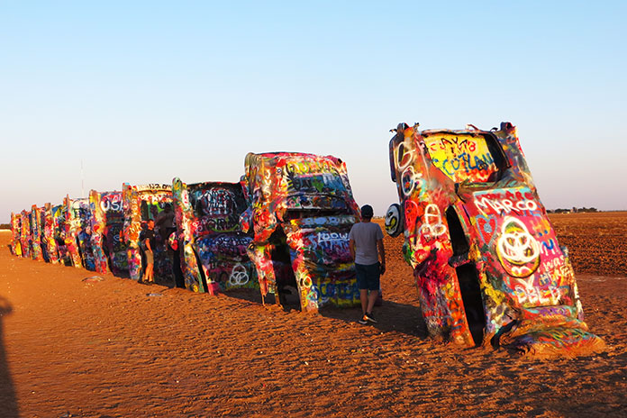
In Texas, much of Route 66 is access highways on either side of the interstate, which worked just fine for my trusty mule since I could travel at more relaxed speeds in the intense heat. Along the way, you pass by the Leaning (water) Tower of Britten in Groom, Texas, and Amarillo gives you the Cadillac Ranch.

Get Your Kickstart on Route 66
Cadillac Ranch is located in Amarillo, Texas.

After visiting the Cadillac Ranch, I stopped at a KOA, and when I tried to start my bike again, it didn’t fire up. It turned out to be an issue with the ignition system, and despite having the parts from my other SR500 shipped to me to attempt a repair, it didn’t take. I cut my trip short and loaded the bike in the back of a Penske truck and headed back east.

In spite of a flat tire, intense heat and humidity, and an ignition failure, this was the most fun I can recall in most of my life. In retrospect, I should have tried making this trip on a newer bike, but part of the fun was riding a kickstart antique.

If you are considering riding this road, I would suggest waiting until 2026 for the 100-year anniversary since I heard plans in various towns along the way for some centennial events, so it should be even better.

ROUTE 66 RESOURCES:

The post Get Your Kickstart on Route 66 appeared first on Rider Magazine.

Source: RiderMagazine.com
Riding South Dakota’s Black Hills BDR-X

Black Hills BDR-X
On the Black Hills BDR-X, Daniel was thrilled with the 411cc Royal Enfield Himalayan. “It’s the way to go for me as I continue to master my off-road riding skills!” (See Shad TR40 Terra Adventure saddlebags review here.)

If you’re looking for a golden adventure riding opportunity, the Black Hills BDR-X marks the spot. Backcountry Discovery Routes are adventure/dual‑­sport routes that typically cover entire states and take about a week to complete, with GPS tracks and helpful info provided for free by the nonprofit BDR organization. In addition to its main routes, BDR has mapped out several shorter BDR-­X loop routes that can be completed in a few days.

Black Hills BDR-X

Scan QR code above or click here to view the route on REVER

Located in western South Dakota, the Black Hills area is known for its scenic beauty, curvy roads, and historic sites like Mount Rushmore and the Crazy Horse Memorial. When most motorcyclists think of the Black Hills, they think of the Sturgis rally, which brings upwards of 500,000 people to the region every August.

The Black Hills BDR-X is a 355‑­mile mostly off‑­road loop that starts and ends in Keystone, just a few miles east of Mount Rushmore, and is divided into three sections. Backcountry Discovery Routes recommends riding the Black Hills BDR-­X counterclockwise, but since it’s a loop, you can start and finish anywhere along the route and run it in either direction.

Black Hills BDR-X Mount Rushmore
The presidents at Mount Rushmore represent key aspects of U.S. history: Washington symbolizes the country’s birth, Jefferson represents expansion, Lincoln signifies development, and Roosevelt signifies preservation.

What makes the Black Hills BDR-X such a perfect adventure route is its variety. The landscape includes rugged mountains, dense forests, and wide‑­open prairies. The route passes through historic towns like Deadwood, Mystic, and Hill City, as well as public lands such as Wind Cave National Park and Custer State Park.

Black Hills BDR-X
We rode into Deadwood covered in Black Hills dust just like they did 150 years ago.

There are great campgrounds or more luxurious lodging available. You’re never far from civilization, so you can get away from it all yet still have access to gas stations, stores, restaurants, and hotels. The BDR-X route includes flowing gravel and dirt roads, challenging two‑­track, and some of the area’s best paved roads, including Spearfish Canyon Road, Needles Highway, and Iron Mountain Road.

Black Hills BDR-X Spearfish Canyon
Spearfish Canyon was the filming location of the final scene in “Dances With Wolves.”

Setting the Hook

Last July, I joined three of my CFMOTO USA colleagues – Reid Strait, Daniel Dégallier, and Bill Baker – at Get On ADV Fest, a four‑­day adventure‑­bike rally in the Black Hills where we introduced the Ibex 800 T adventure bike. There was plenty of off‑­road riding involved, and REVER provided excellent tracks for the event.

Related: 2023 CFMOTO Ibex 800 T | Road Test Review 

Black Hills BDR-X
The Black Hills BDR-X is a best-of-class route. Gorgeous canyon roads. Superb gravel. Epic two-track. Majestic scenery. Native American and U.S. history. Clean, easy camping. Great food. Yup, there’s golden riding in them thar Black Hills.

The riding was so good, we were inspired to return in September and be among the first to ride the new Black Hills BDR-­X. The stars aligned when we learned that Rally for Rangers, a nonprofit organization that raises funds to support park rangers, would be hosting an event in the Black Hills at the same time (see sidebar below). CFMOTO USA provided Ibex 800 Ts for the guides to use during the event, along with a Papio minibike for cruising around the campground.  

Black Hills BDR-X Hitchrail Bar
The Hitch Rail Bar and Restaurant in Pringle is a great lunch stop.

After we delivered the bikes to the event, we spent the next few days riding the Black Hills BDR-­X to do some team bonding. Reid rode an Ibex 800 T, but the rest of us rode our personal bikes: Bill on a KTM 690 Enduro R, Daniel on a Royal Enfield Himalayan, and me on a Kawasaki KLX 300.

Black Hills BDR-X Pactola Reservoir
There’s an old mining town at the bottom of Pactola Reservoir, which was completed in 1956.

Black Hills BDR-X: 4 Riders, 4 Bikes, 4 Days

We may have different tastes in bikes, but we all agree on one thing: The Black Hills BDR-X is fantastic. It’s 355 miles of adventure motorcycling bliss. In terms of difficulty, I’d rate it 4 or 5 on a scale of 1‑­10. (I’ve also ridden the Mid Atlantic BDR, which I’d rate an easy 2 or 3.) Every day of the BDR-­X was filled with moments of euphoria, which crystallized into memories that we’ll share around the campfire for years to come.

Related: Backcountry Discovery Routes Announces Economic Impact of BDR Routes

Black Hills BDR-X Kawasaki KLX
Brad’s Kawasaki KLX after the BDR-X.

During one part of the ride, the sun overhead was radiant, casting a warm, autumn glow. The steady, gentle crunch of gravel under my tires never got old, nor did the scenery. Towering cliffs with rough textures contrasted with the vivid foliage below. The curves and bends unfurled before me, each one as breathtaking as the last. It was a sensory feast, as if Mother Nature took out her paintbrush, mixed up an impossibly diverse palette of rich colors, and painted a masterpiece. At higher elevations, the hills were ablaze in scarlet, amber, and gold, while it was a verdant wonderland down below. I was tempted to ride faster, but I slowed down, smelled the pines, and savored the experience.

Black Hills BDR-X
Campfire quote of the night: “Motorcycles are like beer. The best one is the one in your hand.”

Black Hills Gold

If you love off‑­road adventure riding, you’ll love the Black Hills BDR-X, which was like discovering a vein of gold. There’s gravel, rocky two‑­track, mud, and epic pavement. There’s majestic scenery, wildlife, and history. You can’t see and do it all in one trip, so like the four of us, you’ll want to come back. It’s fun but by no means a stroll in the park, and it’s the difficult stuff that sticks with you for a lifetime.

Black Hills BDR-X
Get the best zip ties money can buy; you’ll be glad you spent the extra quarter.

On Day 3, it was raining, and we opted to do the optional hard section over Bear Mountain. The route was rutted, rocky, steep two‑­track. The slick mud packed up on our tires, turning them into Teflon‑­coated slicks. Bill christened this spur route “Axle Grease Alley.” On the final bit, I chose my line and went for it, twisting the throttle to the stop, desperate for the tires to hook up, every muscle in my body fighting to keep me and the Kawasaki upright. After I made it to the top, Reid gave me a thumbs‑­up and said, “Brad, you looked like a flailing Kool‑­Aid man. Next time keep your feet on the pegs!”

Black Hills BDR-X
Climbing Bear Mountain in the rain took its toll on the KTM’s 17,000-mile clutch, which gave up the ghost short of the top. Bill had just enough bite left to make it to camp.

Happily, we all made it through the toughest sections in one piece. Despite the struggle and the chaos, even with our bikes and bodies caked in mud, we were grinning from ear to ear. Daniel’s quick thinking led us to a car wash in Custer, where we pressure‑­washed our bikes and could again recognize which was which. Cost? A few quarters. Memories? Priceless.

Black Hills BDR-X Bear Mountain lookout tower
BDR-X Section 3: If the trails are muddy, there are two ways to reach the Bear Mountain lookout tower: the “Hard Way” and the “Not Today” way. If it’s dry as July and the dust is flying, no problem.

Rally for Rangers Sidebar

The mission of Rally for Rangers is “to protect the world’s special places by empowering rangers around the world with new motorcycles and equipment.” It has provided more than 160 motorcycles and equipment for rangers in parks in distant places like Mongolia, Argentina, Nepal, Bhutan, Peru, and Namibia.

The first Rally for Rangers USA event took place last September in South Dakota’s Black Hills National Forest and Pine Ridge Reservation. Fifteen adventure riders raised nearly $40,000 before convening in Custer State Park for a weekend of camping, riding, visiting tribal park rangers, and donating equipment and funds to protect parks and forests.

Traditional Rally for Rangers events are two‑­week international journeys, but the USA rallies are held over a long weekend. The Black Hills event donated night vision optics for tribal rangers of the Oglala Sioux Parks to conduct nighttime anti‑­poaching patrols. A donation was also made to the Forest Service motorized trails program to support motorcycle‑­only trails in the Black Hills National Forest.

Black Hills BDR-X Rally for Rangers
On our third day, we met up with Rally for Rangers. It was a night to remember that included amazing food, a meet-and-greet with the Oglala Sioux rangers, and ideal camping conditions in Custer State Park.

Riders in this inaugural event hailed from all over the U.S., with some trailering their bikes and others renting from Rogue Moto or using demo bikes provided by CFMOTO. The weekend included off‑­road training by Heavy Enduro as well as on- and off‑­road riding on Needles Highway, portions of the Black Hills BDR‑­X, and otherwise inaccessible trails on the Pine Ridge Reservation hosted by the Oglala Sioux rangers.

The Black Hills Rally for Rangers event takes place again in September 2024 to support Oglala Sioux and Northern Cheyenne tribal rangers. For more information, visit the Rally For Rangers website or listen to our interview with Rally for Rangers co‑­founder Tom Medema on the Rider Magazine Insider Podcast.

Black Hills BDR-X

Black Hills BDR-X Resources:

The post Riding South Dakota’s Black Hills BDR-X appeared first on Rider Magazine.

Source: RiderMagazine.com
The Return of the Moonshine Lunch Run | Favorite Ride

Moonshine Lunch Run
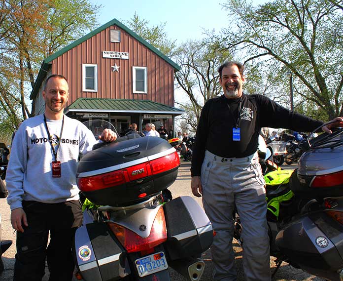
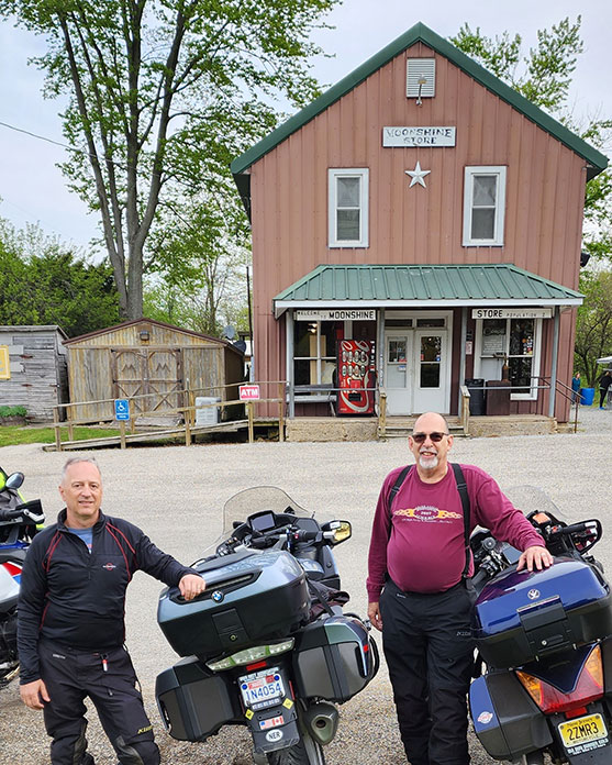
Some of the 2023 Moonshine ride-to-eat participants (left to right): Steve Efthyvoulou, Scott Williams, Chuck Smolka, Randy Bridgewater, and Michael Boucher.

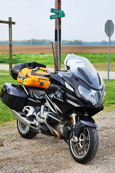
This Favorite Ride doesn’t include a route map because it’s all about a single destination: the corner of 300 Road and 600 Street in Moonshine, Illinois. Getting there is a personal experience for every rider who makes the Moonshine Lunch Run.

You may recall the story I wrote about the last official Moonshine Lunch Run, which took place on April 29, 2018. But on that day, as I gathered with other long‑­distance riders outside the Moonshine Store, munching my Moonburger under a cool Illinois rain, I sensed it wasn’t the end.

Related: Reflections on the Moonshine Lunch Run

The original concept for the MLR, conceived by our late farmer friend Terry Hammond, just required folks to ride from somewhere far. Terry knew certain people would make the long, often difficult ride to Moonshine to connect with other riders who’d do the same. The hamburgers were great, but the fellowship of long‑­distance riders mattered most.

Earlier this year, Bob Cust of Swansea, Illinois, announced he was hosting an RTE (ride-to-­eat) at the Moonshine Store. I shared this with Steve Efthyvoulou, who first brought me to Moonshine in 2010. “I’m in,” he said immediately. We reached out to other MLR alums, including Michael Boucher and Randy Bridgewater, plus newbie Chuck Smolka. All in.

Moonshine Lunch Run
Michigander Randy Bridgewater (left) brought Chuck Smolka of Connecticut to his first Moonshine Lunch Run.

Folks who’ve done a ride to Moonshine understand its special challenges of long distance, changeable weather, and physical endurance. For me, Moonshine has been the eventual destination of multiple April rides that had me leaving Massachusetts and then joining friends to carve mountain roads in Pennsylvania, Virginia, West Virginia, North Carolina, Tennessee, or Kentucky on the way to southeastern Illinois. Moonshine was a waypoint on some trips to more distant riding regions, like the Ozark Mountains of Missouri and Arkansas, and I earned my Iron Butt certification on the Curt Gran Memorial Moonshine 1000.

If you want a genuine Moonshine Lunch Run experience, you really need to ride there during April, when Terry Hammond invited folks to come. The temperature could plunge below freezing, but it might also reach 90. You can count on rain, and snow is possible. It’s also tornado season; one year, a twister touched down a few miles from our motel. The sun might even shine!

Moonshine Lunch Run Moonshine Store Illinois
You’ll find the Moonshine Store at the corner of 300 Road and 600 Street in Moonshine, Illinois, in the middle of nowhere. The burger is worth the ride.

Last April, my ninth run to Moonshine was on backroads through the Connecticut Berkshires and New York’s Hudson Valley, over the hills of northern New Jersey, across Pennsylvania’s northern tier, and then onto the increasingly flat, open spaces of rural Ohio, Indiana, and Illinois.

Moonshine Lunch Run Moonburger Moonshine Store
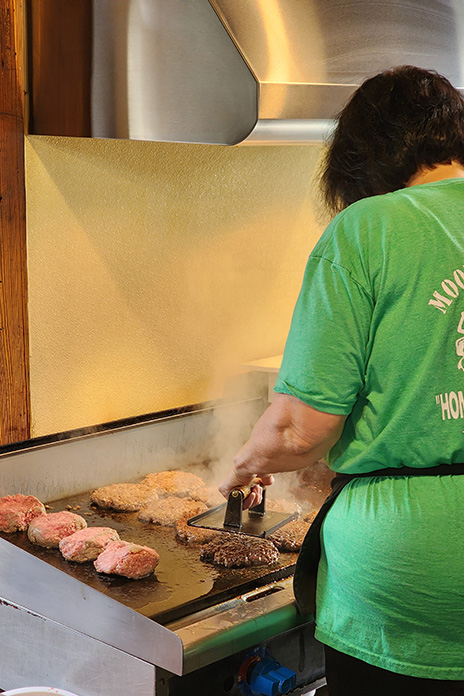
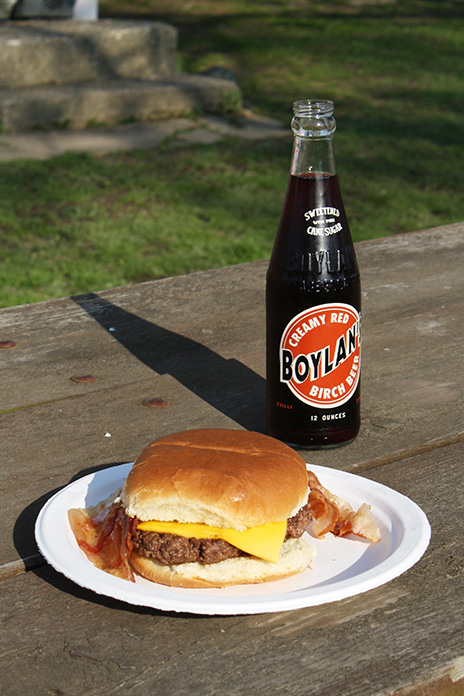
There’s no big secret to a Moonburger…just a large portion of fresh ground beef flattened on a grill. Yum!

Yes, more people visit southeastern Illinois for summer activities. The fairgrounds in DuQuoin host a race in the American Flat Track motorcycle racing series. The Illinois 300 NASCAR Cup race takes place in Madison. There are celebrations for German heritage in Waterloo and Hoyleton, Swiss heritage in Highland, and roots music and barbeque in Mt. Carmel. There are sailing events, a world trapshooting championship, art fairs, music festivals, county fairs, and much more.

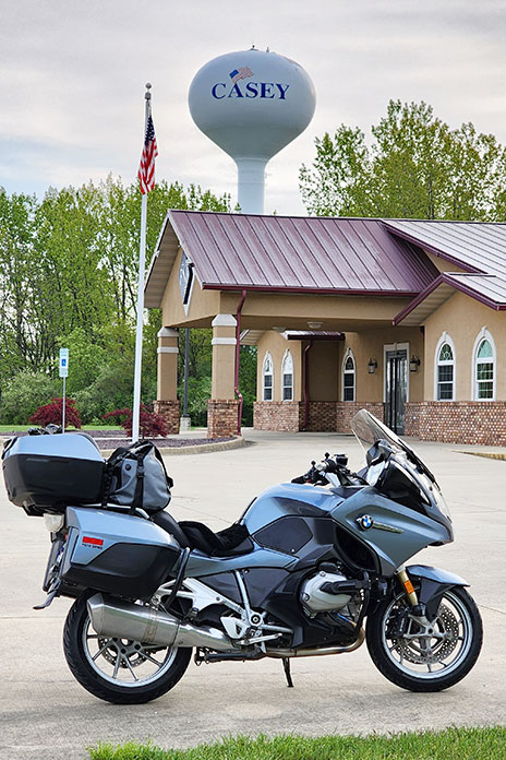
Moonshine Lunch Run world's largest rocking chair Casey Illinois
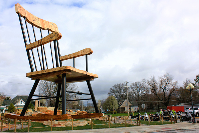
Oversized curiosities, including the world’s largest rocking chair, are on display throughout Casey, Illinois.

Since I’ve always ridden to Illinois in April, I haven’t experienced summertime there. But I’ve enjoyed visiting the town of Casey, some 14 miles from Moonshine and home of the world’s largest mailbox, pencil, pitchfork, wind chimes, rocking chair, golf tee, and other oversized curiosities. Since my last visit, someone added the world’s largest antlers. Every MLR has brought me to Casey, and getting there always involves varying degrees of challenge. Other riders who made it overcame their own challenges. As Terry would say, we “get it.”

Moonshine Lunch Run
Above: Scott Williams (left) and Steve Efthyvoulou in 2010, at their first Moonshine Lunch Run. They’ve made eight trips together to Moonshine. Below: Scott and Steve did the 2023 run together. There’s less hair these days – and what remains is gray – but the smiles are still there.
Moonshine Lunch Run

Since the MLR is no longer an official event, there weren’t 1,000‑­plus riders like before. This time there were a few dozen, with the largest contingent being members of the Motorcycle Tourer’s Forum. But as I’ve come to expect, the effort to get there – and to connect with other riders who did the same – was well-rewarded.

I ran into Mike Brown of Harrisburg, North Carolina, whom I’d seen at multiple MLRs. “If you have been there, you want to go back,” he said. “If you haven’t been there, you need to go!” Mike brought along a first‑­timer, Bob Sweet of Concord, North Carolina. Unlike most riders who come on touring bikes, Bob made his first ride to Moonshine on a naked bike, his 2021 Triumph Street Triple 765 R.

“When we left Harrisburg at 4 a.m., it was dark and drizzly,” Bob told me. “I couldn’t tell Mike ‘I can’t do this.’ I got over the mental barrier, and here I am.” Bob gets it!

Moonshine Lunch Run Casey Illinois
Casey, Illinois, located not far from Moonshine, is the adopted hometown for many long-distance motorcycle riders.

I met Darryl Halbert, who has been to every MLR since 2011, though somehow our paths never crossed. He used to live in Atlanta, Georgia, and his ride to Moonshine would include entertaining curves through the Appalachian Mountains. He’s retired now and living in Denver, Colorado, so he rode to Moonshine across the plains. “There’s a lot of Kansas between here and Colorado,” he chuckled.

I also met Greg Rice, a genuine legend in the long‑­distance rider community, who told me about another “lunch run” he had made. As the Ft. Lauderdale, Florida, resident recalled, “I wanted to take a picture of my bike by the Panama Canal.” So Greg rode to Panama. He got the picture and had a burger for lunch. His round trip took 10 days.

Related podcast interviews

Significantly, some MLR traditions carried on this year, like dinner at Richard’s Farm on Friday evening and Renee Handelman’s cinnamon buns on Saturday morning. I enjoyed my Moonburger with cheese and bacon at a picnic table beside the Moonshine Store with other riders, and it was good. Soon after, my group began our rides home to Texas, Michigan, New Jersey, Connecticut, and Massachusetts.

Moonshine Lunch Run
The Moonburger (single with cheese and bacon variant) pairs well with a Boylan’s birch beer.

Riding east together, Steve and I endured the wettest day in our combined Moonshine history. Over dinner in a warm, dry restaurant, we laughed about it. Adventure is just discomfort retold at leisure, and we’ve had our share of adventure on our runs to Moonshine. Bone-chilling cold. Scorching heat. Nasty storms. Roads that became rock-strewn goat paths despite maps promising otherwise.

Was this year’s Moonshine Lunch Run just like old times? Not exactly. But it was today’s version of good times, shared with other long-distance riders who get it. I expect Terry would be good with that.

See all of Rider‘s touring stories here.

The post The Return of the Moonshine Lunch Run | Favorite Ride appeared first on Rider Magazine.

Source: RiderMagazine.com
Trans Wisconsin Adventure Trail | Favorite Ride

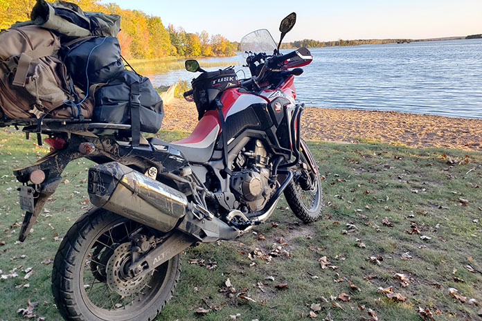
Trans Wisconsin Adventure Trail Honda Africa Twin
Parts of the TWAT wind through farmland.

As I reached for the pump handle to fill up at the start of this trip, I suddenly realized my hydration pack wasn’t on my back. Doubt flooded in, and I wondered if this trip on the Trans Wisconsin Adventure Trail was a bad idea. After returning home to retrieve my pack, I scolded myself for failing right out of the gate.

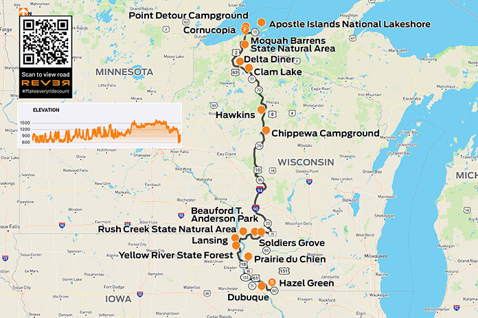
The Trans Wisconsin Adventure Trail is also known as the TWAT, a term I use for “one who tweets” and the British use for an obnoxious person. Though not a term one hears in polite company, this TWAT is a 635-mile dual-sport and adventure motorcycle route that runs from the Illinois/Wisconsin border in the south to the shore of Lake Superior in the north. There are no maps of the route, but you can download a free GPX track at the Trans Wisconsin Trail website.

Trans Wisconsin Adventure Trail

Scan QR code above or click here to view the route on REVER

The TWAT was to be my first time riding off-road. What was I thinking?

To prepare myself, I binged hours of off-road riding instruction on YouTube by Bret Tkacs, Dusty Wessels, and Eric Lange. Their tips and techniques came back to me when I needed them most. YouTube was also my tutor for what to pack. I’d watch a video, hit pause, and click over to Amazon to load up my cart. I felt like a kid on Christmas opening boxes and setting up fake camp in my backyard to try out everything.

Trans Wisconsin Adventure Trail Honda Africa Twin
My Honda Africa Twin was the perfect bike for the 635-mile trek across Wisconsin.

The Trans Wisconsin Adventure Trail starts just south of Hazel Green, Wisconsin. I rode past the gravel road near “The Point of Beginning” historical marker on State Route 80 twice before realizing it was my starting point. There was no sign for the TWAT, but the route I had uploaded to the REVER app indicated I was in the right place. My adventure had begun!

See all of Rider‘s Wisconsin touring stories here.

Day 1: Dirt Legs

The standard advice is to run knobbies on an adventure route, but after all the money I’d spent on gear, I figured replacing the perfectly good 90/10 tires on my Honda Africa Twin would tip Mrs. Trimble over the edge. Rather than make camping a permanent situation, I opted to use my existing rubber.

Trans Wisconsin Adventure Trail Honda Africa Twin
The trail is lush in spring and summer.

The first day had the most pavement of the three. Intermittent road stretches were a welcome break for a novice like me. The limited traction off-road was unnerving, so the grippy bits helped relieve the tension. Hour by hour, my confidence and skills improved.

The Midwest is renowned for its flat landscape and laser-straight roads, which results from most of the region being scraped clean by glaciers during the last ice age. But there’s a small territory where Wisconsin, Minnesota, Iowa, and Illinois meet that was not covered by ice and thus lacks glacial deposits known as drift. Known as the Driftless Area, this playground of hills, ridges, valleys, and rock formations was a highlight of Day 1.

Trans Wisconsin Adventure Trail Honda Africa Twin
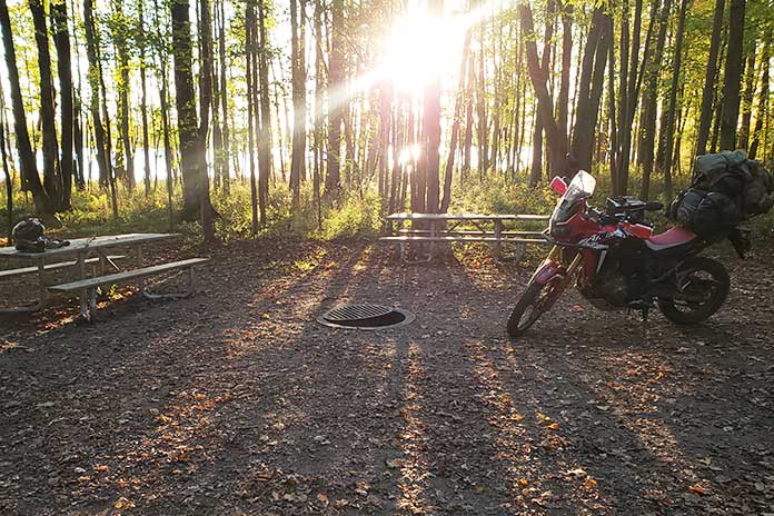
Arriving at a campground like this makes a long day on the trail worthwhile.

The first day also took me over the Mississippi River for some riding in Iowa, which is a little odd for a route across Wisconsin, but the ride through the Yellow River State Forest made it worthwhile. After crossing back into Wisconsin, I rode through the Rush Creek State Natural Area.

I spent my first night camping in Soldiers Grove, right in town at Beauford T. Anderson Park. Stomach issues had me in and out of my tent all night, and dew made everything inside unpleasantly damp. As the sun rose, I hung my things up to dry. Drinking instant coffee from my Jet-Boil, I questioned my decision to camp, which led to more second-guessing about the entire adventure. I rolled out of town disgusted by how soft I had become.

See all of Rider‘s Northeast U.S. touring stories here.

Day 2: Attitude of Gratitude

The next day, I felt more comfortable riding off-road, and gratitude soon replaced despair. The trail meandered through hills covered in baby-head-sized rocks and water-filled bottoms that hid all sorts of bar-yanking surprises. Wrestling my Africa Twin along trails in the Chequamegon-Nicolet National Forest left me drenched with sweat.

When I poked out onto a paved road, the sun was getting low, and I worried about finding a hotel. A half-mile down the road, I passed a sign for Chippewa Campground, which was on my must-visit list. Rather than suffer self-flagellation in a hotel room, I opted to camp. Two days of riding had me so beat that I dropped my bike while trying to lower the kickstand.

Trans Wisconsin Adventure Trail Honda Africa Twin Chippewa Campground
Late afternoon sunlight shines on the lake and filters through the trees at Chippewa Campground.

The campground’s coin-operated shower revived me. For $2 in change, the sweat and dirt disappeared down the drain while the satisfaction of completing two days of off-road exploration lingered. I strolled to a gas station for a six-pack and a cup of ice that I filled with Jameson. That night by the campfire, I felt like a new man. A sense of accomplishment and a nice Irish whiskey buzz made for a more enjoyable night in the woods.

Day 3: Enter Sandman

The third day on the Trans Wisconsin Adventure Trail called for sand, which had seemed treacherous on the YouTube training videos. So far, I’d only taken a few dabs and no falls, so I expected this to be my day to eat humble pie. Not far in, I experienced my first tank slapper after putting too much weight on the front wheel. Rather than panic, I drew upon the wisdom of my YouTube tutors – Don’t cut the power abruptly; Lean back and give it gas; Ride it out until the bike stabilizes – and I recovered. Soon I was sitting back against my dry bag and flying through the sugary stuff without a care in the world. 

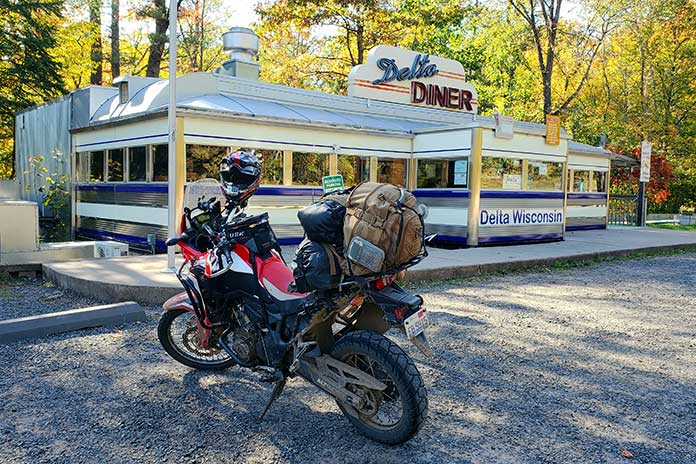
At a stop for gas, I asked the attendant how far it was to the Delta Diner. He said it was about an hour away, so I bought some beef jerky to hold me over. Because I was on the TWAT and not driving by car, it took three hours before I finlly pulled off the trail at the diner, a chrome-and-neon oasis in the middle of nowhere.

The parking lot was empty except for an older couple gearing up to climb back on their BMWs. After removing my sweaty gear and helmet, I nodded to them as I headed for the door. As I reached the top step, the lady said, “They’re closed.” What a gut punch. I was tired and hungry, and for hours I had been fantasizing about a juicy burger with a side of fries and an ice-cold Coke. Dry jerky and warm, plastic-tasting water from my hydration pack was a poor substitute.

Trans Wisconsin Adventure Trail Honda Africa Twin Delta Diner
As a big fan of classic diners, it broke my heart (and pained my stomach) to find the Delta Diner closed. I’ll be back.

North of Delta, I crossed U.S. Route 2 and entered the final stretch. After riding through the Moquah Barrens State Natural Area, I rolled through the town of Cornucopia. A few more county roads later, I arrived at a dirt cul-de-sac by the Point Detour Campground near Apostle Islands National Lakeshore. A faint trail led into the woods and came out at a dilapidated set of stairs down to Lake Superior, and I worked my way to the rocky shore.

As I sat smoking the cigar I saved for the occasion, I felt humbled by the setting and the moment. I had overcome self-doubt, completed my journey, and even learned to love sand.

Trans Wisconsin Adventure Trail
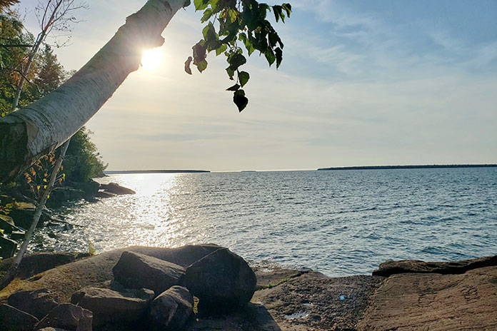
At the end of the trail on Lake Superior, with views of the Apostle Islands.

Trans Wisconsin Adventure Trail Resources:

See all of Rider‘s touring stories here.

The post Trans Wisconsin Adventure Trail | Favorite Ride appeared first on Rider Magazine.

Source: RiderMagazine.com
Exploring the Far North: A Northern Minnesota Motorcycle Ride

Northern Minnesota Motorcycle Ride Rainy Lake International Falls
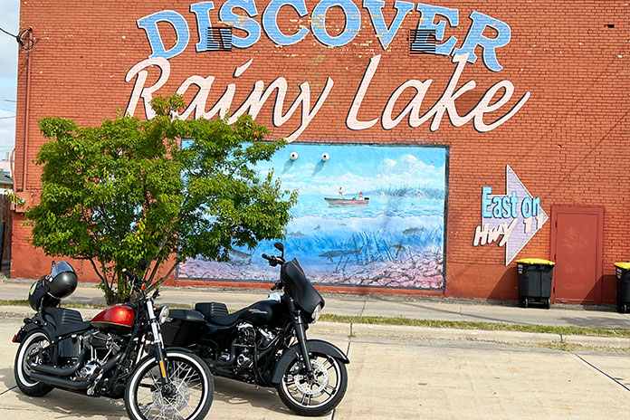
Chad and Chuck park the bikes in front of the Rainy Lake mural, which graces an old brick building in downtown International Falls.

Most of us love the feeling of anticipation leading up to a multiday motorcycle trip. This particular Minnesota motorcycle ride one was more memorable than most because my son, Chad, was able to join me on a trip that would take us north from Minneapolis to the Canadian border at International Falls. We had three days for the ride and only a loose plan. We had a direction, and we knew we wanted to check out some towns that were new to us, but otherwise we’d make it up as we went along.

Northern Minnesota Motorcycle Ride

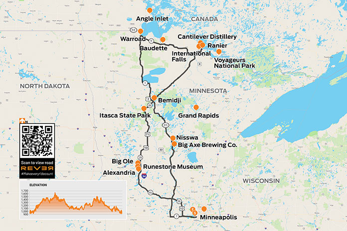
Scan QR code above or click here to view the route on REVER

We were mounted on our Harleys – I was on my 2017 Street Glide Special, and Chad was on his 2011 Softail Blackline – and we were evaluating some new gear: Highway 21 gloves and boots for me and a sissy bar-mounted backpack and Shinko White Wall SR777 tires for Chad’s Blackline (see Chad’s Shinko White Wall SR777 Tires review).

Starting the Minnesota Motorcycle Ride: Rain and Runic Artifacts

Northern Minnesota Motorcycle Ride International Falls
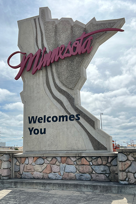
A Classic Minnesota welcome sign in International Falls.

As we pushed off on our mid-August ride, the skies were unsettled. A check of the weather showed we might be able to avoid some rain by heading west for a while before heading north to our first destination, the town of Alexandria. By following my Harley’s navigation system, we took a backroads route to get there, but our slower pace meant we didn’t outrun the rain entirely. After a few missed turns, Chad gave me “the look” – what we call the Head Wag of Shame – but we were out to ride, and we were riding!

Northern Minnesota Motorcycle Ride
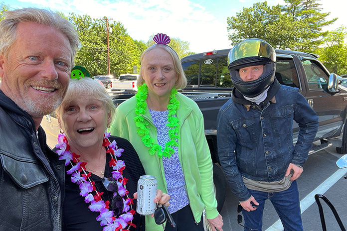
We caught this photo in Ranier with these two friendly longtime residents and parade watchers.

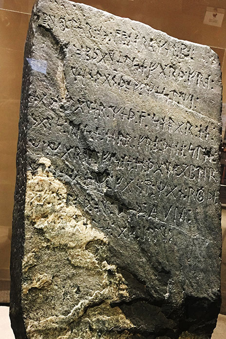
Alexandria, which is nestled between lakes with names like Darling, Victoria, Geneva, Latoka, and Le Homme Dieu, has resorts and activities that make it a popular destination for tourists year-round – and full-time residents too, since the town is one of the fastest growing areas in the west-central part of Minnesota. The town was named after Alexander Kinkead, who established the first townsite in 1858 along the stagecoach road. A Viking artifact from 1362 was unearthed in 1898 in the nearby town of Kensington and is exhibited in Alexandria at the Runestone Museum.

Northern Minnesota Motorcycle Ride Kensington Runestone
The Kensington Runestone was unearthed in 1898 and dates back to 1362, providing evidence that Vikings visited America long before Columbus. (Photo by Mauricio Valle via Wikimedia Commons)

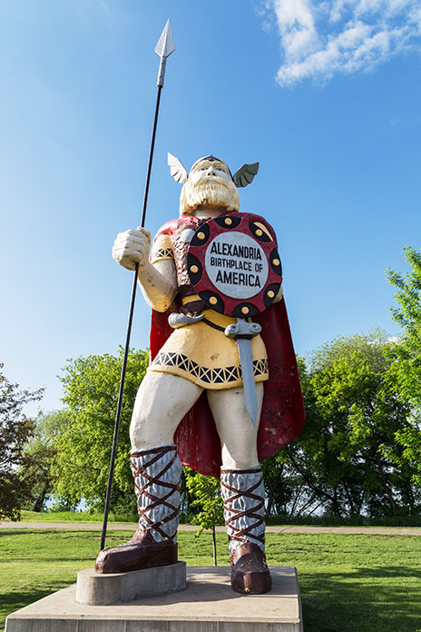
Just a runestone’s throw from the museum, towering over Broadway and 2nd, is Big Ole, a 28-foot-tall Viking statue originally built for the 1964-65 World’s Fair in New York City. This was the first stop on our ride, and we were already surprised by what we were seeing. That’s what I love about motorcycle travel: encountering – and enjoying – the unexpected.

Northern Minnesota Motorcycle Ride Big Ole Alexandria
The 28-foot-tall Viking statue Big Ole towers over downtown Alexandria. (Photo by gdbrekke – stock.adobe.com)

See all of Rider‘s Minnesota motorcycle rides here.

From the Heartland to the Headwaters

From Alexandria, we followed State Highway 29 – part of the Viking Trail – north through towns such as Miltona, Parkers Prairie, and Deer Creek to Wadena. We continued on U.S. Route 71 to Park Rapids, a town in the Heartland Lakes Region. The Heartland State Trail, a multiuse paved recreational trail that was one of the first “rails to trails” projects in the U.S., runs for 49 miles from Park Rapids to Cass Lake. Park Rapids is also a popular destination for camping and fishing, and there are many seasonal cabins nearby.

Northern Minnesota Motorcycle Ride
Rolling grassland along the Rainy River, which separates the U.S. and Canada.

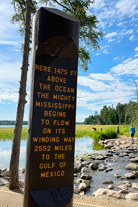
Another 20 miles north of Park Rapids on U.S. 71 is Itasca State Park, Minnesota’s oldest state park, which was established in 1891. There are more than 100 lakes within the 32,000-acre park, and its most famous feature is the headwaters of the Mississippi River. For anyone visiting the park, the headwaters area is a must-see, and it has a visitor center with educational exhibits and a cafe.

Walking down the trail toward the official headwaters, you can wade across the foot-deep babbling trickle that has an average flow rate of just 6 cubic feet per second. After draining much of the U.S. between the Appalachians and the Rockies over the course of 2,552 miles, the Mississippi River ultimately discharges more than 593,000 cubic feet of water per second into the Gulf of Mexico.

Northern Minnesota Motorcycle Ride Mississippi River headwaters
It’s just a short hike to the headwaters post marking the origin of the Mississippi River.

Itasca Park is also the northern terminus of the Great River Road, which runs the length of the Mississippi River for more than 3,000 miles through 10 states. It’s an epic journey that I did with a few buddies in 2021.

On the way out of the park, we hopped on a 10-mile one-way road called Wilderness Drive, a scenic road that winds through woods and meadows and passes by several lakes. Our relaxed approach to discovering the area was paying off, but we couldn’t help feeling a little guilty as we thundered past the occasional cyclist or hiker on our rumbling V-Twins.

Northern Minnesota Motorcycle Ride Great River Road
The end of the Great River Road if you began in New Orleans.

From Bemidji to the Border

We ended our first day’s ride in Bemidji, where we stayed at a hotel right on the shores of Lake Bemidji, the northernmost lake feeding the Mississippi River. I stayed in Bemidji at the start of my Great River Road run, and it was good to be back in such a fun town. By this time, we had a couple hundred miles under us and were a bit cold and soggy.

Northern Minnesota Motorcycle Ride
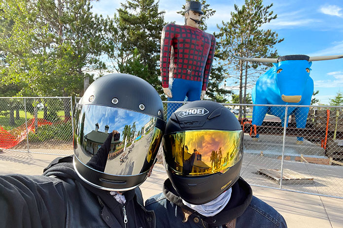
Chad and Chuck in Bemidji with Paul Bunyan and Babe the Blue Ox.

Bemidji, a name derived from an Ojibwe expression, Buh-mid-ji-ga-maug, meaning “a lake with crossing waters,” is known as the “First City on the Mississippi.” It is also the curling capital of the U.S. and the alleged birthplace of Paul Bunyan. After the wilderness of Itasca State Park, the city of 15,000 felt like a modern metropolis. Bemidji is also home to Bemidji State University, and students were moving in during the weekend we were there. Lots of loud co-eds and tired-looking parents. We were ready to get back on the road and away from the crowds.

Northern Minnesota Motorcycle Ride
The Rainy River separates the U.S. from Canada.

With the hotel’s complimentary breakfast under our belts and a blue sky above our heads, we followed a northeastern trajectory on U.S. 71, known in Minnesota as the Voyageur Highway, passing through towns like Blackduck, Northome, Big Falls, and Littlefork. In Pelland, the road makes a sharp turn to the east as it follows the southern shore of the Rainy River, which serves as the border between the U.S. and Canada. Voyageur Highway, though fairly straight and flat, was in good condition, and we enjoyed the rolling fields with farmhouses and barns.

Although Chad is a Minnesota native and I’ve lived in the state for more than 30 years, neither of us had been to International Falls, a city known as the “Icebox of the Nation,” with an average of 109 days per year with a high temperature below freezing.

Northern Minnesota Motorcycle Ride
A border information building.

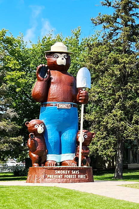
International Falls has a border crossing to Canada – on the other side of the river is Fort Frances, Ontario – and it serves as the gateway to Voyageurs National Park, which is situated on the southern side of the 360-square-mile Rainy Lake. It’s also home to Smokey the Bear Park, where there’s a 26-foot statue of America’s favorite forest advocate made by fiberglass sculptor Gordon Schumaker, who also made Big Ole.

Northern Minnesota Motorcycle Ride
Some friendly advice from Smokey the Bear.

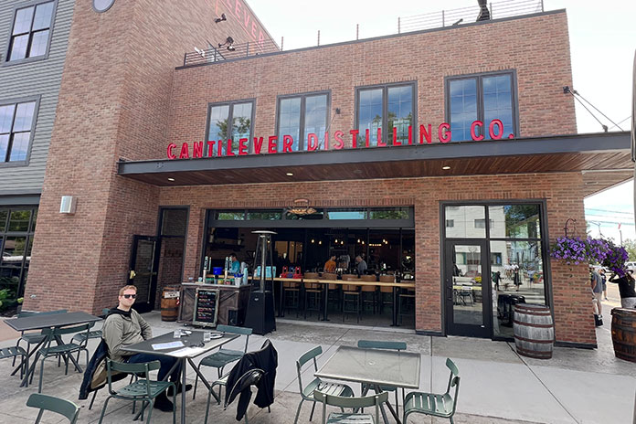
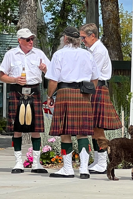
After checking out the long lines of cars waiting to cross into Canada, we were ready for lunch. An online search led us to the small neighboring town of Ranier and the Cantilever Distillery. Sitting outside in the sun with great food and service really hit the spot. While eating, we began seeing men in kilts, some toting bagpipes. Little did we know it, but the annual Ranier Days parade was about to begin.

Northern Minnesota Motorcycle Ride Cantilever Distillery Ranier
In the town of Ranier, we had a great lunch at the Cantilever Distillery overlooking the Ranier Days parade route.

On a beautiful summer afternoon, the people-watching was great, and it was heartwarming to see the enthusiasm and community spirit that still thrives in small-town America. Evidence of this being a close-knit community was obvious with neighbors greeting neighbors. We struck up a conversation with some longtime residents who were surprised we had never been there before and encouraged us to make it a regular stop.

Northern Minnesota Motorcycle Ride
A pre-parade bagpiper meeting.

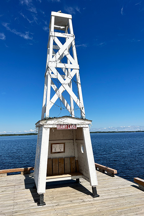
After the parade, we took a stroll down to the lakefront to check out one of the dockside light towers. Put in operation in the 1940s, towers like this provided needed navigational assistance on this international waterway.

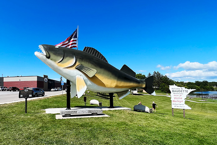
Back on the bikes, we returned through International Falls with the goal of following the Rainy River west through Baudette up to Warroad. From State Highway 11, Canada was almost always in sight to our right. In Baudette, we were greeted by the giant Willie Walleye statue and a sign proclaiming the town the “Walleye Capital of the World.”

Northern Minnesota Motorcycle Ride Willie Walleye Baudette
Willie Walleye greets those entering the town of Baudette, the “Walleye Capital of the World.”

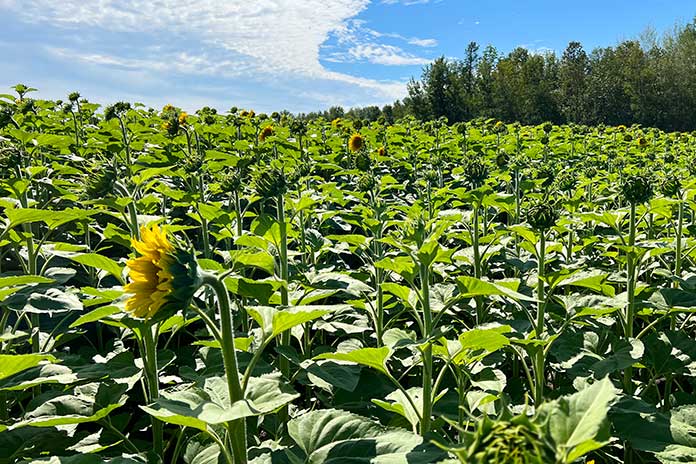
Somewhere along the 40 miles from Baudette to Warroad, which breaks away from the Rainy River, Chad thought I had lost my marbles because I kept stopping to wander into fields of sunflowers that were more than 6 feet tall. My son is very patient, and eventually I got my fill of the flower forests. Warroad, a small town of 1,900 residents on the western shore of Lake of the Woods, is known as “Hockeytown USA” since it is the hometown of several Olympic, NHL, and collegiate hockey players, and the Warroad Lakers have won several boys and girls state championships.

From Warroad, you can take a side trip to the northernmost road in the lower 48 states in a place called Angle Inlet. However, to get there, you must ride north on State Highway 313 and cross into Canada, so be ready to show a passport or other form of approved border-crossing identification. You then need to cross back into the U.S. to reach Angle Inlet, and then back into Canada to return to the U.S. Not including the time it takes to pass through border security twice in both directions, the route is a 2.5-hour roundtrip. We didn’t have the time to do it on this trip, but we plan to go back next summer.

Northern Minnesota Motorcycle Ride
Old navigation tower on Rainy Lake.

Another Lake of the Woods adventure that’s on our radar for next summer is charter fishing. Rods, reels, bait, tackle, and a licensed charter captain provide everything that’s needed for a fun, relaxing fishing trip, so all we’ll have to do is drop our kickstands and climb aboard.

For our return ride to Bemidji, my navigation system routed us onto a couple of roads where the pavement ended, and we had to backtrack to tarmac, eliciting a few more Head Wags of Shame from Chad. Eventually we connected with State Highway 1, which runs along the southern shore of Red Lake, the largest lake in Minnesota, and through part of the Red Lake Reservation, home of the Red Lake Band of Chippewa. The road around the lake is beautiful, and we welcomed the cooler air. We were greeted with a couple of friendly waves as we thundered past various homes along the route. Rounding the bend on the southern shore, State Highway 89 returned us to Bemidji.

See all of Rider‘s North Central U.S. touring stories here.

Heading Home

We wanted to take an interesting route back to Minneapolis, so we followed a different part of the Voyageur Highway: U.S. Route 2 south of Bemidji and over to Cass Lake. Continuing east on U.S. Route 2 would have taken us through the Leech Lake Reservation and over to Grand Rapids, another cool, motorcycle-friendly Northern Minnesota town with breweries, wine bars, and all sorts of recreational activities. The town’s website provides route info for seven scenic rides featuring rolling hills, sparkling lakes, and deep woods.

Northern Minnesota Motorcycle Ride Minnesota State Highway 11
Sunflower fields line Highway 11 along the border with Canada.

But our long weekend was running short, so we continued south on State Highway 371 through an area that is quintessential Minnesota – a recreational paradise of lakes and lakeside cabins, some of which would qualify as mansions. Down around Nisswa, we stopped for lunch and a cold one at Big Axe Brewing.

Northern Minnesota Motorcycle Ride Big Axe Brewing Nisswa
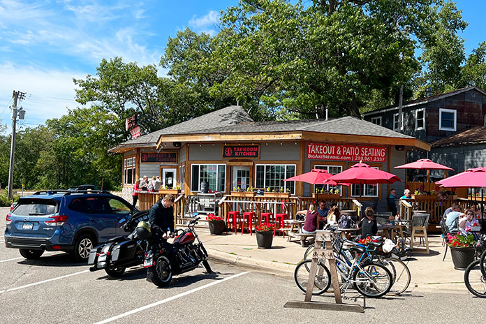
Big Axe Brewing in Nisswa – a welcome cooling off spot on a hot summer day.

This town holds special meaning for Chad and me. Our family has spent many Fourth of July holidays there fishing on Gull Lake, playing golf, and staying at Grandview Lodge. In Little Falls, we picked up U.S. Route 10 – still part of Voyageur Highway – and rode through Royalton, Sauk Rapids, and Becker. The trip home reinforced what I love about living in Minnesota. Our license plates boast “Land of 10,000 Lakes,” but the true figure is 14,380, and they all showcase the beauty of the great outdoors. From the friendliness of the people to the interesting history and boundless recreational opportunities, Northern Minnesota has something for everyone.

See all of Rider‘s touring stories here.

Northern Minnesota Motorcycle Ride Resources:

The post Exploring the Far North: A Northern Minnesota Motorcycle Ride first appeared on Rider Magazine.
Source: RiderMagazine.com
Saving the Best for Last: A Ride to the Sturgis Rally – and Beyond

Chuck Frick Sturgis Rally Suzuki X6 Hustler
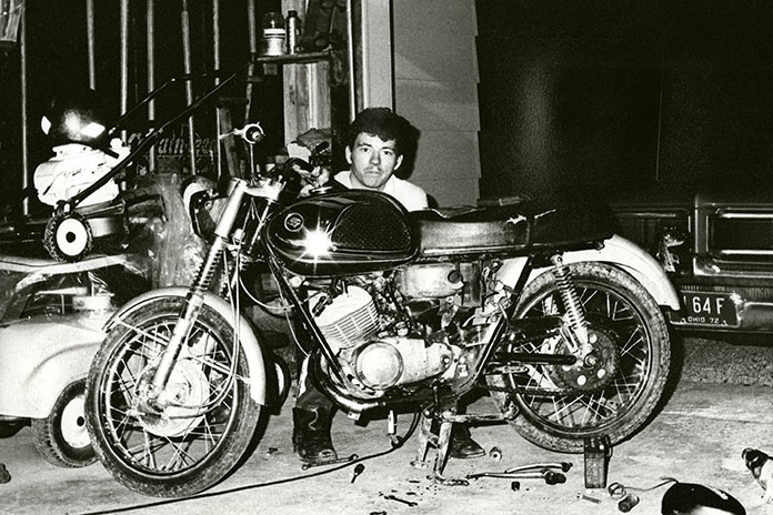
Chuck as a teenager in the ’70s, tinkering with his Suzuki X6 Hustler 2-stroke.

Retirement is underrated, which I discovered both too soon and too late. Fifteen years ago, my employer of 36 years eased me out their door. “If you can’t climb stairs,” they told me, “then you can’t work here.” I don’t like to use the word “handicapped,” but that’s what they called it. It’s actually muscular dystrophy, and I’ve lived with it since my 30s. After they let me go, I didn’t dwell on it, but what life held next was a mystery. I was looking for something to do when my buddy Scott suggested going to the Sturgis Rally. I thought, Why not? There would be 12 of us total, including a few wives and girlfriends riding pillion. They were all on Harleys; I was the only dissenter on my BMW R 1150 RT.

Chuck Frick Sturgis Rally BMW K 1200 LT Hannigan R 1150 RT
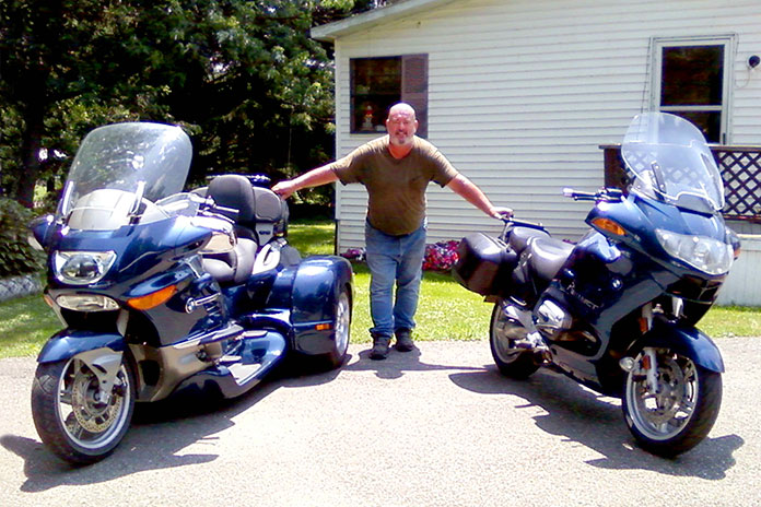
Chuck’s BMWs: an ’07 K 1200 LT Hannigan trike and ’04 R 1150 RT. Combined, he rode them for eight years and 193,000 miles.

From my place in Zanesville, Ohio, Sturgis is roughly 1,700 miles away, so I estimated the trip would take two days. We started on U.S. Route 40, a few miles from my home, and I knew after the first 5 miles it wasn’t going to be much fun. We were going 80 mph one minute, 60 the next, stopping every 75 miles to gas up, puff down two cigarettes, then talk for 20 minutes about the guy in the group who failed to use his turnsignal.

Related: Riding Ohio’s Triple Nickel (OH 555)

We rode for several hours this way. In Illinois, we ran into a light rain, with Scott and me bringing up the rear. I’ve ridden with friends forever, and we never rode side-by-side. Scott and I watched the bikes, riding tandem at 80 mph (then 60), waiting for a mistake that would surely bring the others down. 

We got to Iowa City midafternoon. I thought we were stopping for gas (again), but no, they were already looking for a motel! There were still at least five more good hours of daylight. I’d had enough. “Hey guys, I’ll see you there,” I said and left.

Chuck Frick Sturgis Rally
Chuck and his wife, Terry, holding Ginger during their more carefree years.

Several hours later, I found a mom-and-pop campground west of Des Moines. Even though the sign said “NO Vacancy,” I spotted a grassy area out back in a corner, nearly surrounded by corn, and the proprietors let me have it for half price. I went out for a ham-and-Swiss sub and a six-pack and rode back to my home for the night. I’d ridden 600 miles – not bad – and was ready for a beer.

There were land yachts all over and kids throwing a ball around. One of them saw me and walked over, followed by five or six others. “Hi, where ya from?” they asked. My bike was a kid magnet.

We chatted while I pitched my tent, hoping no one would be offended if I sipped a beer. When I mentioned that the site could use a picnic table, they scrambled off, and I saw them talking to a group of grownups. Four of the dads got together and grabbed an extra table, each holding a corner with one hand and a brew in the other. Suddenly I had my own personal dining table in front of my tent. I felt right at home. The day was ending a lot better than it had started. That’s life on the road on a good day, but aren’t they all good days?

Chuck Frick Sturgis Rally
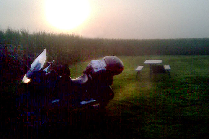
On his way to Sturgis, Chuck spent his first night alone in an Iowa cornfield.

I called Scott that night. He told me he had wanted to join me, but he was riding his brother’s Harley, so his brother called the shots. He said there was only one room with a single bed available at their motel. Eleven people in one bedroom! I thanked my lucky stars. Staying in a room with only one toilet, packed so close you could smell each other’s feet, drinking in the lounge with rows of quarters already on the pool table, sliding a $5 bill across the bar for a beer and getting 50 cents back. Sorry, not for me.

Chuck Frick Sturgis Rally ’72 Honda 750
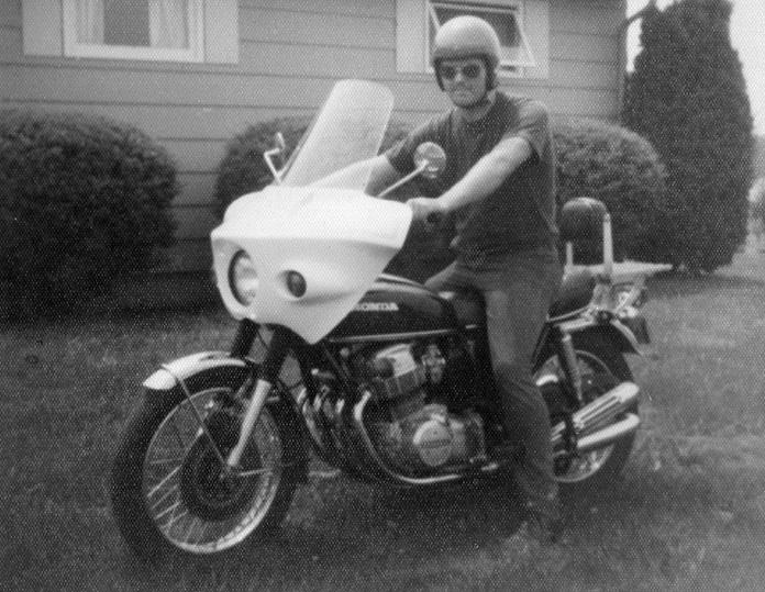
Chuck and his ’72 Honda 750, one of dozens of bikes he owned over the years.

After my new friends left, I sat at my picnic table until 1 a.m. I’d set up my tent facing the interstate and was mesmerized by traffic racing by, streaks of white light in one direction, red in the other, vehicles of all kinds. Sitting alone, soaking all this in, was like a lullaby. It was maybe the best night in a tent I’ve ever experienced. I slept like a baby.

See all of Rider‘s touring stories here.

The next day, I raced west to Nebraska. I made a gas stop and decided to call my cousin Matt, who was driving to Sturgis, hauling his homemade camper/trailer complete with a kitchenette with water, a bed, and clamps on the floor to secure motorcycles. After some conversation about our respective locations, I realized I should have turned north at Des Moines and was on the wrong interstate. What to do? I don’t carry maps, so I kept riding west, figuring there would be a highway north somewhere.

Chuck Frick Sturgis Rally ’79 Honda Gold Wing
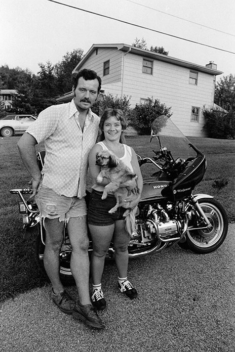
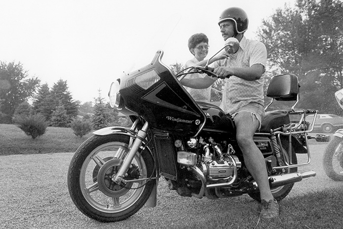
Decades ago, Chuck on his ’79 Honda Gold Wing with his mother, Florence, wishing him well. He rode that Wing for four years, reaching 93,000 miles.

I rode to North Platte, then went north on U.S. Route 83 until I saw a sign for Interstate 90. I could taste Sturgis, now only an hour away. I felt late for the party I’d been racing to get to.

When I hit Sturgis, I peeked at my odometer. I’d ridden 954 miles! I wanted to head out again to ride another 46 miles, but it wouldn’t have mattered to anyone but me, and I was parched. It was just Matt and me at the campsite. My friends, on bikes with gas tanks too small, didn’t arrive until the next day.

Chuck Frick Sturgis Rally
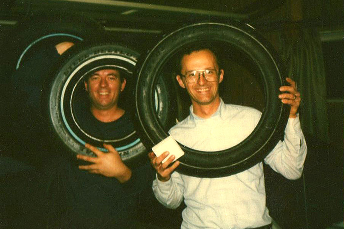
Brothers Chuck and Ken in the ’80s with new tires, a favorite Christmas gift.

Over the next two days, we rode all around the area, hitting the Badlands first. It was amazing, like another planet. Scott had never been out of Ohio before. His brother and Matt knew of a bar just beyond the Badlands. It turned out to be a dump of the first order with a dirt floor and no restroom; you just walked out back and let it flow – girls too. I definitely wasn’t in Ohio anymore. At least the beer was cold! 

The next day we rode to Spearfish for a burnout contest. Matt entered his Harley and put on a great show – so much smoke you could barely see him. Everyone thought he was the favorite, but the last entry was a topless lady. She won.

After Spearfish, we went to see Mount Rushmore, the Crazy Horse Memorial, and finally to the Needles in Custer State Park. It was beautiful country, but I’d seen enough. This was a Harley universe, not mine. It was time for me to go. I asked Scott to come along with me, but he was leashed to his brother and declined again. That was okay. I was used to riding alone – nearly all my past riding friends had either died or moved to Florida.

See all of Rider‘s South Dakota touring stories here.

I was out the next day at first light, unaware that the best five days of my riding life were in front of me. I rode west to Devils Tower, then north. My ride was untarnished, racing along, a world away from Ohio. I ended the day in Custer, Montana, at a great mom-and-pop campground. I pitched my tent and eased into the evening with a chilled six-pack. Seeing the Milky Way brought me back to my childhood. Never having been to the area, everything felt both so real and so unreal. The air felt different, and the smells were spectacular.

Chuck Frick Sturgis Rally Can-Am Spyder
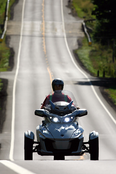
A few years back, riding his beloved Can-Am Spyder on backroads in eastern Ohio.

Related: 2023 Can-Am Spyder and Ryker Updates

The next day, I rode east on U.S. Route 2, to this day my favorite road, wide and straight, with fields of wild sunflowers. The 75-mph speed limit meant I could go as fast as I wanted.

Chuck Frick Sturgis Rally BMW R 1150 RT Devils Tower, Wyoming
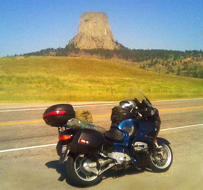
Chuck’s BMW R 1150 RT at Devils Tower, Wyoming, after leaving Sturgis.

I made it to Ross, North Dakota, a small town with a train terminal and several sets of tracks. I found a campsite, pitched my tent, and went looking for beer and a sandwich. I’ve camped at some very nice places, but I’ll remember this one forever because of the trains. In Ohio, I had only seen trains that were a few cars hauling coal, but these trains, with four engines pulling 200 cars, seemed a mile long. The tracks were maybe 500 yards away, and one train would come right after another, each one making its own unique sound, some with squeaky wheels, others with wheels that pounded the track like they were square. I sat at the picnic table until midnight, and to this day, I can still hear the sounds of all those trains.

Chuck Frick Sturgis Rally
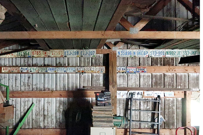
Chuck’s old license plates, covering several decades and hundreds of thousands of miles.

The next morning, I called Scott. He wasn’t with his Harley group. He had been complaining about noise coming from the rear wheel of the Harley he was riding, which turned out to be a bearing. It let loose, the wheel locking for just a second, with the tire terminally resting against the swingarm. The Harley bit the dust. He was alone, and no one came back looking for him. His brother and the group simply abandoned him. There was, however, a friendly fellow nearby, and Scott spent a few hours drinking free beer on his front porch. Luckily, he had Matt’s phone number. Matt came to the rescue and loaded the broken bike in his camper.

The next morning, I left at first light, still riding east on Route 2. I rode at my own pace. Not many people live that far north, probably because of the brutal winters. I passed through towns about every 20 miles – no stop lights, just reduced speed limits. The sideroad signs with white numbering meant gravel; those printed with blue meant the roads were paved. White ones were more common, seemingly 10 to 1. 

Chuck Frick Sturgis Rally
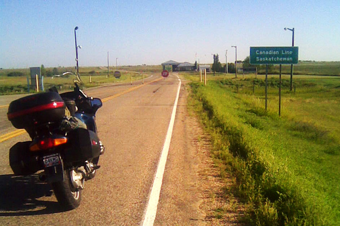
On his way home from Sturgis, Chuck made a brief detour over the border to visit Canada. Leaving the U.S. was easy, but getting back in was another matter.

Over the next two days, I passed through Minnesota, then Wisconsin. Lake Michigan is simply mesmerizing. Every few miles, I spotted a shanty and slowed to see what they were selling. One spot had fresh smoked fish. I never pass on seafood, so I bought two pounds of smoked trout and continued down Route 2 to a very nice campground. 

Related: Great Lakes Getaway: Touring Minnesota, Wisconsin and Michigan

The final day of my trip, I crossed the Mackinac Bridge connecting the Upper and Lower peninsulas of Michigan. I had been warned about the bridge, specifically the mesh steel surface which can lead to motorcycle tire wandering – more than a little unnerving. But one lane was paved.

Chuck Frick Sturgis Rally
By chance Chuck rode into view of brother Ken’s camera lens, just south of Wooster in north central Ohio. Chuck had been sent out to buy a quart of milk, ending up over a hundred miles from home.

When I hit Interstate 75, it started raining. But it was warm, so I didn’t bother to put on my rainsuit. I needed a shower anyway. When I hit Detroit, I was surprised by how clean and orderly the city appeared, contrary to the image I had of it being dirty and smoky. Also, there were never less than five lanes of roadway, so I cruised right through. Every big city should do it so well.

In Ohio, I got on U.S. Route 30, four lanes racing through miles of corn and soybeans, then I rode south on State Route 13 on my way home. 

Chuck Frick Sturgis Rally
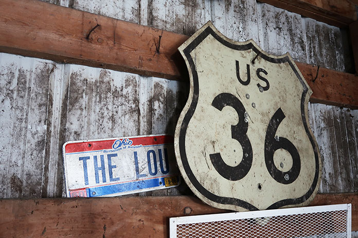
Much of Chuck’s riding history can be found in his garage, including the U.S. Route 36 highway sign given to him by Ken and an Ohio license plate personalized with “The Lou,” his youngest daughter’s nickname.

I made it home just before dark, our three dogs yapping up a storm. I settled in as my wife made me dinner, and in the shower, the water that dripped off me was cloudy with dirt. I was done, home after nine days and 4,800 miles. That night in bed, I cried, thinking it was probably my last long motorcycle ride. And it was.

Because of the muscular dystrophy, I had been having difficulty with my legs during the trip and was happy that I didn’t drop my bike or fall down. My brother Bill lives a similar life – our mother did too when she was still with us. Back then, my MD was an inconvenience. Now it’s a nuisance, controlling every part of my day. 

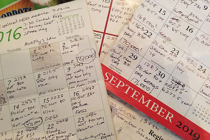
But after Sturgis, I didn’t stop riding. I had two more motorcycles to wear out, saving the best for last. With my failing health, when I could no longer support myself on two wheels, I moved to three. My last bike was a Can-Am Spyder RT, which I dearly loved. In six years, I rode that bike 188,510 miles – until I couldn’t.

Chuck Frick Sturgis Rally
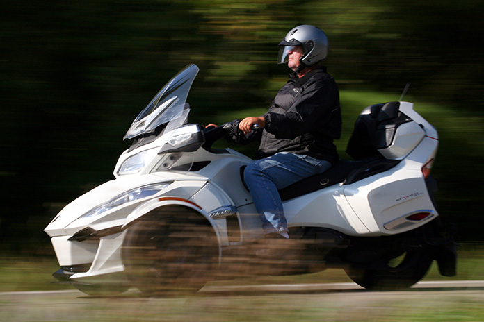
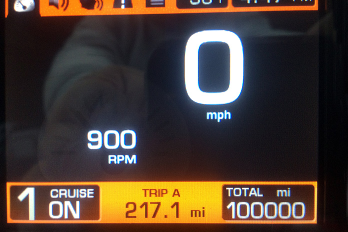
Chuck notched more than 100,000 miles on his 2014 Spyder in three years.

My mobility may have been stymied, but not my mind. I have more than enough memories to fill another lifetime. When I close my eyes, I can be anywhere, always picturing myself on one of my old bikes. When I slip out to my garage for a quick beer or two, I’m surrounded by reminders of my lifetime on two wheels, then three. On the wall are about 20 of my old license plates. Some aren’t especially notable, but there are a few that, if you ask me about them, I’ll talk to you for hours, many of my tales going back to the six or seven or eight special bikes I’ve owned. 

Chuck Frick Sturgis Rally Can-Am Spyder RT
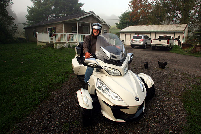
Chuck at home in rural Muskingum County, Ohio, ready to head out on his Can-Am Spyder RT.

There are also two sets of pistons – one from a Gold Wing, the other from an ’83 Honda CB1100F – and posters of concerts I’ve ridden to. There’s a drum skin I caught at a Scorpions concert after drummer James Kottak signed it and threw it into the crowd. And my tools are spread out everywhere from the days when wrenching on my bikes was a favorite pastime. On one of the walls is a newspaper clipping of a story by my brother Ken when he was on assignment covering the Indy 500. One of his pictures shows me, shirtless, leaning back on my cycle, soaking up the sun. He didn’t even realize that I was in his shot until later.

Chuck Frick Sturgis Rally
Chuck uses wall calendars to record his daily mileage and conditions.

My first 12 years of retirement were nearly perfect; the last three, not so much. Still, I see my glass as being half full. My most recent set of wheels is a powered wheelchair, and I can still get around in my custom golf cart. I sold my Spyder to Ken. He still calls it “Chuck’s bike.” I see it often when he stops by, giving me my needed motorcycling fix. It still looks new. To me it always will.

After decades of riding almost nonstop, with well over a million miles on my motorcycles, the one thing I’ve learned is: Never take tomorrow for granted. Live for today. Always, ride on.

Chuck Frick Sturgis Rally
The Frick brothers (left to right): Ken, Chuck, and Bill.

The post Saving the Best for Last: A Ride to the Sturgis Rally – and Beyond first appeared on Rider Magazine.
Source: RiderMagazine.com
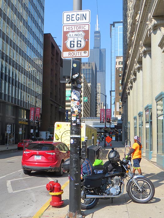
Roller Coaster Hills: A Southeast Ohio Motorcycle Tour

Southeast Ohio Motorcycle Tour best Ohio motorcycle roads
Contributor Scott A. Williams’ 2-day southeast Ohio motorcycle tour highlights some of the best Ohio motorcycle roads and includes a stay in the historic town of Marietta along the Ohio River. (Photos by the author and Greg Nebbia)

This Southeast Ohio motorcycle tour story, which highlights some of the best Ohio motorcycle roads and a stay in the historic town of Marietta on the Ohio River, first appeared in the March 2023 issue of Rider.


For riders who want to carve continual curves through forests, along rivers, and past farms, you won’t find better roads in so focused an area than in the southeast corner of Ohio. The landscape of constantly rising and falling hills results in roller coaster roads that will have you laughing with joy. The rush from blind rises, off-camber curves, and decreasing-radius corners is never-ending. Add abundant wildlife, farm vehicles, and the occasional Amish buggy to the equation and you quickly realize how crucial it is to stay laser-focused on the task at hand.

Southeast Ohio Motorcycle Tour

Scan the QR codes above or click here for Day 1 or here for Day 2

With the benefit of routes created and inspired by Ed Conde of New England Riders, many riders from the Northeast and Canada make the trek south to savor these roads. The small, historic city of Marietta on the bank of the Ohio River is an ideal base of operations for a tour of this region. We found multiple options for lodging, a lively downtown with a variety of great restaurants and pubs, and even a motorcycle shop that will come in handy if your tires lose tread faster than expected.

Get travel, lodging, dining, and other information about Marietta, Ohio, here.

Southeast Ohio Motorcycle Tour Kiedaisch Point Park
While their riders admire the view, bikes stand at the ready near the top of Kiedaisch Point Park in Clarington.

See all of Rider‘s Ohio touring stories here.

Our group of experienced sport-touring riders, including my good friends Steve Efthyvoulou, Randy Palmer, and Bob Holahan, confirmed a plan over breakfast and then began our day heading north and east of Marietta on Ohio State Route 821. Beyond Whipple, a right on Dalzell Road had us winding through forested hills. The constant elevation changes could be a cartographer’s worst nightmare, but they’re a motorcyclist’s dream come true. Our group was connected via bike-to-bike intercom, which enabled the lead rider to offer helpful warnings:

Wow, this curve tightens fast!

Watch for gravel in that right hander.

The road drops left after that blind rise … weeee!

Southeast Ohio Motorcycle Tour Rinard Covered Bridge Wayne National Forest
Rinard Covered Bridge along Ohio State Route 26 in Wayne National Forest is the third covered bridge built at this location, the original dating to 1875.

At State Route 565, we turned right, curved past Zwick Park, then headed south on State Route 260 through Quarry and to New Matamoras. The curves were incredible! At State Route 7, we turned left toward the township of Fly, then left on State Route 800 back up into the hills. Beyond Jackson Ridge Church, we turned right on State Route 255 to Laings, then stayed on 255 back to Sardis and Route 7.

Request a Windy 9 Ohio motorcycle route map here.

Route 7 is designated the Ohio River Scenic Byway. Scenic, yes, but it’s mostly flat and lacks challenging curves. However, it was useful for taking us to the next incredibly curvy road up into the hills: State Route 536 in Hannibal. A short diversion onto Long Ridge Road and Short Ridge Road brought us up to Kiedaisch Point Park. From there we enjoyed the vista overlooking the Hannibal Locks and the bridge crossing the Ohio River to New Martinsville, West Virginia.

Southeast Ohio Motorcycle Tour Hannibal Locks Kiedaisch Point Park
Hannibal Locks and the bridge over the Ohio River to New Martinsville, West Virginia, viewed from Kiedaisch Point Park in Clarington, Ohio.

With our stomachs signaling lunch, we decided to cross that bridge and found Quinet’s Restaurant. The buffet is extensive, and an impressive display of local history covers the walls of this New Martinsville institution. Appetites satisfied, we crossed back into Ohio and picked up State Route 536 all the way to State Route 78, where turning right put us on a parallel track with Sunfish Creek, which meanders and then widens before emptying into the Ohio River at Clarington. Route 7 sent us to State Route 556 where we turned to enjoy more curves all the way to Beallsville and State Route 145.

Southeast Ohio Motorcycle Tour Ohio River
Morning breaks on the Ohio River in Marietta, Ohio.

At Jerusalem, a left pointed us south on State Route 26, the National Forest Covered Bridge Scenic Byway. For most of its length, the byway parallels the Little Muskingum River, and we happened upon Rinard Covered Bridge. It’s the third covered bridge to be constructed on this location, the original dating to 1875. On these winding southeastern Ohio roads, shoulders vary from narrow to nonexistent, so this stop was noteworthy because it was a chance to pull safely off the road to shoot photographs. Continuing on Route 26 provided us miles of smiles back to Marietta.

Southeast Ohio Motorcycle Tour
With constant curves and limited sight distances, places to stop safely along the roadside are few and far between in southeastern Ohio. One solution – just keep riding!

The mental focus required to follow all these curves, coupled with the physical demands of countersteering and shifting body position on heavy sport-tourers, had us feeling tired at the end of the day. After returning to Marietta, we walked to Tampico Mexican Restaurant and rehashed a fantastic day over a relaxed meal and a pitcher of margaritas.

Southeast Ohio Motorcycle Tour Marietta
A beautiful June afternoon finds downtown Marietta looking its best. The charming little town served as an ideal base for our two days of sport-touring in the hills of southeastern Ohio.

Your humble scribe is an early riser, so the next morning as the sky began to lighten, I set out to explore more of downtown Marietta. Reading the many historical signs, I learned that pioneers established the town in 1788 as the first permanent white settlement of the United States Territory Northwest of the River Ohio. Many original settlers were Revolutionary War officers who were offered land grants as compensation for military service. Artisans from my native New England also settled here, bringing with them skills that helped Marietta quickly become a center for shipbuilding. Between 1800 and 1812, nearly 30 ocean-going vessels were built here in eight shipyards.

Southeast Ohio Motorcycle Tour
Commercial barge traffic is ubiquitous on the Ohio.

Another piece of riverfront history is the place where we stayed, the Lafayette Hotel (c. 1918). Inside, the hotel’s lobby feels like a formal parlor. Realtors might describe the rooms as “quaint” and “cozy,” with the period furnishings and fixtures including styles long forgotten by interior designers. Our tidy room overlooked the Ohio River, the Highland Avenue Bridge, and lovely riverside homes on the opposite riverbank in Williamstown, West Virginia. Even the parking area for our bikes overlooked the river. Modern-day riverboats still dock at that very spot, as one did during our stay, so it’s fitting that this lodging retains the feel of the riverboat era.

Southeast Ohio Motorcycle Tour Lafayette Hotel Marietta
The historic Lafayette Hotel in Marietta overlooks the confluence of the Muskingum and Ohio rivers.

After breakfast at the hotel, our group was ready for another day behind the handlebars. Since any road is different in the opposite direction, we began by reversing course on one of our favorites from the day before, Route 26. The weather was perfect, and we enjoyed glimpses of the scenery when we could divert our attention briefly from the curvaceous road. In Woodsfield, we found Ida’s Lunchbox, which other riders had recommended, and enjoyed a light lunch and conversation, while a farmer at the next table listened attentively to the agriculture report on TV.

Southeast Ohio Motorcycle Tour Ida's Lunchbox
Ida’s Lunchbox in Woodsfield is a popular spot with riders. These BMWs were part of another group exploring the curve-rich environment.

We continued on 26 to Jerusalem, turned west on State Route 145, kept twisting southwesterly along Duck Creek to Lewisville, and then took State Route 724 west to Carlisle. A different stretch of Route 260 wound us south along East Fork Duck Creek to Harriettsville. Just past town, we turned right on State Route 564 and began to follow Middle Fork Duck Creek to Caldwell. State Route 78 took us out of town and curved to a highlight of the day: Big Muskie Bucket, the business end of one of the largest machines ever to move on land.

Big Muskie was a walking dragline designed to remove earth and uncover a coal seam that lay 180 feet below the surface. This colossal machine was electric, powered by a 13,000-volt “extension cord,” and so enormous it’s hard to wrap your brain around the scale. It was 1.5 times longer than a football field, more than 222 feet tall, and weighed 12,000 tons. The bucket, which weighs 210 tons when empty, could grab 325 tons of earth in a single “bite” and hold 220 cubic yards. In 1969, the entire Morgan High School Marching Band, nearly 50 members strong, played inside the bucket at Big Muskie’s inaugural ceremonies. By 1991, more efficient mining methods and increasingly stringent environmental regulations sidelined Big Muskie. Now the bucket is all that remains, rusting away in a park on Route 78 near Bristol.

Southeast Ohio Motorcycle Tour Big Muskie Bucket
Pedestrians and a flagpole hint at the scale of the Big Muskie Bucket. It’s HUGE.

We briefly reversed course on 78 to State Route 83 and headed south for gentler curves down to Beverly. There, a left on State Route 339 moved us into farm country and past Crooked Tree. A right on State Route 821 had us paralleling Duck Creek through Macksburg, Elba, and Warner. A right on State Route 530 delivered the day’s last dose of twisties down to Lowell, where leisurely State Route 60 returned us to Marietta.

Southeast Ohio Motorcycle Tour Ohio River
Bikes have an even better view of the Ohio River than we had from our hotel room.

One thing we had missed thus far was a ferry ride, so we made a quick run up Route 7 to the Sistersville Ferry, which has carried people across the Ohio River between Fly, Ohio, and Sistersville, West Virginia, for over two centuries. Several types of ferry have been used throughout the company’s history, and the one currently in use is a type none of us had seen before. Vehicles drive onto a ferry barge, which is propelled through the water by a tug. The barge is double-ended so it doesn’t have to change direction with each river crossing, but the tug needs to turn around after each landing. The tug’s bow is attached to the barge’s side via a pivoting mechanism that resembles an automotive trailer hitch. When the ferry reaches the other side, the captain simply pivots the tug 180 degrees to cross the other way. Pretty slick.

Southeast Ohio Motorcycle Tour Sistersville Ferry
Bob, Randy, and Steve patiently await their arrival in Fly aboard the tug-driven Sistersville Ferry.

After the ferry, we made our way back to Marietta, where our dinner spot was a short stroll through Ohio Riverfront Park to Levee House Bistro for, of all things, lobster – prepared by a chef from Boston no less!

Southeast Ohio Motorcycle Tour American Countess
The riverboat American Countess prepares to dock by the Lafayette Hotel in Marietta.

Find info about the Triple Nickel and Zanesville-Muskingum County, Ohio, here.

Commitments back home had us heading east the next morning, but we plan to return to this region for more great riding. To the north is State Route 555, the renowned “Triple Nickel” (see Ken Frick’s story “Riding Ohio’s Triple Nickel”). To the west are gentler curves leading to Hocking Hills State Park, where riders can enjoy some of Ohio’s best scenery and stretch their legs on short hikes. The hilly landscape is much the same on the West Virginia side of the Ohio River, with roads such as West Virginia State Route 20 from New Martinsville to Mannington and U.S. Route 250 from Mannington to Moundsville, keeping riders on their toes and making joyful noises.

If you prefer roller coaster rides that you control, a motorcyclist’s amusement park awaits you in southeastern Ohio.  

The post Roller Coaster Hills: A Southeast Ohio Motorcycle Tour first appeared on Rider Magazine.
Source: RiderMagazine.com
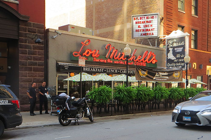
Northeastern Michigan and Lake Huron Lighthouses Loop | Favorite Ride

Northeastern Michigan Lake Huron Lighthouses
It doesn’t get much better than a scenic ride with friends on a bluebird day. (Photos by Kathleen Currie and Corey Aultman)

At first glance the small farming town of Posen, which is situated along State Route 65 in northeastern Michigan and hosts an annual Potato Festival, doesn’t appear to be a logical meet-up spot to kick off a daylong motorcycle tour. But the Route 65 Diner offers up classic breakfast and lunch fare, the nearby Posen EZ Mart is a convenient place to fill up, and the village is near Lake Huron, the second largest of the Great Lakes, so it’s perfect starting point for a Lake Huron lighthouses loop.

Northeastern Michigan Lake Huron Lighthouses

Scan QR code above or click here to view the route on REVER

This scenic route through the northeast corner of Michigan’s Lower Peninsula is about 180 miles and provides a leisurely day of riding with stops for sightseeing and food. It offers unique historical sites, lighthouses, shipwrecks, wildlife sanctuaries, parks and beaches on Lake Huron, and paved roads through deep timber forests.

The ride is best done between Memorial Day and Labor Day but could be done earlier in the spring or later in the fall depending on the weather. We took our ride in September. 

Northeastern Michigan Lake Huron Lighthouses The Old Presque Isle Lighthouse.
The Old Presque Isle Lighthouse.

See all of Rider‘s touring stories here.

About 5 miles north of Posen, Route 65 dead-ends at U.S. Route 23, which runs along the edge of Lake Huron’s Michigan shore from Mackinaw City to Saginaw. We headed east on Route 23 and soon entered Thompson’s Harbor State Park. We turned onto Old State Road, followed it to the end, and went north on East Grand Lake Road, which took us onto a narrow peninsula that juts into Lake Huron between North Bay and Presque Isle Bay.

Northeastern Michigan Lake Huron Lighthouses
Covering just over 23,000 square miles, Lake Huron is the third largest freshwater lake in the world. Somewhere out in the distance is Canada.

On the right, we saw the Old Presque Isle Lighthouse, which was built in 1840. Due to the harsh weather on Lake Huron, the original lighthouse deteriorated, and the New Presque Isle Lighthouse was built in 1870 farther north near the end of the peninsula. Standing 113.5 feet tall, it is one of the tallest lighthouses on the Great Lakes. Both lighthouses have been restored and are part of a 99-acre park that includes a playground, picnic area, pavilion, gift shop, museum, and nature trails.

Northeastern Michigan Lake Huron Lighthouses The New Presque Isle Lighthouse and keeper’s house
The New Presque Isle Lighthouse and keeper’s house.

Adjacent to the New Presque Isle Lighthouse is a keeper’s house that was built in 1905 and is now a museum. Admission is free, but we paid $5 to climb the 130 steps to the top of the lighthouse for excellent views of Lake Huron and the Presque Isle area. The buildings and grounds are open to the public daily from mid-May through mid-October.

We returned to U.S. Route 23 and rode south, finding a few curves along the edges of Grand Lake and Long Lake, which are just inland from Lake Huron. We made our way to Alpena, a town of about 10,000 residents that sits on the northern shore of Thunder Bay. Nearby are two lighthouses, but they are out in the lake on islands and only accessible by boat. 

Northeastern Michigan Lake Huron Lighthouses
The Harley and Indian riders in our group searching for a lumberjack breakfast.

The Thunder Bay National Marine Sanctuary protects an area of Lake Huron known as “Shipwreck Alley” where there have been more than 100 historically significant shipwrecks. Some of the wrecks are close enough to the surface for sightseeing, which we did on a two-hour shipwreck tour on a glass-bottom boat called the Lady Michigan. We also visited the Great Lakes Maritime Heritage Center, a museum with exhibits and pieces of boats that washed ashore.

Northeastern Michigan Lake Huron Lighthouses Great Lakes Maritime Heritage Center
The Great Lakes Maritime Heritage Center in Alpena is a large museum that includes a shipwreck gallery, a theater, and an archeological lab. (Photo by ehrlif – stock.adobe.com)

When we left the museum, the Royal Enfield and Triumph riders in our group insisted we check out a British tavern in downtown Alpena called the Black Sheep Pub. It is decorated with British flags and memorabilia, and the menu includes rich and tasty pub grub like fish and chips, a pork burger drizzled with vinegar, Scotch eggs, and pickled chips.

After lunch, we continued south on Route 23 through parts of Thunder Bay River State Forest, Au Sable State Forest, and Huron National Forest. This is chainsaw country. In Ossineke, we passed colorful concrete statues of Paul Bunyan and Babe the Blue Ox built in the 1940s by Paul Domke, who also built the creatures in the nearby Dinosaur Gardens Prehistoric Zoo.

Northeastern Michigan Lake Huron Lighthouses Huron National Forest
Cruising through some gentle curves in Huron National Forest.

South of Alcona, we visited Sturgeon Point Lighthouse, which was built in 1870. The 70-foot lighthouse is maintained by the U.S. Coast Guard and is open to the public. The keeper’s house is a maritime museum open from Memorial Day to mid-September.

At Harrisville, the Harley and Indian riders in our group made it known that it was time for some American food. We rode west on State Route 72 into the heart of Huron National Forest and then turned north on State Route 65 to Curran. Just north of town, we stopped at the Lunch Block and had a proper lumberjack breakfast.

Northeastern Michigan Lake Huron Lighthouses Sturgeon Point Lighthouse
Sturgeon Point Lighthouse (Photo by Ffooter – adobe.stock.com)

Full from our hearty meal, we further compressed the suspension of our motorcycles and continued north on Route 65 through a section of forest so dense that no paved roads cross to the east. Werth Road finally appeared and provided a paved route with a few curves back to Alpena. Alternatively, you can continue north on 65 and turn east on State Route 32.

Just north of Alpena, past the wildlife sanctuary, we picked up Long Rapids Road, which meanders along the Thunder Bay River heading northwest to the town of Bolton. We continued north on Bolton Road, then west on Long Lake Highway, and finally back onto Route 65 for our return to Posen.

If Michigan is in your motorcycle travel plans, check out the northeastern part of the state near the Lake Huron shore. The roads provide scenic views of the lake and some mellow curves and hills, and the lighthouses and historic sites are a nice diversion when it’s time to stretch your legs.

The post Northeastern Michigan and Lake Huron Lighthouses Loop | Favorite Ride first appeared on Rider Magazine.
Source: RiderMagazine.com
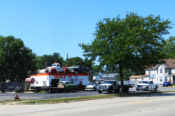
Wolf River Run in Wisconsin | Favorite Ride

Wisconsin Favorite Ride Wolf River Run
Leaving Laona and heading west on U.S. Route 8, the ride passes through the Chequamegon-Nicolet National Forest. The figure-8 route passes in and out of public forest land.

The WisconsinHighways.org website’s State Trunk Highways section says: “One of the noticeable idiosyncrasies is the meandering nature of some of Wisconsin’s state highways. Just pick one of the state’s longer routes, and more than likely you will find many extended stretches concurrently designated with other highways and some meandering behavior.” I like highways that meander. My favorite ride includes State Highways 32, 47, 52, and 55. It’s not the Smoky Mountains, but it has some of the best motorcycle roads in Wisconsin.

Wisconsin Favorite Ride Wolf River Run

Scan QR code above or click here to view the route on REVER

This route is a figure-8, and I prefer to start at the top in Laona. The Shell station there has ethanol-free 91-octane gas and Trig’s beef sticks. Fuel for both the bike and me is a good way to begin the ride, and several stops for both are available along the route.

Wisconsin Favorite Ride Wolf River Run
My 2006 Harley-Davidson Ultra Classic in my front yard. I’ve owned Honda, Suzuki, Yamaha, and other brands of touring bikes over the years, but as a Wisconsin guy I always have a Harley in the garage.

I head west on U.S. Route 8 toward Crandon. It’s a sunny, pleasant day, but with haze in the air. The faint smell of smoke rolls over the windshield. News reports say it’s from large wildfires in Ontario. It occurs to me that I have not been to Canada in 10 years, and that’s way too long. Hopefully someday soon crossing the border will be easy, Covid will be under control, and the fires will be out.
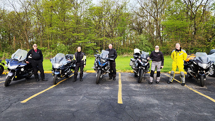
These are some of the straightest highways of the trip, and I turn up the wick on my old Twin Cam to get to the curves. I have owned a variety of bikes over the years and toured on all of them – a Honda Gold Wing, a Suzuki V-Strom, a Yamaha FJR1300 – but I always seem to have a Harley around. It’s a Wisconsin thing.
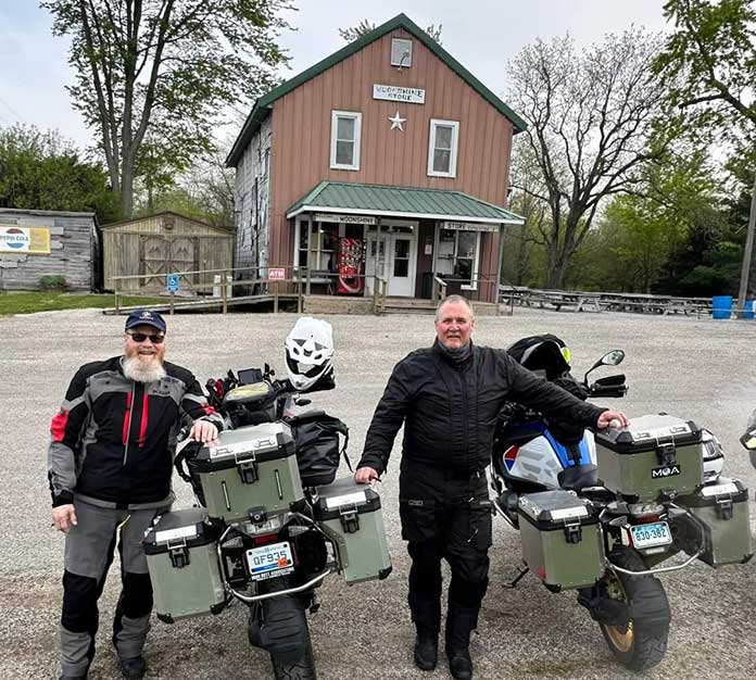
Wisconsin Favorite Ride Wolf River Run
The Wolf River is visible at Langlade, and Highway 55 parallels it for miles.

Outside of town, I enter green hardwood forests. Many are part of the Chequamegon-Nicolet National Forest, which limits development and provides opportunities for nature viewing with minimal human intrusion. I am approaching the Forest County Potawatomi Community, enjoying the rolling hills and views from the tops of those hills. This section of U.S. 8 lies about a mile from Sugarbush Hill, the third highest point in Wisconsin.
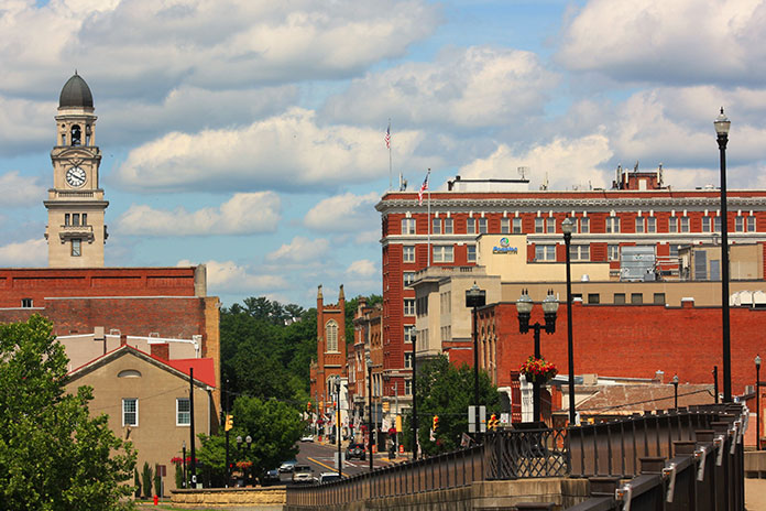
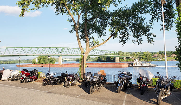
The small city of Crandon provides another opportunity for food, fuel, and lodging, but I’m in a hurry. I roll through town and pick up Highway 55 south and cruise toward Mole Lake. The pavement is in nice shape with wide shoulders and a few gentle curves, but this is an agricultural and residential area that keeps the road relatively straight. The highway continues through the Sokaogon Chippewa Community, which has a casino and anything else a traveler might need.

Wisconsin Favorite Ride Wolf River Run
On Highway 55 in Menominee County, trees create a cool, shaded tunnel of green.

I’m on a mission, because when I clear Mole Lake, I’ll enter Langlade County. The road changes. I can feel the curves and elevation changes. The forest closes around the road with a lot of nice 40-50 mph sweepers. This continues toward the town of Pickerel, where the road opens back up into an agricultural area and we see the Wolf River for the first time. The back-and-forth change of scenery continues for miles as we pass through the small town of Lily, the middle junction of the figure-8.

Wisconsin Favorite Ride Wolf River Run
The Deleglise cabin was the first home in Antigo. It was restored and relocated in front of the Langlade County Historical Society Museum.

The smell of fresh-cut hay pushes out the smell of wildfire haze. The V-Twin continues to thump along at a nice cadence. I gradually slow coming into Langlade, and get a closer look at the Wolf River, which parallels Highway 55 all the way to Keshena. The number of curves increases as the road follows the path of the river.

Wisconsin Favorite Ride Wolf River Run
This was a busy dairy operation when I was a boy. It was my grandparents’ farm where my dad and his five siblings were raised. Now it’s home to beef cows and no longer owned by our family.

Crossing the Menominee County line, the road changes dramatically for the better. The Menominee tribe has been managing their land for sustainable timber for around 150 years. The mature trees are allowed to grow right up to the shoulder of the highway and canopy over in some places. The mix of curves, the views of the Wolf River, and the feeling of riding right through the forest are the best parts of this ride. This is what I’ve been waiting for, and I enjoy leaning the old Ultra back and forth all the way to Keshena Falls, which is the bottom of the figure-8.

Wisconsin Favorite Ride Wolf River Run
Why yes, Wisconsin does have a state soil. The rich soil of the Antigo Flats makes it an agricultural powerhouse.

Taking a right onto Highway 47, I ride in a northwesterly direction. The curves aren’t as spectacular, but I’m still enjoying the area’s scenery. I run through a few more areas of shaded canopy and bend around the backwaters of the Neopit Mill Pond. Returning to Langlade County is like riding out of a forest tunnel and into the neatly organized fields of traditional Wisconsin dairy farms.

Wisconsin Favorite Ride Wolf River Run
The view from the top of the Kettlebowl Family Fun Area, a ski hill near Lily on Highway 52. Nearby are “Caution Steep Grade” signs that are rare in the Midwest.

The road opens as I sail up through Phlox into Antigo, the largest city on the route with plenty of opportunities to stop. I like to take old Highway 52 past the hospital and city parks and into the large orderly fields of the Antigo Flats. This is the home of Antigo Silt Loam, the official state soil of Wisconsin. Highway 52 has 90-degree curves along the boundaries of dairy and potato farms. The highway climbs out of the flats into the Kettlebowl area, which has a volunteer-run ski hill and the only “Caution Steep Grade” signs of the ride. The climb up the south side of the Kettlebowl is rough, but the pavement coming down is new and smooth.

Wisconsin Favorite Ride Wolf River Run
Highway 52 near Antigo has many 90-degree, 15-20 mph corners on property lines that zig and zag between neat, square farm fields.

The broad curves continue into the town of Lily, where we cross the center of the figure-8 again and turn north onto Highway 52. The path is wonderful, but the pavement in this area is a decade or two beyond its service life, so I keep speeds mellow for safety. The road follows 90-degree curves for a few miles through the community of Freeman. Folks are still farming here, but with much smaller operations than in Antigo. Highway 52 terminates at Highway 32 just west of Wabeno, and the ride is almost over. I aim north and relax a little on the wider, straight highway on the return to Laona.

I experienced great roads, sights, and smells, as well as diverse settings, bends, curves, hills, and even a little bit of sunburn. It’s hard to beat a day spent meandering on a motorcycle.

Wisconsin Favorite Ride Wolf River Run
You’ll often have some of these Wisconsin backroads all to yourself.

The post Wolf River Run in Wisconsin | Favorite Ride first appeared on Rider Magazine.
Source: RiderMagazine.com