Tag Archives: West Virginia Motorcycle Rides

Asphalt Heaven: Riding West Virginia Backroads

Asphalt Heaven West Virginia backroads Scott A. Williams Seneca Rocks
Fog was stubborn this morning at Seneca Rocks, but it couldn’t dampen my admiration for West Virginia backroads.

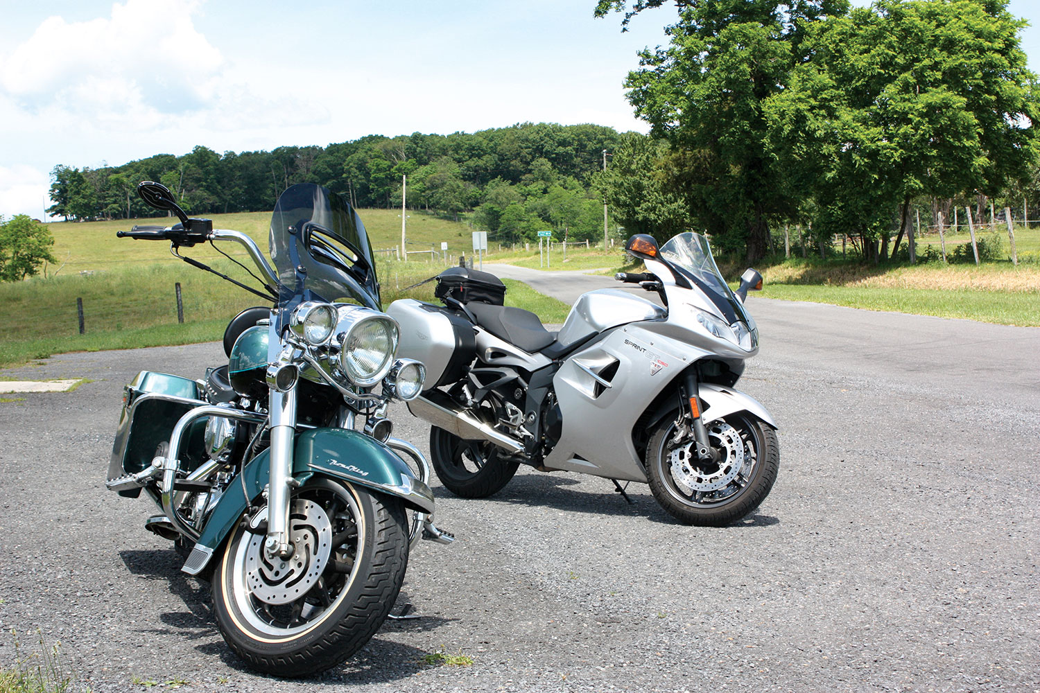
What I like most about motorcycles is that they lean, a trait I describe to nonriders as “dancing with a machine.” A motorcyclist can select a dance partner ranging from a svelte sportbike to a big‑­boned tourer, but how well that partner performs depends on the quality of the dance floor: the road. 

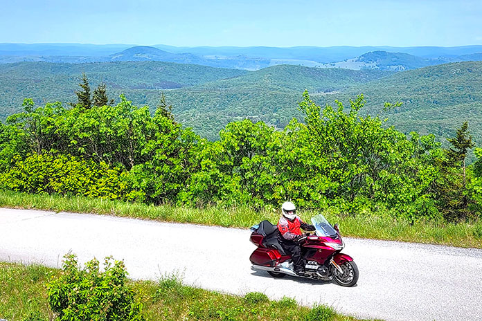
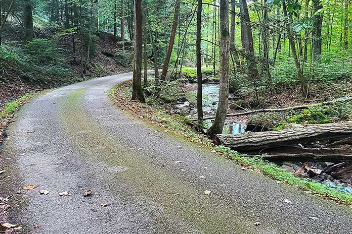
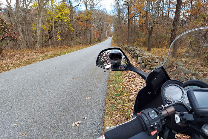
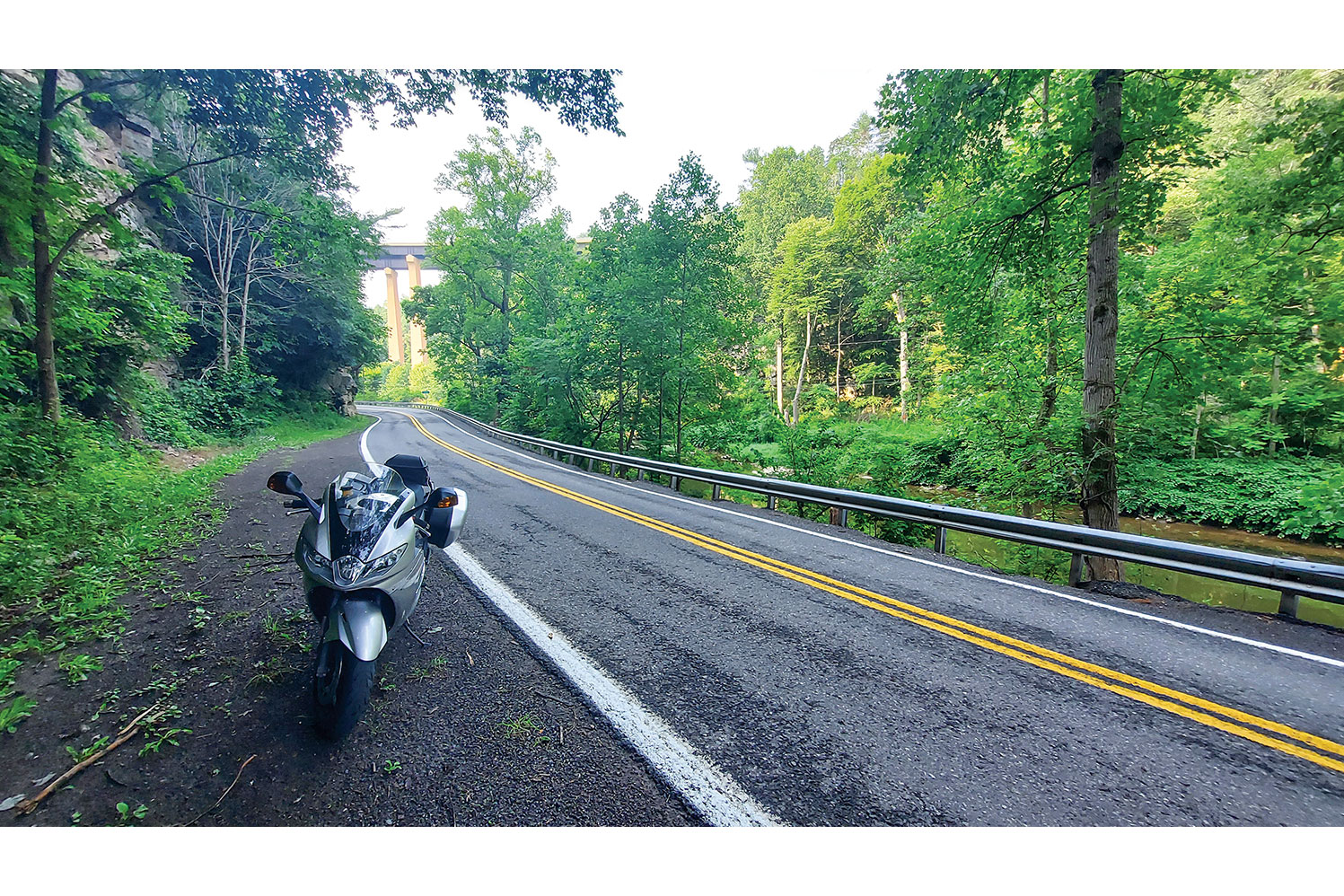
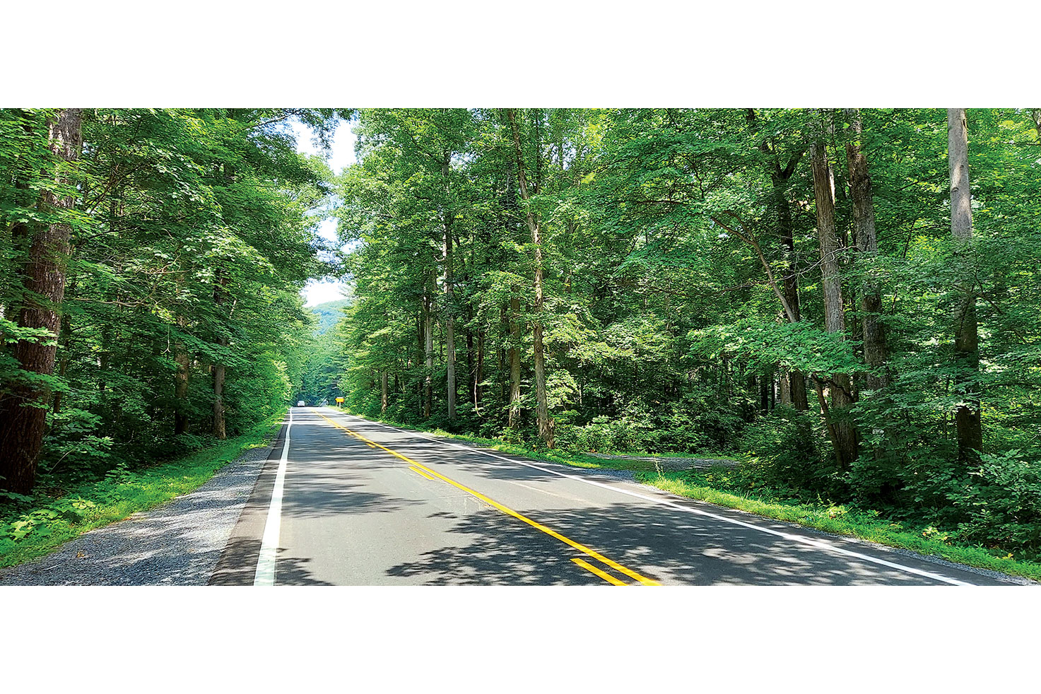
My favorite motorcycle dance floors are smooth asphalt ribbons that snake over mountains and along waterways, and some of the best I’ve found anywhere are West Virginia backroads. Appropriately called the Mountain State, it’s where the Allegheny, Blue Ridge, and Appalachian mountain ranges converge. With the highest average elevation of any state east of the Mississippi River, the roads curve over and around a rugged, varied landscape. The quality of road surfaces in West Virginia is generally superb (see sidebar at end of article). For riders who love to lean, it’s idyllic.

Asphalt Heaven West Virginia backroads Scott A. Williams

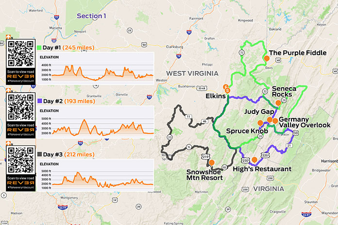
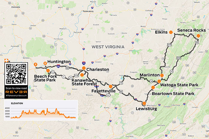
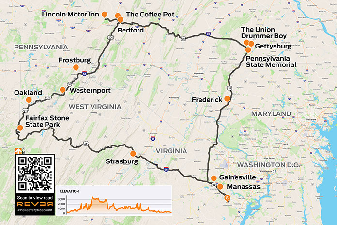
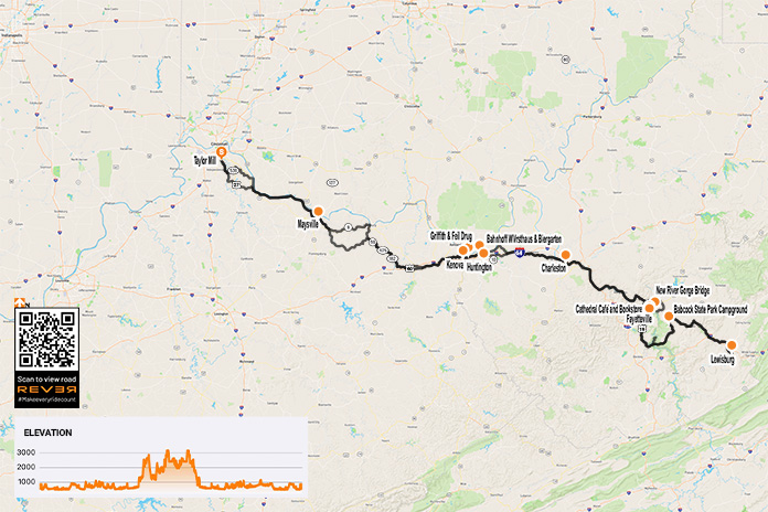
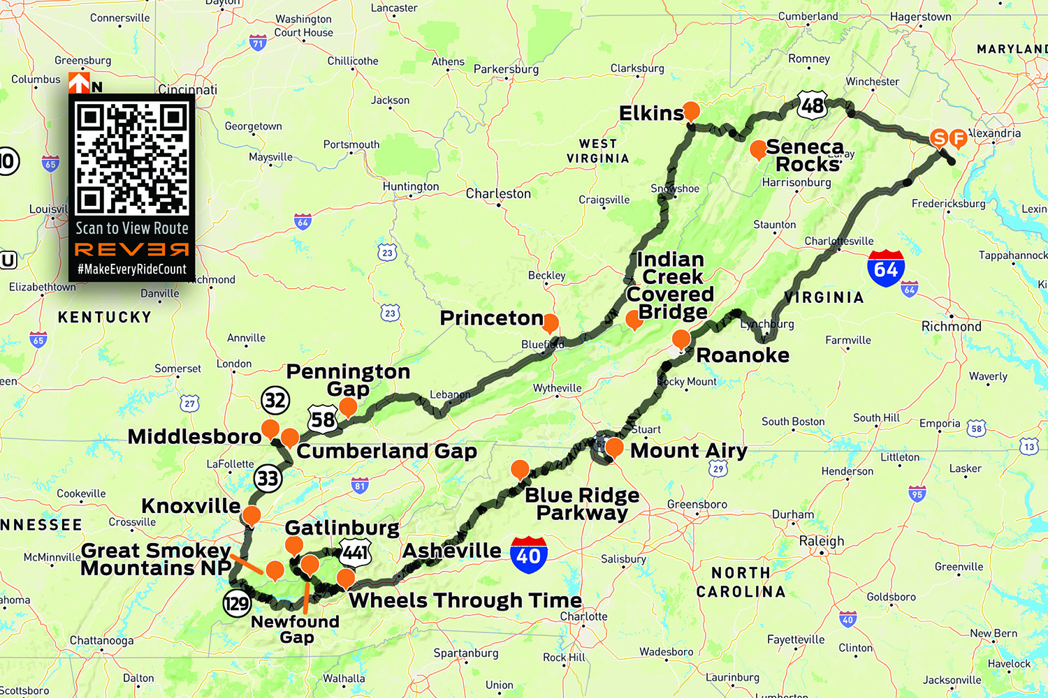
Scan QR codes above or click “Day 1,” “Day 2,” or “Day 3” to view routes on REVER

As I made my way south into West Virginia on these great winding roads, a familiar anthem played in my head, albeit somewhat revised: Asphalt heaven, West Virginia, Blue Ridge Mountains, Shanandoah River…

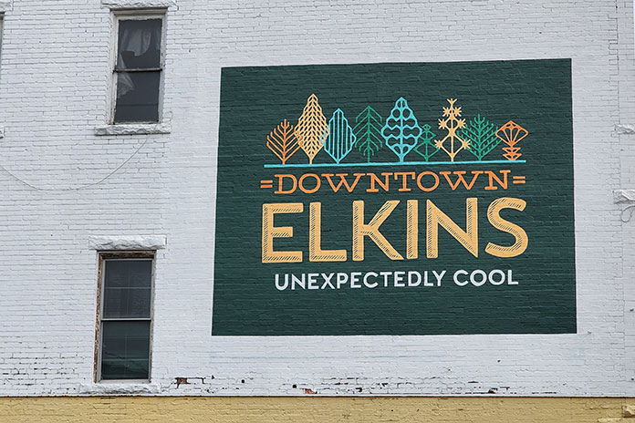
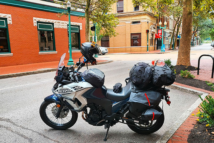
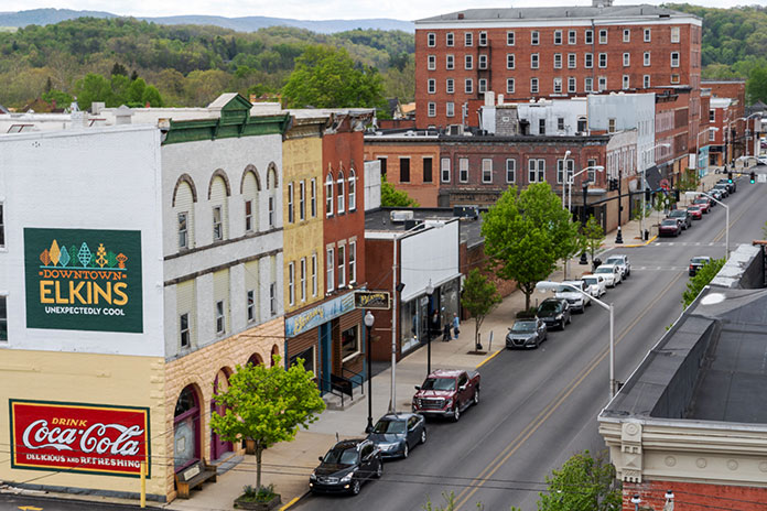
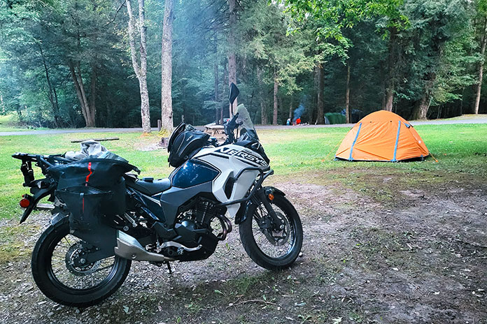
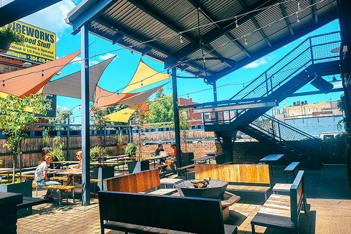
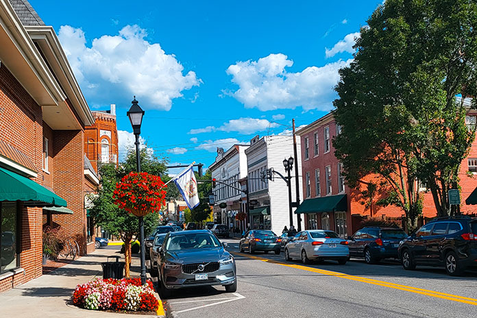
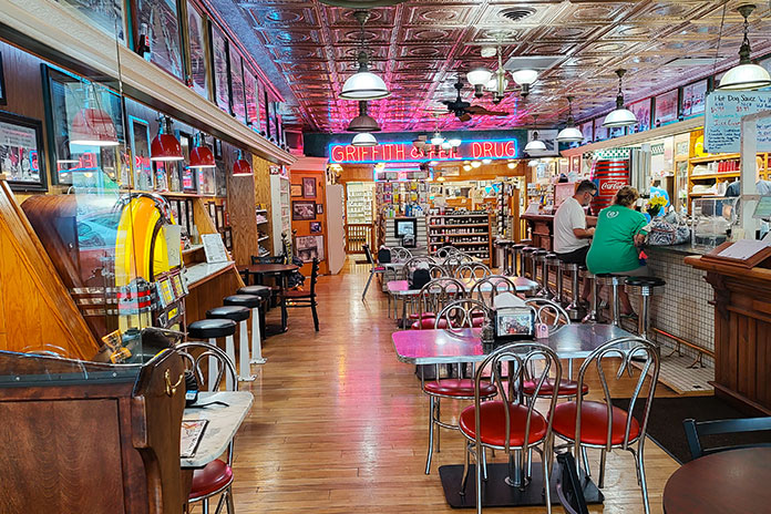
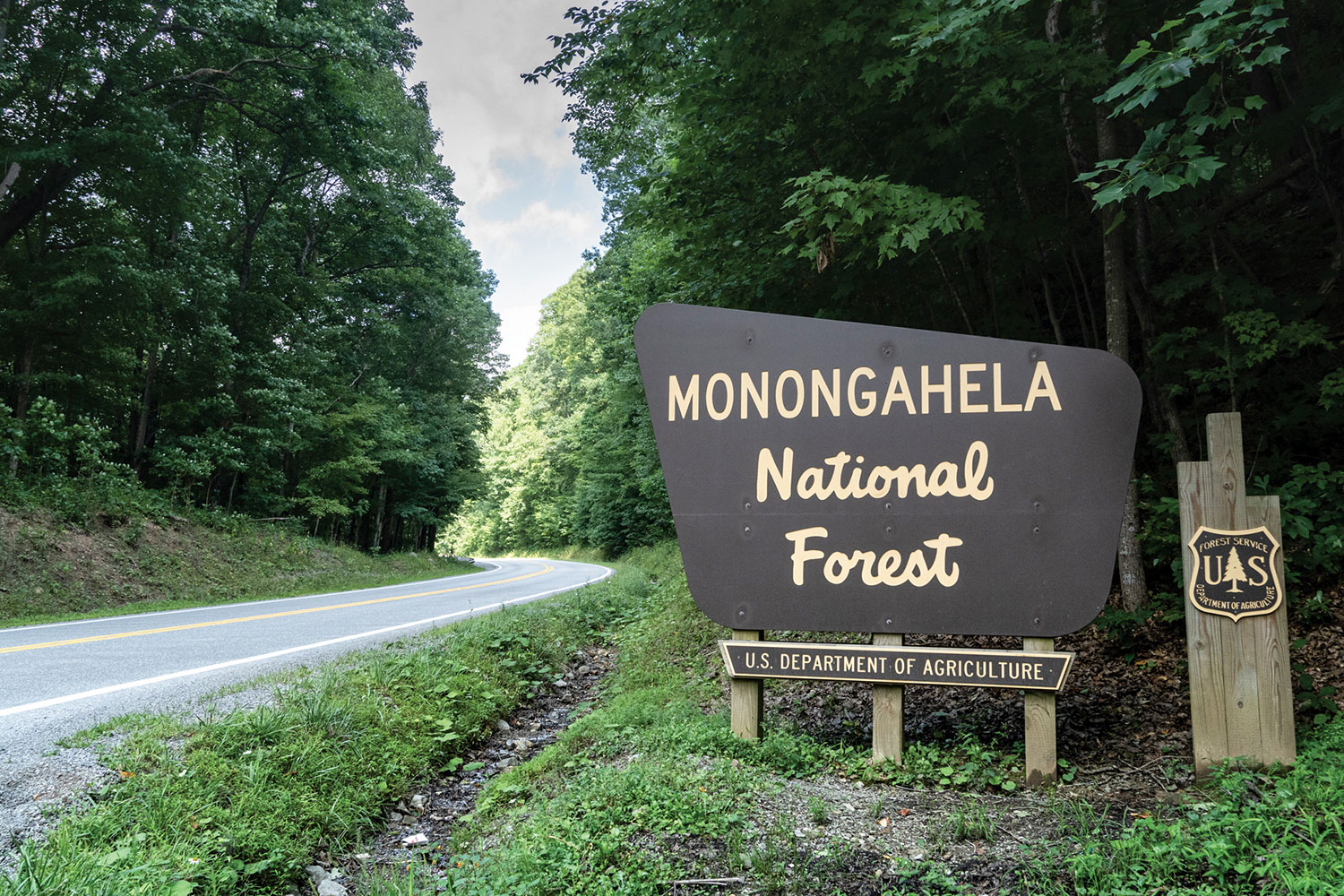
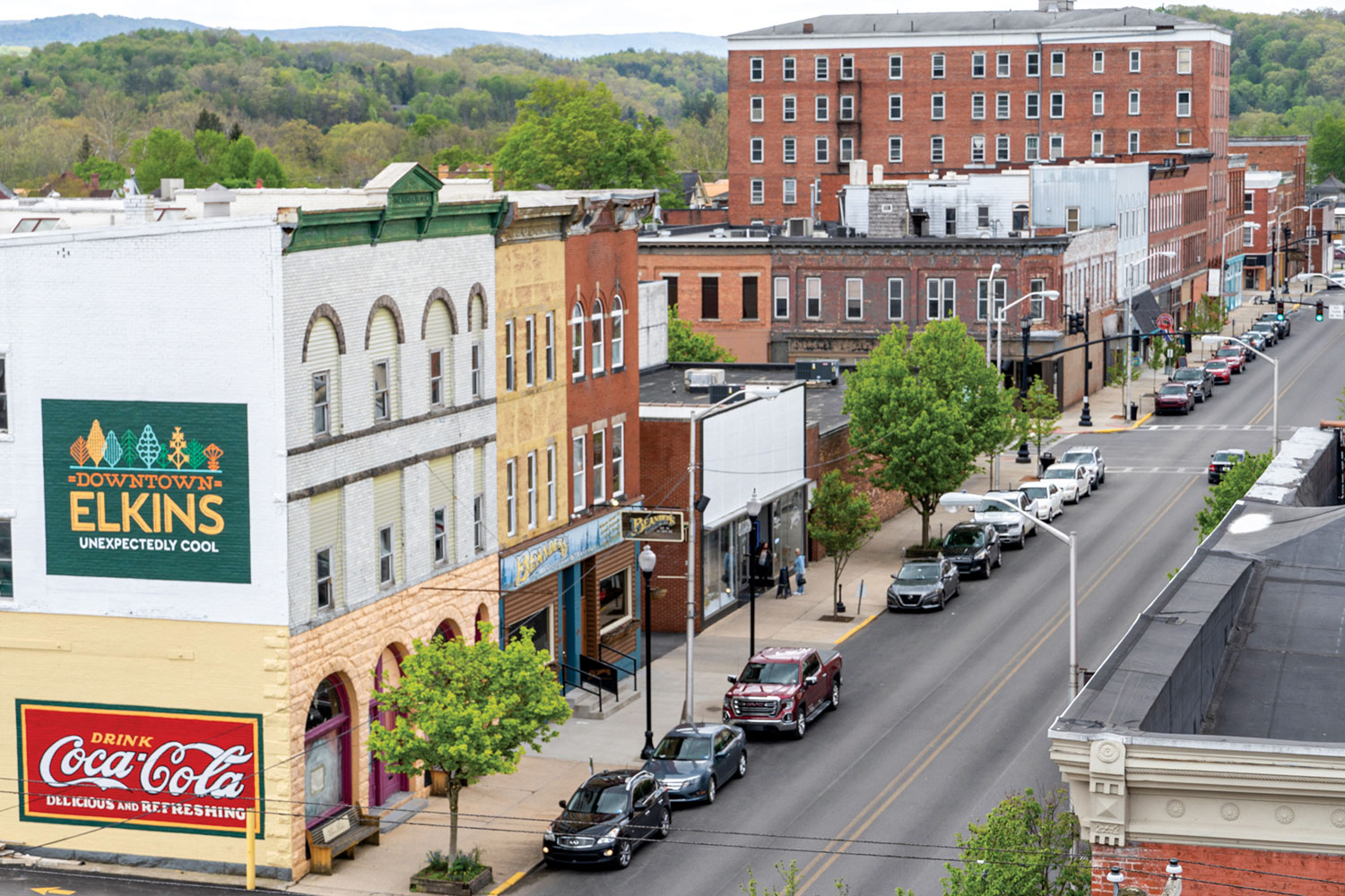
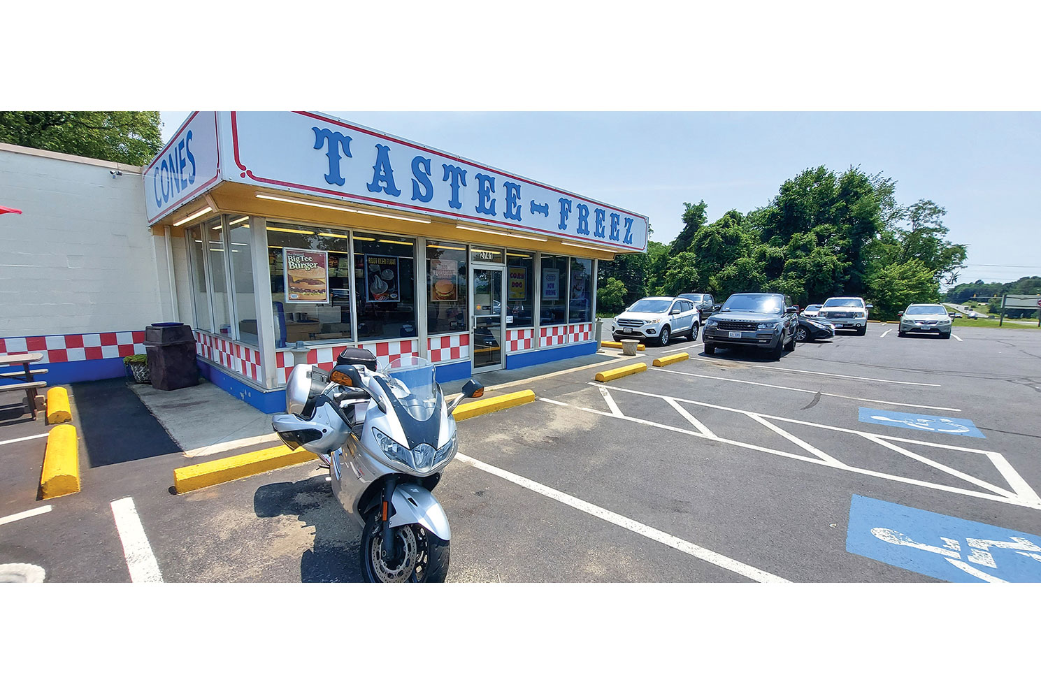
No disrespect to John Denver, but your humble scribe gives top billing to the West Virginia backroads. I was headed to Elkins, a small city at the edge of the Monongahela National Forest in the heart of Randolph County where a group of riders had bivouacked at the Holiday Inn Express. This location offered easy access to the region’s fantastic roads and a short walk downtown to multiple options for post‑­ride dinner and libations.

See all of Rider‘s West Virginia touring stories here

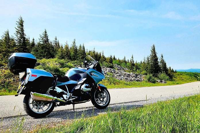
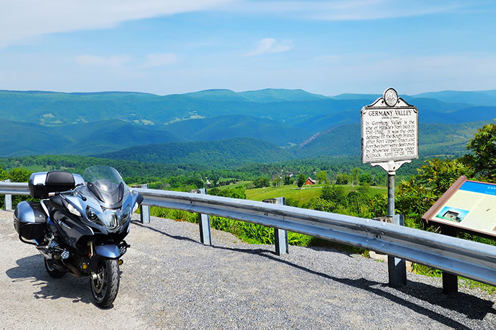
Next morning, I mounted my BMW R 1200 RT and joined routemeister Ed Conde for a well-planned 245‑­mile loop through the Allegheny Highlands. In morning fog, our group rode south on U.S. Route 250, then turned north on State Route 28 at Thornwood. The road was fantastically curvy, though a low‑­pressure warning for my rear tire was a cause for concern. After turning east on U.S. 33 at Judy Gap, we stopped at the Germany Valley scenic overlook, which was fogged in but had room for several bikes to safely pull off the road. I discovered a screw in the center of my tread, but the right tools – and folks willing to help – made for a quick repair.

Asphalt Heaven West Virginia backroads Scott A. Williams Spruce Knob
Stiff winds atop Spruce Knob forced these evergreens to grow leeward.

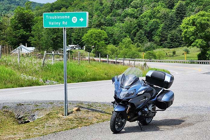
At Franklin, we turned north on U.S. 220. Just past Upper Tract, we continued north on Smoke Hole Road. This very narrow, winding two‑­way road has continuous blind corners, elevation changes, and no center line, with several curves signposted at 5 mph. In one curvy section, we had to get past a farmer whose tractor was pulling a trailer with implements sticking out the side. He pulled as far over as he could, and we squeezed by and acknowledged his effort. The pavement was not as smooth as most roads that day, but the adrenaline meter was pegged. Smoke Hole Road isn’t for the faint of heart.
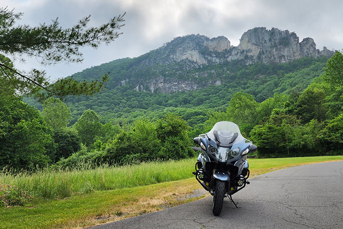
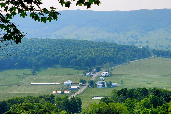
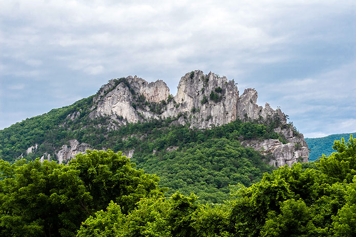
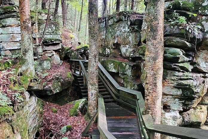
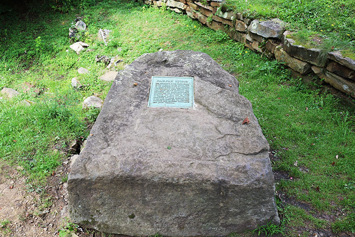
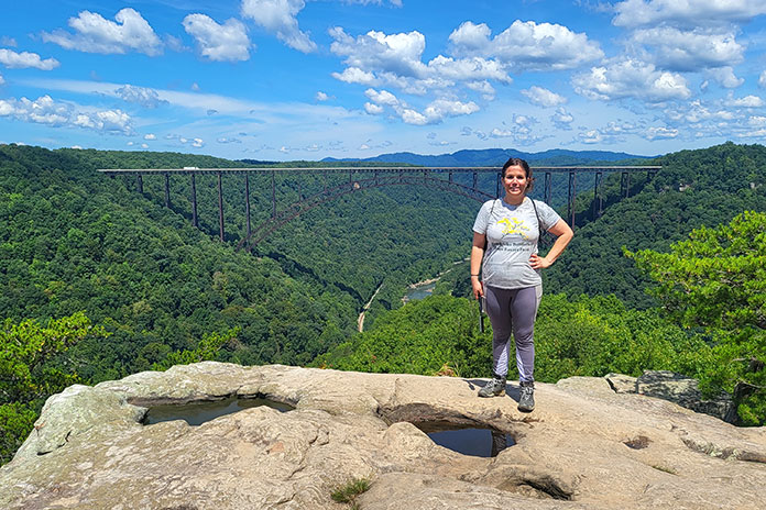
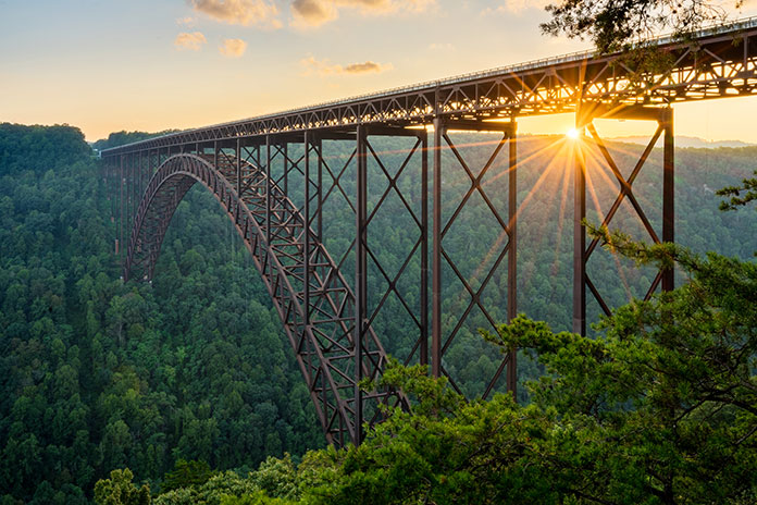
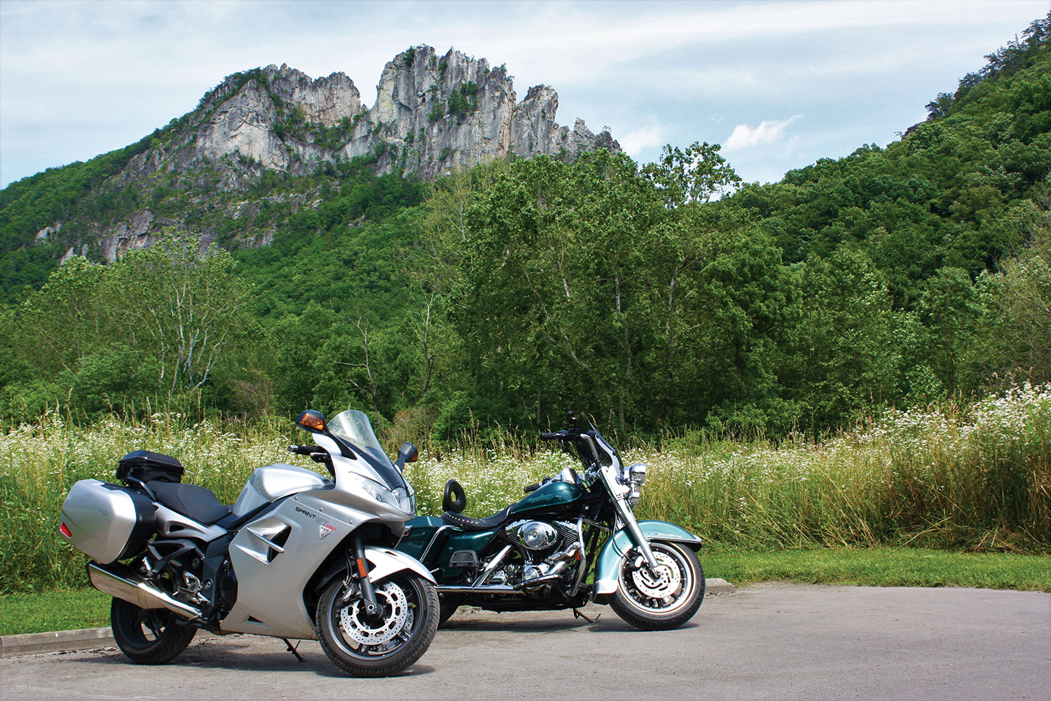
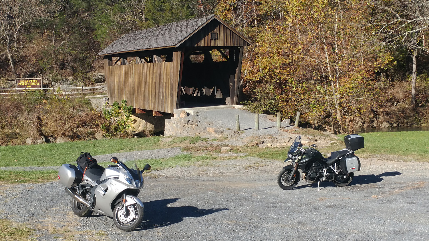
Asphalt Heaven West Virginia backroads Scott A. Williams
Located on U.S. 33 on the way to Franklin, this convenience store looked at home in West Virginia.

We rejoined SR‑­28 near Cabins and wound our way south along the North Fork South Branch Potomac River to Seneca Rocks, where ragged rock ridges reach skyward 900 feet. During World War II, American soldiers trained on these cliffs, and many applied the skills they learned to scale the cliffs of Normandy on D‑­Day. These days, the rocks are popular with climbers and photographers.

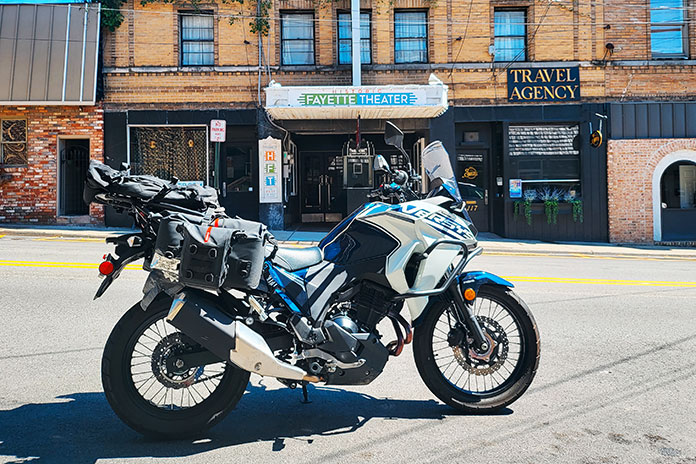
Our ride had been largely within the Monongahela National Forest, and we were back in the heart of it. We rode west on U.S. 33, north on SR‑­32, north on SR‑­72 (Dry Fork Road, another winding, single‑­lane gem), and east on U.S. 48, part of the Seneca Trail, to the hip little town of Thomas in Tucker County. At The Purple Fiddle, where “Live Music Lives,” our lunch break included a performance by a physician-musician who sang about a strained relationship with his one‑­eyed grandmother: “We don’t see eye‑­to‑­eye.”

Asphalt Heaven West Virginia backroads Scott A. Williams Spruce Knob
David Somers of Northfield, New Jersey, motored toward the summit of Spruce Knob along NF 104.

Lunch cravings satisfied, we rode north through Silver Lake and Aurora, over to Macomber, and down to Parsons. A growing part of West Virginia’s energy industry is powered by wind, and we encountered giant turbines spinning atop ridgelines. Later, riding south on deliciously winding U.S. 219, a wide‑­load pilot vehicle stopped all traffic so a tractor‑­trailer hauling a giant windmill blade could get through a section of tight turns. The impressive rig rolled by as we waited. The long blade had wheel‑­trucks attached directly to it, turning the blade into a trailer transporting itself. As the afternoon sunshine grew warmer, we eased back to Elkins.

Out of several local restaurants near the hotel, I picked C. J. Maggie’s and joined other riders for supper at the bar. Later, as we socialized on the hotel’s back patio, the mayor of Elkins, Jerry Marco, paid us a visit. Hizzoner was gracious and welcoming, genuinely pleased to have dozens of motorcyclists staying in his city.

Asphalt Heaven West Virginia backroads Scott A. Williams Elkins
Truth in advertising.

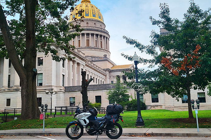
In the morning, I hit the road early and solo, with more twisties and high elevations being my key goals. As I pulled my bike up off the sidestand, I felt some soreness across my chest. Rowing the handlebars of a 630‑­lb sport‑­tourer at a quick pace over hundreds of miles of tight curves had proved a workout.

Aiming the RT east along winding U.S. 33, I made rapid progress toward Alpena, Harman, and Onego. Asphalt heaven, West Virginia repeated in my head as smooth, curvy blacktop unfolded like a roller coaster. It was worth the 600‑­mile ride from my home in western Massachusetts to ride these roads. And here’s some down‑­home irony: The primary author of John Denver’s hit “Take Me Home, Country Roads” is Bill Danoff, who revealed in an interview that the song was inspired by his upbringing…in western Massachusetts! Danoff felt the word “Massachusetts” didn’t sound musical, so he wrote the song about West Virginia.

Asphalt Heaven West Virginia backroads Scott A. Williams
A lay-by along NF 112 offered this midmorning vista toward Circleville.

I turned north on SR‑­28 for a view of Seneca Rocks, then back south to U.S. 33 and Briery Gap Road, where a right turn revealed a view of wickedly serpentine asphalt ahead. Time to apply those trackday lessons on body position.

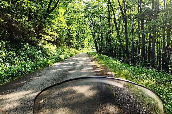
Farther on, a right onto National Forest 112 took me through a tunnel of trees. This road was fairly smooth, suitable for a spirited but reasonable pace. Sight distances were short, and at the crest of a blind rise, an oncoming car reminded me to be wary of oncoming traffic.

Asphalt Heaven West Virginia backroads Scott A. Williams
Zipping along NF 112 felt like being in a tunnel of trees.

A few switchbacks added excitement, but it was repeated deer sightings that quickened my pulse. A doe suddenly appeared in the road ahead, and I hit the binders. She trained her big ears on me and then looked behind. Moments later, a wobbly, spotted fawn appeared at her side. It was captivating to see two beautiful road hazards step effortlessly up a steep incline and vanish into the woods.

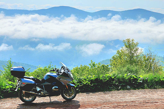
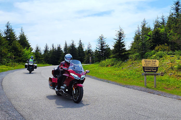
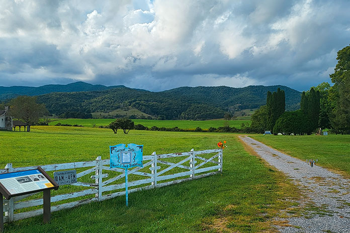
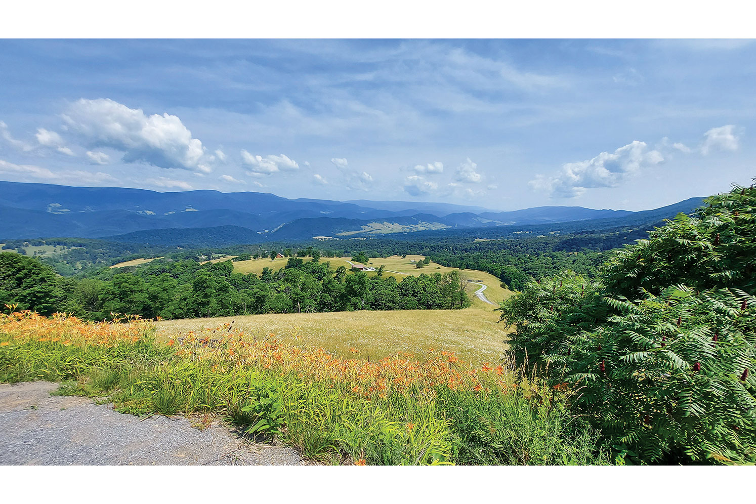
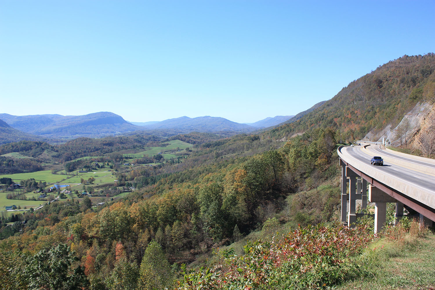
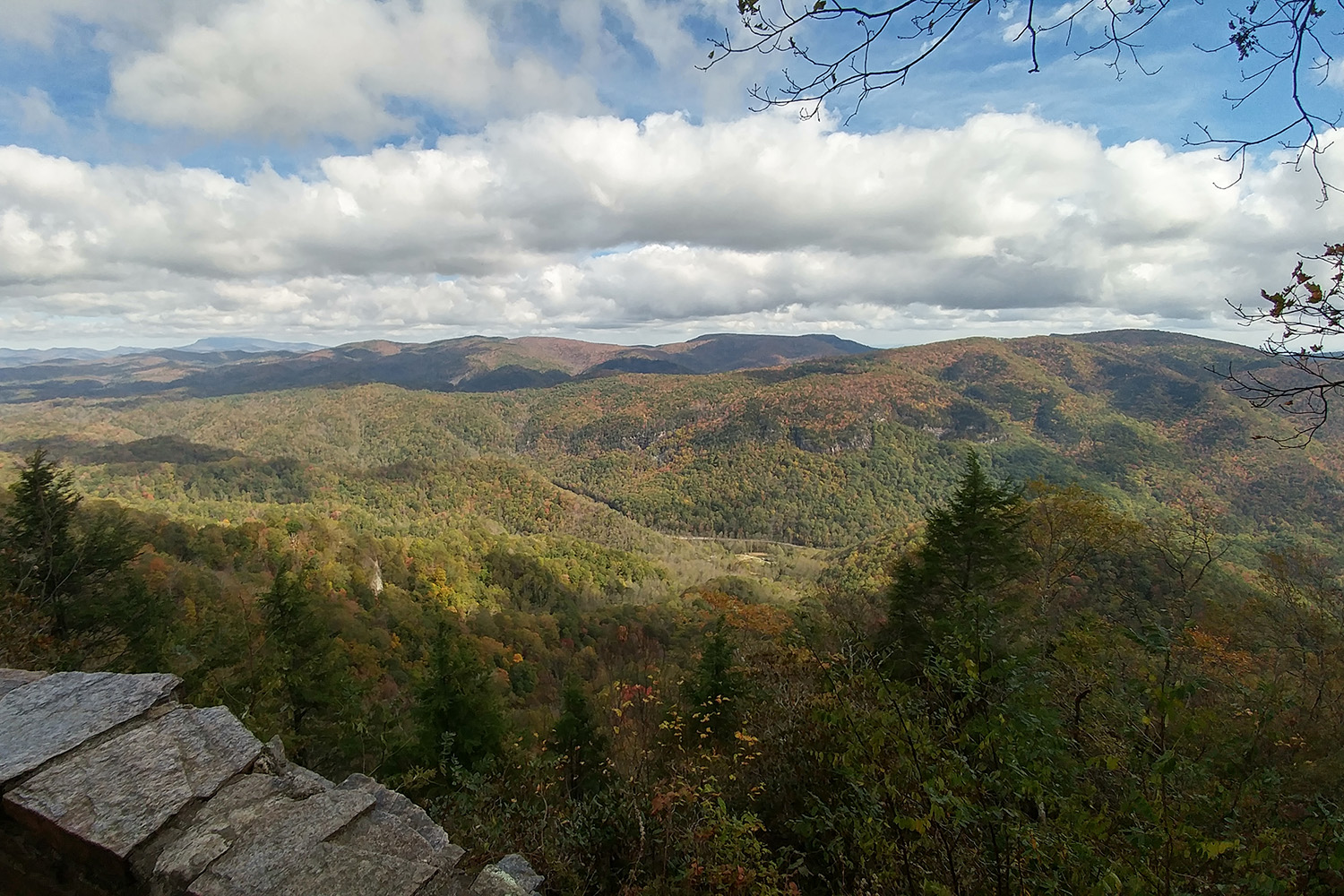
Turning right onto NF 104 took me to the summit of Spruce Knob. At 4,863 feet, it’s the highest ridge in the Allegheny Mountains and the highest point in West Virginia. On this clear day, the view from Spruce Knob was spectacular.

Asphalt Heaven West Virginia backroads Scott A. Williams Spruce Knob
Spectacular view from Spruce Knob, the highest point in West Virginia.

Reversing course, I again savored those wicked twisties descending Briery Gap Road. My ears popped as I reached U.S. 33, now 3,000 feet below the summit. I stopped again at Germany Valley, this time enjoying a fog‑­free view and no flat tire, then rode all the way to Brandywine in Pendleton County. I turned south on County Road 21 and rode past Sugar Grove Station, a National Security Agency communications site that reportedly intercepts all international communications entering the eastern U.S. Since I wasn’t expecting any illicit communiques that morning, I turned west to enjoy curvy Moyers Gap Road.

Asphalt Heaven West Virginia backroads Scott A. Williams Germany VAlley
With no fog and no flat tire, the view of Germany Valley was beautiful.

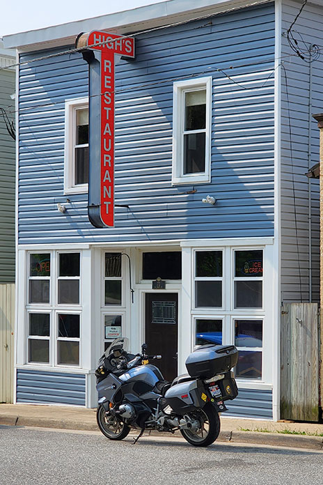
At U.S. 220, I turned south and briefly entered Virginia (what a young boy there called “regular Virginia”). At U.S. 250, I cut right and stopped in Monterey for a late lunch at High’s Restaurant. This venerable eatery now holds the distinction of serving me the best fish sandwich I’ve ever had: rainbow trout, sourced from a local creek, fileted and grilled to perfection, and piled on a brioche bun. “Delicious” can’t do it justice.

Asphalt Heaven West Virginia backroads Scott A. Williams
High’s Restaurant in Monterey, Virginia, is a great spot for lunch.

As I continued north and east on U.S. 250, I rode up and down ridges and leaning through a succession of tight curves that had me laughing inside my helmet. And it was clear the instant I crossed the state border and entered Pocahontas County: Virginia’s road surfaces are good, but West Virginia’s are superb. 

From Thornwood, the ride back to Elkins reversed the beginning of the previous day’s route. A fun road in the opposite direction was its own fun ride. Back at the hotel, I connected with other riders and walked downtown to another local eatery, Mama Mia Pie & Pasta. Over Italian entrees and local craft beers, we compared notes from our day’s riding.

Asphalt Heaven West Virginia backroads Scott A. Williams Spruce Knob
David Somers (foreground) and Mitch Pivor of Dover, New Hampshire, motored down from the summit of Spruce Knob along NF 104.

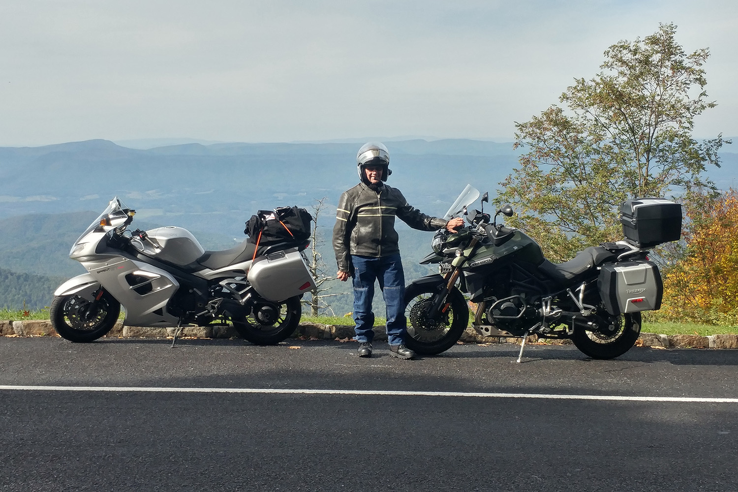
Morning presented another opportunity to ride glorious West Virginia asphalt, this time with my long‑­time riding partner Steve Efthyvoulou. Temps started cool, and the previous day’s crystal blue sky was now tarnished gray with smoke from massive wildfires in Canada. We went south on U.S. 250, a now‑­familiar route out of Elkins. Turning south on SR‑­28, we saw signs for the Green Bank Observatory, home of the world’s largest steerable radio telescope. Astronomy nerds will want to stop, but today we were observing asphalt, laid out before us in smooth, banked curves.

Asphalt Heaven West Virginia backroads Scott A. Williams
The view over Hightown, Virginia, from a lay-by along U.S. 250. Steve and I rode through that farm a few minutes later.

At SR‑­66 we turned west toward Snowshoe, one of West Virginia’s premier ski resorts. It was June, so the slopes were green, and we stopped for lunch at Kickin’ Chicken. Loaded with protein, we paralleled the Tygart Valley River on U.S. 219 north to Valley Head, where a left onto SR‑­15 set us up for an afternoon twist fest. The road presented often tricky curves to Webster Springs, where we picked up SR‑­20 for more fantastic curves. Flat light due to the wildfire haze softened the contrast between sun and shadow, improving visibility on these technically challenging roads.

Asphalt Heaven West Virginia backroads Scott A. Williams
Some roads just sound enticing. This one is off U.S. 33 near Oak Flat.

Near the West Virginia State Wildlife Center, we turned right onto Alexander Road. This narrow, curvy two‑­lane is full of tight corners and elevation changes, all the way to U.S. 250, where we turned north on a familiar route back to Elkins. Another amazing day was in the books. Though I had previously ridden through West Virginia several times on the way to other riding destinations, this was my first dedicated trip to ride the Mountain State – and I just scratched the surface. Without a doubt, there’s asphalt heaven on West Virginia backroads.

See all of Rider‘s touring stories here

West Virginia Backroads Resources

Sidebar: Why are West Virginia Backroads So Good?

Randy Damron, a liaison between West Virginia’s departments of Transportation and Tourism, clued me in. Damron rides a Honda Gold Wing and a Kawasaki KLR, so he understands the motorcycling community. He explained that the improved quality of the state’s roads in recent years owes much to “Roads to Prosperity,” a road construction and maintenance initiative to support West Virginia residents, industry, and tourism.

Transportation and Tourism partnered to create four West Virginia Mountain Rides (with more on the way) that are in excellent condition, have good shoulders and guardrails, and run through beautiful scenery. The Seneca Skyway, for example, is a signposted 300-mile loop that includes several roads covered in this story. Go to the West Virginia Department of Tourism website and click on “Road Trips” to learn more.

And check out Episode 150 of the West Virginia on the DOT podcast, where Damron and co-host Jennifer Dooley had me on the show. Visit the West Virginia Department of Transportation website to listen.

The post Asphalt Heaven: Riding West Virginia Backroads appeared first on Rider Magazine.

Source: RiderMagazine.com

Lessons Learned on a Wandering West Virginia Motorcycle Ride

West Virginia Motorcycle Ride Kanawha Falls State Park Kawasaki Versys-X 300
My campsite at Kanawha Falls State Park on my West Virginia motorcycle ride.

We all have beliefs about what’s expected of a motorcycle camper, and sometimes it takes a certain situation to bring those expectations to the surface. For me, it took heavy rain on a mountain road during a West Virginia motorcycle ride to point out my principles on motorcycle travel and what type of person I thought I needed to be to do it. 

A Beautiful Beginning

Everything was going according to plan. I was on a solo motorcycle camping trip across central West Virginia along the Midland Trail National Scenic Byway (U.S. Route 60), and I spent my first night at the Kanawha State Forest campground. My campsite was pleasantly remote and on top of a bridge that crossed a scenic running creek. Waking up to the sound of gently flowing water was an energizing start to what would be an amazing day – or so I thought.

West Virginia Motorcycle Ride

Scan QR code above or click here to view the route on REVER

I packed up my gear and headed into Charleston for an early lunch. I chose Adelphia Sports Bar & Grille in the historic downtown area and enjoyed the best dish I’ve eaten on any of my dozen or so motorcycle camping trips to date: gyro macaroni and cheese, perfectly spiced gyro meat atop pasta shells and a creamy, cheesy sauce. I was in heaven.

West Virginia Motorcycle Ride Adelphia Sports Bar & Grille Charleston
I had never seen a gyro mac and cheese dish offered anywhere before I ordered it at Adelphia Sports Bar & Grille in Charleston, and it turned out to be one of the most comforting dishes I’ve had.

The First Rainstorm

Having thoroughly enjoyed my meal, I took off along the curvy Route 60 on my way to Lewisburg. Along the way, it started to drizzle, but my waterproof gear was doing its job. Then the rain intensified from a drizzle to a shower and eventually a torrential downpour. The road became curvier, with switchbacks and hairpins that would have been delightful on dry pavement but were treacherous when wet. Not trusting my tires as sheets of water ran across the corners, I was stiff and tense. Having nowhere to stop for cover, I had no choice but to press on.

West Virginia Motorcycle Ride Kanawha Falls State Park
Kanawha Falls State Park has campsites in a serene landscape covered in soft moss, which muffled surrounding noises and created a feeling of complete solitude.

Seeking relief, I consulted the navigation app on my phone and found a shortcut. To my dismay, the shortcut turned out to be a one‑­lane road with no shoulder – my least favorite type of road – and was no less treacherous in terms of cornering. I accidentally took a wrong turn onto a deserted side road, and then the navigation rerouted me to a sharp, steep downhill left turn that would lead to another side route. I froze, uncomfortable with such a tight turn on wet ground.

Deciding that I should go back to Route 60, which at least had lane lines and a shoulder, I suddenly noticed two giant German shepherds nearby, glaring and growling at me. As they both started running toward me, I quickly accelerated and turned down that steep incline to get out of there faster than they could run. That’s one way to initiate a turn you don’t want to take. 

I continued on the narrow, curvy road. My nerves were frayed by this point, and I even had a desperate thought that I should pull over and call my husband to come get me – a ridiculous notion, given that I was nearly eight hours away from home.

I finally made it through the not‑­so‑­shortcut and back onto Route 60, bitter that I could have just stayed on it the whole time. I started seeing signs for Lewisburg and have never been so relieved as when I pulled into Hill & Holler, the pizza place I had programmed into my phone. 

Carbohydrate Therapy

After taking off my soaking wet gear and ordering a 12‑­inch pizza all for myself, I settled in and let my frazzled nerves relax. I wasn’t sure what to do next. My reserved campsite was still an hour away – also along mountain roads. This time, the roads were ones that I had never ridden before, and on the map, they looked as curvy as where I had just been.

Deep down, I wanted to get a hotel. The thought of riding another hour or two in unrelenting heavy rain and setting up a soggy campsite sounded downright miserable. I messaged my husband and some of my riding friends; he supported the hotel idea, but they encouraged me to press on. They said it would be worth it, that I could do it, that there was no giving up or turning back. I felt guilty for thinking about giving up and getting a hotel, even though I knew it was the safest thing to do.

West Virginia Motorcycle Ride Charleston Kawasaki Versys-X 300
Charleston, West Virginia’s capital that’s bisected by the Kanawha River, has a charming historic downtown district.

Never one to back down from a challenge, I decided to continue, leaving the pizza place after cleaning up the massive puddles my dripping gear had left on their floor. Once outside, I discovered it was raining even harder. I hopped on and rode to the nearest gas station to fill up, and as my visor fogged up completely, I decided enough was enough. I found a hotel less than half a mile down the street and checked in. After carrying my luggage up the stairs and stripping off my water‑­logged gear, I collapsed onto the bed. 

At this point, I felt terrible about myself and my decision. I had given up, taken the easy way out, let down myself and everyone who was cheering me on. I realized I had high expectations of myself as a motorcycle camper – that I should be tough and resilient, but instead I was a wuss. Other female moto campers I had seen on social media portrayed themselves as “hardcore” as they slept sitting up or spent the night under a bridge. Why couldn’t I make it through a little rain?

After a hot shower and some takeout, I started feeling better about my decision. Staying in a hotel allowed me to regroup and relax, and it was nice to drift off to sleep in a dry, comfortable bed. 

Bears and Boulders on a West Virginia Motorcycle Ride

West Virginia Motorcycle Ride Seneca Rocks
Seneca Rocks is popular among visitors and rock climbers from all over. (Photo by Edward Bodnar – stock.adobe.com)

The next day, I awoke to sunny skies and headed north on U.S. Route 219, also known as the Seneca Trail and part of the Seneca Skyway loop route. The ride was thrilling. For a while, I forgot I was on my Kawasaki Versys‑­X 300 adventure bike since it was handling the curves like my Ninja 400.

After a thoroughly enjoyable half‑­hour of riding, I dropped my kickstand at Beartown State Park, a must‑­stop for an avid hiker like me. Beartown has one of the most unique hiking trails I’ve ever experienced, a half‑­mile stroll on wooden boardwalks that wind through imposing rock formations on all sides. I was one of the only people there, so walking through this “town” of large boulders was quiet, a little eerie, and the perfect reward after the trials I’d been through the previous day.

West Virginia Motorcycle Ride Beartown State Park
Beartown State Park was named because the pioneers thought it resembled a town for bears since the rocks are roughly the size and shape of buildings.

Route 219 took me all the way north to Elkins, a charming historic town that serves as the seat of Randolph County. Elkins was a coal and timber town in the late 19th and early 20th centuries. Its revitalized downtown has restaurants, bars, shops, lodging, and museums centered around the restored Elkins Depot, where you can take a scenic train ride on the Durban & Greenbrier Valley Railroad. Scottie’s of Elkins, full of locals and serving hearty, delicious comfort food, was the perfect place for lunch.

West Virginia Motorcycle Ride Elkins
West Virginia certainly lives up to its nickname, The Mountain State. Tucked between the rolling Appalachian peaks are cozy burgs like Elkins, which are great places to stay, eat, and enjoy other off-bike activities.

Riding east out of Elkins, U.S. Route 33 follows a winding path up and over the Allegheny Mountains, crossing several rivers along the way to Seneca Rocks, a scenic rock formation that’s popular among climbers. I stayed on Route 33 to Judy Gap, where I continued south on State Route 28, enjoying curves and sunshine all the way to Watoga State Park. 

After setting up my campsite, I walked to the bathhouse and was stopped by a man in his 70s who was in better shape than I am. He yelled out from across the yard, “Are you the biker lady?” I laughed and responded, “Yes sir, that’s me.”

He asked where I had come from and where I was going. When I mentioned I had planned to spend the previous night here but stayed in a hotel instead because of the rain, he exclaimed, “Oh, you sissy!” I was taken aback and momentarily hurt until he laughed and followed his insult with the remark, “Yea right. I’ve never even seen a female on a solo motorcycle trip here in 17 years of being a camp host.”

Point taken: I couldn’t possibly be a sissy given what I was out here doing. This realization and the external validation were a relief. 

West Virginia Motorcycle Ride Elkins Depot
Elkins Depot has a welcome center with information about the area. You can also board a train for a different sort of scenic ride through the mountains.

Return to Route 39 and Motorcycle Camaraderie

Rain started again in the evening, and while it had stopped by morning, my tent and tarp were still wet when I packed them up. My final campground of the trip was at Beech Fork State Park, but I had a few stops I wanted to make along the way. Plus, I wanted to ride State Route 39, which was the other reason I had come to this area – a man on a previous trip had given me a coin and pin commemorating this road (see “Along the Midland Trail: A West Virginia Motorcycle Trip”), but I didn’t get a chance to ride it at that time.

West Virginia Motorcycle Ride Seneca Trail
The landscape of the Seneca Trail (U.S. Route 219) is a remarkable mixture of rolling hills and mountains.

For this trip, I had taken a laissez‑­faire approach to planning: Pick a few destinations and the routes in between them and see what happens. This was different from my usual meticulous planning, and I ended up missing out on a few opportunities. I assumed that Route 39 would be a curvy road through towns and countryside like Route 60, but it runs through a national forest, isn’t particularly curvy, and has plenty of tourist stops along the way. Trying to beat the oncoming rain and knowing I had limited time to get to my next campsite, I didn’t stop at any of them, which I regret. 

I continued south on U.S. Route 19 back to Route 60 when I got stuck in yet another rainstorm, this time on a four‑­lane highway. Given the recent relinquishing of my harsh, self‑­imposed rules about pressing on in misery, it was an easy decision to stop in Fayetteville at Water Stone Outdoors – a befitting name for my situation.

West Virginia Motorcycle Ride Kawasaki Versys-X 300
My Kawasaki Versys-X 300 handled well in the rain, but I still felt tense and nervous on steep, winding roads.

The store had a cafe inside, and my weather app said the rain would pass in about an hour, so I settled in with a warm and comforting chai latte while perusing their clothing options, again dripping puddles all over the floor. 

A local woman approached me and said they didn’t see many motorcycle travelers around there. She asked if I was alone. When I replied that I was, she gave me a fist bump and said, “Wow, so you’re a badass!”

This woman didn’t know that I had stayed in a hotel to escape the rain nor did she care that I had ducked into a cafe to do it again. She just knew I was out here traveling on a bike, and that was enough in her book. It should be enough in my book as well. 

As the sun peeked out of the clouds and the rain stopped, I headed to Beech Fork State Park. On previous trips, I had gone to one homebase campground and then branched out on day trips from there. This time, I had planned an actual tour where I stopped at a new place each night and packed up camp in the morning.

West Virginia Motorcycle Ride Kawasaki Versys-X 300 Beech Fork Lake
My campsite at Beech Fork Lake was a beautiful retreat.

I found this to be exhausting, even with my hotel stay in the middle of it. After packing up my kit at Watoga, I had thought briefly about pushing through and riding the eight hours home just so I wouldn’t have to set up camp again. But I reminded myself that camping was half the reason I was on the trip and I would enjoy it once I was there, feeling the weight of my beloved camp equipment in my hands as I unpacked it. And for once, the weather looked clear for the next two days. 

Related: Motorcycle Camping Tips…From the Backyard?

I arrived at Beech Fork State Park and found a perfect campsite with a stunning view of a lake. I set up camp and enjoyed the quiet solitude until I heard the familiar sound of a motorcycle exhaust. A large BMW adventure bike loaded up with gear and piloted by a man in matching textile apparel pulled around the circle in front of my campsite.

“I heard there was another motorcyclist in the campground,” he said through his helmet. “I thought I might stop by and say hello.”

We chatted briefly about where we were from and where we were headed. “You’re the only other traveling motorcyclist I’ve talked to on one of my trips,” he told me, and I indicated that he was the same. I was reminded of my recent realizations thanks to the camp host at Watoga and the woman at Water Stone Outdoors. They had both taught me that being out on a bike was enough, regardless of whether you’re traveling across the world or just across a state, roughing it every night in the backcountry or sleeping in a campground with amenities, braving the elements or enjoying warm and safe shelter indoors.

Looking at this fellow adventurer, knowing we were both rare individuals among travelers, sealed the deal that my expectations of myself as a moto camper were unfair and unrealistic. I shrugged off the unnecessary emotional weight right there on the shore of Beech Fork Lake.

West Virginia Motorcycle Ride Beech Fork Lake
The sun rising above the mist on Beech Fork Lake was the perfect send-off on my final day in West Virginia.

If you need permission to ditch staunch expectations about what type of person you should be to travel on your motorcycle, take it from me: You are enough, just as you are.

See all of Rider‘s touring stories here.

West Virginia Motorcycle Ride Resources

The post Lessons Learned on a Wandering West Virginia Motorcycle Ride appeared first on Rider Magazine.

Source: RiderMagazine.com

An Appalachians Motorcycle Ride Through Scenery and History | Favorite Ride

Appalachians Motorcycle Ride

In late October, an Appalachians motorcycle ride is a gamble. Weather is the house, and over time, the house usually wins. But once in a while, lady luck is on your side, as she was when a college friend and I gambled on one last ride before the riding season ended, taking a 460-mile loop through the Allegheny Mountains of West Virginia, Maryland, and Pennsylvania, including a section of the historic Lincoln Highway and a visit to Gettysburg.

Appalachians Motorcycle Ride

Scan QR code above or click here to view the route on REVER

From my home in Manassas, Virginia, we headed west on Interstate 66 toward Front Royal under clear blue skies with temperatures in the mid-60s. My leather jacket was perfect for these conditions because my Triumph Sprint GT’s sporty fairing offers only modest wind protection.

After a brief jaunt on Interstate 81, we continued west on U.S. Route 48 into West Virginia, where we enjoyed highway cruising speeds through mountains blanketed with foliage in various hues of yellow, orange, red, and brown.

See all of Rider‘s Southeast U.S. touring stories here.

We made quick time to Baker, where Route 48’s four lanes become two. At Thomas, we turned north on U.S. Route 219, dialed up some throttle, and weaved through the highlands briefly before stopping at the remote Fairfax Stone. The Fairfax Stone, originally placed in 1746, once marked the boundary of land granted to Lord Fairfax. The weather can be unpredictable in the mountains, but our luck held. The wind and the rustle of falling leaves brought a sense of solitude and calm to the area.

Appalachians Motorcycle Ride Fairfax Stone
The Fairfax Stone is tucked away in the highlands near the West Virginia-Maryland border. (Photo by Antony-22 via Wikimedia Commons)

Continuing north on Route 219, we entered Maryland and enjoyed more mountain views, including a ridge lined with big wind turbines. Just outside of Oakland, we turned east on State Route 135 towards Westernport. This part of western Maryland, just south of the Savage River State Forest, in and out of valleys and up and over mountains, felt more remote than any other area we rode through. Occasionally, where the trees had shed their leaves, we caught glimpses of the valley below as we ascended a mountain.

Appalachians Motorcycle Ride
Somewhere outside of Gettysburg, we made a brief stop to enjoy the sights and sounds of one last ride before Old Man Winter arrived.

From Westernport, we took State Route 36 north toward Frostburg, where we hopped on Interstate 68 east for about 12 miles to the exit for U.S. Route 220. We continued north and soon crossed into Pennsylvania, and after about 25 mostly straight miles, we arrived in Bedford, where we picked up U.S. Route 30 and saw the first red, white, and blue sign with a large “L” designating the Lincoln Highway.

Dedicated in 1913, the Lincoln Highway was America’s first transcontinental road for automobiles – and motorcycles! It spanned 3,000 miles and connected New York to San Francisco by way of Philadelphia, Pittsburgh, Chicago, Omaha, Cheyenne, and Salt Lake City.

Appalachians Motorcycle Ride Lincoln Highway
One of the historic markers for the Lincoln Highway. (Photo by MichaelVi – stock.adobe.com)

One of the many historic sites along the Lincoln Highway is The Coffee Pot, an 18-foot-tall building shaped like a coffee pot that was built in 1927 in Bedford, Pennsylvania, and once housed a small restaurant. A few miles west of Bedford, at the crest of one of the rolling hills that ebb and flow through bucolic pastures, the neon sign of the Lincoln Motor Court beckoned us to step back in time.

Appalachians Motorcycle Ride Lincoln Motor Court
My cottage at the Lincoln Motor Court, located just east of Schellsburg on Route 30, was a time machine back to the 1940s.

Built in the 1940s and laid out in the shape of a U, the motor court’s 12 single-room cottages offer more than just a place to rest for the night. The wood paneling, kerosene wall heaters, and period decor transported us back to the days before interstate highways.

Appalachians Motorcycle Ride Coffee Pot Bedford Pennsylvania Lincoln Highway
The Coffee Pot in Bedford, Pennsylvania, once served as a lunch stand along the Lincoln Highway but now rests in the nearby fairgrounds. (Photo by Jeff Kubina via Wikimedia Commons)

With autumn daylight burning away, we hopped back on the bikes and cruised over to Schellsburg for dinner at Judy’s Place (a recommendation from the motel owner), where our bet on wings and a plate of crabby fries paid off. When we returned to the motor court, there was a fire crackling in the fire pit. It doesn’t get much better than sitting in the glow of a fire and trading riding stories over beers.

A crisp autumn day with clear skies welcomed us the next morning. As we cruised east on the Lincoln Highway toward Gettysburg, we tried to imagine what the road was like in its early days. It was once promoted as a way to get from New York City to San Francisco by automobile for the 1915 Panama-Pacific International Exhibition. Completing the full route took weeks back then.

Appalachians Motorcycle Ride Gettysburg
View of the Gettysburg battlefield facing west.

We were less concerned about getting to a destination than getting away, as the Lincoln Highway offers a nice reprieve from the nearby Pennsylvania Turnpike (Interstate 76). There’s less traffic and noise and more scenery – a ribbon of highway that rolls through beautiful Pennsylvania farm country and crests at numerous ridgelines.

Appalachians Motorcycle Ride Gettysburg National Military Park
The Gettysburg National Military Park is surrounded by memorials and markers. In our limited time, we were only able to visit a few. (Photo by Refocus Photography – stock.adobe.com)

In Gettysburg, we had a bite to eat at the Lincoln Diner and browsed at The Union Drummer Boy, a shop that sells Civil War artifacts. Then we cruised through the historic downtown and over to the Gettysburg National Military Park. We climbed to the upper level of the Pennsylvania State Memorial, which offers sweeping views of the hallowed ground where the Battle of Gettysburg was fought in 1863. For anyone who appreciates American history, a visit to Gettysburg is highly recommended.

Appalachians Motorcycle Ride Pennsylvania State Memorial Gettysburg
The Pennsylvania State Memorial is the largest monument on the Gettysburg battlefield, and it offers panoramic views from the upper level. (Photo by imagoDens – stock.adobe.com

Late in the day, my friend and I parted ways. He headed back to Philadelphia, and I turned south toward Virginia. With one last ride in the books before the onset of winter, we walked away from the table as winners.

See all of Rider‘s touring stories here.

The post An Appalachians Motorcycle Ride Through Scenery and History | Favorite Ride first appeared on Rider Magazine.
Source: RiderMagazine.com

Along the Midland Trail: A West Virginia Motorcycle Trip

West Virginia Motorcycle trip Babcock State Park
Babcock State Park, not far from New River Gorge, includes a lushly wooded campground with lots of shade.

Inspiration for a motorcycle trip can come from many avenues – perhaps by word of mouth about legendary riding destinations like the Tail of the Dragon or seeing iconic locations like national parks on television or in movies. Inspiration for this West Virginia motorcycle trip – including riding part of the Midland Trail – was internal; I wanted to challenge myself and get out of my comfort zone. But before I departed, I felt anxious.

Why the Hesitation to Take a West Virginia Motorcycle Trip?

I had been on previous solo moto camping trips, but a trip to central West Virginia from my home in northern Kentucky would be my longest trip, the farthest from home, and in a state I had never ridden. Doubts and insecurities were plaguing me, as I was still relatively new to motorcycle camping and riding long distances. I had also been raised in a town where women didn’t travel alone, and certainly not on a motorcycle. I couldn’t help but wonder if I was getting myself in over my head with a trip this ambitious.

While I yearned to travel to the New River Gorge area and ride the Midland Trail along U.S. Route 60, fear was holding me back. That is, until my husband encouragingly asked me, “You really want to go, don’t you?” When my answer was a sincere and wholehearted “Yes,” it was clear to both of us what I needed to do.

I decided to go the next weekend – I practically had the whole route planned already anyway – and began packing.

West Virginia Motorcycle trip

Scan QR code above or click here to view the route on REVER

An Unlikely Guide in Maysville, Kentucky

After heading out from my house in northern Kentucky with a full pack on my Kawasaki Versys-X 300, my first stop was Maysville, Kentucky. I wasn’t expecting the quaint, darling downtown with perfectly painted old brick buildings and well-maintained streets. Nor was I expecting the restaurant I chose online to be temporarily closed. Struggling to balance my helmet and gear while I looked for another restaurant on my phone, a man approached me with his small dog and asked if I needed help.

West Virginia Motorcycle trip
The author prepares for her West Virginia motorcycle trip.

Related: 2018 BMW G 310 GS vs. Kawasaki Versys-X 300 vs. Royal Enfield Himalayan | Comparison Review

After telling him of my plight, he eagerly offered to show me to “the best restaurant in Maysville” and escorted me down the street a couple of blocks, sharing history about the town as the three of us strolled. Delite’s Downtown had an antique sign befitting the diner’s ’60s-era interior decor, and you could tell it was all original. I ordered biscuits and gravy – a road trip favorite of mine – and while I couldn’t judge if it was indeed the best restaurant in town, I left satisfied.

A Sign from Strangers

West Virginia Motorcycle trip Huntington
Downtown Huntington, West Virginia (Photo by Sherman Cahal/Adobe Stock)

After a few hours of riding with only a stop for gas, I was relieved to arrive at a German restaurant in Huntington, West Virginia, called Bahnhof WVrsthaus & Biergarten. Stretching my legs as I walked into the restaurant, I was enthralled with the indoor/outdoor multiple-story dining area and the atmosphere of the place. I ordered the currywurst topped with a sweet raisin chutney and a side of buttery herbed spaetzle.

Get travel, lodging, dining, and other info about Huntington, West Virginia, here.

The food was delicious, but the real star of the experience was a rowdy group of men and a woman sitting at the bar. Their lively exchanges were impossible not to overhear, and they soon struck up a conversation with me.

West Virginia Motorcycle trip Bahnhof WVrsthaus & Biergarten Huntington
Bahnhof WVrsthaus & Biergarten’s indoor/outdoor seating in Huntington was as unique as their gourmet house-made sausages.

They asked the usual questions – “Where are you from?” and “Where are you going?” – and when they heard I was headed to New River Gorge, they yelled out in unison, “Fayetteville!” All three began talking at the same time, gushing over the food, drinks, views, and roads in that area. I was able to make out “Kanawha Falls” and “Gauley Bridge,” two places I planned on visiting, as well as “hairpin turns” – that’s all I needed to hear. I felt a rush of encouragement, having received a clear sign that I was headed in the right direction for a great trip.

Riding the Midland Trail

As I left Charleston, I was right where I wanted to be – at the mouth of U.S. Route 60, also known as the Midland Trail National Scenic Byway. Route 60 runs from Kenova, near the Kentucky border, clear across West Virginia and east to the Virginia border. Offering a mix of mountain terrain, low-speed cruising through small towns, and rolling countryside, it’s a favorite motorcycle ride in West Virginia.

West Virginia Motorcycle trip Fayetteville
Fayetteville is a gem of the New River Gorge area, complete with its own small theater.

See all of Rider‘s West Virginia touring stories here.

The route started out with easy, flowing curves, but once in the mountains, it was exhilarating hairpin after thrilling switchback for miles on end. After scraping my peg on a decreasing-radius right turn, I put more care into my body positioning and slowed it down a little. The turns rivaled some of my favorite curvy roads in the Great Smoky Mountains of Tennessee. 

Pulling up to my campground at Babcock State Park, I was welcomed with a clean, pretty campsite not far from the bathhouse and some perfect trees from which to hang my hammock. I was exhausted after a full day of riding – the most miles I had ever ridden in one day – and it showed. I struggled to set up camp and prepare some dehydrated food for dinner. Fatigue is a serious concern on motorcycle trips, and I was relieved that I was safely at my home away from home.

West Virginia Motorcycle trip Babcock State Park
While camping at Babcock, I was able to wake up to this delightful view every morning.

An Ethereal Glow and a Famous Bridge

Waking up to a lovely view of my bike from my open tent, I was looking forward to eating some real food. I made my first stop at the Cathedral Cafe & Book Store in Fayetteville. A converted old church, it still has the gorgeous stained-glass windows intact, which glowed ethereal colors on the inside with the sunlight shining through. A breakfast of croissant French toast and locally made chorizo hit the spot, and I was ready to hit the hiking trails.

West Virginia Motorcycle trip Cathedral Cafe Fayetteville Midland Trail
Of all the manmade constructions in the Midland Trail area, these stained-glass windows at Cathedral Cafe were the most stunning.

I hadn’t done much planning in terms of the trails I wanted to hike, so I stopped at the New River Gorge National Park & Preserve Welcome Center. It has an overlook of the New River Gorge Bridge, so I unexpectedly caught my first glimpse of its expansive form. Once inside the building, the friendly state park ranger suggested I head to Long Point Trail for the best view of the bridge, so I set out with their map, kindly marked up with my route.

West Virginia Motorcycle trip Long Point Trail New River Gorge Bridge
The beginning of the Long Point Trail, which leads to the top of a cliff near the New River Gorge Bridge.

The Long Point Trail was a fine, moderately difficult hike, but the magic was at the top of the overlook. Sheer cliffs dropped off dramatically on all sides, while miles of forest extended out into the distance. The woods were only interrupted by the 3,030-foot-long, 876-foot-high New River Gorge Bridge, at one time the highest bridge in the country and still the highest east of the Mississippi. I once stood on the top of the 75-foot-tall Natural Bridge at the Red River Gorge in Kentucky, but this was even more magnificent.

There were two unspoken rules at the top: First, you take a picture for the next person in line on the edge of the cliff in front of the bridge, and second, no one puts anyone else in danger. When visiting treacherous natural wonders, I’m always amazed that people have so much trust in everyone around them – and themselves – to not fall off. After the photo exchange, I sat down on a rock near one side of the cliff and enjoyed a leisurely bagged lunch.

West Virginia Motorcycle trip New River Gorge Bridge
Standing mere inches away from the edge with the New River Gorge Bridge in the background.

More Exploration on My West Virginia Motorcycle Trip

Before heading to the attractions recommended to me the day before, I crossed the New River Gorge Bridge. I was able to steal some glances over the guardrail of the four-lane highway and was rewarded with views of the forest stretching as far as I could see and the winding New River hundreds of feet below me.

West Virginia Motorcycle trip New River Gorge Bridge
The New River Gorge Bridge towers 876 feet above the rushing waters below. It’s possible to ride on top of the bridge as well as on a road below it. (Photo by steheap/Adobe Stock)

Back on Route 60, I saw the sign for Kanawha Falls and pulled off. It is an impressively wide waterfall, as it spans the entire width of the Kanawha River. The viewing area is a bit far from the falls, so I felt disconnected from the powerful water. Cathedral Falls, just down the road, is much closer to the viewing area and is staggeringly tall, but the parking lot was so busy that I couldn’t pull over to get a closer look; I only caught glimpses as I rode past. Gauley Bridge also ran right alongside the road but was a little lackluster after viewing the New River Gorge Bridge.

Learn more about Logan County, West Virginia, and the Hatfield-McCoy Region here.

An Unlikely Riding Partner

It was getting late in the day, and I still wanted to visit Lewisburg. I left Gauley Bridge and headed out, feeling some anxiety about making it back to my campsite before nightfall. I was not looking forward to traversing mountainous roadways after dark, but I pressed on nonetheless.

West Virginia Motorcycle trip Kanawha Falls Midland Trail Gauley Bridge
Kanawha Falls, the largest waterfall in West Virginia, roars alongside the Midland Trail near Gauley Bridge.

Another rider on a large adventure bike, loaded down with hard cases, turned onto Route 60 behind me. It was fun to ride “together” for the rest of the way to Lewisburg. I zipped around curves through gorgeous scenery with this unknown motorcycle tourer. When I pulled into a parking spot just inside Lewisburg’s downtown strip, he gave me a wave over his shoulder as he passed. There’s nothing like the camaraderie of a fellow rider, especially when they’re also clearly on their own unique adventure.

See all of Rider‘s Southeast U.S. touring stories here.

The Unexpected Gift

After eating an overpriced (but still delicious) plate of lasagna at The Humble Tomato, an upscale-but-casual Italian restaurant right on the strip, I decided to walk downtown for a bit before heading back. I stopped in the Lewisburg Welcome Center to see if they had any worthy souvenirs and was greeted by a friendly older man. He was shocked, as many people are, to find a young woman on a solo motorcycle trip, and he had plenty of questions. After I purchased a few stickers, he began fumbling around the cash register and counter, mumbling that he had something special for me.

West Virginia Motorcycle trip Lewisburg
The quaint strip of downtown shops and restaurants along the main road in Lewisburg.

After a few awkward minutes, he finally found what he was looking for – a Route 39 pin and coin – and handed them over proudly. “I give these to all the Harley guys,” he said with a chuckle. I pocketed the trinkets, a little embarrassed as I hadn’t actually ridden Route 39 on my trip but thanked him nevertheless. Then I saddled up and headed back to my campsite at Babcock State Park.

A Unique Blend of Scenery

Having been distracted earlier by my adventure rider buddy on the way to Lewisburg, I had zipped past the beauty of the countryside along that section of the Midland Trail. On my return ride, it was the magical “golden hour,” and the scenery was lit with a warm glow. It was like a charming blend of scenery back home – the green rolling hills of eastern Kentucky rural farmland punctuated with the mountainous terrain and sharp corners of the Great Smoky Mountains of Tennessee.

Riding on the gentle slopes and curves of hills as green as a jewel, I could see Appalachian ridges seemingly on all sides. Peaks would loom straight ahead in the distance, growing closer and closer until I was on them, climbing switchbacks, only to descend minutes later and then do it again. It was a dream ride.

Get a free Southern West Virginia Motorcycle Ride Guide here.

Returning Home from My West Virginia Motorcycle Trip

After a pleasant night at my campsite sitting by a roaring fire, I woke up and began grudgingly preparing for my return home. There was so much I didn’t get a chance to see.

I hopped on the highway for a quicker return trip, and while I wasn’t planning on stopping in Charleston, the view of the 23-karat gold-leaf gilded top of the Capitol, with a dome 5 feet higher than the U.S. Capitol, lured me in.

My last stop was the Griffith & Feil Drug and Soda Fountain in Kenova, West Virginia, literally the last exit before the Kentucky border. I enjoyed the bright and colorful neon lights inside and ordered a root beer float – the absolute best I’ve ever had, with unbelievably creamy vanilla ice cream and fizzy, sweet-and-spicy soda. 

West Virginia Motorcycle trip Kenova Griffith and Feil Drug and Soda Fountain
I enjoyed a root beer float in Kenova at a soda fountain reminiscent of the past.

Plans for the Future

While returning my wallet to my motorcycle jacket after paying for my treat, my fingers brushed against a metal object – the Route 39 coin the kind man in Lewisburg had given me the day before. Not only had I survived the trip I had been nervous about taking in the first place, I had also proven myself to be a capable motorcycle camper and tourer. Proud of my accomplishments, I pocketed the metal coin, thinking to myself, “I’ll come back to ride this mysterious Route 39.” 

West Virginia Motorcycle trip state capitol Charleston
The West Virginia Capitol in Charleston is a sight to see with its gilded top.

I gathered up my things, excited at the prospect of arriving home after a successful solo journey. I was also looking forward to planning my next trip to West Virginia, inspired by a simple gift from a stranger – something I wouldn’t have received had I not taken that leap and just rode.

The post Along the Midland Trail: A West Virginia Motorcycle Trip first appeared on Rider Magazine.
Source: RiderMagazine.com

Favorite Ride: Seneca Rocks, West Virginia

Seneca Rocks West Virginia Favorite Ride
Behind our bikes is Seneca Rocks, a crag that towers 900 feet above the North Fork River and is one of the best-known natural features in West Virginia. Photos by the author.

It’s not until we exit Interstate 81, run through some gears on U.S. Route 48, and catch a whiff of dew-covered fields that I feel like we’ve arrived. Craig, a friend from college who lives in the suburbs of Philadelphia, has a pass for the weekend, so he came down for a ride with me to Seneca Rocks through “Wild and Wonderful” West Virginia. He’s on his 2000 Harley Road King and I’m on my 2011 Triumph Sprint GT.

Check out more of Rider’s Favorite Rides

Our starting point is Manassas, in northern Virginia, and the fastest route west to the Appalachians is Interstate 66, followed by a three-mile hop on I-81 before we exit and turn onto U.S. 48.

Seneca Rocks West Virginia Favorite Ride

Scan QR code above to view route on REVER, or click here

Once off the interstate, everything changes. Time – and our speed – slows down, giving us the opportunity to notice our surroundings. Simple houses have cinder-block foundations and detached garages. Folks out here don’t walk behind wimpy electric mowers, and they don’t put grass clippings in bags. Out here they proudly ride large gas-powered mowers, with clippings flung far and wide across expansive yards. We take in that unmistakable smell of freshly cut grass – it smells like summertime.

Seneca Rocks West Virginia Favorite Ride
Nestled in the Appalachians, Seneca Rocks is part of Monongahela National Forest.

U.S. 48 is two-lane road with farmland on both sides for about five miles before ascending through the forest and over the ridgeline that serves as the border between Virginia and West Virginia. It’s a quick descent on a 9% grade to Wardensville, where 48 gets a major makeover and becomes a four-lane divided highway. Before the superhighway starts, we divert to Old Route 55 (McCauley Road) and wind our way through the shaded Lost River valley.

Seneca Rocks West Virginia Favorite Ride
Old West Virginia Route 55 (McCauley Road), which winds along the forested course of the Lost River, is a more enjoyable ride than the straighter, faster U.S. Route 48.

We hop back on 48 just before Baker and make our way to Moorefield, where we head south on Main Street (U.S. Route 220). The road flattens out through more farmland, but mountains on all sides feed our anticipation of future switchbacks. At Petersburg, we continue west on State Route 28 and follow the North Fork South Branch Potomac River, which carved one of the many gaps through the mountains.

Seneca Rocks West Virginia Favorite Ride

Heading south, we catch glimpses of Champe Rocks, a pair of vertical crags that emerge from the Champe Knobs in the Allegheny Mountains. Roughly 230 million years ago, rock that was once at the bottom of the sea was pushed up until it became vertical. Softer rock eventually eroded, but the quartzite that makes up the fin-looking outcroppings is much harder and still stands today. The rocks are within the Spruce Knob-Seneca Rocks National Recreation Area in the Monongahela National Forest. Cabin rental advertisements along the road speak to the great fishing, canoeing, hiking, and camping to be found nearby.

Seneca Rocks West Virginia Favorite Ride
After cresting High Knob and crossing back into Virginia, we descended through a cathedral-like canopy of forest.

Before long, the Seneca Rocks formation – a well-known scenic destination in the Mountain State – emerges from the dense forest of the River Knobs range. The rock walls are popular among climbers, but after our 150-mile morning ride, Craig and I are more interested in eating. We kick out our stands at Yokum’s Vacationland, at the junction of Route 28 and U.S. Route 33. In business since 1923, Yokum’s has a general store, a deli, a motel, cabins, and a campground.

Seneca Rocks West Virginia Favorite Ride
Yokum’s has been serving visitors to Seneca Rocks since 1923. It has a general store, restaurant, motel, cabins, and camping.

The short-order grill is in the back of the store, so Craig and I walk past all manner of local goods (Traffic Jam catches my eye) and order lunch. Being from Philadelphia, Craig surprises me by ordering a Philly cheesesteak, but the result looks even better than my cheeseburger, which hits the spot. After our meal, we ride a couple hundred yards down the road, park the bikes in a lot along Roy Gap Road, and walk to the river, our eyes focused on the climbers high above on the rocks. We agree that Yokum’s would make a great hub for riding some of the more adventurous routes through the eastern part of the state.

Seneca Rocks West Virginia Favorite Ride
Downtown Elkins, West Virginia.

A curvy 35-mile ride west through the Alleghenies on U.S. 33 brings us to Elkins, a classic American town with restaurants, bars, hotels, and shops. In the center of town is the West Virginia Railroad Museum and a historic train depot that’s one of the stops on the Durbin & Greenbrier Valley Railroad, a tourist train that travels through rugged mountain scenery.

Seneca Rocks West Virginia Favorite Ride
The Durbin & Greenbrier Valley Railroad is a scenic train that connects three historic depots in West Virginia.

After returning to Seneca Rocks, we continue south on U.S. 33, which makes a sharp turn to the east at Judy Gap. On the ascending turns I’m tempted to open up the throttle, but I check my urge so as not to miss Germany Valley overlook – a great view of the valley and the River Knobs range just before the crest of North Fork Mountain. Thirty miles later we crest High Knob and cross back into Virginia. On the descent, where the road is straight and the old growth creates a canopy a hundred feet above, it feels like riding through a cathedral.

Seneca Rocks West Virginia Favorite Ride
Settled by German farmers in the mid-18th century, West Virginia’s Germany Valley was the site of a frontier fort during the American Revolution.

We brave the stoplights and traffic of Harrisonburg before again ascending to Swift Run Gap, where Shenandoah National Park’s Skyline Drive intersects with U.S. 33. Two monuments give a bit of history of the pass, where in 1716 Lieutenant Governor Spotswood and a group of rangers, Native Americans, and government officials set out to prove that an easy path over the Blue Ridge Mountains existed.

Seneca Rocks West Virginia Favorite Ride
Monuments at Swift Run Gap, where Skyline Drive intersects with U.S. Route 33.

At Stanardsville, we take Business Route 33 through the historic district. We turn north on State Route 230, which eventually ends at U.S. Route 29, where we again turn north. Less than half a mile later we stop at a brightly colored Tastee-Freez to escape the summer heat and wolf down hot fudge sundaes. A local informs us it’s the oldest continuously operated, privately owned Tastee-Freez in America.

Seneca Rocks West Virginia Favorite Ride
Nothing takes the edge off a hot summer ride better than ice cream, and this classic Tastee-Freez near Madison, Virginia, didn’t disappoint.

The mountains fade from our mirrors as we continue northeast toward our starting point. We’ve only scratched the surface of what we can discover in West Virginia, and we’re eager to return.

The post Favorite Ride: Seneca Rocks, West Virginia first appeared on Rider Magazine.
Source: RiderMagazine.com

Favorite Ride: Lapping the Appalachians

A Father and Son Tour the Appalachians
Father and son on the the Tail of the Dragon, Tennessee. (Above photo by 129photos.com; other photos by the author)

Dad’s first sojourn through the Appalachian Mountains of Virginia, North Carolina, Tennessee, Kentucky, and West Virginia needed to be grand. Dad is a desert dweller from southern Arizona and has never ridden east of Texas. We agreed on a short list of must-haves: Blue Ridge Parkway, Great Smoky Mountains National Park, and Tail of the Dragon. Everything else – the fall foliage, the swollen creeks and runs, the rural country roads, the morning fog – would be an added bonus.

There would also be pancakes. Lots of pancakes.

We picked up Dad’s Triumph Tiger Explorer at a motorcycle dealership in northern Virginia, where he had it shipped from Arizona. We rode south and entered the Blue Ridge Parkway west  of Lynchburg. The parkway is aptly named, with smooth, graceful curves, well-manicured roadsides, and plenty of parking areas to admire the view. A word to the wise, as I learned as point man: pay attention to mile markers. I missed the country road that the kind ladies at Explore Park said would lead us to Mount Airy, North Carolina, our first stop for the night and the birthplace of actor Andy Griffith.

A Father and Son Tour the Appalachians
Lush valleys provide a stunning backdrop to the Blue Ridge Parkway, Virginia.

Dad’s Explorer has heated grips and a larger fairing than my Triumph Sprint GT, so he was better prepared for the chilly 40-degree temperatures during our ride. For most of the morning, we enjoyed relative seclusion, clear skies, autumn colors, and beautiful farm country. In one short span, the view of the valley below on my left was stolen by a patch of trees and granite outcroppings only to be returned over my right shoulder. It was a literal tennis match of competing landscapes – valleys of farm country on one side and ridgelines stretching to the horizon on the other.

Traffic increased the farther south we traveled, and overflowing pullouts often prevented us from stopping, so, we leaned back and enjoyed the ride. We left the parkway at Asheville, having decided on Maggie Valley for our overnight stay.

A Father and Son Tour the Appalachians
The author’s father posing with their motorcycles on the Blue Ridge Parkway.

A steady downpour and tornado warnings nixed riding the second day, so we covered the bikes and took a taxi to Wheels Through Time. While walking through the museum – home to more than 300 interesting and rare motorcycles – Dad shared stories of his older brother’s 1950 Harley Panhead and their shenanigans on it back on the farm in Iowa. One involved the bike, loaded with three riders, being chased by a dog that gave up the hunt after my uncle retarded the spark for a spectacular backfire. Dad hunted the base of many a cylinder barrel, searching for a stamp that would identify the same year as his brother’s, but to no avail.

Tourist traffic in the lush Great Smoky Mountains National Park slowed our progress. We found a place to park the bikes at Newfound Gap, a 5,049-foot pass on U.S. Route 441, allowing us to stretch our legs. Traffic in the park paled in comparison to the carnival of tourism we saw in Gatlinburg, where we found the Little House of Pancakes.

Dad tucked into a stack of blueberry pancakes, and I gorged on sweet-and-spicy apple pancakes. Between bites – and doing our best not to drip syrup on our map – we sketched out an alternate route back to Maggie Valley. We tested our pioneering skills on Tennessee State Route 32 in search of secluded switchbacks. Any concern about traffic was dispelled by a large red diamond-shaped sign that warned “Do Not Enter, Your GPS is Wrong” a few miles into the alternate route.

Littered with wet leaves and twigs from the previous day’s storms, Route 32’s pucker factor was off the scale, especially when I felt the front wheel push over some wet leaves at the apex of a turn. I rarely engaged 3rd gear after that. Pavement turned to hard gravel at Davenport Gap, where we crossed back into North Carolina on Mount Sterling Road. We found blacktop again at Waterville Road along Big Creek, and after a few miles, under cavernous trees and crags, we came upon Interstate 40 and our path back to Maggie Valley.

Compared to Route 32, the Tail of the Dragon’s 318 curves in 11 miles were not as technical, nor as precarious. The roads in this part of Tennessee, which arc around the southern side of Great Smoky Mountains National Park, plunge into valleys, rise to bluffs overlooking man-made lakes and hydroelectric dams, and hug the steep sides of tree-blanketed mountains. After a full day of Appalachian curves, we stopped for the night in Middlesboro, Kentucky, just a stone’s throw west of Cumberland Gap.

A Father and Son Tour the Appalachians
Another sweeping view along the Blue Ridge Parkway.

With our bellies full of pancakes, we rode east on U.S. Route 58 through southwestern Virginia under crisp, blue autumn skies, with ridgelines on our left marking the border with Kentucky. We continued northeast on U.S. Route 19 for our next overnight in Princeton, West Virginia, and we awoke the next morning to find frost on our bikes. Despite the cold, the scenery from Princeton to Elkins on U.S. Route 219 was a moving feast of fields, pastures, valleys, woodland, creeks, rivers, and quaint towns.

A Father and Son Tour the Appalachians
This route map is available on the REVER app in the Rider Magazine community.

Link to Appalachian tour route on REVER

A section of U.S. 219 we traveled along is known as Seneca Trail. A pleasant surprise around one bend was Indian Creek Covered Bridge, which was completed in 1903 at a cost of $400. The rest of the morning was spent passing farm after farm, including writer Pearl S. Buck’s birthplace in Hillsboro, West Virginia. For pancakes, we recommend Greenbrier Grille and Lodge, overlooking its namesake river in Marlinton.

Our last day involved riding from valley to ridge to valley. We followed curves along various creeks and branches of the Potomac River that snaked their way through the Appalachians. Eventually we had to leave the winding roads behind and hop on Interstate 66 to complete our multi-day loop. For Dad’s first ride east of the Mississippi, he was proud to see his tripmeter roll over 1,504 memorable miles.

A Father and Son Tour the Appalachians
The Indian Creek Covered Bridge on West Virginia Route 219.

The post Favorite Ride: Lapping the Appalachians first appeared on Rider Magazine.
Source: RiderMagazine.com