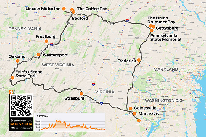
In late October, an Appalachians motorcycle ride is a gamble. Weather is the house, and over time, the house usually wins. But once in a while, lady luck is on your side, as she was when a college friend and I gambled on one last ride before the riding season ended, taking a 460-mile loop through the Allegheny Mountains of West Virginia, Maryland, and Pennsylvania, including a section of the historic Lincoln Highway and a visit to Gettysburg.
From my home in Manassas, Virginia, we headed west on Interstate 66 toward Front Royal under clear blue skies with temperatures in the mid-60s. My leather jacket was perfect for these conditions because my Triumph Sprint GT’s sporty fairing offers only modest wind protection.
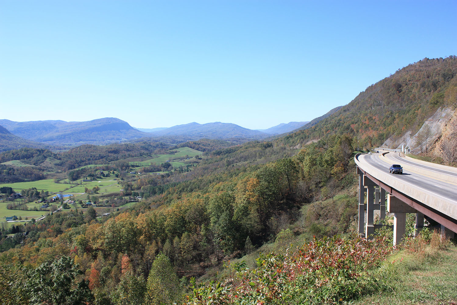
After a brief jaunt on Interstate 81, we continued west on U.S. Route 48 into West Virginia, where we enjoyed highway cruising speeds through mountains blanketed with foliage in various hues of yellow, orange, red, and brown.
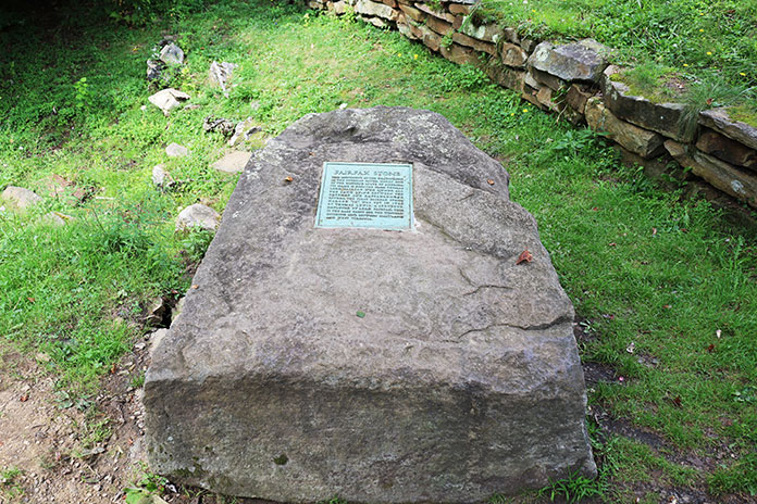
We made quick time to Baker, where Route 48’s four lanes become two. At Thomas, we turned north on U.S. Route 219, dialed up some throttle, and weaved through the highlands briefly before stopping at the remote Fairfax Stone. The Fairfax Stone, originally placed in 1746, once marked the boundary of land granted to Lord Fairfax. The weather can be unpredictable in the mountains, but our luck held. The wind and the rustle of falling leaves brought a sense of solitude and calm to the area.
The Fairfax Stone is tucked away in the highlands near the West Virginia-Maryland border. (Photo by Antony-22 via Wikimedia Commons)
Continuing north on Route 219, we entered Maryland and enjoyed more mountain views, including a ridge lined with big wind turbines. Just outside of Oakland, we turned east on State Route 135 towards Westernport. This part of western Maryland, just south of the Savage River State Forest, in and out of valleys and up and over mountains, felt more remote than any other area we rode through. Occasionally, where the trees had shed their leaves, we caught glimpses of the valley below as we ascended a mountain.
Somewhere outside of Gettysburg, we made a brief stop to enjoy the sights and sounds of one last ride before Old Man Winter arrived.
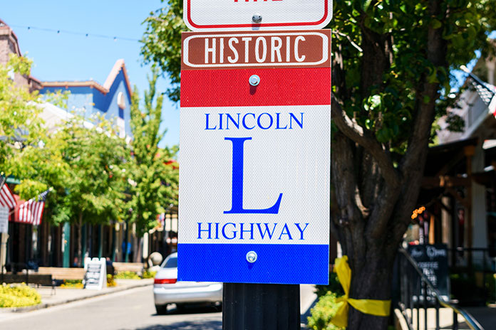
From Westernport, we took State Route 36 north toward Frostburg, where we hopped on Interstate 68 east for about 12 miles to the exit for U.S. Route 220. We continued north and soon crossed into Pennsylvania, and after about 25 mostly straight miles, we arrived in Bedford, where we picked up U.S. Route 30 and saw the first red, white, and blue sign with a large “L” designating the Lincoln Highway.
Dedicated in 1913, the Lincoln Highway was America’s first transcontinental road for automobiles – and motorcycles! It spanned 3,000 miles and connected New York to San Francisco by way of Philadelphia, Pittsburgh, Chicago, Omaha, Cheyenne, and Salt Lake City.
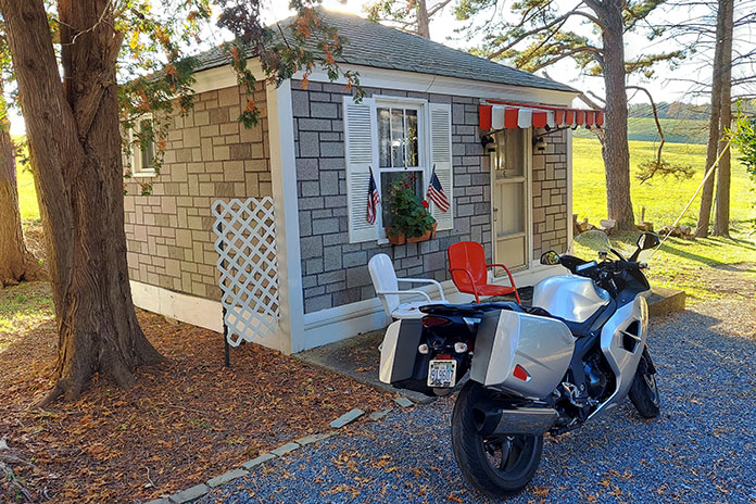
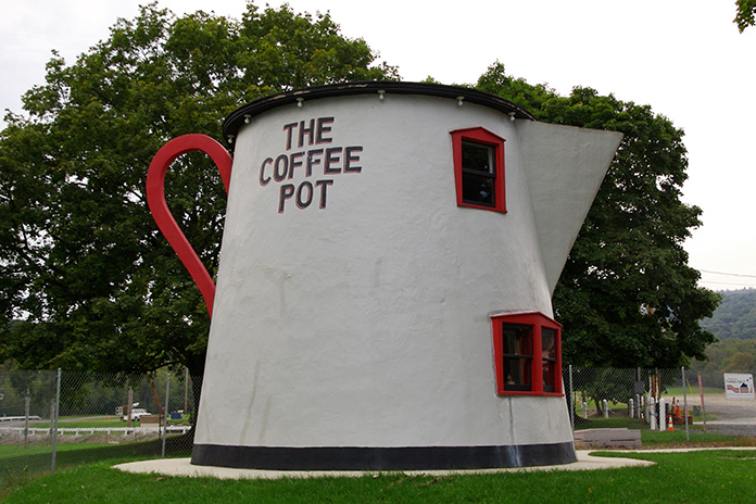
One of the many historic sites along the Lincoln Highway is The Coffee Pot, an 18-foot-tall building shaped like a coffee pot that was built in 1927 in Bedford, Pennsylvania, and once housed a small restaurant. A few miles west of Bedford, at the crest of one of the rolling hills that ebb and flow through bucolic pastures, the neon sign of the Lincoln Motor Court beckoned us to step back in time.
My cottage at the Lincoln Motor Court, located just east of Schellsburg on Route 30, was a time machine back to the 1940s.
Built in the 1940s and laid out in the shape of a U, the motor court’s 12 single-room cottages offer more than just a place to rest for the night. The wood paneling, kerosene wall heaters, and period decor transported us back to the days before interstate highways.
The Coffee Pot in Bedford, Pennsylvania, once served as a lunch stand along the Lincoln Highway but now rests in the nearby fairgrounds. (Photo by Jeff Kubina via Wikimedia Commons)
With autumn daylight burning away, we hopped back on the bikes and cruised over to Schellsburg for dinner at Judy’s Place (a recommendation from the motel owner), where our bet on wings and a plate of crabby fries paid off. When we returned to the motor court, there was a fire crackling in the fire pit. It doesn’t get much better than sitting in the glow of a fire and trading riding stories over beers.
A crisp autumn day with clear skies welcomed us the next morning. As we cruised east on the Lincoln Highway toward Gettysburg, we tried to imagine what the road was like in its early days. It was once promoted as a way to get from New York City to San Francisco by automobile for the 1915 Panama-Pacific International Exhibition. Completing the full route took weeks back then.
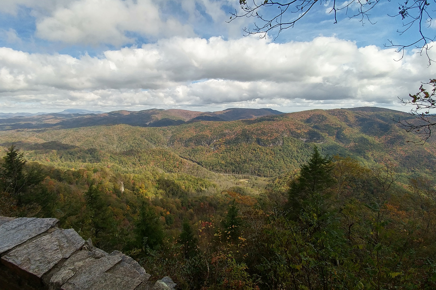
View of the Gettysburg battlefield facing west.
We were less concerned about getting to a destination than getting away, as the Lincoln Highway offers a nice reprieve from the nearby Pennsylvania Turnpike (Interstate 76). There’s less traffic and noise and more scenery – a ribbon of highway that rolls through beautiful Pennsylvania farm country and crests at numerous ridgelines.
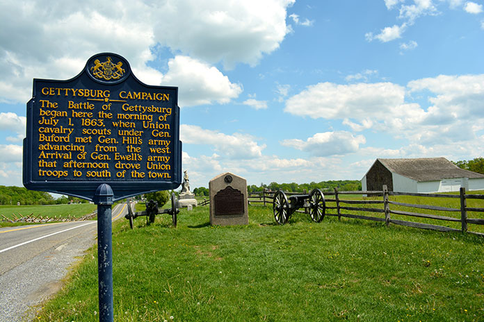
The Gettysburg National Military Park is surrounded by memorials and markers. In our limited time, we were only able to visit a few. (Photo by Refocus Photography – stock.adobe.com)
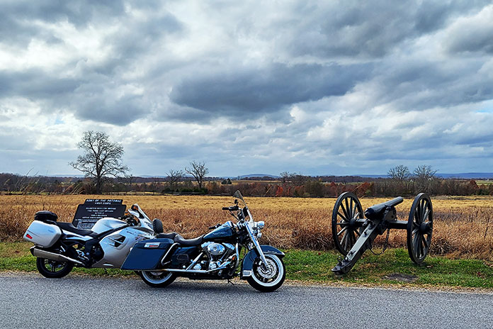
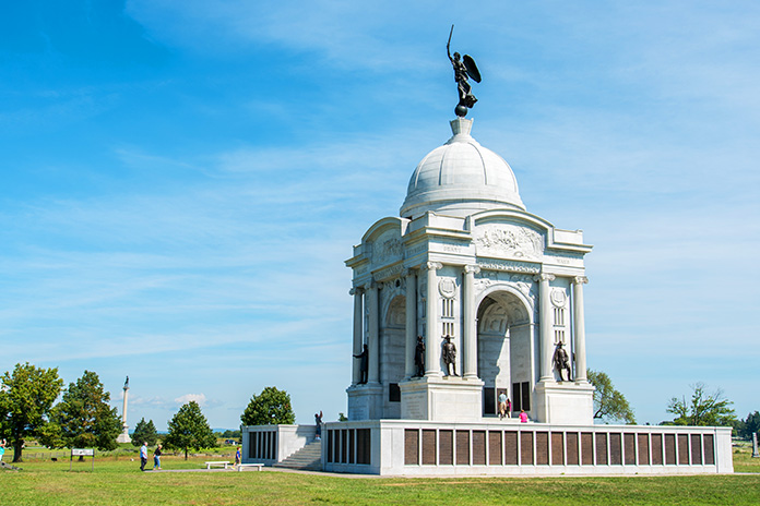
In Gettysburg, we had a bite to eat at the Lincoln Diner and browsed at The Union Drummer Boy, a shop that sells Civil War artifacts. Then we cruised through the historic downtown and over to the Gettysburg National Military Park. We climbed to the upper level of the Pennsylvania State Memorial, which offers sweeping views of the hallowed ground where the Battle of Gettysburg was fought in 1863. For anyone who appreciates American history, a visit to Gettysburg is highly recommended.
The Pennsylvania State Memorial is the largest monument on the Gettysburg battlefield, and it offers panoramic views from the upper level. (Photo by imagoDens – stock.adobe.com
Late in the day, my friend and I parted ways. He headed back to Philadelphia, and I turned south toward Virginia. With one last ride in the books before the onset of winter, we walked away from the table as winners.
Enjoying one of the 318 curves in 11 miles on Tail of the Dragon. (photo by Killboy)
The few months leading up to this ride, which included the famed Blue Ridge Parkway, had been rough. My wife was recovering from some major health issues, I was finally recovering from a relatively minor health issue, and our 16-year-old daughter was in full teenager mode, and we were all still in shock after one of her close friends was murdered.
On many days, I felt like a dark cloud was hanging over me. Happiness eluded me, and the fragility of life occupied my thoughts. Something needed to change, but I didn’t know what. It was time to reset and clear my head.
My wife and daughter convinced me that they would survive – and possibly even thrive – without me for a week, so I decided to take time off from work and go for a solo motorcycle ride. But where to go?
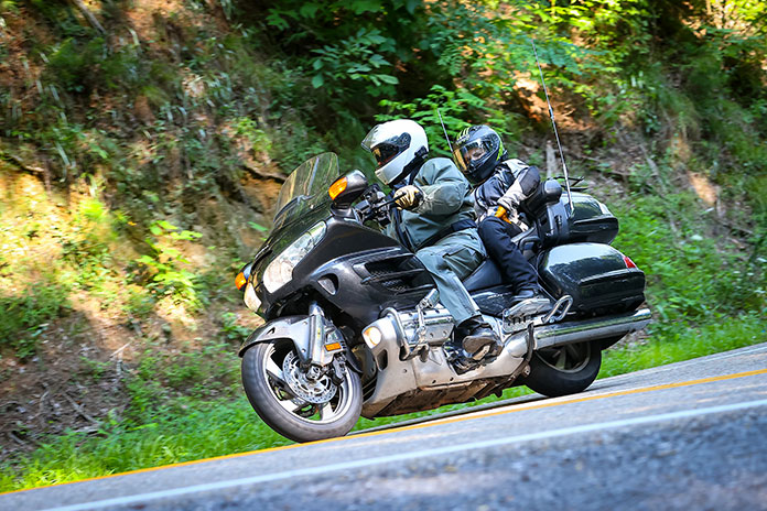
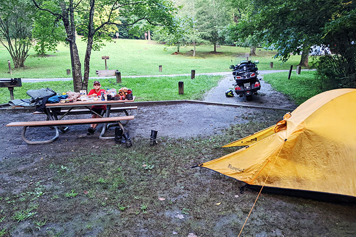
When I bought a used Honda Gold Wing a few years ago, it had a couple of Deals Gap stickers on the back fender, and the previous owner asked if I planned to remove them. I said no, as I had ridden the Tail of the Dragon many times and vowed to do so again on the Gold Wing. This trip would be a perfect time to validate the stickers.
Cameron reading one of the historical markers on the BRP.
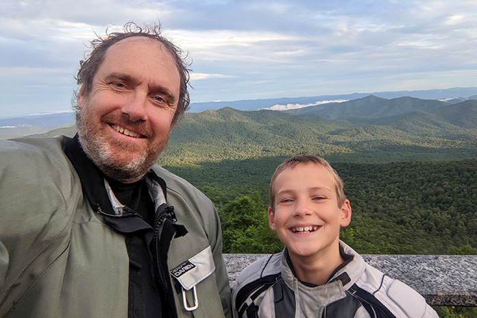
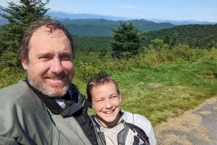
When my 11-year-old son, Cameron, heard about my planned ride, he begged me to let him tag along. He had been on a multiday ride with me before, and he’s a stellar passenger. I figured he could probably use a change of scenery too, and I’d benefit from the natural positivity that kids have before they learn how ugly the world can be.
With my wife’s blessing, Cameron joined me. In addition to riding through the Deals Gap area, I also decided to give Cameron his first taste of the Blue Ridge Parkway and to visit the Wheels Through Time motorcycle museum in Maggie Valley, North Carolina.
After a long, tiring first day of battling an endless procession of left-lane bandits heading south on Interstate 81 from our home in Ottawa (when did the passing lane become the driving lane?), we joined the Blue Ridge Parkway at its northern terminus outside of Waynesboro, Virginia, on a cloudy Sunday morning. It was like entering a different world. Traffic was almost nonexistent. There were no stop signs, no traffic lights, and no commercialism. And no one was in a hurry.
Construction of the 469-mile Blue Ridge Parkway began in 1935 and was largely completed by 1966, with one exception: the Linn Cove Viaduct around Grandfather Mountain in North Carolina, which was completed in 1987. From start to finish, the project took 52 years and cost nearly half a billion dollars. It was worth it.
The clouds were low, so mist and fog were constant companions that morning. It added to the mystique of the ride, but also to my melancholy. The previous day’s long interstate slog had left me tired, which did nothing to clear the dark cloud that had been following me.
Cameron reading one of the historical markers on the BRP.
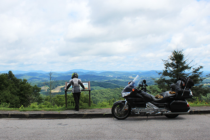
Low traffic and low speed limits made for a relaxing morning, but we got some rain on our Blue Ridge parade. A few light showers helped bring out the rainbows – and the deer. We saw nine of them, and there were probably others we didn’t see, which helped justify the 45-mph speed limit. Cruising at a moderate pace also allowed us to enjoy the scenery.
Cameron loved the idea that we were riding through the clouds that people in the valleys were looking up at. I had been on this stretch of the parkway many times, and I used to think I wouldn’t need to do it again, but seeing it through Cameron’s eyes gave me a new appreciation for the beauty. The stunning views from the overlooks constantly amazed him. His enthusiasm was infectious and eventually broke through my sullenness.
Trust me, there’s a smile behind that chinbar.
After detouring through Roanoke because of road damage on the parkway, we stopped for the night in Christiansburg, Virginia. At a soul food restaurant, Cameron was introduced to Southern accents and Southern food in the form of delicious catfish and grits.
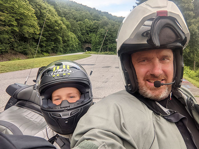
Traveling with a child is different than traveling solo or with another adult. The sense of freedom I usually have on a motorcycle trip was somewhat tempered. I couldn’t simply abandon my parental duties, and safety became a bigger concern. On the other hand, being able to share a passion with my child is an opportunity I relished. I remember motorcycle trips with my father, and I know Cameron will remember this one, so I tried to provide good memories. Luckily, he’s a good traveler and was happy to be there, so most things were easy.
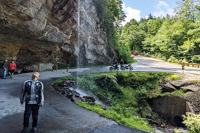
Cameron cooling off at Bridal Veil Falls, which is on Highway 28 near Highlands, North Carolina.
The next day was another good one, with more superb views and a higher cloud ceiling that allowed us to see farther than the day before.
For people who love tight, curvy tarmac, the roads that lead up to and down from the Blue Ridge Parkway are often more fun than the parkway itself. Climbing up to 4,000 feet requires lots of twists and turns, and smooth pavement and good banking made for a Gold Wing carnival ride. Cameron loves the curves as much as I do, so we occasionally took a side road that looked interesting just to get to the bottom, then turned around and went back up.
We had lunch at The Bluffs restaurant, directly on the parkway. Opened in 1949, it was the first spot to provide meals on the parkway through a contract with the National Park Service. After closing in 2010, it was beautifully renovated and re-opened in 2021. It is a charming building, and the lunch was delicious but expensive. I chalked it up to the price of atmosphere and history.
The Bluffs has great food and a great atmosphere.
After some fantastic overlooks and busting into the clouds on a foggy ride up Mount Mitchell at more than 6,600 feet, we pulled into the Mount Pisgah Campground for our first night of camping. At almost 5,000 feet of elevation, it provided a cool break from the heat and humidity lower down. The views from the Pisgah Inn where we grabbed a few sandwiches were incredible.
We woke up to the clearest day of the trip so far, with hardly a cloud in the sky. The southern end of the Blue Ridge Parkway near Asheville, North Carolina, often has more traffic than the northern part, but the views are fabulous. Cameron and I agreed that the best way to ride the parkway is probably north to south, as the views get better as you go south.
Our spacious campsite at the Tsali Campground off North Carolina Highway 28.
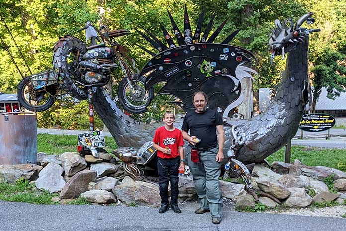
Slaying Dragons…and Mice?
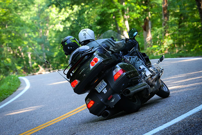
After reaching the southern terminus of the parkway in Cherokee, we rode to the Tsali Campground on North Carolina Highway 28 (aka Moonshiner 28). We set up our tent early to lighten our load for our Deals Gap run. After a stop at Fontana Dam, we rode the Tail of the Dragon’s 318 curves in 11 miles. I’ve ridden the road several times over the past 20 years, but this was the first time on such a big bike and with a passenger. The aftermarket suspension on the Wing helped, and it handled the challenge quite well, validating its stickers for me. The road is fantastic, and we both had a great time on it.
My 2010 Honda Gold Wing handles like a dream on curvy roads, and its footpegs are beveled to a sharp edge. (photo by Killboy)
The next day we rode south on Highway 28, another great road, past Franklin and made a stop at Bridal Veil Falls. We met a couple of guys from Minnesota who recognized my Aerostich jacket as being from Duluth, near where they live. One of them was riding a beautiful early ’70s-era BMW that he restored.
Highway 28 allows you to visit multiple states in a short period. From North Carolina, we crossed into Georgia for about 15 minutes, then into South Carolina. At the pretty town of Walhalla, South Carolina, we decided to head north again to our destination for the night, Maggie Valley, North Carolina. I used the “adventurous routing” on my Garmin GPS, telling it to take us on hilly, curvy roads to our destination. The route delivered and included South Carolina highways 11 and 130 and North Carolina Highway 281 to Tuckasegee and eventually to our motel in Maggie Valley.
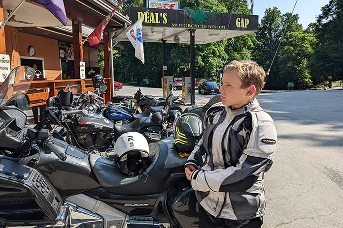
Enjoying a break at the Deal’s Gap Motorcycle Resort before tackling the Dragon.
For those of us not blessed to live in a motorcycle nirvana such as this area, it is really astonishing how outstanding the roads are. Curves are everywhere you look. Reviewing my GPS tracks afterwards highlighted how many curves we went through in a short time. This part of the world is truly a motorcyclist’s paradise.
After a nice evening, we settled in for a quiet night. Cameron slept while I looked at maps to plan our next couple days of riding. The rustling of a plastic bag on the TV stand attracted my attention to a mouse trying to get into our few provisions. I have musophobia – fear of mice and rats – so this was an unwelcome development. After trying in vain to catch the mouse without getting too close to it, I ended up going to the office and requesting another room. I had to wake up Cameron, and we moved all our stuff to a different room. Taming the Dragon on a 950-lb motorcycle? No problem. Sharing a room with a furry little mouse? No thank you!
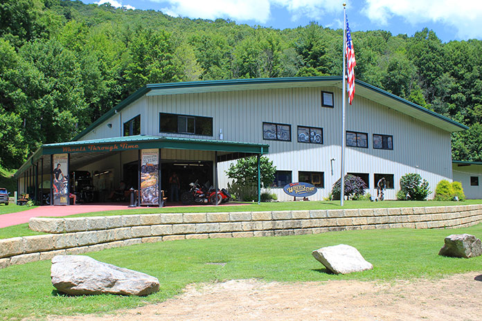
The Wheels Through Time Museum was one of the highlights of our trip. It’s a must-see for any motorcycle enthusiast.
After a fitful sleep filled with nightmares of battling giant mice, we started our day with a visit to the Wheels Through Time Museum, home to over 300 rare American motorcycles, memorabilia, and a few cars. It is advertised as the “Museum that Runs,” and does it ever. Staff walk around answering questions and will often start a bike to let visitors hear it. It’s incredible to listen to a 1950 Harley WL or an opposed-cylinder, shaft-drive military-issue 1942 Harley XA running in all their glory. Most museums are static places where you just look at things – at this one you can feel, hear, and smell history. An incredible place. We were both very impressed and will visit again. If you go, be warned: After leaving, you may feel a powerful urge to buy an old Harley or Indian!
From Maggie Valley we rode toward Boone on North Carolina Highway 209, also known as The Rattler. With curves everywhere and little traffic, it was a great ride, even if we hit a few rain showers that cooled us off. Garmin’s “adventurous routing” again took us along several state routes, each one seemingly curvier than the last, toward our mouse-free hotel in Boone.
Cameron was a great passenger – and an even better companion.
That Blue Ridge Parkway Peace of Mind
There comes a point in every trip where a metaphysical corner is turned, where the journey is no longer about the journey but about getting home. We had reached that point in the ride. Unwilling to let our fun times slip away easily, we spent the next morning taking the long way home, winding our way on some small roads before getting onto the I-81 left-lane traffic jam for the long slog back home to Ontario.
Taking a break on Flat Ridge Road in Virginia, our last bit of fun before the long ride home.
The goal of this trip – and most traveling, really – was to rest, clear the mind, and gain a different perspective. In that, the trip succeeded. A week of waking up every morning with nothing to do but ride some of North America’s greatest motorcycle roads is a wonderful way to come to terms with the hardships and challenges of life. Staying in the present moment by thinking only of the next curve truly does help heal the mind and soul. It’s not the first time a motorcycle ride has done that for me, but this was probably the most significant. Sharing new memories with my son made it even better.
We came, we saw, we slayed the Dragon! We’re already looking forward to our next father-and-son trip.
A new exhibition, “The Open Road: The Art of the Motorcycle,” opens on June 16, 2022, at the William King Museum of Art in Abingdon, Virginia. The exhibition will be part of the Open Road BikeFest, a weeklong celebration of the motorcycle held June 22-25 at locations across Abingdon and Bristol, Virginia.
In addition to the museum exhibition, there will be bike rallies, block parties, bike rides, live music, and more.
Stay in Abingdon, Virginia, for the Open Road BikeFest and never miss a moment of the fun. Plan your route ahead of time with Appalachian Backroads, your complete guide to routes in Southwest Virginia, or The Southern Dozen, your complete guide to routes in Northeast Tennessee.
Indulge in Abingdon’s award-winning Small Town Food Scene at more than 30 independently owned restaurants. Finally, relax for the night at Hampton Inn by Hilton. Receive special BikeFest rates by calling Hampton by Hilton’s front desk at (276) 619-4600 and mentioning William King Museum of Art or the Open Road BikeFest.
JUNE 22 (Wednesday) Bike Night Texas Roadhouse, Bristol, VA 3:00 – 8:00 p.m.
JUNE 23 (Thursday) Cruise In Hampton Inn, Abingdon, VA 6:00 p.m. Music from The EDGE and food trucks on-site
JUNE 24 (Friday) Block Party Spring House Tumbling Creek Cider Company, Abingdon, VA 6:00 p.m. Music by Florencia and the Feeling and Annabelle’s Curse
JUNE 25 (Saturday) Ride to BikeFest Black Wolf Harley- Davidson, Bristol, VA 9:00 a.m. registration Begin your ride at Black Wolf Harley-Davidson on Saturday at 9 a.m. and finish around 1 p.m. at the Open Road BikeFest at Latture Field in Abingdon, VA FREE TO RIDE! Please consider donating to benefit William King Museum of Art, donations collected on site at registration.
JUNE 25 (Saturday) Open Road BikeFest Hosted by William King Museum of Art, Latture Field, Abingdon, VA ** MOTORCYCLE PARKING ON GRASS, BRING YOUR KICKSTAND PLATE ** Gates open at 1:00 p.m. Featuring music, vendors, food trucks, beer garden, best in show contest & more! ** BRING YOUR OWN LAWN CHAIR ** TICKETS: $20.00 at the gates Music starting at 2:00 p.m. by Ron Short and the Possum Playboys and Phantom
More information about the Open Road BikeFest and “The Open Road: The Art of the Motorcycle,” can be found online at williamkingmuseum.org. The Open Road BikeFest is sponsored by The Town of Abingdon, Virginia, and the Virginia Tourism Corporation.
Father and son on the the Tail of the Dragon, Tennessee. (Above photo by 129photos.com; other photos by the author)
Dad’s first sojourn through the Appalachian Mountains of Virginia, North Carolina, Tennessee, Kentucky, and West Virginia needed to be grand. Dad is a desert dweller from southern Arizona and has never ridden east of Texas. We agreed on a short list of must-haves: Blue Ridge Parkway, Great Smoky Mountains National Park, and Tail of the Dragon. Everything else – the fall foliage, the swollen creeks and runs, the rural country roads, the morning fog – would be an added bonus.
There would also be pancakes. Lots of pancakes.
We picked up Dad’s Triumph Tiger Explorer at a motorcycle dealership in northern Virginia, where he had it shipped from Arizona. We rode south and entered the Blue Ridge Parkway west of Lynchburg. The parkway is aptly named, with smooth, graceful curves, well-manicured roadsides, and plenty of parking areas to admire the view. A word to the wise, as I learned as point man: pay attention to mile markers. I missed the country road that the kind ladies at Explore Park said would lead us to Mount Airy, North Carolina, our first stop for the night and the birthplace of actor Andy Griffith.
Lush valleys provide a stunning backdrop to the Blue Ridge Parkway, Virginia.
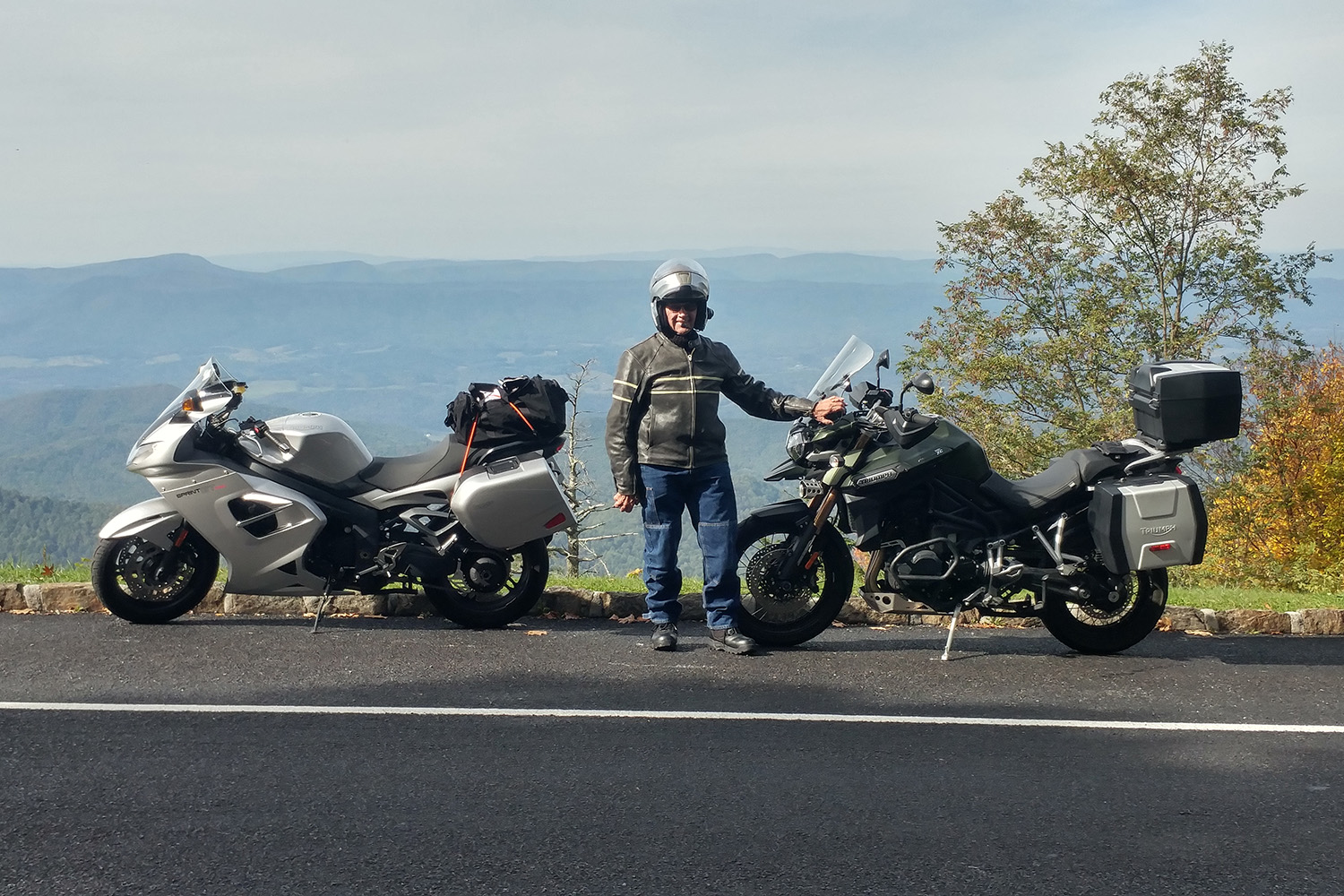
Dad’s Explorer has heated grips and a larger fairing than my Triumph Sprint GT, so he was better prepared for the chilly 40-degree temperatures during our ride. For most of the morning, we enjoyed relative seclusion, clear skies, autumn colors, and beautiful farm country. In one short span, the view of the valley below on my left was stolen by a patch of trees and granite outcroppings only to be returned over my right shoulder. It was a literal tennis match of competing landscapes – valleys of farm country on one side and ridgelines stretching to the horizon on the other.
Traffic increased the farther south we traveled, and overflowing pullouts often prevented us from stopping, so, we leaned back and enjoyed the ride. We left the parkway at Asheville, having decided on Maggie Valley for our overnight stay.
The author’s father posing with their motorcycles on the Blue Ridge Parkway.
A steady downpour and tornado warnings nixed riding the second day, so we covered the bikes and took a taxi to Wheels Through Time. While walking through the museum – home to more than 300 interesting and rare motorcycles – Dad shared stories of his older brother’s 1950 Harley Panhead and their shenanigans on it back on the farm in Iowa. One involved the bike, loaded with three riders, being chased by a dog that gave up the hunt after my uncle retarded the spark for a spectacular backfire. Dad hunted the base of many a cylinder barrel, searching for a stamp that would identify the same year as his brother’s, but to no avail.
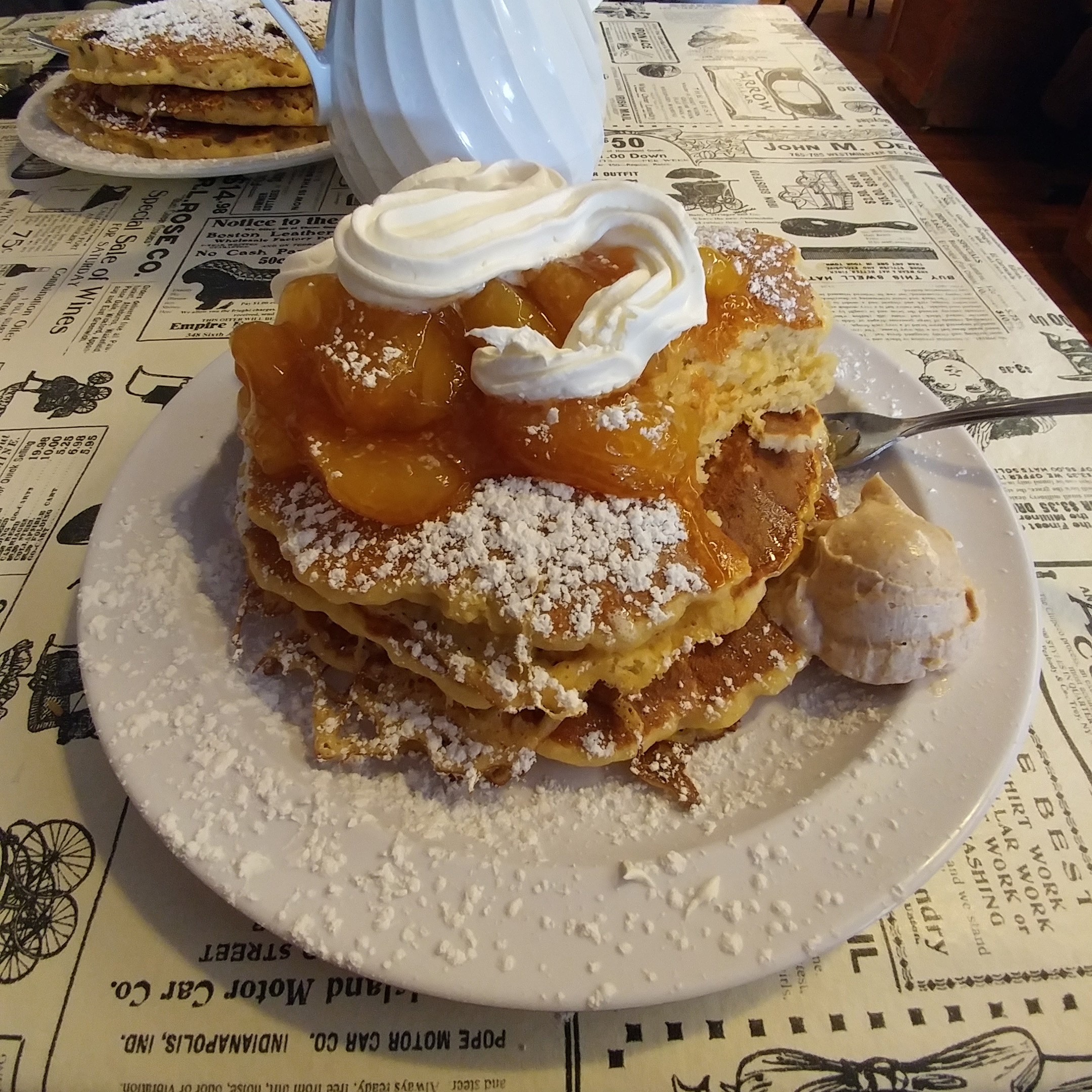
Tourist traffic in the lush Great Smoky Mountains National Park slowed our progress. We found a place to park the bikes at Newfound Gap, a 5,049-foot pass on U.S. Route 441, allowing us to stretch our legs. Traffic in the park paled in comparison to the carnival of tourism we saw in Gatlinburg, where we found the Little House of Pancakes.
Dad tucked into a stack of blueberry pancakes, and I gorged on sweet-and-spicy apple pancakes. Between bites – and doing our best not to drip syrup on our map – we sketched out an alternate route back to Maggie Valley. We tested our pioneering skills on Tennessee State Route 32 in search of secluded switchbacks. Any concern about traffic was dispelled by a large red diamond-shaped sign that warned “Do Not Enter, Your GPS is Wrong” a few miles into the alternate route.
Littered with wet leaves and twigs from the previous day’s storms, Route 32’s pucker factor was off the scale, especially when I felt the front wheel push over some wet leaves at the apex of a turn. I rarely engaged 3rd gear after that. Pavement turned to hard gravel at Davenport Gap, where we crossed back into North Carolina on Mount Sterling Road. We found blacktop again at Waterville Road along Big Creek, and after a few miles, under cavernous trees and crags, we came upon Interstate 40 and our path back to Maggie Valley.
Compared to Route 32, the Tail of the Dragon’s 318 curves in 11 miles were not as technical, nor as precarious. The roads in this part of Tennessee, which arc around the southern side of Great Smoky Mountains National Park, plunge into valleys, rise to bluffs overlooking man-made lakes and hydroelectric dams, and hug the steep sides of tree-blanketed mountains. After a full day of Appalachian curves, we stopped for the night in Middlesboro, Kentucky, just a stone’s throw west of Cumberland Gap.
Another sweeping view along the Blue Ridge Parkway.
With our bellies full of pancakes, we rode east on U.S. Route 58 through southwestern Virginia under crisp, blue autumn skies, with ridgelines on our left marking the border with Kentucky. We continued northeast on U.S. Route 19 for our next overnight in Princeton, West Virginia, and we awoke the next morning to find frost on our bikes. Despite the cold, the scenery from Princeton to Elkins on U.S. Route 219 was a moving feast of fields, pastures, valleys, woodland, creeks, rivers, and quaint towns.
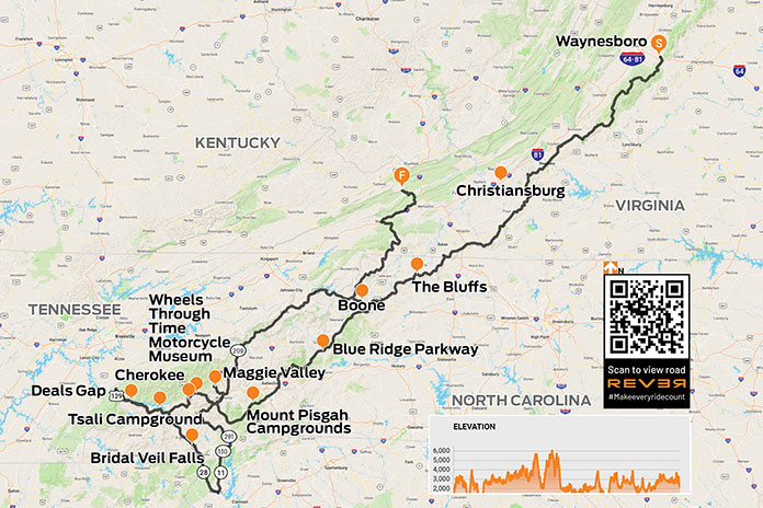
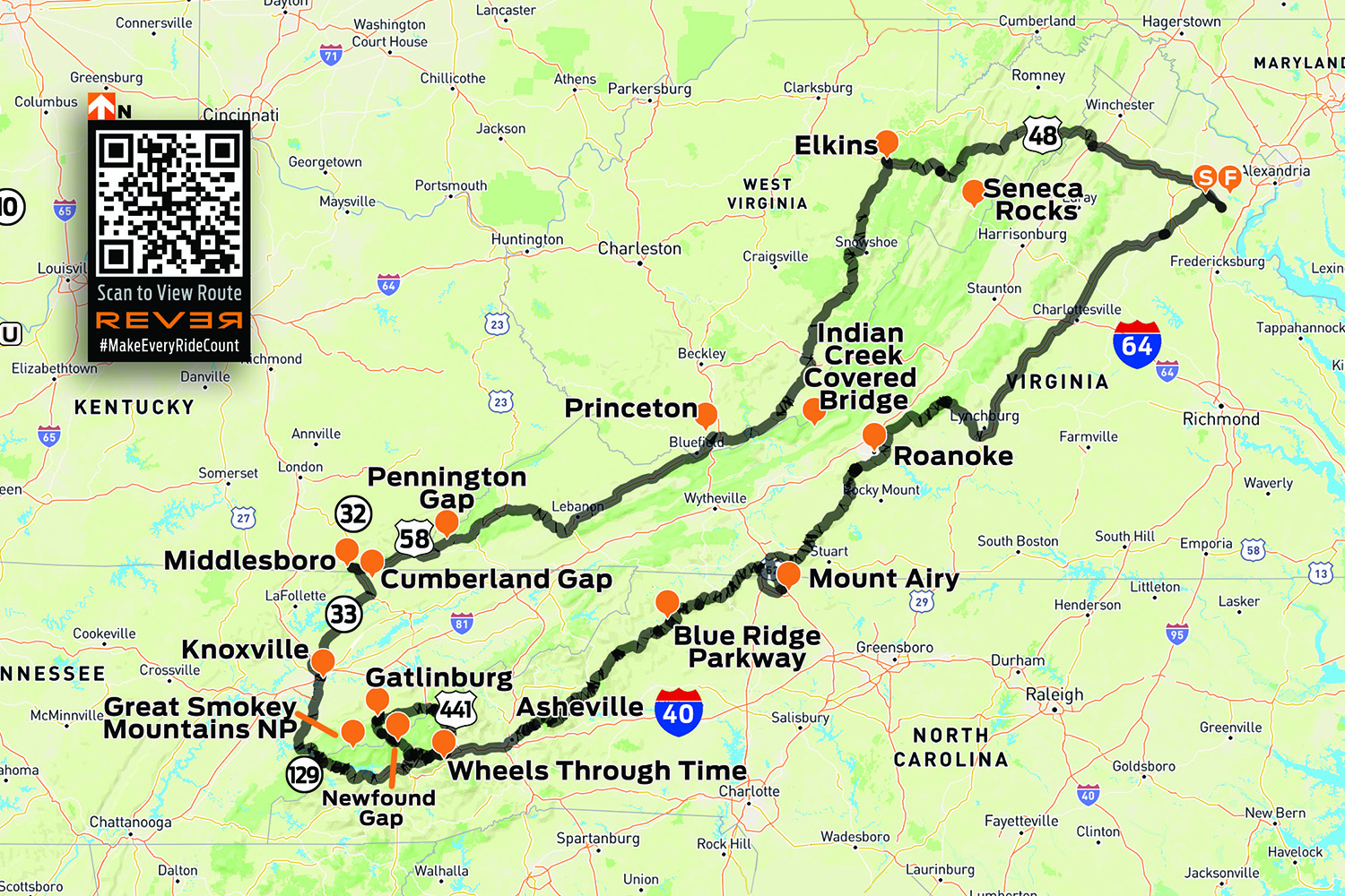
This route map is available on the REVER app in the Rider Magazine community.
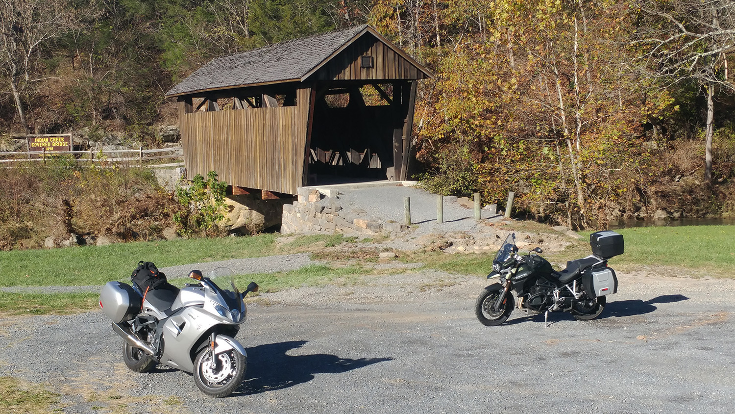
A section of U.S. 219 we traveled along is known as Seneca Trail. A pleasant surprise around one bend was Indian Creek Covered Bridge, which was completed in 1903 at a cost of $400. The rest of the morning was spent passing farm after farm, including writer Pearl S. Buck’s birthplace in Hillsboro, West Virginia. For pancakes, we recommend Greenbrier Grille and Lodge, overlooking its namesake river in Marlinton.
Our last day involved riding from valley to ridge to valley. We followed curves along various creeks and branches of the Potomac River that snaked their way through the Appalachians. Eventually we had to leave the winding roads behind and hop on Interstate 66 to complete our multi-day loop. For Dad’s first ride east of the Mississippi, he was proud to see his tripmeter roll over 1,504 memorable miles.
The Indian Creek Covered Bridge on West Virginia Route 219.
On the Blue Ridge Parkway at milepost 101, the Ducati makes me look better than in real life. In the background is the Quarry Overlook. This dolomite quarry was started in 1916–twenty years before the Parkway. Photos by the author.
Virginia’s Blue Ridge Mountains in autumn are a place of unique beauty not to be missed, especially from the open cockpit of a motorcycle. From my home in the northern tip of the state, the Virginia border runs diagonally southwest for more than 300 miles, parallel to the ridges and valleys of the mountains.
In the southwest corner are my two ride objectives: the Back of the Dragon, a 32-mile run of elbowing blacktop crossing three mountain ridges, and The Crooked Road, a collection of live music and historical venues along scenic motorcycle roads showcasing the regional specialty: bluegrass music. I also plan to make use of the scenic Blue Ridge Parkway, but only when my ambitious schedule will let me travel at the Parkway’s reduced speed limit of 45 mph.
Cars first rambled through this stone tunnel on the Blue Ridge Parkway south of Montebello in the 1930s. I’m sure it didn’t take long for the first motorcycle to follow!
It takes a day to get to my start point of Wytheville, but not without a midday detour along the Blue Ridge Parkway from near Montebello to Buchanan. I share the view at numerous overlooks with other riders, then enjoy lunch on the shore of Abbott Lake beneath the Peaks of Otter. There’s no wondering why the Parkway consistently rates among the top five motorcycle roads in the United States. A rider’s dream, the curvy ridge-top road runs through stone-arched tunnels and next to lakes, campgrounds and lodges–all completely devoid of traffic lights, stop signs and large trucks. Free for public use, the Parkway is open all year except in icy conditions.
Next morning I wake up in Wytheville to a steady rain lingering longer than forecast and wind gusts flexing the glass of the hotel window. I decide to motor circuitously and enter the Back of the Dragon at the north point to allow time for the rain to move out. I take U.S. Route 52 and enjoy a satisfying and twisty climb to Big Walker Lookout, elevation 3,405 feet. Here I find the Big Walker General Store and take a short break to enjoy the terrific views under overcast skies.
A group of riders with camping gear rolls along the Blue Ridge Parkway north of the Peaks of Otter, no doubt heading to one of the Parkway’s many campgrounds.
From there U.S. 52 curves downhill, then runs over rolling terrain alongside Interstate 77 for 20 or so miles—then suddenly joins the interstate and punches through a mile of mountain rock at the East River Mountain Tunnel. I then head west on U.S. Route 460 to Tazewell and turn onto State Route 16–the Back’s north entry point. Thankfully, the rain has stopped and the road is mostly dry.
There are neat, steady curves across the first ridge before dropping more than a thousand feet for a two-mile cruise through a gorgeous, Shire-like valley. The road then winds up the face of the second ridge and slices behind towers of leafy kudzu. Then come mile upon mile of pleasing twists along the second ridge before switchbacking downhill into the second valley, a nice break before the final 1,500-foot climb.
My growling and nimble Ducati Multistrada eats up the twisty climb and we loop through bursting autumn colors that surround rocky crests. The road surface is mostly excellent, though I did encounter a little gravel in spots.
U.S. Route 52 north of Wytheville takes one last dip to the left before twisting its way to Big Walker Lookout. The excellent road surface seen here is what I encountered on every mountain road on my trip.
State Route 16 continues south through Marion and later connects with U.S. Route 58–I’m now officially on The Crooked Road. Designated by the state of Virginia in 2004, The Crooked Road uses U.S. 58 as a central conduit but includes connected roads leading to festivals, museums and live music sessions, all associated with the heritage of bluegrass and country music.
I’m committed to being at the Floyd Country Store for the Friday Nite Jamboree, so I shortcut there on U.S. Route 221. Time permitting, I recommend an alternate route using the Parkway to Floyd and stopping by the Blue Ridge Music Center near Galax for the live music each afternoon.
To get a seat at the Floyd Country Store’s Friday Nite Jamboree you have to get by Barb and Beverly at the ticket counter–I think the five spot is a bargain just for their smiles and friendly company.
The Floyd Country Store is a crown jewel of The Crooked Road. A modest cover charge of $5 gets me in the door. After an initial set of bluegrass gospel, folks are clearing away folding chairs and dancing to the fast-paced syncopation of Katie & The Bubbatones. Many “flatlanders” like myself are simply tapping our feet, but it’s clear that this lively music is still an important way for local folks to unwind after a busy week. On my way out I bag a pastry at the store’s bakery to have with next morning’s coffee.
The sun rises to a chilly but crystal clear morning as I depart Floyd’s cozy Pine Tavern Lodge, a clean and updated hideaway that has continuously served travelers since 1927. A peaceful winding ride on State Routes 8 and 40 takes me through elevated meadows and rolling farms, across small wooded creeks and finally to the Blue Ridge Folklife Festival in Ferrum. You’ll find such festivals along The Crooked Road almost any weekend from June through October.
At the Blue Ridge Folklife Festival, metal meets metal and sparks shoot forth when Billy Phelps brings the hammer down. Billy is a Master Blacksmith who has given live demonstrations at the Smithsonian in Washington, D.C.These experts fix the cap arm on a moonshine still. They taught me a lot–alcohol boils off at 172 degrees (a lower temperature than water) so the cap arm catches the alcohol steam for condensation into moonshine.An Amish group set up a donut operation that was nonstop busy. I ate the best donut that I have ever eaten–or will ever eat.
I decide I need a final cruise on the Parkway so I get there by U.S. 220. Once on the Parkway, two groups of motorcyclists are going my direction, and we leapfrog along the Parkway as we take turns stopping at different overlooks. I exit the Parkway for good on State Route 43 for the small town of Bedford, a place that possesses the tragic distinction of losing more residents per capita in the D-Day landings than any other American community. Bedford’s D-Day Memorial is a good, quiet place to reflect on how fortunate I am to be able to traverse through Virginia’s natural, cultural and historical sites before continuing on home–back to the flatlands.
Map of the route taken, by Bill Tipton/compartmaps.com.


