Tag Archives: Oregon Motorcycle Rides

Border to Border on the Oregon Backcountry Discovery Route

Oregon Backcountry Discovery Route ORBDR The Long Way to Walla Walla
Greg’s BMW taking a dirt nap along the Oregon Backcountry Discovery Route. Photos by Greg Drevenstedt.

This story is about a ride that took place in 2013 on the original Oregon Backcountry Discovery Route, which was developed by the Oregon Off-Highway Vehicle Association. The nonprofit Backcountry Discovery Routes organization developed a new ORBDR that was released in 2023. For more information, visit the Backcountry Discovery Routes website. –Ed.

Oregon Backcountry Discovery Route ORBDR The Long Way to Walla Walla
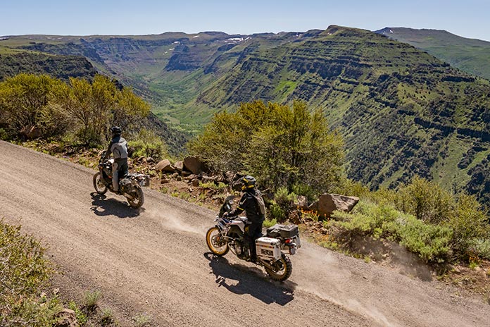
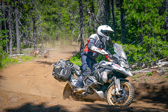
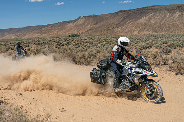
Route 5 of the original ORBDR includes hundreds of miles of gravel roads much like this one, plus a decent helping of dirt, sand, rock gardens, and river crossings.

When your bike topples over in the middle of nowhere, when your bike and its week’s worth of gear weigh more than 600 lb, when you’re hot and sweaty and tired, it’s good to have friends along to lend a hand.

Oregon Backcountry Discovery Route ORBDR The Long Way to Walla Walla
At the California-Oregon border before venturing off-pavement on the ORBDR.

We were three days and nearly 300 miles into the 750-mile, California-to-Washington Route 5 of the Oregon Backcountry Discovery Routes (ORBDR), a network of off-road routes crisscrossing the state’s vast national forests. While struggling my way up a technical jeep road full of embedded rocks, I high-centered the BMW’s skid plate, dabbed my left foot into a hole, lost my balance, and toppled over in a big, dusty heap.

Oregon Backcountry Discovery Route ORBDR The Long Way to Walla Walla

Lead rider Paul was off in the distance, so sweep rider Marten navigated around me, parked his bike on a level spot, and came back to help. Other than some badge-of-honor scratches on the bike, the only damage was to my pride, and I was soon making forward progress again.

Oregon Backcountry Discovery Route ORBDR The Long Way to Walla Walla
Just a few miles into the ORBDR, we took a spur road to the summit of 8,000-foot Crane Mountain, where we enjoyed 360-degree views of California and Oregon.

Backcountry Discovery Routes is a nonprofit organization that establishes and preserves off-highway routes for dual-sport and adventure motorcycles. BDR has mapped and documented north-south routes in most states west of the Rockies as well as mid-Atlantic and Northeast routes and shorter BDR-X routes. Inspiration for these routes came from the ORBDR, which, according to BDR’s website, “was created a few decades ago by Bob and Cheryl Greenstreet as a concept to promote managed travel in the backcountry” and is maintained by the Oregon Off-Highway Vehicle Association.

Oregon Backcountry Discovery Route ORBDR The Long Way to Walla Walla
The view from Fremont Point on Oregon’s Winter Rim.

Paul, Marten, and I wanted to ride the granddaddy of the Backcountry Discovery Routes, so I bought paper maps for Route 5 from OOHVA and Paul spent two weeks creating GPS tracks for us. (GPS tracks are now available upon request when maps are purchased from OOHVA.) Since most of the ORBDR is at 4,000-8,000 feet of elevation, we planned our trip for August to avoid snowpack.

A long-time adventure-riding and homebrewing buddy of mine, Paul Beck, is a computer guy. Since he created our tracks and led our group (his GPS was the only one that worked reliably), we dubbed him the Navigator. Marten Walkker, another riding buddy, is a master carpenter. He made his own tailbag, auxiliary gas tank, toolbox, and highway pegs for this trip, so we called him the Fabricator. And since I kept a journal, shot photos, and sent daily postcards to my wife, I became the Chronicler.

Oregon Backcountry Discovery Route ORBDR The Long Way to Walla Walla
The Three Amigos at Fremont Point, 3,000 feet above seasonally dry Summer Lake.

Similar in pace and temperament and always ready for a quick laugh, we were compatible travelers, like the Three Amigos. We were all of German descent and riding BMWs – Paul on an R 1200 GS, Marten on a G 650 Xchallenge, and me on an F 800 GS Adventure – so Drei Freunde is more accurate, but it doesn’t exactly roll off the tongue.

Oregon Backcountry Discovery Route ORBDR The Long Way to Walla Walla
We had to cross the high desert through Christmas Valley to get from the mountains of Fremont National Forest to the mountains of Malheur National Forest.

Departing from Ventura on California’s southern coast, our first 750 miles were on pavement as we made our way up to the northeastern corner of the state. A half-mile before the Oregon border on the afternoon of our second day, we turned from U.S. Route 395 onto the unpaved County Road 2 and entered Modoc National Forest as we climbed into the Warner Mountains. We had to shift our brains from the grip and monotony of wide-open pavement to the delicate balance of riding top-heavy adventure bikes on loose, uneven dirt and gravel. The road leveled out within a few miles, and we turned north, passing through the green meadows of the (not so) Dismal Swamp and crossing into Oregon.

Oregon Backcountry Discovery Route ORBDR The Long Way to Walla Walla
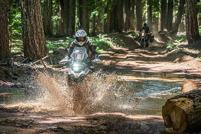
River crossings are nerve-racking with an audience of forest service workers, but Marten made it through like a pro.

After riding a challenging spur road up to the top of 8,000-foot Crane Mountain for panoramic views and navigating through a herd of cows, we stopped at Willow Creek Campground, which was deserted. We crossed a cattle guard to get into the campground, and even though it was surrounded by a fence, we still had to pick our way through a minefield of cow patties to set up our tents. After bathing and rinsing out our sweaty clothes in the creek (but not drinking the water), we fortified ourselves with backpacker meals and relaxed around the campfire, swapping stories and sipping whiskey.

Oregon Backcountry Discovery Route ORBDR The Long Way to Walla Walla
Cooling off in Delintment Lake in Malheur National Forest.

The OOHVA’s detailed, full-color ORBDR map booklets offer the following words of advice: “Your journey will be one of few contacts with others. One needs to plan for being self-sufficient. Travel with others is highly recommended. If one’s means of transport fails, it can be a really, really long hike, and it could be many days before someone comes along.”

Oregon Backcountry Discovery Route ORBDR The Long Way to Walla Walla
The early bird gets to enjoy the sunrise.

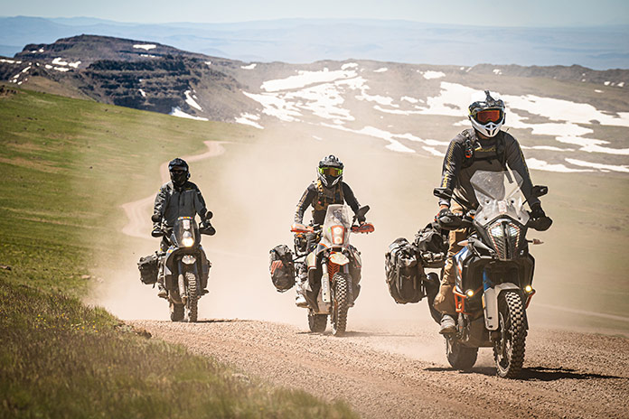
Over the course of five days on the ORBDR, we saw only a handful of people – a few ranchers, a couple of 4×4 trucks, and the occasional hunter. We traveled as a group, each of us brought our own food, water, and gear, and we carried a SPOT satellite tracker/communicator. Gas was available every 100 miles or so, often in small towns or at convenience stores near the route, and we filled up our tanks and hydration backpacks at every opportunity.

Oregon Backcountry Discovery Route ORBDR The Long Way to Walla Walla
Lunch stops at local cafes provided welcome relief from the hot, dusty trail.

“Much energy has been spent to provide you with maps that provide the information needed to successfully navigate without on-ground signs,” says the OOHVA. We saw only a few faded, old ORBDR signs over the entire 750-mile route.

See all of Rider‘s Western U.S. motorcycle rides here.

“The development of route was financed by the Oregon ATV Allocation Funds,” said Leonard Kerns, president of the OOHVA, in a blog on Touratech-USA’s website. “On-the-ground signs were placed and the route was dedicated in the summer of 2000. Unfortunately, it did not take long for people opposed to the route to bring legal action. Support from the Forest Service and Bureau of Land Management was lost and all remaining funds were used to remove the signs. At that point, OOHVA stepped in and created the maps using GPS to navigate.”

Oregon Backcountry Discovery Route ORBDR The Long Way to Walla Walla
Breakfast of champions.

The ORBDR is on public land, so anyone can travel the route using a street-legal vehicle, but much of it passes through areas used for grazing and logging. We crossed dozens of cattle guards and stopped often to open and close barbed-wire gates. Forest land in central and eastern Oregon is all but empty, yet it’s crisscrossed with so many access roads that without GPS tracks and paper maps, getting lost is all but assured.

Oregon Backcountry Discovery Route ORBDR The Long Way to Walla Walla
Even with GPS tracks, sometimes we hit dead ends and had to find a way back to the correct trail.
Oregon Backcountry Discovery Route ORBDR The Long Way to Walla Walla
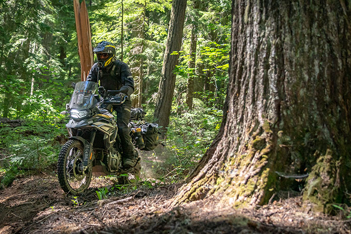
One of several massive fallen trees we had to navigate around since going over wasn’t an option!

The OOHVA’s maps were created in 2002, and in the years since, some roads have been closed and new ones have been cut. Even following the purple line on Paul’s GPS, we still made wrong turns or hit dead-ends and had to figure out how to re-route ourselves. We also encountered the unexpected, such as fallen trees and man-made barricades. Therein lies the adventure. Riding a backcountry route is not like following the Yellow Brick Road; it requires not only preparation and riding skills but also teamwork, patience, and adaptability.

Oregon Backcountry Discovery Route ORBDR The Long Way to Walla Walla
Being far from anywhere, we had campgrounds largely to ourselves and were fortunate to have either a stream or lake nearby.

We quickly established a routine: waking early to heat up water for coffee and oatmeal using portable stoves, breaking camp, riding for several hours, stopping for lunch and gas, riding for several more hours, then stopping early to set up camp and relax. Paul was always in the lead, which meant his gear stayed clean and we had someone to blame for wrong turns. I followed Paul and Marten followed me, and even with space between us the dust filled our noses and covered our gear, making zippers and buckles hard to open and close. We planned to camp every night, but it didn’t work out that way, to our surprise and benefit.

Oregon Backcountry Discovery Route ORBDR The Long Way to Walla Walla
Lead rider Paul stayed clean; sweep rider Marten stayed dirty.

During our five days on the ORBDR, we experienced a steady stream of good luck. We enjoyed mostly warm, dry weather and had no flat tires, breakdowns, or injuries. Rather than eating jerky and energy bars for lunch, we usually found a cafe in a small town where we’d refresh ourselves with air conditioning, limitless iced tea, and other luxuries, and there was always a gas station nearby to fill up and resupply.

Oregon Backcountry Discovery Route ORBDR The Long Way to Walla Walla
We smelled smoke but had no idea the 1,000-acre Vinegar Fire was burning in the area until we popped out of the trees and came upon this U.S. Forest Service fire security truck. Our route was supposed to go down that gravel road in the distance, but we were re-routed onto pavement to the town of Ukiah.

During the three nights we camped, there was either a cool stream or a lake we could swim in to wash off the dust and relax our creaky joints. On our second day on the ORBDR, after a challenging, tiring section with lots of sand and rocks, we ended up in the town of Christmas Valley, where the Lakeview Terrace motel/restaurant spoiled us with cheeseburgers, fries, cold beers, hot showers, and soft beds.

Oregon Backcountry Discovery Route ORBDR The Long Way to Walla Walla
Antlers Inn in Ukiah has a room-size meat cooler to store your game.

Even when we had to leave the ORBDR to route around the 1,000-acre Vinegar Fire, we got to ride 50 miles on the freshly paved Blue Mountain Scenic Byway and ended up in Ukiah on a damp, foggy night. Instead of pitching tents and eating freeze-dried meals in the rain, we stayed warm and dry at the Antlers Inn and savored burgers and beers at the Thicket Cafe & Bar. We enjoy roughing it, but we’re not too proud to take advantage of good fortune when it lands in our laps.

Oregon Backcountry Discovery Route ORBDR The Long Way to Walla Walla
Chris ran the Antlers Inn and served us at the Thicket Cafe & Bar, where she recommended an Oregon-distilled whiskey.

Our five days and three nights on the ORBDR provided us with as much adventure as we could hope for. We rode more than 700 miles on dirt and gravel roads through the backcountry of Oregon, through dense forests, across high-desert plains, along mountain ridges, away from cities and people and normal obligations. We rode through rock gardens and sand washes, forded rivers, and navigated over or around countless obstacles, challenging ourselves and having fun. We had campgrounds to ourselves, where we enjoyed star-filled nights and soul-warming campfires, and we stumbled upon cozy motels and restaurants, where we enjoyed creature comforts.

Oregon Backcountry Discovery Route ORBDR The Long Way to Walla Walla
We were treated to some of the best scenery of the ORBDR, such as wide-ranging views from Kendall Skyline Road in Umatilla National Forest, on the final day.

Paul, Marten, and I – the Navigator, Fabricator, and Chronicler – bonded over the experience. When we reached Walla Walla, Washington, the northern terminus of the ORBDR, having ridden 1,500 miles together, we high-fived and celebrated our shared accomplishment. The next day we headed off in different directions, Paul to Seattle, Marten to Calgary, and me home to Ventura, completing an Iron Butt SaddleSore 1000 in the process, but that’s another story.

Oregon Backcountry Discovery Route ORBDR The Long Way to Walla Walla
After five days and 750 long-and-dusty, not-so-straight south-to-north miles, we completed Route 5 of the ORBDR and arrived in Walla Walla, Washington.

See all of Rider‘s touring stories here.

Oregon Backcountry Discovery Route Resources

The post Border to Border on the Oregon Backcountry Discovery Route appeared first on Rider Magazine.

Source: RiderMagazine.com

Backcountry Discovery Routes Releases Steens Mountain and Alvord Desert, OR BDR-X

Backcountry Discovery Routes Steens Mountains and Alvord Desert Oregon BDR-X
Backcountry Discovery Routes Steens Mountains and Alvord Desert, Oregon, BDR-X (Photo by Ely Woody)

Earlier this year, Backcountry Discovery Routes (BDR) released the Oregon BDR, its 12th full route, and each one can be completed in about a week. BDR has also released shorter BDR-X routes that are loops that can be done in two to three days. Read the press release below to learn more about the latest BDR-X route.

Related: Listen to Our Podcast Interview with BDR’s Inna Thorn and Tim James


Backcountry Discovery Routes Steens Mountains and Alvord Desert Oregon BDR-X
Backcountry Discovery Routes Steens Mountains and Alvord Desert, Oregon, BDR-X (Photo by Ely Woody)

The adventure motorcycling nonprofit Backcountry Discovery Routes (BDR) will release its next route, the Steens Mountain and Alvord Desert, Oregon BDR-X, during a live YouTube broadcast on June 7th from Mosko Moto headquarters in White Salmon, Washington. 

Hosts BDR Executive Director Inna Thorn, route co-architect Nathan Fant, and Mosko Moto CEO Pete Day will premiere the short expedition documentary film and offer viewers a behind-the-scenes look at the creation of the route.

  • Wednesday, June 7, 2023
  • Steens Mountain & Alvord Desert BDR-X Live Route Release
  • 5 p.m. PST / 8 p.m. EST
  • YouTube.com/RideBDR
Backcountry Discovery Routes Steens Mountains and Alvord Desert Oregon BDR-X
Backcountry Discovery Routes Steens Mountains and Alvord Desert, Oregon, BDR-X (Photo by Ely Woody)

The Steens Mountain and Alvord Desert BDR-X is the organization’s fifteenth route and fourth in the BDR-X series of shorter BDR-style loops. Free GPS tracks, travel resources, and a downloadable/printable map will be available at RideBDR.com/AlvordDesert.

“We created this BDR-X because Steens Mountain has to been seen to be believed. Far different than the Cascades or Rockies, this remote mountain has deep glacier-carved gorges and views down to the vast Alvord Desert that riders get to experience on the second day. It’s an awe-inspiring loop that riders will never forget.” — Bryce Stevens, BDR co-founder and route architect

Mosko Moto is the presenting sponsor of this route. The luggage and apparel manufacturer is headquartered in White Salmon, WA, and is perfectly situated between the end of the ORBDR and the start of the WABDR. For BDR riders, Mosko offers free camping at the Bates Mototel – about 5 miles from downtown White Salmon (reserve a site by email). Mosko’s Co-Founder and CEO joined the filming expedition.

“The Alvord is one of my favorite places in the world. The wide open spaces, the absence of noise, clutter, and people. Dark skies and vivid stars. It’s a very special place, and it’s far from everything, which is kind of the point.” — Pete Day, Mosko Moto Co-Founder & CEO

About The Backcountry Discovery Routes OR BDR-X 

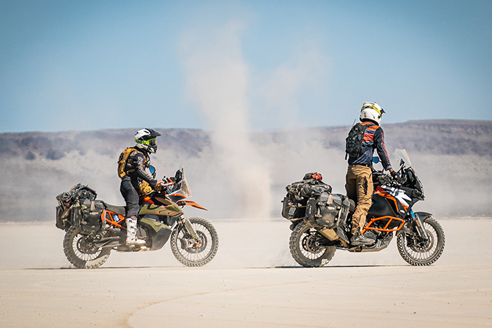
Designed to showcase the striking 5,000-foot elevation transition from the Steens Mountain to the Alvord Desert, this remote BDR-X starts and ends in Fields, Oregon (near section 1 of the Oregon BDR). The 246-mile loop can be accomplished in two days and offers a diverse mix of surface terrain, including gravel roads, rocky double-track, overgrown dirt roads, and open desert playa making this BDR-X truly unique. This 2-day loop is accessible after the snow melts and the roads open in June.

The post Backcountry Discovery Routes Releases Steens Mountain and Alvord Desert, OR BDR-X appeared first on Rider Magazine.

Source: RiderMagazine.com

Backcountry Discovery Routes: BMW and BDR Collaborate on New Oregon Route

Following the success of the first partnership between BMW Motorrad USA and Backcountry Discovery Routes in 2022 with the Wyoming BDR, the two groups have announced a second partnership for a route in Oregon. The new route will be officially launched Saturday, Feb. 4, at the premiere screening of the ORBDR Expedition documentary in Portland and other select locations around the nation. For more information, read the press release below from BMW Motorrad USA.


Backcountry Discovery Routes Oregon BDR

BMW Motorrad USA is excited to announce its second partnership with adventure motorcycling nonprofit, Backcountry Discovery Routes (BDR) on their newest route – Oregon. This is the second BDR route on which BMW Motorrad has collaborated, the first being the Wyoming BDR, released in 2022.

Related: New Route: Wyoming Backcountry Discovery Route

The ORBDR represents the organization’s 12th route for adventure and dual-sport motorcycle travel, with free GPS tracks, travel resources, and a Butler Motorcycle Map scheduled to accompany the film’s debut.

Backcountry Discovery Routes Oregon BDR

Luciana Francisco, BMW Motorrad USA head of brand and marketing, said BMW Motorrad is proud to partner with Backcountry Discovery Routes for the second time in two years.

“In 2023, BMW Motorrad celebrates its 100th year anniversary and also marks 43 years of BMW GS motorcycles,” Francisco said. “This is the perfect time to share our passion for the adventure and dual-sport riding communities and show our continued support for the BDR organization and what they stand for. We look forward to both new and experienced off-road enthusiasts being inspired by the scenic routes of the ORBDR.”

Related: Backcountry Discovery Routes: Two Buddies on Yamaha Ténéré 700s in Utah and Arizona

To launch of the new Oregon route, Backcountry Discovery Routes and BMW Motorrad will kick-off with a film premiere event in Portland, Oregon, and selected BMW Motorrad dealer events on Saturday, Feb. 4. Additionally, over 70 film screenings are planned through spring 2023, hosted by dealers and clubs around the country. More information on the film screening locations is available at the Backcountry Discovery Routes events webpage.

Backcountry Discovery Routes Oregon BDR

The ORBDR expedition film features members of the BDR team and special guests from BMW Motorrad USA, Mosko Moto, and Edelweiss Bike Travel as they take a first run on the all-new ORBDR. Starting in the high desert landscapes of Southeastern Oregon and exploring North into the Cascade Range, the crew tests their endurance, riding cross-state through 750 miles of lava rock, silt, sand, and steep mountain roads. Highlighting the state’s many natural wonders including hot springs, pyroducts, caverns, buttes, and glaciated volcanoes, the route and film showcases why traveling by motorcycle is one of the best ways to discover the backcountry of Oregon.

Story continues below trailer for ORBDR Expedition

Bryce Stevens, Oregon Route architect & BDR co-founder grew up in the Pacific Northwest and said he has “always been fascinated by volcanoes.”

“The ORBDR is a route filled with natural wonders of the volcanic kind. We designed the ORBDR to show off different regions of the state and keep the route ever-changing,” Stevens said. “Oregon has vast high desert in the southeast, sparse pine forests in the central part of the state, and densely forested mountains in the Cascade Range. It almost feels like three BDRs packed into one.”

Related: Backcountry Discovery Routes: Ep. 33 Rider Magazine Insider Podcast

Joining the expedition team in Oregon was Ricardo Rodriguez, lead motorcycle instructor at BMW’s U.S. Rider Academy in Greer, South Carolina. Ricardo is a graduate of BMW’s rigorous International Instructor’s Academy and has been teaching on-road street survival, adventure off-road, and authority riding skills since 2010.

“The BDR Team has set out on a fantastic mission, helping keep public lands accessible to the adventure community,” he said. “I am very proud and excited about the relationship between BDR, BMW Motorrad, and the BMW U.S. Rider Academy. Having the opportunity to be a part of the Oregon BDR has helped build my experience as a rider and a coach. Overcoming the challenges along the ORBDR reinforced to me the value of the skills we teach daily at the US Rider Academy.”

Rodriguez continued to say that Backcountry Discovery Routes offers properly trained riders an opportunity to put their skills to the test.

“The Oregon BDR is a challenge and reward riding adventure.”

For more information, visit the Backcountry Discovery Routes website.

The post Backcountry Discovery Routes: BMW and BDR Collaborate on New Oregon Route first appeared on Rider Magazine.
Source: RiderMagazine.com

Tracing the Cascades on a Yamaha Tracer 900 GT

2019 Yamaha Tracer 900 GT
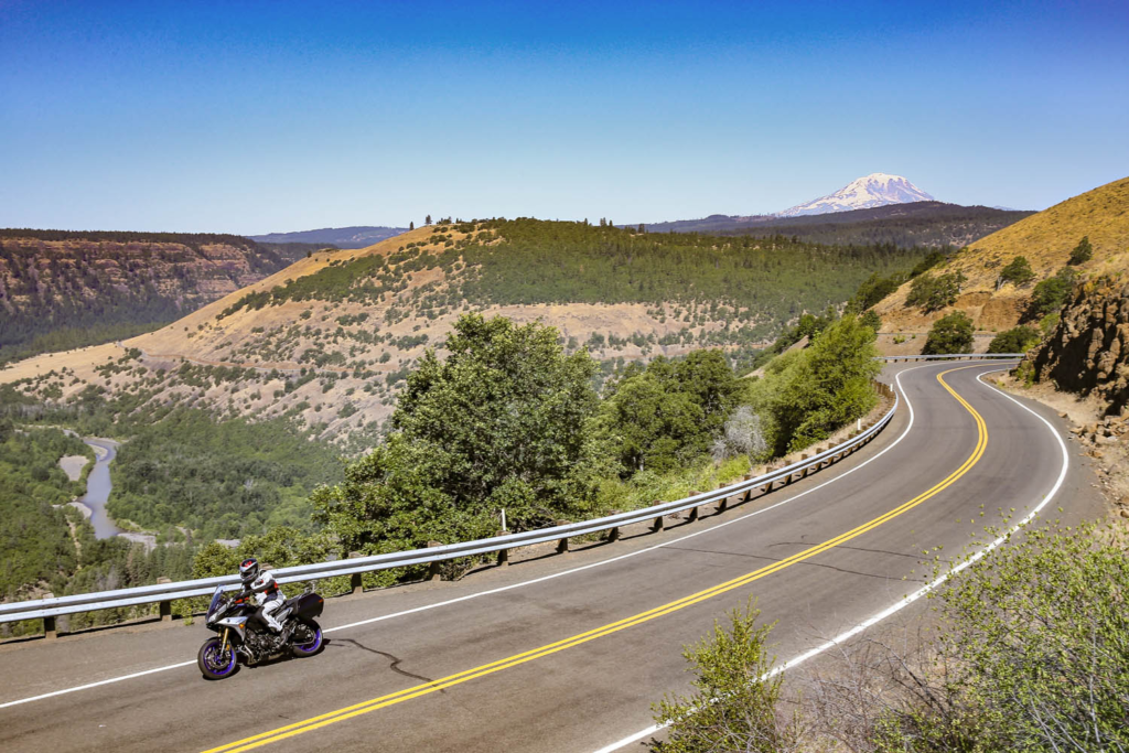
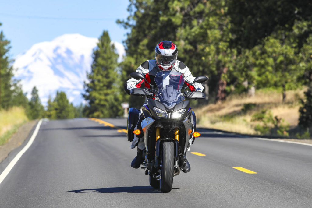
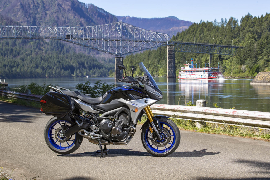
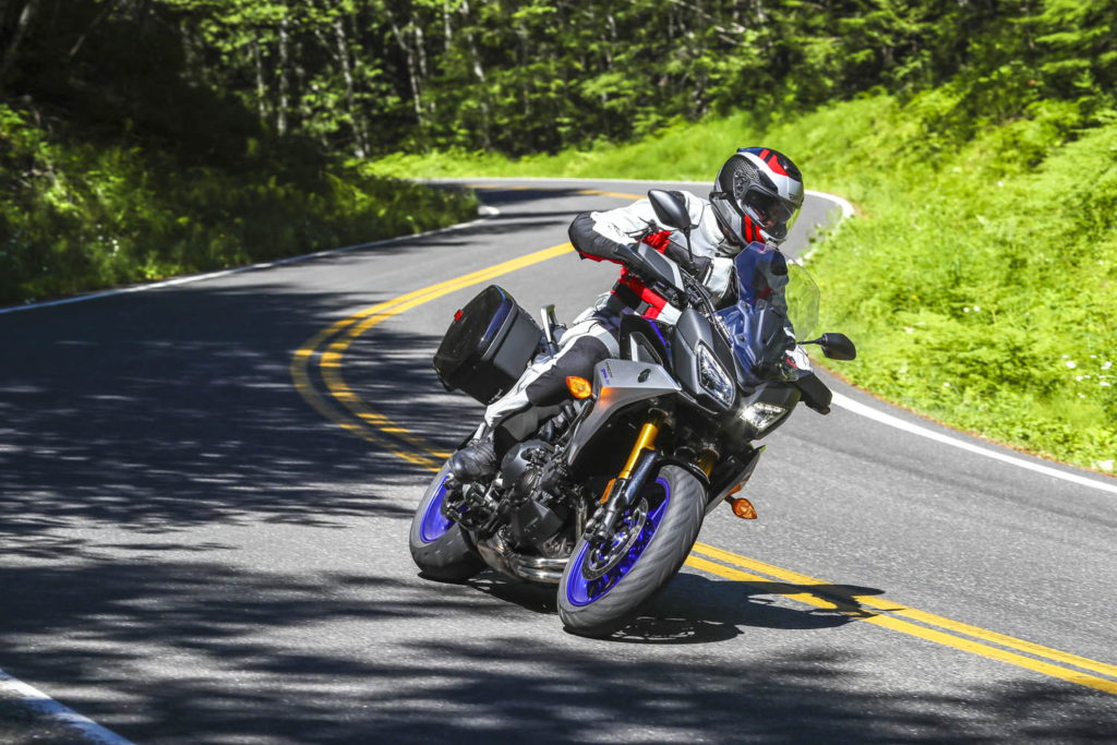
Road testing the 2019 Tracer 900 GT in Washington’s Klickitat River valley, with Mount Adams in the background. (Photos by the author & Brian J. Nelson)

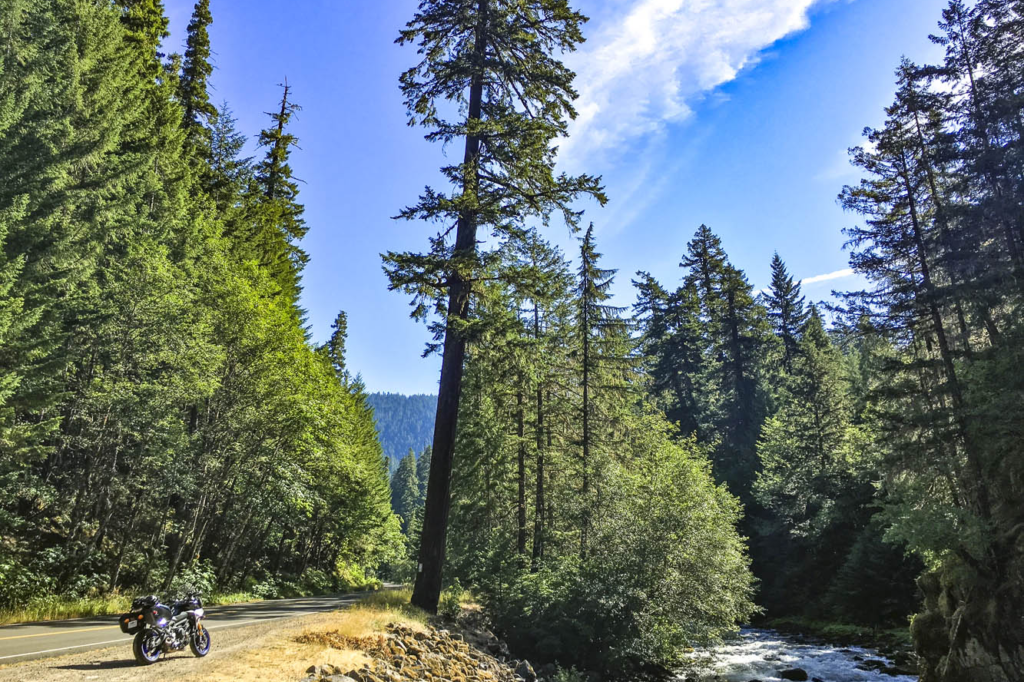
Winding through a dark canopy of evergreens, the road played hide-and-seek with the Clackamas River, offering a glimpse here and there of clear water pouring over rocks as it made its way downstream to the Willamette, then the Columbia, and finally the Pacific. A break in the canopy was like popping out of a tunnel and I set my eyes on a patch of gravel next to the road, just a few feet from where the river made a sharp turn. Down went the Yamaha Tracer 900 GT kickstand, off went the ignition. I hadn’t seen a car for miles. It was just me and the trees and the river. Just what I was looking for.

Emerging from a dark tunnel of trees on the West Cascades Scenic Byway, I found the perfect sunny spot to enjoy the sights and sounds of the Clackamas River.

The previous day I logged 250 miles aboard the Yamaha at the bike’s press launch. The event was based in Stevenson, Washington, a small town in the heart of the Columbia River Gorge National Scenic Area, and I spent a long, hot day testing the GT on local backroads. Weighing just 500 pounds and packing a punch from its 847cc inline-Triple, the Tracer 900 GT is a light, agile, comfortable sport-tourer, perfect for a solo traveler. Yamaha entrusted me with the keys to one for the long ride home to Southern California.

With snow-capped volcanic peaks, wild and scenic rivers, dense evergreen forests, and countless roads that follow the contours of the land, the Cascade Range is a motorcyclist’s paradise.

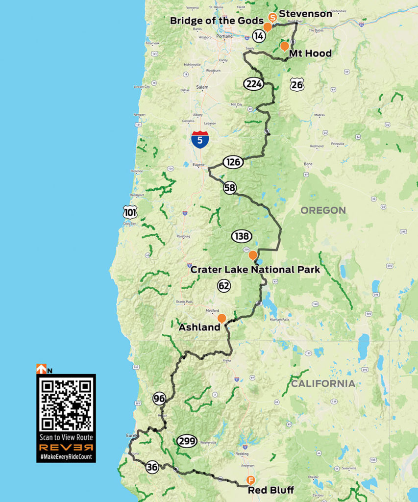
For years I’ve heard and read about how good the riding is in the Cascades, a mountain range that runs from British Columbia down through Washington and Oregon to Northern California. Whenever possible, I like to fill in the blank spots on my mental map –to experience first-hand what roads and scenery are really like. So I sketched out a route from the Columbia River to the California border that zigzags several times over the Cascades, winds its way through four national forests and one national park, and follows three designated scenic byways. Like any good motorcycle route, it would take at least twice as long as a more direct path.

2019 Yamaha Tracer 900 GT
The ride route from Stevenson, Washington, to Red Bluff, California.

Click here to view the route above on the REVER app/website

With the GT’s saddlebags packed and a tailbag strapped to the passenger seat, I hit the road at 6 a.m., crossing the mighty Columbia – and into Oregon – on the Bridge of the Gods, a steel truss bridge named after a natural dam that was created by a landslide at the same location nearly 1,000 years ago. The narrow, 90-year-old bridge has no pedestrian walkway, but it’s where the Pacific Crest Trail crosses the river, so weary hikers with heavy packs must contend with cars and trucks.

The Bridge of the Gods spans the Columbia River, which forms the border between Washington and Oregon.

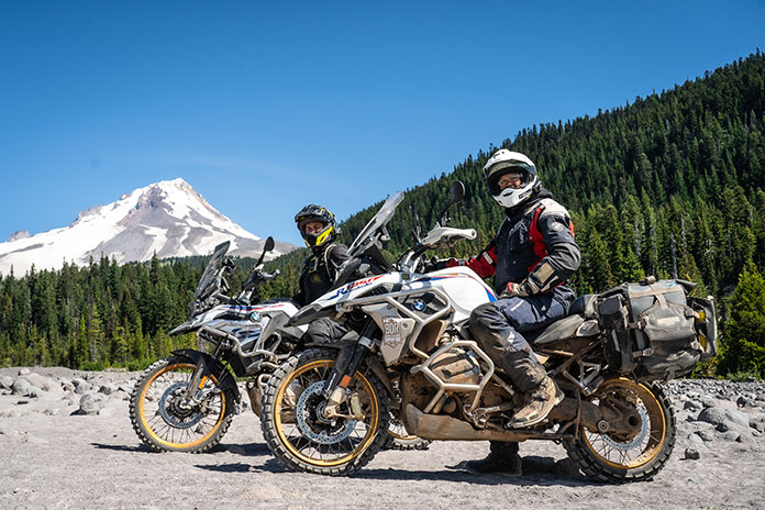
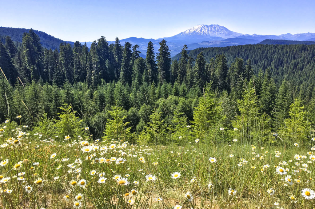
What makes the Cascades special is its many stratovolcanoes –the cone-shaped variety we learned about in grade school –that rise thousands of feet above the surrounding mountains. I’ve ridden along the eastern side of the Sierra Nevada in California dozens of times, and every time I pass through the town of Lone Pine, I struggle to pick out Mount Whitney – the tallest mountain in the lower 48 states – from the neighboring peaks that are nearly as tall. On the Tracer 900 GT press ride we saw several volcanic peaks, Mount Adams (12,281 feet) and Mount St. Helens (8,363 feet – before it blew its top in 1980, it was 1,300 feet taller) in Washington, and Mount Hood (11,249 feet) in Oregon, standing head and shoulders above the landscape, easily visible from miles away. They’re part of the Cascade Volcanic Arc, a series of 12 volcanoes stretching from Mount Silverthorne in British Columbia to Mount Lassen in California, which is part of the Pacific Ring of Fire –more than 450 volcanoes scattered along the outer edge of the Pacific Ocean.

When Washington’s Mount St. Helens erupted in 1980, it literally blew its top, erasing 1,300 feet from its peak. This view is from McClellan Overlook, off Curly Creek Road, in Gifford Pinchot National Forest.

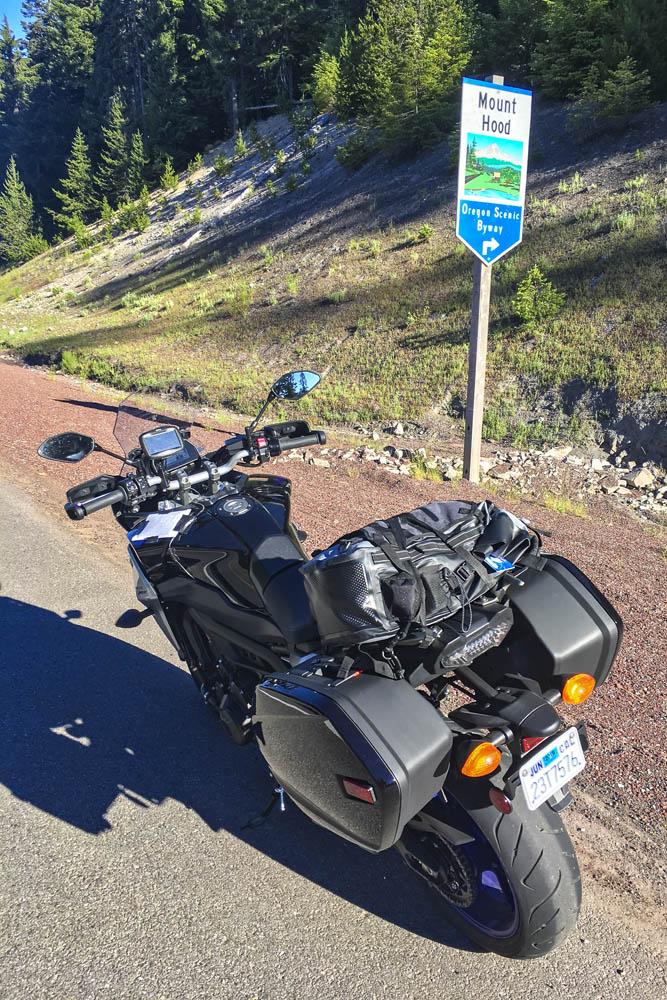
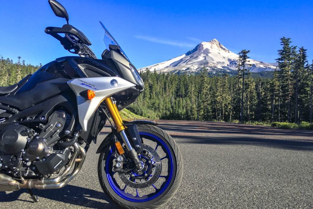
Like a good omen, snow-covered Mount Hood greeted me as I turned south on State Route 35, the beginning of Mount Hood Scenic Byway, where I rode through apple farms on a sunny, cloudless July morning. The previous day topped out at 105 degrees, and the heat wave wasn’t done with me, but early in the morning the byway along the East Fork Hood River was still in deep shadow and my teeth began to chatter. On went the heated grips, and I tried to hold onto the physical memory ofbeing cold, hoping to recall that feeling during theheat of the day (it never works). With graceful curves and smooth pavement, the byway is a pleasure to ride, especially when the screen of trees falls away and Mount Hood takes center stage, framed perfectly in brilliant blue.

Mount Hood Scenic Byway, one of many scenic byways that meander through the Cascades, cuts a wide arc around its namesake peak.

After cutting a wide arc around the eastern and southern sides of Mount Hood, my first crossing of the Cascades came to an end in Sandy. Turning south and then east on State Routes 211 and 224, I picked up the West Cascades Scenic Byway, heading southeast along Estacada Lake and North Fork Reservoir, two finger lakes created by dams on lower sections of the Clackamas River. As the byway crosses into Mount Hood National Forest, it enters a deep, narrow valley as it climbs up into the Cascades, where the Clackamas flows wild and free. The Tracer and I were in a groove, experiencing this road together for the first time –bends, kinks, dips, rises, bridges, blind corners, and fleeting views of the river, the contours of which give the road its character.

A postcard view of Oregon’s Mount Hood from Bennet Pass Trailhead, just off State Route 35 on the Mount Hood Scenic Byway.

With the low-fuel light on, I pulled into Detroit, a crossroads on the shore of Detroit Lake. Folks were starting their summer weekend early. Subarus laden with kayaks and pickups overflowing with camping gear were parked in lots, coolers were being filled with ice and beer. I refueled and scarfed an egg salad sandwich in the shadow of Rivers Run Deli, trying to stay cool while enjoying a view of the marina and the lake’s milky blue water. When traveling solo and covering a lot of miles in just a few days, I rarely stop for long. Just a few minutes here and there, then I’m back in the saddle, trying to cram 10 pounds of riding into a 5-pound sack.

Roads in the Cascades often carve their way through lush forests, with the curving pavement winding in and out of shadows.

From Detroit to Chemult – south, zig west, zag east, back over the Cascades –all I remember are trees, and a cross-section of America. Stopping to use the bathroom at a McDonald’s, I had to negotiate my way through a crowd of boisterous kids wearing matching blue T-shirts bearing the name of their church summer camp, ready to fill their bellies with Happy Meals. Outside, two young women were sitting on the curb, holding a sign: Family in Need. And next door I topped off the Tracer’s tank after the flirtatious – not to mention bald and tattooed – gas station attendant handed me the nozzle. (In Oregon and New Jersey, you’re not allowed to pump your own gas, but attendants often let motorcyclists break the law.) I was just passing through, little more than an observer. Experiences like these give me something to mentally chew on while ticking off miles.

2019 Yamaha Tracer 900 GT
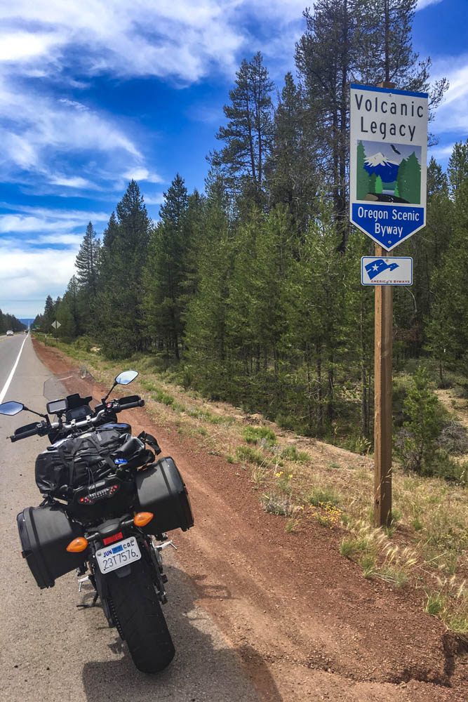
The 500-mile Volcanic Legacy Scenic Byway runs through Oregon and California, connecting volcanic peaks in the Cascades.

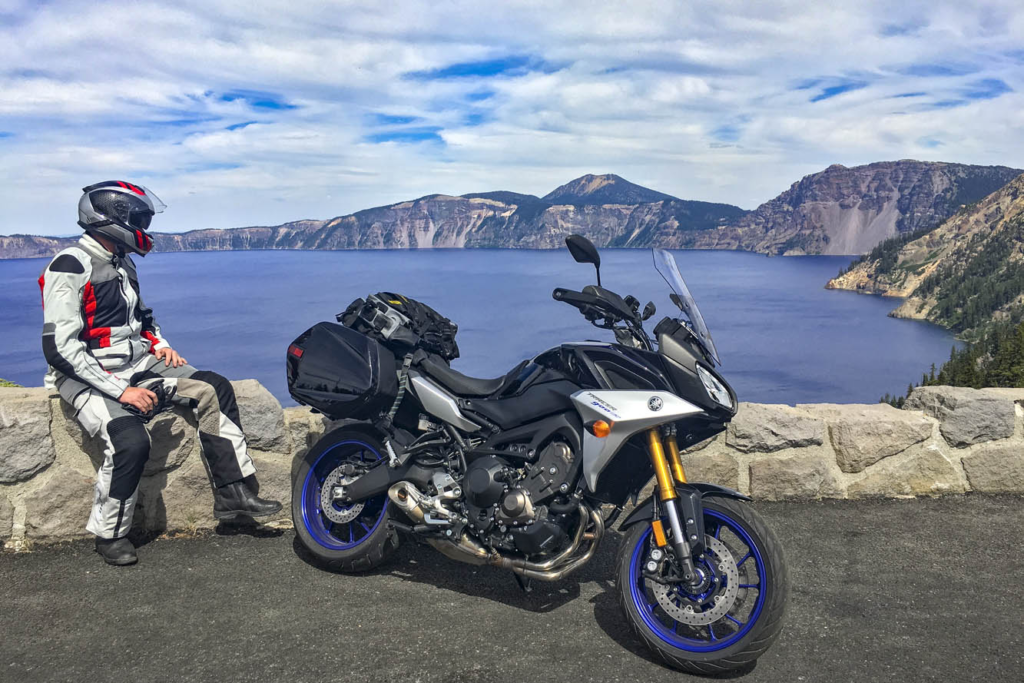
Passing through Chemult, a truck stop on U.S. Route 97 brought back memories of stopping there to refuel during my one and only SaddleSore 1000 ride back in 2013 – a very long day that I’m not likely to repeat. Turning west on State Route 138, the Volcanic Legacy Scenic Byway took me to Crater Lake National Park, where I queued up behind a rumbling Harley and a line of cars and RVs outside the northern gate, keeping my faceshield closed to prevent the army of mosquitos from waging war on my nose. Crater Lake was high on my list of must-see places, and it didn’t disappoint. Created thousands of years ago when a volcano collapsed, the caldera lake is nearly 2,000 feet deep – the deepest in the U.S. – and because it is filled only by rain and snow, the water is pure and a brilliant shade of blue. But I was pressed for time and there were construction delays on the East Rim Road, so I’ll have to go back to ride the full loop.

Taking in the brilliant blue of 2,000-foot-deep Crater Lake, a collapsed volcano filled with thousands of years’ worth of rain and snow.

On the not-politically-correct but wonderfully twisty Dead Indian Road, I descended from the green heaven of the Cascades into the dry, brown hell of Ashland. It’s actually a lovely little town, home to Southern Oregon University and the world-famous Oregon Shakespeare Festival, but it was over 100 degrees and I had been in the saddle for 12 hours. I was in desperate need of a cold shower, a colder beer, and some pizza.

The next day I left the Cascades, riding a few miles south on Interstate 5 into California, where I filled up at a Chevron in Hornbrook. On both sides of the interstate and all around the gas station, the ground and vegetation were charred black from the Klamathon Fire, which roared through just days earlier. It was one of many wildfires that would plague California and other western states in the weeks and months ahead.

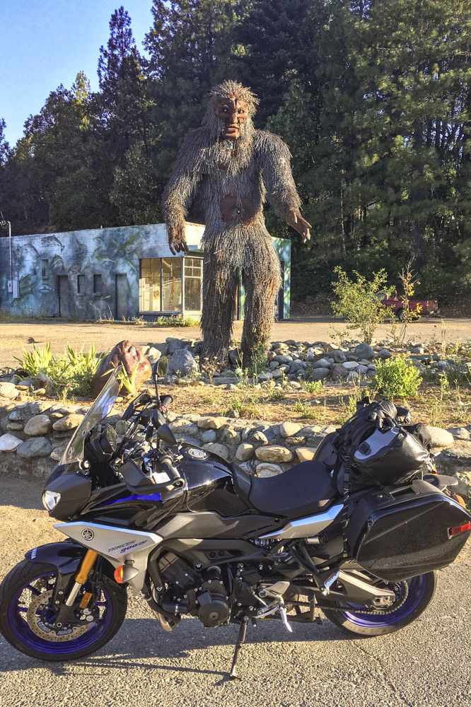
More blanks filled in on my mental map: State Route 96 along the Klamath and Trinity rivers, which cuts through rugged, remote country. In 1941, a group of armed men stopped traffic near the town of Yreka, handing out a Proclamation of Independence for the State of Jefferson, which was in “patriotic rebellion against the States of California and Oregon.” Although the new state never materialized, the movement is still active, and the State of Jefferson Scenic Byway runs along Route 96 from State Route 263 to Happy Camp. After that, 96 becomes the Bigfoot Scenic Byway. Regardless of one’s views on state politics or mythical forest dwellers, the riding along Route 96 is sublime and traffic is almost nonexistent.

Sasquatch sighting in Happy Camp, California, on State Route 96, where the State of Jefferson Scenic Byway turns into the Bigfoot Scenic Byway.

At Willow Creek, I turned west onto State Route 299, known as the Trinity Heritage Scenic Byway because it follows the path of 19th-century gold miners and pioneers. It snakes its way through the heavily wooded Trinity Alps and climbs over a pass before making a long descent to the coast. Even in mid-July, U.S. Route 101 through Arcata, Eureka, and Fortuna was socked in with chilly fog. At Alton, I turned east again, heading inland on State Route 36 –not a designated scenic byway, but known as Serpent to the Sea. Traveling west-to-east, it passes through a few rural communities before entering Grizzly Creek Redwoods State Park, where enormous coast redwoods rise hundreds of feet above the roadside.

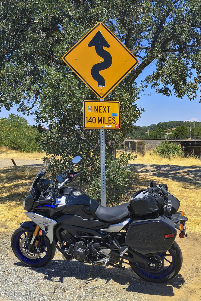
Beyond Bridgeville, Route 36 turns into a narrow goat path as it goes over a ridge, but it’s currently being straightened and widened to accommodate big trucks and RVs –an improvement for them but not for motorcyclists. East of Dinsmore, Route 36 was freshly paved, like having a racetrack all to myself, scraping the Tracer’s peg feelers in corner after corner. And on it goes, over more mountains with endless curves and finally roller-coastering its way through ranch land with blind crests and sudden drops and quick turns. As I approached the town of Red Bluff, just before Route 36 crosses I-5, I found the well-known sign that warns motorists and entices motorcyclists: curvy roads next 140 miles.

This sign tells motorcyclists everything they need to know. Good times ahead!

The thing about riding roads as good as these is that it becomes addictive. Now that I have experienced the Cascades and California Routes 96 and 36 for myself, all I want to do is go back for more.

The post Tracing the Cascades on a Yamaha Tracer 900 GT first appeared on Rider Magazine.
Source: RiderMagazine.com