Tag Archives: Southeast U.S.

Southern Exposure: A Tennessee and Kentucky Motorcycle Ride

Kentucky Tennessee Motorcycle Ride Tim Kessel
This Kentucky and Tennessee motorcycle ride includes a section of the Natchez Trace Parkway, which starts less than 20 miles from downtown Nashville. The historic road follows an ancient pathway for 444 miles to Natchez, Mississippi, on the Mississippi River. (Photos by the author and Cheryl Kessel)

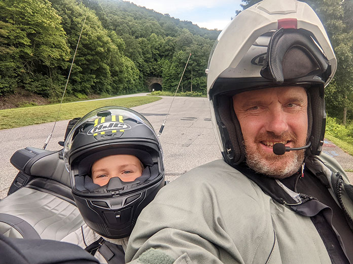
When a family friend decided to celebrate a milestone birthday in Nashville, our interest was piqued. Being big music fans and suckers for seeing new places, especially those with famously good motorcycling roads, my wife, Cheryl, and I decided to tag along. Others handled the search for accommodations and entertainment opportunities for the trip, so I was left to handle the most important job: securing a motorcycle for some adventuring. 

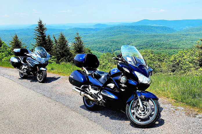
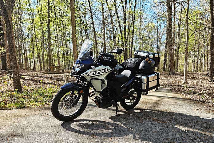
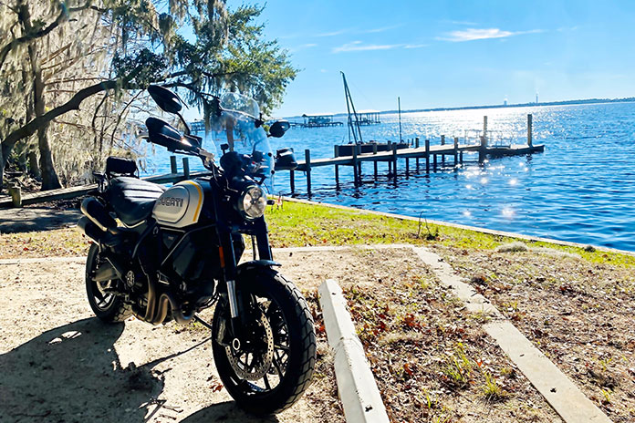
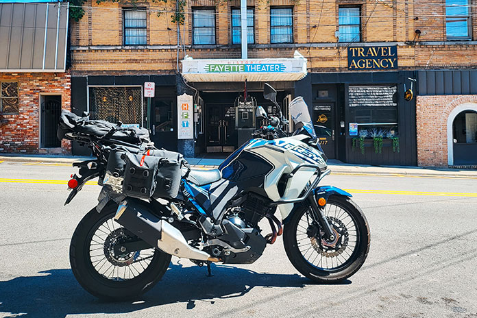
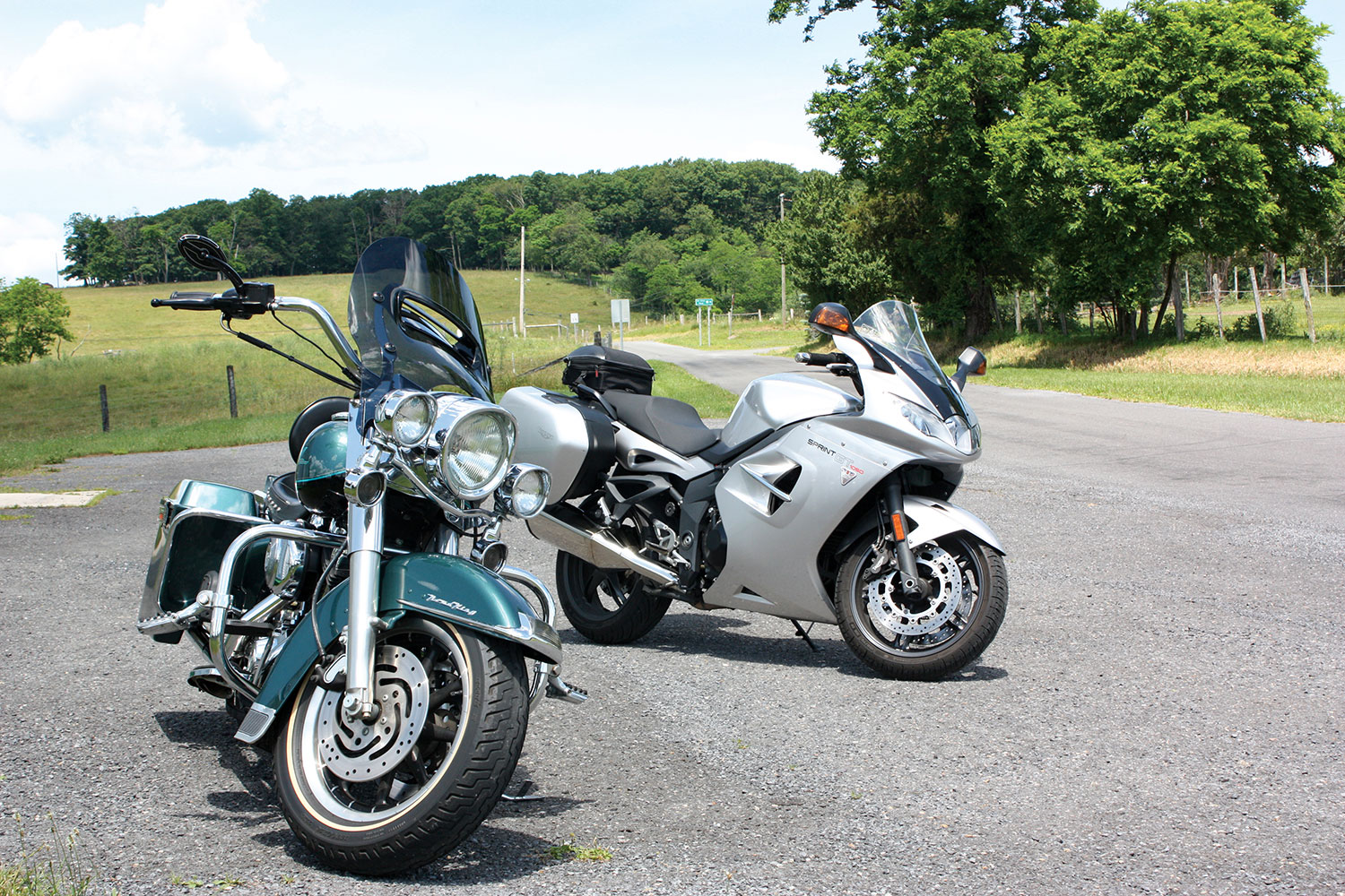
None of the rental companies in Nashville had a motorcycle that matched my criteria, so I searched the Riders Share peer‑to‑peer rental website and found a BMW F 750 GS. I had never used this kind of rental service before, and after some easy back and forth with the motorcycle’s owners, our rental was secure. The owners even agreed to deliver the bike directly to our lodging for a small fee. All we had to do was pack riding gear. 

Kentucky Tennessee Motorcycle Ride Tim Kessel

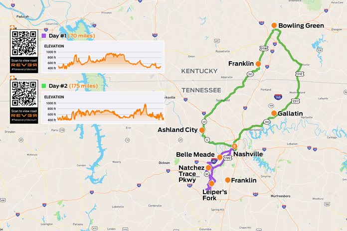
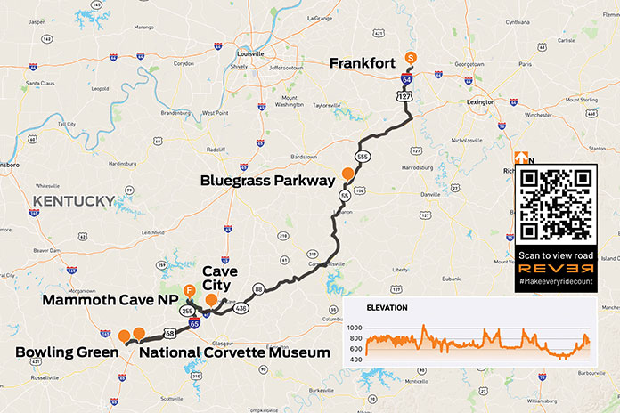
Scan QR codes above or click Day #1 or Day #2 to view routes on REVER

After a late‑night arrival in Nashville, we settled into our rental apartment downtown. About noon the following day, a clean, blue GS rolled up. The friendly owners, Madison and Tim, gave me some great local knowledge tips for our first afternoon of riding.

Day 1: Leiper’s Fork and the Natchez Trace Parkway | Tennessee Motorcycle Ride

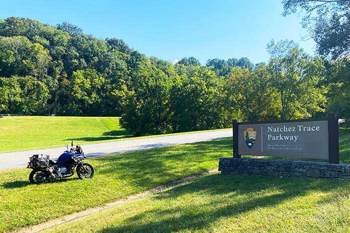
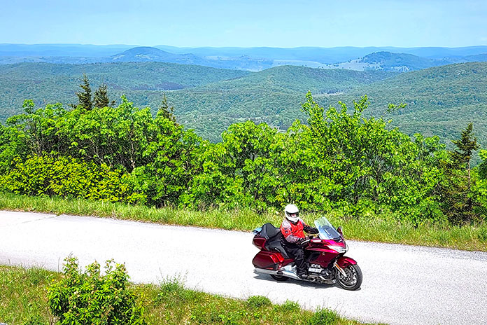
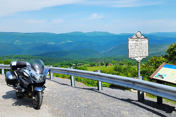
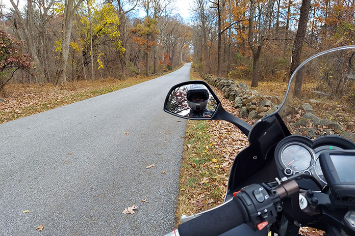
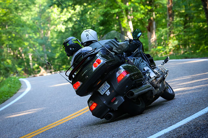
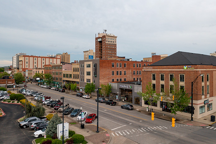
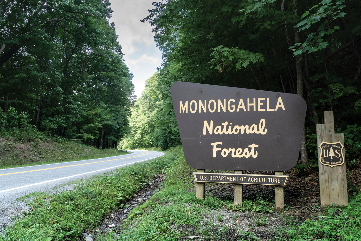
We did not have time on this trip for the complete 444 miles of the famed Natchez Trace Parkway, but I knew we had to ride part of it. Tim gave me a strategy for seeing some great locations and sampling the parkway in an afternoon of riding. Nashville is a hive of tourist activity, and leaving the metro area went how you would expect. We weaved around party buses and through the dense traffic, finally leaving behind the neon lights, blaring music, and bar‑hopping activity for a Tennessee motorcycle ride through the countryside.

Kentucky Tennessee Motorcycle Ride Tim Kessel
The 1,572-foot-long Natchez Trace Bridge is an impressive structure both from below and from above. It carries the Natchez Trace Parkway 145 feet above State Route 96.

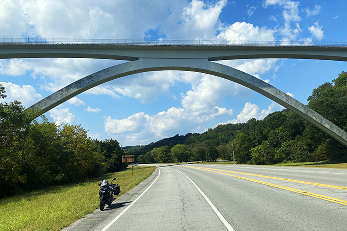
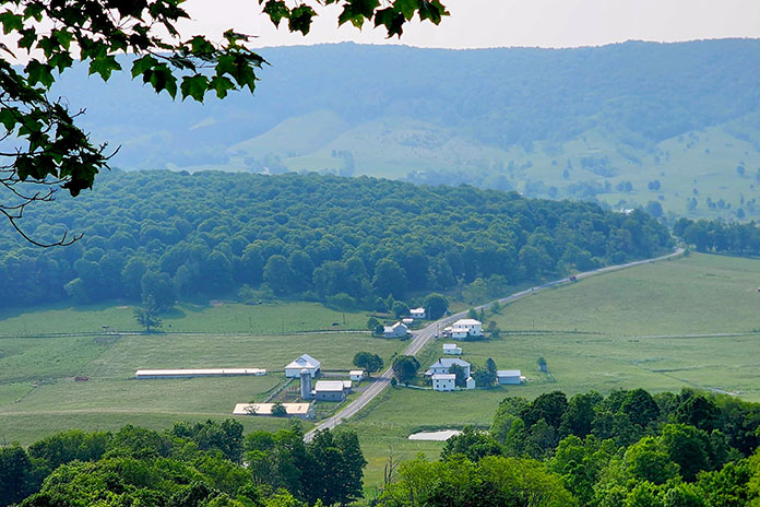
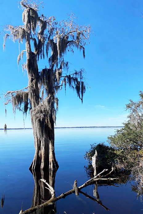
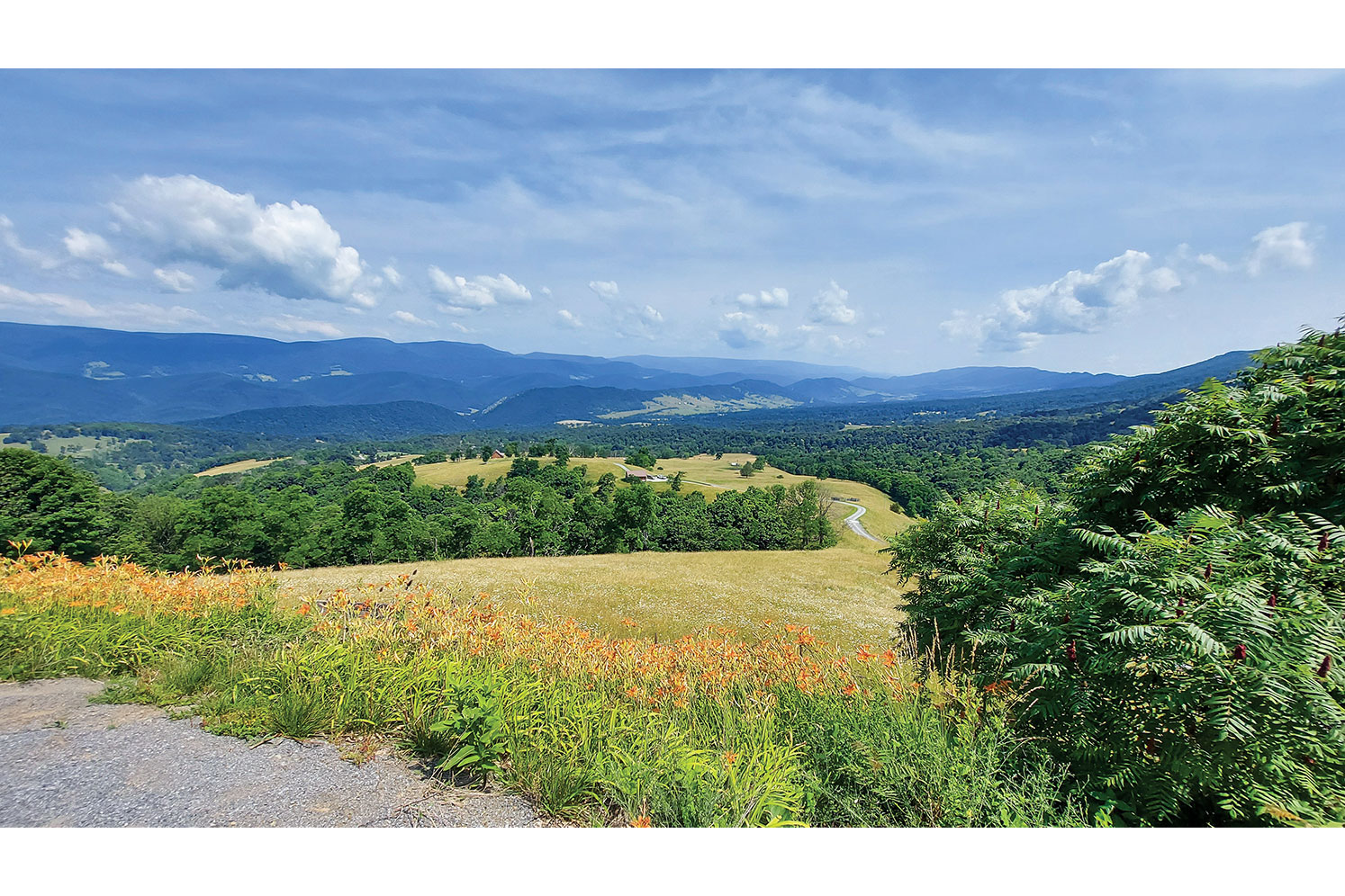
We headed northwest on Interstate 40 through farmland and beside impressive southern mansions, both historic and modern. Our eyes, conditioned by the muted pastel hues of our home state of Arizona, were dazzled by the vibrant greens of the Tennessee landscape. After exiting the freeway at McCrory Lane, perfectly furrowed crops and geometrically mowed estate lawns lined the sweeping corners. On State Route 96, the Natchez Trace Bridge, with its sweeping, whitewashed double arches, grew on the horizon. 

See all of Rider‘s Tennessee touring stories here

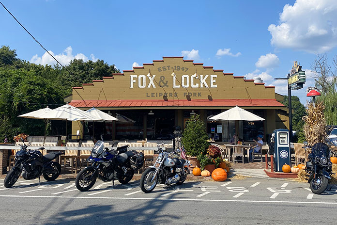
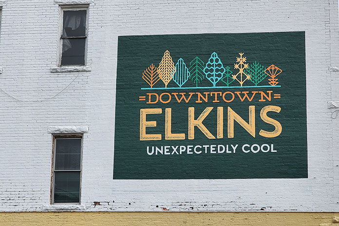
A bit more riding brought us to Leiper’s Fork. The quaint village, once a virtually unknown dot on a map, has emerged as a small, thriving arts and entertainment center. It is also near sprawling estates owned by music and entertainment superstars like Faith Hill, Tim McGraw, and Nicole Kidman.

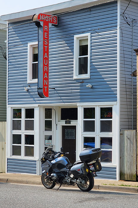
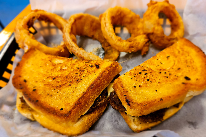
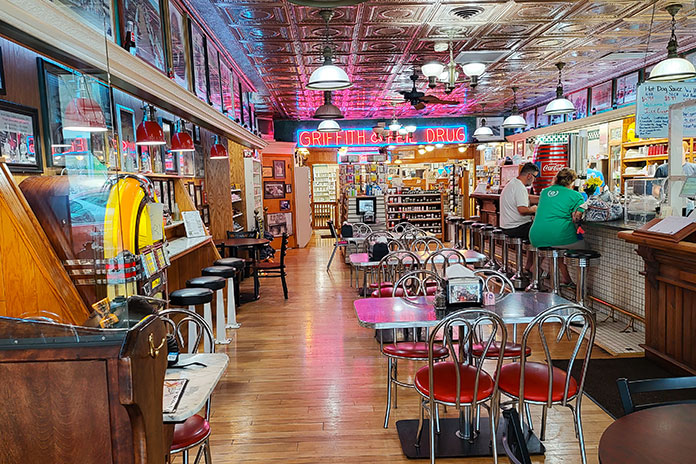
On the town’s short main street, we dropped a kickstand at the Fox & Locke Restaurant, a historic establishment with a common feature at any bar or restaurant in this neck of the woods: a stage for live performances. Cheryl ordered the classic BLT, and I chose the catfish sandwich – flaky white fish topped with a medley of slaw, grilled onions, and pickles – which was a culinary highlight of our entire vacation.

Kentucky Tennessee Motorcycle Ride Tim Kessel
The Fox & Locke in Leiper’s Fork, Tennessee, is a favorite stop for motorcyclists near the Natchez Trace Parkway.

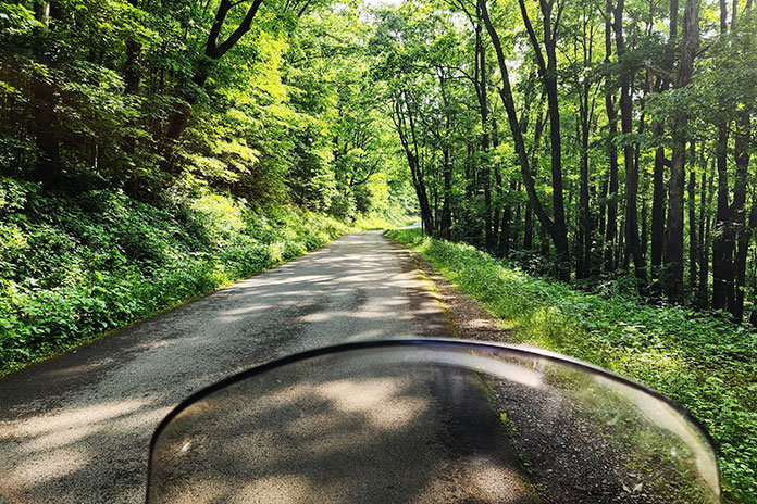
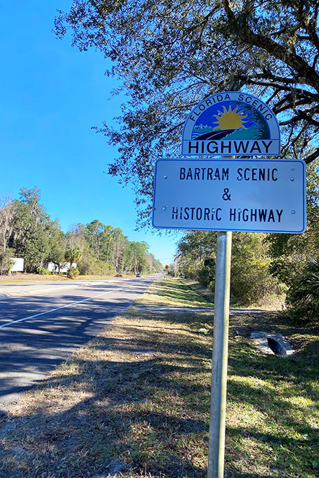
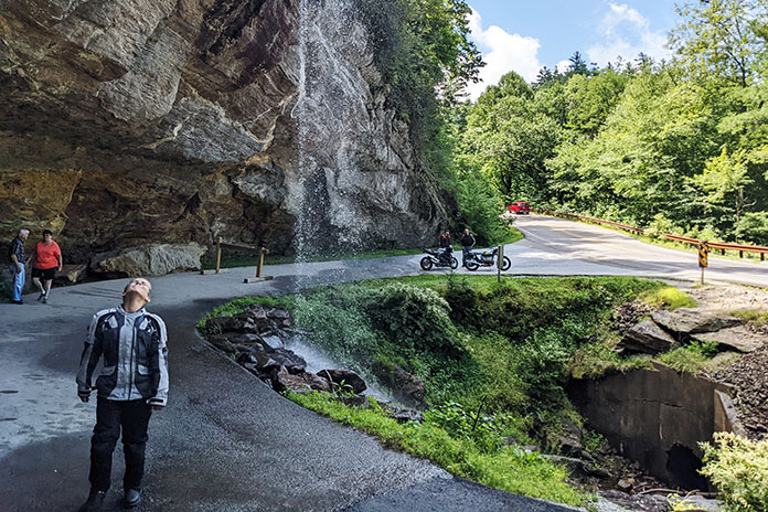
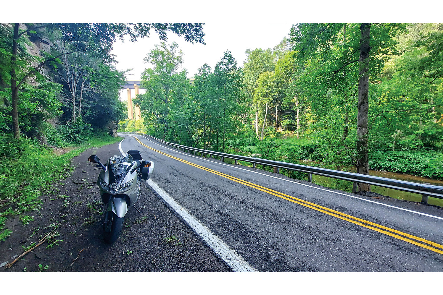
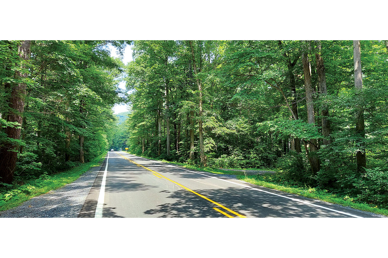
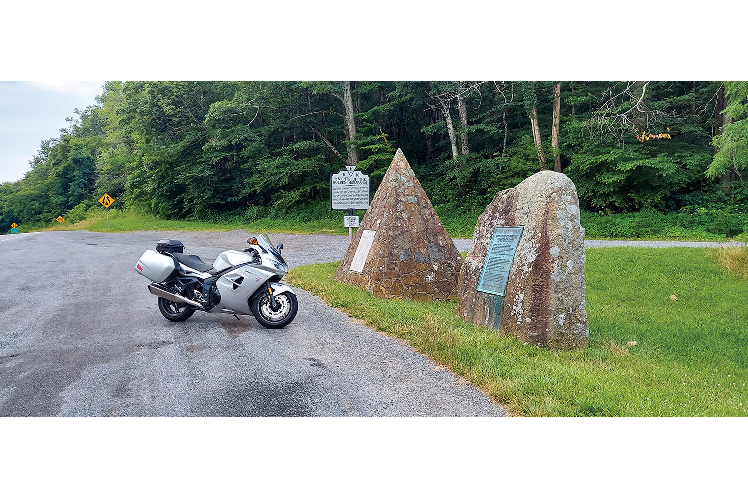
After a walk by the shops and galleries of the small town, we rode onto the Natchez Trace Parkway. It was almost surreal how the traffic dropped away, the road became smooth, and the terrain morphed into an undulating delight. Mowed grass lined the sweeping corners of the parkway, and wooded thickets added to the texture of the ride. I did not have to slow for traffic once on our way to the Parkway’s northern end, which included riding over the massive bridge that we rode beneath earlier. The entirety of the Natchez Trace is now on my bucket list of rides. 

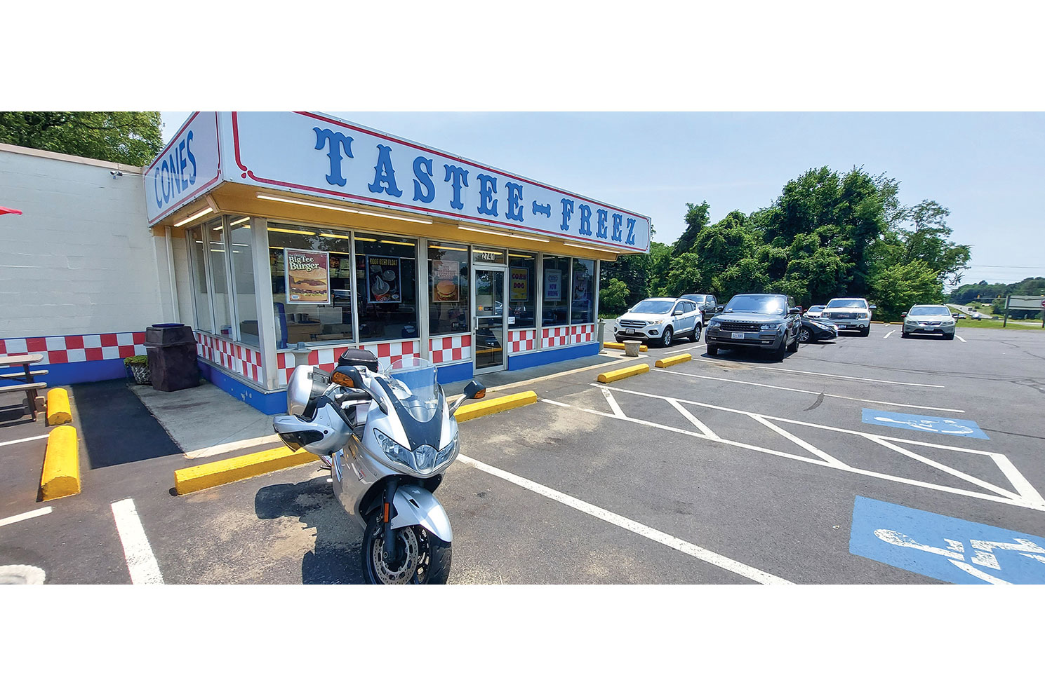
After exiting the Parkway, we passed another famed local eatery, the Loveless Cafe, but I was too full from lunch to indulge in their legendary biscuits and gravy. We made our way to the Belle Meade Estate and Winery for a brief tour of the historic property before rolling back into Nashville.

Kentucky Tennessee Motorcycle Ride Tim Kessel Nashville
Nashville is a nonstop mix of neon, live music, and bustling watering holes.

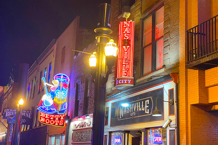
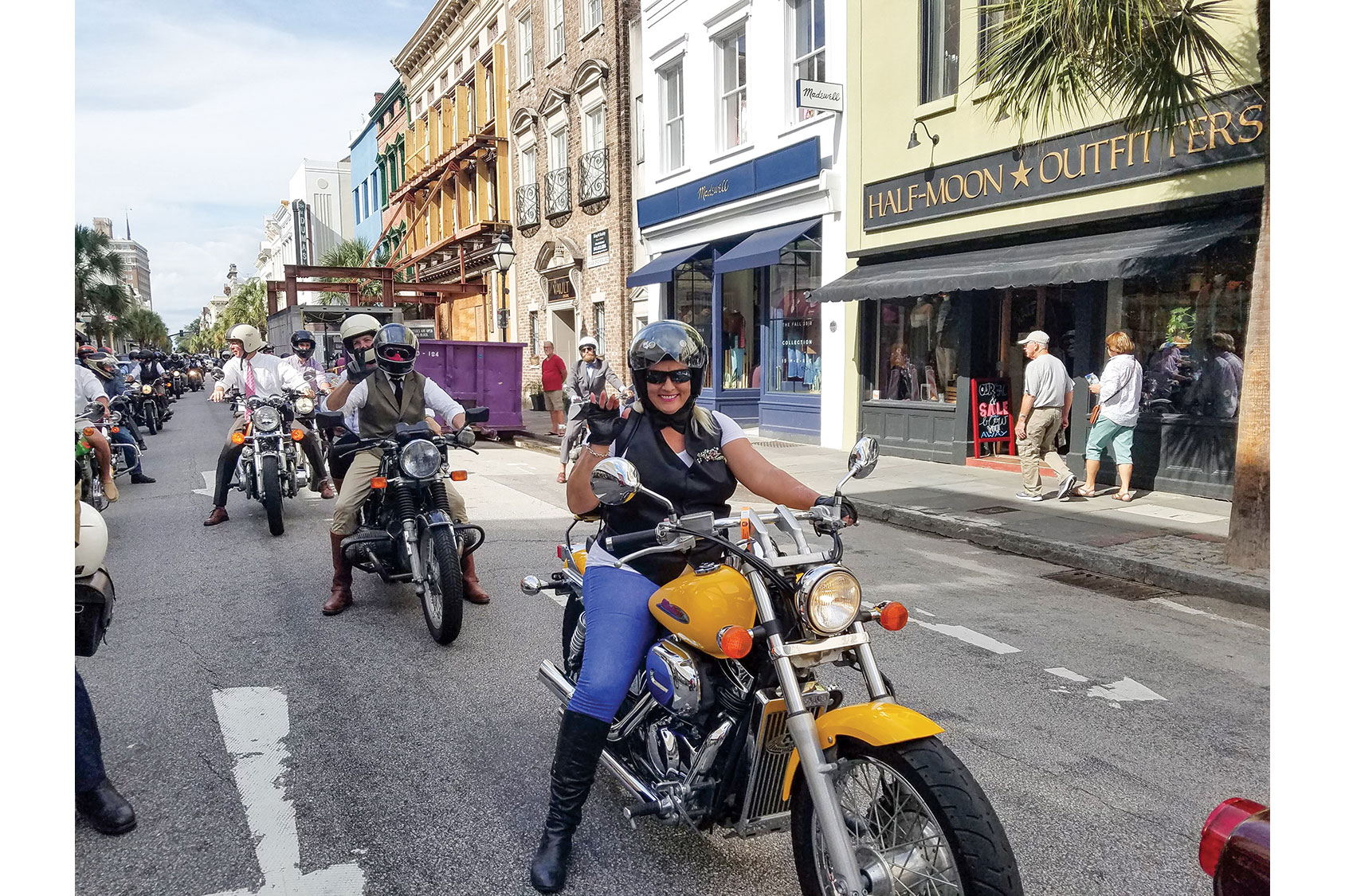
We spent the night sampling what has made Nashville famous – music. I doubt there’s a Broadway Street music hall that we did not visit. Night clubs sporting the names of famous country stars teemed with tourists as music blared from every direction. Multi‑leveled bars offered performers on each floor. We opted for the rooftop settings as they tended to be less intense and crowded. Far from a lazy Southern city, Nashville is a frenzy of people and music often referred to as “Nashvegas.”

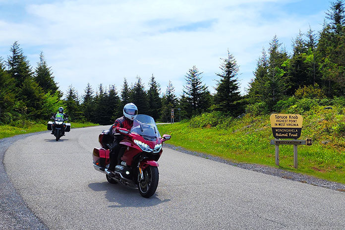
Day 2: Burning Barns and Bowling Green | Kentucky Motorcycle Ride

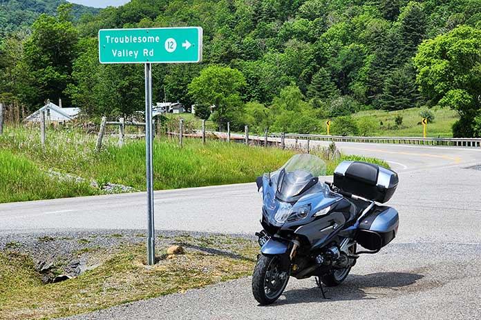
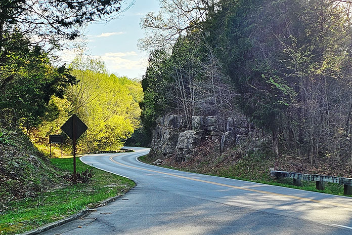
With country music still ringing in my ears, I geared up for a solo ride north of Nashville as Cheryl opted to sleep late. I headed northwest toward Ashland City on State Route 12, a smooth and pleasant roll through sweeping corners on a road which lived up to its designation as a state scenic parkway. From Ashland City, I made my way onto State Route 49 on a northeastern path toward Kentucky.

I was fully engulfed in farmland. End‑of‑season cornfields dried in the September sun, and various other crops were green and thriving. An unexpected sight led me to stop and reach for my cellphone. Smoke was wafting from the gables and overhangs of a large red barn. I could not help but think about the short story “Barn Burning” by one of my favorite Southern authors, William Faulkner. Just before I did my civic duty by calling 911, I noticed another barn on the horizon emitting the same white smoke. A quick Google search set me straight. 

Kentucky Tennessee Motorcycle Ride Tim Kessel tobacco barn
As it cures, tobacco hangs like giant bats in a Kentucky barn.

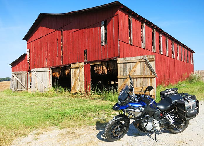
It was tobacco curing season, and farmers were drying their crop at 135‑140 degrees with carefully controlled fires within those barns. What was, at first, a concerning sight was now a source of intrigue and education for this Arizona boy. After passing by those smoldering structures, I saw another type of tobacco curing: huge red barns had doors opened wide, and tobacco hung from ceilings. If I hadn’t already done my roadside research, I may have mistaken the tobacco leaves for drying animal hides.

See all of Rider‘s Kentucky touring stories here

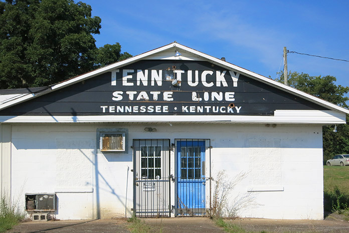
The ride through farmland continued as I passed from Tennessee into Kentucky, another tobacco‑producing state. The road carried new signage as Kentucky Route 383. I rolled into Franklin, a historically rich small city with a beautiful brick and stone downtown area, where Johnny Cash and June Carter were married at the First United Methodist Church. There is much to do in Franklin: thoroughbred racing and gaming at The Mint at Kentucky, tours and live dueling reenactments at the Sandford Duncan Inn, and Kentucky’s largest sunflower maze in August at Ruby Branch Farms. Kentucky is famous for its whiskey, and the Dueling Grounds Distillery is on the Kentucky Bourbon Trail Craft Tour.

Kentucky Tennessee Motorcycle Ride Tim Kessel
A farmer took his tractor to new heights in the region’s rich farmland.

On my way out of town, I stopped at The Fork In The Road, an art installation of a Paul Bunyan‑sized utensil located at the corner of Bunch and Uls roads. Continuing north on U.S. Route 31W toward Bowling Green, I passed Octagon Hall, an eight‑sided brick home built in 1847 that is now a museum of Civil War artifacts.

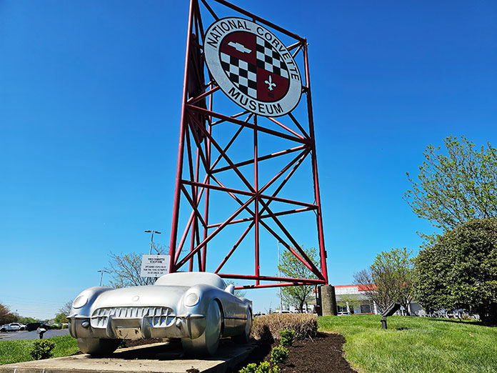
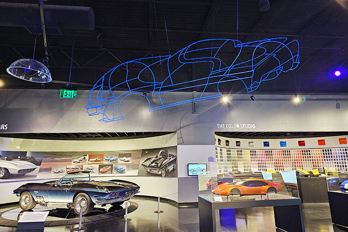
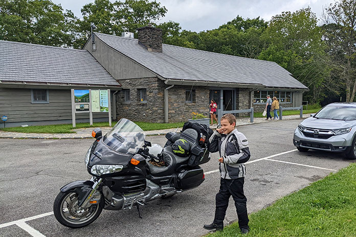
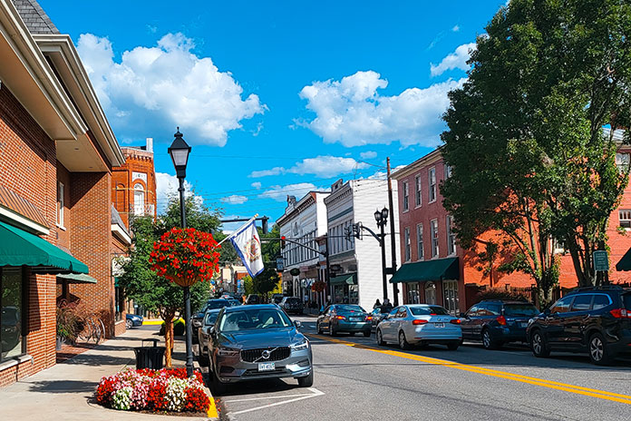
Bowling Green is not just a bustling and vibrant Southern city; it is also the only place in the world where Corvettes are made. I rode past and beside several of the sleek Chevys as I made my way through the city, which is also home to the National Corvette Museum. I motored through the attractive Western Kentucky University campus with its white‑columned and red‑brick buildings. The campus also preserves several historic structures like the impressive Felts Log House, which was built by a Revolutionary War veteran around 1810 and relocated to its current location in 1980. 

Kentucky Tennessee Motorcycle Ride Tim Kessel
This unassuming building squats directly on the Tennessee/Kentucky state line.

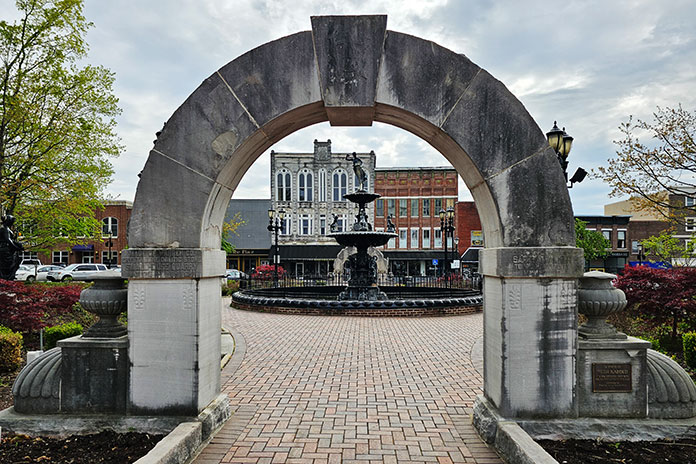
After WKU, I made my way to the downtown district. The town square is a lively city centerpiece. A garden‑like central park sits in the shadows of historic stone buildings, and a beautiful fountain sits as the heart of the setting. My walk around the city center included several historically significant buildings and memorials. The area is well worth a visit.

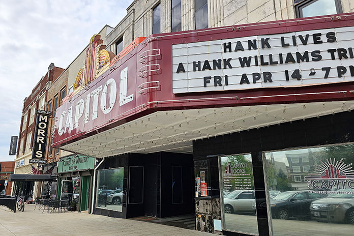
The quick route back to Nashville from Bowling Green would be Interstate 65, but where’s the fun in that? I rode U.S. Route 231 south through southern Kentucky and northern Tennessee until I made the southwestern turn onto U.S. Route 31 toward Nashville. It was a nice, relaxing end to my “exposure” of this part of Tennessee and Kentucky. We ended the night back on the streets of Nashville, visiting the famed Ryman Theater, listening to country music, and sampling Tennessee whiskey. 

Kentucky Tennessee Motorcycle Ride Tim Kessel Bowling Green
The beautiful town square in Bowling Green, Kentucky, is a great place to drop a kickstand and stretch the legs.

Nashville, Bowling Green, and the other smaller towns I visited all exuded their own Southern charm. This was my first visit to the area, and it won’t be my last. I plan to ride the entire Natchez Trace Parkway, and the Nashville area will be either the staging location or the end game to that journey.

See all of Rider‘s touring stories here

Tennessee Motorcycle Ride Resources

Kentucky Motorcycle Ride Resources

The post Southern Exposure: A Tennessee and Kentucky Motorcycle Ride appeared first on Rider Magazine.

Source: RiderMagazine.com

Asphalt Heaven: Riding West Virginia Backroads

Asphalt Heaven West Virginia backroads Scott A. Williams Seneca Rocks
Fog was stubborn this morning at Seneca Rocks, but it couldn’t dampen my admiration for West Virginia backroads.

What I like most about motorcycles is that they lean, a trait I describe to nonriders as “dancing with a machine.” A motorcyclist can select a dance partner ranging from a svelte sportbike to a big‑­boned tourer, but how well that partner performs depends on the quality of the dance floor: the road. 

My favorite motorcycle dance floors are smooth asphalt ribbons that snake over mountains and along waterways, and some of the best I’ve found anywhere are West Virginia backroads. Appropriately called the Mountain State, it’s where the Allegheny, Blue Ridge, and Appalachian mountain ranges converge. With the highest average elevation of any state east of the Mississippi River, the roads curve over and around a rugged, varied landscape. The quality of road surfaces in West Virginia is generally superb (see sidebar at end of article). For riders who love to lean, it’s idyllic.

Asphalt Heaven West Virginia backroads Scott A. Williams

Scan QR codes above or click “Day 1,” “Day 2,” or “Day 3” to view routes on REVER

As I made my way south into West Virginia on these great winding roads, a familiar anthem played in my head, albeit somewhat revised: Asphalt heaven, West Virginia, Blue Ridge Mountains, Shanandoah River…

No disrespect to John Denver, but your humble scribe gives top billing to the West Virginia backroads. I was headed to Elkins, a small city at the edge of the Monongahela National Forest in the heart of Randolph County where a group of riders had bivouacked at the Holiday Inn Express. This location offered easy access to the region’s fantastic roads and a short walk downtown to multiple options for post‑­ride dinner and libations.

See all of Rider‘s West Virginia touring stories here

Next morning, I mounted my BMW R 1200 RT and joined routemeister Ed Conde for a well-planned 245‑­mile loop through the Allegheny Highlands. In morning fog, our group rode south on U.S. Route 250, then turned north on State Route 28 at Thornwood. The road was fantastically curvy, though a low‑­pressure warning for my rear tire was a cause for concern. After turning east on U.S. 33 at Judy Gap, we stopped at the Germany Valley scenic overlook, which was fogged in but had room for several bikes to safely pull off the road. I discovered a screw in the center of my tread, but the right tools – and folks willing to help – made for a quick repair.

Asphalt Heaven West Virginia backroads Scott A. Williams Spruce Knob
Stiff winds atop Spruce Knob forced these evergreens to grow leeward.

At Franklin, we turned north on U.S. 220. Just past Upper Tract, we continued north on Smoke Hole Road. This very narrow, winding two‑­way road has continuous blind corners, elevation changes, and no center line, with several curves signposted at 5 mph. In one curvy section, we had to get past a farmer whose tractor was pulling a trailer with implements sticking out the side. He pulled as far over as he could, and we squeezed by and acknowledged his effort. The pavement was not as smooth as most roads that day, but the adrenaline meter was pegged. Smoke Hole Road isn’t for the faint of heart.

Asphalt Heaven West Virginia backroads Scott A. Williams
Located on U.S. 33 on the way to Franklin, this convenience store looked at home in West Virginia.

We rejoined SR‑­28 near Cabins and wound our way south along the North Fork South Branch Potomac River to Seneca Rocks, where ragged rock ridges reach skyward 900 feet. During World War II, American soldiers trained on these cliffs, and many applied the skills they learned to scale the cliffs of Normandy on D‑­Day. These days, the rocks are popular with climbers and photographers.

Our ride had been largely within the Monongahela National Forest, and we were back in the heart of it. We rode west on U.S. 33, north on SR‑­32, north on SR‑­72 (Dry Fork Road, another winding, single‑­lane gem), and east on U.S. 48, part of the Seneca Trail, to the hip little town of Thomas in Tucker County. At The Purple Fiddle, where “Live Music Lives,” our lunch break included a performance by a physician-musician who sang about a strained relationship with his one‑­eyed grandmother: “We don’t see eye‑­to‑­eye.”

Asphalt Heaven West Virginia backroads Scott A. Williams Spruce Knob
David Somers of Northfield, New Jersey, motored toward the summit of Spruce Knob along NF 104.

Lunch cravings satisfied, we rode north through Silver Lake and Aurora, over to Macomber, and down to Parsons. A growing part of West Virginia’s energy industry is powered by wind, and we encountered giant turbines spinning atop ridgelines. Later, riding south on deliciously winding U.S. 219, a wide‑­load pilot vehicle stopped all traffic so a tractor‑­trailer hauling a giant windmill blade could get through a section of tight turns. The impressive rig rolled by as we waited. The long blade had wheel‑­trucks attached directly to it, turning the blade into a trailer transporting itself. As the afternoon sunshine grew warmer, we eased back to Elkins.

Out of several local restaurants near the hotel, I picked C. J. Maggie’s and joined other riders for supper at the bar. Later, as we socialized on the hotel’s back patio, the mayor of Elkins, Jerry Marco, paid us a visit. Hizzoner was gracious and welcoming, genuinely pleased to have dozens of motorcyclists staying in his city.

Asphalt Heaven West Virginia backroads Scott A. Williams Elkins
Truth in advertising.

In the morning, I hit the road early and solo, with more twisties and high elevations being my key goals. As I pulled my bike up off the sidestand, I felt some soreness across my chest. Rowing the handlebars of a 630‑­lb sport‑­tourer at a quick pace over hundreds of miles of tight curves had proved a workout.

Aiming the RT east along winding U.S. 33, I made rapid progress toward Alpena, Harman, and Onego. Asphalt heaven, West Virginia repeated in my head as smooth, curvy blacktop unfolded like a roller coaster. It was worth the 600‑­mile ride from my home in western Massachusetts to ride these roads. And here’s some down‑­home irony: The primary author of John Denver’s hit “Take Me Home, Country Roads” is Bill Danoff, who revealed in an interview that the song was inspired by his upbringing…in western Massachusetts! Danoff felt the word “Massachusetts” didn’t sound musical, so he wrote the song about West Virginia.

Asphalt Heaven West Virginia backroads Scott A. Williams
A lay-by along NF 112 offered this midmorning vista toward Circleville.

I turned north on SR‑­28 for a view of Seneca Rocks, then back south to U.S. 33 and Briery Gap Road, where a right turn revealed a view of wickedly serpentine asphalt ahead. Time to apply those trackday lessons on body position.

Farther on, a right onto National Forest 112 took me through a tunnel of trees. This road was fairly smooth, suitable for a spirited but reasonable pace. Sight distances were short, and at the crest of a blind rise, an oncoming car reminded me to be wary of oncoming traffic.

Asphalt Heaven West Virginia backroads Scott A. Williams
Zipping along NF 112 felt like being in a tunnel of trees.

A few switchbacks added excitement, but it was repeated deer sightings that quickened my pulse. A doe suddenly appeared in the road ahead, and I hit the binders. She trained her big ears on me and then looked behind. Moments later, a wobbly, spotted fawn appeared at her side. It was captivating to see two beautiful road hazards step effortlessly up a steep incline and vanish into the woods.

Turning right onto NF 104 took me to the summit of Spruce Knob. At 4,863 feet, it’s the highest ridge in the Allegheny Mountains and the highest point in West Virginia. On this clear day, the view from Spruce Knob was spectacular.

Asphalt Heaven West Virginia backroads Scott A. Williams Spruce Knob
Spectacular view from Spruce Knob, the highest point in West Virginia.

Reversing course, I again savored those wicked twisties descending Briery Gap Road. My ears popped as I reached U.S. 33, now 3,000 feet below the summit. I stopped again at Germany Valley, this time enjoying a fog‑­free view and no flat tire, then rode all the way to Brandywine in Pendleton County. I turned south on County Road 21 and rode past Sugar Grove Station, a National Security Agency communications site that reportedly intercepts all international communications entering the eastern U.S. Since I wasn’t expecting any illicit communiques that morning, I turned west to enjoy curvy Moyers Gap Road.

Asphalt Heaven West Virginia backroads Scott A. Williams Germany VAlley
With no fog and no flat tire, the view of Germany Valley was beautiful.

At U.S. 220, I turned south and briefly entered Virginia (what a young boy there called “regular Virginia”). At U.S. 250, I cut right and stopped in Monterey for a late lunch at High’s Restaurant. This venerable eatery now holds the distinction of serving me the best fish sandwich I’ve ever had: rainbow trout, sourced from a local creek, fileted and grilled to perfection, and piled on a brioche bun. “Delicious” can’t do it justice.

Asphalt Heaven West Virginia backroads Scott A. Williams
High’s Restaurant in Monterey, Virginia, is a great spot for lunch.

As I continued north and east on U.S. 250, I rode up and down ridges and leaning through a succession of tight curves that had me laughing inside my helmet. And it was clear the instant I crossed the state border and entered Pocahontas County: Virginia’s road surfaces are good, but West Virginia’s are superb. 

From Thornwood, the ride back to Elkins reversed the beginning of the previous day’s route. A fun road in the opposite direction was its own fun ride. Back at the hotel, I connected with other riders and walked downtown to another local eatery, Mama Mia Pie & Pasta. Over Italian entrees and local craft beers, we compared notes from our day’s riding.

Asphalt Heaven West Virginia backroads Scott A. Williams Spruce Knob
David Somers (foreground) and Mitch Pivor of Dover, New Hampshire, motored down from the summit of Spruce Knob along NF 104.

Morning presented another opportunity to ride glorious West Virginia asphalt, this time with my long‑­time riding partner Steve Efthyvoulou. Temps started cool, and the previous day’s crystal blue sky was now tarnished gray with smoke from massive wildfires in Canada. We went south on U.S. 250, a now‑­familiar route out of Elkins. Turning south on SR‑­28, we saw signs for the Green Bank Observatory, home of the world’s largest steerable radio telescope. Astronomy nerds will want to stop, but today we were observing asphalt, laid out before us in smooth, banked curves.

Asphalt Heaven West Virginia backroads Scott A. Williams
The view over Hightown, Virginia, from a lay-by along U.S. 250. Steve and I rode through that farm a few minutes later.

At SR‑­66 we turned west toward Snowshoe, one of West Virginia’s premier ski resorts. It was June, so the slopes were green, and we stopped for lunch at Kickin’ Chicken. Loaded with protein, we paralleled the Tygart Valley River on U.S. 219 north to Valley Head, where a left onto SR‑­15 set us up for an afternoon twist fest. The road presented often tricky curves to Webster Springs, where we picked up SR‑­20 for more fantastic curves. Flat light due to the wildfire haze softened the contrast between sun and shadow, improving visibility on these technically challenging roads.

Asphalt Heaven West Virginia backroads Scott A. Williams
Some roads just sound enticing. This one is off U.S. 33 near Oak Flat.

Near the West Virginia State Wildlife Center, we turned right onto Alexander Road. This narrow, curvy two‑­lane is full of tight corners and elevation changes, all the way to U.S. 250, where we turned north on a familiar route back to Elkins. Another amazing day was in the books. Though I had previously ridden through West Virginia several times on the way to other riding destinations, this was my first dedicated trip to ride the Mountain State – and I just scratched the surface. Without a doubt, there’s asphalt heaven on West Virginia backroads.

See all of Rider‘s touring stories here

West Virginia Backroads Resources

Sidebar: Why are West Virginia Backroads So Good?

Randy Damron, a liaison between West Virginia’s departments of Transportation and Tourism, clued me in. Damron rides a Honda Gold Wing and a Kawasaki KLR, so he understands the motorcycling community. He explained that the improved quality of the state’s roads in recent years owes much to “Roads to Prosperity,” a road construction and maintenance initiative to support West Virginia residents, industry, and tourism.

Transportation and Tourism partnered to create four West Virginia Mountain Rides (with more on the way) that are in excellent condition, have good shoulders and guardrails, and run through beautiful scenery. The Seneca Skyway, for example, is a signposted 300-mile loop that includes several roads covered in this story. Go to the West Virginia Department of Tourism website and click on “Road Trips” to learn more.

And check out Episode 150 of the West Virginia on the DOT podcast, where Damron and co-host Jennifer Dooley had me on the show. Visit the West Virginia Department of Transportation website to listen.

The post Asphalt Heaven: Riding West Virginia Backroads appeared first on Rider Magazine.

Source: RiderMagazine.com

Small Town Tennessee Motorcycle Loop | Favorite Ride

Small Town Tennessee Motorcycle Loop Honda Rebel 1100T DCT Trace through Land Between the Lakes
The Trace through Land Between the Lakes offers scenic picnic areas for a mid-ride break.

These days, I’ve become so enthralled by all the great motorcycle roads around the world and on my bucket list that I forget about the ones close to home. For this ride, I retraced steps from my early riding days with a 140‑­mile Tennessee motorcycle loop around my hometown of Dover, which is located on the Cumberland River about 30 miles west of Clarksville and, as the crow flies, a little over 60 miles northwest of Nashville.

Small Town Tennessee Motorcycle Loop

Scan QR code above or click here to view the route on REVER

I was joined by my husband, Jake, on his Can‑­Am Ryker Rally, and I was aboard a Honda Rebel 1100T DCT test bike.

Related:

We started out at the Dyers Creek boat ramp, just across the river from downtown Dover. Then we rode across U.S. Route 79 and onto Bumpus Mills Road. This road has some of the best curves of the loop – the perfect way to get our blood pumping at the beginning of the ride.

When we got to the end of the road at the junction with State Route 120, we turned north and stopped at the family‑­owned Bumpus Meals Diner. We had hoped to pop in for a bite of their handmade desserts and a cup of coffee, but the diner was closed that day as the family and staff were enjoying the Thanksgiving weekend.

Small Town Tennessee Motorcycle Loop Can-Am Ryker
My husband, Jake, and I revisited many of the roads we explored as high schoolers with fresh driving licenses.

Oh well, onwards we went. The next stretch of the ride took us into Kentucky on State Route 139. It can be tempting to pick up the speed on this road, but we knew we couldn’t get too carried away. Much of this land is farmed by Amish communities, and you never know when you’ll run up behind a horse‑­drawn buggy just over the next hill.

An optional spur is to take a right on State Route 164 and visit the Oak Ridge Country Store. We love their homemade cheeses, deli sandwiches, and local canned and pickled foods. There are other stops along the road where you can purchase smoked meats, honey, fresh produce, and other goods.

We continued our Tennessee motorcycle loop north until we came to U.S. Route 68, where we turned west for 15 miles and rode over the Cumberland River and into Land Between the Lakes National Recreation Area. We turned south at the Woodlands Trace National Scenic Byway, also known as The Trace (not to be confused with the Natchez Trace Parkway, which runs between Nashville and Natchez, Mississippi).

Small Town Tennessee Motorcycle Loop Honda Rebel 1100T DCT
State Route 232 has nice sweepers and little traffic, allowing us to ride at our own pace without having to worry much about other drivers.

The Trace is a beautiful road that runs right through the center of LBL. Along the way are the Golden Pond Visitors Center and Planetarium, picnic areas, a bison range, campgrounds, the Turkey Bay OHV Area, and the Homeplace 1850s Working Farm and Living History Museum.

We continued through LBL and back toward Dover. At the end of The Trace, we turned west on U.S. Route 79 and popped in at Brien Dill’s Piggly Wiggly. I worked at this grocery store throughout high school and college and still enjoy stopping by to visit with past coworkers and the owner, Brien, who rides a BMW R 1250 GS Adventure and loves chatting about motorcycles.

Small Town Tennessee Motorcycle Loop
My first employer, Brien Dill, always has a smile and loves chatting about bikes.

Down the highway about 6 miles, we turned south onto State Route 232, also known as the “Baby Dragon.” Unlike the famous 11‑­mile road in East Tennessee with a similar name, the Baby Dragon doesn’t have tight, technical curves, but it has plenty of long sweepers with good visibility. By the time we got to the end of the Baby Dragon, we were getting hungry, so we stopped at Southernaire Motel & Restaurant for a meatloaf plate with turnip greens and black‑­eyed peas.

Small Town Tennessee Motorcycle Loop Honda Rebel 1100T DCT Baby Dragon
Cruising down the “Baby Dragon.”

After a tasty lunch, we continued east through the towns of Stewart, Tennessee Ridge, and Erin until we got to Cumberland City, where candy‑­striped steam stacks from the TVA power plant stretch up into the sky. We rode down to the ferry, paid 75 cents (tickets are $1 for out‑­of‑­state motorcycles), and hopped over the river.

Small Town Tennessee Motorcycle Loop
Southernaire has an extensive menu, but you can’t go wrong with the meatloaf plate.

The last leg of this route goes through Indian Mound, the part of Stewart County where I grew up. Maybe I’m biased, but this is my favorite portion of this favorite ride. The roads through the Mound rise up over ridges and snake down along creeks and past fields of cattle. The last road is Old Highway 79, the curviest road of the loop.

Small Town Tennessee Motorcycle Loop Can-Am Ryker
The TVA power plant employs many local residents, including my dad, and the ferry just south of the plant offers a quick jump across the river.

At the end of Old Highway 79, you’ll find yourself back on U.S. Route 79 and just a stone’s throw away from the boat ramp where we began this route. Revisiting these roads and stops that have always been a part of my life gave me a renewed appreciation for my community and town. Sure, there are places in the world with more dramatic views and more exciting roads, but at the end of the day, these are the roads I’ll always come back to.

Tennessee Motorcycle Loop Resources

The post Small Town Tennessee Motorcycle Loop | Favorite Ride appeared first on Rider Magazine.

Source: RiderMagazine.com

Kentucky Motorcycle Ride: Exploring Mammoth Cave and Bowling Green

Kentucky Motorcycle Ride Mammoth Cave National Park Kawasaki Versys-X 300
My fully loaded Kawasaki Versys-X 300 was a trooper on this Kentucky motorcycle ride.

It’s funny how sometimes the best parts of a motorcycle trip have nothing to do with the destination or even the motorcycle. One such moment on a recent Kentucky motorcycle ride involved me relaxing in a hammock under the shade of a tarp, a little sunburnt and a lot exhausted, dozing off for a much-needed nap.

Why was I so exhausted? Hours of walking – first through the woods amidst sinkholes and springs, then deep underground at Mammoth Cave National Park. 

Kentucky Motorcycle Ride

Scan QR code above or click here to view the route on REVER

The Ride Down

From my home in northern Kentucky, I rode south to Frankfort, the state capital, which has a historic downtown reminiscent of many of the small Kentucky cities that punctuate the farmland and curvy roads in this area.

See all of Rider‘s Kentucky touring stories here.

To fortify myself for the ride to Mammoth Cave, I stopped at Main Street Diner, a ’50s-themed restaurant with checkered floors, colorful decor, and vinyl records in the jukebox. It serves a tasty and satisfying plate of biscuits and gravy, one of my favorite road foods. With historic buildings, colorful murals, and interesting shops and restaurants, Frankfort’s well-preserved downtown area is attractive and vibrant.

An hour and a half of riding through rolling hills landed me in Campbellsville. The day was quickly warming up, so I stopped at Harden Coffee to cool off with an iced chai latte and relax in the calm, quiet cafe.

After another hour of riding, I arrived at Mammoth Cave National Park’s visitor center – always my first stop on trips like this. I can’t count how many interesting trails, roads, and sightseeing opportunities I’ve discovered by speaking to the knowledgeable rangers at visitor centers in state and national parks. They know more than the internet and the brochures combined, and they’re more than happy to share their insights with curious travelers.

Kentucky Motorcycle Ride Mammoth Cave National Park
My campsite at Mammoth Cave National Park was surrounded by trees and felt pleasantly secluded.

With a marked-up map of treasures in hand, I arrived at my campsite and set up camp. My neighbor and his young daughter expressed their awe of how much gear I had fit in the 170-plus liters of storage space on my Kawasaki Versys-X 300. In campgrounds, people may stare, but they rarely talk to the odd solo woman on her motorcycle, so the conversation was welcome.

After the ride and setting up camp, I was too tired to venture far to find actual firewood. I purchased some compressed sawdust “logs” at the cute and convenient camp store nearby, allowing me to enjoy a campfire before bedtime.

Kentucky Motorcycle Ride
Rok Straps are indispensable for securing cargo, such as when I needed to transport compressed sawdust “logs” from the store to my campsite.

Hiking Through the Forest and Touring Underground

First on my agenda was to hike some of the trails in Mammoth Cave National Park. While the park is best known for its extensive underground cave system, I had to give the trails aboveground a chance too.

Kentucky Motorcycle Ride Mammoth Cave National Park
Descending to the entrance of Mammoth Cave takes visitors to another world that’s as massive as its name implies.

With names like Sinkhole, Green River Bluffs, and Echo Springs, I was looking forward to seeing what unique features would exist on the trails in this area. Most of them were paved or gravel, which aren’t my favorite surfaces to hike on, but they’re accessible to most walkers – a benefit to anyone looking for an easy hike. I was able to view rock formations, sinkholes, and a spring that arises from within the cave system itself. I saw wildflowers exploding in bloom and several different vantage points of the Green River, which runs into the cave system (and whose eroding properties ultimately created the cave itself). 

Soon after, I had the opportunity to take one of the many options for cave tours offered by the park. I chose the Extended Historic tour, a 2.25-hour hike through 2 miles of the main parts of Mammoth Cave. I’m glad I booked in advance because when I arrived, almost every tour for the day was sold out. 

Kentucky Motorcycle Ride Mammoth Cave National Park
The inside of the cave greets you with both wide and tall passageways.

A blissful 54 degrees underground felt great after my sweaty, sunny hike to the visitor center, where the cave tours begin. Learning about the cave was fascinating. Mammoth Cave is the longest cave system in the world, with over 400 miles mapped and possibly more than 600 miles yet to be explored. Scientists and researchers uncover new passages nearly every day. Over thousands of years, the cave has been used by Native Americans, soldiers in the War of 1812, slaves, and even a failed tuberculosis clinic. Now its main purpose is to entertain and educate tourists who travel through its dark recesses.

After the tour, I rode into nearby Cave City, past dozens of billboards for other caves and attractions in the area. There were many options to choose from, but I was hungry, so I stopped at a restaurant called 5 Broke Girls. I am not exaggerating that they make the best onion rings I’ve ever tasted – and a mean patty melt too. I’ll stop there again when I’m in the area.

Kentucky Motorcycle Ride 5 Broke Girls
The patty melt and onion rings at 5 Broke Girls were amazing.

My next stop was Market KY, a bright and colorful shop with a fun assortment of candies and treats, as well as a wall of stickers and a myriad of T-shirt options. A few boutique sweets might have found their way into my saddlebag.

Overburdened on My Kentucky Motorcycle Ride

Back at camp, I was struggling. I was once told that every item you bring on a motorcycle camping trip is a burden. I never really understood this. If the item is useful and offers you shelter or sleep or sustenance, how could it be a burden?

I learned my lesson on this trip. With my new Givi luggage, it was easy to pack my bike to the gills. This exhausted me in two ways. For one, my kit was heavy, and this meant all my low-speed maneuvers felt sluggish and I was easily thrown off-balance. I hate dreading the process of parking or making a U-turn, preferring to be as nimble and light as possible. 

Kentucky Motorcycle Ride
In hindsight, while many of my camping items were nice to have, some of them weren’t necessary.

Secondly, unpacking and sorting through a pile of gadgets and trinkets to find that one spatula I brought or that collapsible bowl that I ended up forgetting to use when I simply ate out of the dehydrated food package was frustrating and time-consuming.

Finally, I was tired of zippers! Moving my wallet or keys from a zippered pocket of a jacket to a different zippered pocket of my tankbag and back again was tiresome, and I had to repeatedly double check where things were. I hate that panicked moment when you reach into a pocket and the item isn’t there, only to find it in a different pocket moments later.

I ended up going through the trusty things I always use and setting them out front and center, while putting superfluous items aside. This helped ease my frustration, and now that I understand the idea of items burdening us more than I did before, I will be packing much lighter next time.

Kentucky Motorcycle Ride
This underground river has a small but beautiful dripping waterfall.

Back on the Road

It had been a minute since I had ridden more than just to a restaurant and back, and this was a Kentucky motorcycle ride after all. At the visitor center the day before, the ranger had shown me various roads on the map, so I set off to ride one of them: Mammoth Cave Parkway. The speed limit was only 35 mph, so there wasn’t a lot of opportunity to enthusiastically traverse the many curves. One thing I did enjoy, however, was the lovely drop in temperature in this area. It was a welcome reprieve from the hotter conditions elsewhere.

Kentucky Motorcycle Ride Mammoth Cave Parkway
The curves of Mammoth Cave Parkway are fun to ride, but the 35-mph speed limit reduces the thrill.

The next day, I rode to Bowling Green, a bustling small city about 30 miles from Mammoth Cave National Park. I stopped in the historic downtown and enjoyed views of Fountain Square Park, which was surrounded by boutiques, a theater, and the Meltdown ice cream shop. Resistance to frozen treats is futile.

Kentucky Motorcycle Ride Bowling Green
Fountain Square Park is in the heart of Bowling Green.

Meltdown offers house-made ice cream in unique flavors like brown sugar chocolate chip and dump cake (a Southern amalgamation of pineapple, cherries, yellow cake mix, and butter). I’ve had dump cake many times, and putting it in ice cream elevated it to new heights. I savored a sweet scoop on a bench near buzzing bumblebees that were enjoying their own treat of some purple flowers.

Kentucky Motorcycle Ride Bowling Green
The Capitol, a historic theater in downtown Bowling Green, is across the street from Fountain Square Park.

Bowling Green is where Chevrolet Corvettes are produced, and it’s home to the National Corvette Museum. Although I had been to the NCM Motorsports Park racetrack, which is located across Interstate 65 from the museum, for motorcycle track days, I had never been inside the museum. I spent over an hour looking at exhibits, such as a cross-section of the third Corvette ever created, powerful racecars, the iconic Batmobile, and even the remnants of a sinkhole that happened at the museum in 2014.

Kentucky Motorcycle Ride National Corvette Museum Bowling Green
The exterior of the National Corvette Museum in Bowling Green features a sculpture of a classic ’Vette.

This natural disaster damaged eight Corvettes, one of which was estimated to be worth $750,000. While the damage had been cleaned up, markings on the floor showed the vast size of the sinkhole – over 40 feet wide – and a plexiglass panel on the floor showed the bottom of the sinkhole, 30 feet below my feet. Standing there was both eerie and exhilarating.

Before leaving, I ate at the museum’s restaurant, the Stingray Grill. It wasn’t your usual cafeteria-style grill but rather a swanky eatery with nice decor and even better food. I can add “blackberry bacon grilled cheese” to the list of delicious foods I’ve tried. 

Kentucky Motorcycle Ride National Corvette Museum Bowling Green
Corvette fans will love the depth and breadth of the museum’s exhibits.

Finding a Lost River

The final thing on my list for Bowling Green was what initially drew me to this area in the first place: the Lost River Cave. Although much smaller than Mammoth Cave, as its name implies, Lost River Cave has a river leading into it, and the owners run an underground boat tour.

A lost river is a waterway that flows into a cave or underground passageway. I was fascinated by the idea of floating into a cave, so I hopped into the small pontoon boat and listened to my charming tour guide tell the history of this cave.

Kentucky Motorcycle Ride
The Lost Cave boat tour was a unique way to experience an underground river.

Having changed hands many times over the years, the cave’s worst fate was when it was filled with trash, and perhaps its best was when it was a secret nightclub during Prohibition. I was content with its current life as a touristy but fun and engaging tour. It was thrilling to duck under the low ceiling at the entrance to the cave and float along the dam inside that was built to keep the water in. 

The next day, it was that bittersweet time to pack up and leave, thus ending this particular Kentucky motorcycle ride. I had a great experience at the national park and exploring Cave City and Bowling Green. I also enjoyed the downtime, especially that nap in my hammock on the day I ventured into Mammoth Cave. Over the short span of just a few days, I had hiked at ground level in forests and museums, walked underground in cool and dark caves, floated along a lost river, and even hovered 30 feet above a sinkhole. This trip had a little bit of everything, and I look forward to coming back.

See all of Rider‘s touring stories here.

Kentucky Motorcycle Ride Bowling Green
Downtown Bowling Green is a charming blend of old and new.

Kentucky Motorcycle Ride Resources

The post Kentucky Motorcycle Ride: Exploring Mammoth Cave and Bowling Green appeared first on Rider Magazine.

Source: RiderMagazine.com

Florida Motorcycle Ride on Scenic State Road 13 | Favorite Ride

Florida Motorcycle Ride State Road 13
Florida SR 13 runs alongside the St. Johns River, which flows lazily from south to north for more than 300 miles and enters the Atlantic Ocean near Jacksonville. For this ride, my relaxed pace matched that of the river.

I should warn you: This Florida motorcycle ride doesn’t include challenging hairpin curves or drastic changes in elevation. The Sunshine State has a well-earned reputation for flat, straight roads, but there are little nuggets here and there that offer riding entertainment of a different sort.

Jacksonville is the second largest city by area in the contiguous U.S., so it’s spread out in clusters of population density. To get away from the hustle and bustle, I headed to a local favorite for motorcyclists, State Road 13, which runs for nearly 50 miles along the east bank of the north-flowing St. Johns River from Jacksonville south to Spuds, a rural community that grows exactly what its name would suggest.

Florida Motorcycle Ride State Road 13

Scan QR code above or click here to view the route on REVER

On the day of my ride, I hit the lottery in terms of traffic. I had the day off for Presidents’ Day. Schools were out, less fortunate souls were working, and my family was visiting the zoo, so I had a cool, sunny day all to myself.

After filling my body’s tank with high-octane coffee, I fired up my air-cooled Ducati Scrambler 1100, and its Italian rumble brought a smile to my face. I started off midmorning in no particular rush, enjoying the Duc’s torquey Twin while my fellow travelers sat locked in their steel cages.

Related: Ducati Scrambler 1100 First Ride Review

Florida Motorcycle Ride State Road 13 Riverdale Park
Riverdale Park, where I took an opportunity to enjoy the view and fantasize about setting sail on an abandoned sailboat.

See all of Rider‘s Florida touring stories here.

As I approached Greenbriar Road, my thoughts went to the history of this unremarkable stretch. Artist Amy Stump, who is a native to the area, once told me about the road’s history and its nickname, Ghost Light Road, which was summed up in Bill Delaney’s Jaxlore column in The Jaxson:

“[T]he ghost is a young motorcyclist from the area whose father had warned him about speeding on the dirt road. One fateful day, the young man’s brother strung a rope across Greenbriar. This prank merely would have unseated the cocky rider had he heeded his father’s admonition, but, unfortunately, he gunned the engine and lost his head. Thereafter, his ghost shined his headlamp down Greenbriar in a nightly vigil, either searching for his lost head or warning others against being so reckless.”

Florida Motorcycle Ride State Road 13
Trees draped in Spanish moss are a common sight in this part of Florida.

Like The Legend of Sleepy Hollow, the tale is apocryphal, but why let the truth get in the way of a good story?

Greenbriar Road ends at SR 13 near Switzerland (which is nothing like the country), and I headed south toward the town of Orangedale, passing under a large canopy of oak trees casting shadows over the road. The 17-mile stretch of SR 13 between Julington Creek and Wades Creek is designated as the William Bartram Scenic and Historic Highway, named after the naturalist and botanist who documented plants, animals, and native peoples in the area during the late 1700s.

Florida Motorcycle Ride State Road 13 Bartram Scenic and Historic Highway
Part of SR 13 honors 18th-century botanist and naturalist William Bartram.

As I rolled along the well-kept two-lane road, I caught peeks of the St. Johns River through the trees, and a few curves and roundabouts provided an opportunity to lean the Ducati over. There are small parks aplenty for scenic stops, many with benches to take in the river views and get a taste of “Old Florida.” 

As I approached Orangedale, I was enveloped by the smokey smell wafting from Woodpeckers Backyard BBQ, a local favorite. Amy Stump’s mural of angel wings encircling regional landmarks greeted me as I placed an order for brisket and datil corn. Luckily, I got there before the brisket sold out, a gutting experience for those who arrive late in the day. I took my platter across the street to the Shands Pier and ate while watching boats gliding on the glint of the St. Johns.

Florida Motorcycle Ride State Road 13 Amy Stump Woodpeckers Backyard BBQ
A mural by Amy Stump at Woodpeckers Backyard BBQ, which is across from Shands Pier on SR 13.

Continuing south on SR 13, I took a brief detour on State Road 16 and crossed the Shands Bridge, passing fishermen, food trucks, and farm vendors. After riding by boatyards full of masts jutting into the sky, I stopped at The Military Museum of North Florida, located at the former site of Naval Air Station Lee Field. With its bunker-like main building, heavy machinery, and even a couple of military motorcycles from past theaters of war, it serves as a vivid reminder of the area’s deep military history.

Florida Motorcycle Ride State Road 13 St. Johns River Shands Pier
View of the St. Johns River at Shands Pier. Between Palatka and Jacksonville, the river ranges from 1 to 3 miles wide.

Back on SR 13, I stopped at Trout Creek Memorial Park and Marina, highlights of which include the Major Gen. William W. Loring Monument and swamp-boat rentals for sightseeing or fishing. While enjoying an inspiring view of the creek, I imagined William Bartram recording observations and gathering samples in the same location hundreds of years ago.

Florida Motorcycle Ride State Road 13 Military Museum of North Florida
The Military Museum of North Florida is on the west side of the river in Green Cove Springs.

Just down the road, I stopped at Buddy Boy’s Country Store, the best gas station on this route to fill up or enjoy the camaraderie of fellow riders. With its Adirondack chairs, general store provisions, and tasty country barbecue, it’s a must-stop if you’re in the area.

See all of Rider‘s Southeast U.S. touring stories here.

On the road again, the beauty of my ride really unfolded with curvy roads winding through tree canopies with peekaboo views of the river, piers, boat docks, and parks. Between the well-to-do town of Picolata (once the home of a Spanish fort) and Tocoi, SR 13 opened up, giving the Ducati a chance to stretch its legs.

Once past Tocoi, I recommend stopping at Riverdale Park. With picnic tables, benches, and a well-kept public restroom, it’s a nice place to relax and reflect. As the glassy calm waters of the St. Johns lapped gently against the shore, I closed my eyes and soaked in the ambience.

Florida Motorcycle Ride State Road 13 Trout Creek Memorial Park and Marina
A taste of Florida’s primitive beauty at Trout Creek Memorial Park and Marina.

SR 13 ends at the junction with State Road 207 near Spuds. I had a decision to make: head east toward the coast to towns like St. Augustine, Palm Coast, and Daytona Beach, or cross the river and ride up the west bank of the St. Johns. Eager to get home in time to enjoy dinner with my family and listen to the adventures my 6-year-old and his friends had at the zoo, I returned home the way I came, enjoying the open road and the scenery in the opposite direction. The beauty of this route is that it’s enjoyable on its own, or it can be combined with other scenic roads nearby. One thing’s for sure: It was the change of pace I was looking for.

See all of Rider‘s touring stories here.

The post Florida Motorcycle Ride on Scenic State Road 13 | Favorite Ride appeared first on Rider Magazine.

Source: RiderMagazine.com

An Appalachians Motorcycle Ride Through Scenery and History | Favorite Ride

Appalachians Motorcycle Ride

In late October, an Appalachians motorcycle ride is a gamble. Weather is the house, and over time, the house usually wins. But once in a while, lady luck is on your side, as she was when a college friend and I gambled on one last ride before the riding season ended, taking a 460-mile loop through the Allegheny Mountains of West Virginia, Maryland, and Pennsylvania, including a section of the historic Lincoln Highway and a visit to Gettysburg.

Appalachians Motorcycle Ride

Scan QR code above or click here to view the route on REVER

From my home in Manassas, Virginia, we headed west on Interstate 66 toward Front Royal under clear blue skies with temperatures in the mid-60s. My leather jacket was perfect for these conditions because my Triumph Sprint GT’s sporty fairing offers only modest wind protection.

After a brief jaunt on Interstate 81, we continued west on U.S. Route 48 into West Virginia, where we enjoyed highway cruising speeds through mountains blanketed with foliage in various hues of yellow, orange, red, and brown.

See all of Rider‘s Southeast U.S. touring stories here.

We made quick time to Baker, where Route 48’s four lanes become two. At Thomas, we turned north on U.S. Route 219, dialed up some throttle, and weaved through the highlands briefly before stopping at the remote Fairfax Stone. The Fairfax Stone, originally placed in 1746, once marked the boundary of land granted to Lord Fairfax. The weather can be unpredictable in the mountains, but our luck held. The wind and the rustle of falling leaves brought a sense of solitude and calm to the area.

Appalachians Motorcycle Ride Fairfax Stone
The Fairfax Stone is tucked away in the highlands near the West Virginia-Maryland border. (Photo by Antony-22 via Wikimedia Commons)

Continuing north on Route 219, we entered Maryland and enjoyed more mountain views, including a ridge lined with big wind turbines. Just outside of Oakland, we turned east on State Route 135 towards Westernport. This part of western Maryland, just south of the Savage River State Forest, in and out of valleys and up and over mountains, felt more remote than any other area we rode through. Occasionally, where the trees had shed their leaves, we caught glimpses of the valley below as we ascended a mountain.

Appalachians Motorcycle Ride
Somewhere outside of Gettysburg, we made a brief stop to enjoy the sights and sounds of one last ride before Old Man Winter arrived.

From Westernport, we took State Route 36 north toward Frostburg, where we hopped on Interstate 68 east for about 12 miles to the exit for U.S. Route 220. We continued north and soon crossed into Pennsylvania, and after about 25 mostly straight miles, we arrived in Bedford, where we picked up U.S. Route 30 and saw the first red, white, and blue sign with a large “L” designating the Lincoln Highway.

Dedicated in 1913, the Lincoln Highway was America’s first transcontinental road for automobiles – and motorcycles! It spanned 3,000 miles and connected New York to San Francisco by way of Philadelphia, Pittsburgh, Chicago, Omaha, Cheyenne, and Salt Lake City.

Appalachians Motorcycle Ride Lincoln Highway
One of the historic markers for the Lincoln Highway. (Photo by MichaelVi – stock.adobe.com)

One of the many historic sites along the Lincoln Highway is The Coffee Pot, an 18-foot-tall building shaped like a coffee pot that was built in 1927 in Bedford, Pennsylvania, and once housed a small restaurant. A few miles west of Bedford, at the crest of one of the rolling hills that ebb and flow through bucolic pastures, the neon sign of the Lincoln Motor Court beckoned us to step back in time.

Appalachians Motorcycle Ride Lincoln Motor Court
My cottage at the Lincoln Motor Court, located just east of Schellsburg on Route 30, was a time machine back to the 1940s.

Built in the 1940s and laid out in the shape of a U, the motor court’s 12 single-room cottages offer more than just a place to rest for the night. The wood paneling, kerosene wall heaters, and period decor transported us back to the days before interstate highways.

Appalachians Motorcycle Ride Coffee Pot Bedford Pennsylvania Lincoln Highway
The Coffee Pot in Bedford, Pennsylvania, once served as a lunch stand along the Lincoln Highway but now rests in the nearby fairgrounds. (Photo by Jeff Kubina via Wikimedia Commons)

With autumn daylight burning away, we hopped back on the bikes and cruised over to Schellsburg for dinner at Judy’s Place (a recommendation from the motel owner), where our bet on wings and a plate of crabby fries paid off. When we returned to the motor court, there was a fire crackling in the fire pit. It doesn’t get much better than sitting in the glow of a fire and trading riding stories over beers.

A crisp autumn day with clear skies welcomed us the next morning. As we cruised east on the Lincoln Highway toward Gettysburg, we tried to imagine what the road was like in its early days. It was once promoted as a way to get from New York City to San Francisco by automobile for the 1915 Panama-Pacific International Exhibition. Completing the full route took weeks back then.

Appalachians Motorcycle Ride Gettysburg
View of the Gettysburg battlefield facing west.

We were less concerned about getting to a destination than getting away, as the Lincoln Highway offers a nice reprieve from the nearby Pennsylvania Turnpike (Interstate 76). There’s less traffic and noise and more scenery – a ribbon of highway that rolls through beautiful Pennsylvania farm country and crests at numerous ridgelines.

Appalachians Motorcycle Ride Gettysburg National Military Park
The Gettysburg National Military Park is surrounded by memorials and markers. In our limited time, we were only able to visit a few. (Photo by Refocus Photography – stock.adobe.com)

In Gettysburg, we had a bite to eat at the Lincoln Diner and browsed at The Union Drummer Boy, a shop that sells Civil War artifacts. Then we cruised through the historic downtown and over to the Gettysburg National Military Park. We climbed to the upper level of the Pennsylvania State Memorial, which offers sweeping views of the hallowed ground where the Battle of Gettysburg was fought in 1863. For anyone who appreciates American history, a visit to Gettysburg is highly recommended.

Appalachians Motorcycle Ride Pennsylvania State Memorial Gettysburg
The Pennsylvania State Memorial is the largest monument on the Gettysburg battlefield, and it offers panoramic views from the upper level. (Photo by imagoDens – stock.adobe.com

Late in the day, my friend and I parted ways. He headed back to Philadelphia, and I turned south toward Virginia. With one last ride in the books before the onset of winter, we walked away from the table as winners.

See all of Rider‘s touring stories here.

The post An Appalachians Motorcycle Ride Through Scenery and History | Favorite Ride first appeared on Rider Magazine.
Source: RiderMagazine.com

Healing Ride: A Father-and-Son Journey on the Blue Ridge Parkway and Beyond

Blue Ridge Parkway Tail of the Dragon
Enjoying one of the 318 curves in 11 miles on Tail of the Dragon. (photo by Killboy)

The few months leading up to this ride, which included the famed Blue Ridge Parkway, had been rough. My wife was recovering from some major health issues, I was finally recovering from a relatively minor health issue, and our 16-year-old daughter was in full teenager mode, and we were all still in shock after one of her close friends was murdered.

On many days, I felt like a dark cloud was hanging over me. Happiness eluded me, and the fragility of life occupied my thoughts. Something needed to change, but I didn’t know what. It was time to reset and clear my head.

Blue Ridge Parkway

Scan QR code above or click here to view the route on REVER

Escape Plan

My wife and daughter convinced me that they would survive – and possibly even thrive – without me for a week, so I decided to take time off from work and go for a solo motorcycle ride. But where to go?

When I bought a used Honda Gold Wing a few years ago, it had a couple of Deals Gap stickers on the back fender, and the previous owner asked if I planned to remove them. I said no, as I had ridden the Tail of the Dragon many times and vowed to do so again on the Gold Wing. This trip would be a perfect time to validate the stickers.

Blue Ridge Parkway
Cameron reading one of the historical markers on the BRP.

When my 11-year-old son, Cameron, heard about my planned ride, he begged me to let him tag along. He had been on a multiday ride with me before, and he’s a stellar passenger. I figured he could probably use a change of scenery too, and I’d benefit from the natural positivity that kids have before they learn how ugly the world can be.

With my wife’s blessing, Cameron joined me. In addition to riding through the Deals Gap area, I also decided to give Cameron his first taste of the Blue Ridge Parkway and to visit the Wheels Through Time motorcycle museum in Maggie Valley, North Carolina.

Blue Ridge Parkway
Cameron’s smile always boosts my spirits.

See all of Rider‘s Southeast U.S. touring stories here.

Blue Ridge Parkway Bound

After a long, tiring first day of battling an endless procession of left-lane bandits heading south on Interstate 81 from our home in Ottawa (when did the passing lane become the driving lane?), we joined the Blue Ridge Parkway at its northern terminus outside of Waynesboro, Virginia, on a cloudy Sunday morning. It was like entering a different world. Traffic was almost nonexistent. There were no stop signs, no traffic lights, and no commercialism. And no one was in a hurry.

Construction of the 469-mile Blue Ridge Parkway began in 1935 and was largely completed by 1966, with one exception: the Linn Cove Viaduct around Grandfather Mountain in North Carolina, which was completed in 1987. From start to finish, the project took 52 years and cost nearly half a billion dollars. It was worth it.

The clouds were low, so mist and fog were constant companions that morning. It added to the mystique of the ride, but also to my melancholy. The previous day’s long interstate slog had left me tired, which did nothing to clear the dark cloud that had been following me. 

Blue Ridge Parkway
Cameron reading one of the historical markers on the BRP.

Low traffic and low speed limits made for a relaxing morning, but we got some rain on our Blue Ridge parade. A few light showers helped bring out the rainbows – and the deer. We saw nine of them, and there were probably others we didn’t see, which helped justify the 45-mph speed limit. Cruising at a moderate pace also allowed us to enjoy the scenery. 

Cameron loved the idea that we were riding through the clouds that people in the valleys were looking up at. I had been on this stretch of the parkway many times, and I used to think I wouldn’t need to do it again, but seeing it through Cameron’s eyes gave me a new appreciation for the beauty. The stunning views from the overlooks constantly amazed him. His enthusiasm was infectious and eventually broke through my sullenness.

Blue Ridge Parkway
Trust me, there’s a smile behind that chinbar.

After detouring through Roanoke because of road damage on the parkway, we stopped for the night in Christiansburg, Virginia. At a soul food restaurant, Cameron was introduced to Southern accents and Southern food in the form of delicious catfish and grits.

Traveling with a child is different than traveling solo or with another adult. The sense of freedom I usually have on a motorcycle trip was somewhat tempered. I couldn’t simply abandon my parental duties, and safety became a bigger concern. On the other hand, being able to share a passion with my child is an opportunity I relished. I remember motorcycle trips with my father, and I know Cameron will remember this one, so I tried to provide good memories. Luckily, he’s a good traveler and was happy to be there, so most things were easy.

Blue Ridge Parkway Bridal Veil Falls
Cameron cooling off at Bridal Veil Falls, which is on Highway 28 near Highlands, North Carolina.

The next day was another good one, with more superb views and a higher cloud ceiling that allowed us to see farther than the day before.

For people who love tight, curvy tarmac, the roads that lead up to and down from the Blue Ridge Parkway are often more fun than the parkway itself. Climbing up to 4,000 feet requires lots of twists and turns, and smooth pavement and good banking made for a Gold Wing carnival ride. Cameron loves the curves as much as I do, so we occasionally took a side road that looked interesting just to get to the bottom, then turned around and went back up. 

Related: 2021 Honda Gold Wing Tour DCT | Road Test Review

We had lunch at The Bluffs restaurant, directly on the parkway. Opened in 1949, it was the first spot to provide meals on the parkway through a contract with the National Park Service. After closing in 2010, it was beautifully renovated and re-opened in 2021. It is a charming building, and the lunch was delicious but expensive. I chalked it up to the price of atmosphere and history.

Blue Ridge Parkway The Bluffs
The Bluffs has great food and a great atmosphere.

After some fantastic overlooks and busting into the clouds on a foggy ride up Mount Mitchell at more than 6,600 feet, we pulled into the Mount Pisgah Campground for our first night of camping. At almost 5,000 feet of elevation, it provided a cool break from the heat and humidity lower down. The views from the Pisgah Inn where we grabbed a few sandwiches were incredible. 

We woke up to the clearest day of the trip so far, with hardly a cloud in the sky. The southern end of the Blue Ridge Parkway near Asheville, North Carolina, often has more traffic than the northern part, but the views are fabulous. Cameron and I agreed that the best way to ride the parkway is probably north to south, as the views get better as you go south.

North Carolina Highway 28 Tsali Campground
Our spacious campsite at the Tsali Campground off North Carolina Highway 28.

Slaying Dragons…and Mice?

After reaching the southern terminus of the parkway in Cherokee, we rode to the Tsali Campground on North Carolina Highway 28 (aka Moonshiner 28). We set up our tent early to lighten our load for our Deals Gap run. After a stop at Fontana Dam, we rode the Tail of the Dragon’s 318 curves in 11 miles. I’ve ridden the road several times over the past 20 years, but this was the first time on such a big bike and with a passenger. The aftermarket suspension on the Wing helped, and it handled the challenge quite well, validating its stickers for me. The road is fantastic, and we both had a great time on it.

Blue Ridge Parkway Tail of the Dragon
My 2010 Honda Gold Wing handles like a dream on curvy roads, and its footpegs are beveled to a sharp edge. (photo by Killboy)

The next day we rode south on Highway 28, another great road, past Franklin and made a stop at Bridal Veil Falls. We met a couple of guys from Minnesota who recognized my Aerostich jacket as being from Duluth, near where they live. One of them was riding a beautiful early ’70s-era BMW that he restored. 

Highway 28 allows you to visit multiple states in a short period. From North Carolina, we crossed into Georgia for about 15 minutes, then into South Carolina. At the pretty town of Walhalla, South Carolina, we decided to head north again to our destination for the night, Maggie Valley, North Carolina. I used the “adventurous routing” on my Garmin GPS, telling it to take us on hilly, curvy roads to our destination. The route delivered and included South Carolina highways 11 and 130 and North Carolina Highway 281 to Tuckasegee and eventually to our motel in Maggie Valley. 

Blue Ridge Parkway Deal's Gap
Enjoying a break at the Deal’s Gap Motorcycle Resort before tackling the Dragon.

For those of us not blessed to live in a motorcycle nirvana such as this area, it is really astonishing how outstanding the roads are. Curves are everywhere you look. Reviewing my GPS tracks afterwards highlighted how many curves we went through in a short time. This part of the world is truly a motorcyclist’s paradise. 

After a nice evening, we settled in for a quiet night. Cameron slept while I looked at maps to plan our next couple days of riding. The rustling of a plastic bag on the TV stand attracted my attention to a mouse trying to get into our few provisions. I have musophobia – fear of mice and rats – so this was an unwelcome development. After trying in vain to catch the mouse without getting too close to it, I ended up going to the office and requesting another room. I had to wake up Cameron, and we moved all our stuff to a different room. Taming the Dragon on a 950-lb motorcycle? No problem. Sharing a room with a furry little mouse? No thank you!  

Blue Ridge Parkway Wheels Through Time Museum
The Wheels Through Time Museum was one of the highlights of our trip. It’s a must-see for any motorcycle enthusiast.

After a fitful sleep filled with nightmares of battling giant mice, we started our day with a visit to the Wheels Through Time Museum, home to over 300 rare American motorcycles, memorabilia, and a few cars. It is advertised as the “Museum that Runs,” and does it ever. Staff walk around answering questions and will often start a bike to let visitors hear it. It’s incredible to listen to a 1950 Harley WL or an opposed-cylinder, shaft-drive military-issue 1942 Harley XA running in all their glory. Most museums are static places where you just look at things – at this one you can feel, hear, and smell history. An incredible place. We were both very impressed and will visit again. If you go, be warned: After leaving, you may feel a powerful urge to buy an old Harley or Indian!

Related: VIDEO: Wheels Through Time’s Dale Walksler Fires Up Rare, American-made Motorcycles

From Maggie Valley we rode toward Boone on North Carolina Highway 209, also known as The Rattler. With curves everywhere and little traffic, it was a great ride, even if we hit a few rain showers that cooled us off. Garmin’s “adventurous routing” again took us along several state routes, each one seemingly curvier than the last, toward our mouse-free hotel in Boone.

Blue Ridge Parkway
Cameron was a great passenger – and an even better companion.

That Blue Ridge Parkway Peace of Mind

There comes a point in every trip where a metaphysical corner is turned, where the journey is no longer about the journey but about getting home. We had reached that point in the ride. Unwilling to let our fun times slip away easily, we spent the next morning taking the long way home, winding our way on some small roads before getting onto the I-81 left-lane traffic jam for the long slog back home to Ontario. 

Flat Ridge Road Virginia
Taking a break on Flat Ridge Road in Virginia, our last bit of fun before the long ride home.

The goal of this trip – and most traveling, really – was to rest, clear the mind, and gain a different perspective. In that, the trip succeeded. A week of waking up every morning with nothing to do but ride some of North America’s greatest motorcycle roads is a wonderful way to come to terms with the hardships and challenges of life. Staying in the present moment by thinking only of the next curve truly does help heal the mind and soul. It’s not the first time a motorcycle ride has done that for me, but this was probably the most significant. Sharing new memories with my son made it even better.

Blue Ridge Parkway
We came, we saw, we slayed the Dragon! We’re already looking forward to our next father-and-son trip.

See all of Rider‘s touring stories here.

Resources:

Blue Ridge Parkway

Patrick County, Virginia, motorcycle routes

The Bluffs (Blue Ridge Parkway milepost 241)

Mount Pisgah Campground (Blue Ridge Parkway milepost 408.6)

Pisgah Inn (Blue Ridge Parkway milepost 408.6)

Switzerland Inn (Blue Ridge Parkway milepost 334)

Tsali Recreation Area

Deal’s Gap Motorcycle Resort

Tail of the Dragon Photos

Maggie Valley Area Chamber of Commerce

Wheels Through Time Museum

The Rattler / NC 209

The post Healing Ride: A Father-and-Son Journey on the Blue Ridge Parkway and Beyond first appeared on Rider Magazine.
Source: RiderMagazine.com

Along the Midland Trail: A West Virginia Motorcycle Trip

West Virginia Motorcycle trip Babcock State Park
Babcock State Park, not far from New River Gorge, includes a lushly wooded campground with lots of shade.

Inspiration for a motorcycle trip can come from many avenues – perhaps by word of mouth about legendary riding destinations like the Tail of the Dragon or seeing iconic locations like national parks on television or in movies. Inspiration for this West Virginia motorcycle trip – including riding part of the Midland Trail – was internal; I wanted to challenge myself and get out of my comfort zone. But before I departed, I felt anxious.

Why the Hesitation to Take a West Virginia Motorcycle Trip?

I had been on previous solo moto camping trips, but a trip to central West Virginia from my home in northern Kentucky would be my longest trip, the farthest from home, and in a state I had never ridden. Doubts and insecurities were plaguing me, as I was still relatively new to motorcycle camping and riding long distances. I had also been raised in a town where women didn’t travel alone, and certainly not on a motorcycle. I couldn’t help but wonder if I was getting myself in over my head with a trip this ambitious.

While I yearned to travel to the New River Gorge area and ride the Midland Trail along U.S. Route 60, fear was holding me back. That is, until my husband encouragingly asked me, “You really want to go, don’t you?” When my answer was a sincere and wholehearted “Yes,” it was clear to both of us what I needed to do.

I decided to go the next weekend – I practically had the whole route planned already anyway – and began packing.

West Virginia Motorcycle trip

Scan QR code above or click here to view the route on REVER

An Unlikely Guide in Maysville, Kentucky

After heading out from my house in northern Kentucky with a full pack on my Kawasaki Versys-X 300, my first stop was Maysville, Kentucky. I wasn’t expecting the quaint, darling downtown with perfectly painted old brick buildings and well-maintained streets. Nor was I expecting the restaurant I chose online to be temporarily closed. Struggling to balance my helmet and gear while I looked for another restaurant on my phone, a man approached me with his small dog and asked if I needed help.

West Virginia Motorcycle trip
The author prepares for her West Virginia motorcycle trip.

Related: 2018 BMW G 310 GS vs. Kawasaki Versys-X 300 vs. Royal Enfield Himalayan | Comparison Review

After telling him of my plight, he eagerly offered to show me to “the best restaurant in Maysville” and escorted me down the street a couple of blocks, sharing history about the town as the three of us strolled. Delite’s Downtown had an antique sign befitting the diner’s ’60s-era interior decor, and you could tell it was all original. I ordered biscuits and gravy – a road trip favorite of mine – and while I couldn’t judge if it was indeed the best restaurant in town, I left satisfied.

A Sign from Strangers

West Virginia Motorcycle trip Huntington
Downtown Huntington, West Virginia (Photo by Sherman Cahal/Adobe Stock)

After a few hours of riding with only a stop for gas, I was relieved to arrive at a German restaurant in Huntington, West Virginia, called Bahnhof WVrsthaus & Biergarten. Stretching my legs as I walked into the restaurant, I was enthralled with the indoor/outdoor multiple-story dining area and the atmosphere of the place. I ordered the currywurst topped with a sweet raisin chutney and a side of buttery herbed spaetzle.

Get travel, lodging, dining, and other info about Huntington, West Virginia, here.

The food was delicious, but the real star of the experience was a rowdy group of men and a woman sitting at the bar. Their lively exchanges were impossible not to overhear, and they soon struck up a conversation with me.

West Virginia Motorcycle trip Bahnhof WVrsthaus & Biergarten Huntington
Bahnhof WVrsthaus & Biergarten’s indoor/outdoor seating in Huntington was as unique as their gourmet house-made sausages.

They asked the usual questions – “Where are you from?” and “Where are you going?” – and when they heard I was headed to New River Gorge, they yelled out in unison, “Fayetteville!” All three began talking at the same time, gushing over the food, drinks, views, and roads in that area. I was able to make out “Kanawha Falls” and “Gauley Bridge,” two places I planned on visiting, as well as “hairpin turns” – that’s all I needed to hear. I felt a rush of encouragement, having received a clear sign that I was headed in the right direction for a great trip.

Riding the Midland Trail

As I left Charleston, I was right where I wanted to be – at the mouth of U.S. Route 60, also known as the Midland Trail National Scenic Byway. Route 60 runs from Kenova, near the Kentucky border, clear across West Virginia and east to the Virginia border. Offering a mix of mountain terrain, low-speed cruising through small towns, and rolling countryside, it’s a favorite motorcycle ride in West Virginia.

West Virginia Motorcycle trip Fayetteville
Fayetteville is a gem of the New River Gorge area, complete with its own small theater.

See all of Rider‘s West Virginia touring stories here.

The route started out with easy, flowing curves, but once in the mountains, it was exhilarating hairpin after thrilling switchback for miles on end. After scraping my peg on a decreasing-radius right turn, I put more care into my body positioning and slowed it down a little. The turns rivaled some of my favorite curvy roads in the Great Smoky Mountains of Tennessee. 

Pulling up to my campground at Babcock State Park, I was welcomed with a clean, pretty campsite not far from the bathhouse and some perfect trees from which to hang my hammock. I was exhausted after a full day of riding – the most miles I had ever ridden in one day – and it showed. I struggled to set up camp and prepare some dehydrated food for dinner. Fatigue is a serious concern on motorcycle trips, and I was relieved that I was safely at my home away from home.

West Virginia Motorcycle trip Babcock State Park
While camping at Babcock, I was able to wake up to this delightful view every morning.

An Ethereal Glow and a Famous Bridge

Waking up to a lovely view of my bike from my open tent, I was looking forward to eating some real food. I made my first stop at the Cathedral Cafe & Book Store in Fayetteville. A converted old church, it still has the gorgeous stained-glass windows intact, which glowed ethereal colors on the inside with the sunlight shining through. A breakfast of croissant French toast and locally made chorizo hit the spot, and I was ready to hit the hiking trails.

West Virginia Motorcycle trip Cathedral Cafe Fayetteville Midland Trail
Of all the manmade constructions in the Midland Trail area, these stained-glass windows at Cathedral Cafe were the most stunning.

I hadn’t done much planning in terms of the trails I wanted to hike, so I stopped at the New River Gorge National Park & Preserve Welcome Center. It has an overlook of the New River Gorge Bridge, so I unexpectedly caught my first glimpse of its expansive form. Once inside the building, the friendly state park ranger suggested I head to Long Point Trail for the best view of the bridge, so I set out with their map, kindly marked up with my route.

West Virginia Motorcycle trip Long Point Trail New River Gorge Bridge
The beginning of the Long Point Trail, which leads to the top of a cliff near the New River Gorge Bridge.

The Long Point Trail was a fine, moderately difficult hike, but the magic was at the top of the overlook. Sheer cliffs dropped off dramatically on all sides, while miles of forest extended out into the distance. The woods were only interrupted by the 3,030-foot-long, 876-foot-high New River Gorge Bridge, at one time the highest bridge in the country and still the highest east of the Mississippi. I once stood on the top of the 75-foot-tall Natural Bridge at the Red River Gorge in Kentucky, but this was even more magnificent.

There were two unspoken rules at the top: First, you take a picture for the next person in line on the edge of the cliff in front of the bridge, and second, no one puts anyone else in danger. When visiting treacherous natural wonders, I’m always amazed that people have so much trust in everyone around them – and themselves – to not fall off. After the photo exchange, I sat down on a rock near one side of the cliff and enjoyed a leisurely bagged lunch.

West Virginia Motorcycle trip New River Gorge Bridge
Standing mere inches away from the edge with the New River Gorge Bridge in the background.

More Exploration on My West Virginia Motorcycle Trip

Before heading to the attractions recommended to me the day before, I crossed the New River Gorge Bridge. I was able to steal some glances over the guardrail of the four-lane highway and was rewarded with views of the forest stretching as far as I could see and the winding New River hundreds of feet below me.

West Virginia Motorcycle trip New River Gorge Bridge
The New River Gorge Bridge towers 876 feet above the rushing waters below. It’s possible to ride on top of the bridge as well as on a road below it. (Photo by steheap/Adobe Stock)

Back on Route 60, I saw the sign for Kanawha Falls and pulled off. It is an impressively wide waterfall, as it spans the entire width of the Kanawha River. The viewing area is a bit far from the falls, so I felt disconnected from the powerful water. Cathedral Falls, just down the road, is much closer to the viewing area and is staggeringly tall, but the parking lot was so busy that I couldn’t pull over to get a closer look; I only caught glimpses as I rode past. Gauley Bridge also ran right alongside the road but was a little lackluster after viewing the New River Gorge Bridge.

Learn more about Logan County, West Virginia, and the Hatfield-McCoy Region here.

An Unlikely Riding Partner

It was getting late in the day, and I still wanted to visit Lewisburg. I left Gauley Bridge and headed out, feeling some anxiety about making it back to my campsite before nightfall. I was not looking forward to traversing mountainous roadways after dark, but I pressed on nonetheless.

West Virginia Motorcycle trip Kanawha Falls Midland Trail Gauley Bridge
Kanawha Falls, the largest waterfall in West Virginia, roars alongside the Midland Trail near Gauley Bridge.

Another rider on a large adventure bike, loaded down with hard cases, turned onto Route 60 behind me. It was fun to ride “together” for the rest of the way to Lewisburg. I zipped around curves through gorgeous scenery with this unknown motorcycle tourer. When I pulled into a parking spot just inside Lewisburg’s downtown strip, he gave me a wave over his shoulder as he passed. There’s nothing like the camaraderie of a fellow rider, especially when they’re also clearly on their own unique adventure.

See all of Rider‘s Southeast U.S. touring stories here.

The Unexpected Gift

After eating an overpriced (but still delicious) plate of lasagna at The Humble Tomato, an upscale-but-casual Italian restaurant right on the strip, I decided to walk downtown for a bit before heading back. I stopped in the Lewisburg Welcome Center to see if they had any worthy souvenirs and was greeted by a friendly older man. He was shocked, as many people are, to find a young woman on a solo motorcycle trip, and he had plenty of questions. After I purchased a few stickers, he began fumbling around the cash register and counter, mumbling that he had something special for me.

West Virginia Motorcycle trip Lewisburg
The quaint strip of downtown shops and restaurants along the main road in Lewisburg.

After a few awkward minutes, he finally found what he was looking for – a Route 39 pin and coin – and handed them over proudly. “I give these to all the Harley guys,” he said with a chuckle. I pocketed the trinkets, a little embarrassed as I hadn’t actually ridden Route 39 on my trip but thanked him nevertheless. Then I saddled up and headed back to my campsite at Babcock State Park.

A Unique Blend of Scenery

Having been distracted earlier by my adventure rider buddy on the way to Lewisburg, I had zipped past the beauty of the countryside along that section of the Midland Trail. On my return ride, it was the magical “golden hour,” and the scenery was lit with a warm glow. It was like a charming blend of scenery back home – the green rolling hills of eastern Kentucky rural farmland punctuated with the mountainous terrain and sharp corners of the Great Smoky Mountains of Tennessee.

Riding on the gentle slopes and curves of hills as green as a jewel, I could see Appalachian ridges seemingly on all sides. Peaks would loom straight ahead in the distance, growing closer and closer until I was on them, climbing switchbacks, only to descend minutes later and then do it again. It was a dream ride.

Get a free Southern West Virginia Motorcycle Ride Guide here.

Returning Home from My West Virginia Motorcycle Trip

After a pleasant night at my campsite sitting by a roaring fire, I woke up and began grudgingly preparing for my return home. There was so much I didn’t get a chance to see.

I hopped on the highway for a quicker return trip, and while I wasn’t planning on stopping in Charleston, the view of the 23-karat gold-leaf gilded top of the Capitol, with a dome 5 feet higher than the U.S. Capitol, lured me in.

My last stop was the Griffith & Feil Drug and Soda Fountain in Kenova, West Virginia, literally the last exit before the Kentucky border. I enjoyed the bright and colorful neon lights inside and ordered a root beer float – the absolute best I’ve ever had, with unbelievably creamy vanilla ice cream and fizzy, sweet-and-spicy soda. 

West Virginia Motorcycle trip Kenova Griffith and Feil Drug and Soda Fountain
I enjoyed a root beer float in Kenova at a soda fountain reminiscent of the past.

Plans for the Future

While returning my wallet to my motorcycle jacket after paying for my treat, my fingers brushed against a metal object – the Route 39 coin the kind man in Lewisburg had given me the day before. Not only had I survived the trip I had been nervous about taking in the first place, I had also proven myself to be a capable motorcycle camper and tourer. Proud of my accomplishments, I pocketed the metal coin, thinking to myself, “I’ll come back to ride this mysterious Route 39.” 

West Virginia Motorcycle trip state capitol Charleston
The West Virginia Capitol in Charleston is a sight to see with its gilded top.

I gathered up my things, excited at the prospect of arriving home after a successful solo journey. I was also looking forward to planning my next trip to West Virginia, inspired by a simple gift from a stranger – something I wouldn’t have received had I not taken that leap and just rode.

The post Along the Midland Trail: A West Virginia Motorcycle Trip first appeared on Rider Magazine.
Source: RiderMagazine.com

Favorite Ride: Seneca Rocks, West Virginia

Seneca Rocks West Virginia Favorite Ride
Behind our bikes is Seneca Rocks, a crag that towers 900 feet above the North Fork River and is one of the best-known natural features in West Virginia. Photos by the author.

It’s not until we exit Interstate 81, run through some gears on U.S. Route 48, and catch a whiff of dew-covered fields that I feel like we’ve arrived. Craig, a friend from college who lives in the suburbs of Philadelphia, has a pass for the weekend, so he came down for a ride with me to Seneca Rocks through “Wild and Wonderful” West Virginia. He’s on his 2000 Harley Road King and I’m on my 2011 Triumph Sprint GT.

Check out more of Rider’s Favorite Rides

Our starting point is Manassas, in northern Virginia, and the fastest route west to the Appalachians is Interstate 66, followed by a three-mile hop on I-81 before we exit and turn onto U.S. 48.

Seneca Rocks West Virginia Favorite Ride

Scan QR code above to view route on REVER, or click here

Once off the interstate, everything changes. Time – and our speed – slows down, giving us the opportunity to notice our surroundings. Simple houses have cinder-block foundations and detached garages. Folks out here don’t walk behind wimpy electric mowers, and they don’t put grass clippings in bags. Out here they proudly ride large gas-powered mowers, with clippings flung far and wide across expansive yards. We take in that unmistakable smell of freshly cut grass – it smells like summertime.

Seneca Rocks West Virginia Favorite Ride
Nestled in the Appalachians, Seneca Rocks is part of Monongahela National Forest.

U.S. 48 is two-lane road with farmland on both sides for about five miles before ascending through the forest and over the ridgeline that serves as the border between Virginia and West Virginia. It’s a quick descent on a 9% grade to Wardensville, where 48 gets a major makeover and becomes a four-lane divided highway. Before the superhighway starts, we divert to Old Route 55 (McCauley Road) and wind our way through the shaded Lost River valley.

Seneca Rocks West Virginia Favorite Ride
Old West Virginia Route 55 (McCauley Road), which winds along the forested course of the Lost River, is a more enjoyable ride than the straighter, faster U.S. Route 48.

We hop back on 48 just before Baker and make our way to Moorefield, where we head south on Main Street (U.S. Route 220). The road flattens out through more farmland, but mountains on all sides feed our anticipation of future switchbacks. At Petersburg, we continue west on State Route 28 and follow the North Fork South Branch Potomac River, which carved one of the many gaps through the mountains.

Seneca Rocks West Virginia Favorite Ride

Heading south, we catch glimpses of Champe Rocks, a pair of vertical crags that emerge from the Champe Knobs in the Allegheny Mountains. Roughly 230 million years ago, rock that was once at the bottom of the sea was pushed up until it became vertical. Softer rock eventually eroded, but the quartzite that makes up the fin-looking outcroppings is much harder and still stands today. The rocks are within the Spruce Knob-Seneca Rocks National Recreation Area in the Monongahela National Forest. Cabin rental advertisements along the road speak to the great fishing, canoeing, hiking, and camping to be found nearby.

Seneca Rocks West Virginia Favorite Ride
After cresting High Knob and crossing back into Virginia, we descended through a cathedral-like canopy of forest.

Before long, the Seneca Rocks formation – a well-known scenic destination in the Mountain State – emerges from the dense forest of the River Knobs range. The rock walls are popular among climbers, but after our 150-mile morning ride, Craig and I are more interested in eating. We kick out our stands at Yokum’s Vacationland, at the junction of Route 28 and U.S. Route 33. In business since 1923, Yokum’s has a general store, a deli, a motel, cabins, and a campground.

Seneca Rocks West Virginia Favorite Ride
Yokum’s has been serving visitors to Seneca Rocks since 1923. It has a general store, restaurant, motel, cabins, and camping.

The short-order grill is in the back of the store, so Craig and I walk past all manner of local goods (Traffic Jam catches my eye) and order lunch. Being from Philadelphia, Craig surprises me by ordering a Philly cheesesteak, but the result looks even better than my cheeseburger, which hits the spot. After our meal, we ride a couple hundred yards down the road, park the bikes in a lot along Roy Gap Road, and walk to the river, our eyes focused on the climbers high above on the rocks. We agree that Yokum’s would make a great hub for riding some of the more adventurous routes through the eastern part of the state.

Seneca Rocks West Virginia Favorite Ride
Downtown Elkins, West Virginia.

A curvy 35-mile ride west through the Alleghenies on U.S. 33 brings us to Elkins, a classic American town with restaurants, bars, hotels, and shops. In the center of town is the West Virginia Railroad Museum and a historic train depot that’s one of the stops on the Durbin & Greenbrier Valley Railroad, a tourist train that travels through rugged mountain scenery.

Seneca Rocks West Virginia Favorite Ride
The Durbin & Greenbrier Valley Railroad is a scenic train that connects three historic depots in West Virginia.

After returning to Seneca Rocks, we continue south on U.S. 33, which makes a sharp turn to the east at Judy Gap. On the ascending turns I’m tempted to open up the throttle, but I check my urge so as not to miss Germany Valley overlook – a great view of the valley and the River Knobs range just before the crest of North Fork Mountain. Thirty miles later we crest High Knob and cross back into Virginia. On the descent, where the road is straight and the old growth creates a canopy a hundred feet above, it feels like riding through a cathedral.

Seneca Rocks West Virginia Favorite Ride
Settled by German farmers in the mid-18th century, West Virginia’s Germany Valley was the site of a frontier fort during the American Revolution.

We brave the stoplights and traffic of Harrisonburg before again ascending to Swift Run Gap, where Shenandoah National Park’s Skyline Drive intersects with U.S. 33. Two monuments give a bit of history of the pass, where in 1716 Lieutenant Governor Spotswood and a group of rangers, Native Americans, and government officials set out to prove that an easy path over the Blue Ridge Mountains existed.

Seneca Rocks West Virginia Favorite Ride
Monuments at Swift Run Gap, where Skyline Drive intersects with U.S. Route 33.

At Stanardsville, we take Business Route 33 through the historic district. We turn north on State Route 230, which eventually ends at U.S. Route 29, where we again turn north. Less than half a mile later we stop at a brightly colored Tastee-Freez to escape the summer heat and wolf down hot fudge sundaes. A local informs us it’s the oldest continuously operated, privately owned Tastee-Freez in America.

Seneca Rocks West Virginia Favorite Ride
Nothing takes the edge off a hot summer ride better than ice cream, and this classic Tastee-Freez near Madison, Virginia, didn’t disappoint.

The mountains fade from our mirrors as we continue northeast toward our starting point. We’ve only scratched the surface of what we can discover in West Virginia, and we’re eager to return.

The post Favorite Ride: Seneca Rocks, West Virginia first appeared on Rider Magazine.
Source: RiderMagazine.com

Favorite Ride: Bridges of Charleston County

Bridges of Charleston County
Wide lanes and stunning views make the Arthur Ravenel Jr. Bridge over the Cooper River a rider’s dream.

Charleston, South Carolina, is a true Southern belle. She turns 352 years old this year and has quite a past. In America’s early days, her importance rivaled New York and Boston. Shipping, as well as rice and cotton production, created extreme wealth. Hurricanes, wars, and bondage brought great despair. Like Scarlet O’Hara, Charleston has persevered, and today she wins “Best City” awards for her food, culture, and history.

One of the best ways to experience Charleston is from the seat of a motorcycle, flying over her many bridges. Charleston’s bridges link more than land and water. They link past and present, problems and answers, people and places. These days, twisting the throttle over Charleston’s bridges provides reflection and hope.

Check out more of Rider‘s Favorite Rides

Bridges of Charleston County

To view route above on REVER, scan the QR code or click here

Since Charleston is located an hour off the I-95 superslab, many riders miss her charms. That’s a shame, as Charleston hits the redline on the motorcycle smile-to-mile dial. For you Northern bikers on a Florida run, this is a fantastic stop-over spot. I’ll bet you a flounder sandwich it will be a highlight of your journey. Lodging is plentiful at all price levels, and the local cuisine is world renowned, bringing together farm, ocean, Southern, and soul.

This ride can be done any time of year, but beware: Charleston is in the Deep South. Summers can be stifling and rainstorms can be intense. Wearing mesh apparel, keeping raingear handy, and avoiding afternoon traffic are highly recommended during summer months.

Bridges of Charleston County
The author and his son, Luke, on a hot dog quest in Mount Pleasant.

From I-95, head southeast on I-26 for an hour. Take the ramp for I-526 East to Mount Pleasant. Cruising high above the salty marsh, in the first 15 minutes you’ll glide over two major bridges – the Don N. Holt over the Cooper River, and the James B. Edwards over the Wando River. You’re riding over the Lowcountry, a sprawling coastal region that’s just above sea level. With the tides shifting four times a day, much of the marshy terrain spends half its time under water.

Take the exit for Hungry Neck Boulevard, then turn right onto the Isle of Palms Connector (State Route 517). Cruising over the estuary, flip up your visor and enjoy the salty air and coastal views. At low tide, you’ll see mounds of “rocks” in the marsh, which are actually wild oysters. Raw, roasted, or in a Bloody Mary shot, they’re delicious.

Bridges of Charleston County
Nattily dressed motorcyclists cruise down King Street during the Distinguished Gentleman’s Ride.

You’ll cross two more bridges before reaching Isle of Palms. When the Connector ends, keep going straight to Front Beach. Biker law says you can’t get this close and not get in the ocean, so this is a great place to kick off your boots and get your toes wet.

Continue southwest on Palm Boulevard (State Route 703). Ride with the breeze along the Intracoastal Waterway until you cross Breach Inlet on the H.L. Hunley Bridge, named after the first submarine to sink a ship in battle. In 1864, the hand-cranked Hunley sank a Yankee ship but then disappeared off the coast of Sullivan’s Island, along with its crew of eight men. It wasn’t found until 1995. Stop at Thomson Park to enjoy the views and learn more about this historic location.

Bridges of Charleston County
The Ben Sawyer swing bridge rotates to allow tall boats to pass on the Intracoastal Waterway.

From the park, hang a left on Middle Street. You’re now riding through “shabby chic” Sullivan’s Island, South Carolina’s wealthiest zip code, and you’ll see bars and restaurants. All are good, but the crispy/spicy Bangin’ Shrimp tacos at Mex 1 Coastal Cantina are my go-to. Salt in the air, beach on your boots, shrimp tacos in your hand, and your faithful steed parked under a palmetto tree. Life is good!

Continuing southwest on Middle Street takes you to Fort Moultrie National Historical Park. This high ground has a long history as a military post, going as far back as the Revolutionary War. The self-guided tour and harbor views are interesting, inspiring, and a great way to stretch your legs.

Bridges of Charleston County
Colonial-era homes along the Battery, a seawall and promenade near downtown Charleston.

Backtrack to where Route 703 turns north and becomes Ben Sawyer Boulevard, a causeway that cuts back across the marsh. Take in the scent of salt, oysters, and tidal “pluff” mud. The Ben Sawyer Bridge is a swing bridge that rotates to allow tall boats to pass through. First opened to traffic in 1945, it was heavily damaged by Hurricane Hugo in 1989. When the islands evacuated, the tender left the bridge unlocked. When hurricane-force winds hit the bridge, it spun like a top, and one end plunged into the water.

Crossing the Ben Sawyer takes you into Mount Pleasant. Traffic increases through this vibrant area, with plenty of good restaurants and bars attracting the hungry and thirsty. Another bridge on Route 703 crosses over Shem Creek, with boats, kayaks, and bars below jammed with folks having a good time. Fresh local seafood is sold right on the docks. For a closer look, make a left and visit Shem Creek Park.

Bridges of Charleston County
The party never ends on Shem Creek.

Continuing west on Route 703 (Coleman Boulevard), the road merges with U.S. Route 17 before crossing Charleston’s most prominent span, the Arthur Ravenel Jr. Bridge over the Cooper River. Riding over the Ravenel, you’re at the highest point in the Lowcountry, with inspiring views of Charleston Harbor and the USS Yorktown, a WW2-era aircraft carrier anchored near Patriots Point. The Yorktown is now part of the Patriots Point Naval & Maritime Museum, and military buffs can easily spend a full day touring the ship, imagining or remembering the challenging days of our Greatest Generation.

Bridges of Charleston County
The USS Yorktown aircraft carrier and USS Laffey destroyer are part of the Patriots Point Naval & Maritime Museum.

After crossing the Ravenel, follow signs for U.S. 17 South to Savannah and take the King Street exit. Turn right onto King Street for a fun, sweeping ride through history, from modern hipster hotels to perfectly preserved colonial-era homes. It’s a great time to reflect on our nation’s past, present, and potential.

Take King Street until it ends at Oyster Point overlooking the harbor. The views are spectacular, but Charleston is more than just her pretty petticoat and parasol. She’s beautiful and strong, old and new, happy and sad. Like America, she’s not perfect, but she’s authentic and awesome. This ride makes me proud, and hopeful for what’s over the next bridge.

Bridges of Charleston County
A gathering of bikes at Oyster Point overlooking Charleston Harbor.

The post Favorite Ride: Bridges of Charleston County first appeared on Rider Magazine.
Source: RiderMagazine.com