On this Spring Trifecta ride, Tim Kessel combined his three loves: a scenic motorcycle ride, baseball, and live music. Photos by the author.
I am not one to repeat most motorcycle rides, and I am certainly not one to revisit my old articles. However, there is a curious symmetry to this Spring Trifecta piece. Two years ago, virtually to the day, I wrote a web article for Rider titled, Spring Training: A Good Reason to Dust Off the Bike. I penned the piece after intertwining some great southern Arizona motorcycle rides, Cactus League spring training, and concerts at the appropriately named Innings Festival. It was a great time, but the precipitous onset of Covid-19 followed immediately cutting spring training short and rendering gatherings like music festivals a thing of the past.
This spring, with Covid loosening its talons on society, I was going to return to spring training to watch the boys of summer hone their skills and to the Innings Festival for more good music. I had already traced new southern Arizona motorcycle routes. This time, it was not a novel virus that interfered; it was a dispute between those same boys of summer and their bosses that silenced the baseball diamonds. With one leg of my trifecta of fun severed, I cancelled my spring riding and concert plans.
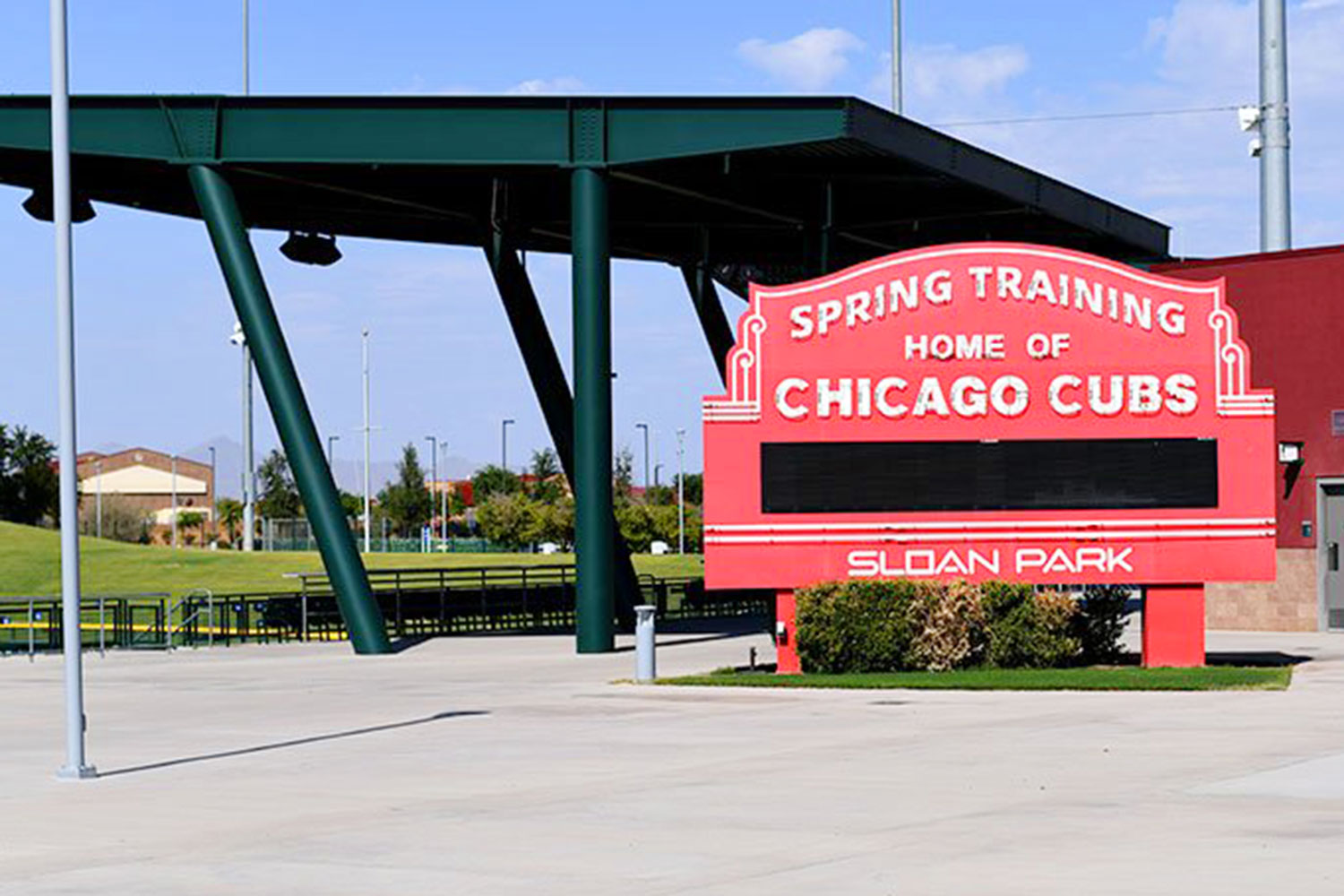
Sloan Park is home to the Cactus League spring training for the Chicago Cubs.
A few weeks later, the baseball owners and the players’ union agreed to an eleventh-hour deal, and spring training was green-lighted for a late start. My routes were already in place and bats were again going to crack. All I was missing was a musical component to complete my return to southern Arizona and some semblance of normalcy. An Internet search revealed that Roger Clyne, the rock balladeer of the Southwest, was to perform at the intimate and beautiful outdoor Mesa Amphitheatre, which is just a stone’s (or hardball’s) throw away from the Arizona training facility of the Chicago Cubs. Perfect!
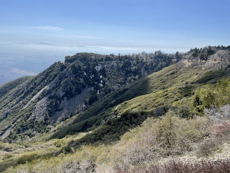
Arizona’s Sonoran Desert is the perfect place for a scenic springtime ride.
As it turns out, it was perfect. My ride south of Phoenix was amazing. Towering cacti stood sentinel as I wound though Sonoran Desert National Monument. Blue skies and rugged mountains served as backdrop in my loop ride even further south through the Southwestern desert. Things like labor disputes, global viruses, and two years of missing many of my favorite things blurred in my rearview mirrors.
The night after my sojourn into the arid version of God’s country, I settled my saddle fatigued posterior into my seat at the Mesa Amphitheatre. Intermixed in the enthusiastic audience were Roger Clyne and the Peacemakers concert shirts and various iterations of baseball jerseys. Clearly I was not the only one enjoying a vibrant melding of spring activities. Under the Mesa, Arizona, stars, Clyne played his raucous mix of original songs, threw back shots of his proprietary tequila, and generally whipped his fans into a communal frenzy. I offer up a strong recommendation. Experience a Roger Clyne show as it is very easy to become a fan.
Enjoying a performance by Roger Clyne and the Peacemakers at the Mesa Amphitheatre in Mesa, Arizona.
In the couple of days that followed, I embarked on another much-needed and spirited desert ride through Arizona’s burgeoning wine country. The high grasslands of southeastern Arizona are fertile ground for both grapes and entertaining riding. I rode past isolated vineyards and unique small towns in the high desert expanse. My big BMW R 1200 GS seemed as happy to free from the stagnancy of winter, variants, and quarantines as I was.
I followed the riding with a bit of sun-warmed bleacher time watching the relaxed pace of an early Cactus League practice at the Cubs spring training facility. Listening to bats cracking and the banter of players returning to their diamond sanctuary was just what the doctor ordered.
So there you have it – one man’s return to some kind of normalcy. Baseball is back, concerts are returning, and riding is always there. There is a smile on my face. Trifecta complete.
Since 2010, the adventure motorcycling non-profit Backcountry Discovery Routes (BDR) has created 10 trans-state routes for dual-sport and adventure motorcycle travel. Now, BDR announces its eleventh route, the Wyoming Backcountry Discovery Route (WYBDR), produced in partnership with BMW Motorrad USA and Wyoming Office of Outdoor Recreation.
The BDR organization’s WYBDR release includes free GPS tracks, a digital map, professional photographs, and travel resources at RideBDR.com/WYBDR. This will be followed by a printed waterproof map, produced in collaboration with Butler Motorcycle Maps, and currently available for pre-order at Touratech-USA and Butler Maps. Additionally, a documentary film directed by Sterling Noren and produced by BDR Documentary Films will be available.
The WYBDR Route
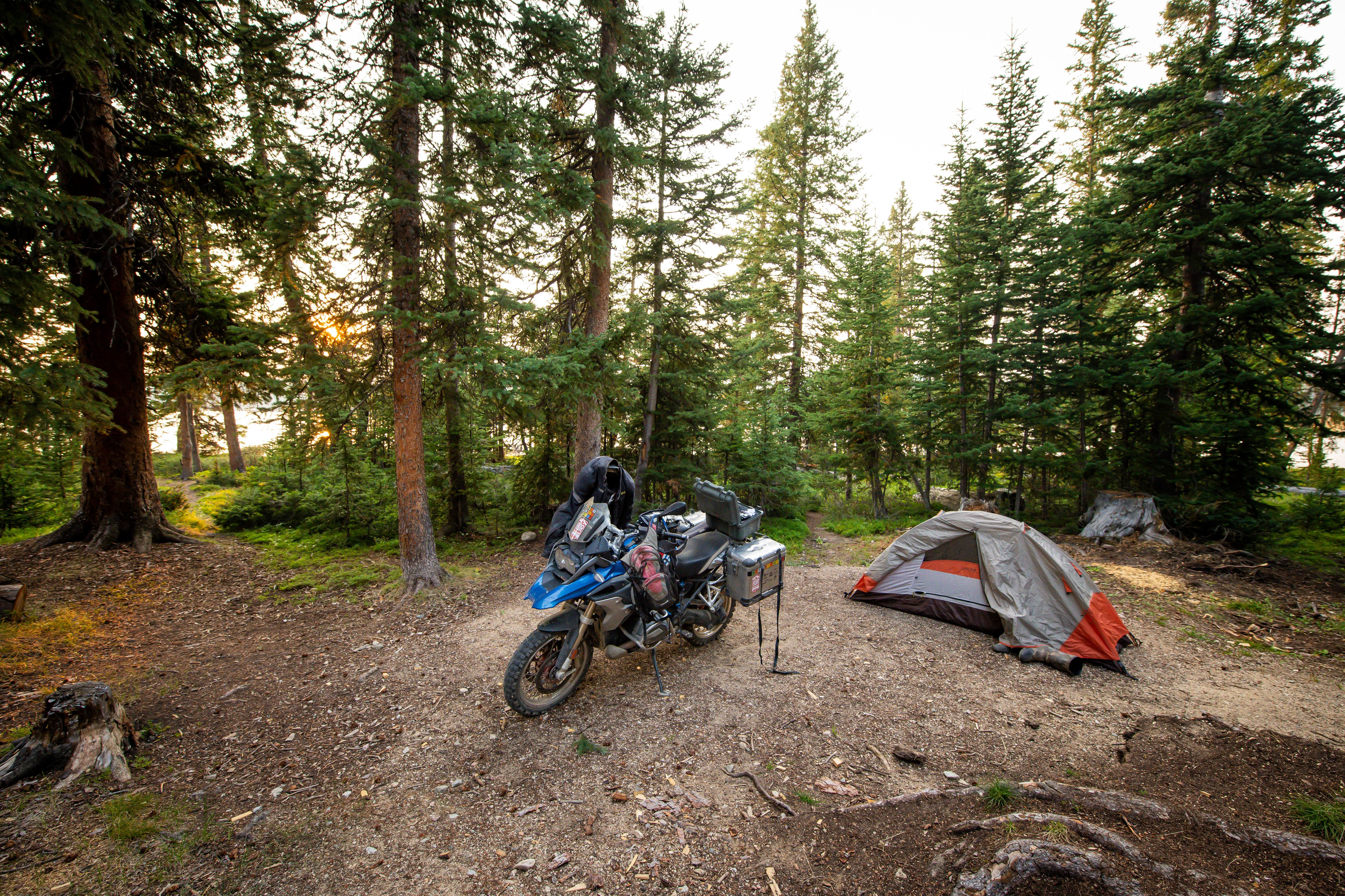
The Wyoming Backcountry Discovery Route is the eleventh route developed by the BDR organization for adventure motorcycle travel. Riders will test their skills and endurance on this epic 950-mile backcountry tour of Wyoming spanning from the border of Colorado to Montana. The tracks wind through five mountain ranges and explore vast high-desert regions on public dirt roads and primitive double-track. Expect scenic views, endless forest roads under a canopy of trees, high-desert terrain, flowing curves, rocky expert-only sections, and alpine elevations reaching 11,000 feet.
Riders will traverse two major rim escarpments and pass through many seldom visited areas and historic mining towns. This route regularly throws unexpected challenges at riders, and almost every section includes some technical riding. WYBDR is the most remote of all the BDRs, so preparedness is key to a successful WYBDR adventure.
“Riders will love the scenic diversity of the WYBDR. This route showcases the character of the state with forested mountain ranges, high-desert plains, rural valleys and so many different backcountry settings. The elevations frequently change and so does the scenery. The challenging sections were the most special to me and I think they will test even the most experienced of riders.” – Bryce Stevens, Wyoming Route Architect & BDR Co-Founder
WYBDR Film & Tour
The WYBDR expedition documentary film tour begins February 5th at dealerships and clubs across the country. Join fellow adventure enthusiasts for an exciting evening of film and adventure at one of the upcoming WYBDR film screenings, or help organize a film event near you.
The expedition documentary film features the BDR team and special guests Wendy Naessens of the BMW US Rider Academy, and Jocelin Snow, former AMA racer and BMW International GS Trophy competitor, taking a first run on the WYBDR. The team tests their skills and discovers the gems of the Wyoming backcountry, as they enjoy the rugged beauty of the wildlands and meet creatures that inhabit these remote and seldom visited regions of Wyoming.
“Having the opportunity to ride the entire 1,000-mile Wyoming Backcountry Discovery Route as part of the documentary film truly has been an awesome life experience. I have been fortunate enough to instruct others, new and old, on how to improve their motorcycle skills and broaden their riding horizons. This breathtaking route that BDR has put together will test your skills and leave you with memories that will last a lifetime.”- Wendy Naessens, BMW US Rider Academy
For listing of Backcounty Discovery Routes events and film screenings, visit RideBDR.com/Events
A film tour is being planned in over 50 cities across the country. Dealerships and motorcycle clubs interested in hosting a film event are encouraged to contact BDR to reserve their date on the tour.
Free Film Public Release
The BDR organization has decided to make its latest WYBDR film available for free on YouTube after the film tour is complete on May 1, 2022. This decision was made to help broaden the availability of the film to the community. Free distribution is a more environmentally friendly approach and also eliminates the costly process of producing, storing and distributing DVDs.
Wyoming Tourism Partners
The Wyoming BDR has been developed in partnership with the Wyoming Office of Outdoor Recreation. Local governments in seven different counties along the route supported the project and embraced BDR’s mission of helping to boost local economies with a sustainable new form of tourism. This BDR route is projected to bring riders from across the county and around the world to Wyoming in the coming years, and not just to the usual tourist hot spots, but to rural communities that will benefit from this positive economic impact.
“As participation in the outdoors continues to increase, Wyoming’s Office of Outdoor Recreation recognizes the importance of enhancing and developing outdoor recreation opportunities, promoting responsible and sustainable recreation, and the need for quality, accessible resources for recreationists. Partnering with Backcountry Discovery Routes has been the perfect opportunity to expose a reputable group of adventurers to the lesser-known treasures of Wyoming’s public lands while utilizing existing infrastructure and initiating a positive economic impact in rural communities along a route otherwise less traveled.”-Laurel Thompson, Outreach Coordinator, Wyoming Office of Outdoor Recreation
BDR-X: A New Backcountry Discovery Routes Concept
As BDR heads into its second decade, a big goal for the organization is to improve and expand on the experiences and resources it provides to the ADV community.
The BDR community has been asking for more routes, and, specifically, for routes that loop. So in addition to the classic BDR routes, in 2022 BDR is introducing the BDR-X. A shorter, BDR-style route that loops.
A BDR-X may be an excursion off of an existing route or something entirely new in an area where there’s yet to be a BDR route. BDR-X’s will be designed to only take a few days to ride and BDR plans to rollout multiple routes in the coming years, starting with the Red Desert, Wyoming BDR-X.
The Red Desert BDR-X tracks are available on the BDR website. A print-ready PDF of the Red Desert BDR-X map and a short video will be available following the route release.
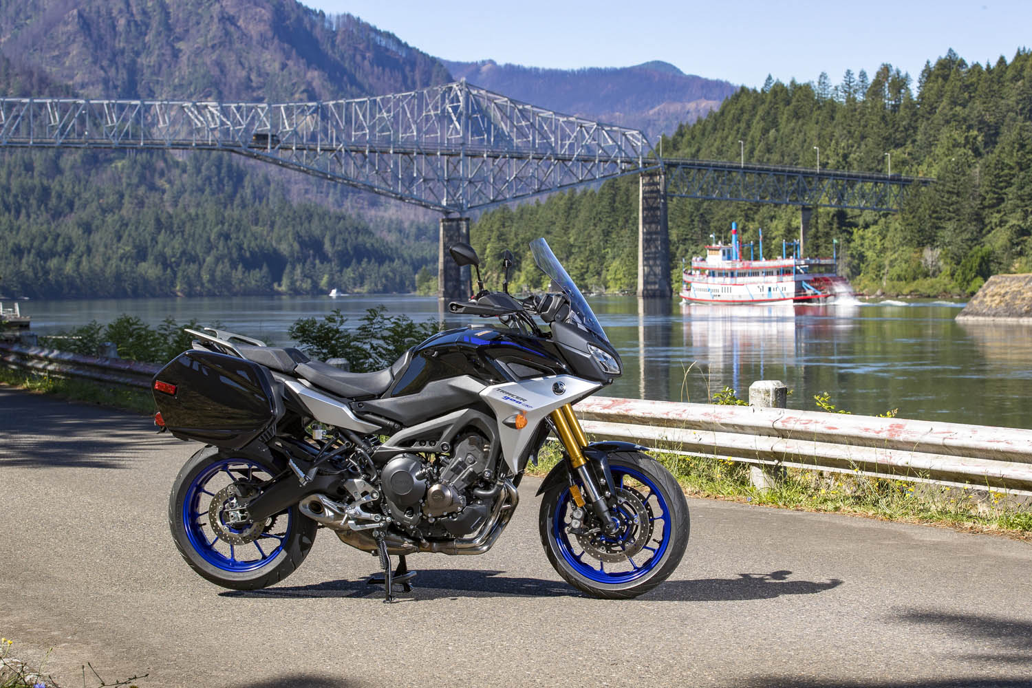
Road testing the 2019 Tracer 900 GT in Washington’s Klickitat River valley, with Mount Adams in the background. (Photos by the author & Brian J. Nelson)
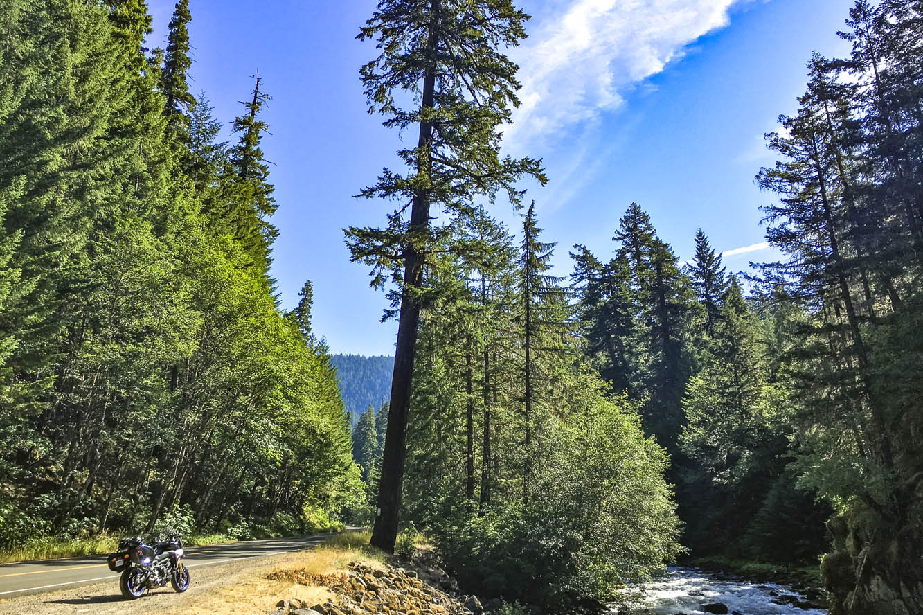
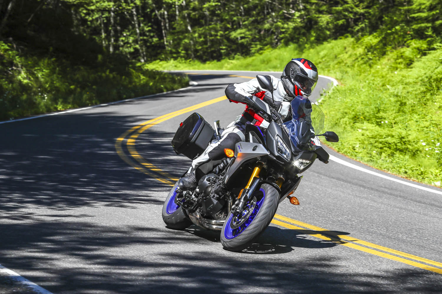
Winding through a dark canopy of evergreens, the road played hide-and-seek with the Clackamas River, offering a glimpse here and there of clear water pouring over rocks as it made its way downstream to the Willamette, then the Columbia, and finally the Pacific. A break in the canopy was like popping out of a tunnel and I set my eyes on a patch of gravel next to the road, just a few feet from where the river made a sharp turn. Down went the Yamaha Tracer 900 GT kickstand, off went the ignition. I hadn’t seen a car for miles. It was just me and the trees and the river. Just what I was looking for.
Emerging from a dark tunnel of trees on the West Cascades Scenic Byway, I found the perfect sunny spot to enjoy the sights and sounds of the Clackamas River.
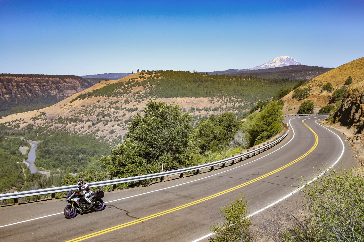
The previous day I logged 250 miles aboard the Yamaha at the bike’s press launch. The event was based in Stevenson, Washington, a small town in the heart of the Columbia River Gorge National Scenic Area, and I spent a long, hot day testing the GT on local backroads. Weighing just 500 pounds and packing a punch from its 847cc inline-Triple, the Tracer 900 GT is a light, agile, comfortable sport-tourer, perfect for a solo traveler. Yamaha entrusted me with the keys to one for the long ride home to Southern California.
With snow-capped volcanic peaks, wild and scenic rivers, dense evergreen forests, and countless roads that follow the contours of the land, the Cascade Range is a motorcyclist’s paradise.
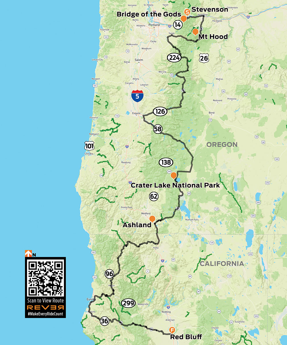
For years I’ve heard and read about how good the riding is in the Cascades, a mountain range that runs from British Columbia down through Washington and Oregon to Northern California. Whenever possible, I like to fill in the blank spots on my mental map –to experience first-hand what roads and scenery are really like. So I sketched out a route from the Columbia River to the California border that zigzags several times over the Cascades, winds its way through four national forests and one national park, and follows three designated scenic byways. Like any good motorcycle route, it would take at least twice as long as a more direct path.
The ride route from Stevenson, Washington, to Red Bluff, California.
With the GT’s saddlebags packed and a tailbag strapped to the passenger seat, I hit the road at 6 a.m., crossing the mighty Columbia – and into Oregon – on the Bridge of the Gods, a steel truss bridge named after a natural dam that was created by a landslide at the same location nearly 1,000 years ago. The narrow, 90-year-old bridge has no pedestrian walkway, but it’s where the Pacific Crest Trail crosses the river, so weary hikers with heavy packs must contend with cars and trucks.
The Bridge of the Gods spans the Columbia River, which forms the border between Washington and Oregon.
What makes the Cascades special is its many stratovolcanoes –the cone-shaped variety we learned about in grade school –that rise thousands of feet above the surrounding mountains. I’ve ridden along the eastern side of the Sierra Nevada in California dozens of times, and every time I pass through the town of Lone Pine, I struggle to pick out Mount Whitney – the tallest mountain in the lower 48 states – from the neighboring peaks that are nearly as tall. On the Tracer 900 GT press ride we saw several volcanic peaks, Mount Adams (12,281 feet) and Mount St. Helens (8,363 feet – before it blew its top in 1980, it was 1,300 feet taller) in Washington, and Mount Hood (11,249 feet) in Oregon, standing head and shoulders above the landscape, easily visible from miles away. They’re part of the Cascade Volcanic Arc, a series of 12 volcanoes stretching from Mount Silverthorne in British Columbia to Mount Lassen in California, which is part of the Pacific Ring of Fire –more than 450 volcanoes scattered along the outer edge of the Pacific Ocean.
When Washington’s Mount St. Helens erupted in 1980, it literally blew its top, erasing 1,300 feet from its peak. This view is from McClellan Overlook, off Curly Creek Road, in Gifford Pinchot National Forest.
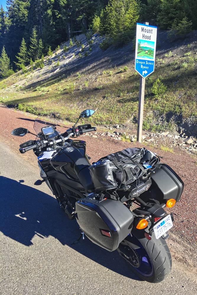
Like a good omen, snow-covered Mount Hood greeted me as I turned south on State Route 35, the beginning of Mount Hood Scenic Byway, where I rode through apple farms on a sunny, cloudless July morning. The previous day topped out at 105 degrees, and the heat wave wasn’t done with me, but early in the morning the byway along the East Fork Hood River was still in deep shadow and my teeth began to chatter. On went the heated grips, and I tried to hold onto the physical memory ofbeing cold, hoping to recall that feeling during theheat of the day (it never works). With graceful curves and smooth pavement, the byway is a pleasure to ride, especially when the screen of trees falls away and Mount Hood takes center stage, framed perfectly in brilliant blue.
Mount Hood Scenic Byway, one of many scenic byways that meander through the Cascades, cuts a wide arc around its namesake peak.
After cutting a wide arc around the eastern and southern sides of Mount Hood, my first crossing of the Cascades came to an end in Sandy. Turning south and then east on State Routes 211 and 224, I picked up the West Cascades Scenic Byway, heading southeast along Estacada Lake and North Fork Reservoir, two finger lakes created by dams on lower sections of the Clackamas River. As the byway crosses into Mount Hood National Forest, it enters a deep, narrow valley as it climbs up into the Cascades, where the Clackamas flows wild and free. The Tracer and I were in a groove, experiencing this road together for the first time –bends, kinks, dips, rises, bridges, blind corners, and fleeting views of the river, the contours of which give the road its character.
A postcard view of Oregon’s Mount Hood from Bennet Pass Trailhead, just off State Route 35 on the Mount Hood Scenic Byway.
With the low-fuel light on, I pulled into Detroit, a crossroads on the shore of Detroit Lake. Folks were starting their summer weekend early. Subarus laden with kayaks and pickups overflowing with camping gear were parked in lots, coolers were being filled with ice and beer. I refueled and scarfed an egg salad sandwich in the shadow of Rivers Run Deli, trying to stay cool while enjoying a view of the marina and the lake’s milky blue water. When traveling solo and covering a lot of miles in just a few days, I rarely stop for long. Just a few minutes here and there, then I’m back in the saddle, trying to cram 10 pounds of riding into a 5-pound sack.
Roads in the Cascades often carve their way through lush forests, with the curving pavement winding in and out of shadows.
From Detroit to Chemult – south, zig west, zag east, back over the Cascades –all I remember are trees, and a cross-section of America. Stopping to use the bathroom at a McDonald’s, I had to negotiate my way through a crowd of boisterous kids wearing matching blue T-shirts bearing the name of their church summer camp, ready to fill their bellies with Happy Meals. Outside, two young women were sitting on the curb, holding a sign: Family in Need. And next door I topped off the Tracer’s tank after the flirtatious – not to mention bald and tattooed – gas station attendant handed me the nozzle. (In Oregon and New Jersey, you’re not allowed to pump your own gas, but attendants often let motorcyclists break the law.) I was just passing through, little more than an observer. Experiences like these give me something to mentally chew on while ticking off miles.
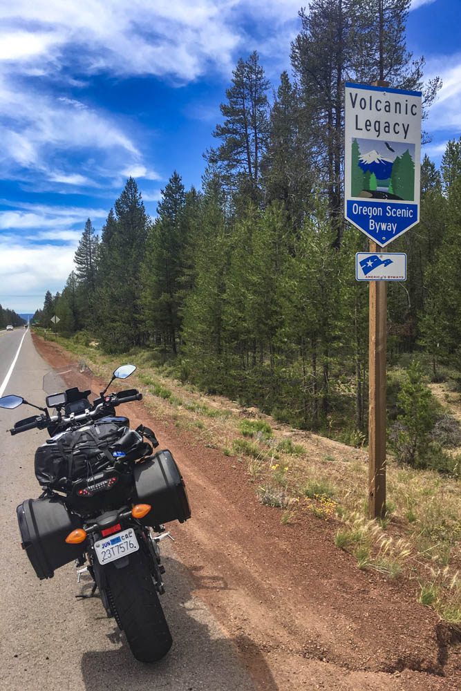
The 500-mile Volcanic Legacy Scenic Byway runs through Oregon and California, connecting volcanic peaks in the Cascades.
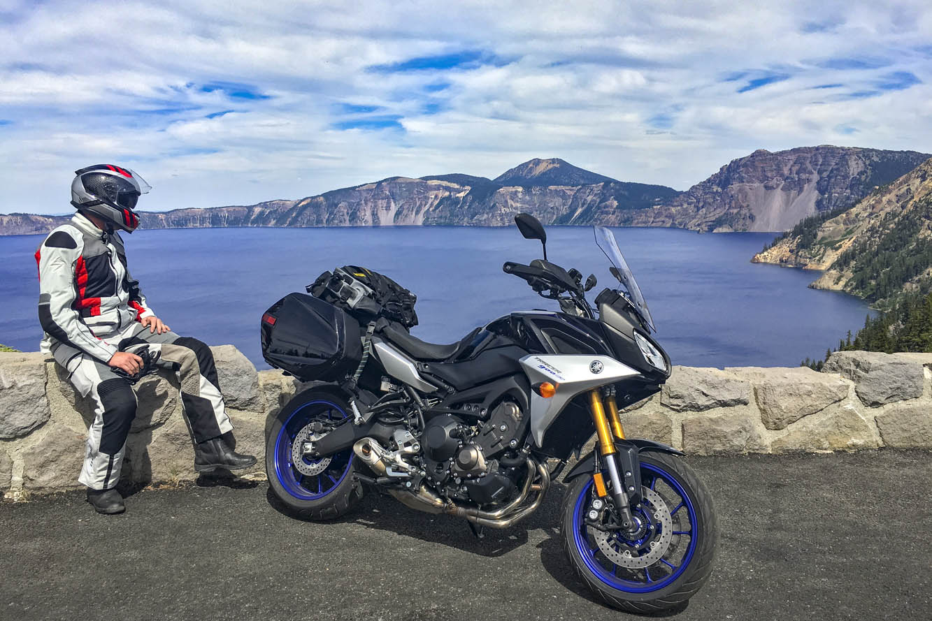
Passing through Chemult, a truck stop on U.S. Route 97 brought back memories of stopping there to refuel during my one and only SaddleSore 1000 ride back in 2013 – a very long day that I’m not likely to repeat. Turning west on State Route 138, the Volcanic Legacy Scenic Byway took me to Crater Lake National Park, where I queued up behind a rumbling Harley and a line of cars and RVs outside the northern gate, keeping my faceshield closed to prevent the army of mosquitos from waging war on my nose. Crater Lake was high on my list of must-see places, and it didn’t disappoint. Created thousands of years ago when a volcano collapsed, the caldera lake is nearly 2,000 feet deep – the deepest in the U.S. – and because it is filled only by rain and snow, the water is pure and a brilliant shade of blue. But I was pressed for time and there were construction delays on the East Rim Road, so I’ll have to go back to ride the full loop.
Taking in the brilliant blue of 2,000-foot-deep Crater Lake, a collapsed volcano filled with thousands of years’ worth of rain and snow.
On the not-politically-correct but wonderfully twisty Dead Indian Road, I descended from the green heaven of the Cascades into the dry, brown hell of Ashland. It’s actually a lovely little town, home to Southern Oregon University and the world-famous Oregon Shakespeare Festival, but it was over 100 degrees and I had been in the saddle for 12 hours. I was in desperate need of a cold shower, a colder beer, and some pizza.
The next day I left the Cascades, riding a few miles south on Interstate 5 into California, where I filled up at a Chevron in Hornbrook. On both sides of the interstate and all around the gas station, the ground and vegetation were charred black from the Klamathon Fire, which roared through just days earlier. It was one of many wildfires that would plague California and other western states in the weeks and months ahead.
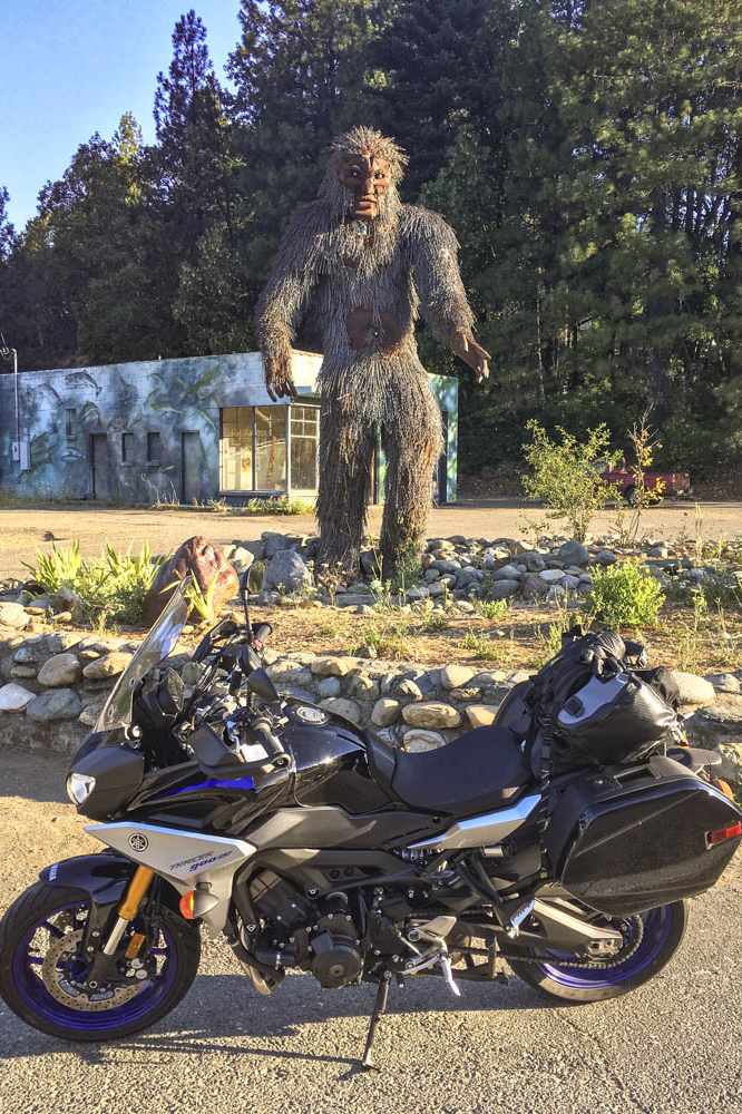
More blanks filled in on my mental map: State Route 96 along the Klamath and Trinity rivers, which cuts through rugged, remote country. In 1941, a group of armed men stopped traffic near the town of Yreka, handing out a Proclamation of Independence for the State of Jefferson, which was in “patriotic rebellion against the States of California and Oregon.” Although the new state never materialized, the movement is still active, and the State of Jefferson Scenic Byway runs along Route 96 from State Route 263 to Happy Camp. After that, 96 becomes the Bigfoot Scenic Byway. Regardless of one’s views on state politics or mythical forest dwellers, the riding along Route 96 is sublime and traffic is almost nonexistent.
Sasquatch sighting in Happy Camp, California, on State Route 96, where the State of Jefferson Scenic Byway turns into the Bigfoot Scenic Byway.
At Willow Creek, I turned west onto State Route 299, known as the Trinity Heritage Scenic Byway because it follows the path of 19th-century gold miners and pioneers. It snakes its way through the heavily wooded Trinity Alps and climbs over a pass before making a long descent to the coast. Even in mid-July, U.S. Route 101 through Arcata, Eureka, and Fortuna was socked in with chilly fog. At Alton, I turned east again, heading inland on State Route 36 –not a designated scenic byway, but known as Serpent to the Sea. Traveling west-to-east, it passes through a few rural communities before entering Grizzly Creek Redwoods State Park, where enormous coast redwoods rise hundreds of feet above the roadside.
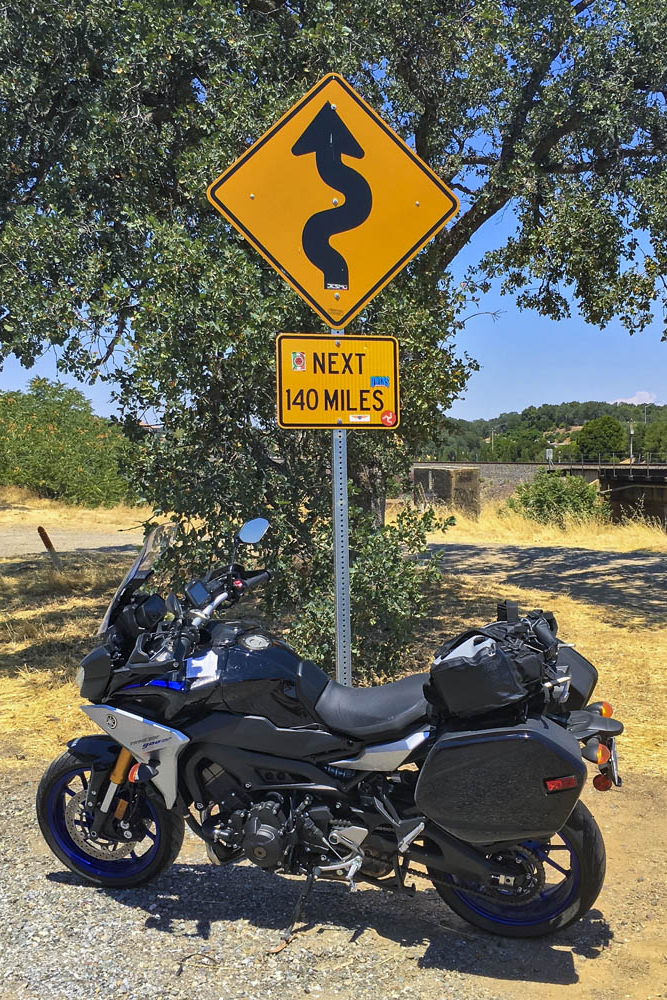
Beyond Bridgeville, Route 36 turns into a narrow goat path as it goes over a ridge, but it’s currently being straightened and widened to accommodate big trucks and RVs –an improvement for them but not for motorcyclists. East of Dinsmore, Route 36 was freshly paved, like having a racetrack all to myself, scraping the Tracer’s peg feelers in corner after corner. And on it goes, over more mountains with endless curves and finally roller-coastering its way through ranch land with blind crests and sudden drops and quick turns. As I approached the town of Red Bluff, just before Route 36 crosses I-5, I found the well-known sign that warns motorists and entices motorcyclists: curvy roads next 140 miles.
This sign tells motorcyclists everything they need to know. Good times ahead!
The thing about riding roads as good as these is that it becomes addictive. Now that I have experienced the Cascades and California Routes 96 and 36 for myself, all I want to do is go back for more.
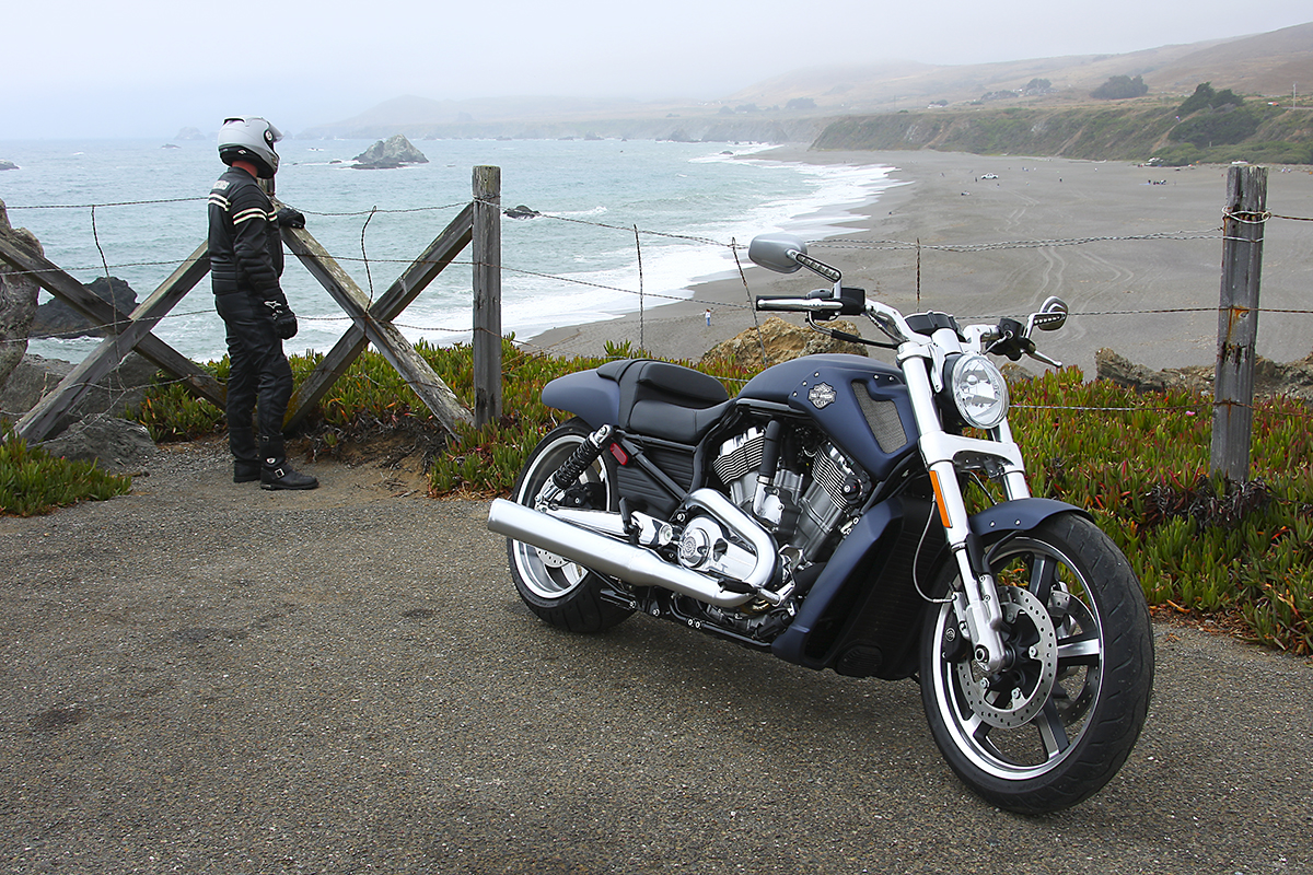
Taking in the view from Duncans Point on a cold, foggy summer day.
(Photo by Kevin Wing)
For 2021, the Progressive International Motorcycle Shows tour has been rebranded as Progressive IMS Outdoors and events will be held outside, like open-air powersports festivals. The tour will visit nine major markets around the U.S. between July and November (see the full schedule at motorcycleshows.com). Each stop will be a three-day event for powersports enthusiasts and potential riders of all ages and skill levels, with motorcycle demo rides and hands-on experiences unique to each venue.
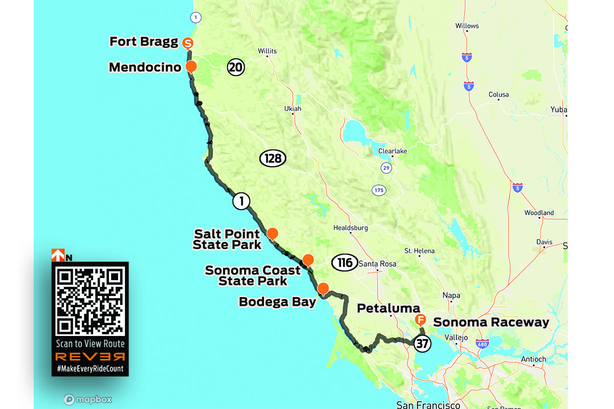
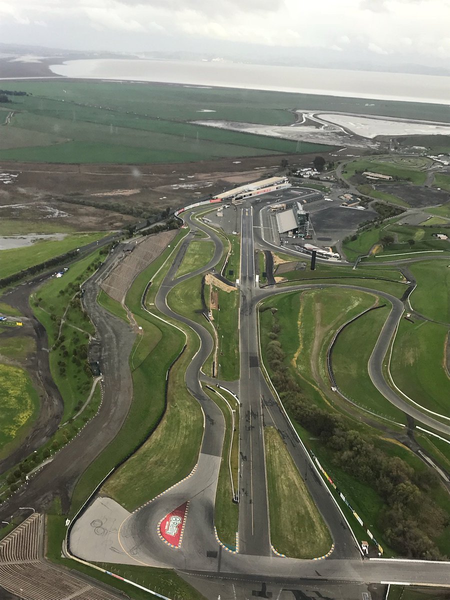
The first stop is in Northern California, at Sonoma Raceway over the weekend of July 16-18. We’re providing suggested scenic rides to or near each tour stop, with routes available on the REVER app. The Northern California ride is a 165-mile paved route that starts in the coastal town of Fort Bragg and ends at Sonoma Raceway, which is located north of San Francisco. Most of the route follows California State Route 1 south along the scenic, rugged Pacific Coast.
Fort Bragg is a charming burg that’s home to the Sea Glass Museum, the Skunk Train, and North Coast Brewing Company. Heading south through town on Route 1 (Main Street), the ride begins on the Noyo River Bridge. Known in this area as Shoreline Highway, Route 1 is a scenic two-lane road that winds along the contours of the coast. Despite being just 165 miles long, this route typically takes four to five hours, not including stops.
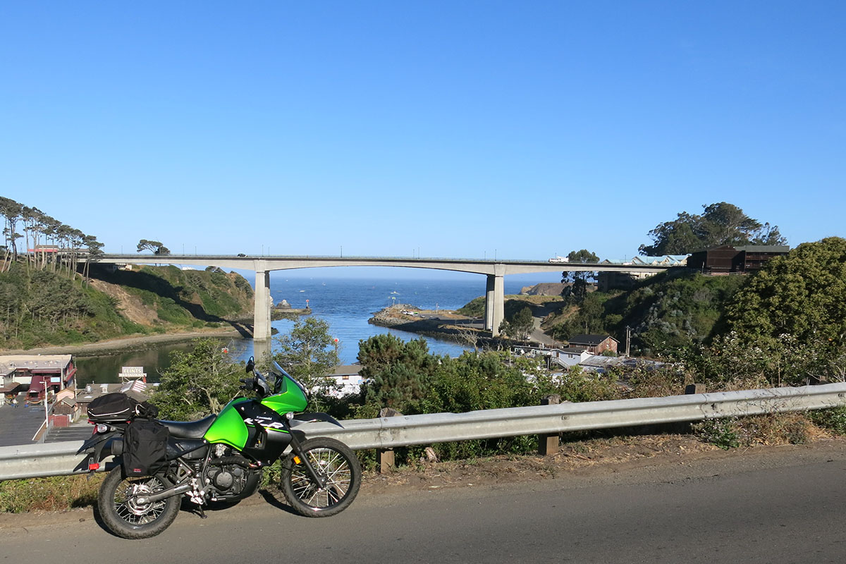
The route starts on the Noyo River Bridge in Fort Bragg. (Photo by Clement Salvadori)
You’ll want to stop often at the many towns, natural areas, scenic overlooks, and state parks along the way, such as the Navarro River Bridge, where Route 128 goes inland to the Navarro River Redwoods State Park. Other highlights include Mendocino, Point Arena Lighthouse, Stewarts Point, Salt Point State Park, Fort Ross, Jenner, Sonoma Coast State Park, Duncans Point, and Bodega Bay.
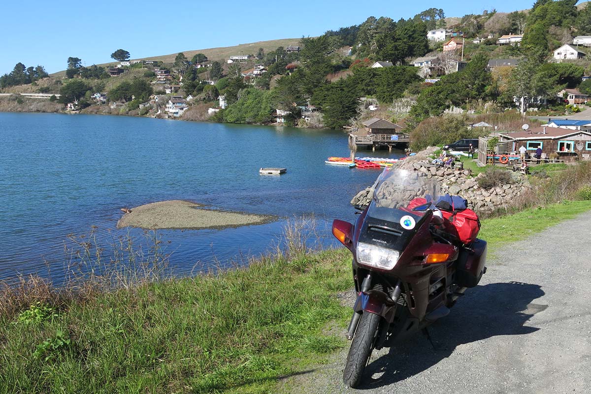
Jenner is a charming village near where the Russian River flows into the Pacific. (Photo by Clement Salvadori)
After riding along the eastern edge of Tomales Bay, you’ll arrive in the town of Point Reyes Station. Turn onto Point Reyes-Petaluma Road, which follows Lagunitas Creek and passes along the Nicasio Reservoir. The route continues east, crosses U.S. Route 101, and follows State Route 37 (Sears Point Road) and State Route 121 (Arnold Drive) to Sonoma Raceway. Enjoy the ride and enjoy the show!
For more information about Progressive IMS Outdoors and to buy tickets, visit motorcycleshows.com.
Sonoma Raceway is located northern of San Pablo Bay.
Describe your dream tour, anywhere in the USA. Win the use of a V85 TT adventure bike for 14 days and a $2,500 travel budget.
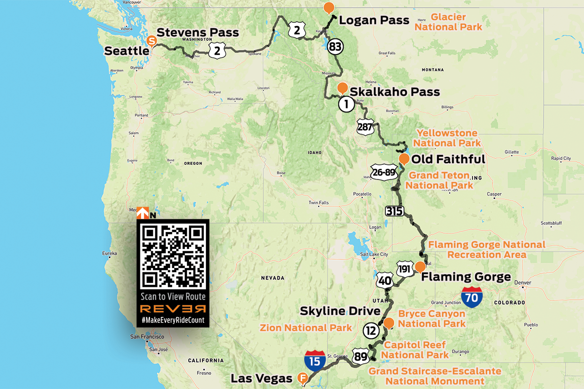
I threw down a route. Start in Seattle, ride east to Glacier National Park, then follow the Rocky Mountains south through Yellowstone, Grand Teton, Flaming Gorge, Capitol Reef, Grand Staircase-Escalante, and finish in Las Vegas. Eight days, seven states, six national parks and monuments, 2,600 miles. Epic!
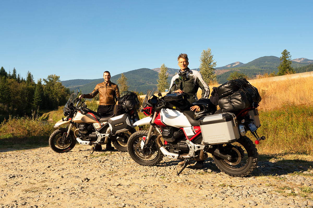
When the Piaggio Group called me last August to tell me I had won, it didn’t leave much time to prep and hit the road to beat the cold weather in Glacier National Park. My buddy Kit agreed to join me, and Moto Guzzi generously offered us a second bike. The adventure/dual-sport market isn’t Guzzi’s typical realm, so when I read that the TT stands for tutto terreno (all-terrain), I figured the least we could do is put them through a genuine off-road test. Part of the budget went toward Michelin Anakee Wild tires; billed as 50/50 on-/off-road, they have a surprisingly aggressive tread pattern. At 500-plus pounds, the V85 TT is no dirt bike, but if adventure is your goal, sooner or later you’re going to find yourself off the beaten path, and that’s exactly where we planned to be.
Our Chariots Await
We flew to Seattle and first saw our V85 TTs parked outside at Optimum Performance Motorsports. Their styling reminded me of old Paris-Dakar bikes. I took the Adventure edition, sporty in bright red and white livery, with only a gesture of a windscreen. Kit took the Travel edition, with a sophisticated metallic sand color and a larger windscreen, auxiliary lights and heated grips. Both bikes were fitted with excellent panniers, and the Adventure also included a top box, which I removed to allow more room for my DrySpec soft bags. After a chat with Alan Kwang, the dealership owner, he handed us the keys and wished us well. It was surreal riding away on brand new bikes without having exchanged anything more than a conversation.
A Dash Across an Apocalyptic Plain
It was nearly noon by the time we packed everything on the bikes and rode east out of Seattle. U.S. Route 2 climbs into rugged, pine-strewn mountains and goes over Stevens Pass (4,061 feet) before descending along the floor of a dramatic, glacial valley. During a late lunch in Leavenworth, the smell of smoke reminded us there were wildfires still burning across Washington State. After crossing the Columbia River, a steep ascent took us out of the rocky canyon onto a vast, windswept plain. Rolling grassland swept off to the horizon in all directions. Huge areas, scorched black by the recent flames, were still smoldering. It was like riding through the wake of a recent battle. We raced across the plateau for 140 miles, and then descended into Spokane and made quick time to our hotel in Ponderay, Idaho.
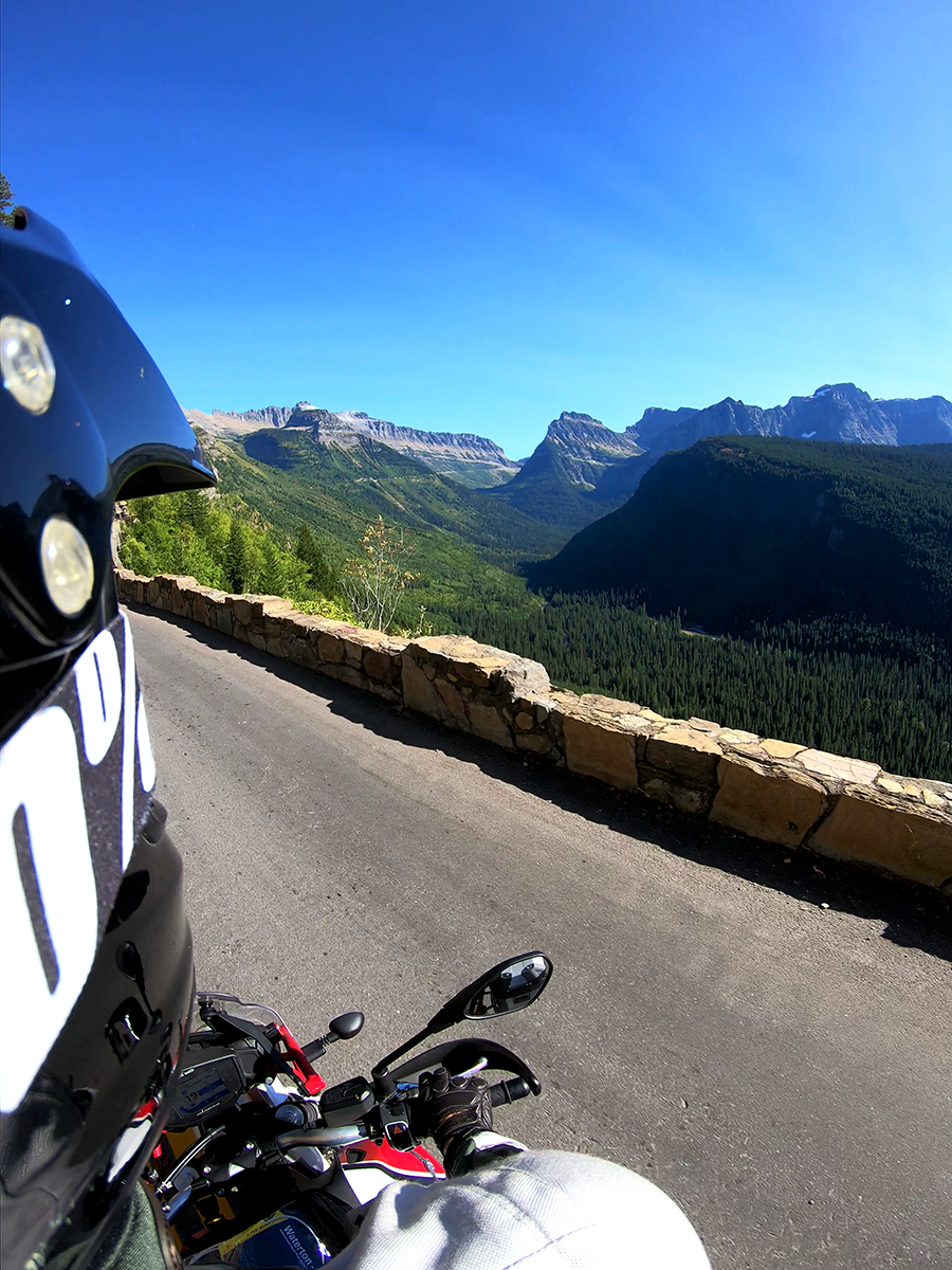
Going-to-the-Sun Road provides panoramic views of the dramatic arêtes, cascading valleys and ribbon lakes that make up Glacier National Park.
Majestic Glacier National Park and Deer in the Headlights
Still refining the bike-packing process, we began the first of 440 miles much later than planned. Just shy of the Canadian border, Route 2 turns east near Bonners Ferry, into the dense fir and spruce forests of Montana. Entering Glacier National Park, crystal-clear Lake McDonald sweeps up the valley alongside Going-to-the-Sun Road, a narrow strip of asphalt (and an engineering marvel) carved into the side of a mountain range. Logan Pass (6,647 feet) offered awesome views, as sheer valleys tumbled down to the lakes below and knife-edged arêtes towered above us. The light was fading by the time we got on the deserted forest road to Missoula. Kit spotted a mule deer, her almond eyes reflecting brightly in the Travel’s auxiliary lights. She was the first of many, and it was 10 p.m. when we finally walked into the Missoula Club bar, famous for its burgers and beer.
The Glorious Mountain Roads of Montana
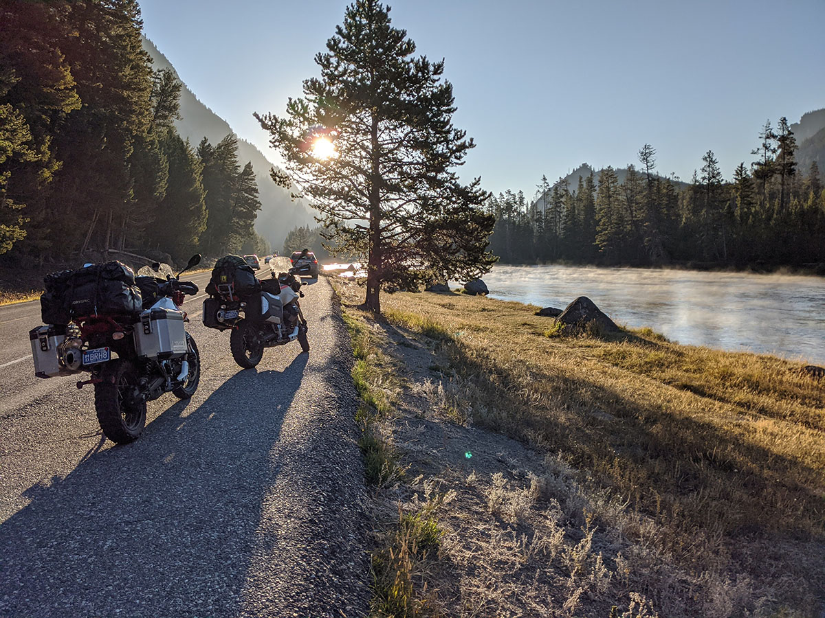
After refueling in Hamilton, we turned east into the Sapphire Mountains on a steep gravel track and climbed up to Skalkaho Pass (7,257 feet). It was our first off-road test for the bikes and tires, and we quickly found our confidence on the hard-packed gravel. Abundant torque served us well, especially in 2nd and 3rd gears. By afternoon, the towering canyons had relented to reveal panoramic views of the dramatic scenery. We swept up another pass, riding into Virginia City, a marvelous authentic gold-rush town established in 1863. Following the Madison River south from Ennis, we had a breathtaking sight as the setting sun lit up a colossal rift running along the western bank. Eventually, we made it to our hotel in the dark, tired and hungry, only to discover the nearest restaurant was eight miles away, in West Yellowstone.
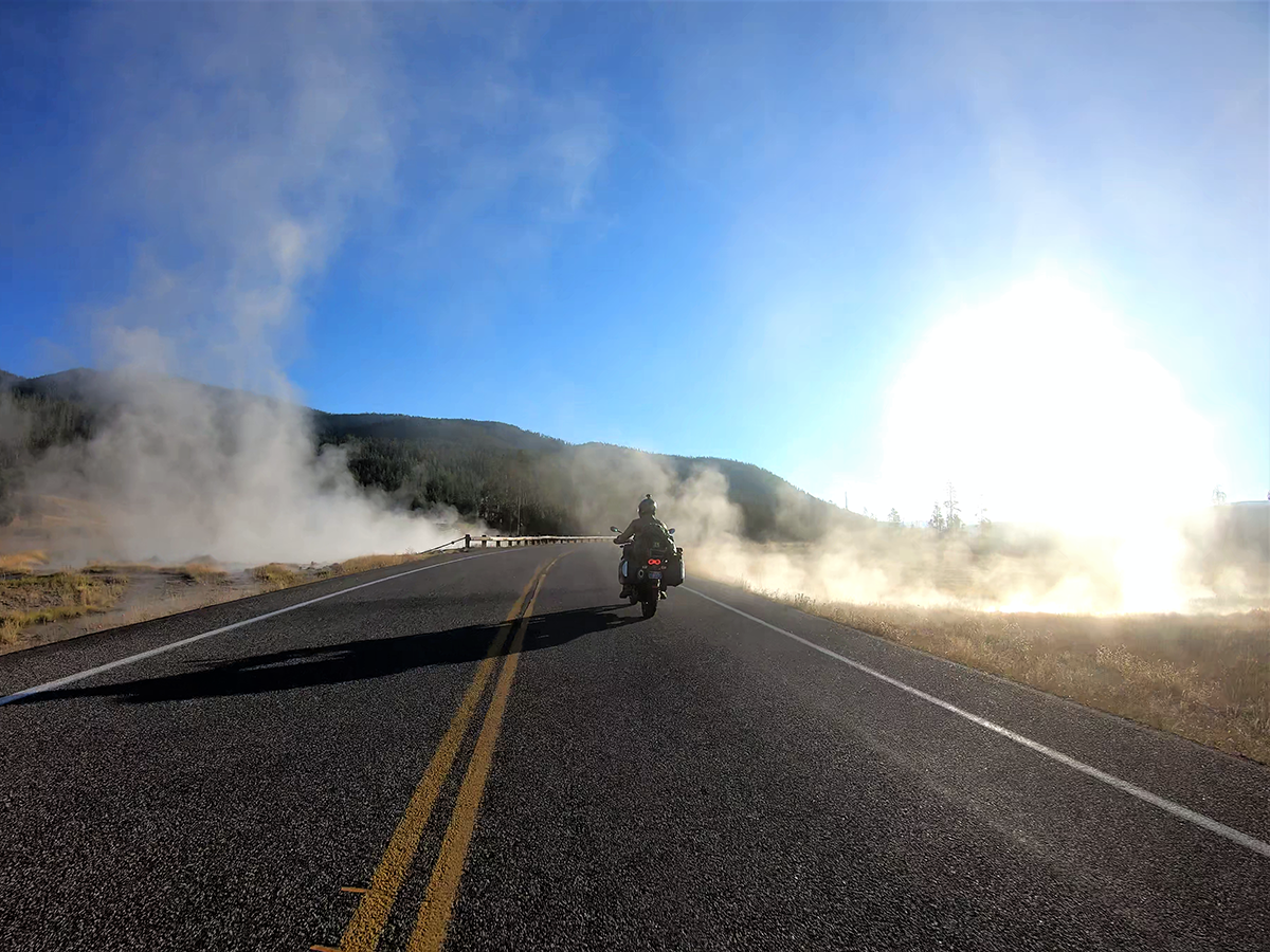
Clouds of sulphur-smelling steam billow up from boiling pools along the road through Yellowstone.
Enchanting Yellowstone and Towering Grand Teton
As the sun came up, we brushed the ice off our seats and rode into Wyoming and Yellowstone National Park. We rode a clockwise loop around the park, passing steaming geysers, volcanic hot springs that belched scorching, sulfurous gas, and bison that grazed the roadside meadows, eventually coming upon enormous Yellowstone Lake. We made a quick stop at the amazing Old Faithful Inn, just as its namesake geyser erupted.
The Tetons looming over Jackson Lake
The road exiting Yellowstone’s southern entrance runs along the edge of a sheer canyon, ending at Jackson Lake, where the Tetons, a series of three spectacular peaks, soar up from the western bank to over 13,500 feet like giant fossilized teeth. It was late afternoon when we stopped at Alpine to buy supplies. The Guzzis always drew a small crowd and a flurry of questions. I discovered our next leg, a 95-mile dirt track through Bridger-Teton National Forest, was only graded for the first 40. Undeterred (somewhat), we proceeded anyway and soon found an idyllic spot to make camp by the river.
Scarlet Sockeye and the Stunning Beauty of Flaming Gorge
After a chilly, restless night, we rejoined the track running along Greys River, a ribbon of blue and lush green framed by rocky bluffs. As predicted, the track became steep and challenging, but the V85 TTs’ suspension capably soaked up the abuse, while their V-twins churned out torque with a lovely, distinctive rumble. We savored awesome view after awesome view as our fifth day’s route took us out of Wyoming’s forested mountains and into the painted desert canyons of Utah.
Steaming in the early chill, bucolic Madison River flows into Yellowstone National Park
Desolate plateau roads delivered us to a series of tight corners cut into the red rock, descending hundreds of feet into Flaming Gorge. At the bottom, we stopped at Sheep Creek, where the shallow, limpid water was teeming with sockeye salmon. A series of thrilling sweepers and twisties climbed out of the gorge, providing a spectacular view of the sheer, banded cliffs of crimson and terracotta strata and the reservoir below. The plateau finally ended with a dramatic zig-zagging 3,000-foot descent to the town of Vernal, Utah. We used every electrical socket in the room to charge the crap out of everything — cameras, phones, drone — making the most of our last night in a hotel.
Ridge Riding on Top of the World and A Steer Standoff
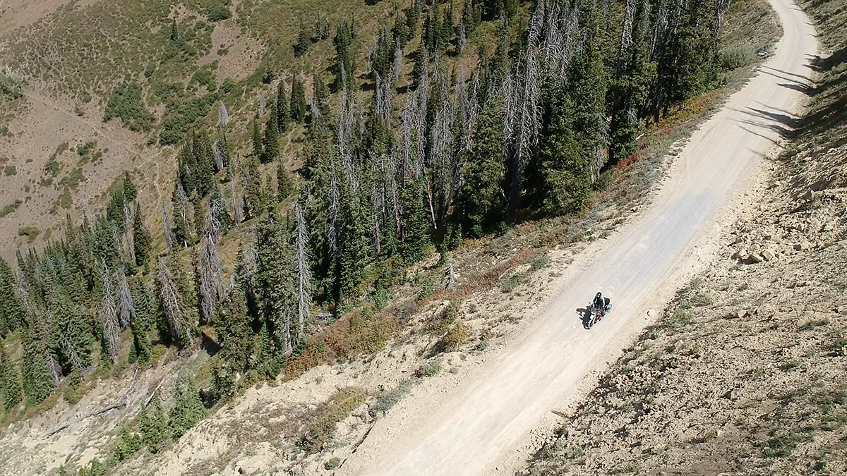
After a dash across the vast Uinta Basin, we descended into Scofield (pop. 23), home to Snack & Pack, a quirky gas station where customers broil their own burgers. With us and the Guzzis refueled, we climbed into the mighty Manti-La Sal Mountains and onto Skyline Drive Scenic Backway, a rough unpaved road that follows a knife-edged ridge at over 10,000 feet, with sheer drops down both sides to the valleys below. I tried to focus on the riding, despite the arresting views at every turn. This was not a good place to screw up.
Skyline Drive can test the nerves, but at 10,000 feet the views are worth the effort
With one eye on the clock, we reluctantly turned off Skyline, riding down into the valley, where we found our route blocked by a herd of belligerent bovine. Stores are scarce in this remote part of Utah, and we were forced to ride 20 miles past our exit to buy supplies, starting the last leg as the sun began to set — a steep, 18-mile dirt track that provided plenty of butt-clenching moments in the dusk. We pitched our tents on patches of sand among boulders and stunted juniper. There was no moon, and when the last of the firewood burnt out, we could see the Milky Way painted across the night sky, with shades of purple, blue and red in an ocean of stars.
We Max Out the V85 TTs and Reluctantly Ride to Vegas
The morning sun blazed across the desert as we tore off down the rocky trail and into Cathedral Valley, where a group of distinctive striped mesas rise up from the plain like a village hewn from rock. Capitol Reef National Park is amazingly varied. Terracotta cliffs are the backdrop to white and yellow hoodoos, vivid green yuccas and gnarly juniper, as well as a formidable mix of sand-and-rubble tracks. Our pace had increased, and at times we asked more from the Guzzis than they were designed for, but what a ride! Inevitably, a deep sandy section proved too much of an ask, and I dumped my Adventure — scuza amore.
The Milky Way, spanning the sky on a moonless night at our camp in Capitol Reef National Park’s Cathedral Valley
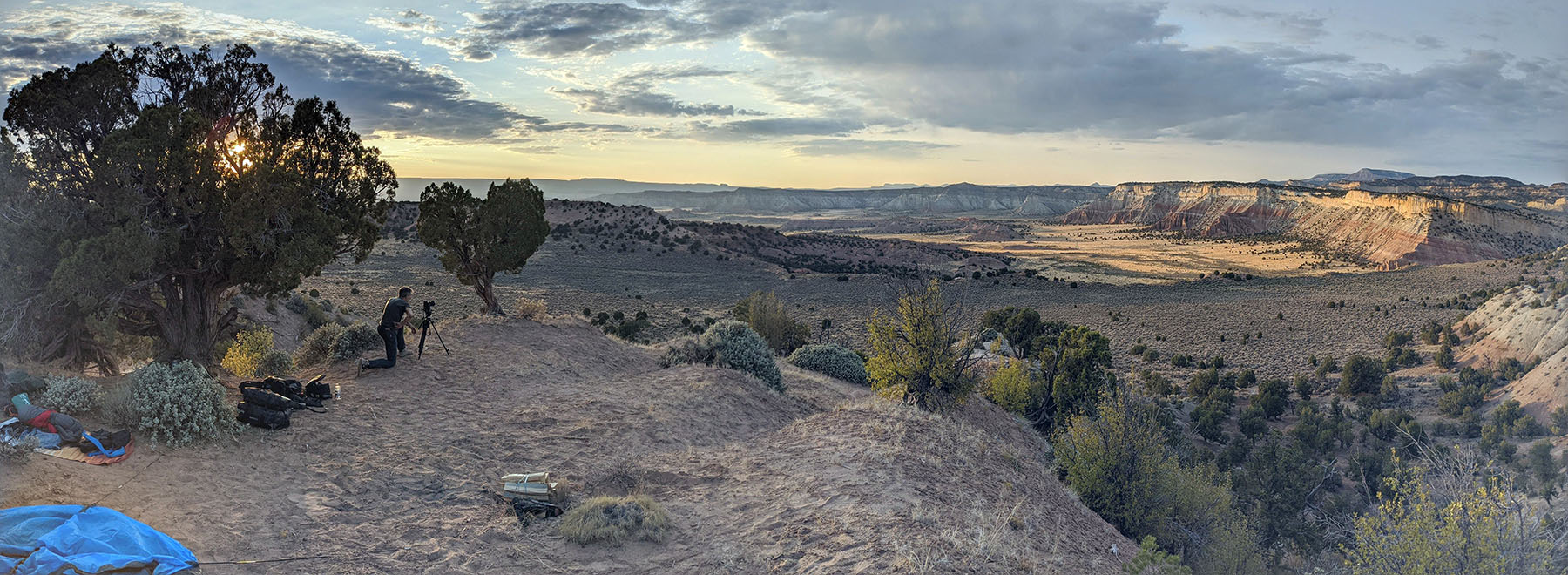
As we neared its end, the trail entered a dense line of trees and abruptly ended at the Fremont River. The fast running water was muddy, and Kit was the first to ford with little notion of depth and no idea what lay below. A breathtaking narrow road perched atop a meandering ridge separated by two yawning canyons delivered us to Grand Staircase-Escalante National Monument. Completely exhausted, we began looking for a campsite along Cottonwood Canyon Road. I found a ledge with a panoramic view across the valley. A series of sheer, striped ridges ran across the horizon, and towering above these, the giant mesa we had traversed all afternoon. We toasted our last night as the last of the sun’s rays set alight Escalante’s vivid strata. It had all gone so fast, and yet Seattle seemed like a lifetime ago. The view from my tent the following morning was worthy of its own trip.
Our last campsite, overlooking a majestic valley in Utah’s Grand Staircase-Escalante National Monument, was in itself worthy of riding 2,600 miles
On our final day, we thundered down a deserted, undulating track running along the floor of Cottonwood Canyon, a dust cloud in our wake and rocks pinging off the sump guards. With the road through Zion National Park closed, we had to take a southern loop through Arizona before starting the last, searing leg down to Las Vegas.
The Moto Guzzi V85 TT, È Tutto Terreno?
After riding hundreds of miles on dirt tracks, some seriously challenging, the V85 TT has convinced this skeptic that it will handle anything you can reasonably expect to throw at it. Overall build quality is excellent. Even with its handsomely sculpted 5.6-gallon tank full of gas, the V85’s center of gravity feels surprisingly low, and coupled with the Michelin Anakee Wild tires, inspired the kind of off-road confidence usually associated with lighter bikes. On the road, more midrange power would make fast overtaking maneuvers less of an exercise in physics, but otherwise, the V85 TT was a superb ride.
A new day in Cathedral Valley, and the most challenging terrain yet
Both Kit and I are over six feet tall, and I’d figured we’d be folded up like a couple of deckchairs, but with some huge miles undertaken, we appreciated the excellent ergonomics and supremely comfortable seat. In terms of range, comfort, durability and handling on- and off-road, the V85 TT is a credible contender at a competitive price, and the folks in Mandello del Lario deserve credit for also making it so very beautiful. We were reluctant to hand back the keys. Arrivederci bellissima! Thanks for the good times!
Thundering down the deserted Cottonwood Canyon Road in Grand Staircase-Escalante National Monument
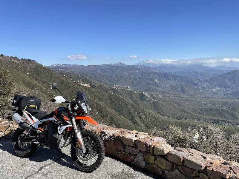
California Route 38 follows Mill Creek Canyon as it climbs into the San Bernardino Mountains.
There are rides we’ve ridden only once and they became favorites, and then there are favorite rides we’ve ridden over and over again. This ride falls into the latter category. I’ve lost track of how many times I’ve ridden Rim of the World Scenic Byway, but I’ve done it on pleasure rides, solo tests, comparison tests and press launches, on cruisers, sport-tourers and adventure bikes.
This route is entirely paved, but it goes through California’s San Bernardino National Forest and provides easy access to many unpaved forest roads and OHV routes. And although I describe the route from its eastern end in Redlands to its western end at Mormon Rocks, it’s just as enjoyable when ridden the other direction. The route is about 100 miles and can be ridden in just a few hours, or it can serve as the main artery for a weekend of adventure, from camping and hiking to boating, fishing or relaxing in mountain communities like Big Bear and Lake Arrowhead.
Most of Rim of the World Scenic Byway is above 5,000 feet, so snow and ice are common in winter and early spring. The road is plowed regularly, but shaded sections can be dicey.
Redlands is part of the Inland Empire, a vast metropolitan area east of Los Angeles that covers parts of Riverside and San Bernardino counties. State Route 38 begins in Redlands, at the junction with Interstate 10. Rim of the World Scenic Byway begins as Route 38 starts to climb into the foothills of the San Bernardino Mountains. The escape from civilization happens quickly as the road starts to gently curve its way up Mill Creek Canyon, with slopes rising steeply on both sides of the road.
Rim of the World Scenic Byway offers panoramic views of the valley below
Following a 180-degree, constant-radius sweeper, the road begins a much steeper climb into the mountains. Now we’re talking! Route 38 winds its way through beautiful mountain scenery on its way to 8,443-foot Onyx Summit. Due to the high elevation, snow and ice are common during the winter and early spring, so proceed with caution. On the flip side, the thinner air makes this route a wonderful escape from broiling heat down in the valley during summer and early fall.
The Pacific Crest Trail passes just east of Onyx Summit, and beyond that high point, Route 38 begins a gradual descent with sweeping views of the desert valley to the northeast. As you begin to see residential areas, be mindful of posted speed limits. Route 38 takes an abrupt left as it becomes Big Bear Boulevard and heads west. After the intersection with Greenway Drive you’ll be on Route 18 (Route 38 turns off to the north) and travel through a heavily trafficked area. Some folks who work down in the valley live up in Big Bear, and it’s a popular weekend destination with many rustic cabins available to rent. There are plenty of options for gas, food, supplies and lodging.
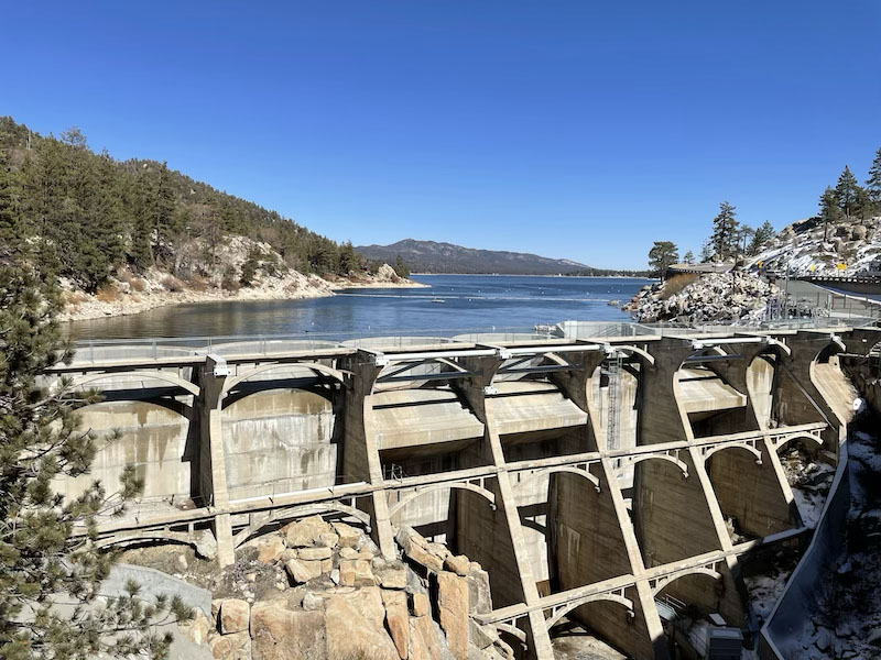
Bear Valley Dam was originally built in 1884
Route 18 roughly follows the southern shore of Big Bear Lake, an expansive blue reservoir. (Route 38 runs along the northern shore and typically has less traffic.) After navigating your way through town and a tight, winding section of road through trees and big lakeside houses, you’ll see Bear Valley Dam. There’s a parking area where you can stop to check out the dam and snap photos of the lake.
From Bear Valley Dam to Lakeview Point, Route 18 hugs rugged cliffs and offers up a delightful — and at times challenging — series of curves. Beware of rockslide debris and fine gravel used for traction in the winter, and commuter and tourist traffic can add their own hazards. Lakeview Point (7,100 feet) is a scenic overlook with great views of the mountains and a peekaboo view of Big Bear Lake off in the distance.
A view of Silverwood Lake from an overlook on Route 138
What follows is a tight, technical section that will put your riding skills — and the limits of your cornering clearance — to the test. After passing through the community of Arrowbear Lake, you’ll come to the town of Running Springs. Pay attention to the road signs and stay on Route 18, which follows an off-ramp to the right. It’s easy to end up on Route 330, an absolute blast of a road that winds its way back down to the valley; it’s a fun down-and-back-up spur if you want to extend your ride.
West of Running Springs the route offers up some of the most scenic views on the entire byway, as Route 18 follows the spine of the mountains. There are many turnouts where you can enjoy the view, particularly Red Rock Scenic Overlook, but from the westbound lane be careful crossing the eastbound (valley side) of the road on blind corners.
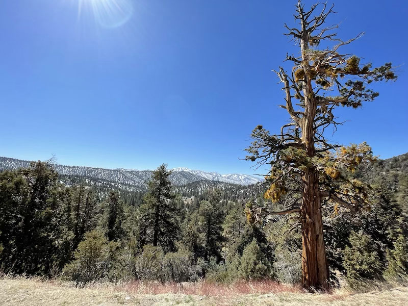
A majestic juniper stands sentry near Onyx Summit. The Pacific Crest Trail passes nearby.
As Route 18 starts to make its way down to the valley (another fun one), at Mount Anderson Junction you’ll turn onto Route 138 (another off-ramp to the right) toward Crestline. Roads are well marked, so if you’re paying attention or following the route on REVER, you’ll be fine. After winding your way through tall trees and densely clustered cabins, Route 138 becomes a rollercoaster of tight turns, hairpins, dips and rises. This is my favorite section of the entire route, but it’s also the most challenging.
As you come out of the forest, the road opens up as it approaches and rounds Silverwood Lake. No more hairpins, just big sweepers, a few rollers and some straights through sandy desert landscape. After crossing over I-15 and railroad tracks at Cajon Junction, you’ll see Mormon Rocks, a dramatic wind-eroded sandstone formation, rising up in the distance.
That’s the end of the scenic byway, but it doesn’t have to be the end of your fun. Right across from Mormon Rocks is Lone Pine Canyon Road, a lightly trafficked back road that goes to Wrightwood and Route 2, better known as Angeles Crest Highway, a legendary favorite ride.
The Red Rock Scenic Overlook was built during the Great Depression, with masonry work by Donald S. Wiesman
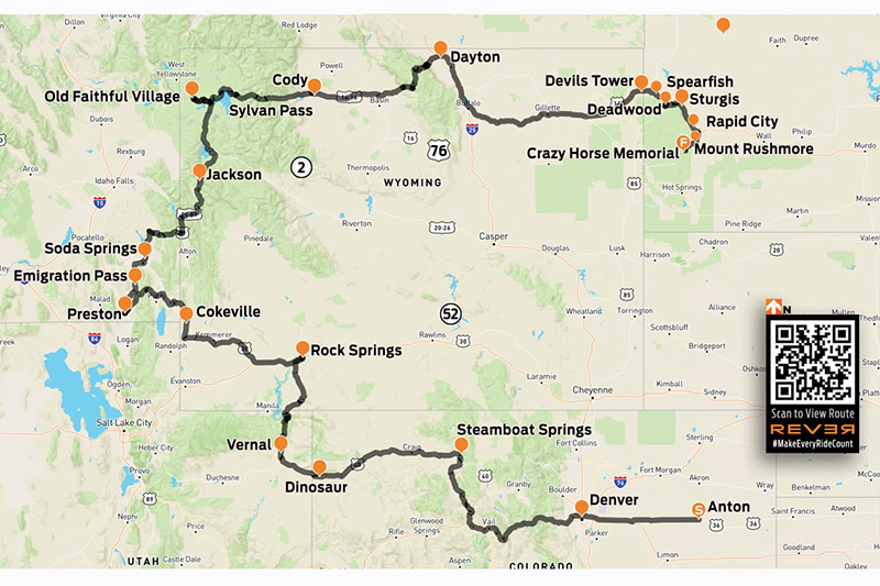
We rode from the Mountain State of West Virginia to visit the Rockies. After hundreds of miles across the Great Plains, we were ready for some elevation. (Photos by the author)
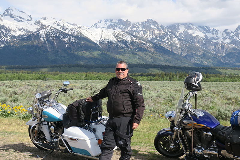
I see mountains! It’s Thursday, somewhere west of Anton, Colorado, and after four-and-a-half days and 1,600 miles, the snowcapped Rockies appear on the horizon. My riding buddy Jay and I left our home state of West Virginia on Sunday. Now midday, we see the jagged peaks we’ve been longing for. The Great Plains were beautiful and adventurous, but we’re anxious to ride into some elevation.
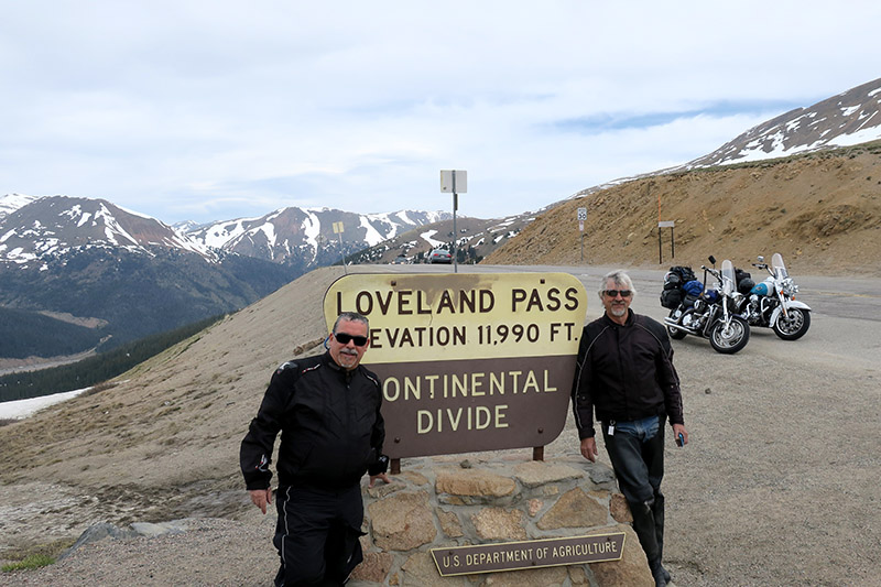
In Aurora, Jay makes the required pilgrimage to a Harley shop and buys yet another T-shirt while I get a long overdue full-face helmet. Then we climb up, up, up. West Virginia, known as the Mountain State, has great riding, but its mountains are mere hills compared to the Rockies. West of Denver significant climbing and a diversion onto U.S. Route 6 leads to 11,990-foot Loveland Pass on the Western Continental Divide. Beyond that the road winds through scenic towns like Dillon and Frisco until we stop for two nights in Edwards.
Maybe if we stood on the sign we could have reached an even 12,000 feet.
Our next two travel days are memorable! Riding through the high plains beyond Steamboat Springs, the spectacular views blew us away. We stopped for gas in Maybell, Colorado, and encountered three dual-sport riders on their fourth day off-road — and they sure looked it. Our lunch break was at the BedRock Depot in Dinosaur, where delicious sandwiches and milkshakes hit the spot. Then on into Utah, climbing up to 8,300 feet on U.S. Route 191, north of Vernal. In Wyoming the land became so dramatic through the Flaming Gorge National Recreation Area that I could hardly keep my eyes on the road. When a cold, wet front was forecast and we could see clouds ahead, the flat broadly curved roads allowed for high-speed fun. We beat the storms, passed the 2,000-mile mark and ended the day’s ride in Rock Springs.
Our tour route is available on the REVER app in the Rider Magazine community.
Winds were a brutal distraction at the start of the next day, leaning constantly into 30-mph gusts until the wind abated near Cokeville, Wyoming, but soon after lunch in Montpelier, Idaho, the rain started. We climbed into the Uinta-Wasatch-Cache National Forest and it began snowing hard, sticking to trees, bushes and my windshield, but fortunately not the road. We were cold, but it made for a memorable photo at Emigration Pass on Idaho Highway 36. Dropping below the snow line, we ended the day’s ride outside of Preston, Idaho, at the Riverdale Resort. It has geothermally heated outdoor pools where we simmered for an hour. Ahhh ….
Brrrr! Freezing temperatures and snow made for a memorable ride over Emigration Pass in Idaho. Luckily it didn’t stick to the road.
Two nights and friend farewells later, we headed north through Soda Springs, where many of the roads are posted “Open Range.” Sure enough, we rounded a curve to find a herd of cattle blocking the road. We honked, and they genially ambled aside. Idaho Highway 34 followed Tincup Creek on its way to the Wyoming border, and we paralleled the Snake River on U.S. 89/191 through the Bridger-Teton National Forest, reminiscent of our own West Virginia roads. As the valley opened, we finally entered Jackson.
We continued north on U.S. 191 through the incomparable Grand Teton National Park and into Yellowstone National Park from the south. Twice we crossed the Continental Divide at 8,000-plus feet before descending into the Firehole River valley. We enjoyed lunch and a timely geyser eruption at Old Faithful Village before riding a long circle around the park. East of Yellowstone Lake we cursed in our helmets as traffic halted. Up ahead a bison plodded along in our lane. Awestruck and humbled, we eventually rolled past this massive creature.
Ed stands under one of the elk horn arches in Jackson, Wyoming, while the guy with the backpack tries to count them all.
We exited via Yellowstone’s east entrance on U.S. Route 14 and rode over 8,524-foot Sylvan Pass, and rolled downhill for 20 long, pleasurable miles. The surroundings turned from pine green to desert brown as we passed between huge sandstone sentinels along the Shoshone River. We reached Cody, a nice thriving western town. At dinner, Jay smiled and ordered Rocky Mountain oysters. About half a bite was all I could manage of fried bull’s balls.
Continuing east on U.S. 14, we crossed a broad valley and began to climb yet again. The view behind us became breathtaking, the temperature dropped to 45 degrees and we crossed the Bighorn Mountains via 9,033-foot Granite Pass. We picked up I-90 at Ranchester, but I foolishly ignored a gas stop. My engine sputtered to a stop and we had to siphon a quart from Jay’s tank. He’ll never let me live it down.
We didn’t see extraterrestrials at Devils Tower, just tourists.
Devils Tower was impressive. No extraterrestrials, just busloads of photo-snapping tourists. Our destination was Keystone, South Dakota, 130 miles away. Signs for Spearfish, Deadwood and Sturgis flashed by, but it was getting dark and drizzling so we roared on. Finally, we reached our hotel. We rode 510 miles over 12 hours and our backsides were numb. What’s half of an Iron Butt — a Wood Butt? An Iron Cheek?
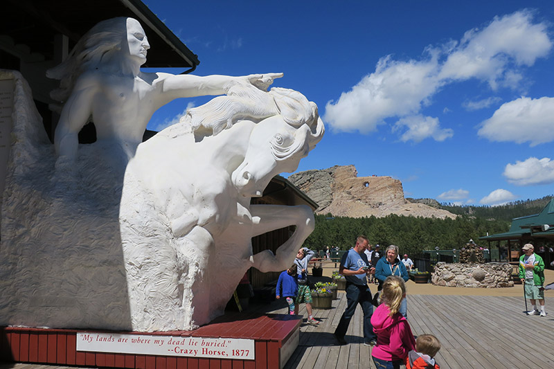
We visited Mount Rushmore and the Crazy Horse Memorial, which is much larger than Rushmore and was the highlight of our visit to the Black Hills. Under construction since 1948, the only recognizable part is Crazy Horse’s face and it won’t be finished in my lifetime.
The plaster statue shows visitors what the Crazy Horse Memorial will look like — some day.
After 3,300 memorable miles, we became horses headed for the barn. Our tripmeters were just shy of 5,000 miles when we arrived back home in West Virginia four days later. My wife greeted me by asking, “So, where to next year?”
Headed for home on County Road E17. Mid-September and it’s 89 degrees in the shade! Which is why the helmet and the jacket were quickly shed for this photo!
Iowa is not known as a motorcycling destination but a through state. Motorcyclists travel primarily on the four-lane roads thinking that’s all there is to see, and that includes many of those who live in Iowa. Even our maps don’t make it look inviting, as the squiggly lines aren’t all that squiggly. So here are some roads that I enjoy traveling that will be a treat for any motorcyclists looking for lightly traveled, interesting roads, and a highly adaptable route.
Crossroads of the Universe in Waubeek. This is looking at the bar after you turn right at the bar and cross the bridge. The bar is very rustic but does have food, even a good breakfast.
I start at the intersection of State Route 13 and U.S. Route 151 in Marion only because I live near there. The route begins on what I call “transit” roads, or primarily straight roads. At County Road E34, head east toward the small town of Whittier (a few houses, a Friends meeting house and a small store), then turn north. I should note that terms like “village” and “hamlet” are not common in Iowa, so even a few houses grouped together are called a town. At Waubeek you’ll cross the Wapsipinicon River, where an old mill has been turned into a rustic bar. You’re now on Boy Scout Road, a former gravel road paved in the chip-and-dip manner. It’s narrow, the pavement is uneven but not rough, and it has some tight corners. It’s a short stretch to savor before returning to more traditional Iowa-style main roads.
he 25 MPH suggested speed on Boy Scout Road is for grain wagons not motorcycles. Be aware of furry forest creatures though!
When Boy Scout Road ends, turn east onto County Road E16 and enjoy some smooth pavement with nice open curves. At a four-way stop, seemingly in the middle of nowhere, turn north on County Road X20. This is a nice paved road off the beaten path where you can enjoy the scenery with a few curves thrown in to keep you from getting white line fever (remember that!). Next take the road toward Hopkinton where you can, and most likely will, encounter horses and buggies, since there is an Amish population that runs several inviting country stores along the route. The road to Hopkinton, County Road D47 / 310th, starts out straight but then gets nice and curvy, with a tight S curve that can catch out the unaware. At Hopkinton, there’s a college that used to be active — it was in business about a hundred years ago and today you can do a ghost hunt/sleepover if that’s your thing. Heading north, you’ll find it is mostly smooth and mostly straight with a few open curves. The road is, however, somewhat rough between Hopkinton and Delhi. Delhi makes for a nice stop, with fuel available and a couple of good restaurants located on the small-town main street. You’ll run into State Highway 3 at a T intersection, where you’ll head left, then in a few short miles turn right onto Co. Rd. C7X. Turn right before the first big grain storage facility — bright metal bins — you can’t miss them.
The road is smooth and has plenty of curves with gentle elevation changes. As you look around you’ll see what I call “vista views” across the hills that make up this corner of Iowa. You’ll pick up CR X3C at what’s left of Elkport. A flood devastated the community some years ago: they made the best of the situation and created a greenspace camping facility. The curves keep coming along with the views and smooth pavement until you intersect with State Highway 13 — yes, the same highway I started on. Head south toward an Iowa Welcome Center that has information, a small “Iowa Made” shop and displays of Iowa wildlife, making for a relaxing stop. There are plenty of opportunities to get food or gas along the way, but this stop makes for a quiet interlude. Leave the welcome center heading south looking for a right turn, County Road C24 / State Highway 112, heading west to Volga — any guesses as to what group settled here?
The church is still going strong at Elkport even though the town is almost non-existent.
This road twists and turns, rises and falls, with a few blind turns thrown in as well. At Volga there’s a park that offers camping as well as access to the Volga River for kayaking. This area has become a destination for both leisurely kayakers and whitewater kayaking. Volga, like most of the other towns on the route, has a convenient city park perfect for a picnic. Follow the signs to Wadena and you’ll be on a trip back through time to what many people think of when they think of rural Iowa. In Wadena you can stop at a locker, a no-frills meat market, and pick up travel food like meat sticks and jerky or steaks to take home if you have a cooler. You’ll also see an old hotel turned into a private residence that still has the name Wadena stenciled on the windows (so that when you got off the train a hundred years ago you knew where you were). Been wondering why so many very small towns exist along this route? One word — railroad. These towns owe their existence to having access to a rail line when rail was the only reliable transportation and communication line in Iowa. In Claremont you’ll see an old depot that a local group is trying to save.
This is looking back at the small city park in Claremont honoring Civil War and all Veterans.
When you reach Claremont, also known as “Brick City,” you can’t miss the turn of the century architecture throughout the town. Claremont was the home of the first governor of Iowa and has a statue and museum to prove it. Wadena and Claremont are still active and offer hospitality in the form of small-town restaurants and bars. These are not tourist towns, though they do cater to hunters in the fall and you won’t feel out of place.
Even small towns in Iowa usually have some form of Veterans Memorial.
My ride doesn’t end at Claremont, you can reverse it (I like the way the curves string together heading north to south better then south to north), meander back on the other good roads in the area, explore the many graveled roads along the way if you’re so inclined or pick a new destination. I suggest that the best time to ride the route is any time you can — I’ve ridden it four times already this year and plan on riding it at least one more time. So look for the guy on a BMW RT wearing hi-viz gear. That most likely will be me!
The expansive view along County Road X3C reveals the gentle hills of northeast Iowa.
The new-to-me BMW strikes a pose atop a favored section of the Pacific Coast Highway.
Northern California’s Pacific Coast Highway might be the best use of asphalt anywhere. From expansive ocean views to the west, to often fog-shrouded hilltops to the east, this north coast section of the roadway splits coastal prairies, tunnels through cypress groves, twists into stream gullies and, around turns, repeatedly prompts an involuntary “Oh, my!” no matter how many times I’ve ridden it.
This day, I’m heading south from Point Arena astride a 1986 BMW R80RT I’d just inherited. My brother had injured his throttle hand in an industrial accident and his bike needed a home. I volunteered. That’s what brothers do.
Weathered barn / building at Sea Ranch, California.
I’d been smitten with this model since 1983 when I was offered use of the brand-new RT for the day while my year-old bike was in the shop. I remember an irrepressible grin as I sampled a curvy road just out of town. I liked the slightly taller saddle, roomier accommodations, breeze protection and space-age look. Not available 12 months earlier, I remember thinking, “Why couldn’t I have just waited a year and gotten one of these?”
Fast forward 35 years, and one falls into my lap.
The first order of business for this new-to-me old bike was a visit to Point Arena’s Zen House, the place for “the art of motorcycle maintenance,” for a professional service and safety once-over. While I viewed some of the classic restorations in and about the shop, owner David Harris checked out the RT and explained how he would sort my new possession, addressing seals, gaskets and busted parts and even replacing roundels on the tank. “Let’s do it!” I said.
A couple of weeks later, I’m back listening as David walks me through the care and feeding of the old R80 much as a dealer would for a customer about to head out on something shiny and new. His final comment? “You know, you could take this bike around the world if you wanted.”
Author and BMW outside the Stewarts Point Store. Only one of us is particularly photogenic. Perhaps if I were sporting a beret?
Around the world wasn’t on today’s agenda but the day is lovely, and I am already out on the Pacific Coast Highway.
Moments after leaving Point Arena, I’m immersed in mist and splashes of sunlight and the aroma of sea spray and pasture. The ragged fence lines, aging barns, sweeping curves and tantalizing crests of this familiar road are a good kind of different on the vintage machine. Perhaps it’s the rustic thrum of the old boxer’s engine.
The RT gets a thorough sorting at the Zen House in Point Arena.
Gualala offers fuel and food and, across the river, a fine county park to explore, where I pause. A paved path leads to bluffs and the siren’s song of surf and sea lions prompts me to take it. Remnants of cables and concrete remind me that redwood from these parts, transported on dog hole schooners, built San Francisco. Twice.
The Sea Ranch, an enclave of mostly second homes, rests on the bench south of the Gualala River. The highway is wide and well maintained, though damp where shaded. Views of the ocean are infrequent. There is some cross traffic from residents and renters, so perhaps it’s good not to be distracted by the sea.
The Stewarts Point Store offers food, drink, rest and a peek into the area’s ranching and timber heritage. The store offers a sandwich called “the Hog,” in which I indulged even though I was not riding American iron this day.
At Stewarts Point a small country store offers freshly baked breads, a deli producing delectable sandwiches, hot coffee for those days of foggy rides and cold beverages for when the sun shines, along with local wines, sweets and knickknacks. Entering the building I can hear century-old footsteps from when the mercantile was frequented by area ranchers and nearby mill workers. I’m told there’s a dance hall upstairs.
Winding south, I pass through villages and vacation rentals, viewpoints and trailheads. I should stop for a picture of a breaking wave or the roadway slipping around a curve and disappearing into a copse of coastal evergreens, but riding an iconic airhead on this iconic highway is magical—the grin from 30 years ago has returned—and I don’t want to stop.
Fort Ross and its farm fields once served as the grocery store for Russian fur trappers working the Aleutians. Here, I take a break. A handsome visitors center introduces me to those lost pieces of history I often whiz right past and later curse myself for missing. The original wall was repurposed by John Sutter after the Russians departed. The hewn lumber of the old stockade was shipped to where Sutter was building his own fort in what would become Sacramento. Highway 1 once passed right through the parade grounds but has been rerouted and the stockade rebuilt.
South from here, Highway 1 climbs and dives over disintegrating cliffs and benches that were once sea floor. I am tracing the scarp of the notorious San Andreas Fault for quite a distance. Along this windy stretch, two forces are engaged in an epic battle: plate tectonics and erosion versus highway maintenance workers. Pavement in this section slumps and cracks, but the old bike feels solid and surefooted.
Historic Fort Ross reminds us that the Russians preceded our occupation in these parts.
Clear day views stretch forever. I stop at a favored spot with a breathtaking view of the Pacific and snap a picture of my new possession. The photo will join the collection of a half-dozen other bikes I’ve owned whose portraits have been taken here.
Late autumn dusk settles early, and I head inland at Jenner. Winding along the Russian River, I reflect on how perfectly the old Beemer handled today’s first ride. The engine purred in harmony with the sea. The skinny tires devoured the curves. The low center of gravity made handling second nature. And the windscreen and heated grips—quite the innovations for bikes of that era—made the chilly ride comfortable.
It turns out that not having purchased this model three decades ago had an upside. It allowed me to better appreciate the delight that now carried me—make that us—home.
A short walk at Pelican Bluffs, just south of Point Arena, offers a breathtaking view of the never-ending work of the Pacific.
An Old Bike and the Sea: A first ride on Highway One Photo Gallery:
With international travel in 2020 looking less certain by the week (and possibly risky, not just health-wise but also with the possibility of becoming stranded or quarantined outside the U.S.), this might be a great time to explore this beautiful country.
While you could certainly peruse back issues of Rider (or do some research here on our website) in search of ride ideas throughout the country, you’ll still be on the hook for logistical planning, hotel reservations and knowing whether or not the gas station in that tiny desert town is still open…not to mention handling the “what-ifs” of mechanical issues or a crash. Or you could let a tour company handle all of it, leaving you free to enjoy the ride.
All the companies on this list run scheduled, guided motorcycle tours in the United States using rental motorcycles — either their own fleet or rented from a local source — but you should obviously check with them right off the bat to make sure they’re still running tours this year.
Most have a chase vehicle to carry your luggage and gear and to deal with mechanical issues that may occur en route. Some companies will allow you to ride your own bike, but check for any restrictions. The information here is provided by the companies, and not guaranteed by Rider.
Ayres Adventures
Tours Include: Alaska/Yukon Adventure, Prudhoe Bay Excursion Accommodations: Upscale hotels Length of Tours: 9-13 days Rental Options: BMW GS models Equipment: Support vehicle Dates: July-August Typical Cost: 9-day Prudhoe Bay Excursion starting at $5,950 including bike rental Age/Experience Requirements: Motorcycle license and touring experience required; for off-road adventures, off-road experience or training required Tel: (877) 275-8238 or (972) 635-5210 Website:ayresadventures.com
Ayres Adventures prides itself in providing a premium tour experience, so if you want to ride Alaska this is a great way to do it. You’ll ride late-model BMWs equipped with chunky Continental TKC80 tires for the ultimate Alaska experience.
Bike Week Motorcycle Tours
Tours Include: All the major Bike Weeks, including Daytona, Laughlin, Myrtle Beach, Laconia, Hollister, Sturgis and Bikes, Blues & BBQ Accommodations: RVs, private homes and carefully selected hotels/motels Length of Tours: 12-14 days Rental Options: Late model Harley-Davidson and Indian models Equipment: Support vehicle with spare motorcycle Dates: March-October Typical Cost: $7,950, includes single room and motorcycle rental Age/Experience Requirements: Min. age 21, min. one-year experience on heavyweight motorcycles Tel: (619) 746-1066 Website: bikeweekmotorcycletours.com
Get the ultimate Bike Week experience, as you travel some of America’s most scenic roads on your way to one of nine legendary Bike Weeks. Let the party begin!
California Sunriders
Tours Include: Blue Ridge Parkway, California Dreaming, Route 66, Sturgis, DreamCatcher, The Mighty 6, Yellowstone Accommodations: Selected 3- and 4-star hotels Length of Tours: 11-13 days Rental Options: Harley-Davidson, select other makes/models Equipment: Support vehicle with spare motorcycle Dates: May-October Typical Cost: 13-day Route 66 tour starting at $8,972, single occupancy, includes rental motorcycle Age/Experience Requirements: Min. age 21 Tel: (310) 359-2353 Website: california-sunriders.com
California Sunriders wants to show you the best of the west — plus some fun roads back east too. You’ll explore California, the Rockies, the famous Blue Ridge Parkway and, of course, the legendary Route 66.
EagleRider
Tours Include: Wild West I, II and III, Route 66, Triple B, Coast to Coast, Sturgis Bike Week, Florida Keys, Southwest Canyon Country Accommodations: Hotels & motels Length of Tours: 6-17 days Rental Options: Varies by tour; fleet includes BMW, Harley-Davidson and Indian cruisers, tourers and trikes Equipment: Support van with spare motorcycle Dates: Year-round Typical Cost: 15-day Route 66 tour starting at $7,179, single occupancy, includes rental motorcycle Age/Experience Requirements: Min. age 21, experience riding a touring motorcycle at highway speeds Tel: (877) 557-3541 Website:eaglerider.com
Eaglerider is the largest and arguably most well-known motorcycle rental and tour company in the U.S. With 45 different domestic tours to choose from, you’re sure to find something to suit your tastes!
Photo by Scott A. Williams
Edelweiss Bike Travel
Tours Include: Alaska-Yukon Adventure, American Dream, California Extreme Accommodations: Comfortable hotels and motels Length of Tours: 8-13 days Rental Options: Select BMW, Harley-Davidson and Suzuki models Equipment: Support vehicle Dates: May-October Typical Cost: 7-day American Dream tour starting at $5,660 for a solo rider, including rental bike Age/Experience Requirements: Age limits vary by tour; 5,000 miles riding experience required Tel: 011 43 5264 5690 Website:edelweissbike.com
Tour the warm and beautiful Southwest or the wilds of Alaska with Edelweiss Bike Travel. Edelweiss has been operating guided motorcycle tours since 1980, and now offers 2,350 tours in 180 destinations worldwide.
Globebusters
Tour: North America Accommodations: 3- to 4-star hotels Length of Tour: 34 days Rental Option: Triumph Tiger 800 Equipment: Support vehicle Dates: July 23-August 27, 2020 Cost: $20,531 for a solo rider, double occupancy, including Tiger 800 rental bike Age/Experience Requirements:No age requirement, recommended for experienced riders only, comfortable riding on unpaved/gravel roads Tel: 011 44 (0)3452 30 40 15 Website:globebusters.com
This is an ultimate motorcycle tour of North America, showing you some of the very best riding from Anchorage, Alaska, north to Prudhoe Bay and then south all the way to the Mexican border.
Great American Touring
Tours Include: Pacific Coast North and South, Sturgis Bike Week, Canadian Rockies, Best of the West Accommodations: Hotels Length of Tours: 7-14 riding days Rental Options: Harley-Davidson, select other makes/models Equipment: Support vehicle Dates: July-Sept Typical Cost: 14-day Best of the West starting at $8,995, solo occupancy, includes rental bike Age/Experience Requirements: Min. age 21 to rent motorcycle, no limit for own bike Tel: (800) 727-3390 Website: greatamericantouring.com
How does Great American stand out? When it says “eight day tour,” that’s eight riding days. Other companies’ eight-day tours may be only six, or even just five riding days. It makes a difference.
Hertz Ride
Tours Include: Best of California, California, Miami & Deep South and Route 66 Accommodations: Minimum 4-star hotels Length of Tours: 9-16 days Rental Options: BMW models Equipment: Support vehicle Dates: July-Sept Typical Cost: 14-day Best of California starting at $6,995, single occupancy, includes rental bike Age/Experience Requirements: Min. age 25, at least three years’ riding experience Tel: 011 351 210 413 334 Website: hertzride.com
Car rental giant Hertz has entered the motorcycle tour market, and it offers four guided tours in the U.S. Hop onto one of its late-model BMWs and take a ride in California, along Route 66 or through the Southeast.
Leod Motorcycle Escapes
Tours Include: High Sierra Escape, California Curves to Laguna Seca, California Curvin’ Accommodations: 3- to 4-star hotels with a local flavor Length of Tours: 3-9 days Rental Options: Selected BMW and Ducati models Equipment: Support vehicle Dates: June-Oct Typical Cost: 9-day California Curves to Laguna Seca starting at $6,900, includes rental bike and two days’ track instruction at Laguna Seca with California Superbike School Age/Experience Requirements: Intermediate riding level for track time tours Tel: (866) 562-6126 Website: leodescapes.com
Although Leod Escapes offers guided and self-guided sport-touring rides out of its San Francisco headquarters, it specializes in combining a tour with track time on some of the most famous tracks worldwide — including legendary Laguna Seca in California.
MotoDiscovery
Tours Include: Heart of Colorado ADV, Moab Adventure Training, Heart of Idaho ADV Accommodations: Quality accommodations Length of Tours: 7-9 days Rental Options: Select BMW, KTM and Suzuki ADV and dual-sport bikes Equipment: Support vehicle Dates: June-September Typical Cost: 8-day Heart of Colorado ADV tour starting at $4,895 including rental bike Age/Experience Requirements: Off-road riding experience required; training is available and included in some tours Tel: (800) 233-0564 Website:motodiscovery.com
If you’re looking for adventure, this is the place. MotoDiscovery will lead you on bucket list rides to some beautiful and remote locations that can only be accessed via unpaved roads and trails. Off-road rider training is included in some tours.
MotoQuest
Tours Include: Wonders of the West, American Southwest, Pacific Coast Highway, North to Alaska, Trail of Lewis and Clark, Alaska Women’s Tour Accommodations: Lodges, hotels Length of Tours: 4-13 days Rental Options: BMW, Suzuki V-Strom 650, Harley-Davidson, Honda Africa Twin Equipment: Support vehicle Dates: Year-round Typical Cost: 12-day Trail of Lewis and Clark tour starting at $6,450, includes Suzuki V-Strom 650 Age/Experience Requirements: Min. age 21 Tel: (800) 756-1990 or (907) 272-2777 or (562) 997-7368 Website:motoquest.com
MotoQuest offers a number of tours of the last frontier, Alaska, during its short riding season. At other times of the year, tours are offered in the American West and Southwest, including Baja, out of its San Francisco, Portland and Long Beach locations.
Photo by Mark Tuttle
Northeastern Motorcycle Tours
Tours: New England Fall Foliage, Gaspe Maritime Extended Accommodations: Inns, hotels and resorts Length of Tours: 6-12 days Rental Options: Various models available from local rental agencies Equipment: None Dates: August-October Typical Cost: 6-day New England Fall Foliage tour starting at $2,395, excluding bike rental Age/Experience Requirements: Min. age 18, touring experience recommended Tel: (802) 463-9853 Website:motorcycletours.com
Northeastern Motorcycle Tours is a small company that specializes in an extraordinarily beautiful and varied region of North America. The routes, hotels and dining used on the tours are regularly researched to always meet very high standards.
Pashnit Motorcycle Tours
Tours: El Dorado, Delta Bodega, Parkfield, Mosquito Ridge, Coast Range, North Pass, Mile High Xtravaganza, Santa Barbara Accommodations: Hotels, motels Length of Tours: 3-4 days Rental Options: Various models available from local rental agencies Equipment: None Dates: March-October Typical Cost: Most 3-day tours cost $425, excludes motorcycle rental, food, gas, accommodations and incidentals Age/Experience Requirements: Min. age 21, at least 5 years of riding experience is recommended Tel: (530) 391-1356 Website: pashnittours.com
Pashnit Motorcycle Tours (“pashnit” = passionate, get it?) started out as a “best roads” list and now offers a full menu of California-based tours, many of which are held on long weekends.
RawHyde Adventures
Tours Include: Continental Divide, Rocky Mountain Adventure Ride, Mid-Winter Adventure, California Adventure, Best of the West Accommodations: Hotels and camping Length of Tours: 5-10 days Rental Options: BMW GS models Equipment: Support vehicle, chuck wagon on camping tours Dates: Year-round Typical Cost: 5-day Mid-Winter Adventure tour starts at $3,495 including rental bike Age/Experience Requirements: Min. age 21, off-road riding experience required for ADV tours (training is available) Tel: (661) 993-9942 Website:rawhyde-offroad.com
RawHyde Adventures is an official BMW off-road training center, and its tours offer you the chance to hit the dirt and see some of the most remote and beautiful parts of America. On-road tours, such as California Adventure, are also available.
Ride Free Motorcycle Tours
Tours Include: Route 66, Sturgis-Chicago to Las Vegas, Northern California, Wild West, American History Washington DC Battlefields, California Wine, Blue Ridge Parkway, American Music Accommodations: Hotels and motels with local flair Length of Tours: 4-14 days Rental Options: Harley-Davidson models Equipment: Support vehicle Dates: Year-round Typical Cost: Extremely flexible pricing and tour duration; example: 13-day American Music tour $6,789 including bike rental Age/Experience Requirements: Min. age 21, competent rider Tel: (310) 978-9558 Website: ridefree.com
Classic routes with classy motorcycles (and classic cars) is what Ride Free specializes in. Based in Los Angeles, the company offers tours throughout the country.
Reuthers Tours
Tours Include: Route 66 Dream, Florida Sunshine, Wild West, Highway 1, Bluegrass Wonders and Pony Express Accommodations: Midrange and top-class hotels Length of Tours: 6-15 days Rental Options: BMW, Harley-Davidson Equipment: Support vehicle Dates: Year-round Typical Cost: 11-day Bluegrass Wonders tour starts at $4,795, double occupancy, including bike rental Age/Experience Requirements: Min. age 21 Tel: (414) 455-4384 Website: reuthers.com
Reuthers is a worldwide entertainment, travel and leisure company with headquarters in Germany and a U.S. office in Milwaukee. With its touring expertise you’re guaranteed to be well cared for.
Twisted Trailz Motorcycle Tours
Tours Include: Cowboy Country, Grand Canyon & Red Rocks, Unique Utah, Canyons & National Parks, Awesome Arizona, Monuments & Million $ Highways Accommodations: Unique or historical hotels and lodges Length of Tours: 3-7 days Rental Options: Harley-Davidson Equipment: Support vehicle on tours 5 days and more Dates: February-November Typical Cost: 7-day Monuments & Million $ Highways tour starts at $4,395 including bike rental Age/Experience Requirements: Min. age 25, experience riding heavyweight motorcycles Tel: (602) 795-8888 Website:twistedtrailz.com
All of Twisted Trailz’s motorcycle tours are planned and structured with the rider in mind. It encourages participants to enjoy the spectacular scenery of the Southwest on one of its once-in-a-lifetime tours.