During the long, dark winter in Minnesota, when the ground is covered in snow and ice and our motorcycles are mothballed for months, dreaming about riding in a warm, dry place gives us hope. That’s when my friend Craig and I started planning an adventure ride out West. We sketched out a route that included a mix of backroads, parts of the Arizona and Utah Backcountry Discovery Routes, other off-road tracks, and interesting sights along the way.
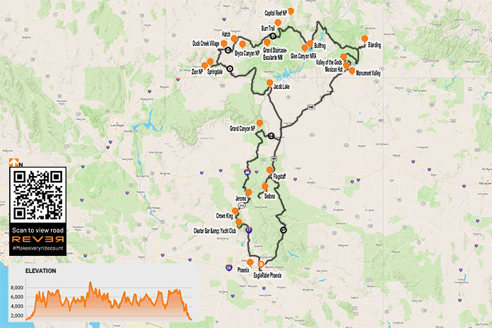
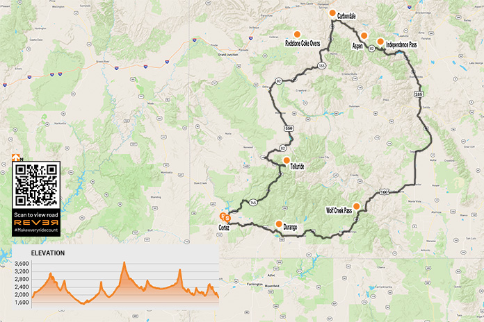
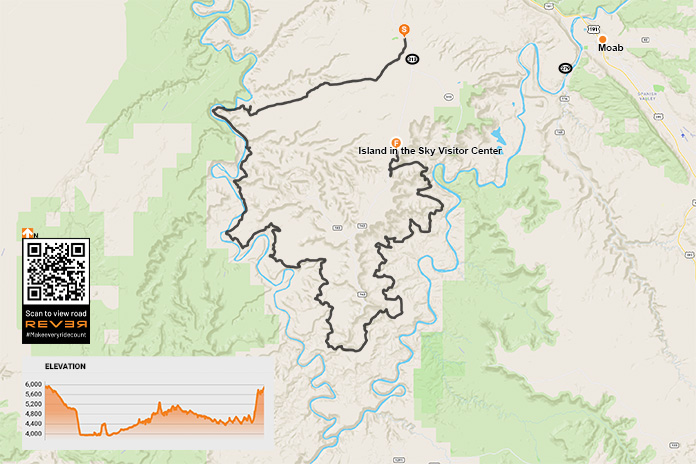
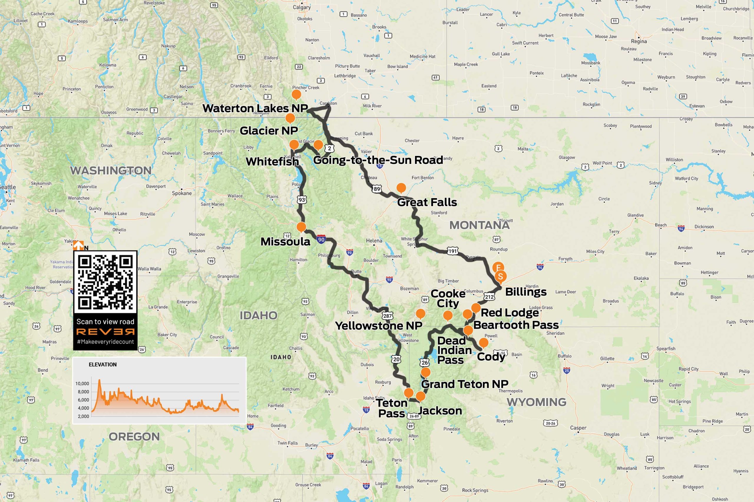
Scan QR code above or click here to view the route on REVER
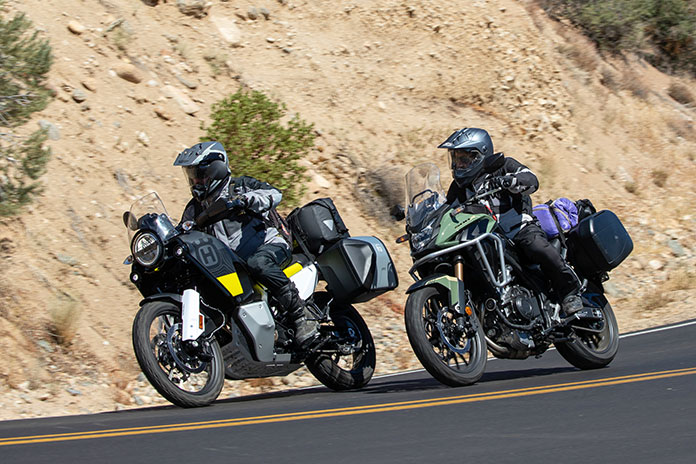
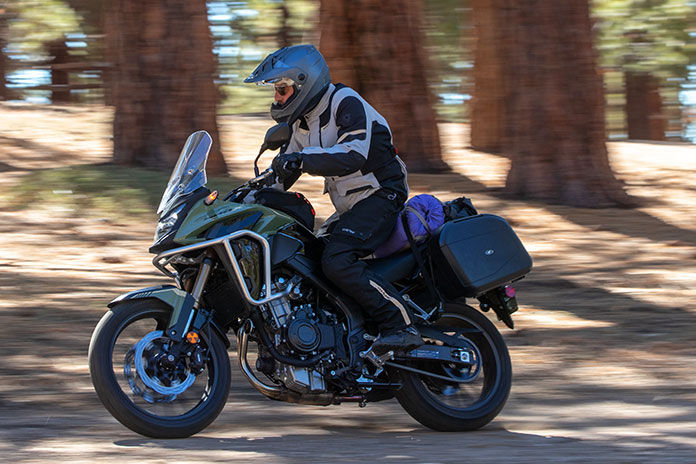
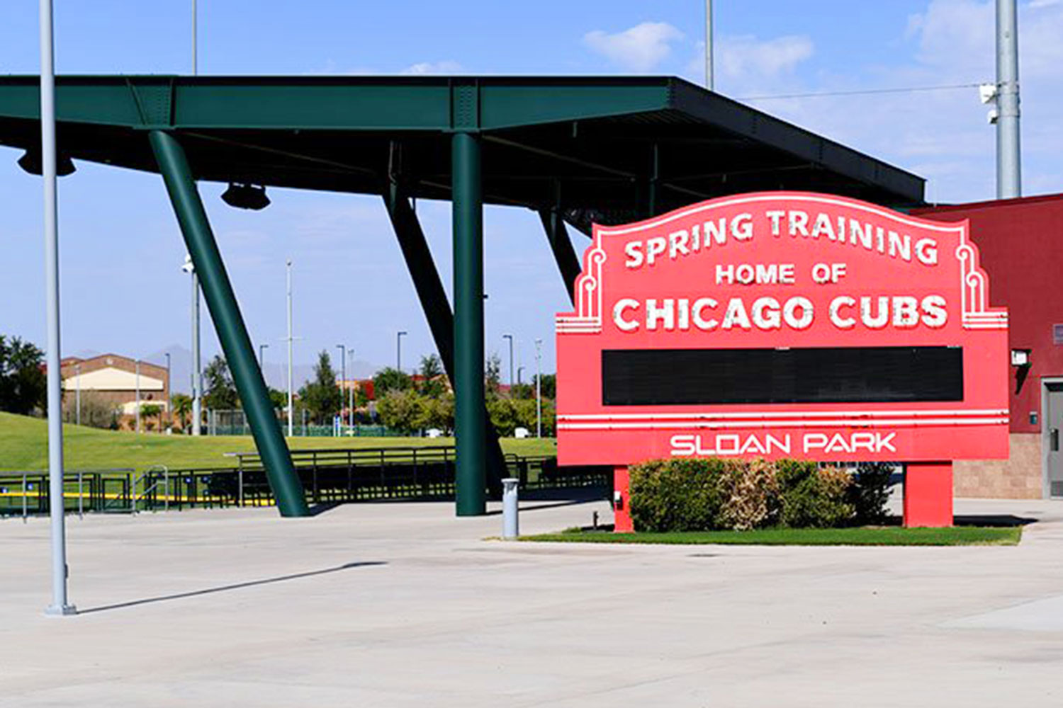
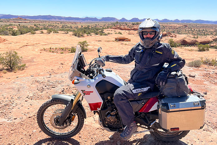
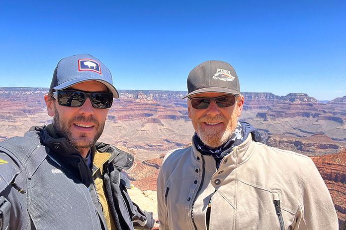
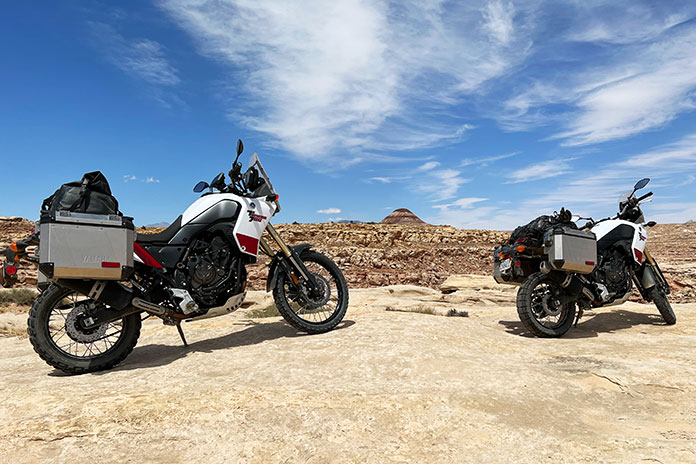
In May, we flew into Phoenix and headed to EagleRider in nearby Mesa, where we were greeted by a friendly guy named Bob. After a quick paperwork checkout procedure, we packed our gear on two rented Yamaha Ténéré 700s and headed north on Interstate 17.
With temperatures in the triple digits, the frigid days of winter seemed like a distant memory, so we busted north to gain some elevation.
Related: 2021 Yamaha Ténéré 700 | Long-Term Ride Review
Even in full riding gear, we started to cool off as we rode farther north. Our bikes were unfamiliar to us, and they were stuffed to the gunwales with camping gear and other essentials. We soon grew accustomed to their added weight as we passed over the “Carefree Highway,” a 30-mile stretch of road made famous by Canadian singer Gordon Lightfoot that runs between I-17 and U.S. Route 60.
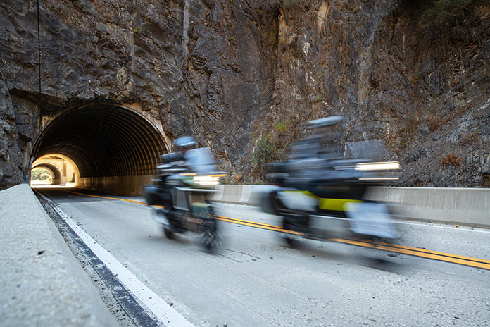
I have a lot of street miles under my belt, but this was my first adventure bike trip, so I wasn’t entirely prepared for the primitive roads where the gravel feels like marbles under your wheels. However, it didn’t take long for the combination of my ancient dirtbike experience and a few unplanned rear-wheel kickouts to provide a quick education on keeping the Ténéré upright. Enthusiasm tempered with caution was the order of the day.
We took County Road 59/Bumble Bee Road off I-17 to check out the Cleator Bar and Yacht Club. The name of this welcoming 4×4 oasis run by Tina Barnhart is a bit tongue-in-cheek, as it is located hundreds of miles from open water. Barnhart is also in the vehicle delivery business to such faraway places as Africa and is active in the Global Rescue Project based in Scottsdale, Arizona, which works to end child slavery and reunite children with their families.
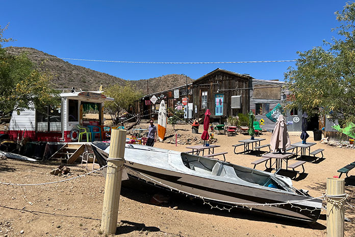
The Cleator Bar is a must-stop location, complete with boats in the “marina” out back and a stage for live music. Interestingly, the entire town of Cleator, comprising 40 acres, a bar, a general store, a few other structures, and mineral rights, was put on the market by descendants of James P. Cleator in 2020 for $1.25 million, and it was sold at the bargain price of $956,000.
Related: Backcountry Discovery Routes: First BDR-X Route and YouTube BDR Film Library
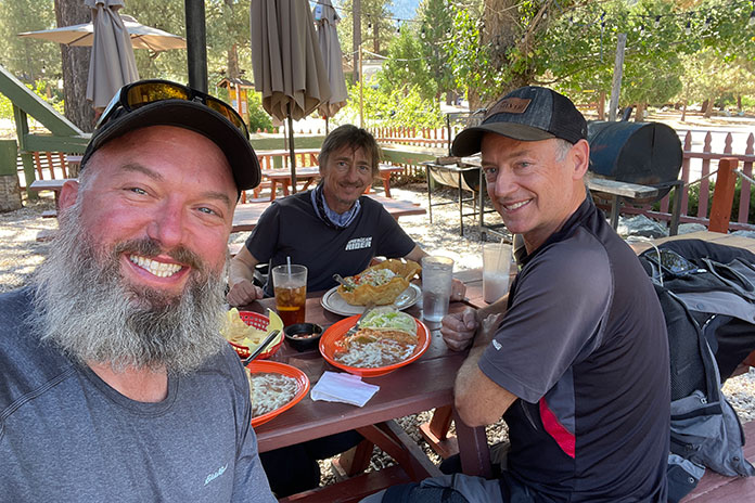
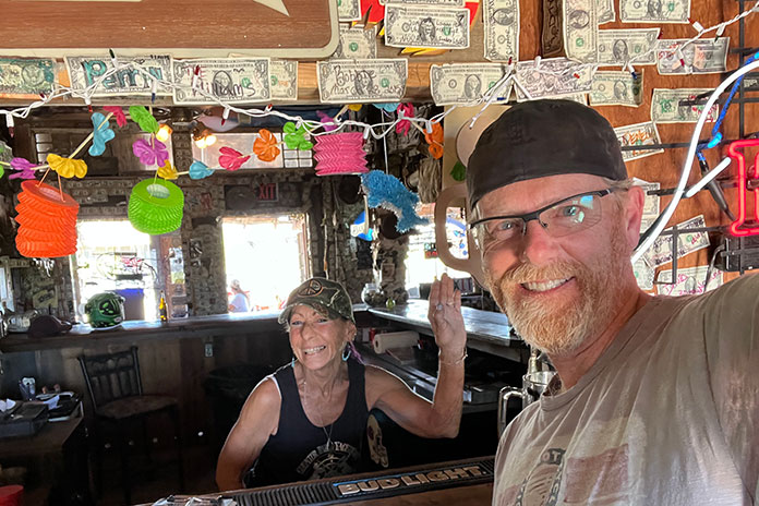
Our next stop was Crown King, located another 13 miles along CR 59 at an elevation of 5,771 feet. A high-clearance four-wheel-drive vehicle is recommended on the deteriorated roads. The Ténérés managed well, and we soon found ourselves taking a load off in the Crown King Saloon & Eatery, one of the oldest continuously operated saloons in the state. We enjoyed a cold drink and a hearty lunch, and the $5 bottle of scotch we bought there (on sale courtesy of Mother’s Day) served us well during the rest of the trip.
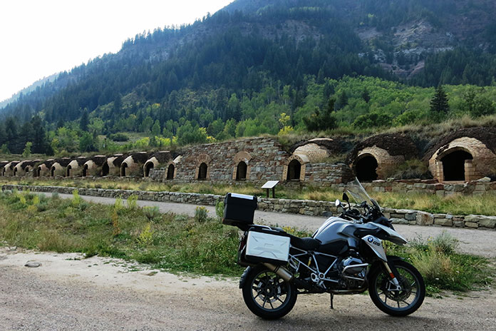
Like a lot of small towns in the Bradshaw Mountains of Arizona, Crown King used to be a thriving mining community. In 1904, a railroad was built to help mining operations, but due to a lack of water and high transportation costs to process the ore, it was abandoned in 1926. The old railroad bed is still used today as the main access road to Crown King.
While there, we met Chuck Hall, who is a great ambassador for the area – and a talented guitar picker to boot. He told us he’d lived there for over 30 years and recommended we check out the Senator Highway, on which he’d lost many an exhaust pipe from his old Dodge Neon. A former stagecoach route, the rutted road snakes 37 miles from Crown King to Prescott with many blind switchbacks, eroded surfaces, several water crossings, and spectacular scenery.
Hall recommended we visit Palace Station, a stage stop built in 1878 midway between Crown King and Prescott. Back in the day, the station had a bar and was a social meeting center for the miners who worked in the area.
See all of Rider‘s touring stories here.
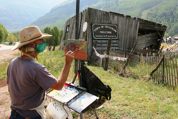
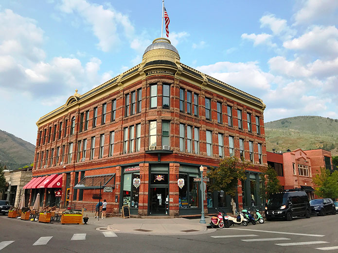
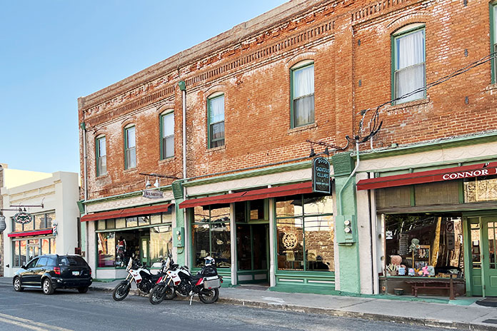
We targeted the town of Jerome for the night. This old copper mining town earned its nickname, “Wickedest Town in the West,” during its heyday in the early 20th century. After the mining bust, the town descended into desperation, greed, and crime. It was revived in the 1960s as a tourist destination, and many of its historic buildings are now filled with restaurants, shops, and hotels. Jerome is said to be a hotbed of paranormal activity, and we stayed at the Connor Hotel, which is reportedly haunted by the “Lady in Red.” We didn’t see any ghosts, so maybe she had the night off.
Related: Backcountry Discovery Routes: Ep. 33 Rider Magazine Insider Podcast
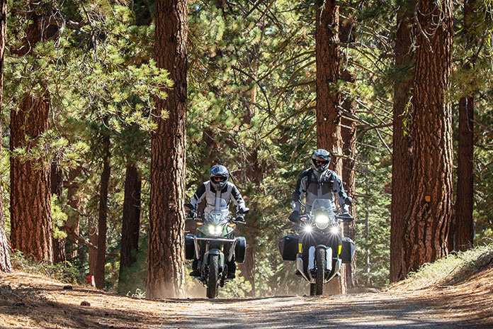
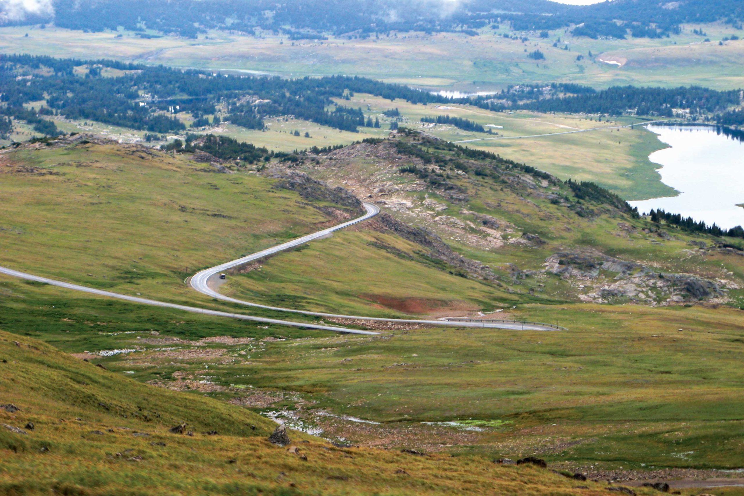
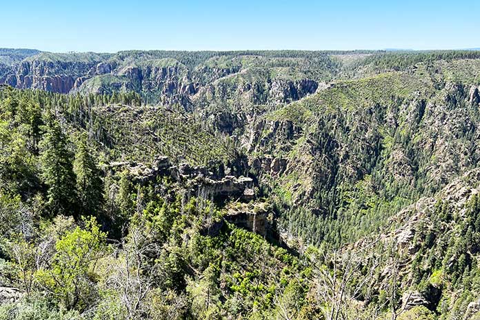
With a long day of off-roading ahead, we left Jerome and headed north toward the Grand Canyon on a series of unpaved national forest roads. We wound our way around the contours of Woodchute Mountain, crossed the Verde River, and ascended to the Colorado Plateau at more than 6,000 feet. We could see the volcanic San Francisco Peaks rising above the plateau to the east.
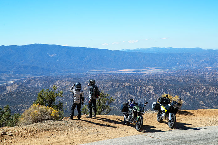
We crossed Interstate 40 near Williams, and after a few miles on State Route 64, we turned onto a national forest road to take an unpaved “back door” route into Grand Canyon National Park. We hooked up with Route 64 again where it’s known as East Rim Drive and enjoyed scenic views from the Grand Canyon’s South Rim.
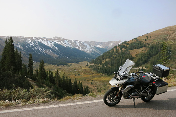
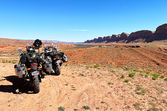
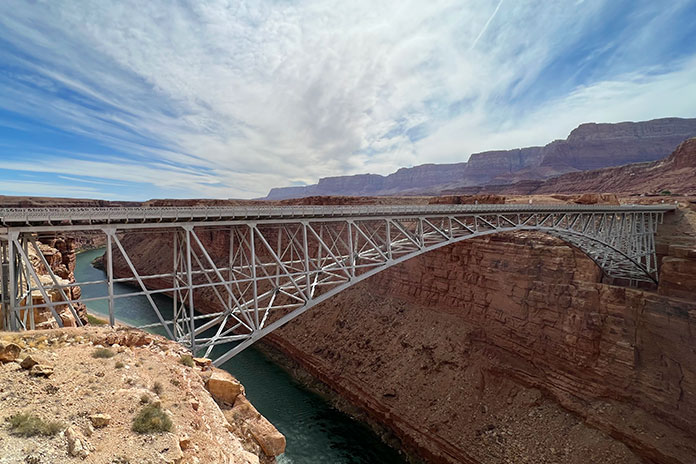
After leaving the park, we connected with U.S. Route 89 and refueled at Cameron, where the highway crosses the Little Colorado River. At Bitter Springs, U.S. 89 splits to the east toward Page, but we continued north on U.S. Route 89A, crossing the Colorado River at Marble Canyon via the Navajo Bridge and following 89A west into an area known as the Arizona Strip. We rode with the majestic Vermilion Cliffs to our right, crossed House Rock Valley, and then climbed out of the desert and into the evergreens of the Kaibab Plateau.
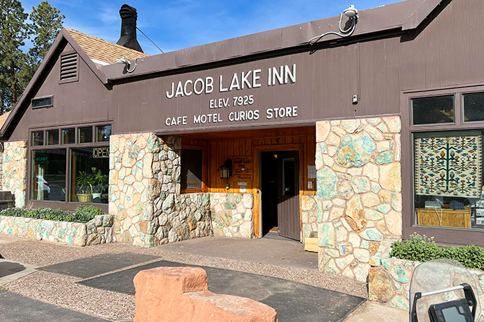
We stopped at Jacob Lake, a small crossroads that sits at 7,925 feet, and it was noticeably cooler at the higher elevation. Known as the gateway to the North Rim of the Grand Canyon, Jacob Lake has a gas station and a hotel with a restaurant and gift shop. The town was named after Jacob Hamblin, an early Mormon pioneer who was shown the location in the mid-1800s by the Kaibab band of Southern Paiutes. And according to the hotel staff, the lake is more of a pond.
We continued west through Fredonia and crossed into Utah near Kanab, known locally as “Little Hollywood” because of its rich history in filmmaking – most notably Westerns, with more than 100 movies and television shows being filmed there.
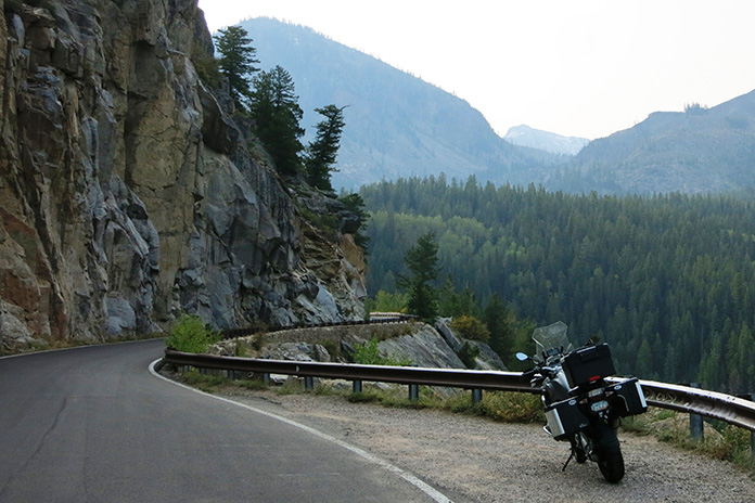
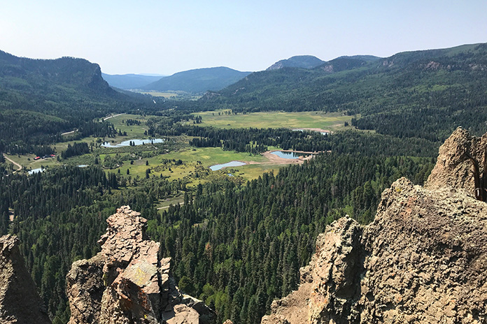
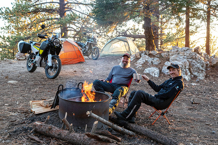
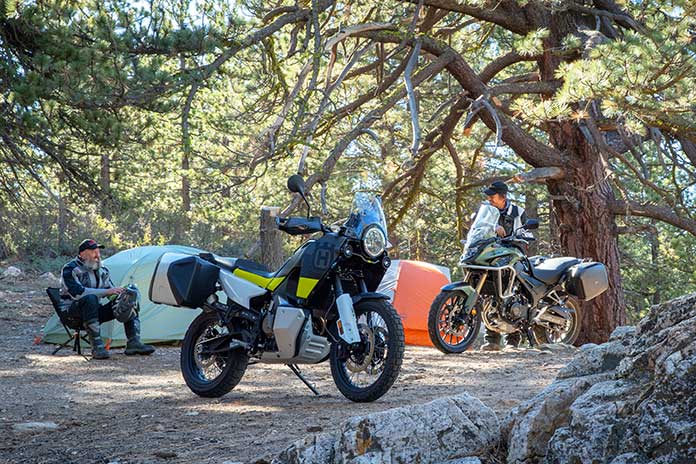
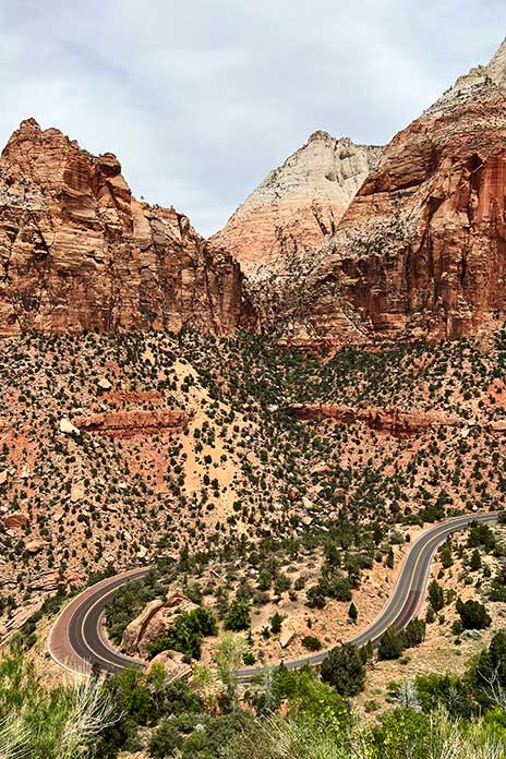
Thus far we had stayed at motels, so we weren’t exactly roughing it. We decided we needed to get some use out of the camping gear we’d been lugging around. After riding through Zion National Park, where we were blown away by the majesty of the cliff faces and rock formations, we traversed the Dixie National Forest through Duck Creek Village to Hatch, where we found suitable dispersed camping.
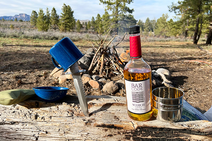
It had been about 20 years since my last camping experience. I narrowly avoided putting an eye out with the tent poles, and after the camp was set and the fire built, it felt good to relax with that $5 bottle of scotch. It was a clear night, and the 7,000-foot elevation yielded cool temperatures. With the fire all but gone, it was time to turn in for the night. I live in Minnesota and am no stranger to the cold, but I clocked 19 degrees overnight in that campsite and don’t think I have ever been so happy to see the sun start to rise. Note to self: Next time bring a sleeping bag rated below 30 degrees.
Once packed up, we put Hatch in the rear view and were soon heading east on Utah’s stunning State Route 12, known as one of the most scenic highways in the nation. We visited Bryce Canyon National Park and its many rock spires and hoodoos and rode through the vastness of Grand Staircase-Escalante National Monument.
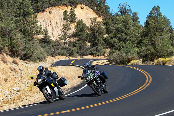
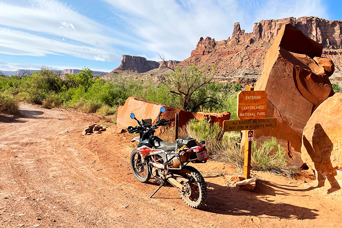
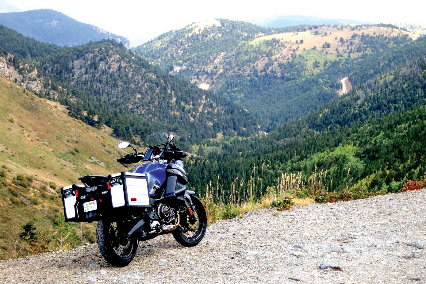
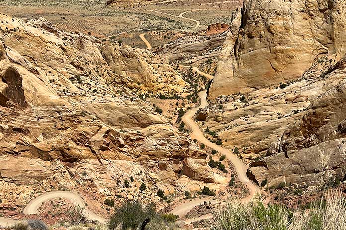
At Boulder, we left the pavement and took the Burr Trail, a well-known backcountry route that passes through Capitol Reef National Park on its way to the Bullfrog Basin in the Glen Canyon National Recreation Area. The trail was named for John Burr, a cattle rancher who developed the route to move his cattle between winter and summer ranges. The country was nearly impassable then and continues to be challenging to this day, with RVs and trailers “not recommended.” Southern Utah is one amazing vista after another, and this stretch featured outstanding scenery as well as many switchbacks on loose gravel that kept us on our toes.
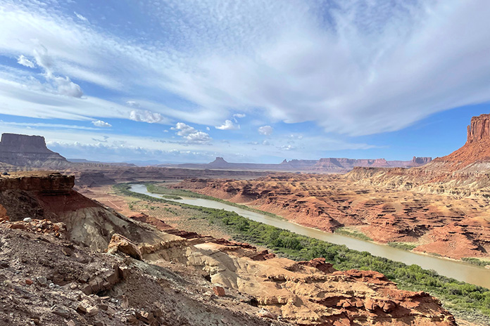
Throughout the trip, we’d been battered by winds that were contributing to fire restrictions in Arizona and Utah. At this point, the wind was howling, with 50-mph gusts giving us a good sand blasting. After a quick stop in Bullfrog, we headed north on State Route 276 and then south on State Route 95 to Hite Crossing over the Colorado River.
We had violated our “never pass gas” top-off policy in Bullfrog, expecting to find a place to refuel in Fry Canyon. Given the time of year and possibly other reasons unknown, the gas pumps were closed in Fry, so we pushed on through some gorgeous country that might’ve been easier to appreciate if we weren’t worried about our dwindling fuel.
At one point, we pulled over to assess the situation. Craig had been smart enough to fill his reserve bottle, which he poured into his tank. My bike was still showing a couple bars of fuel left. I tip my cap to the Yamaha Ténéré 700. Even though my fuel gauge was blinking “empty” and both of us were expecting the pullover of shame, we made it all the way to Blanding. The Arch Canyon Inn was a welcome stop, but being informed that it’s a dry town put the “bland” in Blanding.
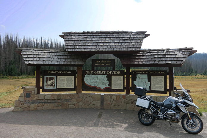
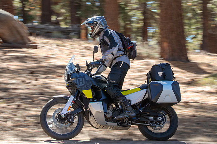
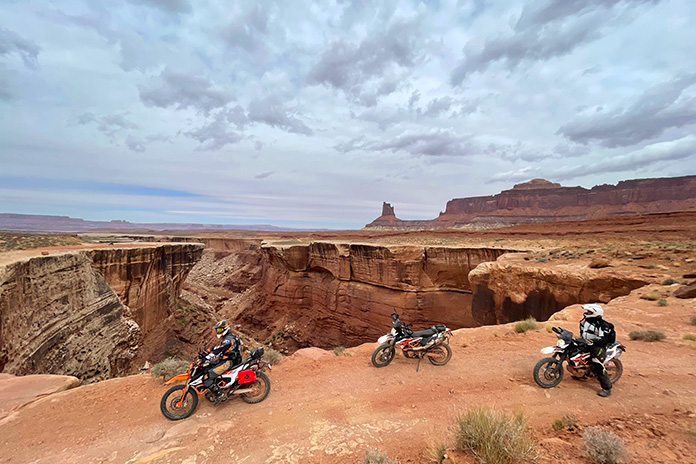
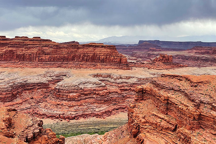
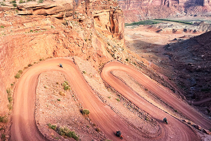
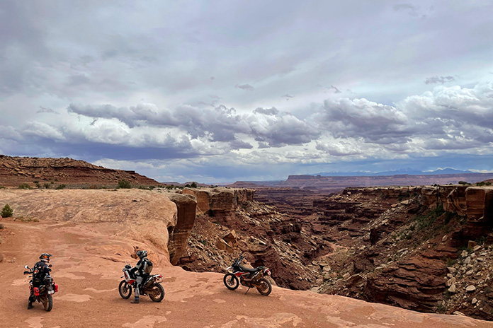
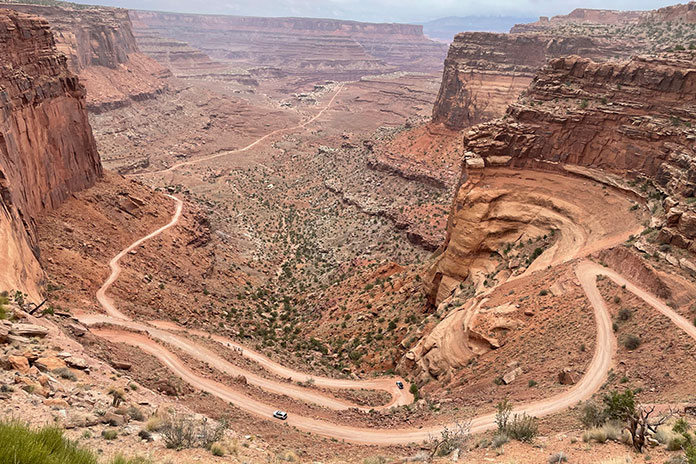
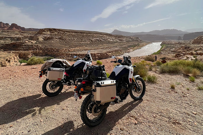
Leaving Blanding and getting on the Utah BDR was like visiting another planet. The Butler and Comb washes, the Moki Dugway, and Valley of the Gods were some of our favorite parts of this trip. With all the distinct rock formations, it was a challenge to stay focused on the trail and not get distracted by the scenery. In most cases, one blown turn can mean disaster, but the rewards are more than worth the risks. Again, caution saved the day.
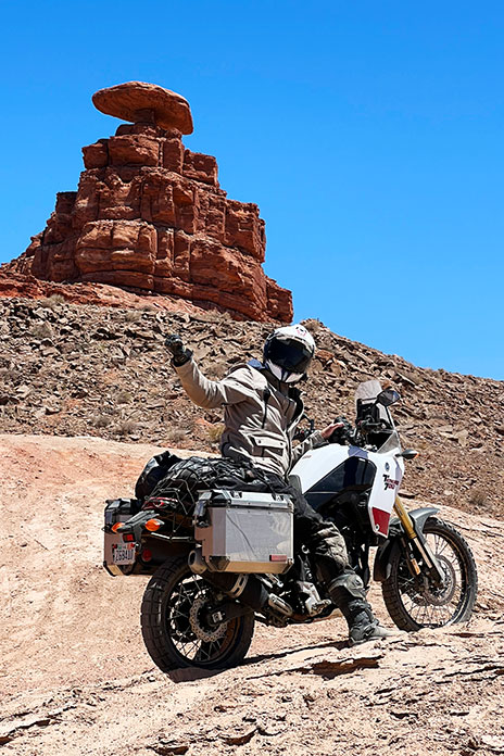
The southern terminus of the Utah BDR is in the town of Mexican Hat, which I assumed was named after a mountain resembling a sombrero. Turns out, it is a distinctive disc-shaped rock about 60 feet in diameter that’s perched atop a smaller base at the top of a mesa. I’ll always remember it as the site of my first involuntary dismount from the Yamaha during a charge up a softer-than-expected mound of sand.
Related: (Mis)Adventures on the Utah Backcountry Discovery Route (BDR)
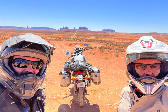
The area around Mexican Hat borders the northern section of the Navajo Nation into Monument Valley. This area is considered the sacred heart of Navajo country, and you can’t help but marvel at how iconic the straight-line stretch of road is as it leads into the horizon, framed with towering sandstone rock formations. Hiking in the park is highly restricted, with only one path that can be hiked without a guide. Monument Valley Trail Park had been previously closed after a movie crew was caught filming without a permit. It is now reopened at a reduced occupancy limit, but no motorcycles are permitted on the 17-mile loop due to deep sand dunes in the area.
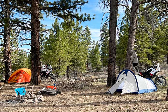
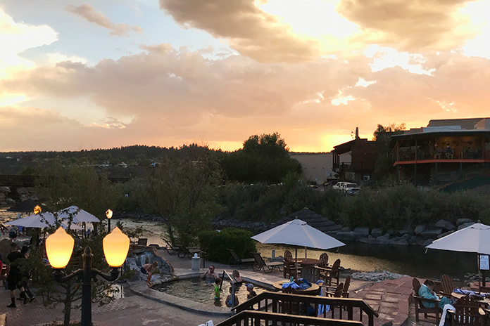
Back in Arizona, we cruised paved highways to Flagstaff and then down into Sedona. Determined to camp at a lower (read: warmer) elevation, we found the Lo Lo Mai Springs Outdoor Resort. Lo lo mai is a Hopi Indian word that represents a greeting with many meanings, similar to the Hawaiian aloha. It also means “beautiful,” which the owners of Lo Lo Mai Springs say is where the resort’s name originated. The area borders spring-fed Oak Creek, which is a valuable and rare natural water source in this part of Arizona. The campground had some welcome amenities and was a lot warmer than the prior camping stop.
We spent our last day exploring some of the Arizona BDR tracks in the Coconino National Forest near Sedona and Flagstaff. With time running out, we finally hopped on State Route 87 and burned the final miles to Scottsdale, where the town was alive with nightlife.
Returning the bikes was bittersweet. Bob welcomed us back, relieved that the Ténérés had only a layer of dust and a bit less rubber on their tires after 1,591 on- and off-road miles. As we grabbed an Uber to the airport, I could not help but realize the vast additional riding world that adventure motorcycling opens up. Soon after getting home, I put one of my streetbikes up for sale, and an adventure bike could be in my future.
The post Backcountry Discovery Routes: Two Buddies on Yamaha Ténéré 700s in Utah and Arizona first appeared on Rider Magazine.
Source: RiderMagazine.com