
White Rim Trail – or White Rim Road in national park parlance – is a 100-mile unpaved route that loops around the Island in the Sky mesa in Canyonlands National Park near Moab, Utah. It’s on the bucket list of many dual-sport and adventure riders, and rightfully so. The scenery is spectacular, and the trail is ridable by anyone with a modicum of off-road experience.
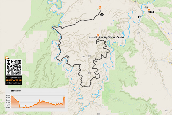
Scan QR code above or click here to view the route on REVER
White Rim Trail, named after the layer of White Rim Sandstone that it runs on top of, was built in the 1950s by the Atomic Energy Commission to access uranium deposits. The mines didn’t produce much ore and were abandoned, and the road became part of Canyonlands after it was established in 1964.
Although White Rim Trail is a rough and rugged route, only street-legal (plated) motorcycles and high-clearance, four-wheel drive vehicles are permitted. Off-road-only dirtbikes, ATVs, and side-by-sides that are common on many trails around Moab are prohibited, which helps keep noise and traffic down. There’s also a daily limit of 50 day-use permits.
Since the trail is within Canyonlands, a national parks pass or entrance fee ($25 per motorcycle, good for seven days) is required. Day-use permits are free at visitor centers, but a $6 fee is required for permits purchased online at Recreation.gov. There are several campgrounds along the trail that require overnight permits for an additional fee. In the spring and fall, reservations are strongly encouraged.
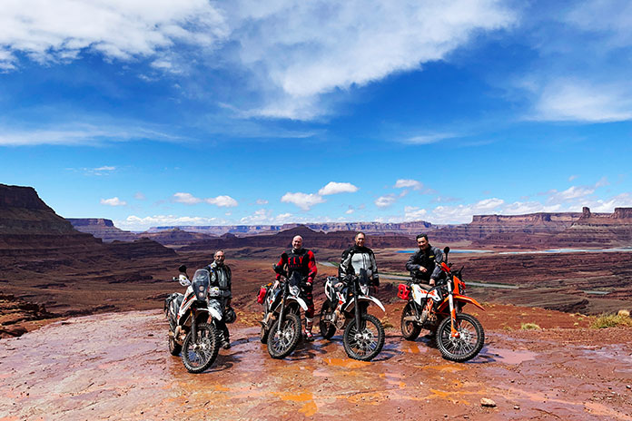
The plan was for four of us – Bruce Gillies, Vic Anderson, Kevin Rose, and me – to ride the entire White Rim Trail in one day. We would be traveling light, with all of us riding KTM 690 Enduro Rs. As enjoyable as camping would be in such a beautiful place, it requires gear that would’ve weighed us down, and whatever was in our saddlebags or panniers would be subjected to paint-shaker conditions for hours on end. Instead, we rented a house in Moab that served as our base for two days of riding.
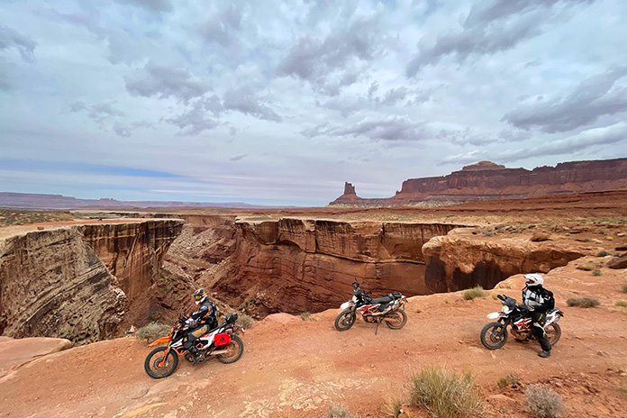
As a warm-up for the White Rim, we spent our first day riding Chicken Corners Trail, a 42-mile out-and-back route on Bureau of Land Management land that passes through Kane Springs Canyon, goes over Hurrah Pass, and runs along a high sandstone bench on the southern edge of the Colorado River. We got hammered by rain early on, but then the clouds parted, and we enjoyed a fun, scenic ride. The trail ends 400 feet above the river across from Dead Horse Point Overlook, the filming location for the final scene in Thelma and Louise when they drive off the cliff.
Having obtained our day-use permits online, the next day we left the house around sunrise and rode north on U.S. Route 191 past Arches National Park and then turned west on State Route 313. There’s no gas in Canyonlands, and the nearest gas station is about 30 miles away in Moab, so completing the loop requires at least 160 miles of range. We were equipped with auxiliary fuel canisters just in case.
White Rim Trail is a two-way road, so it can be ridden in either direction. Our plan was to ride it counterclockwise, saving the famous Shafer Trail for the very end. We turned west on Mineral Canyon Road (BLM 129) before entering Canyonlands and followed the long, flat, well-graded dirt road for about 12 miles.
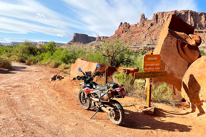
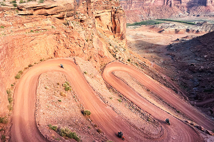
The road into Canyonlands climbs up onto the Island in the Sky mesa, which is where the visitor center and many RV-clogged overlooks are located. Since the White Rim is below the mesa, riding it in either direction requires going down a series of steep switchbacks to get to the trail.
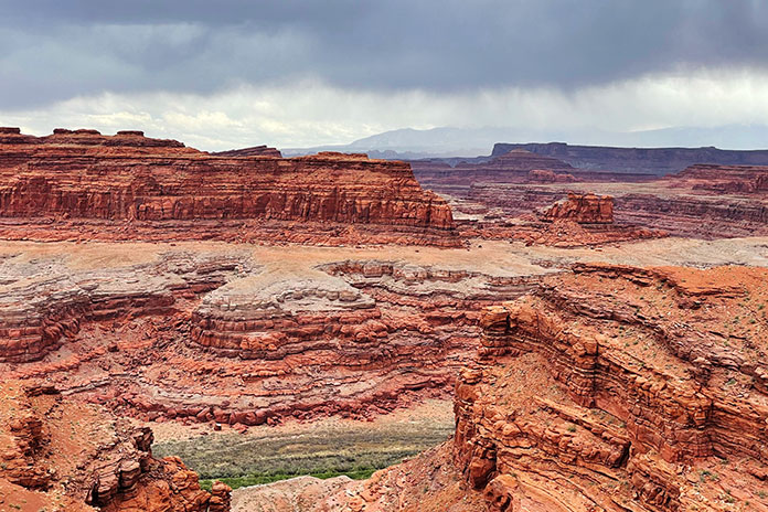
On a crisp morning in late May, we peered down into the red sandstone canyon carved by the Green River and descended to Horsethief Bottom. After passing the Canyonlands National Park boundary sign, we cruised along the flat trail and took in the full spectrum of colorful scenery: green vegetation along the river; layers of red, pink, yellow, white, and gray rock; and blue skies sprayed with tufts of white cirrocumulus clouds. Off in the distance was Canyonlands’ Maze district.
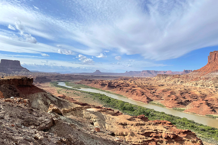
Our first challenge was crossing a sand wash where Upheaval Canyon dumps into the Green River. If the Green is running high, the wash can be flooded and make the trail impassable. We blasted through on the gas and soon found ourselves at one of the two most technical sections on the trail: Hardscrabble Bottom. Since we rode the loop counterclockwise, this section was downhill, and we picked our way along without incident.
Even though it was a Saturday, we rarely saw others on the trail. We waved to a group of Jeepers at a campground, and we passed a few 4x4s and mountain bikers followed by support trucks. Otherwise, it was just the four of us enjoying the sweeping views and a fun trail with minimal dust thanks to the previous day’s rains.

The second technical challenge on White Rim Trail is climbing up and over Murphy’s Hogback. Our KTMs were perfectly suited for the terrain, and we again made it through without any problems. Bigger ADV bikes would be more of a handful here but certainly capable of getting through.
Read all of Rider‘s KTM coverage here.
While some of White Rim Trail is red dirt and sand, miles of it are on bare sandstone, which makes for a bumpy ride. Long-travel suspension, good ground clearance, and a sturdy skid plate are essential.
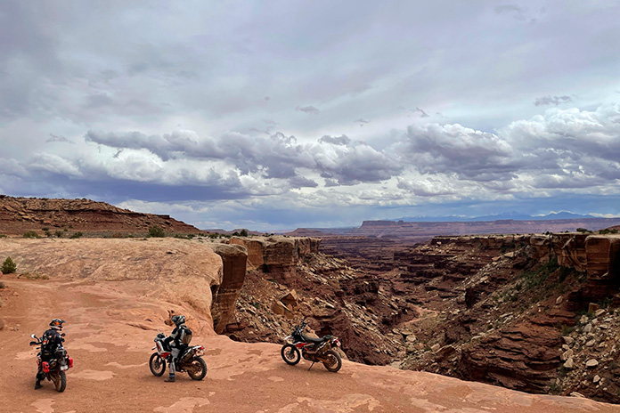
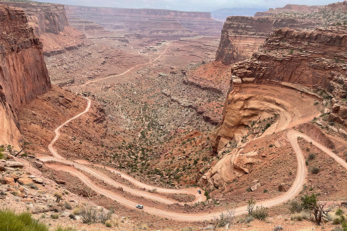
The sky had become progressively cloudier throughout the day, and by midafternoon, dark clouds blotted out the sun. At the junction with Potash Road, a ranger checked our permits before we began the final climb up the Shafer Trail switchbacks. This section of trail is accessible by anyone visiting Canyonlands, so we worked our way to the top around not only Jeeps and mountain bikes but Toyota Camrys full of Instagrammers too.
A few fat raindrops began to fall as we exited the trail. We made a hasty retreat back to the house to hoist celebratory beers and share stories about our adventure.
The post White Rim Trail on KTM 690 Enduros | Favorite Ride first appeared on Rider Magazine.
Source: RiderMagazine.com