As a Kentucky native, I was long overdue for a visit to Bullitt County, home to two famous whiskey distilleries – Jim Beam and Four Roses – and beautiful rolling countryside. Less than two hours from my house, I explored curvy backroads and followed the famous Wine, Whiskey, and Ale Trail, enjoying the history and culture of these beloved beverages along this Bullitt County, Kentucky motorcycle ride.

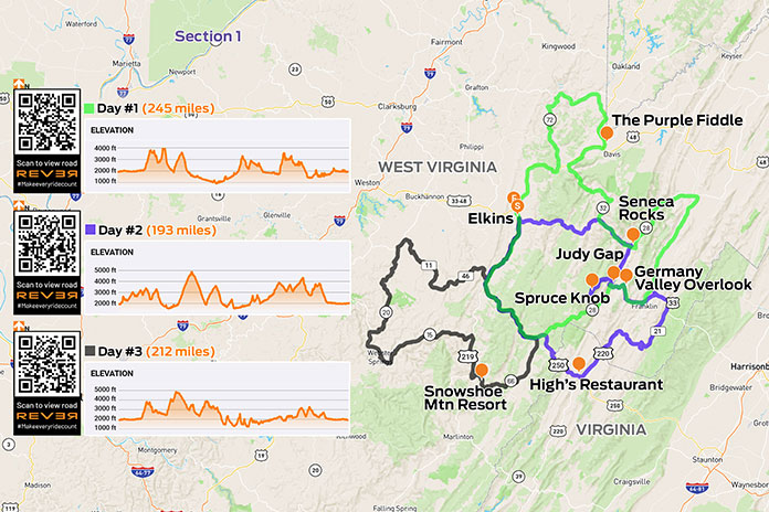
Scan QR codes above or click Day 1 or Day 2 to view routes on REVER
Shepherdsville, located half an hour south of Louisville, is the trailhead of the WWAT, which also includes four wineries and a brewery. The trail allows you to sip, taste, and experience the history of the spirits of Kentucky, especially bourbon.
Bourbon whiskey has been distilled since the 1700s as a distinctive American product, and it is most associated with Kentucky, where it was first distilled. Legends abound about the early production of bourbon, and one can hear about that history and more on the WWAT tours.
Bullitt County recommends two days to fully experience everything the self-guided WWAT has to offer. If I had planned to partake in any of the samplers or tastings, I would have found a designated driver or used one of the available guided tour or transportation services, which are listed on the Shepherdsville travel website, where you can also download a digital passport.
Since my trip by motorcycle didn’t allow me to imbibe, I focused on the highlights and skipped the tastings. On my first day, I enjoyed a scenic ride east, mostly on U.S. Route 62, to the headquarters of Four Roses, one of the world’s most sought-after Kentucky bourbons. Having distilled fine bourbon since 1888, Four Roses has a romantic and fascinating history. With year-round tours, a tasting bar, an outdoor patio, and a gift shop, there is plenty for bourbon lovers to sample. I was particularly impressed by the property’s beautiful architecture and ambiance.

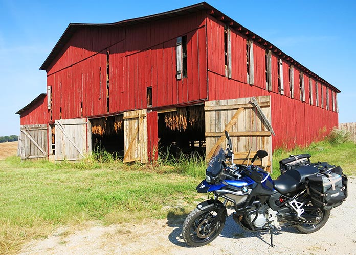
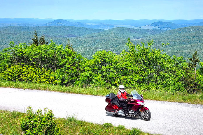
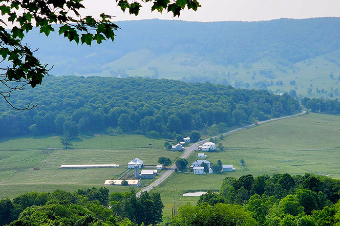
For my return to Shepherdsville, I rode north to Lawrenceburg and then west on State Route 44, the sort of road that makes Kentucky such a wonderful place to ride. SR-44 is a rural two-lane that curves its way through peaceful countryside, including farmland, forest, and residential areas. The homes in Bullitt County are beautiful and well-maintained, providing picturesque scenery.
On SR-44, I enjoyed a few blissful instances where the road wound its way over hills above the surrounding countryside. With a rock face on one side and a drop off on the other, the road swept through a few switchbacks that kept me on my toes. The state route continues all the way to Shepherdsville and a little farther west, ending at the Ohio River.

It was well into the evening when I arrived at my hotel, Spark by Hilton (see sidebar below). A sign nearby marked the entrance to Kart Kountry, said to be the country’s longest go-kart track, and it was open for another hour. I bought tickets for their fastest karts, and I was thrilled by the challenge and skill required to maneuver the kart around the well-maintained 1.5-mile track. With a wide grin on my face, I ran inside and bought more tickets. What a fun and exhilarating way to end my day.
On the next day of this Kentucky motorcycle ride, I rode to the Bernheim Forest and Arboretum, where I noticed a large wooden figure across the lake. Intrigued, I entered the visitor center, and a kind woman explained how to get to the sculpture, which is one of three known as the Forest Giants. After enjoying a cold brew coffee and sweet pastry at the visitor center’s cafe, I set out to view the Giants.

A two-mile round-trip loop connects these larger-than-life wooden sculptures, and parking is available at each Forest Giant for accessibility. I opted to hike the loop to see all three, and while I came back tired and hot from trekking in boots and motorcycle pants, the trail is a flat and easy hike for people of all ages and abilities.
A nationally renowned recycling artist, Thomas Dambo, created the sculptures, which were inspired by the nature and landscape of the area. They are unique and impressive works of art that complement the other points of interest in the park. After seeing the Forest Giants, I cruised around the rest of the arboretum on Bernheim Forest Road, a lovely tree-lined loop, enjoying the cool, fresh air of the shaded forest.

Continuing on the WWAT, I rode to the nearby James B. Beam distillery, where America’s No. 1 bourbon has been produced since 1795. Not only is there a wealth of history, but there are also generations of experience perfecting the bourbon-making process – both of which you can learn about in the American Outpost building and the tours and tastings offered there.
See all of Rider‘s South U.S. touring stories here.
Famished, I found a seat at the large, well-lit bar in the on-site restaurant, The Kitchen Table. I ordered a starter with two cheese spreads and slices of a unique and tasty seasoned-and-fried bread. Above me was a sign proclaiming “Any damn way you please.” The bartender explained that one of the Beam distillers famously answers people with that statement when they ask about the proper way to drink Jim Beam. I love the freedom and self-expression that it implies. And I will certainly put this restaurant on my list of favorites for my next trip to Bullitt County.

My next stop on the WWAT was the Wight-Meyer Vineyards and Winery. I followed country roads and a well-maintained gravel lane to the owner-operated winery. Located on 16 acres, Wight-Meyer was the first commercial vineyard in Bullitt County and produces its wines from Kentucky grapes.

I was greeted by a friendly owner, Sandy Wight, and her even friendlier dog, Charlie. She suggested a tasting from their selection of 25-plus wines, many of which are award-winning, but I had to take a raincheck since I was on a motorcycle. She graciously showed me around the cozy tasting room, covered patio, and serene vineyard. It was a beautiful day, and the puffy white clouds across the blue sky framed the rows of tendrilled grape vines that stretched off into the distance. I enjoyed the peace and tranquility before setting out.

Everyone in Kentucky loves steakhouses, so for dinner I chose a new one for me – Cattleman’s Roadhouse in Shepherdsville. It’s a family-style restaurant boasting a plentiful salad bar that was substantial enough for a meal, especially when combined with the complimentary melt-in-your-mouth rolls slathered with cinnamon butter.
Before heading home, I visited the Awesome Flea Market in Shepherdsville. A short ride from the hotel, this enormous building contains indoor and outdoor sellers. When I stepped out back, I was greeted by an impressively large painted sign – the kind that makes you feel small – proclaiming The Most Awesome Flea Market in the World. Inside, I found a climate-controlled market with a food court and countless shops with varied, eclectic wares and friendly customer service.

This short, local Kentucky motorcycle ride was a satisfying scratch to the itch one experiences when two-wheeled travel is a passion. Even though I was relatively close to home, I still rode new routes, met new people, and saw new sights – the makings of a successful motorcycle trip, indeed.
See all of Rider‘s touring stories here.
Bullitt County, Kentucky Motorcycle Ride Resources
SIDEBAR: Spark by Hilton Shepherdsville Louisville South

The Spark by Hilton is only a half mile off I-65 at exit 117. It’s a short ride from a variety of restaurants, and some are within walking distance. It’s also near Kart Kountry, the world’s longest go-kart track. The clean, recently renovated hotel includes a variety of amenities that are great for a motorcycle trip, such as free wi-fi, an in-room mini-fridge, free hot breakfast, and an indoor pool. For more information, visit the Spark by Hilton website.

Carly Becker lives to ride. If she’s not on her bike, she can be found at her desk, writing about her motorcycle tours and moto camping trips. She lives in northern Kentucky with her husband, her dog, and her Kawasaki Versys-X 300.
The post Bullitt County, Kentucky Motorcycle Ride: Rolling Through Nature and History appeared first on Rider Magazine.
Source: RiderMagazine.com