In 2021, Steven Goode completed the Great American Deli Schlep, a 75‑day, 15,000‑mile motorcycle ride during which he visited the best Jewish deli in nearly every state and raised funds for MAZON, a Jewish nonprofit that fights hunger in America. You can read Goode’s feature about that ride here. –Ed.
I haven’t been everywhere, but it’s on my list.” This is a quote by Susan Sontag and words I ride by.

After completing four major motorcycle trips around our wonderful country, each ranging from 11,000 to 17,000 miles, I told my wife I was done with long‑distance rides. Sort of the same way I’ve told her, many times over, that this was going to be my last motorcycle purchase. Of course, she didn’t believe me.

So when a riding buddy said we should plan a big trip, I was all in. All I needed was a cause and a theme for the ride.
For a cause, I chose the Parkinson’s Foundation. In 2001, my mother passed away from Parkinson’s disease. A motorcycle trip supporting this cause would be a great way to not only honor her memory but raise money to support finding a cure and providing resources for those afflicted with this terrible disease.
Although my mother most likely would not have approved of my 60‑day, 16,000‑mile motorcycle trip – she was still a mother after all – she would have been extremely proud of my commitment to this cause. She had a wild side, but she didn’t show it often for fear of encouraging her sons to follow in her path, which we did anyway.

For a theme, we decided to ride the top scenic byways in nearly every state. To help us plan the trip, National Geographic’s Guide to Scenic Highways and Byways (fifth edition) was an invaluable resource that provided descriptions, photos, maps, and interesting facts.
When I told the Parkinson’s Foundation about my plan, they were immediately supportive and offered to help create public awareness for the trip. An important part of the publicity was social media. I’m in my late 60s, and I didn’t do Facebook, Instagram, TikTok, etc., so their team handled that for me. They also created logos and designed T‑shirts, banners, and a web page for my blog. Klim supported the ride by providing me with a Latitude Gore‑Tex suit, and Nelson‑Rigg provided some waterproof luggage.

Scan the QR code or click here to make a donation to the Parkinson’s Foundation.
We named the ride The Great American Scenic Byways Tour supporting Parkinson’s Foundation. After reviewing the route and the time necessary to complete the ride, my friend said the trip would require too much time away from work, so he bowed out. Since I had already committed to the Foundation and this was a personal ride on behalf of my mother, I decided to go alone.

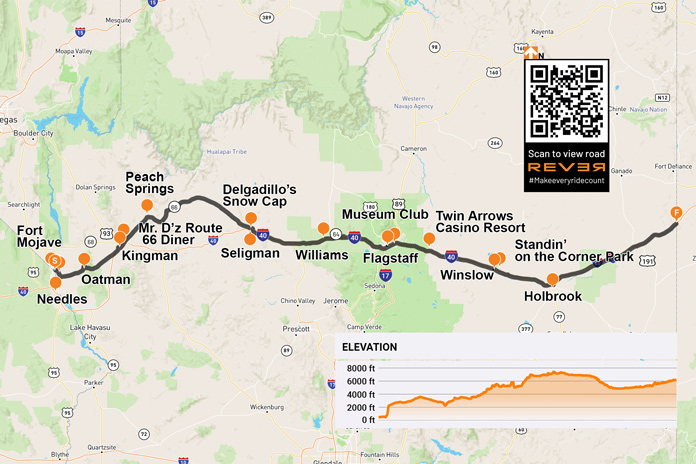
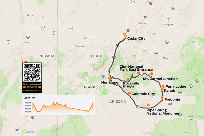
For those of you who are curious how someone plans a 16,000‑mile trip, here are a few guidelines. First, get a map of the United States and put markers next to the places you plan to travel to. Second, using the rough route map, create a spreadsheet with columns for the city in which you begin your day’s ride; the destination city for that day; miles you plan to ride each day; and notes about the route, landmarks, and things to see. Good planning is key for a successful ride, and being organized reduces stress.

A key element to any trip of this magnitude is planning for unforeseen events. My mantra is “It’s all about Plan B.” On a two‑month trip, there will be at least one unexpected twist pop up. Mine came three days in when my dermatologist called to tell me I had a melanoma on my back and he wanted to surgically remove it as soon as possible. Plan B: I turned the bike around, made a beeline to Chicago, had the surgery, and was back on the road 17 days later.

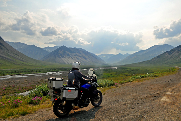
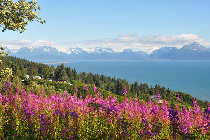
The beauty of this ride’s theme was that each scenic byway has its own personality. Like a thumbprint, every byway is unique. Almost everyone I met during the trip asked me, “What is the best scenic byway?” Just like when asked what the best motorcycle is, I answered, “The one I’m riding.” There are good reasons why National Geographic picked each of these byways to include in its guide. Each one gives the rider a special glimpse into the beauty of the region.

For example, the Red River Gorge Scenic Byway in Kentucky took me into forested backcountry, and I was able to get lost in my thoughts in the deep woods. One of the interesting features of this scenic byway is the Nada Tunnel, which is 900 feet long but only 12 feet wide and 13 feet high. There’s a single lane through the mountain, with no lights or painted lines. While pondering how to go through it, I asked some local Harley riders for advice. They said, “Look for a headlight at the end of the tunnel. If you see one, don’t go.” I felt like I was in a Road Runner cartoon.

In Newport, Rhode Island, the scenic 10‑mile Ocean Drive provided a glimpse of how the other half lived during the Gilded Age in the late 1800s. The Vanderbilt, Astors, and Morgans all had their summer homes along this rocky coast.

Spanning two states, the Talimena National Scenic Byway follows Arkansas Highway 88 and Oklahoma State Highway 1. On the morning I planned to ride it, the forecast said it would be 105 degrees in Dallas, Texas, my next destination. I left at 5 a.m. to arrive in Dallas in time to beat the heat. This early start gave me an opportunity to watch the sunrise over the byway.

After five days on the road, I could no longer remember where I was the day before, what I had for dinner the night before, or which hotel I stayed in. That’s one of the great things about a two‑month motorcycle trip – getting lost in the journey. Writing a blog forced me to recreate the trip daily so it didn’t become one huge blur, and it also allowed friends, family, and supporters to follow my progress.

Another benefit of a trip of this scale is all the things I learned along the way. Like a school on wheels, I learned about our United States up close and personal, gaining a new appreciation for each region’s distinct personality and history. After the trip, I had a better understanding of our collective history. Whether it was exploring what life was like on plantations, following the Trail of Tears, or riding the path of Lewis and Clark, I was able to take a long look at our country and how we grew up as a nation, both the good and the bad.

Every long motorcycle trip has unexpected moments, and one left me speechless and cleaning the mess off my bike for days. Leaving Elko, Nevada, to ride to Idaho, I took State Route 225, a two‑lane road with virtually no traffic. As I was riding north, I noticed something that looked like pinecones on the pavement up ahead. Once I got closer, the “pinecones” began to scurry. As I continued to ride north, they completely covered the road. Then I noticed that the road’s tire tracks were turning red, not asphalt gray. It was an infestation of Mormon crickets, which are about 2 inches long and don’t fly, and I was riding through an invasion of Biblical proportions that went on for 50‑plus miles!

My original plan was to ride through California’s Death Valley National Park. Just before I left, I received a call from my son. “Dad, did you hear that a 65‑year‑old guy just died in Death Valley? He had two flat tires on his car, and nobody came to his rescue. Are you sure you want to go into Death Valley by yourself, on your motorcycle, with temperatures reaching 115 degrees?” Plan B: Due to the intense heat and time constraints after my unexpected surgery, I opted to bypass California, Oregon, and Washington.

My favorite scenic byway changed from day to day. When I was on the East Coast, I loved the Rangeley Lakes National Scenic Byway in Maine. Riding the 17.6‑mile Chesapeake Bay Bridge‑Tunnel (U.S. Route 13) in Virginia, which includes a tunnel under the water, from Norfolk to Fisherman Island National Wildlife Refuge, was spectacular.

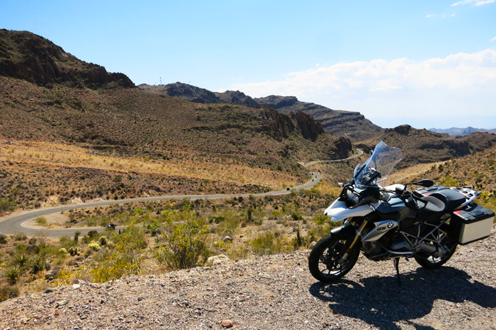
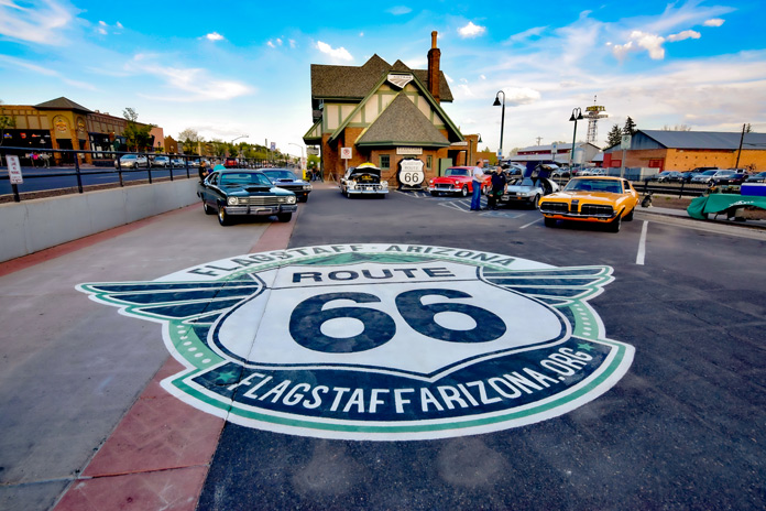
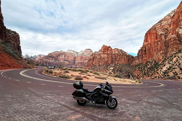
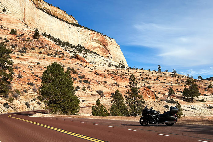
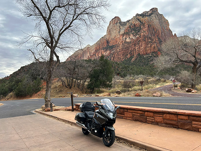
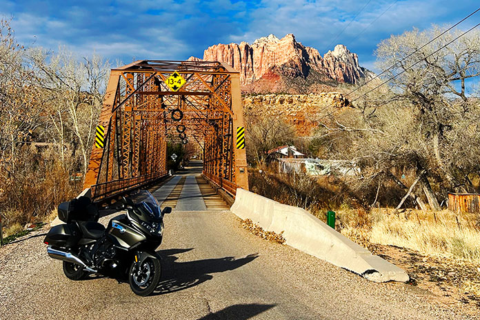
Out West, it was U.S. Route 191 (Coronado Trail) in Arizona and State Route 12 in Utah. Beartooth Highway in Wyoming and Montana is a must‑ride. It is hard to choose only one scenic byway because each is special, and every one of them gave me new perspectives on the areas I was traveling through.

People also asked, “How do you pack for such a big trip?” My only advice is to take less than you think you need but all that’s necessary for unforeseen conditions (rain, cold, heat, etc.). You must think through all the variables and prepare a Plan B. If traveling solo, use a satellite tracking device so family and friends know how to find you.

Long motorcycle trips are not for everyone, but I love not knowing what is on the other side of the hill and feeling the thrill and power of the bike beneath me, experiences that keep me going day after day. I highly recommend checking out National Geographic’s Guide to Scenic Highways and Byways, picking a region, and planning your own adventure. I guarantee you won’t be disappointed. Take the time to enjoy the sights, sensations, and sinuous curves on America’s rich bounty of scenic byways.

During his Great American Scenic Byways tour, Steven Goode raised nearly $22,000 for the Parkinson’s Foundation. To make a donation, use the QR code above or click here. To read Goode’s blog, visit this page on Facebook. Below you’ll find a complete list of the scenic byways Goode rode on this tour.
See all of Rider‘s touring stories here.
Great American Scenic Byways Tour
- Alabama – Talladega Scenic Drive
- Arkansas – Arkansas Route 7 Scenic Byway
- Arizona – Coronado Trail
- Colorado – Pikes Peak Highway
- Connecticut – Lower Connecticut River Valley (State Route 9)
- Delaware – Delaware Bayshore Byway
- Florida – Panhandle Scenic Drive (State Route 399, U.S. Route 98)
- Georgia – Sea Island
- Idaho – Ponderosa Pine Scenic Byway
- Indiana – Ohio River Scenic Byway
- Kansas – Wetlands and Wildlife Scenic Byway
- Kentucky – Red River Gorge Scenic Byway
- Louisiana – Great River Road
- Maine – Rangeley Lakes Scenic Byway
- Maryland – Harriet Tubman Byway
- Massachusetts – Old King’s Highway (Cape Cod)
- Michigan – Copper Country Trail
- Minnesota – Great River Road
- Mississippi – Gulf Coast Scenic Byway/Hospitality Highway
- Missouri – Missouri Ozarks (State Route 19)
- Montana – Beartooth Highway
- Nevada – Lamoille Canyon Scenic Byway
- New Hampshire – Kancamagus Scenic Byway
- New Jersey – Delaware River Scenic Byway
- North Carolina – Outer Banks Scenic Byway & Blue Ridge Parkway
- New Mexico – High Road to Taos Scenic Byway
- New York – Catskill Mountains Scenic Byway
- North Dakota – Standing Rock Native American Scenic Byway
- Ohio – Ohio River Scenic Byway
- Oklahoma – Talimena National Scenic Byway
- Pennsylvania – PA Route 6
- Rhode Island – Ocean Drive
- South Carolina – Edisto Island National Scenic Byway
- South Dakota – Native American Scenic Byway
- Tennessee – Cherohala Skyway
- Texas – Canyon Sweep (State Route 207)
- Utah – Scenic Byway 12
- Vermont – Vermont Route 100
- Virginia – Back of the Dragon & Blue Ridge Parkway
- West Virginia – Midland Trail
- Wisconsin – Great River Road
- Wyoming – Beartooth Highway
The post Great American Scenic Byways Tour appeared first on Rider Magazine.
Source: RiderMagazine.com