Tag Archives: North Central U.S.

Great Lakes Getaway: Touring Minnesota, Wisconsin and Michigan

Great Lakes Getaway
The number of double-track dirt roads in the Great Lakes area is countless, tempting travelers off the snaky paved highways with their promise of adventure. (Photos by the author)

I arrive in Duluth, Minnesota, in the middle of the night, welcomed by a cleansing wind blowing off Lake Superior, the largest of the Great Lakes. The West had been ablaze for weeks when I’d departed California two days before, and smoke from those massive fires had gathered, unasked, across the Plains to form a thick, murky blanket. My eyes and throat are still burning as I hobble, ass whipped, from my BMW R 1200 GS to my waiting hotel room.

Great Lakes Getaway

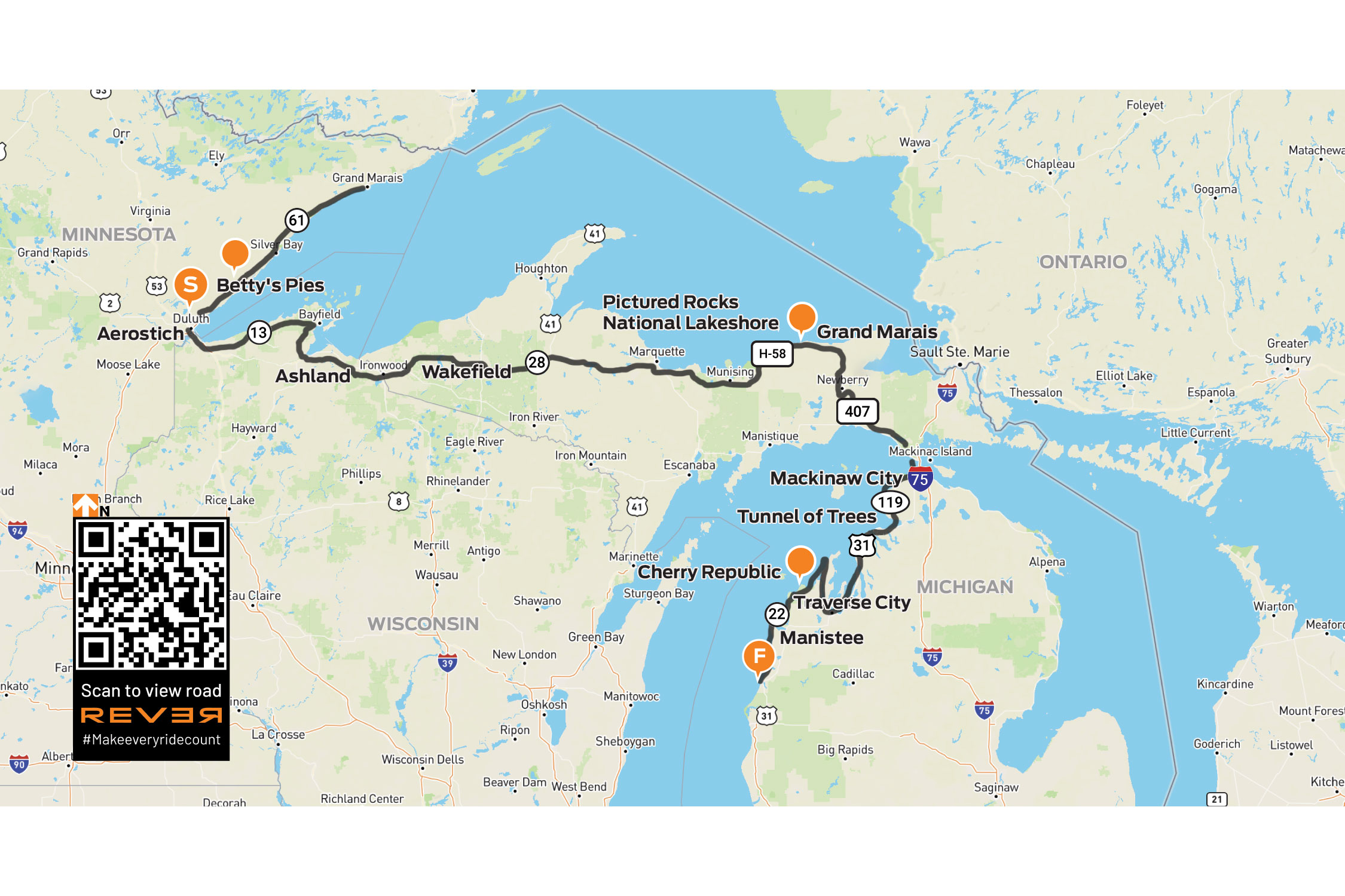
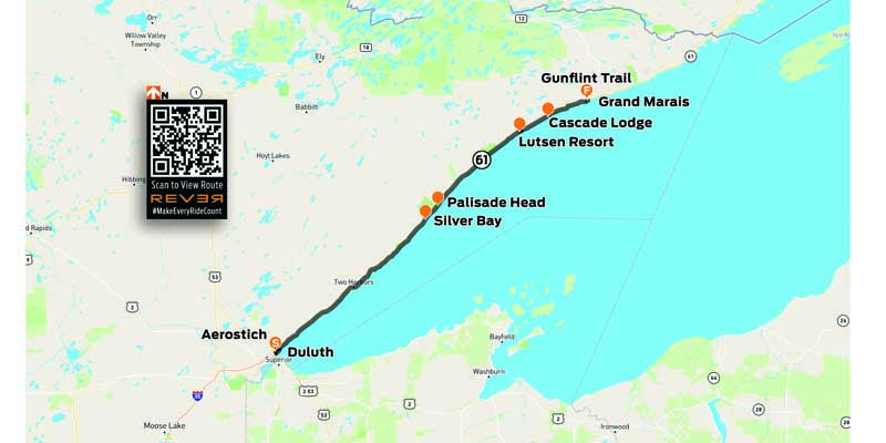
Scan QR code to view route on REVER, or click here

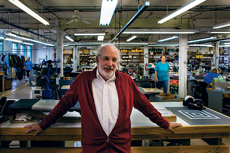
I’ve just started on a 6-week ride and my first official stop is a visit to the Aerostich factory to catch up with my old friend, Andy Goldfine. Andy and I go back to the mid-80s when we were starting in the motorcycle industry, him as the founder of Aerostich and me as an associate editor at Rider. I zipped up my first Roadcrafter the day we met and have since appreciated no gear – or friendship in the business – more.

Listen to our interview with Andy Goldfine on the Rider Magazine Insider Podcast

Great Lakes Getaway
A meet-up with Aerostich founder Andy Goldfine and his riding buddy, John Grinsel.

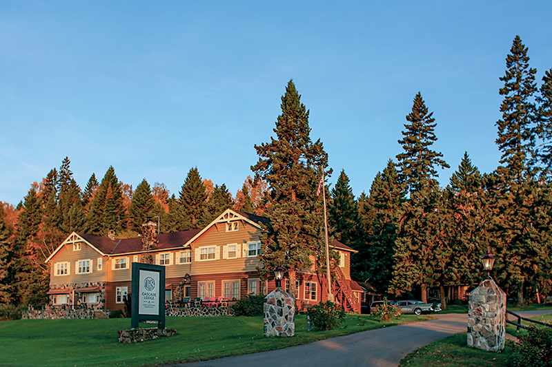
Duluth has always charmed me with its terraced streets and historic port town vibe. Spending a day off the bike here is a joy. I’m able to hang out at Aerostich and watch as suits are cut and stitched. Some would call this a factory, but it’s much more like a workshop where skilled technicians craft riding apparel.

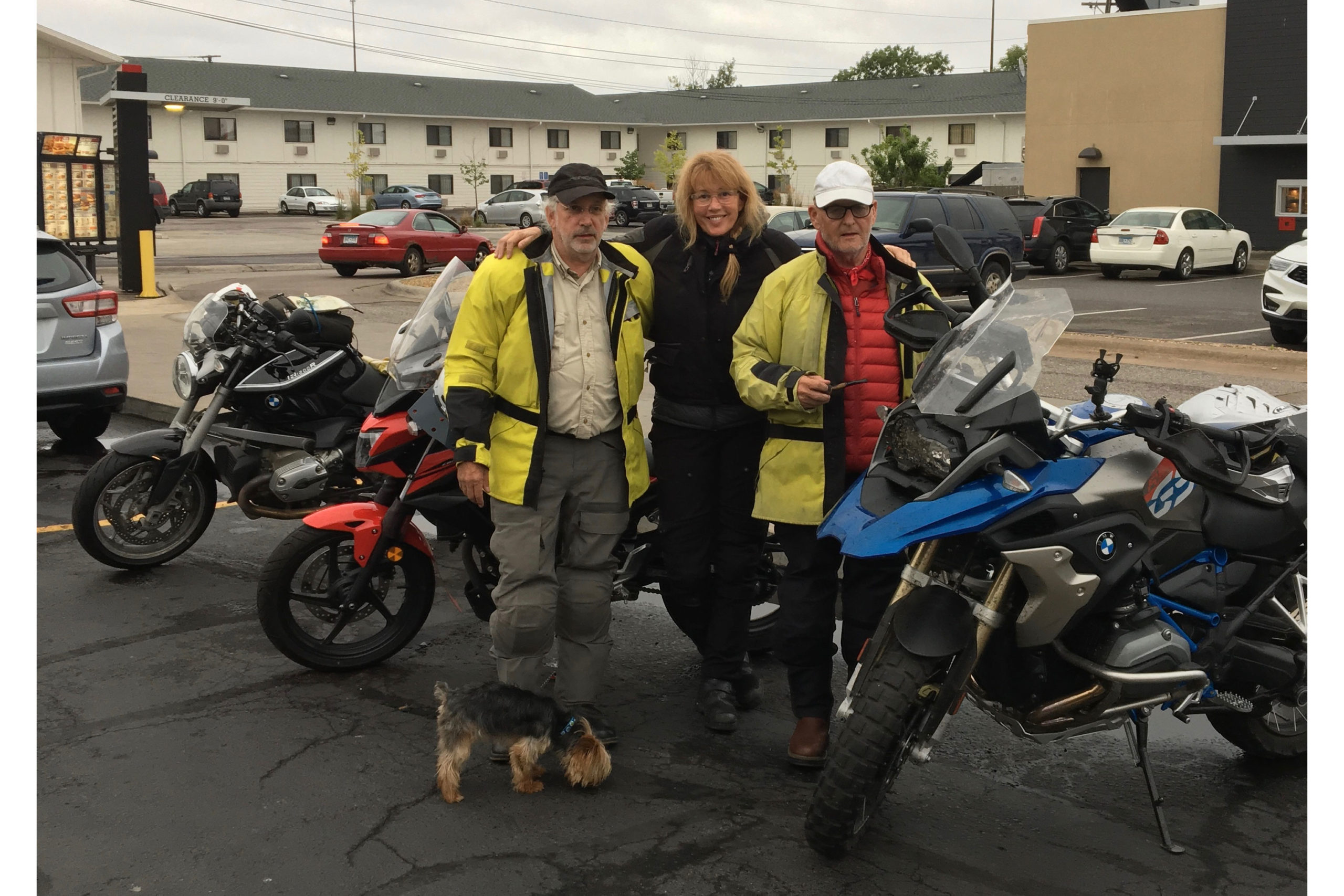
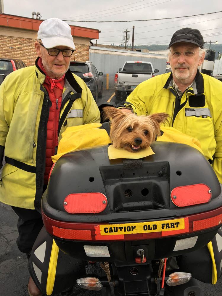
After enjoying a classic biker breakfast the next morning at the Duluth Grill with Andy and his “most curmudgeonly riding friend” John Grinsel, an 80-something-year-old character who rides up to 20,000 miles each year with a pipe in his mouth and a tiny pup named Moose poking out of his top box, I’m back in the saddle of the GS heading north around the edge of the world’s largest freshwater lake.

Great Lakes Getaway
We’ve all seen the occasional pup as co-pilot, but none as adorable as John Grinsel’s 3-lb dog, Moose, who pops his head out of a modified Givi top case when he wants to check out the view.

The Greatest Lake

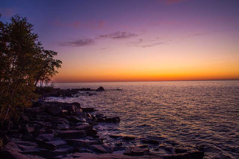
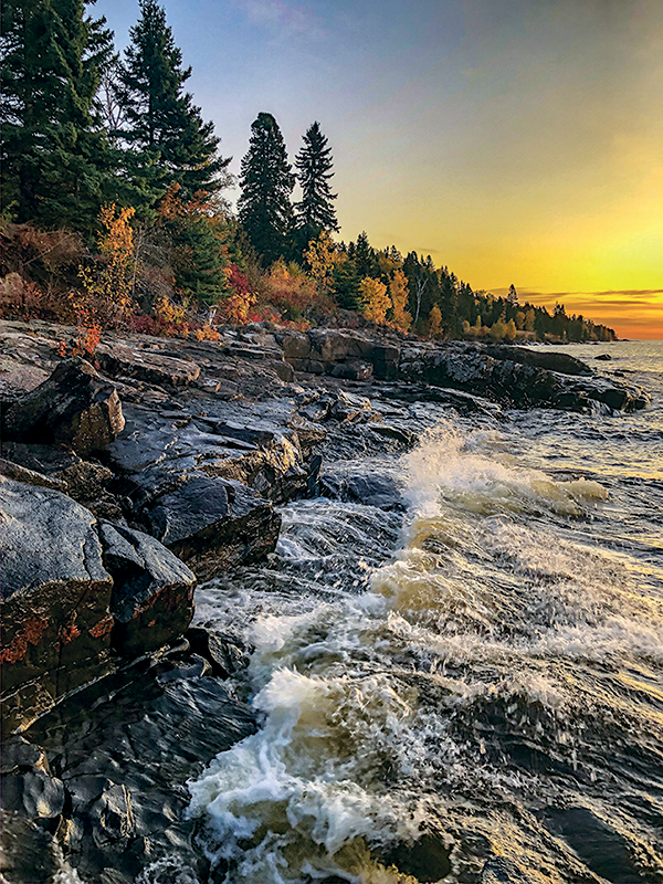
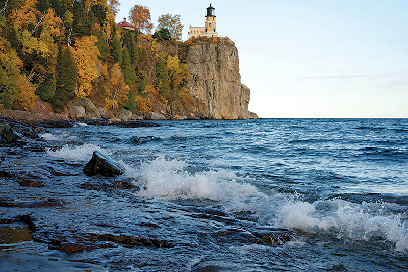
Behaving more like an inland sea than a lake, Superior is massive, holding 10% of the world’s fresh surface water. It and the other Great Lakes to the east are so dynamic they create their own weather patterns. Today, I’m riding through a Scotch mist I’m not sure I can blame on the lake, and it’s giving my finger squeegee a workout.

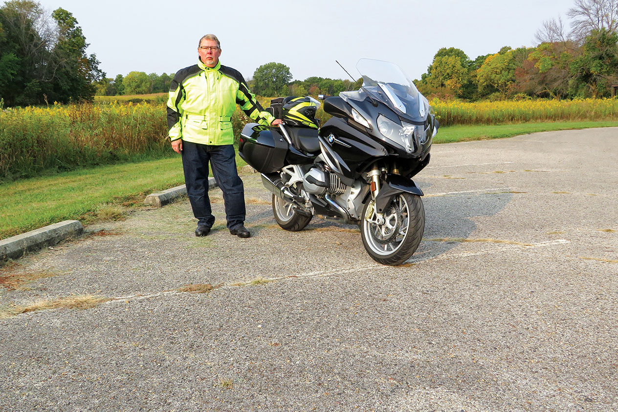
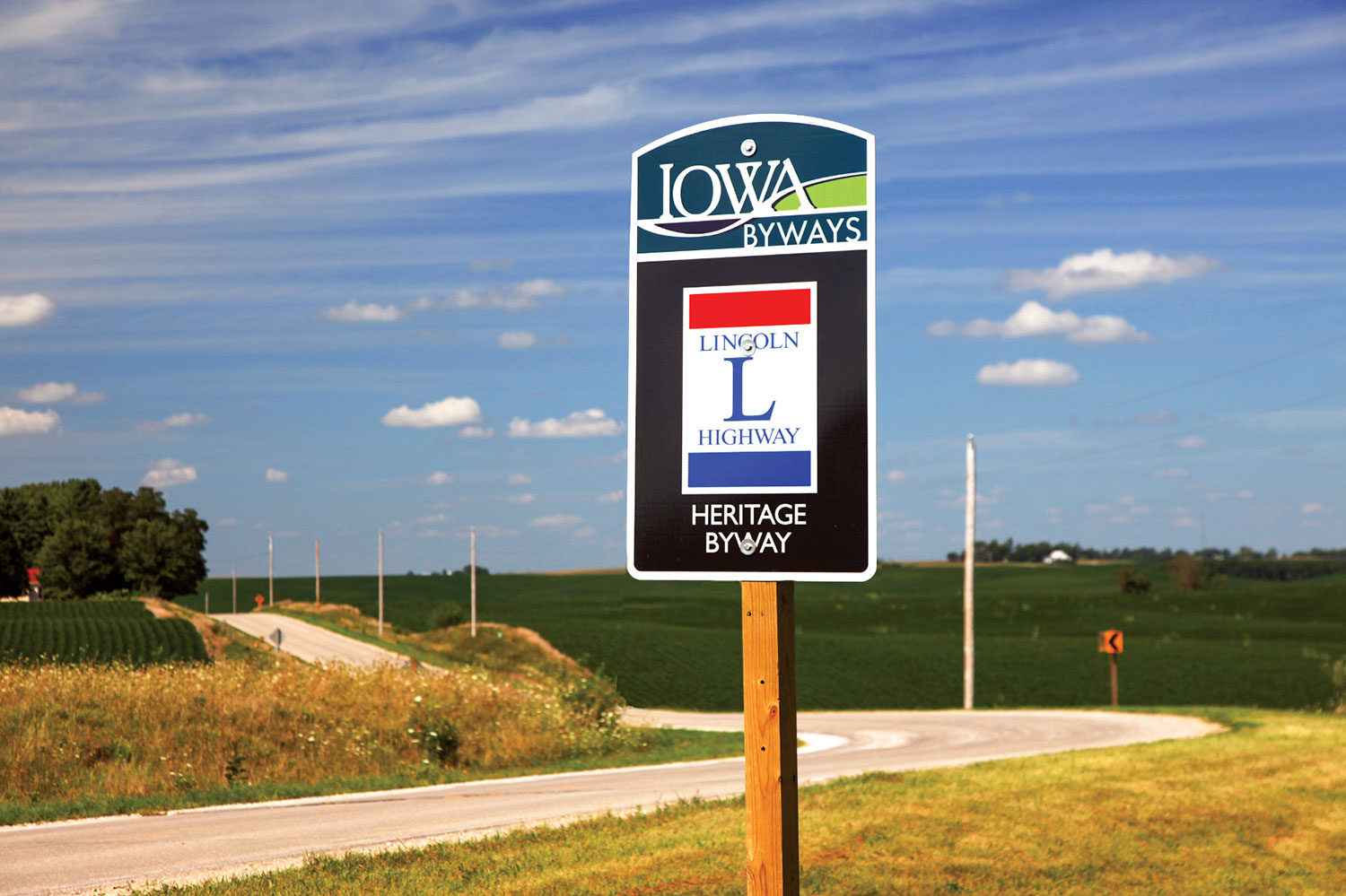
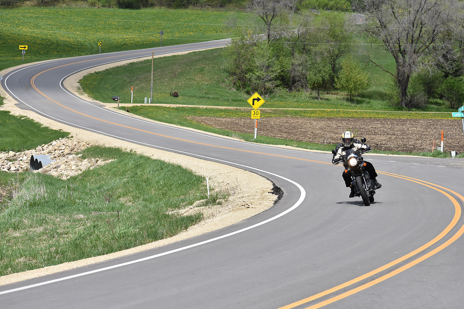
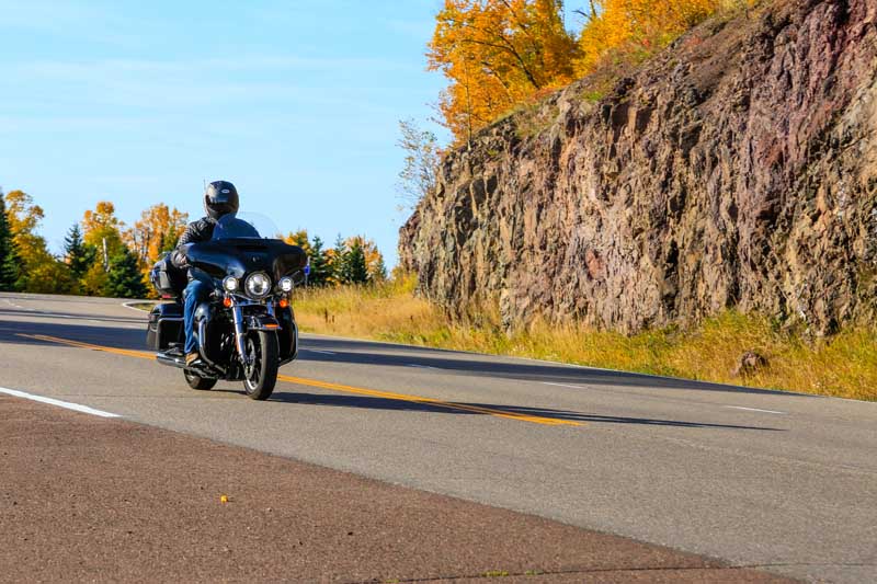
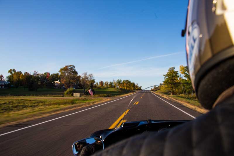
I’m riding a loaner R 1200 GS Rallye edition I’ve had for seven months. I’ll never get enough of the GS bikes, and over three decades I’ve used them to explore five continents. Having been one of BMW’s flagship models for four decades, the “big” GS was legitimately the first travel bike to be truly versatile, but what I find most endearing is the way the chatty boxer Twin feels like an old friend every time I fire one up. It’s a pleasant bike to ride anywhere, including roads like Minnesota’s super scenic State Route 61 along the North Shore.

Great Lakes Getaway
If there’s one thing that’s undeniable about these Midwestern states, especially their more rural areas, it’s how genuinely nice the people are. Everywhere you go.

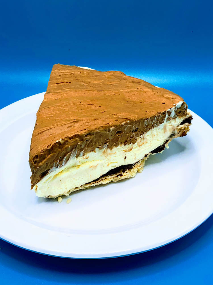
By the time I reach Grand Marais, it’s clearly storming hard to the north, and I retreat back down the highway, ducking into the famous Betty’s Pies for a slice and a coffee. I love this place, and if I weren’t on a bike, in the rain, I’d take an entire 5 Layer Chocolate Cream Pie to go.

Great Lakes Getaway
I ate my slice of 5 Layer Chocolate Cream Pie so fast Betty’s Pies had to send me a photo.

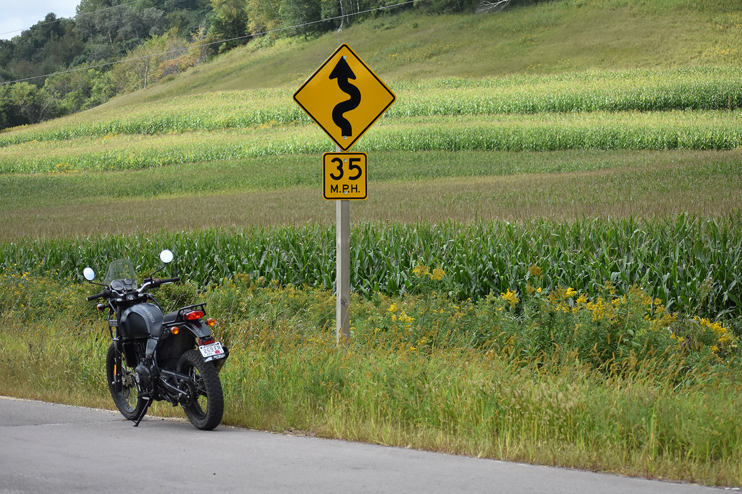
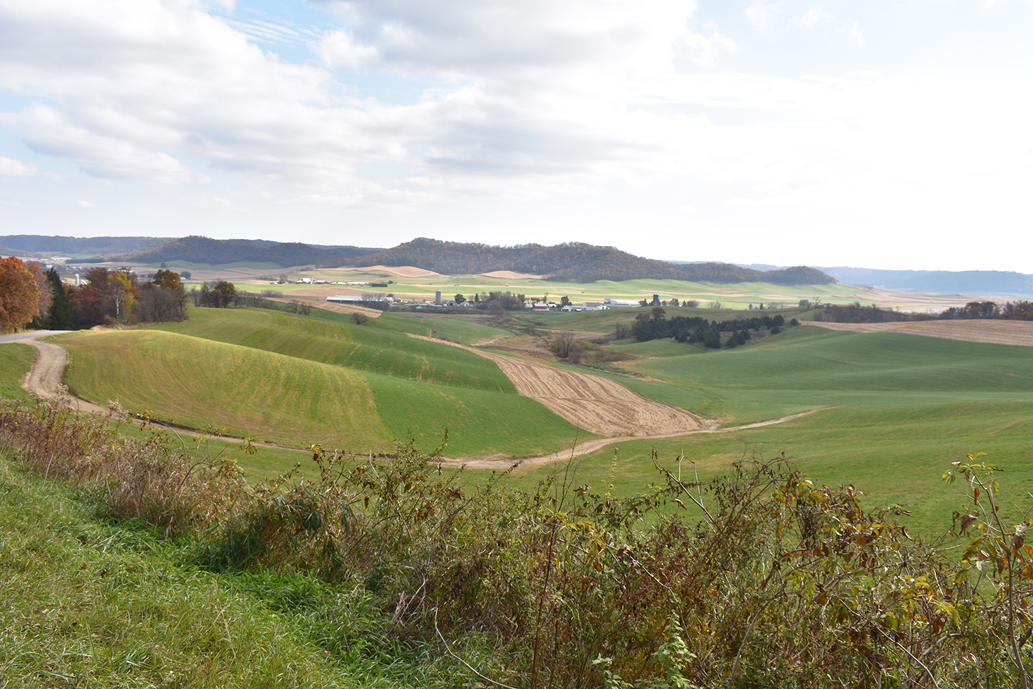
Early the next morning, the sun is out and I’m in Wisconsin exploring the bottom edge of Superior. While I’d traveled to the top of the lake a few years back, the southern section was a mystery. I throttle the GS up Wisconsin’s Lake Superior Scenic Byway, State Route 13, connecting fishing villages to waterfalls to sandy beaches and orchards.

Great Lakes Getaway
Exploring Northern Michigan on the venerable R 1200 GS was a delight. The people, the scenery, the roads, but also the intriguing history of spots like the town of Ironwood and the famous Leg’s Inn, which waits at the top of M-119, aka the Tunnel of Trees.

The Road to Pictured Rocks

I want to shoot up Michigan’s Keweenaw Peninsula to Copper Harbor on U.S. Route 41, and not just because the road looks amazing on the map. I’ve heard there are monks who bake delicious treats and sell preserves they make from local fruit at The Jampot bakery. But I’m short on time and even shorter on tires. The Continental TKC80s I opted for seven months back now have more than 6,500 miles on them and my replacements are waiting at a dealership 700 miles away, which means limiting side trips.

Great Lakes Getaway
The pristine beaches near Michigan’s Pictured Rocks National Lakeshore were empty and an ideal rest stop.

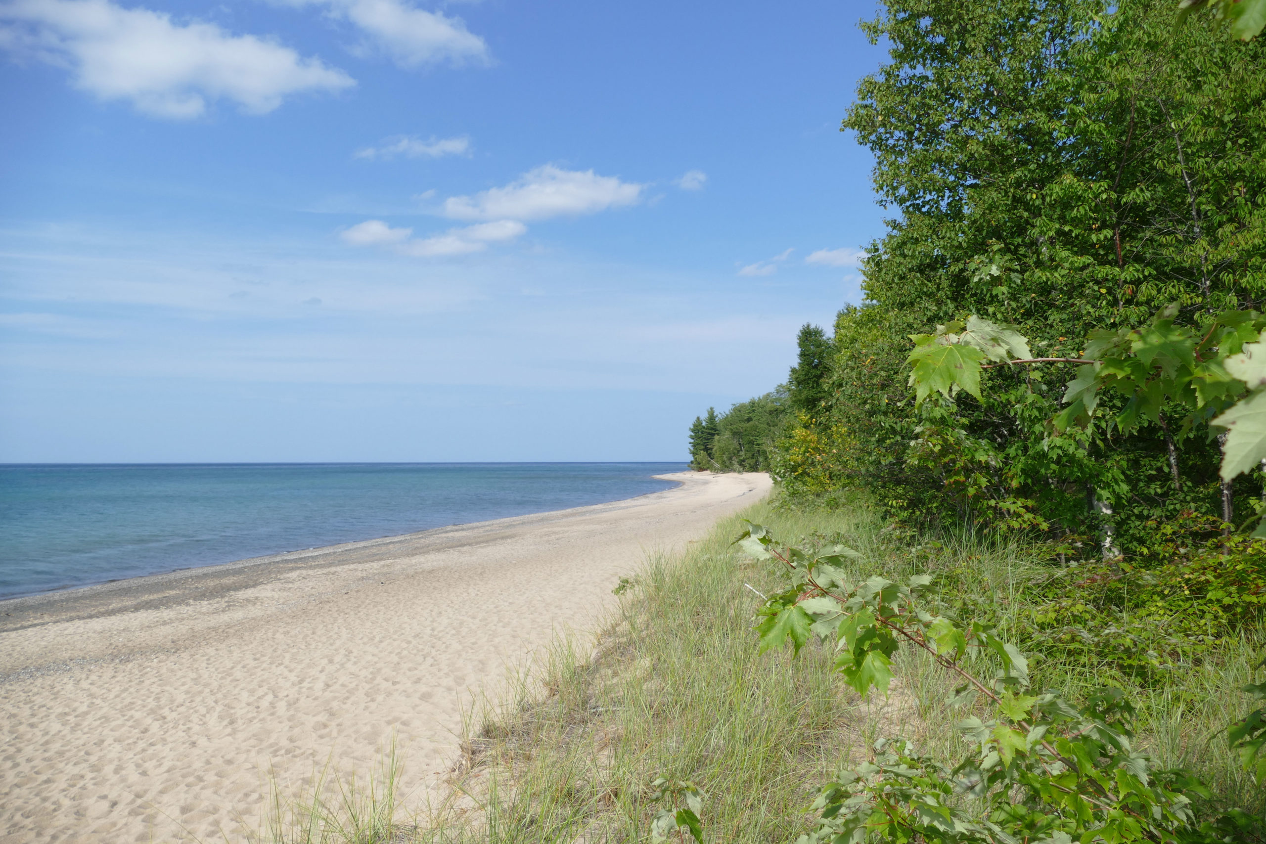
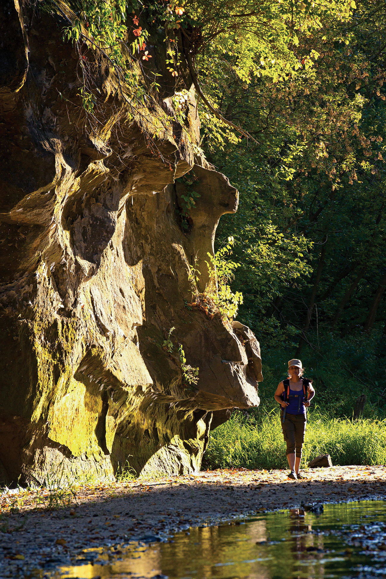
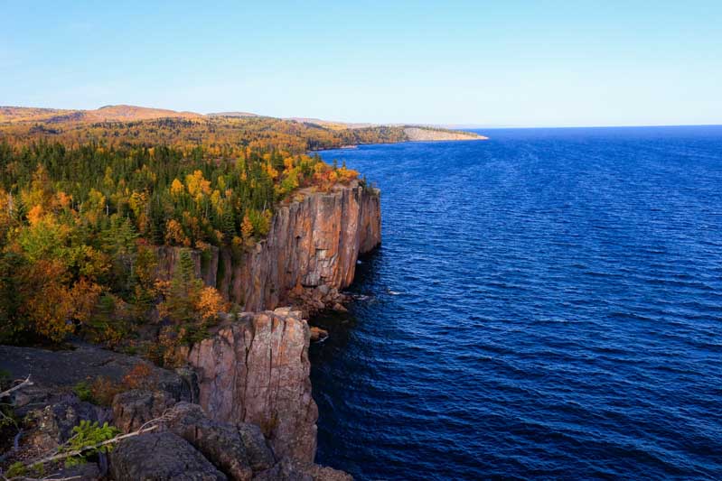
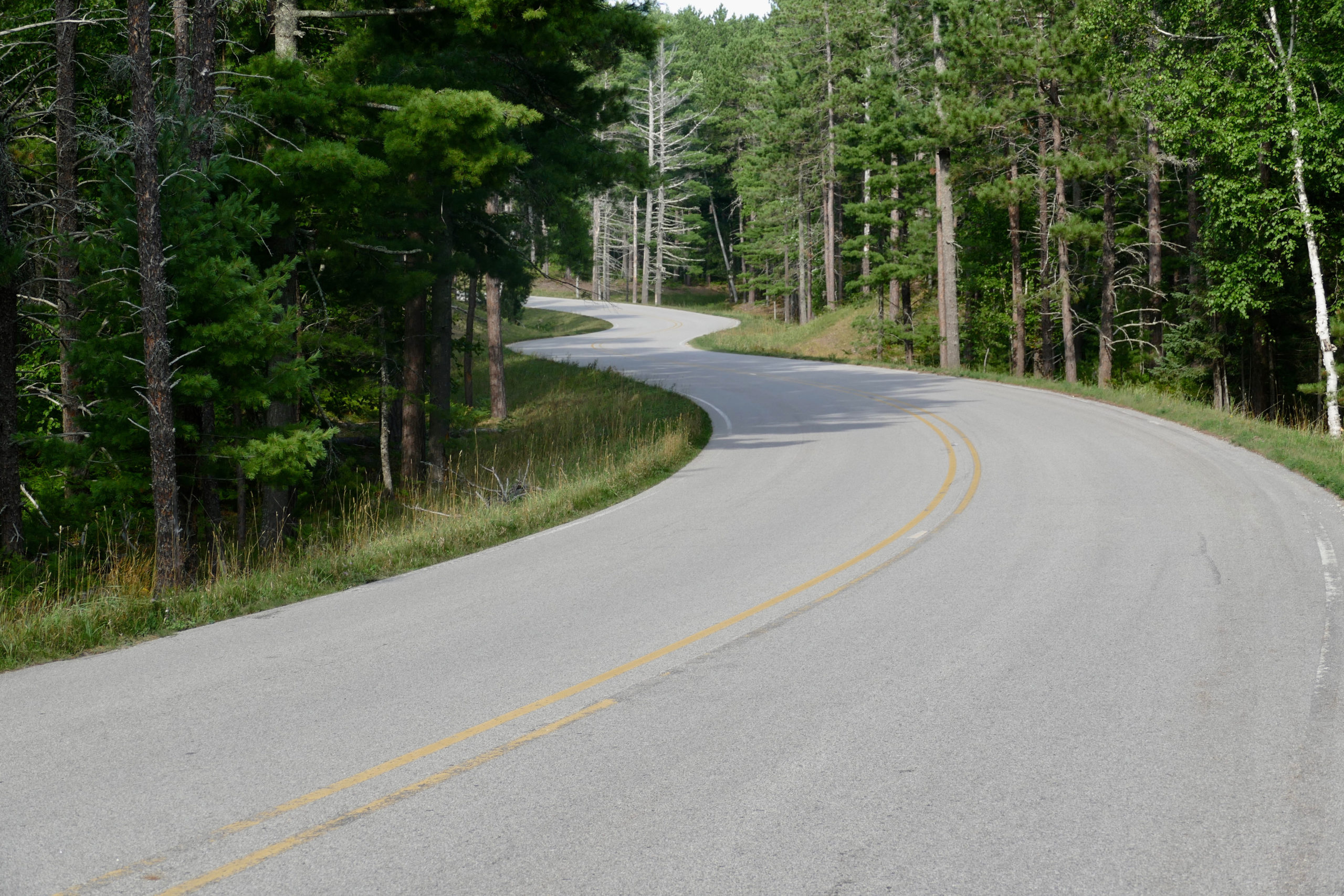
So, I head from Ashland, Wisconsin, straight for Pictured Rocks National Lakeshore on the recommendation to ride County Road H-58. And wow, what a sweet road. I hear it was even more fun to ride before it was fully paved in 2010, but today the 69 miles of smooth shaded corners and flowing undulations ride like a song. And for the other senses? The beautiful lake up here is edged by colorful sandstone cliffs and unspoiled sandy coves.

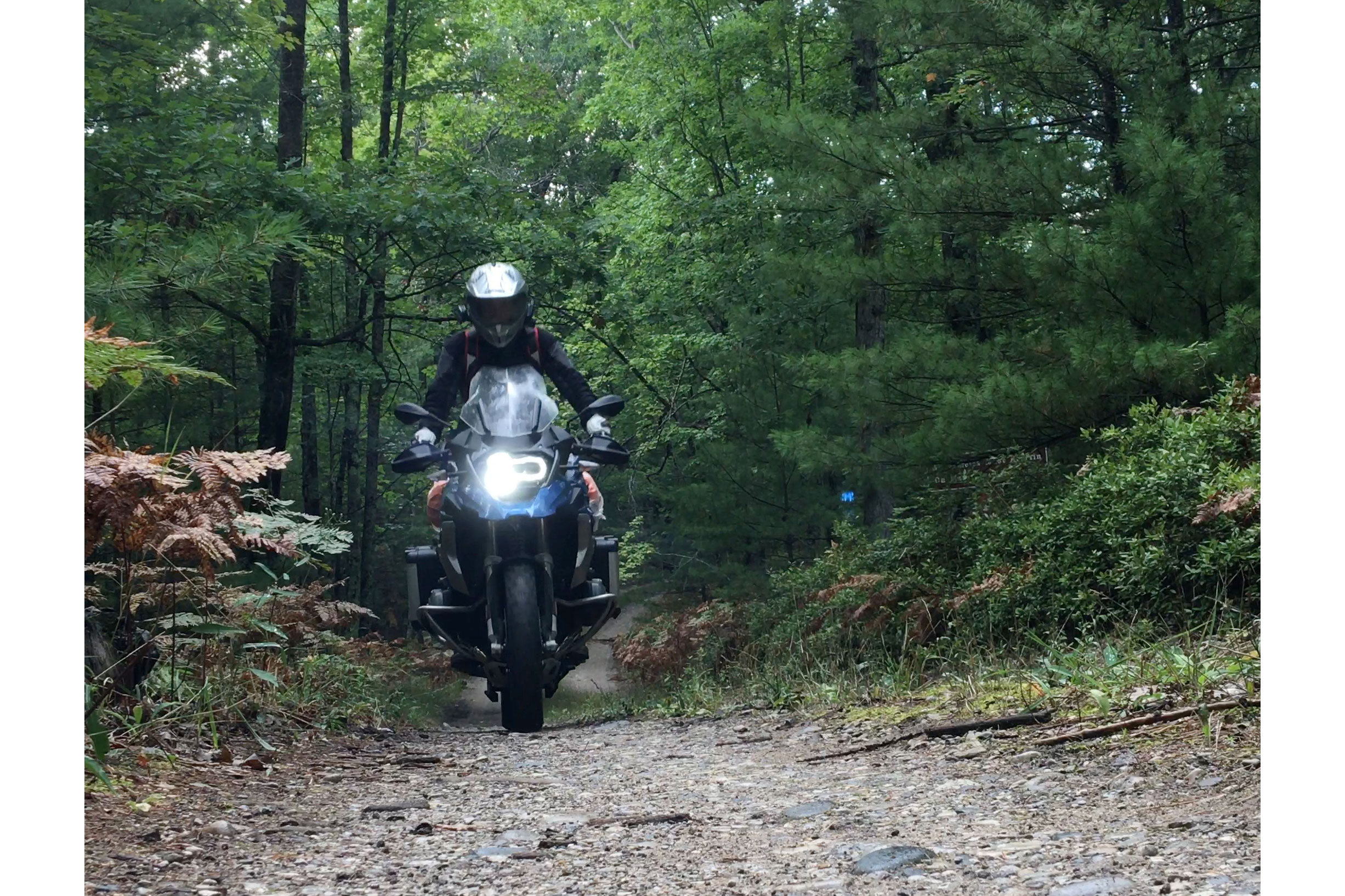
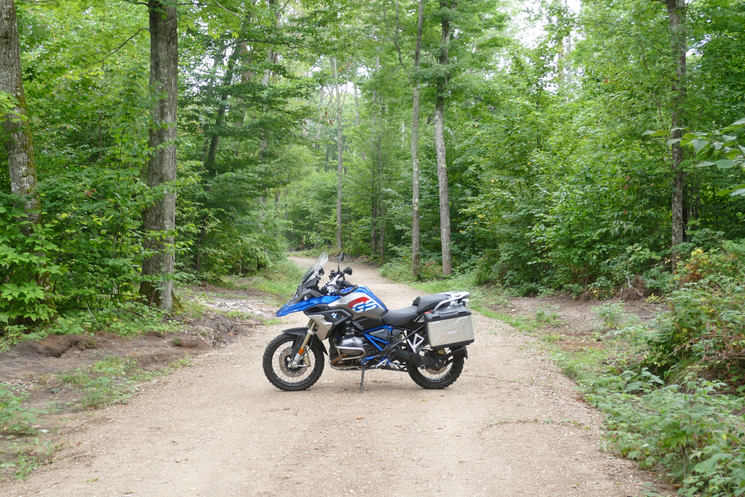
When you’re on an adventure bike, another thing to love about Michigan is its more than 3,100 miles of off-road vehicle trails, proudly documented and promoted on the state government’s website, and on Pure Michigan, a site sponsored by Michigan’s lead economic development agency. How civilized for these Midwestern states to celebrate their off-roading opportunities instead of quashing them.

Great Lakes Getaway

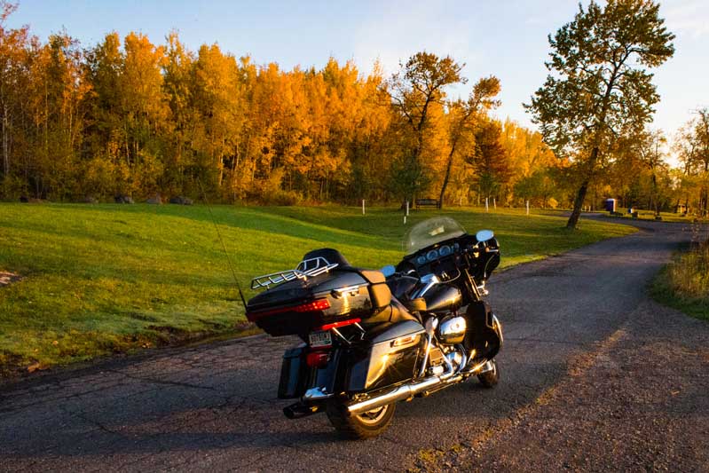
But you hardly need a map to find a tempting two-track here, which is the reason I’m not making good time on Michigan’s Upper Peninsula, but finally I’m at the famous Mackinac Bridge, gearing up to ride its five swaying miles to the Lower Peninsula. Yup, Big Mac is one of the longest suspension bridges in the world and it’s built to swing (apparently, up to 35 feet at its center span), and on a windy day, you can feel it, as I did when I crossed it years back on a Harley Ultra Glide Classic.

Great Lakes Getaway
The Old Post Office Museum encapsulates the history of Grand Marais, Michigan, which visitors can explore free of charge.

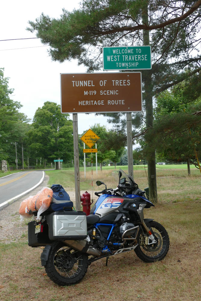
Especially in Michigan

But today it’s only breezy, and purring across the impressive bridge on the GS is a joy. I don’t have time to stop in touristy Mackinaw City because I want to ride some small roads I’d missed on my last trip, starting with M-119 from Cross Village to Harbor Springs, aka the Tunnel of Trees.

Great Lakes Getaway
Though not a fast road, Michigan’s famous Tunnel of Trees and its 137 snaky corners were high on my list of must-rides.

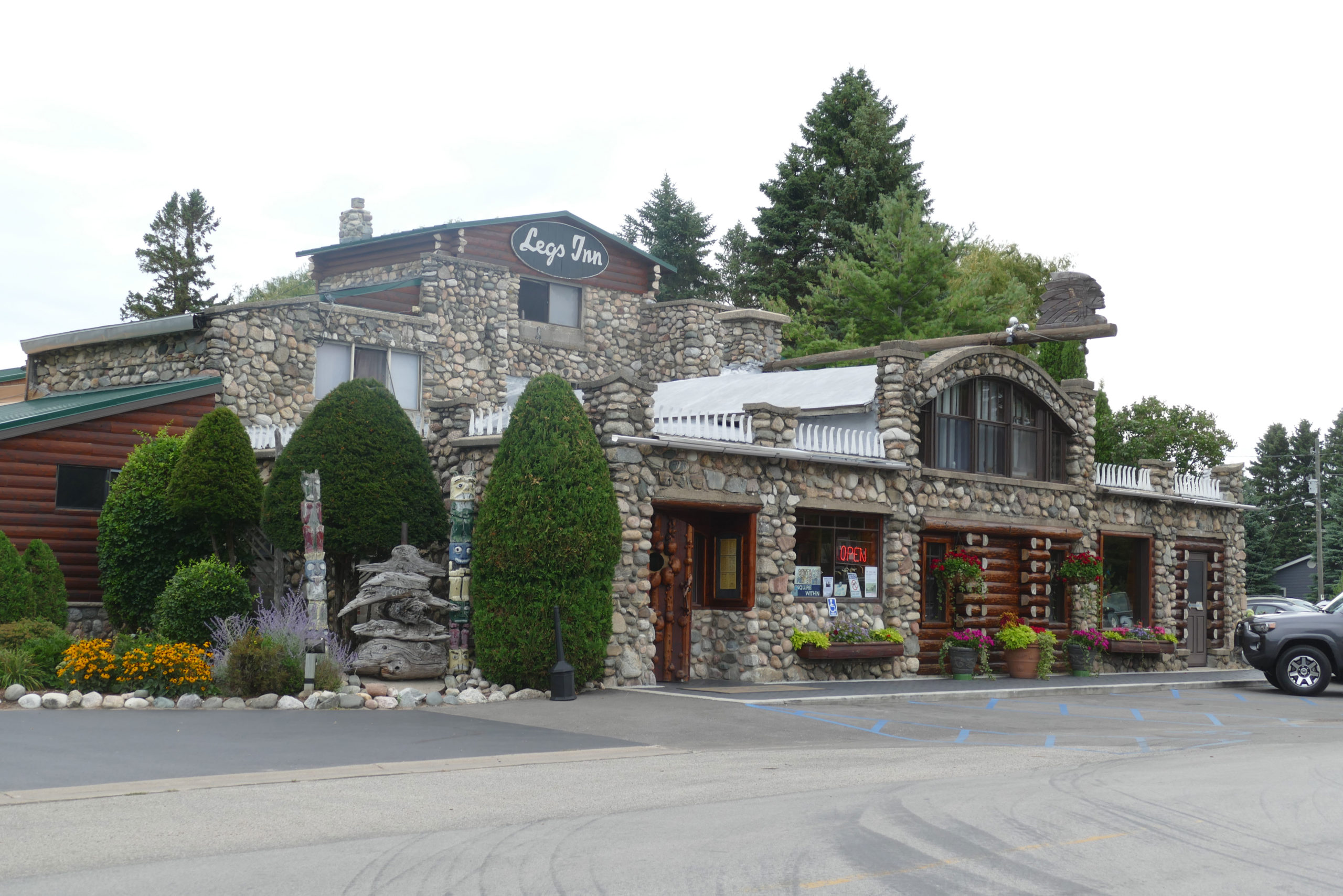
I approach from the north, stopping at the historic Polish-themed Legs Inn in Cross Village where you can spend hours taking in all the details of wood and stonework, or if you’re hungry, enjoy some kielbasa and pierogi. The famous 20-mile section of M-119 that kicks off from here is narrow, curvy, and truly a tunnel of foliage, and I’m sure its beauty is staggering in the fall, but it loses points as a premium motorcycle road for its 35-mph speed limit and profusion of deer and driveways. Still, those 137 corners are a lovely way to spend time.

Great Lakes Getaway
The GS I was riding was capable and comfortable, not to mention photogenic, even when encumbered by my ugly orange tent.

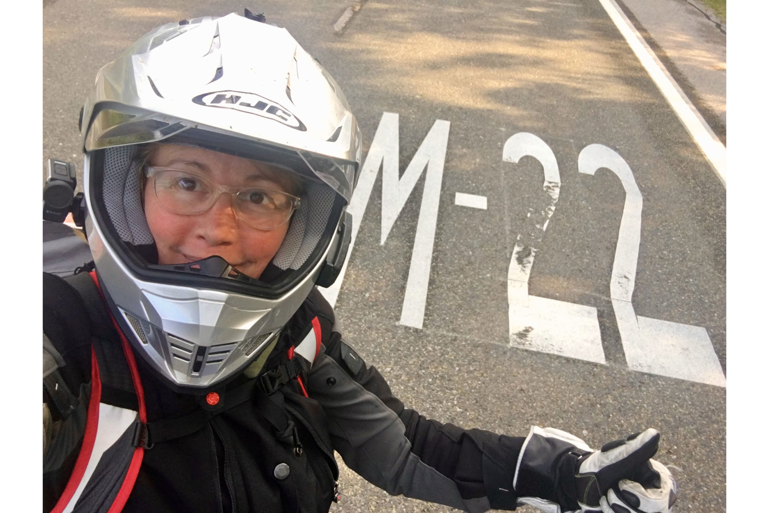
After an overnight in Petoskey, I head for Traverse City and M-22. If there’s one thing that’s undeniable about these Midwestern states, especially their more rural areas, it’s how genuinely nice the people are. Everywhere you go. The M-22 is recommended to me by a new friend, and I take my time exploring Suttons Bay, Northport, and the Leelanau Peninsula’s pretty lakes, all miniatures next to a hulking Lake Michigan.

Great Lakes Getaway
Leg’s Inn in Cross Village, Michigan

In Glen Arbor, I indulge in house-made cherry ice cream at the original Cherry Republic and slip a jar of cherry salsa in a saddlebag for later. I do not partake in the pit spitting at the establishment’s Olympic-size cherry spitting pit (the world record is 93 feet, 6.5 inches).

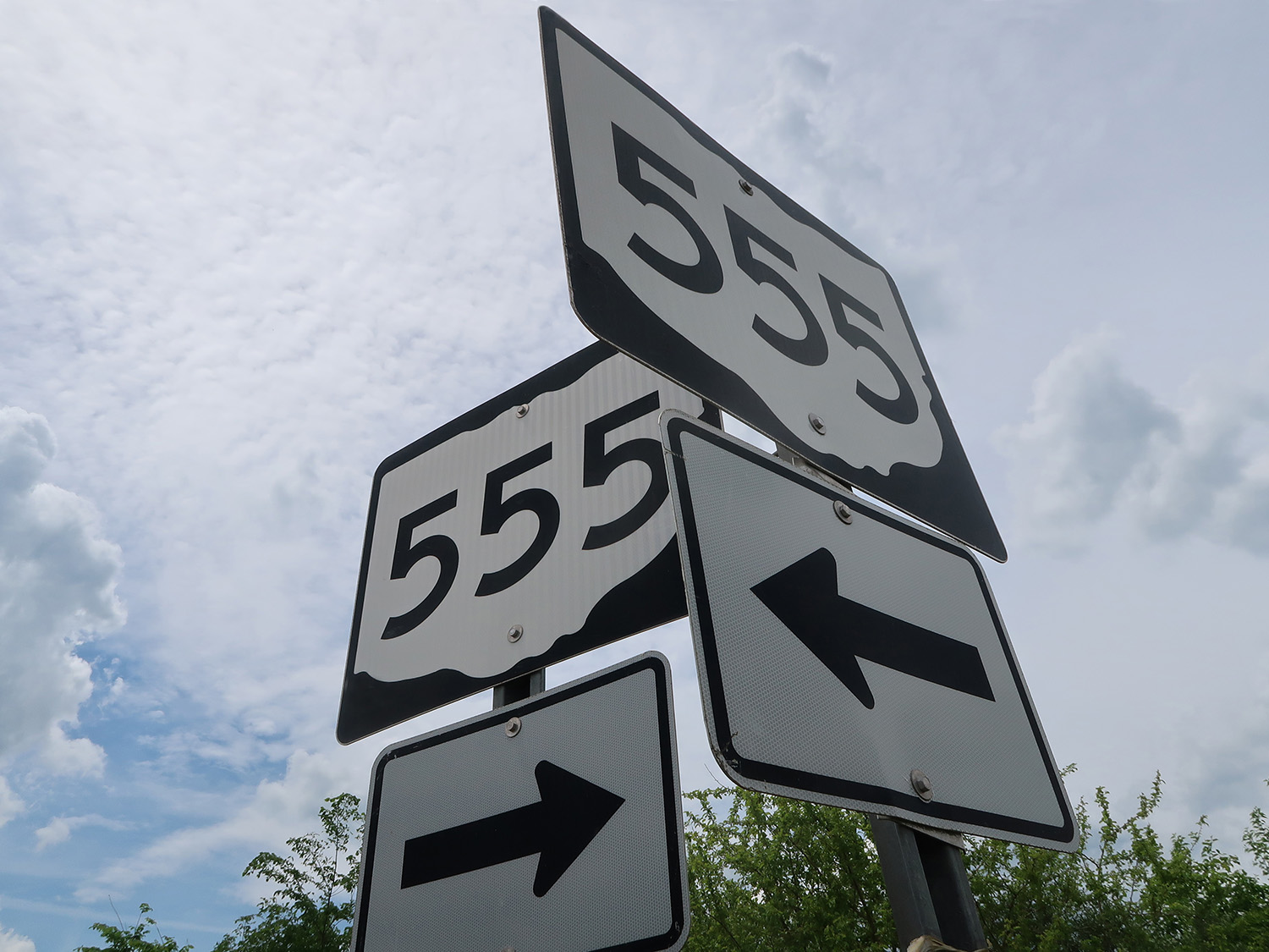
In addition to gorgeous views of the lake and rolling farmland, this part of Michigan has local wines to taste, dunes to explore, and apples to pick. The longer I spend on M-22, the more I realize it’s not just a road to the people in this area, M-22 represents a lifestyle. In fact, the M-22 highway signs have been stolen so often – 90 signs in three years – the Michigan DOT dropped the M on some replacements so they show only the number 22. If you missed your chance to nab a sign, there are plenty of places along the highway where you can buy a fake, as well as upscale M-22 apparel and souvenir tchotchkes.

Great Lakes Getaway
“M-22” has come to represent a lifestyle, not just an awesome highway.

And I get it. There’s something about this area (the people? the chill vibe? the scenery?) that just makes you want to stick around and explore every corner. Sadly, I don’t have time or tread for further exploration, and chug east from Manistee to Bay City, overnighting in some basic chain motel and wishing I was back in my tent on the lakeshore. In the morning, I scoot down I-75 to get the GS serviced and shod at BMW Motorcycles of Southeast Michigan. Again, the nicest people.

Great Lakes Getaway
Fields of sunflowers and historic landmarks dot the Great Lakes region.

Over the next five weeks I’ll ride through another 13 states, many of them bucket-list destinations for motorcyclists. And yet I’ll keep thinking about this Great Lakes area and its empty roads, slow pace, and big-hearted locals. If you’ve ridden there, you know. If you haven’t, go. I’ll be right behind you.

Great Lakes Getaway
The highways in this region of the Great Lakes aren’t meant to be traveled fast. A slower pace rewards riders with sweeping scenery and new treasures in every small town.

The post Great Lakes Getaway: Touring Minnesota, Wisconsin and Michigan first appeared on Rider Magazine.
Source: RiderMagazine.com

Favorite Ride: Des Moines River Loop

Des Moines River Loop
The author and his BMW R 1200 RT at Ledges State Park.

There are some great roads in central Iowa around the town of Boone, which is about 45 miles north of Des Moines. This ride crisscrosses the Des Moines River on a series of county highways and backroads, offering a nice selection of curves and scenery. I’m on a BMW R 1200 RT today, but these roads are friendly for just about any kind of motorcycle. This 124-mile loop minimizes straight sections and takes a few hours, so let’s go!

Des Moines River Loop

Click here to view route on REVER

First things first: this ride is in rural farm country, so be alert for deer, farm equipment, and debris on the road. Our starting point is in downtown Boone. We follow Mamie Eisenhower Avenue (the former First Lady was born here) east to the junction with Highway R27, where we turn south and ride along the west side of Boone Municipal Airport. Like all the roads on this ride, the pavement is in good condition and meanders easily; you can see through the curves, so they’re fun to ride at any pace.

Check out more Favorite Rides

Des Moines River Loop
Ledges State Park is named after the sandstone bluffs that run along the Des Moines River. Photo courtesy of Iowa Tourism Office.

We cross U.S. Route 30 and continue south to Highway E52 (250th Street). Turning right (west), we continue to the upper entrance of Ledges State Park, where sandstone ledges tower 100 feet above the Des Moines River. The scenic park offers hiking, picnicking, and camping, and we’ll return to it at the end of the ride.

We backtrack to R27, turn right, and head south again until R27 ends at the junction with Highway E57 (270th Street). We turn right (west) and cross the Des Moines River, enjoying the first of many scenic river views. Past the river is a sign for Camp Mitigwa, and we turn left (south) on R26, also known as Magnolia Road. We follow the twists and turns on excellent pavement down into the Des Moines River valley, and then turn left (east) on Highway E62 (325th Street) and soon arrive at the junction with State Highway 210.

Des Moines River Loop
The Des Moines River is a 525-mile tributary of the Mississippi that runs through the heart of Iowa and its namesake city. Crossing and riding along the river gives this ride a curvy character most people don’t associate with the Hawkeye State.

Looking straight ahead, you’ll see the High Trestle Trail Bridge, a former railroad bridge over the Des Moines River that’s now a biking and walking trail. After enjoying the view, we turn around and ride E62 and R26 north again to E57. We turn left (west) on E57, then right (north) on R18 (L Avenue) toward the small town of Moingona.

We cross U.S. Route 30 and turn right (east) on Highway E41 (216th Drive), which is part of the Lincoln Highway Heritage Byway and crosses the Des Moines River. After a twisting climb out of the river valley, we see a strange-looking shale mound on the left, a reminder of Iowa’s once-booming coal industry. We enter Boone again from the west, picking up Mamie Eisenhower Avenue and then turning north on Marion Street.

Des Moines River Loop
Part of the route follows the Lincoln Highway Heritage Byway.

After crossing the train tracks, we turn left on Highway E26 (12th Street) and make a few more turns as we follow E26 along curvy pavement and cross back over the Des Moines River. We exit the river valley on a wonderfully smooth and winding stretch of road followed by a short straight section.

We turn right (north) on Highway P70 (H Avenue), which runs along the western edge of Don Williams Recreation Area, which has a lake, camping facilities, and a golf course. We continue north to the junction with Highway E18 (130th Street), and turn right (east) toward Pilot Mound, a small town with a sense of humor that you’ll notice as you ride by. We cross the Des Moines River once again on E18, and then turn left (north) on Highway R21 (Nature Road).

Des Moines River Loop
In addition to the scenic, wooded areas along the Des Moines River, there are several nice parks on this route that offer recreational opportunities.

We pass through another very small town, Ridgeport, which isn’t on most maps. We stay on R21, which twists and turns a few times until it becomes first Chase Avenue, then Stagecoach Road, and arrive in Stratford. We turn left (west) on State Highway 175, and quickly turn right (north) onto Highway D54 (Bellville Road), a real treat that heads steeply down into – you guessed it – the Des Moines River valley. There can be a lot of gravel at the bottom of this road, so stay sharp.

Des Moines River Loop
A Boone and Scenic Valley Railroad locomotive painted in old Chicago North Western livery. This excursion train and museum is a must-see for railway buffs.

Exiting the river area, the road straightens (and becomes 330th Street) until we take a sweeping left (onto Racine Avenue) into Dayton, a small town with fuel, eateries, and rodeo grounds we see on our right as we leave town heading south. We’re back on Highway 175, which curves to the east and takes us over the Des Moines River, our sixth crossing! When Highway 175 curves north, we continue straight ahead and turn right (south) on Washington Avenue. After an interesting set of curves, we return to R21 (Chase Avenue/Nature Road) and continue south to Boone on Division Street.

Des Moines River Loop
A trail bridge in McHose Park on the south side of Boone.

At 10th Street, you can turn left (east) to visit the Boone and Scenic Valley Railroad. This excursion train was started by volunteers and has grown into a fine attraction with an excellent museum. We continue south on Division Street, crossing 3rd Street (Lincoln Highway) and coming to a four-way stop at Park Avenue.

We turn left (east) on Park Avenue and ride through the Honey Creek ravine and enter McHose Park, a great place to stop and stretch your legs. We turn right on Francis Mason Drive and wind our way south through the park, exiting near U.S. Route 30.

Des Moines River Loop
A stone bridge built by the Civilian Conservation Corps in Ledges State Park. Photo courtesy of Iowa Tourism Office.

We head east briefly on U.S. 30, then turn right (south) on Oriole Road toward the Boone Speedway. Oriole Road meanders its way toward the Des Moines River and the lower entrance of Ledges State Park. The road is smooth and deceptively fast because, before you know it, the speed limit drops and there’s a chicane to slow you down before entering the park. Check out the sandstone ledges, enjoy the park, and then head back to Boone for fuel, food, or a hotel room. Me? I’m ready to gas up and ride another 120 miles to get back home.

The post Favorite Ride: Des Moines River Loop first appeared on Rider Magazine.
Source: RiderMagazine.com

Riding Ohio’s Triple Nickel

Riding Ohio's Triple Nickel
Ohio State Route 555, also known as the Triple Nickel, has for a long time been a beacon, calling single riders or large groups from all corners to experience its challenge. (Photos by the author)

No more than 10 miles from where I learned to ride a motorcycle is one of our country’s finest set of twists and turns. Prejudiced, you may be thinking, but these are not just my thoughts. They come straight from Car and Driver magazine, which in 2020 published a list of the dozen best driving (and riding!) roads in America. First on their list: Ohio State Route 555, also known as the Triple Nickel.

It’s a throwback, a two-lane highway built in another era, originally a gravel road for farmers and small-town folk to get to the big cities of Zanesville or Belpre, back in the Depression years when you might find a Hudson or Studebaker puttering along its 63 miles, the driver cursing every twist and turn that today make it a destination for car and motorcycle enthusiasts.

Riding Ohio's Triple Nickel
The Triple Nickel has the feel of a time long ago. Some may think it has a nostalgic charm, but don’t be deceived. There’s attitude-a-plenty along its miles. Photos by the author.

Nicholas Wallace introduced his Car and Driver piece by writing about the mystique of the best places to aim your car, or in our case, motorcycle: “Looking for an adventure – even if only in your mind? Let these treks take you away. Maybe it’s the fact that, despite constricting responsibilities and busy schedules, the car still stands as a beacon of freedom in our daily lives. It would take us hundreds of pages to list every great road, so instead we’ve brought you twelve of the best. Twisty, scenic, dangerous, and remote, these routes offer a lifetime’s supply of variety. So pack your stuff and head out – we promise it will be worth it.”  

Riding Ohio's Triple Nickel
Pick a direction and at some point the highway will take you there, but rarely in a straight line.

Our motorcycles offer us that same beacon of freedom. Starting just south of Zanesville, I’ve been down our great Ohio highway many times, always on something made for scraping footpegs, not that I still have that kind of nerve. But today was to be different. For this ride I’d be on three wheels, on my brother’s Can-Am Spyder. It was to be my maiden voyage, my first time on his trike, soon to be mine. Chuck had warned me about an adjustment period, the time it would take to get comfortable on a machine so different from the two-wheeled motorcycles that have carried me for over half a million miles.

Riding Ohio's Triple Nickel

Click here to view/download the Triple Nickel route on REVER

But my life had changed. Two vertigo attacks within three days had forced me to open my eyes to what might come next. The first bout had been when riding my Beemer on a western Ohio county road. In an instant I simply lost all sense of balance, going left of center and crashing in a farmer’s front yard. Luckily, I was unhurt and there was little damage to my bike. The second attack, when in my car, sealed the deal. For nearly a year since my crash, I’d been without a bike, until today.

The three-wheeled cycle, a 2014 model, had been Chuck’s pride and joy, the best bike he’d ever owned, he told me. Riding it that day was bittersweet. It should have been Chuck out on his Spyder. But his life had taken a turn of its own. For half of his 66 years he’d been plagued with muscular dystrophy, the disease slowly eating away at his ability to get around. It had finally gotten the upper hand, relegating Chuck to a walker and a wheelchair.

Riding Ohio's Triple Nickel
Dozens of American flags lined a long section of the highway, quickly out of view over the next hilltop. Around Halloween, there are small pumpkins on display.

But he had not gone quietly into his new solitude. Over the previous several years, Chuck had a single focus: to get his Spyder to 200,000 miles. He’d pushed hard, riding hundreds of miles every day. Only three years earlier he’d ridden over 43,000 miles in 12 months, with every year but the last tallying well over 30,000. But last June, at the height of the riding season, his body told him it was finished. It was done. (You can read more about Chuck’s high-mileage pursuits in “Chuck’s Race”.)

Riding Ohio's Triple Nickel
There are reminders along the highway of other eras, with Ohio’s famous highway having outlived them all.

Chuck had put up a valiant fight, but there are some things a human being simply can’t overcome. That last day, when he parked his trike, its odometer was frozen at 188,303 miles. But now, on this day – my day – it was to move again. It had fresh oil and a full tank of gas, so all I had to do was to check the tire pressure. Chuck had kept his Can-Am road-ready all winter, sometimes visiting and sipping a beer or two, reminiscing about the good old days, sometimes firing it up, simply to listen to the Spyder’s engine quietly humming along.

Riding Ohio's Triple Nickel
Farms, some owned by the Amish, thrive in the area, most found on hilly terrain, our motorcycles carving along their boundary lines.

The Spyder had been waiting, patiently, for nearly a year for its next adventure. It had waited long enough. Me too! For his trike, this was to be a new spring with a long summer ahead. There were miles to be ridden, new places to explore, with me holding the grips.

It was to be a careful ride. It was me that had to be broken in. Chuck watched as I rode up and down his rural road, getting my first feel of the Spyder. I couldn’t help but wonder what was going through his mind. He knew it would be my goal to get his Spyder’s odometer in motion once again, to get it past 200,000 miles. His trike was not meant to sit as a quiet monument to its past glory. What Chuck knew, in no uncertain terms, was that the road was where his Spyder was meant to be. And maybe, hopefully, this year it would take me along other top-ranked riding roads.  

Riding Ohio's Triple Nickel
Near the highway’s northern beginning, the Triple Nickel Saloon has a sign out front asking everyone to “Look Out For Motorcycles.”

With both Chuck’s and my limitations, this three-wheeled cycle was meant for where I was heading. True, on a road meant for many to be a test of their riding talents, maybe riding the Triple Nickel wasn’t my wisest decision. There would be a learning curve, that I knew. But what better road was there to get the feel for the Spyder, to accelerate that learning curve, than where others went to challenge themselves. And for my Sunday ride, this highway, one of Ohio’s least traveled, was perfect.  

Riding Ohio's Triple Nickel
The Triple Nickel Diner is in Chesterhill, the prettiest of the small communities along the highway. Some who ride the highway consider dining there mandatory.

“While not the most technical course,” Wallace wrote, “the Triple Nickel’s combination of high-speed sweepers and tight, low-speed corners means there’s something for everyone.” Granted, the other 11 highways in his story may have offered something more unique, a view of the Pacific, or the northern tundra along the Top of the World Highway, or the relentless craziness of the Tail of the Dragon. Of the nine highways on the list I’d ridden, the Triple Nickel, with its twists and turns, may have more closely resembled Mulholland Drive in California. But as I rode on, there was no question that Ohio State Route 555 fit right in.  

This ride offered me the solitude I needed. This was a reawakening for me, a bridge from my past to a new future, to again feel the wind and see the road surface blurring beneath me. But respect for the highway was in order. The riding rules had changed. The undulating highway surface beneath me, not my natural sense of balance when on two wheels, set all of the rules. There was an initial element of uncertainty, with me in an unsettled place, somewhere between riding on two wheels and driving a car.

Riding Ohio's Triple Nickel
Words to live by, found at the Pleasant Hill M.E. Church Cemetery, the church founded in 1889 but long ago abandoned.

At one of my stops, local resident Tom Collins, who had seen me ride by and knew of this highway’s history all too well, summed up its danger in only one sentence, reminding me that, “For every mile of highway, there are two miles of ditches.” Riding buddy Mac Swinford added, “The 555, especially between Ringgold and Chesterhill, resembles a paved footpath constructed by a drunk who hated people.” 

Cannelville, then Deavertown and Portersville, were first in line, three tiny towns forgotten as soon as I rode beyond them, reminded of their names only by looking at my map. Then Chesterhill, a quaint and attractive community, and Bartlett, where you can find lunch if you know where to look. You can get gas just north of Chesterhill on Ohio Route 377, and in Bartlett a half mile to the east on Ohio 550, another great ride by the way, but nowhere else

Riding Ohio's Triple Nickel
Judy Pletcher’s front porch message in Deavertown, something I had to stop and ask about. It was something she had seen and liked, and a gift from her daughter, Martha.
Riding Ohio's Triple Nickel
Russell Pletcher, a Vietnam veteran, with one of his pride and joys, a ’64 Chevrolet Impala SS. Russell scored 15 points for the York Tigers basketball team in their February 12, 1965, 171-point record performance, a record that still stands today.

The highway draws you in, encompassing you in a unique way. Then all too suddenly, once after little Decaturville, then into Fillmore and near Little Hocking, the highway ends. One minute you’re on the highway, and then the next it’s over, finished. There’s not even a sign. Every time I ride this road there’s an immediate sense of disappointment, wishing there was more.

Riding Ohio's Triple Nickel
A new chapter opens for Chuck, from two wheels to three and now on four, where he can still feel the breeze against his face. He installed a GPS unit in his new golf cart to keep track of his speed, and naturally his miles driven. What else would you expect? Chuck’s race continues.

If it hadn’t been for my brother’s Spyder, I doubt I’d ever have ridden again. At 72 years of age, I might have simply allowed myself to leave behind the joy of riding I’ve known from before my adult years. Chuck sensed it too. He wanted me to ride toward a sunset he could no longer enjoy. There are always new highways, singular places we need to find, known and unknown to us. This day I was being introduced to the Spyder that would take me to many of them.  

This highway is worthy of its #1 ranking, with its endless array of ups and downs and arounds, where not long ago I might have stretched my limits. But that was not my purpose this first day on the Spyder. By the end of my ride, I knew Chuck’s trike a lot better. I knew after the Triple Nickel’s 63 miles it was something I could get used to. I should know better by the time the odometer rolls over 200,000 miles.  

Ride on! 

Riding Ohio's Triple Nickel
The Can-Am felt right at home. It had been here before. But for me, on my first Spyder ride, it was slower going, calling for caution and patience

The post Riding Ohio’s Triple Nickel first appeared on Rider Magazine.
Source: RiderMagazine.com

Riding Wisconsin’s Waumandee Valley River Roads

Where Motorcyclists Roam
Riding Highway 88, aka Black Lightning. Photos by Kathleen Currie

Buffalo County, Wisconsin, is a hidden gem for motorcyclists. Located in the northwest part of the state, its southern border is the Mississippi River, which is the dividing line between Wisconsin and Minnesota. This is rural farm country, and the entire county has only one traffic light.

Buffalo County boasts dozens of fantastic motorcycling roads that twist along river banks, climb steep bluffs, dive into coulees and steep ravines, and cling to the edges of sandstone ridges. Numerous creeks and small rivers flow through the Waumandee Valley on their way to join the Mississippi, and they influence the shape and slope of these roads.

Where Motorcyclists Roam
Buffalo County appears to have the most curvy road signs in Wisconsin.

The best starting point is the town of Mondovi, located in the northeastern corner of Buffalo County. A quick fuel and food stop is recommended, as gasoline stations, restaurants, and other amenities are sparse as you head south. After a bite at McT’s Diner we follow County Roads (CR) H and ZZ south to a hook up with State Highway 88 at the Buffalo River.

Known as “Black Lightning,” Highway 88 has approximately 130 corners and curves in 40 miles as it runs from Gilmanton to the Mississippi River, making it one of Wisconsin’s highest-rated biker roads. It gives riders — and their brakes — a real workout as they ride the ridges and slash through a sandstone cut north of Praag.

Where Motorcyclists Roam
This tour route is available on the REVER app in the Rider Magazine community.

Link to Waumandee Valley River Roads tour on REVER

At CR U, we head east until we reach CR C at a crossroads just north of the village of Montana. CR C dishes up a variety of steep climbs and hairpin curves as we work our way south along Swinns Valley Creek, on our way to State Highway 95 just west of Arcadia. A short jog going west on 95 takes us to CR E, which heads northeast through Pansy Pass and Glencoe to Waumandee. CR E east of Waumandee has such steep hills that many homeowners have large angled mirrors mounted on posts at the foot of their driveways to help provide a view of any hidden oncoming traffic.

The village of Waumandee — Chippewa for “clear and sparkling water” — is worth a stop. It dates back to the 1850s, and Waumandee House, which was built in 1879, is still an active inn and restaurant. Every September the village hosts the Waumandee Hillclimb, a unique event for sports car enthusiasts. A two-mile stretch of Blank Hill Road west of Highway 88 is closed for a day of timed runs up an 18-turn hillclimb road course.

Where Motorcyclists Roam
J & J BBQ in downtown Nelson is a favorite biker stop.

Crossing Highway 88 we take a shot at Blank Hill Road, which is as challenging as advertised. Take care along the section of road that clings to the side of a cliff and has no guardrail. At CR N, we head north along Alma Ridge, which has some white-knuckle descents on its way to the Buffalo River at State Highway 37. A short jog up Highway 37 takes us to Highway KK on the west side of the Buffalo River.

Where Motorcyclists Roam
The lunch crowd heading down Great River Road (Highway 35) to Nelson.

Want a taste of riding the Isle of Man TT? Much like the famed road circuit, the CR KK south of Modena has climbs and descents chiseled into the sides of ridges with few guardrails, testing our binders and our nerves as we plunge down to CR D.

CR D winds west through rolling farm country to its junction with State Highway 35, which is known as the Great River Road and hugs the northern shore of the Mississippi. Overlooking the river, the town of Nelson has several recommended dining stops. On the day of our visit, J & J Barbeque and Nelson Creamery are overwhelmed with two-wheeled customers. We find an empty table at Beth’s Twin Bluff Café, and enjoy the best lemon pie we’ve ever tasted.

Where Motorcyclists Roam
Picturesque farms are everywhere in Buffalo County.

We headed north on State Highway 25 along the eastern edge of the Tiffany Bottoms Natural Area. At the village of Misha Mokwa, we turn east onto CR KK and complete the circle at the junction with CR D. Twists and turns command our full attention on our way to the village of Modena. Visit the general store in Modena to see two large motorcycle sculptures made from scrap metal, and pick up some cheese curds for a snack. We continue east on D until it dead-ends at Highway 37, then we follow the Buffalo River north and return to Mondovi.

The roads on this 110-mile loop are challenging, but most of the pavement is in good condition (be mindful of gravel in some corners). Part of what makes Buffalo County a great riding destination is the traffic — except for Highway 35, there is none! On a full day of weekend riding we encountered two tractors, two pickups, seven motorcycles, and one corn picker, which was blocking a narrow farm road. The only thing missing for a perfect riding weekend is a motorcycle class at the Waumandee Hillclimb so we can clock our time going up Blank Hill Road!

Where Motorcyclists Roam
Snaking roads and incredible scenery in the Waumandee Valley.

The post Riding Wisconsin’s Waumandee Valley River Roads first appeared on Rider Magazine.
Source: RiderMagazine.com

Highway 61 Remastered: Riding Along Minnesota’s North Shore

Rider Minnesota North Shore Lake Superior
The North Shore of Minnesota may look all pretty. But don’t let it fool you. Billions of years of violence sculpted this land. (Photos by the author and Sahlee Grace Kotoski)

If you go when the snowflakes storm
When the rivers freeze and summer ends
Please see if she’s wearing a coat so warm
To keep her from the howlin’ winds

— Bob Dylan, “Girl from the North Country”

I had forgotten about that feeling of violence that rises up through the ancient volcanic rock of Minnesota’s North Shore, where Highway 61 carves a thin rivulet of asphalt against a dead mountain range that descends into deep, dangerous water.

Rider Minnesota North Shore REVER map

REVER Route — MN North Shore: Duluth to Gunflint Trail via Highway 61

The sun had yet to rise. The air was cold but there was no frost. Cars with bright lights and loud trucks with loads of lumber cut through the darkness on their way to the Canadian border. My mind wandered, from Bob Dylan’s youth to the geologic time scale to the warm, soft bed my wife and I had just left.

My wife was huddled, bundled tight, hiding from the wind in a wave-carved basalt pocket. Besides a flashlight and the burning ember of my Newport, it was completely dark. Slowly the sun rose, turning purple, red, orange, and finally yellow. The lake turned blue again, and behind the lodge, the forest that covered the mountain came alive with color. It had been over 10 years since I had looked clear to the horizon over Lake Superior.

“It’s hard to believe this place is real,” Sahlee said.

Rider Minnesota North Shore Harley-Davidson Ultra Limited
Regal riding on the Harley-Davidson Ultra Limited.

We were on the third day of a four-day motorcycle trip along Lake Superior to capture the peak autumnal colors before the heavy Minnesotan winter tightened its grip. And it was our first long ride together in many years. We started our journey at St. Paul Harley-Davidson, where we borrowed an Ultra Limited in Vivid Black — a beast of a machine in both weight and power, a 900-pound workhorse designed for regal riding. It turned heads, and with a 114ci Milwaukee-Eight V-twin, it chewed up miles without hesitation.

We had checked into the historic Cascade Lodge, located between Lutsen and Grand Marais — a ski resort and a bohemian art enclave, respectively — shortly before dark the night before, following a 100-mile brisk ride north from Duluth. The lodge was established in 1927 to serve affluent Duluthians and wealthy socialites. Profiting from fishing, forestry, mining, and trade along the Great Lakes, some had predicted that Duluth would rival Chicago. F. Scott Fitzgerald, a Minnesota native, would have fit in well there. Thom McAleer, who has run the Cascade Lodge with his wife since 2017, said business was good year-round, with plenty of motorcyclists in summer and snowmobilers in winter.

Rider Minnesota North Shore Cascade Lodge
The historic Cascade Lodge catered to the wealthy and elite during the early 1900s, now it welcomes motorcyclists and snowmobilers.

The geology of Lake Superior has always fascinated me. It is a history of violence that can still be felt today. Long before human barnacles — from the ghostly-white Scandinavians to the soiled French fur trappers on down to the spirits that guided the Ojibwe — clung to life on this rocky, inhospitable shore, billions of years of primeval and powerful forces created, shaped and sculpted what we see today: the world’s largest freshwater lake that has claimed thousands of mariners’ lives and at least 550 ships, including the Edmund Fitzgerald, which sank in 1975. 

As we rode into Grand Marais (French for “big swamp”), we followed advice we received the day prior from Andy Goldfine, founder of the legendary riding apparel company Aerostich, and scanned the sky, hoping to see a congregation of seagulls darting at a skiff loaded with fresh herring.

Rider Minnesota North Shore Andy Goldfine Aerostich
The wise and wonderful Andy Goldfine at the Aerostich factory in Duluth, where Roadcrafter suits are made.

“If you sneak behind the Angry Trout Cafe, you can find fishermen cutting up the day’s catch, and freeze packing them to be sent to a rabbi in Chicago to make them kosher,” Goldfine told us.

When we met Goldfine the day before at his factory in west Duluth, we were greeted by a short, thoughtful, balding, and bespectacled man. Andy and I commiserated over our time at the University of Duluth, albeit decades apart, him with his philosophy major and English minor, and me with the exact opposite. As our conversation moved from topic to topic, from technology and its effects on society (good and bad), to the absurdity of the global fashion industry as satirized in the movie “Zoolander,” to the history of Duluth’s post-WWII economy, to global trade and how America has become a consumerism-driven throw-away society and finally trends in motorcycling, it became clear that Goldfine was not just an inventor, but a sage.

Rider Minnesota North Shore Highway 61
The road along the North Shore has few curves, but the scenery is beautiful.

He started Aerostich in 1983, when Duluth was in an economic recession and on the verge of becoming another hollowed-out Rustbelt town. U.S. Steel closed its coke plant in 1979. A decade prior the Air Force shuttered the base that housed the 11th Fighter-Interceptor Squadron, a secretive Cold War defense outpost that housed 2,500 to 3,500 servicemen tasked with aircrafts that would be deployed in the event of a Soviet invasion.

When I was living in Duluth 16 years ago, the west side of town was rundown and largely abandoned. Tourism, college kids with bar money, and gentrification have revived the area, with craftspeople, brewers, and restaurateurs operating in clean, modern industrial spaces like you’d find in Brooklyn. Goldfine observed all of the changes to this historic part of town. What hasn’t changed is his philosophy regarding Aerostich’s Roadcrafter suits, which have been an integral part of the riding community for decades.

Rider Minnesota North Shore Harley-Davidson Ultra Limited
With leaves past their fall peak, winter is coming.

“Our customers are everyday riders because Aerostich makes equipment. Just like a farmer’s overalls, a carpenter’s pants, a lawyer’s or banker’s suit, it is the equipment that these professions invest in, not fashion,” Goldfine said. “Our logic is that our products are sacrificial. [A Roadcrafter] keeps you safe from the elements, and say you crash going 60 and you are okay, it did its job.”

We toured Goldfine’s factory, met with his tailors, and checked out his waterproofing testing equipment and impact armor fabrication set-up. When we left, he wished us a happy marriage and I felt better knowing that guys like Andy Goldfine are so dedicated to their craft.

Rider Minnesota North Shore Lake Superior
Sunrise along the North Shore somewhere south of Grand Marais.

From Grand Marais, we rode north and then northwest, 15 or so miles up the beautiful Gunflint Trail Scenic Byway that, further north, terminates at the Boundary Waters Canoe Area Wilderness — a 150-mile stretch of hard-to-reach pristine lakes along the U.S./Canada border that skirts the Laurentian Divide, which separates water flow from either going down to the Gulf of Mexico or up to Hudson Bay. Starting in the 1600s, voyageurs would make a special stop here to collect flint from chert deposits for their rifles.

A loaded lumber truck with two blown-out wheels partially blocked our path up the Gunflint, so we turned around and returned to the lake, thundering down the road on the mighty Ultra Limited as a kaleidoscope of fall colors became a blur.

Rider Minnesota North Shore Split Rock Lighthouse
A 1905 storm that wrecked 30 ships prompted the construction of Split Rock Lighthouse. (Photo by John Steitz)

“The Lake Superior Basin … sits dead center over an ancient rift [that] was active 1.1 billion years ago when Minnesota was really the center of the North American continent,” wrote geologist Ron Morton, in his 2011 book A Road Guide: The North Shore of Lake Superior on Highway 61. “Hot molten magma rose upward from deep within the earth, and as it approached the surface, it caused the crust to arch or bow upward, and then split like an overcooked sausage,” he added. A heavy, miles-deep pancake of basalt lava spread across the region, with larger eruptions piling pyroclastic rocks around the edges of what today is the rugged Lake Superior shoreline. When the volcanic activity stopped, the weight of the lava started to sink the earth.

Rider Minnesota North Shore
Morning coffee at a rustic family cabin.

But long before that, a massive mountain range — larger than the Alps or Rockies today — had formed. As the mountain range eroded over eons, the sinking basin filled with sediment, creating a swampy plain. Then came what’s known as the Last Glacial Period, starting a mere 115,000 years ago. Thick sheets of ice covered the land and pushed southward, violently scooping out the basin like excavators. The earth warmed, the glaciers melted and a lake was formed — the world’s largest in terms of area, third-largest in terms of volume. Geologic instability causes the south and southwestern sides of Lake Superior to rise a few centimeters each year, raising the waterline on the Canadian side.

From Grand Marais, we drove up to the Lutsen Mountains Ski and Summer Resort, where we paid $24 each to take the gondola up to the summit for impressive and expansive views of the landscape. From a western outlook hundreds of feet above the valley floor, the trees were dead brown and red, a couple of days past peak, while to the east, yellows, oranges, and reds mingled with the green, winter-hardened conifers.

Rider Minnesota North Shore Palisade Head
The rhyolitic red rock of Palisade Head and the Tettegouche area is the legacy of ancient lava flows over 1.1 billion years ago.

Our final sightseeing stop was Tettegouche State Park to see Palisade Head, a large rock formation with staggering 300-foot sheer cliffs that end in a jumble of jagged rocks along the shore. I remember coming here when I was in college. The wind would whip so hard it felt as if it would blow you right off the cliff edge, creating a mix of fear and excitement. Palisade Head and I have both aged. It looks and feels the same. Can’t say the same about myself.

Biting cold wind meant that Old Man Winter would arrive soon. Time to get back down to St. Paul to return the Harley and hunker down.

The post Highway 61 Remastered: Riding Along Minnesota’s North Shore first appeared on Rider Magazine.
Source: RiderMagazine.com

Beartooth Forever: a Father-Daughter Ride to Yellowstone

Beartooth Forever – a Father-Daughter Ride to Yellowstone
Looking at the next stretch of road from an overlook on the Chief Joseph Scenic Byway.

Every now and then, you have a day that stands head and shoulders above others. A day when everything goes right, things look and smell better than usual, and all is right with the world. Today is one of those days.

We’re in the Sheridan Lake Campground in the Black Hills National Forest. I make my coffee on my single cup burner and look at maps while my 13-year-old daughter Shayla sleeps in. The next few days of our two-week summer trip to Yellowstone promise to be the most memorable.

Beartooth Forever – a Father-Daughter Ride to Yellowstone
Shayla at the roomy Sheridan Lake Campground site, in the Black Hills of South Dakota.

The trip has been great so far. The shoulder that I had injured a few weeks earlier has hardly bothered me. My new-to-me 2010 Gold Wing is keeping us comfortable and running as smoothly and as well as expected. My quest to maintain close ties with my now-teenage daughter seems to be working, since we are getting along very well, enjoying each other’s company and creating new shared memories.

We take U.S Route 16A south through Custer State Park, enjoying the curves in the early morning. I wish we could spend more time in this area because the roads are so great, and are currently almost free of traffic. The refreshing, crisp morning air, the curves — including a few of the hairpin variety — make this the best road of the trip so far. We then take Route 16 west toward Wyoming. Route 16 becomes Interstate 90 for about 100 miles, but then turns back into two-lane Route 16 as we ride through the Bighorn National Forest. There we experience more great curves and beautiful vistas. It’s a hot day so we stop often for drinks and ice cream.

Beartooth Forever – a Father-Daughter Ride to Yellowstone
Photographing the view from an overlook on the Chief Joseph Scenic Byway. Not shown, obese chipmunk planning for his next snack.

At the small town of Ten Sleep, Wyoming, we turn north onto Lower Norwood Road, which turns into Wyoming Highway 31. Both are small roads that roughly follow the land, making them a delight through the wide open spaces. Greybull Highway 14 into Cody is straight as an arrow with little traffic. Riding into the sun might normally be annoying but today it is somehow magical. I’m not sure if it is the wide open spaces, the almost total lack of traffic or if I’ve achieved a state of zen, but in my mind’s eye I can see us from above, riding into the sunset along this lonely stretch of road.

In Cody, we get a room at the cozy A Western Rose Motel on Sheridan Avenue, which is the main downtown street. It’s a lovely evening so we walk down to the Irma Hotel for dinner. Buffalo Bill Cody, who founded the town with his name, built the Irma in 1902 and named it after his daughter. Buffalo Bill, born in 1846, was an American soldier, bison hunter and a showman, best known for his traveling Wild West shows. The hotel menu has an appetizer called Rocky Mountain Oysters — Buffalo Bill’s Original Sack Lunch. I suggest to Shayla that we try them, but she’s disgusted at the thought and refuses. We have an enjoyable meal anyway, to cap off a perfect day.

Beartooth Forever – a Father-Daughter Ride to Yellowstone
The Irma Hotel in downtown Cody, Wyoming.

From Cody we ride along the Chief Joseph Scenic Highway toward Beartooth Highway and enjoy the many curves and scenic views. The Gold Wing may be a big beast, but it’s still a joy on the curves. At an overlook, we meet the fattest little chipmunk we’ve ever seen, one who has obviously mastered the art of obtaining free food from tourists. Shayla succumbs to his charms and feeds him a cracker, ensuring that his battle with obesity will continue.

The last time I was on Beartooth Highway I was a much younger, more fit version of myself. The amazement and the feeling of riding on top of the world is the same this time. The weather is beautiful, the views are stunning, and the road that has been called “The Most Beautiful Drive in America” doesn’t disappoint. Shayla and I continually marvel and comment on the beauty through our headsets.

Beartooth Forever – a Father-Daughter Ride to Yellowstone
Beautiful curves are easy to find on the Beartooth.

As planned, we ride from south to north, have lunch in Red Lodge, Montana, and then turn around and ride the road again. We reach heights of 10,900 feet, so at an overlook stop, Shayla makes a snow angel and we have a brief snowball fight. The views on the way back are equally stunning.

At the south end of the Beartooth, we enter Yellowstone National Park. The park is initially disappointing after the views we had experienced on the Beartooth. Then we enter the Lamar Valley and start to see bison in the fields. First bison near the road, and then on the road. We watch a giant male wander along the centerline of the road, causing all traffic to stop. Fascinating to watch — from afar.

Beartooth Forever – a Father-Daughter Ride to Yellowstone
Bison causing traffic jams in Lamar Valley in Yellowstone National Park.

We camp at a small campground owned by the Diamond P Ranch on U.S Route 20 outside of West Yellowstone. In the morning we do some horseback riding, then head into Yellowstone again. Yellowstone is all about geysers, so we investigate many of those, including Old Faithful. The crowds are worth it, since those geysers are impressive. We witness the eruption of the Beehive Geyser, whose eruptions are unpredictable, but it is one of the most powerful ones in the park. The eruptions average about five minutes and shoot water an incredible 200 feet into the air. We also enjoy the colorful sulfur pools that look way nicer than they smell.

In the evening, after cowering in our tent during a flash thunderstorm, we go to a rodeo a couple of miles up the road from our campsite. It is literally our “first rodeo,” and we take it all in and have a great time. We get back to our tent shortly before the rain starts again, and it continues for much of the night.

Beartooth Forever – a Father-Daughter Ride to Yellowstone
Photographing the view from an overlook on the Chief Joseph Scenic Byway. Not shown, obese chipmunk planning for his next snack.

In the morning we load up the bike. Returning from the outhouse, I notice the Gold Wing is on its side! The ground, softened by the overnight rain, was not able to support the fully loaded bike, forcing us to heave it back up again. The practice we get picking the bike up will come in handy the next day in Montana.

We make our way north on U.S Route 191, west of Yellowstone park, and enjoy the scenic ride through mountainous recreation areas to Bozeman. We then take the lovely Montana Highway 86 up to U.S Route 89 and then to the deserted Montana Highway 294. The secondary highways in this area are almost traffic free, and are quite scenic at times. We hop back on the 191 up to Lewistown, Montana. At the Yogo Inn we enjoy the indoor pool, hot tub and a poolside meal from the hotel restaurant.

Beartooth Forever – a Father-Daughter Ride to Yellowstone
Picturesque view from Montana Highway 86 north of Bozeman, Montana.

The next day, on a whim we decide to visit the ghost town of Kendall, outside of Lewistown off Route 191 that we’re taking to head north toward Saskatchewan. The road to the ghost town starts off as a nicely paved secondary road, but soon turns to gravel. We pass a couple ruins of old buildings, but the road continues, so we continue. The road narrows and turns into a single lane path, with big rocks and bumps. On an adventure bike it would be fun, but this is definitely not Gold Wing territory. There is no one else on this road, and as we climb the mountain to see where the road takes us, the guardrails disappear and the drops become larger.

As the bike bumps and gyrates along, Shayla expresses concern that we should probably not be on this road. Even though I tend to have a mental defect that makes me press on even when it may not be wise, I eventually have to admit that I’m pushing it too far.

Beartooth Forever – a Father-Daughter Ride to Yellowstone
It’s easy to feel like you’re on top of the world while taking a break at a Beartooth Highway overlook.

The road seems narrower than the Gold Wing is long, so I get Shalya to disembark and proceed to do a multi-point U-turn. While backing up, the bike leans toward the left, my bad shoulder side, and I drop it! I’m OK, the bike is OK, and we both start laughing. I take a photo of the downed bike, which is really the only good thing about a bike being on its side.

We straighten up the bike and make our way back down the mountain. I derive a strange sort of pleasure from riding a motorcycle where it has no business being ridden, and Shayla starts getting into the absurdity of it. I’m cautious, and we bump and bounce along at 5 mph, laughing and giggling in our headsets. We don’t get to see the full ghost town, but the memory of trying to get to it will surely stay with us for a lifetime.

Beartooth Forever – a Father-Daughter Ride to Yellowstone
Beehive Geyser in Yellowstone National Park erupting with bursts up to 200 feet in the air.

We head north on Route 191 and back into Canada, and eventually back home to Ottawa, Ontario. Sixteen days and 5,700 miles after leaving, we pull into our driveway, safe and sound.

I’ve heard it said how having kids is like a long, slow, painful good-bye. Kids start out being fully dependent on their parents, becoming less dependent as they grow, until they are eventually (hopefully) self-sufficient. My goal is to maintain as many ties as possible while that happens. My hope with this ride is that the shared experiences, the hours of conversation through our headsets, the challenges, the dropped bikes, the joys, the heat, the rain, and the time spent together, have contributed to that in some way. We’ll always remember the Beartooth, and we’ll always be able to laugh about the ghost town we almost visited. 

Beartooth Forever – a Father-Daughter Ride to Yellowstone
Pull-off on U.S. Route 16 in Wyoming, in the Bighorn National Forest. with the mountains getting closer.

Beartooth Forever: a Father-Daughter Ride to Yellowstone Photo Gallery:

Source: RiderMagazine.com

List of U.S. Motorcycle Tour Operators 2020

EagleRider motorcycle tour
Photo courtesy EagleRider.

With international travel in 2020 looking less certain by the week (and possibly risky, not just health-wise but also with the possibility of becoming stranded or quarantined outside the U.S.), this might be a great time to explore this beautiful country.

While you could certainly peruse back issues of Rider (or do some research here on our website) in search of ride ideas throughout the country, you’ll still be on the hook for logistical planning, hotel reservations and knowing whether or not the gas station in that tiny desert town is still open…not to mention handling the “what-ifs” of mechanical issues or a crash. Or you could let a tour company handle all of it, leaving you free to enjoy the ride.

All the companies on this list run scheduled, guided motorcycle tours in the United States using rental motorcycles — either their own fleet or rented from a local source — but you should obviously check with them right off the bat to make sure they’re still running tours this year.

Most have a chase vehicle to carry your luggage and gear and to deal with mechanical issues that may occur en route. Some companies will allow you to ride your own bike, but check for any restrictions. The information here is provided by the companies, and not guaranteed by Rider.

Ayres Adventures 

Tours Include: Alaska/Yukon Adventure, Prudhoe Bay Excursion
Accommodations: Upscale hotels
Length of Tours: 9-13 days
Rental Options: BMW GS models
Equipment: Support vehicle
Dates: July-August
Typical Cost: 9-day Prudhoe Bay Excursion starting at $5,950 including bike rental
Age/Experience Requirements: Motorcycle license and touring experience required; for off-road adventures, off-road experience or training required
Tel: (877) 275-8238 or (972) 635-5210
Website: ayresadventures.com

Ayres Adventures prides itself in providing a premium tour experience, so if you want to ride Alaska this is a great way to do it. You’ll ride late-model BMWs equipped with chunky Continental TKC80 tires for the ultimate Alaska experience.

Bike Week Motorcycle Tours

Tours Include: All the major Bike Weeks, including Daytona, Laughlin, Myrtle Beach, Laconia, Hollister, Sturgis and Bikes, Blues & BBQ
Accommodations: RVs, private homes and carefully selected hotels/motels
Length of Tours: 12-14 days
Rental Options: Late model Harley-Davidson and Indian models
Equipment: Support vehicle with spare motorcycle
Dates: March-October
Typical Cost: $7,950, includes single room and motorcycle rental
Age/Experience Requirements: Min. age 21, min. one-year experience on heavyweight motorcycles 
Tel: (619) 746-1066
Website: bikeweekmotorcycletours.com

Get the ultimate Bike Week experience, as you travel some of America’s most scenic roads on your way to one of nine legendary Bike Weeks. Let the party begin!

California Sunriders

Tours Include: Blue Ridge Parkway, California Dreaming, Route 66, Sturgis, DreamCatcher, The Mighty 6, Yellowstone
Accommodations: Selected 3- and 4-star hotels
Length of Tours: 11-13 days
Rental Options: Harley-Davidson, select other makes/models
Equipment: Support vehicle with spare motorcycle
Dates: May-October
Typical Cost: 13-day Route 66 tour starting at $8,972, single occupancy, includes rental motorcycle
Age/Experience Requirements: Min. age 21
Tel: (310) 359-2353
Website: california-sunriders.com

California Sunriders wants to show you the best of the west — plus some fun roads back east too. You’ll explore California, the Rockies, the famous Blue Ridge Parkway and, of course, the legendary Route 66. 

EagleRider

Tours Include: Wild West I, II and III, Route 66, Triple B, Coast to Coast, Sturgis Bike Week, Florida Keys, Southwest Canyon Country
Accommodations: Hotels & motels
Length of Tours: 6-17 days
Rental Options: Varies by tour; fleet includes BMW, Harley-Davidson and Indian cruisers, tourers and trikes
Equipment: Support van with spare motorcycle
Dates: Year-round
Typical Cost: 15-day Route 66 tour starting at $7,179, single occupancy, includes rental motorcycle
Age/Experience Requirements: Min. age 21, experience riding a touring motorcycle at highway speeds
Tel: (877) 557-3541
Website: eaglerider.com

Eaglerider is the largest and arguably most well-known motorcycle rental and tour company in the U.S. With 45 different domestic tours to choose from, you’re sure to find something to suit your tastes!

Blue Ridge Parkway motorcycles
Photo by Scott A. Williams

Edelweiss Bike Travel

Tours Include: Alaska-Yukon Adventure, American Dream, California Extreme
Accommodations: Comfortable hotels and motels
Length of Tours: 8-13 days
Rental Options: Select BMW, Harley-Davidson and Suzuki models
Equipment: Support vehicle
Dates: May-October
Typical Cost: 7-day American Dream tour starting at $5,660 for a solo rider, including rental bike
Age/Experience Requirements: Age limits vary by tour; 5,000 miles riding experience required
Tel: 011 43 5264 5690
Website: edelweissbike.com

Tour the warm and beautiful Southwest or the wilds of Alaska with Edelweiss Bike Travel. Edelweiss has been operating guided motorcycle tours since 1980, and now offers 2,350 tours in 180 destinations worldwide.

Globebusters

Tour: North America
Accommodations: 3- to 4-star hotels
Length of Tour: 34 days
Rental Option: Triumph Tiger 800
Equipment: Support vehicle
Dates: July 23-August 27, 2020
Cost: $20,531 for a solo rider, double occupancy, including Tiger 800 rental bike
Age/Experience Requirements:No age requirement, recommended for experienced riders only, comfortable riding on unpaved/gravel roads
Tel: 011 44 (0)3452 30 40 15
Website: globebusters.com

This is an ultimate motorcycle tour of North America, showing you some of the very best riding from Anchorage, Alaska, north to Prudhoe Bay and then south all the way to the Mexican border.

Great American Touring

Tours Include: Pacific Coast North and South, Sturgis Bike Week, Canadian Rockies, Best of the West
Accommodations: Hotels
Length of Tours: 7-14 riding days
Rental Options: Harley-Davidson, select other makes/models
Equipment: Support vehicle
Dates: July-Sept
Typical Cost: 14-day Best of the West starting at $8,995, solo occupancy, includes rental bike
Age/Experience Requirements: Min. age 21 to rent motorcycle, no limit for own bike
Tel: (800) 727-3390
Website: greatamericantouring.com

How does Great American stand out? When it says “eight day tour,” that’s eight riding days. Other companies’ eight-day tours may be only six, or even just five riding days. It makes a difference.

Hertz Ride

Tours Include: Best of California, California, Miami & Deep South and Route 66
Accommodations: Minimum 4-star hotels
Length of Tours: 9-16 days
Rental Options: BMW models
Equipment: Support vehicle
Dates: July-Sept
Typical Cost: 14-day Best of California starting at $6,995, single occupancy, includes rental bike
Age/Experience Requirements: Min. age 25, at least three years’ riding experience
Tel: 011 351 210 413 334
Website: hertzride.com

Car rental giant Hertz has entered the motorcycle tour market, and it offers four guided tours in the U.S. Hop onto one of its late-model BMWs and take a ride in California, along Route 66 or through the Southeast.

Leod Motorcycle Escapes

Tours Include: High Sierra Escape, California Curves to Laguna Seca, California Curvin’
Accommodations: 3- to 4-star hotels with a local flavor
Length of Tours: 3-9 days
Rental Options: Selected BMW and Ducati models
Equipment: Support vehicle
Dates: June-Oct
Typical Cost: 9-day California Curves to Laguna Seca starting at $6,900, includes rental bike and two days’ track instruction at Laguna Seca with California Superbike School
Age/Experience Requirements: Intermediate riding level for track time tours
Tel: (866) 562-6126
Website: leodescapes.com

Although Leod Escapes offers guided and self-guided sport-touring rides out of its San Francisco headquarters, it specializes in combining a tour with track time on some of the most famous tracks worldwide — including legendary Laguna Seca in California.

MotoDiscovery

Tours Include: Heart of Colorado ADV, Moab Adventure Training, Heart of Idaho ADV
Accommodations: Quality accommodations
Length of Tours: 7-9 days
Rental Options: Select BMW, KTM and Suzuki ADV and dual-sport bikes
Equipment: Support vehicle
Dates: June-September
Typical Cost: 8-day Heart of Colorado ADV tour starting at $4,895 including rental bike
Age/Experience Requirements: Off-road riding experience required; training is available and included in some tours
Tel: (800) 233-0564
Website: motodiscovery.com

If you’re looking for adventure, this is the place. MotoDiscovery will lead you on bucket list rides to some beautiful and remote locations that can only be accessed via unpaved roads and trails. Off-road rider training is included in some tours. 

MotoQuest

Tours Include: Wonders of the West, American Southwest, Pacific Coast Highway, North to Alaska, Trail of Lewis and Clark, Alaska Women’s Tour
Accommodations: Lodges, hotels
Length of Tours: 4-13 days
Rental Options: BMW, Suzuki V-Strom 650, Harley-Davidson, Honda Africa Twin
Equipment: Support vehicle
Dates: Year-round
Typical Cost: 12-day Trail of Lewis and Clark tour starting at $6,450, includes Suzuki V-Strom 650
Age/Experience Requirements: Min. age 21
Tel: (800) 756-1990 or (907) 272-2777 or (562) 997-7368
Website: motoquest.com

MotoQuest offers a number of tours of the last frontier, Alaska, during its short riding season. At other times of the year, tours are offered in the American West and Southwest, including Baja, out of its San Francisco, Portland and Long Beach locations.

Route 66 motorcycle
Photo by Mark Tuttle

Northeastern Motorcycle Tours

Tours: New England Fall Foliage, Gaspe Maritime Extended
Accommodations: Inns, hotels and resorts
Length of Tours: 6-12 days
Rental Options: Various models available from local rental agencies
Equipment: None
Dates: August-October
Typical Cost: 6-day New England Fall Foliage tour starting at $2,395, excluding bike rental
Age/Experience Requirements: Min. age 18, touring experience recommended
Tel: (802) 463-9853
Website: motorcycletours.com

Northeastern Motorcycle Tours is a small company that specializes in an extraordinarily beautiful and varied region of North America. The routes, hotels and dining used on the tours are regularly researched to always meet very high standards.

Pashnit Motorcycle Tours

Tours: El Dorado, Delta Bodega, Parkfield, Mosquito Ridge, Coast Range, North Pass, Mile High Xtravaganza, Santa Barbara
Accommodations: Hotels, motels
Length of Tours: 3-4 days
Rental Options: Various models available from local rental agencies
Equipment: None
Dates: March-October
Typical Cost: Most 3-day tours cost $425, excludes motorcycle rental, food, gas, accommodations and incidentals
Age/Experience Requirements: Min. age 21, at least 5 years of riding experience is recommended
Tel: (530) 391-1356
Website: pashnittours.com

Pashnit Motorcycle Tours (“pashnit” = passionate, get it?) started out as a “best roads” list and now offers a full menu of California-based tours, many of which are held on long weekends. 

RawHyde Adventures

Tours Include: Continental Divide, Rocky Mountain Adventure Ride, Mid-Winter Adventure, California Adventure, Best of the West
Accommodations: Hotels and camping
Length of Tours: 5-10 days
Rental Options: BMW GS models
Equipment: Support vehicle, chuck wagon on camping tours
Dates: Year-round
Typical Cost: 5-day Mid-Winter Adventure tour starts at $3,495 including rental bike
Age/Experience Requirements: Min. age 21, off-road riding experience required for ADV tours (training is available)
Tel: (661) 993-9942
Website: rawhyde-offroad.com

RawHyde Adventures is an official BMW off-road training center, and its tours offer you the chance to hit the dirt and see some of the most remote and beautiful parts of America. On-road tours, such as California Adventure, are also available.

Ride Free Motorcycle Tours

Tours Include: Route 66, Sturgis-Chicago to Las Vegas, Northern California, Wild West, American History Washington DC Battlefields, California Wine, Blue Ridge Parkway, American Music
Accommodations: Hotels and motels with local flair
Length of Tours: 4-14 days
Rental Options: Harley-Davidson models
Equipment: Support vehicle
Dates: Year-round
Typical Cost: Extremely flexible pricing and tour duration; example: 13-day American Music tour $6,789 including bike rental
Age/Experience Requirements: Min. age 21, competent rider
Tel: (310) 978-9558
Website: ridefree.com

Classic routes with classy motorcycles (and classic cars) is what Ride Free specializes in. Based in Los Angeles, the company offers tours throughout the country.

Reuthers Tours

Tours Include: Route 66 Dream, Florida Sunshine, Wild West, Highway 1, Bluegrass Wonders and Pony Express
Accommodations: Midrange and top-class hotels
Length of Tours: 6-15 days
Rental Options: BMW, Harley-Davidson
Equipment: Support vehicle
Dates: Year-round
Typical Cost: 11-day Bluegrass Wonders tour starts at $4,795, double occupancy, including bike rental
Age/Experience Requirements: Min. age 21
Tel: (414) 455-4384
Website: reuthers.com

Reuthers is a worldwide entertainment, travel and leisure company with headquarters in Germany and a U.S. office in Milwaukee. With its touring expertise you’re guaranteed to be well cared for. 

Twisted Trailz Motorcycle Tours

Tours Include: Cowboy Country, Grand Canyon & Red Rocks, Unique Utah, Canyons & National Parks, Awesome Arizona, Monuments & Million $ Highways
Accommodations: Unique or historical hotels and lodges
Length of Tours: 3-7 days
Rental Options: Harley-Davidson
Equipment: Support vehicle on tours 5 days and more
Dates: February-November
Typical Cost: 7-day Monuments & Million $ Highways tour starts at $4,395 including bike rental
Age/Experience Requirements: Min. age 25, experience riding heavyweight motorcycles
Tel: (602) 795-8888
Website: twistedtrailz.com

All of Twisted Trailz’s motorcycle tours are planned and structured with the rider in mind. It encourages participants to enjoy the spectacular scenery of the Southwest on one of its once-in-a-lifetime tours. 

Source: RiderMagazine.com

Connecting Small Towns in Northeast Iowa

FB & Company, a bar in Waubeek
Looking back across the river at FB & Company, a bar in Waubeek. Housed in a century-old Stone City building, the place is very rustic but does have food, even a good breakfast. Photos by the author.

Iowa is not known as a motorcycling destination, but rather a through state. Motorcyclists travel mostly on the four-lane roads thinking that’s all there is to see, and that includes many of those who live in Iowa. Even our maps don’t make it look inviting, since the squiggly lines aren’t all that squiggly. So here are some roads I enjoy traveling that will be a treat for any motorcyclists looking for lightly traveled, interesting roads and a highly adaptable route.

Iowa motorcycle ride
Map of the route taken, by Bill Tipton/compartmaps.com.

I start at the intersection of State Highway 13 and U.S. Route 151 outside Cedar Rapids only because I live near there. The ride starts on what I call transit roads, or primarily straight roads. At County Road E34 head east toward the small town of Whittier, past a few houses, a Friends meeting house and a small store, then turn north. I should note that terms like village and hamlet are not common in Iowa, so even a few houses grouped together is called a town. At Waubeek you’ll cross the Wapsipinicon River, where an old mill has been turned into a rustic bar. You’re now on Boy Scouts Road, a former gravel road paved in the chip and dip manner. It’s narrow, the pavement is uneven but not rough and it has some tight corners. It’s a short stretch to savor before returning to more traditional Iowa-style main roads.

curvy road sign
Now this is a sign we like to see! The 25 mph suggested speed on Boy Scouts Road is for grain wagons, not motorcycles. Be aware of furry forest creatures though!

When Boy Scouts Road ends, turn east onto County Road E16 and enjoy some smooth pavement with nice open curves. At a four-way stop, seemingly in the middle of nowhere, turn north on County Road X20. This is a nice paved road off the beaten path where you can enjoy the scenery with a few curves thrown in to keep you from getting white line fever (remember that!).

Boy Scouts Road Iowa
Boy Scouts Road. If only this sign was true!

Next take the road toward Hopkinton, where you will most likely encounter horses and buggies, since there is an Amish population that runs several inviting country stores along the route. The road to Hopkinton, County Road D47, starts straight but then gets nice and curvy with a tight “S” curve that can catch out the unaware. At Hopkinton, there’s a college that used to be active — OK, it was in business about 100 years ago and today you can do a ghost hunt/sleepover if that’s your thing. Heading north you’ll find it is mostly smooth and mostly straight with a few open curves. It is, however, somewhat rough between Hopkinton and Delhi, which makes for a nice stop with available fuel and a couple of good restaurants located on the small-town main street.

Iowa landscape
Heading north on County Road C7X: not your stereotypical cornfield view of Iowa.

You’ll run into State Highway 3 at a T intersection where you’ll head left, then in a few short miles you will turn right onto County Road C7X. Turn right before the first big grain storage facility — you can’t miss the bright metal bins.

The road is smooth and has plenty of curves with gentle elevation changes. As you look around you’ll see what I call “vista views” across the hills that make up this corner of Iowa. You’ll pick up County Road X3C at what’s left of Elkport. A flood devastated the community some years ago; they did, however, make the best of the situation and created a green space camping facility.

Elkport Iowa
Looking south at what is left of Elkport. It does have a camping area with facilities — as long as you don’t mind outhouses.

The curves keep coming along with the views and smooth pavement until you intersect with Highway 13, yes, the same highway I started on. Head south toward an Iowa Welcome Center that has information, a small “Iowa Made” shop and displays of Iowa wildlife that make for a relaxing stop. There are plenty of opportunities to get food or gas along the way, but this stop makes for a quiet interlude. Leave the welcome center heading south looking for a right turn, County Road C24, heading west to Volga — any guesses as to what group settled here?

BMW R 1200 RT
Taking a break at the Iowa Welcome Center, a relaxing stop with an opportunity to stretch your legs.

This road twists and turns, rises and falls, with a few blind turns thrown in as well. At Volga there’s a park that offers camping as well as access to the Volga River for kayaking. This area has become a destination for both leisurely kayakers as well as whitewater kayaking. Volga, like most of the other towns on the route, has a convenient city park perfect for a picnic.

Iowa farm road
A view along County Road C24. I had the experience of seeing a bald eagle on the side of the road that lifted off and flew at my eye level for a second or two before taking to the skies.

Follow the signs to Wadena and you’ll be on a trip back through time to what many people think of when they think of rural Iowa. In Wadena you can stop at a locker (think no-frills meat market) and pick up travel food like meat sticks and jerky, or if you have a cooler, steaks to take home. You’ll also see an old hotel turned into a private residence that still has the name Wadena stenciled on the windows, so that when you got off the train a hundred years ago you knew where you were. Been wondering why so many very small towns exist along this route? One word: railroad. These towns owe their existence to having access to a rail line when rail was the only reliable transportation and communication line in Iowa. In Clermont you’ll see an old depot that a local group is trying to save.

Clermont Iowa depot
The author and his bike in front of the depot at Clermont. A local group is raising money to preserve the historic building. When I was there they were doing some tuck pointing to help it get through the coming winter.

When you reach Clermont, also known as “Brick City,” you can’t miss the turn of the century architecture throughout the town. Clermont was the home of the 13th governor of Iowa and has a statue and museum to prove it. Wadena and Clermont are still active and offer hospitality in the form of small-town restaurants and bars. These are not tourist towns, and they do cater to hunters in the fall, yet you’ll not feel out of place.

Grove Creek Cemetery Iowa
Many “wrought iron” cemeteries are along the route; where you see these old wrought iron signs you know a town was once there too. These old cemeteries mark just how much Iowa has changed through the years.

My ride doesn’t end at Clermont. You can reverse it (I like the way the curves string together heading north to south better then south to north), meander back on the other good roads in the area, explore the many graveled roads along the way if you’re so inclined or pick a new destination. The best time to ride the route is any time you can — I’ve ridden it four times already this year and plan on riding it at least one more time, so look for the guy on a BMW RT wearing high-viz gear: that most likely will be me!

Source: RiderMagazine.com

Big Water: Exploring Southern Indiana’s Chunk of the Ohio River Valley

V-Strom Ohio River
The Strom has been a fantastic partner over the years and carried me to some great vantage points. This one at Aurora, Indiana, looking upstream on the Ohio ranks high on the list. Photos by the author.

Despite being a lifelong Hoosier, I hadn’t spent much time riding in the southern part of Indiana. This year would be different — I had a family reunion coming up in Bloomington, only four hours away from home in Valparaiso. I also had some rare extra days off from my mill job, so I thought I’d meander my way there instead of taking the direct route. Using secondary roads exclusively crossed my mind, but I didn’t have that much time.

Indiana motorcycle ride map
A map of the route taken. By Bill Tipton/compartmaps.com.

I headed east on U.S. Route 30, then south on U.S. Routes 35 and 31. Thankfully, the rains that plagued us for weeks had finally stopped. Indiana is squarely in the Corn Belt, but the crop in our part of the state was pretty much toast due to the wet conditions. This was painfully obvious mile after mile, as stunted seedlings were barely at the ankle. The old saying is “knee high by the Fourth of July,” but with modern hybrids, most years the stalks are at the shoulder or better by late June.

North of Indy I jumped on State Highway 38. I’d noticed a scenic route designation on the map for State Highway 1, starting at Hagerstown, less than 20 miles from the Ohio border. The town is also just above the imaginary line that separates the state into north and south — as good a place to start as any. There was even a motorcycle-friendly eatery, Dave’s Café/Flatlanders Motorcycles. The Harley parked among the pool tables made my burger taste all the better. As poor luck had it, I’d showed up the day before their weekly bike night. Still, this was shaping up to be a good ride.

Dave's Café/Flatlanders Motorcycles
As soon as I pulled into Dave’s Café/Flatlanders Motorcycles, I knew they were serious about being bike-friendly.

The Whitewater Canal Scenic Byway offers a snapshot of 19th-century American travel: river, canal and rail. I’d heard at the Greens Fork Family Diner it was also a fine motorcycle road. The report was accurate, with smooth pavement, abundant curves and frequent elevation changes, features that riders seek out but are rare north of the dividing line — especially the smooth part. Plank roads aren’t represented, but there is a heritage railroad running between Connersville and Metamora that features a restored section of the Whitewater Canal that once stretched 76 miles, from Hagerstown to Harrison, Ohio. Construction was a major engineering feat due to the steepness of the route, requiring 56 locks and seven dams, and the costly project drove the state into bankruptcy for a time.

Whitewater Canal Scenic Byway
This rustic barn likely once overlooked a dirt road that is now the Whitewater Canal Scenic Byway. Evidence the Indiana DOT has made some progress over the years.

I’m a fan of big rivers. I enjoyed riding the Mississippi and Missouri river valleys a couple of years ago in the Show Me State. Since I was close to the Ohio, I figured I would check it out. I was particularly interested in how it compared to those two flooding-wise, as my Missouri route was often dictated by water-related closures. But the first diversion was due to construction, not flooding. Instead of Lawrenceburg, where the river enters Indiana, the detour put me a few miles downstream in Aurora, where I picked up the Ohio River Scenic Byway. The Hoosier State segment covers 302 miles and follows several Indiana State Highways, 56, 156, 62 and 66, which meld together rather seamlessly. The distance suggested a lot of curves and didn’t disappoint.

Among American waterways, the Ohio is second only to the Mississippi in volume of water discharged. It has been described as a series of strung-together reservoirs, built and operated by the Army Corps of Engineers. As such, it serves many of the same functions as other Corps projects, such as drinking water, recreation, flood control and shipping. Barge traffic was abundant. I stopped a couple of times at riverside parks to watch the towboats do their magic. A century ago, the river towns catered primarily to businesses. Now tourism is a big economic activity as well.

Harleys Indiana roads
Harleys heading for the abundant curves on the Whitewater Canal Scenic Byway.

Given the combination of good pavement, hills, curves and friendly locals, unsurprisingly there were lots of motorcycles on the byways. On one construction reroute, where it took 50 miles to go 10, two Harley riders gave chase. They weren’t dressed for a crash but pushed me hard on the straights and sweepers anyway, then I’d walk away from them in the tighter curves. We repeated the pattern several times. Fun!

I’d always wanted to visit our first Indiana state Capitol building, in Corydon. Just off the byway and easy to find, the tidy limestone structure is dwarfed by the current rendition in Indianapolis. But it was doubtless a big undertaking for the fledgling state in 1816. Unfortunately, it was closed for the day, a constant aggravation on my rides when visiting historical sites.

Corydon capitol building
This tidy limestone building was Indiana’s first Capitol in Corydon.

The afternoon was fading when I encountered another reroute. I wondered if this one really was due to flooding, as the stretch ran right along the river. Water or roadwork, I never found out, but I’d neglected to top off the Suzuki V-Strom’s tank in Jeffersonville and the blinking fuel gauge was making me nervous. I’d passed through several small settlements, but none with gas available. Luckily, the Derby General Store was still open. One of the pumps offered ethanol-free 90-octane mid-grade, rare in my corner of the state, and the Strom loved the unadulterated fuel. The attendant clued me into a shortcut that didn’t show as connecting on the map. It allowed me to see the dam at Cannelton, which the sanctioned route bypassed. I don’t use a construction avoidance feature on my GPS; folks that live in an area can generally advise the best route anyway.

Derby also carried a grim reminder of the potentially destructive power of big rivers: flood lines spanning eight decades posted on a utility pole. Like the Mississippi and Missouri, the Ohio sometimes jumps its banks despite man’s best efforts to tame it. But even with the proximity of big water and recent heavy rains, the corn crop in the area was comparatively healthy. One lush field shared space with another common Midwestern fixture, the oil pumpjack.

Ohio River
There’s lots of places to launch small craft on the Ohio River. Driftwood littering this public access site was deposited only a week or so before I arrived.

I stopped for the night in Evansville, an easy enough town to navigate considering its relatively large population. I often wish I’d been born in the southwest rather than the northwest corner of the state. The milder winters, better roads and laid-back lifestyle are big plusses. The next morning, I rode the remaining 25 miles of the Ohio River Scenic Byway to where it crosses the Wabash River into Illinois, then doubled back to Mount Vernon to begin the trek back north on State Highway 69.

I had the whole day to make it to Bloomington, so I stuck to state highways. They passed through endless farmland and the occasional small town. I prefer mom-and-pop diners, and one of the best indicators of quality food is pickup trucks in the parking lot; if the fare is substandard, the locals won’t patronize. JJ’s in Cynthiana looked promising. A man I guessed correctly to be JJ stood behind the register, hands on hips, looking me over, and asked, “What’d ya need, captain?” “How about a menu,” seemed the obvious reply. He shot back, “You sure you can read?” as he handed me one with a smirk. Then he put on a fresh pot of coffee, not so much for me, but for the lunch crowd about to arrive. Like clockwork, trucks of every description soon moved in. I hung out for a while, talking bikes, farm equipment, weather and steel mills.

Metamora Historic District alongside the Whitewater Canal
The quaint Metamora Historic District alongside the Whitewater Canal is listed on the National Register of Historic Places.

ABATE of Indiana is a robust motorcycle rights organization. Twenty years ago, it purchased 400 acres in Lawrence County to host its annual fundraising party, the Boogie, which is dubbed the “Midwest’s Best Biker Fest.” The property has since been developed into a full-service off-road riding area with 60 miles of trails, campgrounds, showers and RV hookups. The Lawrence County Recreational Park is off the beaten path, but worth a visit. One day, I’d like to give those trails a try. The Indiana Motorcycle Safety Memorial is at the park’s entrance, dedicated to fallen Hoosier riders. The memorial grounds are impressive and made my detour worthwhile.

Bloomington is smack in the middle of some of the best motorcycling in Indiana. My youngest daughter once rode with me there. She said it felt like “riding through a tunnel,” as we motored under the canopy of trees that covers many of the highways. I’m not complaining, but at times the hills and curves became almost overwhelming. Once, I dropped my guard and almost overshot a tight turn. But I knew in a few hours I’d be back on straight and boring roads, with a large helping of potholes thrown in, so I enjoyed the squiggly lines while I could. Efficiency dictates that major highways cut the hills down to level the run, but rest assured there are still many miles of unmolested pavement in southern Indiana.

New York Central #6894
New York Central #6894 was built by the American Locomotive Company in 1912. Currently non-functioning, the Whitewater Valley Railroad hopes to perform at least a cosmetic restoration.

U.S. Route 231 was my chosen route home, avoiding the interstate. The dry and beautiful Saturday night brought out bikes by the score. In Crawfordsville, a chapter of the Iron Order with dozens of rumbling steeds had gathered for a run. I waved and they waved back. We were all on V-twins, albeit built for different styles of riding, but it didn’t matter. At West Lafayette, I once again overruled the Garmin’s choice of I-65 and picked up State Highway 43, then U.S. Route 421 for the last 70 miles. It’s weird, but after all the curves and hills, the arrow-straight run that I’ve made many times was strangely satisfying.

The Ohio River Valley is now on my list of favorite places. The byway hugs the river for many miles and I’m glad I ran the Indiana section almost beginning to end. I only wish I could have spent more than a day taking it in. Two or three would’ve been better, as there’s much to do and see. I’m always searching for the perfect ride. Turns out one of the best has been in my backyard all along. 

Source: RiderMagazine.com

Iron Range Ramble: Riding Minnesota’s Arrowhead Region

The Emergence of Man Through Steel
The Iron Man statue is actually named “The Emergence of Man Through Steel” and honors miners’ work through the Industrial Age. Photos by the author.

“It’s not the destination, it’s the journey,” says the motorcycling adage. That’s true! Most highlights of motorcycling are experienced during the ride. I choose journeys with an interesting place to turn around (destination) before heading back home. Riding the Iron Range in northeastern Minnesota provides wide choices of appealing destinations and journeys, riding through forests, hills and curves in Minnesota’s “arrowhead.”

Northern Minnesota motorcycle ride
Map of the route taken, by Bill Tipton/compartmaps.com.

Aptly named due to the huge iron ore mining economy formed in the late 19th century, we started our ride from the town of Mountain Iron, at the Holiday Inn Express. Riders will appreciate the covered parking for a few motorcycles. The Iron Range Tourism Bureau publishes ride guides every year. My wife Jean and I picked up one at the inn and selected potential routes to try during our few days “on the Range.” We modified and combined our routes to fit in a few destinations that piqued our interests. After our complimentary breakfast, our journey began.

Downtown Cook’s main drag, River Street, is just beggin’ for a parade.

The Mines and Pines tour was our warm-up ride for Memorial Day weekend. Heading north on U.S. Route 53 to Cook, turning west, we rode through the rural settings on Trunk Highway 1. Logging and farming appeared to be the main economic activities. Heading south on County Road 5 there was a noticeable change from farming to tourism as we rode to McCarthy Beach State Park for a break. Out of the saddle, we rehydrated, and off we went.

Mines and Pines tour
The northern part of the Mines and Pines tour is filled with rural settings.

Finally, we arrived at the “mines” part of the Mines and Pines tour. We ended up at the Iron Man, a tribute to the miners who worked the iron mines. After a quick lunch under the shade tree at The Stand, we were refreshed and ready to explore our destination for the day, the Minnesota Discovery Center. The Center is an exhibition of the mining and cultural artifacts associated with mining in the Range. A rail trolley used for transporting miners to and from the mines is still in operation for tourists. Some of the original buildings, homes and boarding houses still stand and are well maintained, providing a glimpse into the past’s daily life above ground.

Minnesota Discovery Center
The mine trolley is still running. Our conductors shared the history and evolution of mining technologies
with us on the loop around an open pit iron mine.

We finished back at our starting point and went out to dinner. We discovered a nice new restaurant in the neighboring town of Virginia, The Northern Divide, which provided an excellent dinner and outstanding service.

The next day was dark and gloomy in the north woods of Minnesota. Another adage for motorcyclists is, “There’s no such thing as bad weather, only bad wardrobe choices.” We mustered up the right perspective with, “Today is a good day to test our rain gear!” Since it was raining, we decided our journey should take us to an indoor destination. More than indoors, we picked an underground destination. Trunk Highway 135 runs from Gilbert north to Tower. It’s smooth and wide, and the forest is cut back from the roadway, providing good visibility for any deer, moose or other forest creatures that might wander onto the roadway.

open pit mine
All the public mine overlooks were closed due to expansion of the mining operations, but we knew a guy who knew a guy who could give us a private tour of the new overlooks still under construction. Mining technologies allowed more efficient open pit mining of lower grade ore. Although the iron ore in the Soudan Mine is much higher quality, steel can be produced at lower costs with ore from the open pit processes.

After we arrived at Lake Vermilion-Soudan Underground Mine State Park, a three-minute elevator ride took us down 2,341 feet below the surface. From there we rode a trolley in total darkness. Arriving at a “stope,” a steplike excavation that is formed as the ore is mined in successive layers, we could see and hear how miners worked one of the richest iron ore mines in the world.

Minnesota Discovery Center
James, our guide, is a geologist and miner with experience in underground mines in North America and South America.

Back on the surface, the rain had stopped but the roads were still wet. Back in our rain suits and off we went to Ely via Trunk Highway 169. The journey on the two-lane road was through heavy forest and light traffic, just the way it should be. We had two destinations in Ely, the International Wolf Center and the North American Bear Center. I can’t say enough about these attractions. The quality and educational value of the displays are superb! We arrived at each just before feeding time, so the wolves and bears were up and active. Both centers have large glass viewing areas great for photographers.

black bear
As the bears meandered back into the woods, it’s time to get back on the motorcycle and head for dinner ourselves.

Backtracking west on Highway 169, then south on Highway 135, our destination for the night was The Lodge at Giants Ridge. It’s open year-round for skiers, travelers and golfers. Tomorrow’s ride would be over to the north shore of Lake Superior.

The North Shore Scenic Drive is a must for any rider. Our destination was Two Harbors, where all the iron ore from the mines comes by rail then ships out to destinations all over the world. County Highway 110 winds through Aurora and Hoyt Lakes, then County Highway 11’s sweepers took us into Silver Bay. I mentioned to Jean, “I don’t think I’ve ever seen so many shades of green.” The north woods were waking up from the long winter and the brilliant sunshine illuminated the greenery from every angle. Following the designated scenic route, we leaned into the curves going up and over the rolling forest terrain.

Baldwin Yellowstone Mallet #229
Built during World War II, this is one of the “locomotives that defeated Hitler.” Manufacturing the Baldwin Yellowstone Mallet #229 was a higher priority than military tanks and ships. It was so powerful that it pulled ore trains that would require four diesel locomotives today. An average of 10,000,000 tons of ore are shipped every year.

Reaching Silver Bay, we turned southwest on Trunk Highway 61. The road hugs Lake Superior’s north shore. It is smoother and straighter than it used to be, but the scenery is still a beautiful shoreline drive all the way to Two Harbors. Along the way we stopped at The Rustic Inn Café. It has the best pie on the north shore. Although the day was sunny, it was also cool and windy. With a hot cup of coffee, a warm piece of pie and a scoop of ice cream, I agreed with my GPS navigation when it said, “You have reached your destination.”

Source: RiderMagazine.com