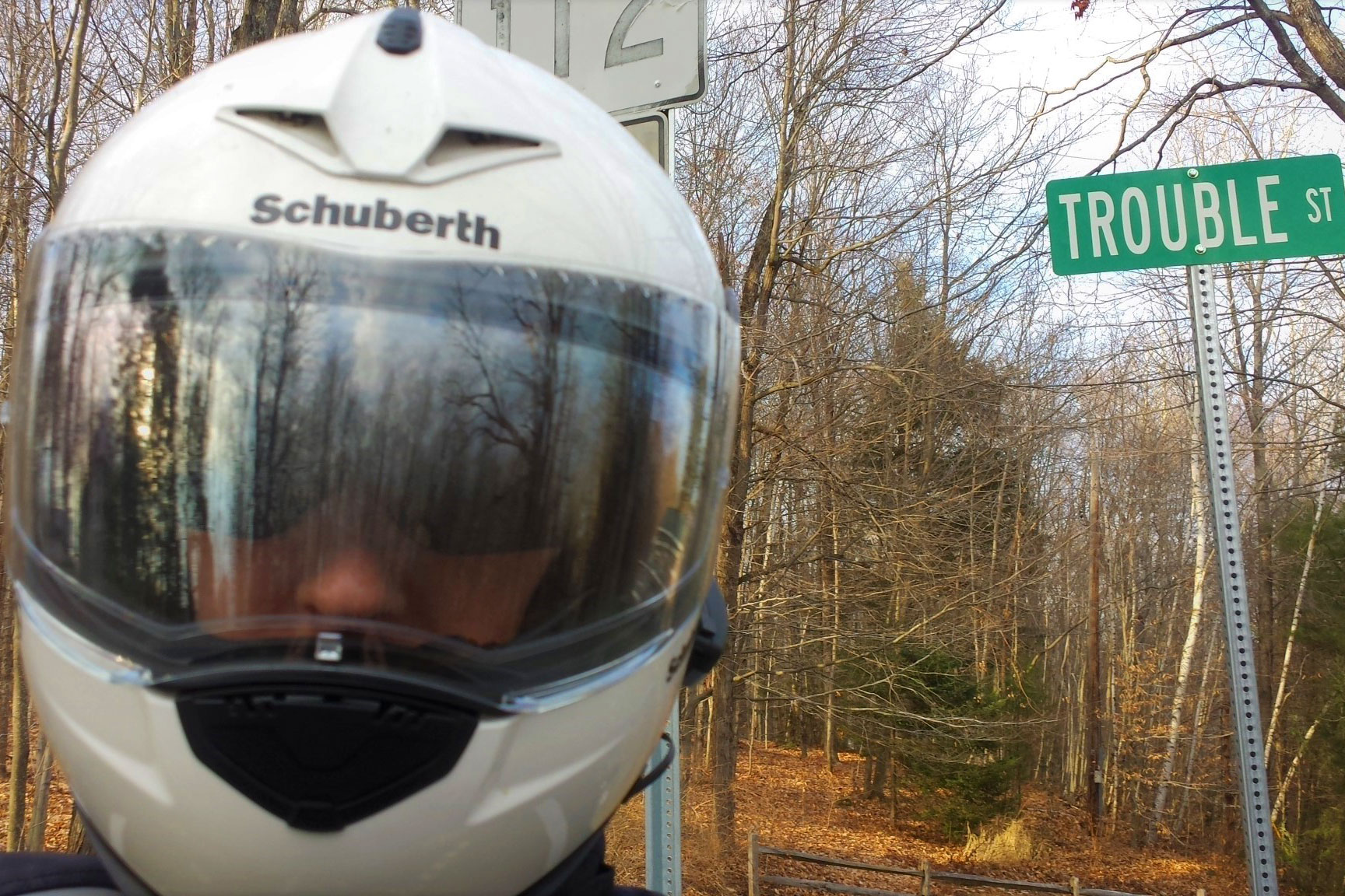
Would you accept an offer of help from this man? Are you sure? (Photos by the author)
Each of us has likely been advised not to judge a book by its cover, but my experience as a motorcyclist confirms that those of us who ride are routinely judged in that manner. It doesn’t help that media and pop culture frequently portray motorcycle riders as noisy bad-ass bikers or reckless crotch-rocket squids.
But that’s not who I am. Friendly, slight of build, and respectful, I am the definition of non-threatening. Have a question? I’m all ears. Need a hand? I’ll help.
When I’m riding, I make a concerted effort to be an ambassador for everyone who rides. I stop for people crossing the road, let other vehicles pull out, and give extra space to those with dogs or horses. Off the bike, I hold open doors, especially for old folks and families with kids. I leave generous tips for waitstaff. I say hi to people in uniform. Honestly, it doesn’t take that much effort, and if non-riders get a good feeling about someone they meet who is riding a motorcycle, the next time they think about a motorcycle they’ll be able to associate it with something positive.
Consider a couple of cases in point. Rides in my home region of Massachusetts often find me at Quabbin Reservoir. One particular day in March, the sky was cold blue crystal as I motored through the reservation. Water cascaded over the 400-foot-long stone spillway, indicating that the reservoir was at capacity. I continued up Quabbin Hill Road and, at the rotary, curved right toward the Summit Tower. From there I could enjoy splendid views of the valley and the mountains beyond. The unpaved parking area was a muddy mess, so I parked at the paved road’s edge behind the lone car there.
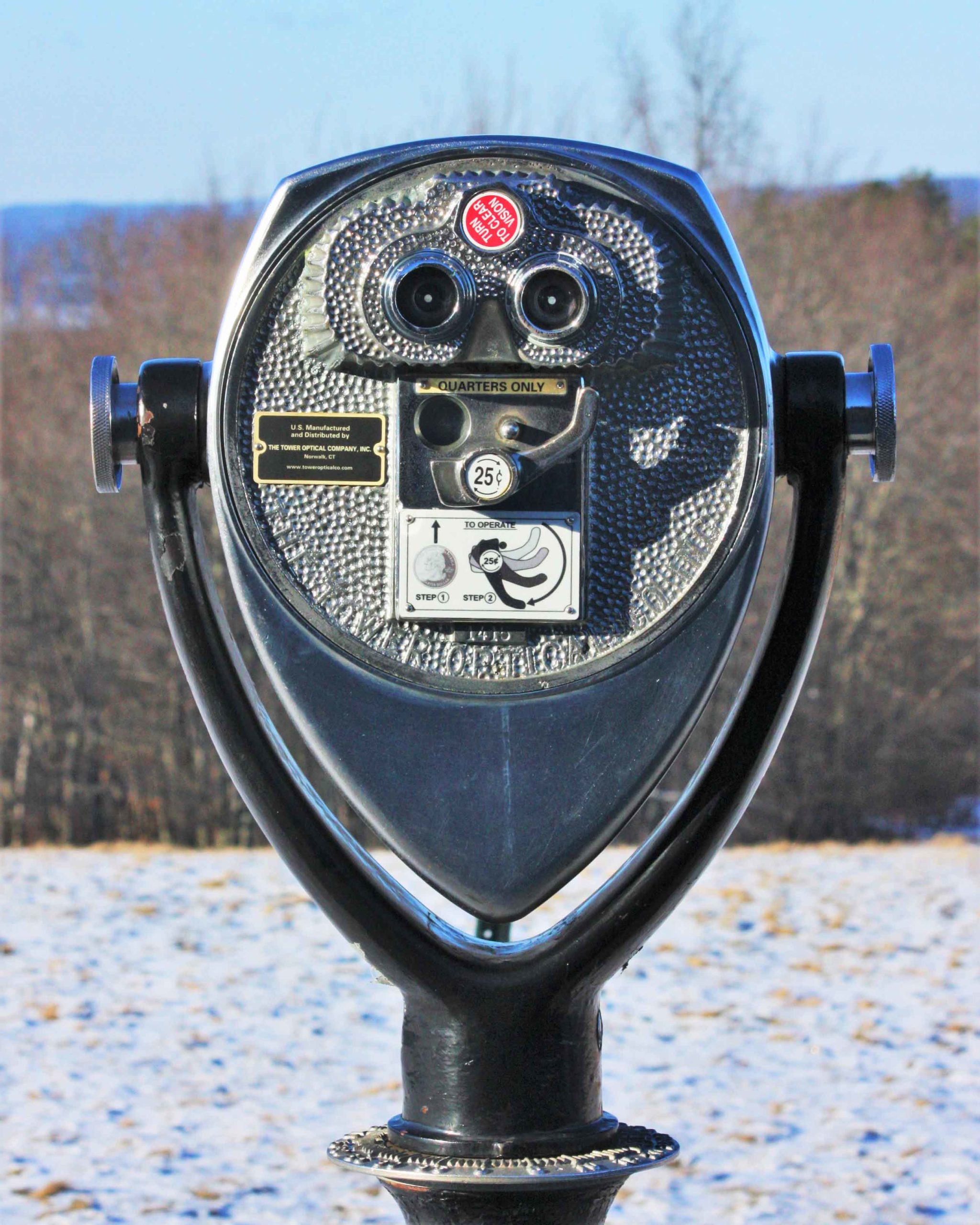
As I walked up toward the tower, a little girl, probably five years old, turned sharply at the sound of her name, looked back at me, then scampered to hide behind her parents. I offered a friendly hello, but my presence was clearly met with suspicion.
Though I gave them space, I couldn’t help but overhear their conversation: The girl was asking her mother for a quarter so she could look through the coin-operated binoculars. “Sorry,” her mom said, “I didn’t bring any quarters.” A hopeful look at her dad was also answered with “Sorry.” The girl’s expression switched from anticipation to disappointment.
Can a quarter change one person’s perception of another?
I had a quarter. I fished it out of my pocket and held it up for the mom’s approval. Looking a bit surprised, she nodded her consent, so I offered the coin to the girl. The youngster flashed a grin and thanked me.
“My daughter is a few years older than yours,” I told her parents. “She always liked looking through those binoculars.” They smiled. Twenty-five cents had changed me from someone best avoided to someone with a daughter.
Stopping to be a good Samaritan has long been my practice, although it has not always been met with appreciation. Several summers ago, while riding in Vermont’s remote Northeast Kingdom, I came upon a minivan parked on the shoulder. A tire was flat, so I pulled over to see how I could help. A young woman and her kids were in the van. I parked my bike ahead, removed my helmet and, keeping back what I considered a respectful distance, offered to help. The driver held up her hands: No! She didn’t know me or whether my intentions were honorable, so I couldn’t blame her.
My family was expecting me back home in a few hours, and I could have just left, but my fatherly instincts were telling me this young family was vulnerable. Another dad who rides once shared with me his story of simply staying on-site until proper help showed up, so even though this driver didn’t trust me to help, I decided to wait until help she did trust arrived.
Sometimes the good Samaritan arrives on a motorcycle.
“I’ve got a family and I’d hate to think of them stranded,” I told the driver, keeping back at that respectful distance. “I’ll just stay here by my bike until a cop arrives.” She was looking right at me but didn’t respond. I went back to my bike and reached into the tankbag for a snack.
It was sometime later when a Vermont state police cruiser, with its distinctive green livery, came into view. I waved my arms and the lights flashed on. The trooper pulled over next to me and got out immediately.
“What’s happening here?” he demanded.
“I saw the van had a flat and stopped to help,” I explained. “The lady said no, but it’s just her and the kids, so I decided to stay until help she trusts arrived. My family is expecting me home in Massachusetts, so I really need to go now.”
The trooper pointed an authoritative finger at me. “Wait here.” He walked to the van, spoke briefly with the driver, then came back. “Thank you for staying,” he said. “Ride safely.” The lady waved at me from the van. I waved back and she smiled. The motorcycle guy had changed from an untrustworthy character to that thoughtful dad who stayed until help arrived.
It rarely hurts to be friendly, especially when we’re out riding motorcycles. That way, people who do not ride might appreciate that those of us who do aren’t outlaws or hooligans by default. They just might realize that motorcyclists aren’t all that different from them. We just prefer to ride.
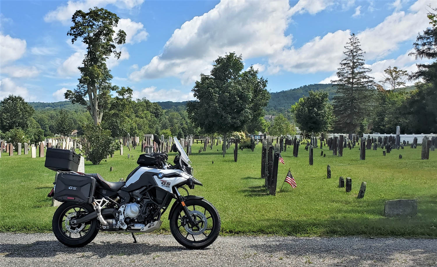
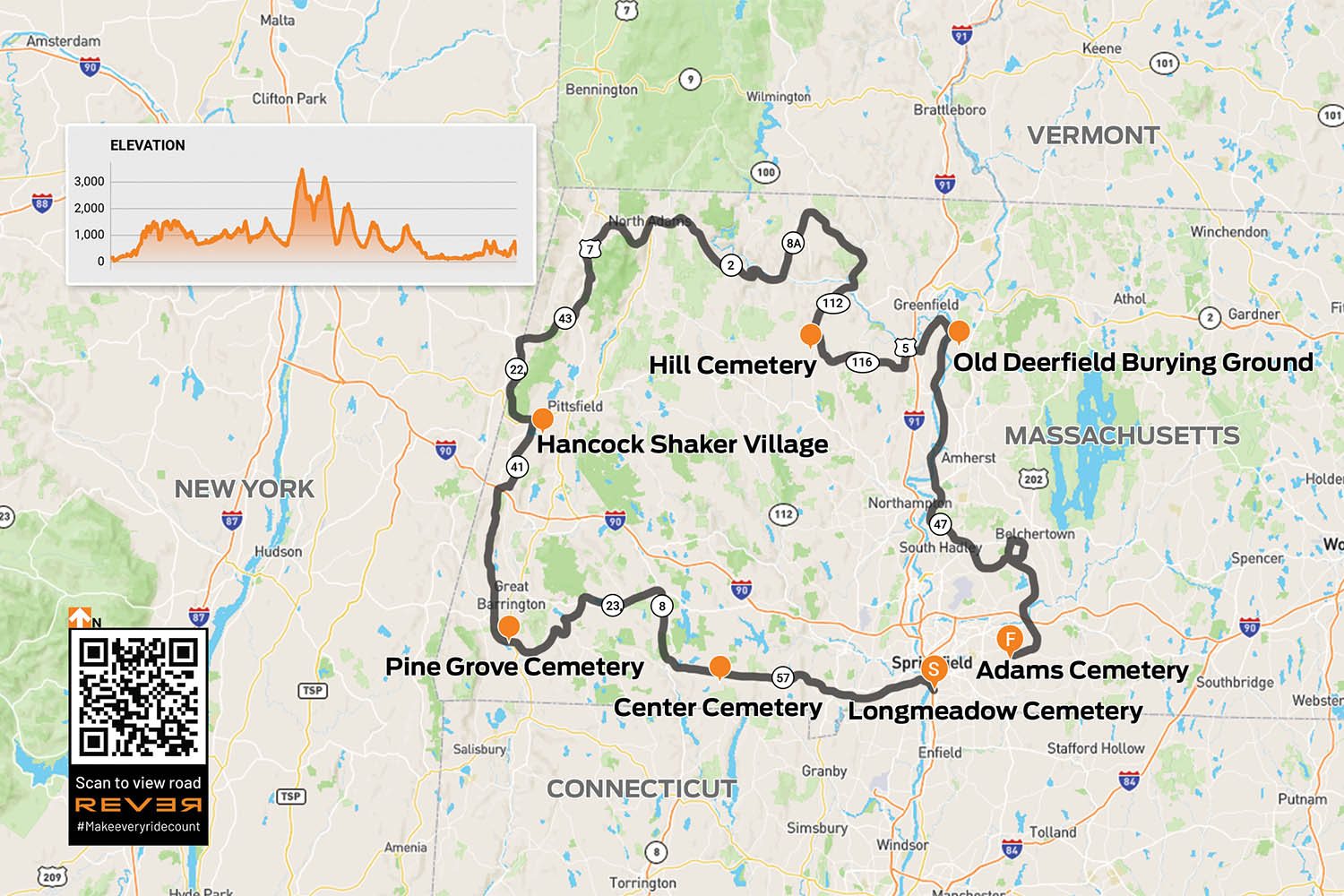
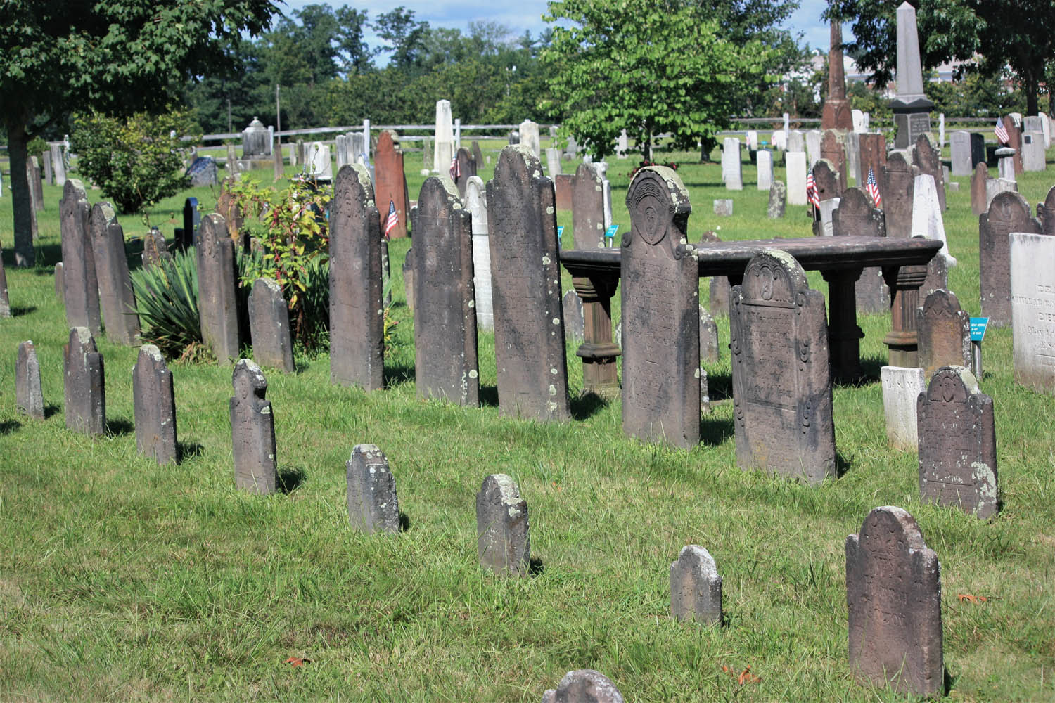
In early New England graveyards, such as Adams Cemetery in Wilbraham, Massachusetts, grave markers are irreplaceable historical documents that tell stories carved in stone. (Photos by the author)
“You’re riding your motorcycle to find graveyards – on purpose?” The conversation with a young police officer on a road construction detail in western Massachusetts was brief, but it motivated me to share why old graveyards are fascinating places to explore.
Rewind to the 1970s. My dad was a college professor whose academic interests included early New England graveyards. On weekends and summer vacations, he dragged my sisters and me along to find them. Long before GPS, such trips often became a quest since Dad’s approach to navigating involved dead reckoning. “I wonder where that road goes?” he’d say. “One way to find out.” It’s fair to say that Dad informed my interest in exploring on motorcycles.
Since Massachusetts has some of America’s oldest communities settled by Europeans, it has some of the country’s oldest graveyards. Three of Dad’s favorites were in the towns of Longmeadow, Deerfield, and Wilbraham, all in the Connecticut River Valley of western Mass. I decide to revisit these graveyards with the benefit of an adult perspective. Since they’re not even 40 miles apart, I extend the ride a couple hundred miles using Dad’s “I wonder where that road goes” approach, and along the way I find other old graveyards to explore.
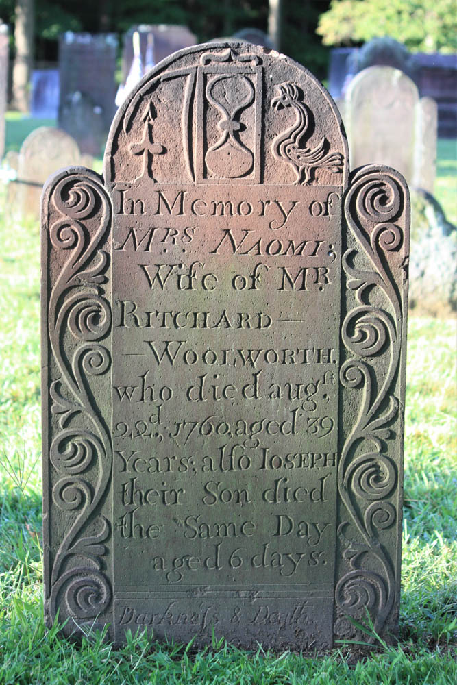
A cut flower signifies death, an hourglass shows time has run out, but a rooster suggests a new dawn.
With eyes looking up and wings, this effigy implies the soul’s flight to heaven.
The ride begins in Longmeadow. Along Williams Street, behind historic First Church, is the Olde Burying Ground, c. 1718, a small section within Longmeadow Cemetery. In old graveyards like this, carvings in stone offer insights into family life, social status, occupations, religious beliefs, sickness, tragedy, and the ways people conceived of death.
The Olde Burying Ground, c. 1718, a section of Longmeadow Cemetery, is the town’s oldest burial ground.
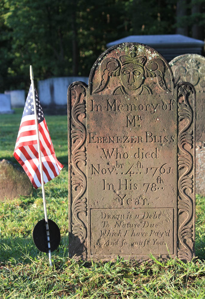
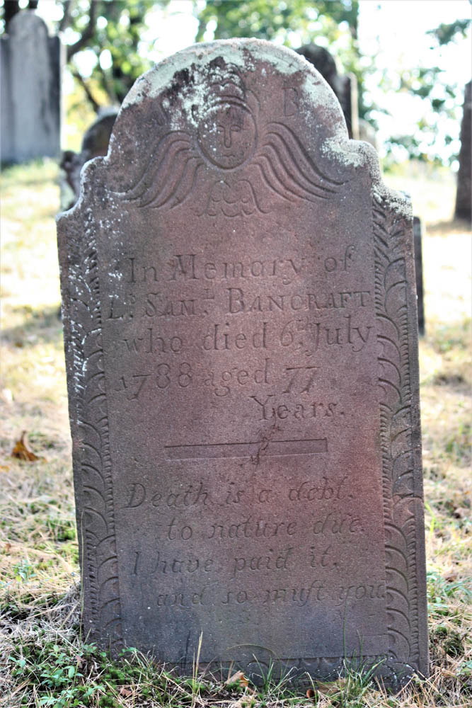
The stone of Ebenezer Bliss concludes with this stark epitaph: “Death is a Debt To Nature Due Which I have Pay’d And so must You.” The nature of one’s death is often explained, such as from smallpox, childbirth, or drowning, although Adjt. Jonathan Burt’s stone leaves us wondering, because he “departed this life in a sudden and surprising manner.”
From Longmeadow, I point my BMW F 750 GS north on U.S. Route 5 across the Connecticut River, then west on State Route 57. To avoid built-up sections of Agawam, I cut through Rising Corner and rejoin 57 past the Southwick fire station. The curves beyond Granville Gorge entice me to quicken the pace, though as I enter the village of Granville a flashing speed limit sign convinces me to roll off.
Center Cemetery, c. 1753, in Granville was located away from the church, a widespread practice at the time.
Up the hill beyond the town hall, I come upon Center Cemetery, c. 1753. As with many old graveyards that are no longer “active” (accepting new burials), one cannot drive into this graveyard, so I park just off the road. Also like many old graveyards, it isn’t next to a church. Some early settlers of New England, notably Puritans, located their dead away from the everyday lives of the living.
The headstone of Lt. Samuel Bancraft, Granville’s first settler, includes a slight variation of the epitaph I saw earlier in Longmeadow: “Death is a debt, to nature due. I have paid it, and so must you.”
This headstone in Center Cemetery includes a variation of an epitaph popular in the era.
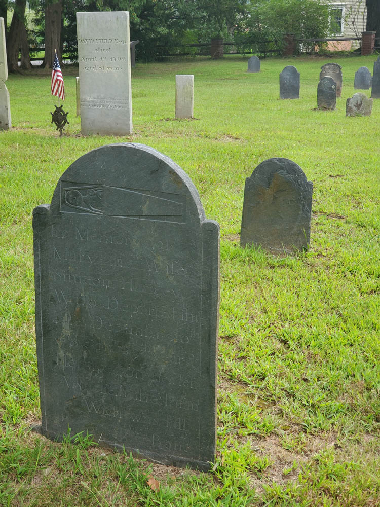
“…on her left Arm lieth the infant Wich was still Born.”
Continuing west, I enjoy several miles of new tar, but on the steep downhill curves to New Boston I am cursing the inventor of tar snakes. Beyond the village, I notice unpaved Beech Plain Road, and a right turn takes me along stands of trees dressed in vibrant yellow fall foliage. There’s not a tar snake in sight.
In Otis, I merge onto State Route 8 north and then lean west onto State Route 23, an entertaining two-lane that hugs the contours of the Berkshire Hills. Past the village of Monterey, I see a sign for River Road. Dad explained that roads of that name are usually curvy and rarely dead end. Right on both counts!
Any dog-loving rider needs to find out where this road goes!
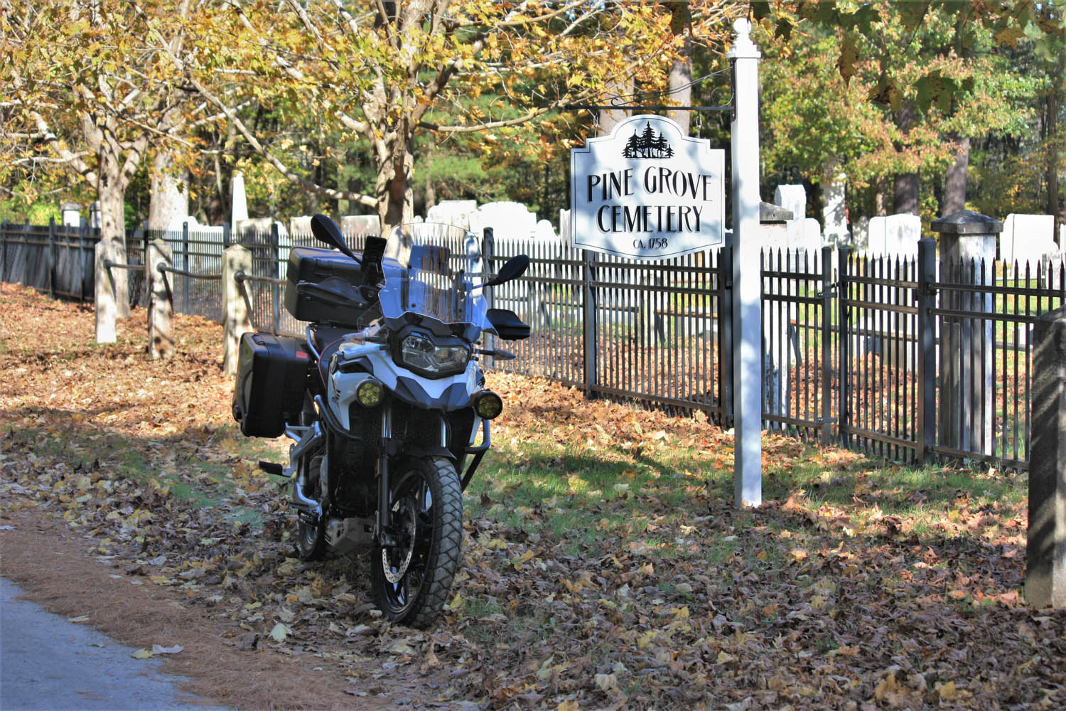
Following a bridge-out detour, I arrive in Sheffield. On the other side of U.S. Route 7 there’s a sign for Bow Wow Road, and being a dog lover, I need to see where it goes. A ways after it turns to dirt, I find Pine Grove Cemetery, c. 1758. I see family plots for Olds and Curtiss and wonder if these graves include ancestors of the automobile and aviation pioneers of those names.
I continue on North Undermountain Road and Pumpkin Hollow Road. At the village of Alford, Center Cemetery, c. 1780, warrants investigation. Among the finds is this pithy epitaph: “Gone not lost.”
Down the road a piece, Bow Wow Road turns to dirt and delivers your humble scribe to Pine Grove Cemetery in Sheffield.
Leaving the town center, West Road gets the nod over East Road, and after a couple turns I’m on State Route 41 riding north through Richmond to Hancock. History buffs can visit Hancock Shaker Village. Shakers were a religious community known for their elegantly functional barns and furniture, and for their devotion to celibacy. (The latter may account for their current lack of numbers.)
Heading west on U.S. Route 20 takes me over the New York border to State Route 22 north and Stephentown. A right on State Route 43 returns me to Massachusetts, having sidestepped Pittsfield’s population center. Another right on Brodie Mountain Road leads to U.S. 7 north. At the five-corners intersection, I turn right onto State Route 43 and follow the Green River to Williamstown, a quintessential New England college town. At the junction of State Route 2, a left leads to lively Spring Street and multiple options for eats and coffee.
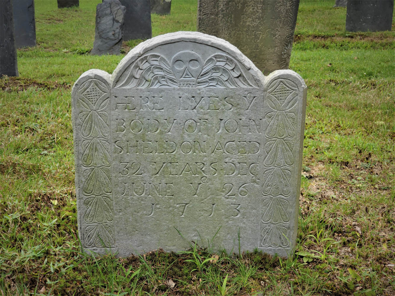
In the 18th century, death’s heads began to soften with angel wings and carvings suggesting life everlasting.
Refreshed and re-caffeinated, I head west toward North Adams and know exactly where to go: up the Mount Greylock Scenic Byway. This technical twist-fest leads to the highest point in Massachusetts (3,491 ft). Rockwell Road winds me down the other side of the mountain, and at the Mount Greylock Visitor’s Center, I turn around to ride the route in reverse. This 30-mile round trip is too much fun to pass by.
East of North Adams, the scenic Mohawk Trail (Route 2) rises through the famous Hairpin Turn, on to the town of Florida, then back down through Mohawk Trail State Forest. Exciting curves and elevation changes are enhanced by the clear autumn day. At Charlemont, I go north on State Route 8A, another twisting gem, to Branch Road, which tracks the west branch of North River east to State Route 112. This two-lane path curves quick and easy south to Ashfield where a left on State Route 116 puts me on a favorite twisty two-lane. But first, I stop at Elmer’s, an eatery popular with locals as well as motorcyclists passing through.
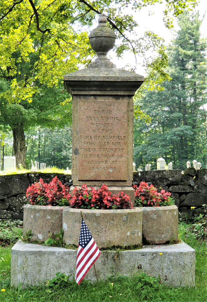
A monument for the War of Nationality, 1861-1865.
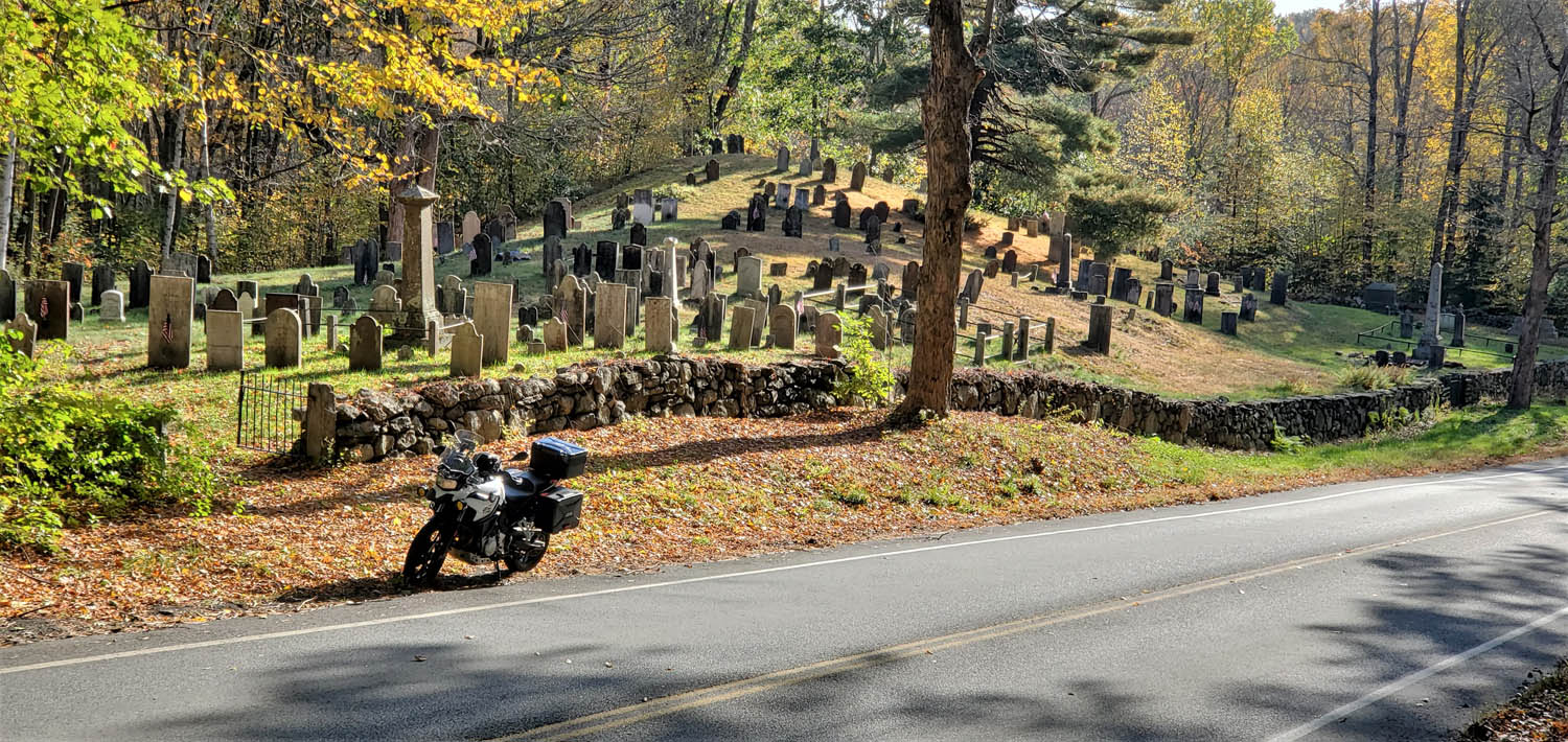
While jawing with some old-timers, I learn there’s a “really old” graveyard I should see on Norton Hill Road. As I pull up to Hill Cemetery, I can tell from the styles of gravestones that it’s no older than mid-19th century, but a war memorial right next to the road rewards the stop. Erected in 1867, it includes this wording: “TO THE EVER LIVING MEMORY OF THE SONS OF ASHFIELD WHO DIED FOR THEIR COUNTRY IN THE WAR OF NATIONALITY 1861-1865.” It’s the only place I have seen the U.S. Civil War described using this term.
At Creamery Road, I turn left toward South Ashfield then savor those curves on 116 to South Deerfield. It’s easy to bypass busy U.S. 5 via Lee Road and Mill Village Road to reach the Old Deerfield historic district. There, at the end of Albany Road, is another of Dad’s favorite graveyards, the Old Deerfield Burying Ground, c. 1690s (aka Old Albany Cemetery).
Some old graves, including these at Adams Cemetery in Wilbraham, are marked by both headstones and footstones, carved with complementary designs.
More than a dozen stones date back to the 1600s, the oldest one for Mary Blanchard, who had 10 children with her first husband, John Waite, and nine more with her second husband, John Blanchard. Notably, this graveyard includes a monument to 47 settlers killed during a raid on the town by native residents and their French military allies on February 29, 1704.
Walking the rows of stones, it’s intriguing to note how the styles have evolved over time. Early carvings with skulls gave way to skulls with wings, then winged angels, and then urns with weeping willows. Few parents still give their newborns names like these: Eleazer, Flavia, Zenas, Temperence, Dorcas, Ithamser, Arrethusa, and Thankfull Experience. Also here is a gravestone for a young woman whose name is hard to read without chuckling: Fanny Forward.
Leaving Deerfield, a short stretch north on U.S. 5 connects to another River Road, this one following the Connecticut River south to Mount Sugarloaf. Beyond the bridge, a right onto State Route 47 south follows the river’s other bank where harvested tobacco fields and the Mount Holyoke Range provide scenery.
It’s fitting that Dad is buried in one of the graveyards that so intrigued him.
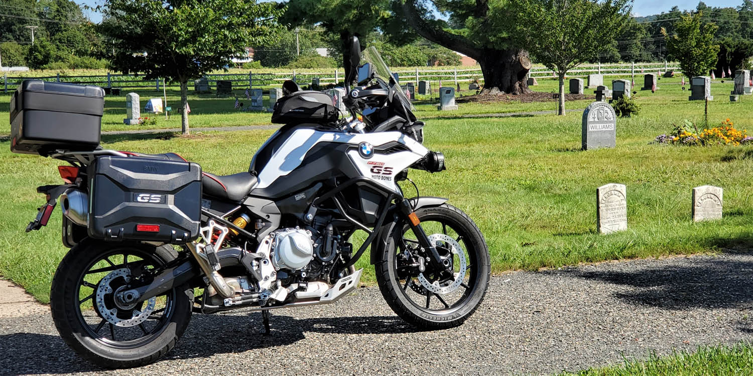
Keeping to roads less traveled, I make my way through South Hadley, Belchertown, Ludlow, and Wilbraham, to Adams Cemetery, c. 1740. Gravestones here include dozens with epitaphs that speak to the difficulty of life and inevitability of death. Consider two:
“Friends and Physicians could not save, My mortal body from the grave.”
“Youth blooming learn your mortal state, How frail your life, how short the date.”
It’s fitting that Dad is buried here in one of the graveyards that so intrigued him – particularly one that is actively preserved and celebrated as a historical resource. Even if the graveyards in your neck of the woods aren’t as old, it’s likely they’re peaceful, beautiful, and interesting places to explore. When you’re enjoying a ride, take the opportunity to experience history in outdoor museums along the way. Explore old graveyards – on purpose.
Above the Amenia Hairpin, this lay-by looks over the New York landscape east of the Hudson River.
Snakes employ astonishing methods of locomotion. Legs? Who needs ’em! Using muscles and scales, snakes hug the landscape as they wind along their way. Roads can be like that, with narrow, winding runs of asphalt that hug each rise and bend.
Snaking asphalt brings joy to this motorcycle rider, and east of the Hudson River there’s a region with plenty of it. This area of small towns, farms and woodlands straddles New York’s border with Connecticut and Massachusetts. The rolling landscape means the roads rarely go straight, and with some route planning it’s easy to avoid population centers. Connecting roads with snake-like curves is the inspiration for this ride.
Roughly in the center of this region is the western Massachusetts town of Great Barrington. It has a picturesque, old-fashioned Main Street neighborhood and interesting options for eats, accommodations and entertainment, so it’s a good base of operations for two routes that begin and end there.
Map of the route taken, by Bill Tipton/compartmaps.com.
My friend Andrew joins me and we’re up early to take photographs in the best morning light. Andrew points out the Mahaiwe Performing Arts Center on Castle Street. Berkshire County, the westernmost part of Massachusetts, is renowned as an arts region, and this historic venue has been a performance site since 1905. One marquee is lit up and the neon calls to be captured.
Mahaiwe (“muh-HAY-we”) Theater on Castle Street in Great Barrington opened in 1905 as a vaudeville house and has presented arts programming continually ever since. A major renovation was completed in 2005.
On Main Street, at the corner of Taconic Avenue, the sun shines brightly on St. James Place. It was built as an Episcopal church in 1857 and by the late 20th century it had fallen into disrepair. But it was renovated and, in 2017, reopened as an arts center with offices and performance spaces.
Built in 1857 as St. James Episcopal Church, the restored St. James Place is now home to several Berkshire arts organizations.
Just south of downtown, we bear right onto Massachusetts State Route 23/41. After a quarter-mile on the left, in a green space next to Silver Street, we find the Newsboy Statue. In 1895, William L. Brown, who was a town resident and part owner of the original New York Daily News, presented it to the people of Great Barrington. I was a paperboy, so it feels right to stop and pay my respects.
The Newsboy Statue pays homage to young entrepreneurs (your humble scribe among them) who spread the news.
When 23 goes right, we stay left on 41 then make a quick right onto Mount Washington Road. It can be hard to find the signs that point the way to Bash Bish Falls State Park, but it’s worth the effort. Turn right onto Cross Road, right onto West Street and left onto Falls Road to the park. Bash Bish Falls is the highest single-drop waterfall in Massachusetts and a short walk from the parking area.
Bash Bish Falls is the highest single-drop waterfall in Massachusetts.
Continuing west lands us in New York, the first of many “border crossings” we’ll be making. We turn left at New York State Route 22, which will make several short appearances throughout our route, then start looking for Under Mountain Road. At U.S. Route 44, we go right and when we reach McGhee Hill Road, begin to meander through sparsely populated areas along serpentine roads.
We curve around Hunns Lake, then in Bangall turn hard left onto Bangall-Amenia Road. A ways on we merge back onto U.S. 44 and pull into the scenic overlook to survey the landscape from a standstill. Just below the overlook — and waiting when we hop back on the bikes — is the Amenia Hairpin, a delightful and downward sloping left curve. Farther along, Halls Corners Road and Chestnut Ridge Road keep us smiling.
Sometimes, snake roads appear to have their own scales.
By the Union Vale Fire House, a right on Clove Road has us winding south and a bit west. U.S. Route 9 eases us to Philipstown, then we turn left onto State Route 301 through Fahnestock State Park. The area ahead is known to local curve-loving riders, and we spot several enjoying it with a mechanical symphony from their bikes’ exhaust.
Back underway we’re on Gipsy Trail Road and County Road 41 to Farmers Mills. Haviland Hollow Road crosses into Connecticut. We wrap around Squantz Pond State Park and back into New York, then roll north through Pawling and Wingdale. At Dog Tail Corners Road we wag left and soon we’re in Connecticut again, crossing Bulls Bridge over the Housatonic River and turning north onto a gently winding stretch of U.S. Route 7 that parallels the river. The quaint village of Kent is a good place for a break, but we make our stop just beyond at Kent Falls State Park to see another great waterfall.
A few miles north is Lime Rock, home to the Lime Rock Park racing circuit. Actor and philanthropist Paul Newman spent a lot of time here, shunning the spotlight, making friends and honing skills that would lead him to the Sports Car Club of America national title (as an amateur) in 1976 and a second place finish with his team at the 24 Hours of Le Mans in 1979. Lime Rock Road goes right past the track, which is quiet today.
Old movie houses like Quirino’s Crandell Theater in Chatham, New York, offer an alternative to the Cineplex.
A right on Connecticut State Route 41 begins the return stretch north into Massachusetts and we arrive back in Great Barrington, leaving 221 snaking miles behind us. I notice that the First Congregational Church, which was in shadow this morning, is now basking in afternoon sun. Built in 1883 from locally-sourced limestone, it’s listed in the U.S. National Register of Historic Places.
Unlike early this morning, Great Barrington’s old-fashioned Main Street neighborhood is bustling now. There are interesting places to eat, shop, explore and spend the night. U.S. Route 7 just north of downtown resembles Anytown, USA, with additional options for accommodations, restaurants and stores, plus a microbrewery.
On such a calm, fair morning, we’re surprised by the absence of pilots at Koladza Airport in Great Barrington.
It’s another early start for day two and another easy roll down Main Street to Massachusetts State Route 23, then right onto State Route 71 and into New York before shooting briefly south onto New York State Route 22 and turning right onto County Road 21. In much of New York, numbered county roads are the roads less traveled, and in this region they embrace the rolling hills and keep me smiling. Sight distances are typically short and forest critters could emerge from anywhere, so I dial up my Spidey senses.
We like that creative use of an inverted curve sign, but wish it was pointing to breakfast.
Crow Hill Road and State Route 203 lead us to Chatham and another still-sleeping downtown. There’s no place open for breakfast yet so we continue to Old Chatham, but the Country Store hasn’t opened either.
My bike’s long shadow reveals how early it is…still too early for breakfast!
County Road 13 snakes through East Nassau and Stephentown, then we curl back west on County Road 16 toward Nassau. A right on Rabie Road curves toward West Sand Lake, then Route 351 goes to Poestenkill and Plank Road goes to Berlin. At State Route 22 we turn north to Petersburg then slither east up Taconic Trail (State Route 2). At the top of the ridge we cross into Massachusetts and wind back down to Williamstown.
Massachusetts State Route 2 cuts through the picturesque campus of Williams College. In front of the Museum of Art, we stop to look at several sets of large, disembodied eyes, sculpted in bronze. I ride my bike onto the sidewalk to set up a photo, and even though no one is around I get the feeling I’m being watched.
“Eyes” by Louise Bourgeios, standing watch next to Goodrich Hall at Williams College.
A short ways on, we turn right onto Luce Road toward Notch Road and the Scenic Byway to the summit of Mount Greylock. On a map, this narrow, 7-mile, seasonal jewel resembles a sidewinder, with successive climbing hairpins. We keep up the revs and power through, while staying alert for trail hikers crossing the road.
From a left at the T, Summit Road rises to the highest point in the Commonwealth of Massachusetts (3,491 feet). Reaching skyward another 92 feet is the Massachusetts Veterans War Memorial, a lighted beacon atop a granite tower, which was completed in 1932 and rededicated in 2017 after a two-year renovation. On a clear day we’d see nearly 100 miles over western Massachusetts, southern Vermont and eastern New York, but today we’re in the clouds.
The Massachusetts Veterans War Memorial rises 92 feet above the summit of Mount Greylock, the highest point in the Commonwealth (3,491 feet).
Also near the summit is Bascom Lodge, built in the 1930s by the Civilian Conservation Corps. Out front I talk with a young couple who are “thru-hikers,” completing all 2,190 miles of the Appalachian Trail, which runs through here. They started in Georgia a few months ago and have a few more weeks to reach the end in Maine. What’s their hike been like so far? “It’s sure a good way to get to know someone,” the young man replies, eliciting a steely gaze and raised eyebrows from his companion.
Back down the mountain, Rockwell Road rewards us with more twisties and hairpins. At the bottom, a right on U.S. 7 and a sharp left on State Route 43 soon has us back into New York and more curvy county roads through Stephentown, East Chatham and Austerlitz. A short run north on New York State Route 22 and then east on State Route 102 returns us to Massachusetts.
Andrew circles (over and over) before Tracy Memorial Village Hall (c. 1913) in Chatham, New York.
Rolling through the village of Stockbridge seems to transport us into a Norman Rockwell painting, and there’s a reason for that. Norman Rockwell lived here, and his experience inspired his iconic scenes of 20th century American life. Fans of his work can go one mile south on Massachusetts State Route 183 to the Norman Rockwell Museum.
State Route 102 continues along the Housatonic River toward Lee and U.S. Route 20, where most vehicles (thankfully) turn into the outlet mall. We continue onto the best stretch of U.S. 20 in Massachusetts, Jacob’s Ladder Trail. The alternating downhill curves going into Chester are downright danceable on a motorcycle, and mellower curves continue all the way to Russell. There, a right on Blandford Stage Road takes the less traveled leg over to State Route 23.
Turning west, Route 23 twists and curls back to Great Barrington, all the way hugging asphalt undulations in that most enjoyable manner: like a snake.
West Branch Reservoir Causeway in Carmel, New York, is the southernmost point in our southern loop.
Mid-morning sun warms Kettle Cove at low tide. Photos by the author.
When New Englanders talk of “The Cape,” typically they mean Cape Cod, the flexing arm of Massachusetts that reaches from the South Shore into the Atlantic. But there’s another peninsula jutting into the Atlantic off the North Shore: Cape Ann. Here you’ll find “America’s Oldest Seaport,” scenic beaches, fresh seafood, stunning vistas and narrow, winding roads connecting it all.
A map of the route taken, by Bill Tipton/compartmaps.com.
The ride begins on State Route 127 in Beverly. You pass the oceanfront campus of Endicott College, where my daughter and money are both going. Each July, Endicott’s ocean-front Misselwood Cottage hosts a Concours d’Elegance, an event that may help you source a vintage Rolls-Royce or Duesenberg for the carriage house at your seaside estate.
Homes built on rocks are common on Cape Ann’s coastline. As my wife likes to say, “That would do.”
As Route 127 winds through Prides Crossing, the region’s rocky geography becomes apparent. Homes are often made with stone, surrounded by stonewalls or built on rock outcroppings. The Singing Beach in Manchester-by-the-Sea presents a fun phenomenon: dry sand that creaks as you walk on it.
In Manchester-by-the-Sea, the lobster boat Diana Lee rests on stands in a yard. After a long Cape Ann winter, it should be back on the water soon.
In Kettle Cove Village, turn right onto Ocean Street to hug the shoreline along White Beach and then Black Beach before rejoining 127. In Magnolia, a right off 127 onto Shore Road takes you past some of Cape Ann’s grandest homes and stunning ocean vistas. The views certainly beat the road. I encountered one section with potholes that could swallow a Buick. “I like the bumps,” a cheerful old woman in front of her home told me. “It keeps people from passing through.” Guess I missed that memo, ma’am.
The elderly woman whose house commands this view came outside. I said, “Sure is beautiful here.” She replied, “The only way I’ll ever leave is in a pine box.”
Beyond those bumps I returned to 127 and found Hammond Castle, where a museum displays inventions of John Hays Hammond, Jr. (1888-1965). Hammond held more than 400 patents, many related to radio remote control. You might thank him next time you change channels from the couch.
Gloucester (natives say “GLOSS-tuh”) calls itself “America’s Oldest Seaport.” Settled by English immigrants in 1623, Gloucester rises above a natural harbor. For nearly four centuries, fishing has been the community’s lifeblood. It’s so engrained in local culture, Gloucester’s high school sports teams are called the Fishermen. An easy self-guided walk (less than 2 miles) takes you through Gloucester’s working waterfront and historic downtown. There’s way more than you can glimpse–or eat–riding by.
Stalwartly facing Western Harbor are two memorials to remind passersby that fishing at sea is a dangerous occupation. East of the drawbridge over Blynman Canal, the Gloucester Fisherman’s Memorial honors 5,368 Gloucester fishermen who have perished at sea since 1623 (officials now peg the total number lost at more than 10,000). The memorial includes “The Man At The Wheel,” a statue commissioned for Gloucester’s 300th anniversary in 1923. The inscription, THEY THAT GO DOWN TO THE SEA IN SHIPS, is borrowed from Psalm 107:23. West of the drawbridge is the Fishermen’s Wives Memorial, erected in 2001 to honor the faith, diligence and fortitude of the wives and families of fishermen.
On Gloucester’s waterfront, the Fisherman’s Memorial honors THEY THAT GO DOWN TO THE SEA IN SHIPS.
Beyond the Cape Ann Whale Watch terminal, turn right onto Route 127A for views of the harbor and also Boston on a clear day, especially from Niles Beach. At Good Harbor Beach there’s a large, flat parking area, a rarity in these parts. During the off-season (October through April), dogs are welcome here on even-numbered days. Today is April 16 and temperatures have spiked into the 80s. Good Harbor Beach is dog utopia and I make several new friends.
A warm, even-numbered, off-season day spells “dog central” at Good Harbor Beach.Boo-Boo, a Bernese Mountain Dog/Golden Retriever hybrid, knows the best time to roll in the sand is when you’re wet.
Next up the coast is aptly named Rockport, for years a major source of granite for the eastern United States. Also historically an artists’ colony, Rockport has a different vibe than Gloucester. The historic business lane down Bearskin Neck, with its galleries, shops and restaurants, reminded me of Harry Potter’s Diagon Alley. Walk onto the breakwater for views of Rockport Harbor. After 127A merges back into 127, drop down to Granite Pier for views of Rockport’s Back Harbor.
If you haven’t needed lunch until now, just past Halibut Point State Park you’ll find the Lobster Pool. This old school, side-of-the-road, on-the-water eatery served me a sumptuous sandwich of yellowfin tuna–seasoned, seared and served rare, as nature intended (drool, drool). The view out back made it taste even better. Manhandling my bike into the one meager parking space that was available proved worth the effort.
The Lobster Pool’s yellowfin is seasoned, seared and served rare, as nature intended.
When 127 ends at the rotary, hop onto Route 128, cross the Annisquam River, and take the second exit to enjoy Concord Street, which cuts and curves through Cape Ann’s interior. The landscape is worlds away from the seacoast route thus far. When Concord Street merges with Route 133, continue into Essex, where more fresh seafood restaurants await. You’ll also find the Essex Shipbuilding Museum and the Essex Riverwalk, both worth a visit.
If you still haven’t eaten–or if you’re ready for more–stop at the Clam Box, an Ipswich institution for more than 80 years. Its tall, angled walls resemble a box of fried clams…hard to miss. Regulars suggest the fried whole-belly clams. A short ways farther, the route concludes at Winthrop Elementary School. Why here? I like the giant dog statue out front.
College Hall, an English Tudor-style mansion, highlights Cape Ann’s ubiquitous stone. Built in 1916 as a summer residence, today it houses the office of the president of Endicott College.
While this ride is just 54 miles, with frequent stops it can take all day. If you ride more and stop less, turn around at the end and reverse course for a different perspective. My advice is to ride here during the off-season. A warm day in April, May, September or October will have less traffic and fewer pedestrians that often clog these narrow oceanside streets in summer.