It’s all scenic. It’s all charming. And it’s all green … except when it’s not, and then it’s even better.
A few days into a trip to the lush forests of northeastern Vermont, we were reminded of Sedona, Arizona. The connection between these two dramatically different climes may at first seem nebulous, but Vermont’s consistent beauty called to mind the time we visited an outdoors outfitter in Sedona and asked, “Which are the most scenic trails?” The jaded clerk responded with a sigh, “All of them. They’re all scenic.” His tone let us know there was nothing to be gained by pressing him for further details. We would have to make our own choices from the seemingly infinite good ones available.

Likewise, trying to narrow down the best scenery in Vermont is a fool’s errand. It would be difficult to make a bad choice. Our adventure riding journey to the state’s Northeast Kingdom took us into what may be some of Vermont’s most remote territory, lending itself beautifully to the pursuit of riding motorcycles down dark, green, tree‑canopied lanes and over roads the likes of which Paul Revere might have traveled in colonial days.
See all of Rider‘s Northeast U.S. motorcycle rides here.

These are Vermont’s northeastern highlands, dubbed the Northeast Kingdom in the 1940s by a former Vermont governor in recognition of the area’s distinct culture and geography. The region lies within the southernmost range of the cold boreal forest of spruce and fir, birch and aspen, which stretches to the Arctic. It’s a place of long winters and short growing seasons where ponds, lakes, and villages nestle in valleys and twisting roads follow clear streams between small granite hills and mountains. Adventure in Vermont, like the New England states themselves, comes in tight and tidy packages, so the remoteness here can be surprising to the traveler accustomed to the vast, open American West.

It was mid‑September, on the cusp of the imminent explosion of fall colors for which this place is famous. Still, there was plenty of sensory stimulation. Besides the inexplicable feeling of navigating these woods in a late summer shower, leaves were beginning to carpet the trail like gold doubloons cast forth from some cosmic seeder. Pungent scents of cut evergreens, vegetation at the end of its cycle, and earth, freshly disturbed by our tires and dampened by the rain, filled our heads with aromas fit for expensive candles sold in artisan shops. Days that started with fog and mist and ended with afternoon showers added mystique and urgency to move along yet held us in the moment, hoping it would never stop.

Eric Milano, owner of MotoVermont (see sidebar below), led our group of a dozen riders from all walks of life. Most were successful in business and seeking another way to enjoy the outdoors. Sailors, skydivers, scuba divers, and racecar drivers, they were here to learn the nuances of adventure riding versus railing through the woods with their hair on fire, replaying the antics of their younger selves.

Our business, D.A.R.T. (Dragoo Adventure Rider Training), is often invited on such tours to coach guests not only on the finer points of riding well over difficult terrain but also the philosophy of leaving behind a legacy of responsibility as we explore on adventure motorcycles, a term that can apply to most any off‑road‑capable two‑wheeled machine with enough legs to make it between fuel stops.

A high priority for adventure riders is respecting landowners and other trail users, helping to ensure trails stay open. There is more than enough joy in smelling the roses (and other flora) while tackling technical trails with natural obstacles. Adventure riders see no need to run loud pipes, ride at breakneck speeds, or travel off trail, risking damage to adjacent lands and hard‑earned relationships.

Our first day together was dedicated to enhancing rider skills, and the second was spent applying them over some of Vermont’s most remote backroads. Many are Class IV roads, barely maintained byways kept open mostly by locals who traverse their craggy, narrow tunnels on snow machines during winter and by motorcycle the rest of the year.

Our troupe traveled west out of Burke Mountain Resort, stopping off at Cafe Lotti in East Burke before turning north and entering the woods and our first Class IV challenge. Cafe Lotti is a homegrown hangout set in a typical aging Vermont building which has no doubt fueled generations of local folk and travelers alike with a belly full of breakfast and a hot cup of craft coffee or tea. It is the perfect meeting spot for adventure seekers of all types, from mountain bikers to adventure riders to cross‑country and downhill skiers.

We left town westbound and turned north into the woods, winding our way past drop lines – pieces of tubing strung between taps in a forest of maple trees like webs from a giant prehistoric and overactive arachnid. Eric stopped at the entrance to a steep, rocky uphill and explained the best options for a successful path of travel. Rain had turned the rocks into slippery entrapments like greased turtle shells, ranging from tiny spotted tortoises to 6‑foot sea turtles.

Most riders made the climb without incident, but one or two forgot their training and sat down or, worse, dragged their feet, losing control and learning the hard way why adventure riders stand up. Steering, suspension, and sight are all improved by standing tall and proud, and this mild lesson was a graphic illustration of just how important it is to do so in the rough.
The onset of rough terrain was the portal to this enchanted Northeast Kingdom, a region mentioned in Patricia Schultz’s book 1000 Places to See Before You Die, which boasts that when the foliage flames in autumn, this may well be the most beautiful place in America. Indeed, it should not be missed. A few years back, we made the trip by motorcycle during the peak of fall color, and years ago, Bill traversed Vermont by bicycle on his way across the northern tier of the United States, a solo journey that permanently pinned this place to his psyche and keeps us coming back.
Our rugged upward trail eventually turned down, and the trail from the top was no disappointment. Sketchy ruts through mudholes, strategically dispersed to reward good judgment in not rushing, kept us on our toes. Most of these roads shed water well and remained rideable, but caution was of the essence. The road continued to undulate throughout the 100‑plus‑mile clockwise loop that would eventually take us back to our starting point.

But first, a stop at Devaney Farmstand near the intersection of Hudson Road and Town Highway 29 outside West Charleston, Vermont. The clouds opened and rain came down in full force as we dismounted and climbed a stairway, ducking into a loft room where lunch had been laid out for us by Bob and Sharyl Devaney. Calzones, fresh corn on the cob, and apple pie awaited. We gobbled down the fare as rain drummed on the roof. Maple syrup, candles, fresh jams, and pies of all kinds added their fragrance to the shop, and antiques and other local trinkets were neatly displayed for anyone wanting a souvenir.
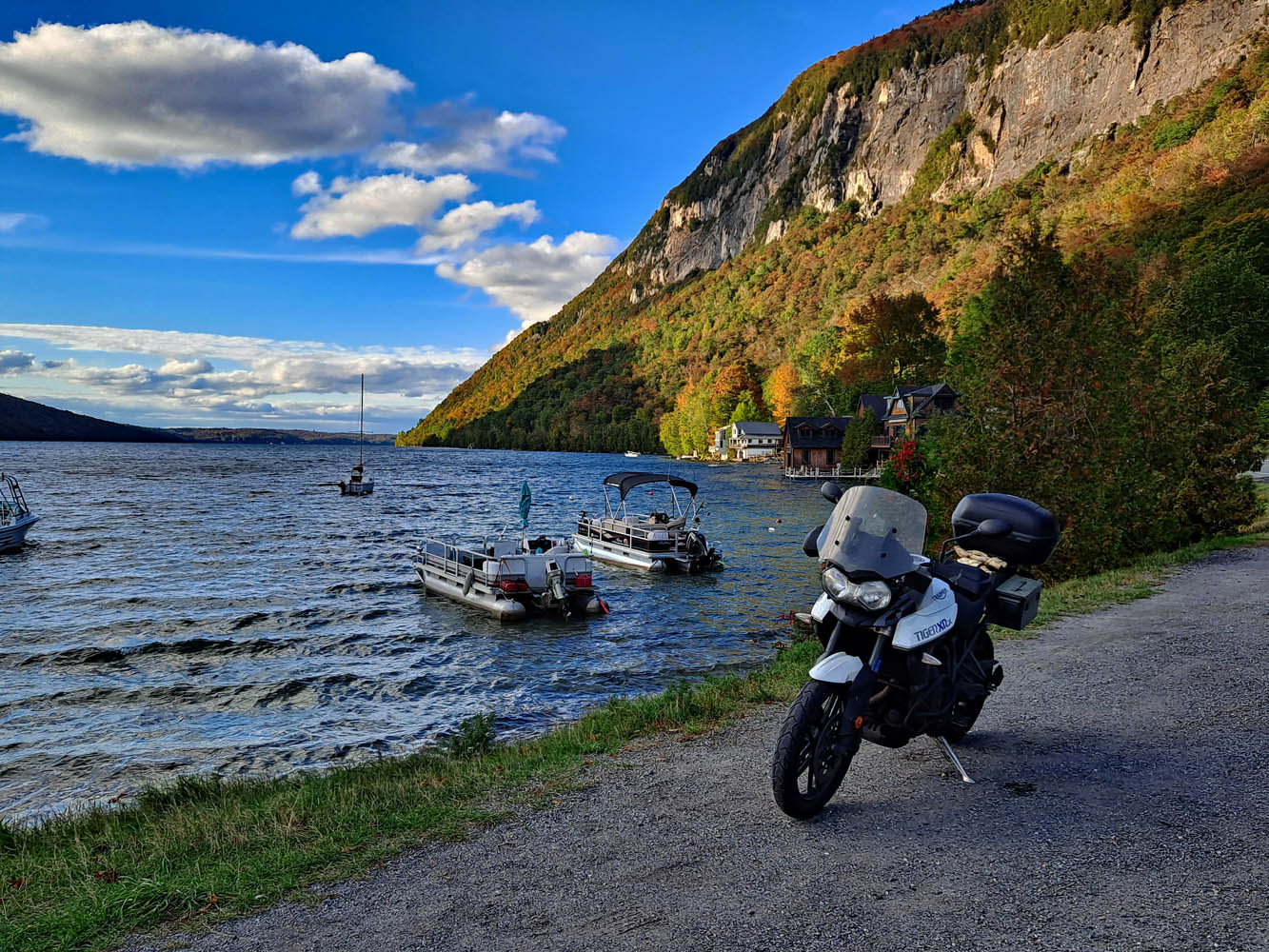
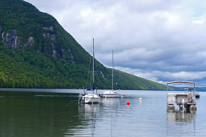
Our timing was perfect. The sun began to peek through the clouds as we said our thank‑yous and goodbyes to the Devaneys and fired up our machines. A short ride on twisty pavement led us back to the reason we were here: more Class IV roads. After skirting the fjord‑like Lake Willoughby, a glacial lake dotted with vacation cabins and summer camps, Eric turned right onto a barely noticeable two‑track trail that climbed steadily toward the mountain top.

Eventually we descended again and crossed an old bridge leading onto a magnificent, fast gravel road following a river through the canyon. Although tempted to open up the throttle, good judgment kept our horses in check, and we ran at a brisk but reasonable pace. Riding right is critical here, as some turns are blind and, as remote as these roads are, we still saw other users. Respectfully, we would hold up five fingers to oncoming traffic if there were five or more riders behind us, then four, three, two, one, and the sweep rider held up a closed fist to indicate he was the last one. Trail etiquette is critical to maintain good relationships with the locals who hold the power to shut us out. We happily demonstrated good stewardship and appreciation for the privilege of exploring their home turf.

We hit pavement just as the rain began again and made our way the last few miles to the resort. Parking under the canopy, we shed our outer gear and immediately began to relive all that had happened in a short couple of days. New friendships had been made and lessons learned. Everyone left with a quiver full of new skills and a renewed appreciation for our freedom to ride, perhaps not by lantern light warning the colonists of the British invasion, but with our own versions of enthusiasm as we explored the Enchanted Kingdom.
See all of Rider‘s touring stories here.
SIDEBAR: MotoVermont
MotoVermont specializes in adventure motorcycle tours, training, rentals, and retail sales. Tours range from day rides in Vermont to week-long adventures farther afield, including New Mexico, Arizona, North Carolina, and other locations. Training events are typically 1-2 days in length with a focus on balance, mastery of bike controls, preparedness, and courtesy. Rental options include the Yamaha Ténéré 700, Kawasaki KLX 300, and Yamaha XT250.
MotoVermont founder and operator Eric Milano is a Backcountry Discovery Routes ambassador and a member of the development team for the NEBDR route. He spends much of his time developing tours and organizing events for adventure motorcyclists. MotoVermont has a retail store in Milton, Vermont, or you can meet them at one of the many rallies and events they attend throughout the Northeast. For more information, visit the MotoVermont website.
SIDEBAR: Burke Mountain Resort

Burke Mountain Resort offers a comfortable stay with great views of Burke Mountain or Willoughby Gap from every suite. Located three miles from the Kingdom Trails Welcome Center, the resort has 116 suites ranging from studios to three-bedroom suites.
Guests can enjoy pub food, craft beers, and cocktails at The View Pub on the second floor, with large windows looking out to Willoughby Gap. Edmund’s Coffee Shop, located in a cozy timber-framed room with stone fireplaces, serves breakfast and coffee. The resort also includes on-site retail shopping opportunities at Bear Essentials and Vertical Drop Retail, with products ranging from basic groceries to home décor and outdoor gear. Other amenities include a heated pool and hot tub, a family arcade, and a fitness center. For more information, visit the Burke Mountain Resort website.

Bill and Susan Dragoo own and operate Dragoo Adventure Rider Training (D.A.R.T.) in Norman, Oklahoma, and are widely published writers, especially in the field of adventure travel. Learn more at BillDragoo.com and SusanDragoo.com.
The post Enchanted Kingdom: Northeast Vermont Motorcycle Ride appeared first on Rider Magazine.
Source: RiderMagazine.com