Tag Archives: Favorite Rides

Riding the ‘Other’ Cape: Cape Ann

Kettle Cove Mass
Mid-morning sun warms Kettle Cove at low tide. Photos by the author.

When New Englanders talk of “The Cape,” typically they mean Cape Cod, the flexing arm of Massachusetts that reaches from the South Shore into the Atlantic. But there’s another peninsula jutting into the Atlantic off the North Shore: Cape Ann. Here you’ll find “America’s Oldest Seaport,” scenic beaches, fresh seafood, stunning vistas and narrow, winding roads connecting it all.

Cape Ann motorcycle ride
A map of the route taken, by Bill Tipton/compartmaps.com.

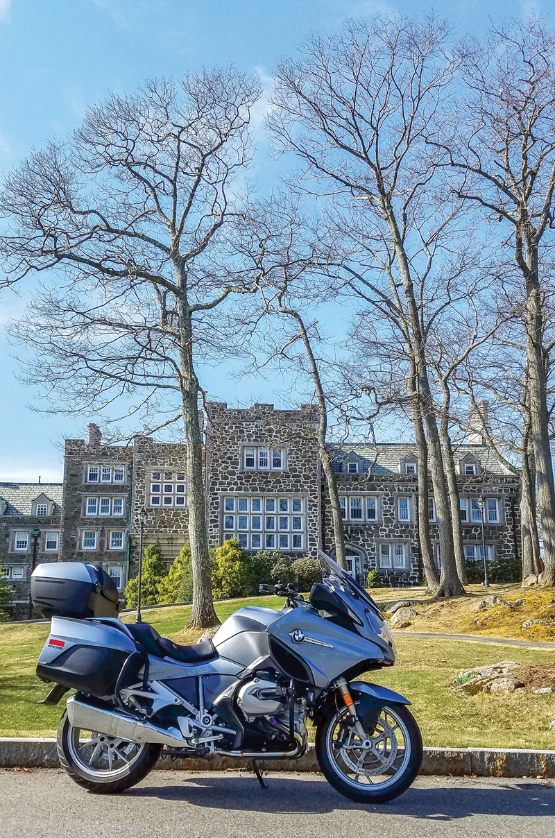
The ride begins on State Route 127 in Beverly. You pass the oceanfront campus of Endicott College, where my daughter and money are both going. Each July, Endicott’s ocean-front Misselwood Cottage hosts a Concours d’Elegance, an event that may help you source a vintage Rolls-Royce or Duesenberg for the carriage house at your seaside estate.

Cape Ann motorcycle ride
Homes built on rocks are common on Cape Ann’s coastline. As my wife likes to say, “That would do.”

As Route 127 winds through Prides Crossing, the region’s rocky geography becomes apparent. Homes are often made with stone, surrounded by stonewalls or built on rock outcroppings. The Singing Beach in Manchester-by-the-Sea presents a fun phenomenon: dry sand that creaks as you walk on it.

Cape Ann motorcycle ride
In Manchester-by-the-Sea, the lobster boat Diana Lee rests on stands in a yard. After a long Cape Ann winter, it should be back on the water soon.

In Kettle Cove Village, turn right onto Ocean Street to hug the shoreline along White Beach and then Black Beach before rejoining 127. In Magnolia, a right off 127 onto Shore Road takes you past some of Cape Ann’s grandest homes and stunning ocean vistas. The views certainly beat the road. I encountered one section with potholes that could swallow a Buick. “I like the bumps,” a cheerful old woman in front of her home told me. “It keeps people from passing through.” Guess I missed that memo, ma’am.

Cape Ann motorcycle ride
The elderly woman whose house commands this view came outside. I said, “Sure is beautiful here.” She replied, “The only way I’ll ever leave is in a pine box.”

Beyond those bumps I returned to 127 and found Hammond Castle, where a museum displays inventions of John Hays Hammond, Jr. (1888-1965). Hammond held more than 400 patents, many related to radio remote control. You might thank him next time you change channels from the couch.

Gloucester (natives say “GLOSS-tuh”) calls itself “America’s Oldest Seaport.” Settled by English immigrants in 1623, Gloucester rises above a natural harbor. For nearly four centuries, fishing has been the community’s lifeblood. It’s so engrained in local culture, Gloucester’s high school sports teams are called the Fishermen. An easy self-guided walk (less than 2 miles) takes you through Gloucester’s working waterfront and historic downtown. There’s way more than you can glimpse–or eat–riding by.

Stalwartly facing Western Harbor are two memorials to remind passersby that fishing at sea is a dangerous occupation. East of the drawbridge over Blynman Canal, the Gloucester Fisherman’s Memorial honors 5,368 Gloucester fishermen who have perished at sea since 1623 (officials now peg the total number lost at more than 10,000). The memorial includes “The Man At The Wheel,” a statue commissioned for Gloucester’s 300th anniversary in 1923. The inscription, THEY THAT GO DOWN TO THE SEA IN SHIPS, is borrowed from Psalm 107:23. West of the drawbridge is the Fishermen’s Wives Memorial, erected in 2001 to honor the faith, diligence and fortitude of the wives and families of fishermen.

Cape Ann motorcycle ride
On Gloucester’s waterfront, the Fisherman’s Memorial honors THEY THAT GO DOWN TO THE SEA IN SHIPS.

Beyond the Cape Ann Whale Watch terminal, turn right onto Route 127A for views of the harbor and also Boston on a clear day, especially from Niles Beach. At Good Harbor Beach there’s a large, flat parking area, a rarity in these parts. During the off-season (October through April), dogs are welcome here on even-numbered days. Today is April 16 and temperatures have spiked into the 80s. Good Harbor Beach is dog utopia and I make several new friends.

Cape Ann motorcycle ride
A warm, even-numbered, off-season day spells “dog central” at Good Harbor Beach.
Cape Ann motorcycle ride
Boo-Boo, a Bernese Mountain Dog/Golden Retriever hybrid, knows the best time to roll in the sand is when you’re wet.

Next up the coast is aptly named Rockport, for years a major source of granite for the eastern United States. Also historically an artists’ colony, Rockport has a different vibe than Gloucester. The historic business lane down Bearskin Neck, with its galleries, shops and restaurants, reminded me of Harry Potter’s Diagon Alley. Walk onto the breakwater for views of Rockport Harbor. After 127A merges back into 127, drop down to Granite Pier for views of Rockport’s Back Harbor.

If you haven’t needed lunch until now, just past Halibut Point State Park you’ll find the Lobster Pool. This old school, side-of-the-road, on-the-water eatery served me a sumptuous sandwich of yellowfin tuna–seasoned, seared and served rare, as nature intended (drool, drool). The view out back made it taste even better. Manhandling my bike into the one meager parking space that was available proved worth the effort.

Cape Ann motorcycle ride
The Lobster Pool’s yellowfin is seasoned, seared and served rare, as nature intended.

When 127 ends at the rotary, hop onto Route 128, cross the Annisquam River, and take the second exit to enjoy Concord Street, which cuts and curves through Cape Ann’s interior. The landscape is worlds away from the seacoast route thus far. When Concord Street merges with Route 133, continue into Essex, where more fresh seafood restaurants await. You’ll also find the Essex Shipbuilding Museum and the Essex Riverwalk, both worth a visit.

If you still haven’t eaten–or if you’re ready for more–stop at the Clam Box, an Ipswich institution for more than 80 years. Its tall, angled walls resemble a box of fried clams…hard to miss. Regulars suggest the fried whole-belly clams. A short ways farther, the route concludes at Winthrop Elementary School. Why here? I like the giant dog statue out front.

Cape Ann motorcycle ride
College Hall, an English Tudor-style mansion, highlights Cape Ann’s ubiquitous stone. Built in 1916 as a summer residence, today it houses the office of the president of Endicott College.

While this ride is just 54 miles, with frequent stops it can take all day. If you ride more and stop less, turn around at the end and reverse course for a different perspective. My advice is to ride here during the off-season. A warm day in April, May, September or October will have less traffic and fewer pedestrians that often clog these narrow oceanside streets in summer.

Enjoy riding the “other” Cape.

Source: RiderMagazine.com

Gila County Loop: A Nice Place to Ride in Winter

Roosevelt Bridge and Sierra Ancha range
Looking east at the Roosevelt Bridge and Sierra Ancha range. Over the mountain is Young, Arizona, site of the famous Pleasant Valley range wars, after which Zane Grey patterned many of his books. Before this was built in the mid-1990s you had to cross the top of the dam on a one-lane road. Photos by the author.

I’ve been thinking about writing this story for a few months, but the inspiration for it goes back every winter for 20 years. About the time Jack Frost arrives across much of the nation, I’m able to just keep riding most days. You can too if you can just get to Arizona. Why here, other than the hospitable winter weather?

In addition to the usual visitor attractions, January in Scottsdale brings the Barrett-Jackson auto auction, for more than a week of gearhead eye candy. February brings Arizona Bike Week. And then there is the riding, and not just the loop I’m going to describe. We do get winter storms in the state, but most of the time the sun and temperatures are motorcycle friendly, reasons enough to trailer, rent or borrow a bike and get out here.

Arizona motorcycle ride
A map of the route taken, by Bill Tipton/compartmaps.com.

This ride I’m going to describe is all country roads, has very little traffic and fantastic views, and stop signs are scarce. I live in central Arizona, so my loop starts in Payson, but it is the same if you start from what we refer to as “the valley,” which is everything around metro Phoenix. Get your kickstands up and head to the East Valley–Mesa and Apache Junction to be exact, taking old U.S. Route 60. Go north at Ellsworth Road and get the heck “out of Dodge,” riding over Usury Pass. This will start you clockwise on the loop. It’s not a high pass, but after the summit you ride downhill with a spectacular panoramic vista of the Salt River Canyon. Whether or not you’ve been out west much, you’ll be amazed at how green the Sonoran Desert remains in winter.

After six or eight miles, take a right at the four-way stop and head east on the Bush Highway. You’ll be headed for State Route 87, but before you get there, you’ll see Saguaro Lake and the marina on the right. If it’s lunchtime stop and get a bite, sitting outside on the patio overlooking the lake. There’s a nice view (yes we do have some water in Arizona).

Tonto National Monumento BMW R 1200 RS
Scenic views forever and this one is not far from the Tonto National Monument, with a visitor center and hiking paths to Anasazi cliff dwellings.

When the Bush Highway ends after a dozen miles, take a right and go north toward Payson. This is a four-lane, undulating mountain road, with a forest of Saguaro cacti and 4WD roads in every direction. Look around for the iconic landmarks of Four Peaks, Weaver’s Needle and countless mountains and washes absent any towns, houses and other signs of civilization. If you’re riding an adventure bike, you’ll find an off-road turnoff shortly after you see Four Peaks to the east (Four Peaks looks like what it sounds like–the four peaks are the highest in the string of mountains).

The dirt road is Forest Road 401/143 just a few miles along State Route 87 (a.k.a. the Beeline Highway). It is actually the shortcut to State Route 188, where we are headed, and it saves at least 20 miles, but of course it’s slower. I would really not recommend it for a road bike. Road-going folks should continue up State Route 87 and turn right on State Route 188 headed south.

Roosevelt Dam
The Roosevelt Dam was built in 1911 and was the tallest masonry dam at 286 feet at the time Teddy visited and celebrated its completion. It was raised to 357 feet in the 1990s right over the old dam.

In less than 15 miles you will approach the north end of Theodore Roosevelt Lake, the largest lake in Arizona. Those long, grand, rugged azure mountains to the east are part of the Sierra Ancha range. On the other side of it lies Young, Arizona, site of the Pleasant Valley wars written about by Zane Grey. The lake is full of trout and bass but that’s another (fish) story altogether. Continue south and there are places to pull over at the impressive dam and arch bridge. Now, if you’re on that adventure bike and addicted to dirt, you can cut the loop short and head back to Apache Junction on State Route 88. Arizona has the audacity to call this a state route, but none of it is paved and parts make you want to really slow down and say “whoa horsey.”

State Route 88 to Tortilla Flats
That arrow above the bike takes you on State Route 88 to Tortilla Flats in what we call the East Valley (of Phoenix). It is unpaved and the state has the audacity to call it a state highway – but great for an adventure bike.

For the road riders, a few miles past the dam is the Tonto National Monument. If you have a pass for the National Park system, you can use it here or pay to see the cliff dwellings and visitor center. Farther south of the lake a few miles is Boston’s Lake House Grill. It’s good for a sandwich and there’s a country store and gas there as well. This whole loop is less than 180 miles, but if it is all new, you just might find yourself stopping so often that it takes a lot longer than usual.

The old steel bridge crosses the Salt River where it fills Lake Roosevelt
The old steel bridge crosses the Salt River where it fills Lake Roosevelt, the linchpin of the five-lake watershed. Cross that bridge and you can travel to Young, Arizona. I just love the 100-year-old steel bridges but they keep tearing them down as fast as they can.

Continue another 30 miles or so to the Globe/Miami junction, meeting U.S. 60. If it’s time to put on the feedbag, there’s an old-time Mexican restaurant, Guayo’s On The Trail, on the left before you get there, or Judy’s Cookhouse is at the intersection where you turn right on U.S. 60. The good ol’ boys and locals go to both, but gourmet dining is unknown in Gila County.

The last westbound segment of the loop runs about 55 miles back to the East Valley. You’ll pass the entrance to the Renaissance Festival, which takes place in March. It’s a great venue to watch guys wearing armor get knocked off their horses with a lance–if watching medieval violence and munching on deep fried turkey legs is your entertainment preference.

Steel bridge over the Salt River
A close-up look of the old bridge over the Salt River. Most of the road to Young is also unpaved, but an easy ride for an adventure bike. The vistas are unparalleled.

U.S. 60 was one of the few roads to Phoenix before freeways and goes through rugged, spectacular, boulder-strewn mountains and canyons. Most of the road hasn’t changed much in 70 years, until you get closer to the valley. This is copper mining country. Putting a four-lane road through here would cost a mighty sum and rural Arizona is poor, so the road just winds its way as best it can. There are some passing lanes if you get stuck behind slow traffic.

If you had a good ride on this loop, there’s more to enjoy in Arizona in winter. I don’t get tired of it and am thanking my lucky stars to have such a pretty place to ride any time of year.

Source: RiderMagazine.com

Favorite Ride: Washington’s Glacier-Fed Jewel

Washington state motorcycle ride
Weaving ridiculously close to Lake Chelan’s western shore at times, State Route 971 serves travelers up a scenic platter of lakefront views. Photos by the author.

When the need arises for a quick, fun jaunt that includes great food, I point my front wheel north through a landscape that at times appears to be from another world, or at least another time on this planet some tens of thousands of years ago. My mid-ride target is to meet my niece Karen and her fiancé Buddy, then proceed to his restaurant in Manson, Washington. Karen owns a salon in neighboring Chelan, so for both of them the busy summer is their bread and butter but they still make time to join old U.B. (Uncle Ben) for a portion of the ride.

Washington state motorcycle ride
Map of the route taken, by Bill Tipton/compartmaps.com.

Starting my loop out of Ephrata, the main north tributary out of town that becomes Sagebrush Flats Road should be cautiously approached…it goes right by the county jail! Just a mile later one can exercise the throttle through rolling fields and abundant sagebrush amid very solitary conditions. This is a pleasant respite from the crowds and traffic that must be endured later through the beautiful areas around Lake Chelan.

With nothing too technical, the “Flats” roll and buck like some of the horses you will pass in their corrals, then crossing a county line it changes name and personality to Coulee Meadows/Moses Coulee Road. More fun; a bit bumpy with a few giddy elevation changes and blind corners making for mildly challenging entertainment. Along this stretch one really begins to experience the terrain, channeled scablands of volcanic basalt and massive cliffs and mesas formed eons ago by continent-wide ice age floods and shifting glaciers.

Washington state motorcycle ride
Near the top of McNeil Canyon Road, riders can catch a glimpse of the alpine calmness of Lake Chelan waiting in the valley below.

Soon you’re on U.S. Route 2, where a short romp through this desolate landscape is still impressive if you like wide-open spaces. Fittingly named Farmer on the map, it consists of only a grain elevator and old grange hall, but provides the only shade for miles around if you need a break from summer heat. More importantly it signals the turn north onto State Route 172, where if you enjoy the sensation of trying to escape earth’s gravitational pull there are a couple of hills that will not disappoint.

Soon you come upon the sign for Lake Chelan, an alpine jewel that in this flat, scabby plateau must make first timers think it is some sort of joke. This initial portion of McNeil Canyon Road teases riders, as it jitters and jigs with a few sharp nineties and chicanes that bring you to a precipice over the gorge. From this vantage one gets a glimpse of the lake below and of the glacial peaks that feed it.

Washington state motorcycle ride
With Lake Chelan as a crazy beautiful backdrop, the welcome to the eastside town of Manson frames our machines nicely.

After plunging like last year’s necklines, the terrestrial cleavage of McNeil deposits travelers onto U.S. Route 97 for a quick crossing of the Columbia via a very old steel trellis bridge, before throwing another fun twist at you as it augers up the Chelan Falls hill into town. This is part of State Route 150, and by following the signs you will end up riding casually (read: slowly) amidst summer fun-seekers through this tourist haven up Lake Chelan’s eastern shore to Manson.

Chelan is touted as the third-deepest lake in the United States–geological surveys record a depth of 1,486 feet, however some locals maintain the lake has no bottom in spots. At 55 miles long and 1 to 2 miles wide it is also considered one of the most pristine bodies of water in North America, with a high degree of clarity.

Washington state motorcycle ride
The best place to eat in Manson, with the proprietor Buddy and his fiancée, my niece Karen.

After a warm welcome at Buddy’s Place and a great lunch, it is time to backtrack to Chelan and work around the southern end to explore the western shore. The up-lake vista invigorates with smooth two-lane that follows the rocky shoreline on State Route 971. The roadside is full of expensive vacation properties and an increasing number of vineyards that ply their wares at tasting rooms and tapaterias. Once broken free of these clinging tendrils of urbanization, the road begins to rock and roll with a shoreline lined with deep green pines decorating steep hillsides and the occasional glimpse of brilliant white glaciers.

After 16 delightful miles we reach pavement’s end at Twenty-Five Mile Creek Campground, situated on a picturesque point that serves as a lovely rest stop. While carefully careening through the woods on the return leg of 10 miles, watch for the Lake Chelan State Park entrance and the rustic Watson’s Alpenhorn Café, where State Route 971 now beckons riders south. Also tagged Navarre Coulee, this fragrant, tree-lined “tunnel” contains sharp hairpins on each end of its nine miles, as if needed to hold its place in the earth’s coiffure. It almost too abruptly bursts out of the shade into a few tight switchbacks before dropping down to meet again with U.S. Route 97A. Once southbound for Entiat, for the next 30 miles you will begin to appreciate the amount of work it must have taken to blast this rugged path from the brown stone mountainsides.

Washington state motorcycle ride
Nearing the end of pavement at Lake Chelan’s halfway point, the views from Twenty-Five Mile Creek Park show alpine lake beauty even in summer.

The Columbia River, harnessed here both for power and irrigation, is your companion as you bend lazily past orchards neatly covering either side’s steep slopes. Segueing directly into the apple-growing outskirts of Wenatchee you follow the signs back to U.S. 2 via the concrete bridge spanning the Columbia. Flowing faster than the river you pass through East Wenatchee along Sunset Highway/U.S. 2/State Route 28 all rolled into one, and eventually rejoin Route 28 heading out of town and back into time.

At least that is what it seems like to me after making the turn north onto Palisades Road. Entering a green, well-irrigated valley surrounded by more of this region’s steep volcanic basalt cliffs, it feels like I am in 1969’s blockbuster film, “Valley of Gwangi.” In the creepy stillness of this gorge I would not be surprised to see a Claymation dinosaur pop its head out of a cave.

Washington state motorcycle ride
The scenery surrounding you on Palisades Road will make you wonder if you should be riding a horse and carrying a six-shooter instead of a motorcycle and cell phone.

Ambling deeper and deeper between emerald colored fields and dusty ranchettes, my mental channel changes and I can just see “The Duke” John Wayne riding up on his horse yelling at me to take cover from the bandits in the cliffs! Oh imagination…fun until the pavement ends, and then that requires most of one’s attention. Though the twisting Devil’s Gulch portion that reconnects us to Sagebrush Flats back to Ephrata has about eight miles of dirt, it is quite navigable and hopes are that soon it will be covered in asphalt.

Whether out for a half day ride to see your “Buddy,” or dinosaurs or The Duke…our favorite rides hold familiarity and yet with each new one, a realm of new experiences and possibilities.

Source: RiderMagazine.com

Favorite Ride: Melodic Montana

Montana motorcycle ride
Riding in Montana is big: big skies, big trees, big rivers and big fun. Photos by the author.

It’s with a nod to the late, great music show host Lawrence Welk that I start this ride spanning a couple of Montana’s scenic blue highways. The bandleader’s famously accented musical lead-in is doubly relevant for this trek. First, this ride will begin and end with music. Second, it will encompass rolling on Montana’s historic Highways 1 and 2. So, without further ado, “Ah one, an’ ah two….”

Montana motorcycle ride
Map of the route taken, by Bill Tipton/compartmaps.com.

Rockin’ the Rivers and Rollin’ on Highway 2

While it is most certainly true that it’s “about the ride not the destination,” having something entertaining to do before and after a ride adds spice to the adventure. With that in mind, my trek starts at the Rockin’ the Rivers Music Festival near Three Forks, Montana. It is not an accident that I found this event in my ride planning as it sits directly on the first of the routes that attracted me to the area. So as I sit listening to the classic rock of the Grass Roots and then Tommy James and the Shondells, my mind wanders to Montana State Highway 2.

Montana motorcycle ride
The Grass Roots echo in the grasslands at the Rockin’ the Rivers Music Festival.

As I leave the festival, my ride on Highway 2 leads me almost immediately to the entrance of the Lewis and Clark Caverns State Park. While I decide not to do any spelunking, I stop long enough to read about the caverns and the fact that the Lewis and Clark expedition camped very close to the cave.

Rolling out of the park, the riding fun begins. The 20-mile stretch of Highway 2 that leads to my night’s lodging in Whitehall, Montana, is a great series of curves that follows the Little Pipestone Creek through an impressive river canyon. It is a nice precursor to what I will experience the rest of this ride.

Montana motorcycle ride
This ride is dotted with historical sites, many of which document the Lewis and Clark expedition.

After a night’s sleep, I gas up in Whitehall and head northwest on the remainder of Highway 2. I roll past farms and ranches through big, sweeping curves. As I continue north, the grasslands morph into high chaparral. The road tightens into some entertaining hairpins as I gain elevation into a pine forested stretch. This is clearly great three-season motorcycle country.

Montana motorcycle ride
The motorcycles in Montana are as diverse as the music.

Ultimately, this pine forest gives way to rich grasslands as I approach the historic mining town of Butte. Before grabbing lunch in a local diner, I ride through Butte’s well-preserved historic district. Amazingly, there are more than 10,000 miles of abandoned mine shafts and tunnels beneath the city. The wealth attained in those mines earned Butte the moniker “The Richest Hill on Earth.”

Montana motorcycle ride
Rivers like the Little Blackfoot make the area around Missoula a fly fishing paradise.

Carving Highway 1 to a Jam in Missoula

A short stretch on Interstate 90 after Butte leads me to the exit for Montana State Highway 1. Signs tell me that Highway 1 is also known as the Pintler Veterans Memorial Scenic Highway and it certainly lives up to that “scenic” designation.

The first thing that catches my eye as I head west on the highway is a huge smokestack in the distance. It turns out that smelter stack is the most notable landmark in the town of Anaconda. It also turns out that the town’s name is prophetic. After leaving Anaconda, the road begins to coil into a serpentine motorcycle playground.

Montana motorcycle ride
The road west of Anaconda clings resolutely to spectacular crimson canyon walls.

As I climb into the Anaconda-Pintler Mountain Range on Highway 1, I stop at several interesting historic sites. Montana does a great job of providing well-written and informative signage for its historic markers. Just as Lewis and Clark’s exploration is well-documented on the route, significant mining windfalls are also highlighted.

Montana motorcycle ride
The author does a bit of map study beside yet another interesting historical marker.

I stop beside the deep blue waters of Silver and Georgetown lakes, which spell the approximate midpoint of this ride on the scenic route. After the lakes, the road coils again as it passes through pines, grasslands and crimson canyons. It’s a very entertaining ride indeed, and the number of motorcycles I meet on the road indicates it is not a secret to riders.

Montana motorcycle ride
Blue waters and blue sky converge at Montana’s high-mountain Silver Lake.

The Pintler Veterans Memorial Scenic Highway ends at Interstate 90. However, I have found that it can pay off in spades to travel frontage roads rather than the nearby interstate. The long frontage road on this stretch of I-90 to Missoula is just such a find. The beautiful tree-lined Clark Fork River separates the interstate from the frontage road, making it seem worlds away. Like so many of the rivers in the area, the Clark Fork makes me think of Norman Maclean’s Montana-set literary masterpiece, “A River Runs Through It.”

Montana motorcycle ride
This frontage road is a nice alternative to riding on the interstate south of Missoula.

When the fun of the I-90 frontage roads ends, there is just a short stretch of the interstate that leads to Missoula. Like Butte, Missoula is a town worth an extended visit. The historic city has a bustling charm that is enhanced by the vibrancy infused by the University of Montana.

Montana motorcycle ride
Pearl Jam rocks the beautiful University of Montana football stadium in Missoula.

As I sit in the beautiful Montana Grizzly Stadium listening to Pearl Jam and watching the sun set on the rolling hills just past the stage, I can’t help but reflect on a great ride. To steal a few song titles from the band, the “Even Flow” of the ride certainly made me feel “Alive.” Or, as Mr. Welk might say, this Montana tour was “wunnerful, wunnerful.”

Source: RiderMagazine.com

Riding Virginia’s Crooked Road and Blue Ridge

Virginia crooked road blue ridge
On the Blue Ridge Parkway at milepost 101, the Ducati makes me look better than in real life. In the background is the Quarry Overlook. This dolomite quarry was started in 1916–twenty years before the Parkway. Photos by the author.

Virginia’s Blue Ridge Mountains in autumn are a place of unique beauty not to be missed, especially from the open cockpit of a motorcycle. From my home in the northern tip of the state, the Virginia border runs diagonally southwest for more than 300 miles, parallel to the ridges and valleys of the mountains.

In the southwest corner are my two ride objectives: the Back of the Dragon, a 32-mile run of elbowing blacktop crossing three mountain ridges, and The Crooked Road, a collection of live music and historical venues along scenic motorcycle roads showcasing the regional specialty: bluegrass music. I also plan to make use of the scenic Blue Ridge Parkway, but only when my ambitious schedule will let me travel at the Parkway’s reduced speed limit of 45 mph.

Virginia crooked road blue ridge
Cars first rambled through this stone tunnel on the Blue Ridge Parkway south of Montebello in the 1930s. I’m sure it didn’t take long for the first motorcycle to follow!

It takes a day to get to my start point of Wytheville, but not without a midday detour along the Blue Ridge Parkway from near Montebello to Buchanan. I share the view at numerous overlooks with other riders, then enjoy lunch on the shore of Abbott Lake beneath the Peaks of Otter. There’s no wondering why the Parkway consistently rates among the top five motorcycle roads in the United States. A rider’s dream, the curvy ridge-top road runs through stone-arched tunnels and next to lakes, campgrounds and lodges–all completely devoid of traffic lights, stop signs and large trucks. Free for public use, the Parkway is open all year except in icy conditions.

Next morning I wake up in Wytheville to a steady rain lingering longer than forecast and wind gusts flexing the glass of the hotel window. I decide to motor circuitously and enter the Back of the Dragon at the north point to allow time for the rain to move out. I take U.S. Route 52 and enjoy a satisfying and twisty climb to Big Walker Lookout, elevation 3,405 feet. Here I find the Big Walker General Store and take a short break to enjoy the terrific views under overcast skies.

Virginia crooked road blue ridge
A group of riders with camping gear rolls along the Blue Ridge Parkway north of the Peaks of Otter, no doubt heading to one of the Parkway’s many campgrounds.

From there U.S. 52 curves downhill, then runs over rolling terrain alongside Interstate 77 for 20 or so miles—then suddenly joins the interstate and punches through a mile of mountain rock at the East River Mountain Tunnel. I then head west on U.S. Route 460 to Tazewell and turn onto State Route 16–the Back’s north entry point. Thankfully, the rain has stopped and the road is mostly dry.

There are neat, steady curves across the first ridge before dropping more than a thousand feet for a two-mile cruise through a gorgeous, Shire-like valley. The road then winds up the face of the second ridge and slices behind towers of leafy kudzu. Then come mile upon mile of pleasing twists along the second ridge before switchbacking downhill into the second valley, a nice break before the final 1,500-foot climb.

My growling and nimble Ducati Multistrada eats up the twisty climb and we loop through bursting autumn colors that surround rocky crests. The road surface is mostly excellent, though I did encounter a little gravel in spots.

Virginia crooked road blue ridge
U.S. Route 52 north of Wytheville takes one last dip to the left before twisting its way to Big Walker Lookout. The excellent road surface seen here is what I encountered on every mountain road on my trip.

State Route 16 continues south through Marion and later connects with U.S. Route 58–I’m now officially on The Crooked Road. Designated by the state of Virginia in 2004, The Crooked Road uses U.S. 58 as a central conduit but includes connected roads leading to festivals, museums and live music sessions, all associated with the heritage of bluegrass and country music.

I’m committed to being at the Floyd Country Store for the Friday Nite Jamboree, so I shortcut there on U.S. Route 221. Time permitting, I recommend an alternate route using the Parkway to Floyd and stopping by the Blue Ridge Music Center near Galax for the live music each afternoon.

Virginia crooked road blue ridge
To get a seat at the Floyd Country Store’s Friday Nite Jamboree you have to get by Barb and Beverly at the ticket counter–I think the five spot is a bargain just for their smiles and friendly company.

The Floyd Country Store is a crown jewel of The Crooked Road. A modest cover charge of $5 gets me in the door. After an initial set of bluegrass gospel, folks are clearing away folding chairs and dancing to the fast-paced syncopation of Katie & The Bubbatones. Many “flatlanders” like myself are simply tapping our feet, but it’s clear that this lively music is still an important way for local folks to unwind after a busy week. On my way out I bag a pastry at the store’s bakery to have with next morning’s coffee.

The sun rises to a chilly but crystal clear morning as I depart Floyd’s cozy Pine Tavern Lodge, a clean and updated hideaway that has continuously served travelers since 1927. A peaceful winding ride on State Routes 8 and 40 takes me through elevated meadows and rolling farms, across small wooded creeks and finally to the Blue Ridge Folklife Festival in Ferrum. You’ll find such festivals along The Crooked Road almost any weekend from June through October.

Virginia crooked road blue ridge
At the Blue Ridge Folklife Festival, metal meets metal and sparks shoot forth when Billy Phelps brings the hammer down. Billy is a Master Blacksmith who has given live demonstrations at the Smithsonian in Washington, D.C.
Virginia crooked road blue ridge
These experts fix the cap arm on a moonshine still. They taught me a lot–alcohol boils off at 172 degrees (a lower temperature than water) so the cap arm catches the alcohol steam for condensation into moonshine.
Virginia crooked road blue ridge
An Amish group set up a donut operation that was nonstop busy. I ate the best donut that I have ever eaten–or will ever eat.

I decide I need a final cruise on the Parkway so I get there by U.S. 220. Once on the Parkway, two groups of motorcyclists are going my direction, and we leapfrog along the Parkway as we take turns stopping at different overlooks. I exit the Parkway for good on State Route 43 for the small town of Bedford, a place that possesses the tragic distinction of losing more residents per capita in the D-Day landings than any other American community. Bedford’s D-Day Memorial is a good, quiet place to reflect on how fortunate I am to be able to traverse through Virginia’s natural, cultural and historical sites before continuing on home–back to the flatlands.

Virginia crooked road blue ridge
Map of the route taken, by Bill Tipton/compartmaps.com.

Source: RiderMagazine.com