Tag Archives: California Motorcycle Rides

Tour Test Review | 2019 Indian Scout

Nipton California Indian Scout
Exploring the tiny community of Nipton, California, will uncover quirky secrets, like this old Chevy-turned-art installation. Photos by the author.

I knew I’d stumbled onto someplace…different…when I pulled into the packed dirt parking lot of the Nipton Trading Post, and it wasn’t just the huge glass octopus sculpture wriggling next to the highway. I rolled to a stop next to the five-room adobe hotel, which was built in 1910, almost startled by the silence after switching off the rumbling Indian Scout.

I could smell the hot, dusty leather of my saddlebags, and was very much aware of the crunching of sand and rock beneath my boots as I stood and swung a leg, stiff from hours of slogging across the desert, over my luggage roll and backrest. My skin tingled – someone was watching me.

For a few fleeting moments I was in another time, a wandering cowgirl who just rode into an unfamiliar – and dangerously quiet – town. A tumbleweed staggered across the empty dirt street to the theme from “The Good, The Bad and The Ugly”…OK, maybe that last bit was just in my head. I doffed my hat – er, helmet – squinting in the harsh desert light, and turned to see that I was far from alone, and yes, I had definitely attracted some attention.

Old West map Nevada
Nipton sits just over the border from the Nevada, on the edge of the Mojave National Preserve, making it a convenient launch point for Las Vegas, Lake Mead and other desert attractions.

Two middle-aged guys got out of a fire engine red ’65 Mustang convertible and were walking toward me, clearly curious about my equally iconic motorcycle. Past them, clustered around the railroad tracks, was a team – posse? – of photographers and assistants, all focused on a blonde woman in a gauzy dress, prancing up and down on the tracks. Based on the tour bus parked in the shade I deduced this was an album cover photo shoot.

I stood for a moment, taking in the rest of the tiny settlement of Nipton: the aforementioned hotel, a restaurant called the Whistle Stop Café, a trading post, a historical marker and a few houses. Farther out in the scrubby desert, past the hotel, I glimpsed a scattering of white teepees, along with a brightly painted old car and what appeared to be metal sculptures. Yep, this is the place.

Trading Post in Nipton
The Trading Post in Nipton offers basic groceries and assorted Southwestern-themed art and jewelry.

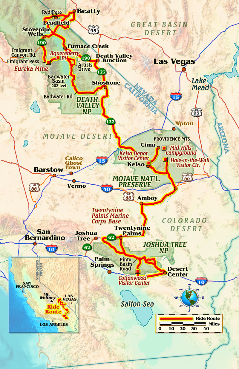
Nipton, California, current population somewhere between 15 and 20 souls, was founded in 1905 as a stop on the San Pedro, Los Angeles & Salt Lake Railroad, which merged with the Union Pacific Railroad in 1910. It feels very much in the middle of nowhere, despite being just 12 miles southeast of the bright casinos of Primm, Nevada, but positioned as it is on a lonely two-lane state highway in the Mojave Desert, it’s definitely off the beaten path.

I was heading to Las Vegas for a karate tournament on a 2019 Indian Scout that we’d outfitted with some touring accessories, and rather than just slab it the whole way I’d booked a night in Nipton. This put me in an ideal position for a nice ride up to the Hoover Dam and then north into Valley of Fire State Park, before dropping into Sin City to get my butt kicked at the tournament.

Nipton California metal sculptures
Metal sculptures are scattered throughout Nipton. This one does double-duty with a swinging chair suspended beneath.

Nipton’s location is convenient for a journey into the desert, be it the nearby Mojave National Preserve, Lake Mead or Lake Havasu, or the motorcycle destination of Laughlin. And its quirkiness appealed: accommodations include the old hotel, little “ecocabins” or, my choice, teepees. The ecocabins and teepees are solar-powered, just enough to run the interior lights and to charge your phone, but there are no TVs. The cabins are heated in the winter with woodstoves and the teepees have little propane heaters, but the weather during my visit in late April was warm enough that the provided blankets were plenty comfortable.

Nipton California teepee
I chose to stay in one of Nipton’s teepees, which are nicely furnished with a comfortable bed, LED lighting, chairs/tables and a small propane heater for chilly desert nights.

I was up with the sun the next morning, wanting to get to Boulder City, the gateway to Lake Mead and the awe-inspiring Hoover Dam, for breakfast. I’d already put 263 mostly freeway miles behind me the day before, and was settling into familiarity with the Scout, which we accessorized with Indian’s 19-inch Quick Release Windshield, sumptuous Desert Tan leather saddlebags and a matching rider backrest. My karate gear took up one whole saddlebag, my street clothes and toiletries the other, so I strapped a duffel across the back to hold my camera gear.

Indian’s Scout (read our full review here) is a Goldilocks weekend tourer for someone my size traveling one-up, with an easy-to-handle wet weight of 591 lbs. (as tested), plenty of cruising and passing power, adjustable ergonomics for reduced or extended reach and a smoothly loping cadence from the liquid-cooled 69ci (1,133cc) 60-degree V-twin that produced little in the way of nuisance vibration.

2019 Indian Scout
We added Indian’s accessory Desert Tan saddlebags and backrest to our 2019 Scout, making it a nice lightweight touring machine.
Indian Scout engine
Liquid-cooled 69ci (1,133cc) 60-degree V-twin is smooth and powerful with no annoying vibes.
Indian Scout Desert Tan saddlebags
Sumptuous Desert Lan saddlebags are genuine leather, with a hard plastic inner liner to help them keep their shape. They’re rather small inside, so I strapped a duffel across the back.

That is, as long as you don’t mind stopping often for fuel; I averaged 46.6 mpg from the 3.3-gallon tank, meaning 154 miles was my limit. In the lonely desert, that translates to “fill up whenever you can,” especially since the analog/LCD instrument lacks both a fuel gauge and fuel consumption data. Otherwise, the windshield causes the fat front tire to wander a bit at times, progressing from a minor annoyance to more a disconcerting experience in a stiff crosswind, but overall I was enjoying my ride on the Scout.

It’s also undeniably pretty, especially in the Indian Red/Thunder Black livery with gold pinstriping and feathered headdress Indian graphics that accentuate the Desert Tan seat, backrest and saddlebags. As I snapped roadside photos at the Hoover Dam, the new Mike O’Callaghan/Pat Tillman Memorial Bridge arcing overhead, many a passing driver’s head swiveled at the bike in appreciation. Completed in 1936, the dam still produces power for California, Nevada and Arizona, although falling water levels in Lake Mead have affected how much it can output. 

Hoover Dam
The Hoover Dam provides power to parts of California, Nevada and Arizona. It’s still possible to drive across, after paying a fee and proceeding through a security checkpoint.

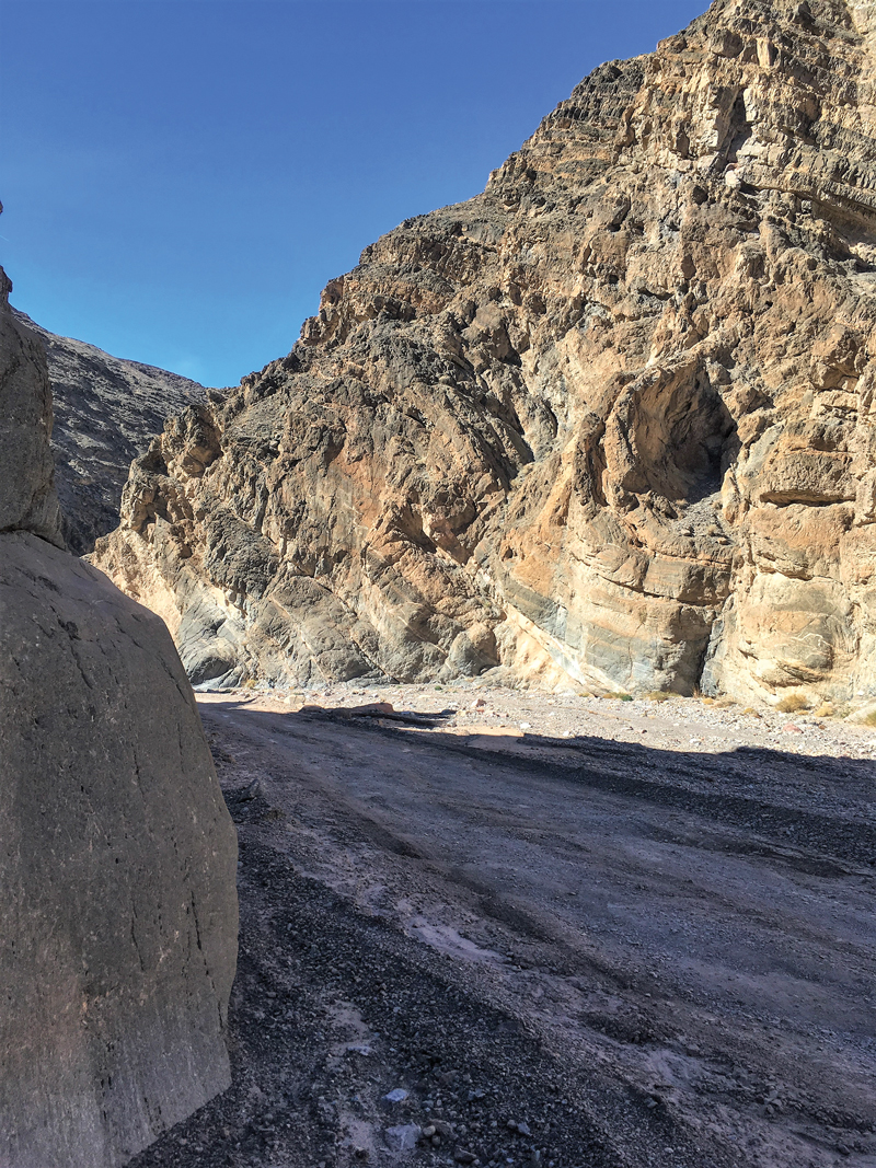
From there I cruised north through the Lake Mead National Recreation Area and then into Valley of Fire State Park. Valley of Fire, as its name suggests, is full of interesting and beautiful red rock formations, and there are plenty of pullouts with picnic tables and hiking trails where you can stop and stretch your legs. I turned north at the Visitor Center for a ride into the heart of the park, the road dipping, climbing and weaving through a Technicolor landscape of eroded sandstone that’s more than 150 million years old.

Lake Mead National Recreation Area
The road through Lake Mead National Recreation Area is smooth and flowing, with vistas ranging from wide-open desert to red rock cliffs to low mountains.
Valley of Fire State Park Indian Scout
Red rock formations in Valley of Fire State Park are an impressive backdrop for the red, black and gold Indian.

Tourist traffic can be heavy, especially through this section, and there are several blind, off-camber turns that can catch you off-guard, so I was happy to putt along and enjoy the scenery, my dance with the Scout a gentle sway. At 5 feet, 9 inches, I found the standard riding position to be comfortably feet-forward; shorter and taller riders may opt for the reduced or extended reach ergo kits to tailor the bike to their needs.

In fact, I was enjoying myself so much that when Scout and I returned to I-15 on the west side of the park, for a moment I wished I could turn north and continue exploring the desert’s hidden secrets, perhaps discovering more gems like Nipton. But I had made a commitment, so south to Las Vegas it was. Still, there are more roads and more secrets to uncover…where should I point my front wheel next?

Nipton UFO
More Nipton discoveries: a grounded “UFO” flies a tattered Stars and Stripes. The sculpture in the background is made of old shopping carts.

2019 Indian Scout Specs

Base Price: $11,999
Price as Tested: $15,804 (paint, windshield, backrest and saddlebags)
Website: indianmotorcycle.com
Engine Type: Liquid-cooled, transverse 60-degree V-twin, DOHC, 4 valves per cyl.
Displacement: 69 ci (1,133cc)
Bore x Stroke: 99.0 x 73.6mm
Transmission: 6-speed, cable-actuated wet clutch
Final Drive: Belt
Wheelbase: 61.5 in.
Rake/Trail: 29 degrees/4.7 in.
Seat Height: 26.5 in.
Wet Weight: 591 lbs. (as tested)
Fuel Capacity: 3.3 gals., last 0.5 gal. warning light on
MPG: 91 AKI min. (low/avg/high) 41.4/46.6/54.4

Source: RiderMagazine.com

Voyage of Re-Discovery in Gold Country and the Sierra Nevada

motorcycle ride Sierra Nevada gold country
We riders enjoy not only the twisty roads and breathtaking vistas in settings such as California’s Sierra Nevada mountain range, but also the crystal-clear air and full range of scents nature pours out. The aromas from this particular combination of flowers, shrubs, grasses and conifers magically swept me back in time to relive some long-forgotten memories. Photos by the author and Katie Lee.

It was the scent in the air that did it, plucking me out of the Suzuki’s seat and transporting me back to the distant past. Not physically, of course. But my brain kept reporting I’d been swept away to relive a fond childhood moment buried deep in my subconscious. Riding along the Sierra Nevada foothills through California’s Gold Rush country, the particular combination of local trees, bushes, flowers and grasses surrounding us made my brain fold back on itself and suddenly I was 11 years old once again, trudging along a dusty wooded path at Boy Scout camp–a surreal moment to be sure. But also a pleasant reminder about the many small, unexpected joys we discover with motorcycle travel.

motorcycle ride Sierra Nevada gold country
The author’s wife Katie poses with the 2018 Suzuki V-Strom 1000 XT they took on the ride.

My wife Katie and I are native Californians but strangely enough we’ve never visited the Gold Country together, nor have we toured Yosemite National Park as a couple. So we started by spending a few nights along State Route 49 in the vicinity of Jamestown, Sonora, Columbia and Twain Harte, an area chockfull of historic sites and a wealth of varied activities–not to mention world-class riding roads. The open road always beckons to motorcyclists, so we riders enjoy striking our own balance between seat time and tourist/vacation activities. For this trip, Katie and I agreed on keeping a distinctly leisurely schedule since there’s so much to do and see in the area, but also because we both wanted to try and find some old haunts from our childhood years.

motorcycle ride Sierra Nevada gold country
A map of the route taken, by Bill Tipton/compartmaps.com.

A hot highway drone north from our Southern California abode brought us to Merced, which served as our jumping-off spot for the good stuff as we traced two-lane roads eastward. We took flat, straight State Route 140 to connect with Route 49 at Mount Bullion on our way to Jamestown. Here, 49 is simply spectacular: fresh pavement, rising and falling twists and turns, and virtually no traffic. In short, riding bliss.

Jamestown gave us a warm welcome, in part due to the hot weather, but this little town offers an engaging, quiet, old-time feel to the place with plenty of stops for refreshments and window-shopping. But here’s the big find: Railtown 1897 State Historic Park with its tribute to steam-powered locomotives. Railtown gives a whole new meaning to the notion of big-displacement iron as the 26-acre park includes historic locomotives, a working roundhouse, belt-driven machine shops and a horde of train-related parts, signs and memorabilia scattered throughout. Steam train rides are available on weekends April through September, and if you’re a film buff you might recognize Sierra No. 3, a steam engine circa 1891 that appeared in many movies, such as “High Noon” and “Back to the Future Part III.”

motorcycle ride Sierra Nevada gold country
Railtown 1897 in Jamestown is a must-see stop for everyone visiting the area.
motorcycle ride Sierra Nevada gold country
Gear heads, history buffs, cinema fans and kids young or old will enjoy riding behind the still-operational steam locomotive from 1891.

Nowadays, nearby Columbia State Historic Park is a working town filled with historic re-creations including a blacksmith shop, an historic saloon, stagecoach rides, a gold-panning stop where you can try your luck and the Fallon Theatre, which still stages performances. We stayed in the Fallon Hotel, one of the two historic hotels still operating in Columbia, but my favorite stop had to be the ice cream shop located right between the hotel and theater. Our biggest disappointment is that we couldn’t stay longer to just soak in the atmosphere. Also close by, the town of Sonora is bigger and busier than Jamestown and Columbia, and offers much more to see and do (and buy!). Twain Harte, in turn, feels small, sleepy and relaxed, so pick the one that best suits your mood.

motorcycle ride Sierra Nevada gold country
In Columbia, we walked out of our lodgings at the Fallon Hotel and just a few steps took us to the stagecoach stop—talk about stepping back in time!

All of these stops proved delightful, but we also scheduled time to just roam around local roads on the V-Strom 1000 too. We both spent our childhood years growing up in the San Francisco Bay Area, and this portion of the Sierra could be easily reached for day trips throughout the year. And so I had to ride up State Route 108 to revisit the place where I first strapped on snow skis, Dodge Ridge. At nearby Pinecrest Lake, Katie and her family spent summer days trout fishing. And up the mountain we stumbled upon the Strawberry Inn, the lodge where Katie’s parents made their first stop on their honeymoon in 1947, on their way to Idaho for more fishing. For no reason at all we decided to go poke around on Old Strawberry Road, which meanders around on the north side of Route 108, crisscrossing the South Fork of the Stanislaus River. Understand that while 108 is a great road for motorcycling, the entire area is laced with miles and miles of back roads that don’t even show up on large-scale maps. It’s fun and easy to set up looping day rides along deserted byways, and again we only wished we had more time to just go see what’s on the other side of the mountain.

motorcycle ride Sierra Nevada gold country
For this trip, we kept a more leisurely schedule and were rewarded handsomely. Taking time to wander down tiny spurs such as Old Strawberry Road led us to isolated little gems such as this spot beside the rushing Stanislaus River. We shoulda brought a picnic lunch along…

Eventually, it came time to literally head over the mountain as we rode Route 108 up and over to Bridgeport in the Eastern Sierra along U.S. Route 395. Although you’re smack dab in the middle of Big Country–Sonora Pass sits 9,624 feet high–it’s only 97 miles between Sonora and Bridgeport with an approximate driving time of 2 hours–no sweat at all on a bike. A portion of this gorgeous expanse of high-mountain goodness suffered greatly at the hands of the huge Donnell Fire in the summer of 2018 and although the scars will last for a long while it’s still spectacular country. A short hop south on U.S. 395 led us to State Route 270 and another California State Historic Park, the gold-mining ghost town of Bodie. The final three miles to Bodie turns from paved road to dirt, which the V-Strom handled easily, even with our two-up load. Once a thriving town of 10,000 people, Bodie is now preserved in a state of “arrested decay,” and no food or gasoline is available so come prepared.

motorcycle ride Sierra Nevada gold country
An entertaining three miles of graded dirt road brought us to the gold-mining ghost town of Bodie.
motorcycle ride Sierra Nevada gold country
The entire site is preserved in a state of “arrested decay” and many, but not all, buildings are open to visitors.
motorcycle ride Sierra Nevada gold country
At its peak, 65 saloons lined the mile-long Main Street in Bodie to serve nearly 10,000 residents.
motorcycle ride Sierra Nevada gold country
Be sure to set aside enough time to cover the area and view the many artifacts and buildings.

Our overnight stop at the Double Eagle Resort in June Lake had us wishing for a longer stay, but early in the morning we rode to the shores of Mono Lake to meet with Nora Livingston, a naturalist and guide with the Mono Lake Committee (monolake.org). Nora shared some of the history and ecology of the area that includes unique tufa tower limestone formations, and an ancient saline lake that covers more than 70 square miles, holding trillions of brine shrimp and alkali flies that nourish millions of migratory birds every year.

motorcycle ride Sierra Nevada gold country
The Mono Lake Committee offers field seminars during summer and autumn; we enjoyed a private mini-tour of this fantastic setting.

From U.S. 395, Route 120 traverses 9,941-foot Tioga Pass as you enter Yosemite National Park, which is indeed one of the greatest natural wonders in the world. Low speed limits and tons of vehicular traffic slow your speeds–so just go slow! You’ll want to take in the awe-inspiring views anyhow, and plan on making lots of stops to enjoy the vistas fully. In fact, it’s best to bring a lunch along so you can just hang out at one of the many scenic pullouts along the way and take in the views. 

motorcycle ride Sierra Nevada gold country
Yosemite’s Hetch Hetchy Valley was the favorite spot for naturalist John Muir, but in 1913 San Francisco was allowed to clear-cut, dam and flood the valley to create a source of drinking water.
motorcycle ride Sierra Nevada gold country
Many gorgeous scenic stops remain throughout Yosemite; this one offered 360-degree views, each magnificent in its own right.

Canny readers will note an ongoing theme lurking in the background of this story: our continuing wish to spend more time enjoying the area. If we could do it all over again each overnight stay would last two nights to allow more time for exploring and whimsical stops. Especially when considering the many incredible secondary roads in the area, we barely scratched the surface. Nonstop twisty, turning mountain back roads, gorgeous mountain scenery and virtually zero traffic outside the main roads in Yosemite. What’s not to like about that?

In fact, maybe next time I can go looking for that old Boy Scout camp I remember so fondly….

Sierra Stopovers

Thanks to some help from the good folks at the Tuolumne County Visitors Bureau (VisitTuolumne.com) and the Mono County Tourism bureau (MonoCounty.org), we tapped into some excellent options for overnight stays, all with plenty of history, atmosphere and memorable surroundings.

motorcycle ride Sierra Nevada gold country

Fallon House in Columbia State Historic Park: Situated right in this California State Historic Park, a night here feels like you’re immersed within a Wild West movie. parks.ca.gov

The Inn on Knowles Hill in Sonora: Sited on a picturesque hilltop overlooking Sonora, this bed and breakfast features lush appointments creating a turn-of-the-century experience, plus a sumptuous breakfast. knowleshill.com

McCaffrey House Bed and Breakfast Inn in Twain Harte: Spacious and well-appointed rooms in a secluded wooded setting, located just off Route 108. mccaffreyhouse.com

Double Eagle Resort and Spa in June Lake: Spacious cabins, spa services and a fly fishing pond for guests up in the high Sierra combines mountain living with full-on resort facilities. doubleeagle.com

Groveland Hotel in Groveland: Modern renovations make this historic hotel a delight, one that’s within easy reach of Yosemite National Park. groveland.com

Source: RiderMagazine.com

Big Deserts, Small Bike: Riding Death Valley, Mojave and Joshua Tree on a Yamaha XT250

California deserts motorcycle ride
Straddling the Colorado and Mojave deserts, Joshua Tree National Park is full of its namesake trees, various species of cacti, rock formations and unpaved roads that take you off the beaten path. Photos by the author.

Rolling through Death Valley National Park, I have an eerie feeling that I am being watched. Passing a road sign indicating that I am below sea level, a glance at the GPS confirms it–150 feet below sea level, in fact! But who is spying on me? Pulling over to contemplate the situation and grab a few pictures of the amazing landscape, I have goosebumps, but it isn’t from the brisk February morning air since I’m wearing heated gear.

I am traveling alone and the uneasy feelings will haunt me throughout my three-week journey. As a birthday present to myself, I’ve hauled my 2018 Yamaha XT250 from Missouri to escape the crummy winter weather and research three desert parks–Death Valley National Park, Joshua Tree National Park and Mojave National Preserve.

California deserts motorcycle ride
A map of the route taken, by Bill Tipton/compartmaps.com.

It’s not my first time here. In the 1960s, my father was stationed at Travis AFB here in California. He always had a scooter or a motorcycle and I was the kid who always darted outside at the sound of the engine. Dad and I loved exploring on two wheels, and now a mental image of him riding a Cushman and wearing an Air Force flight suit is coming into focus. 

In his senior years he enjoyed sitting on the pillion of my Honda Gold Wings, reminiscing about our adventures. Now it’s me in my senior years, the Gold Wings are gone, and I’m finding that motorcycle adventures can be just as much fun on a 250 as they are on an 1800!

California deserts motorcycle ride
Aguereberry Point, perched at 6,433 feet in Death Valley’s Panamint Range, provides an exceptional view of Badwater Basin, the lowest point in North America.

Downshifting now for the upcoming turn onto Emigrant Canyon Road, I negotiate potholes, rocks, sand and dirt as the road ascends past Eureka Mine toward my destination today: the 6,433-foot overlook at Aguereberry Point. Below is Badwater Basin, the lowest point in North America at 282 feet below sea level. Mount Whitney, the highest point in the contiguous 48 United States, resides 85 miles to the northwest.

To get here I’ve skirted decrepit mines and settlements scattered throughout the park. Encompassing 3.4 million acres, Death Valley is the largest U.S. national park outside Alaska, with nearly 1,000 miles of roads providing access to spectacular remote locations–provided you are on a street-licensed machine. A dual-sport is perfect, and an adventure bike can handle most of the unpaved byways.

This park features rugged mountains rising as much as 11,000 feet, deep and winding canyons, rolling sand dunes and spring-fed oases, some of which are accessible on street bikes. But to see today’s sights you’ll need long-travel suspension, good ground clearance, prior off-road experience and the ability to pick up your bike by yourself if you choose to travel alone. There were days exploring these parks that I didn’t see another human being until I returned to pavement.

California deserts motorcycle ride
Due to harsh conditions, with extreme temperatures and months of no rainfall followed by flash floods, only the hardiest plants and animals can survive in the desert.

I chose February for this trip because summer daytime temperatures often exceed 120 degrees and nights remain hot, with lows in the 90s. This winter morning is typical–bright sun, a light breeze and afternoon highs in the 70s in the basin and in the 40s and 50s in the mountains.

One morning I take the fun-to-ride paved and winding Badwater Road south from my campground at Furnace Creek to Shoshone, where I plan to refuel and have lunch. I’ve clocked my fuel-injected XT250 at 70 mph on a GPS, but today I’m limited by the hills and blind curves. It’s 150 miles round trip to Shoshone–doable with the XT’s 2.6-gallon fuel tank and estimated 76 mpg fuel economy, but fuel outside the park is nearly $2 a gallon cheaper! I fill up in Shoshone, which allows exploring several of the attractions along the way, such as the newly paved and unforgettable Artists Drive. The curvy, one-way drive through mountains and canyons displays a colorful palate of ancient claystone. There are several parking areas for water breaks and photography.

California deserts motorcycle ride
Although unpaved backcountry roads provide more adventure and solitude, the well-maintained paved roads through the desert parks offer easy access and beautiful scenery.

My day on Badwater Road and Artists Drive was a highlight of my Death Valley adventure, but the best was yet to come! Having an off-road vehicle allows access to Titus Canyon, a rough, rocky road that is steep and narrow and often closed due to snow, mud or washouts. The one-way entrance is in Nevada and the exit is in California. Twenty-seven miles long, the canyon is infrequently patrolled and summer travel is not advised. Fuel, food and water are available in Beatty, Nevada, six miles from the canyon entrance. The trip to Beatty from my campsite at Furnace Creek was 40 miles. Careful fuel planning is essential, but you’ll be treated to an adventure of steep climbs and descents, colorful rock deposits and fossil beds 30 to 35 million years old. The fossilized skull of a huge, rhino-like Titanothere was found here in 1933.

The highest point on the road, Red Pass (5,250 feet), affords a grand view and a great place for a break. Next up is the ghost town of Leadfield, which “boomed” for less than a year in 1926-27 because the lead deposits bottomed out quickly. All that is left today are a few shacks and a number of mines.

California deserts motorcycle ride
Accessible via Titus Canyon Road, a winding one-way dirt road that climbs over 5,250-foot Red Pass in Death Valley National Park, Leadfield was a mining town that boomed and busted in 1926-27.

California deserts motorcycle rideThe final 1.5 miles of the canyon are narrow; the walls squeeze down to less than 20 feet apart in some places. As the road enters the narrows it descends into the roughest part of the ride, but it’s no big deal for the XT with its remarkable 11 inches of ground clearance and 9/7 inches of front/rear suspension travel. With a 21-inch spoked front wheel, 51 degrees of maximum turning angle and a seat roughly 31 inches above the ground, the canyon is a walk in the park. From there I enter an area of shadow and echoes that make my 250 sound like a 650! Moments later I emerge from the canyon into dazzling sunlight and the conclusion of part one of my adventure.

California deserts motorcycle ride
The final 1.5 miles of Titus Canyon is narrow, squeezing down to as little as 20 feet across, making it vulnerable to flash floods.
California deserts motorcycle ride
Navigating loose gravel in the wash is easy on a light dual-sport like the XT250.

The historic town of Kelso, plopped down in the center of Mojave National Preserve, is some 100 miles south of Death Valley, and connected to the larger park not just by geography, but also captivating railroad history. The fabled Harmony Borax Works in Death Valley desperately needed a rail line to replace the slow and treacherous twenty-mule team route. But one steam locomotive was not capable of hauling heavy loads over the steep two-percent grade at Cima Summit, which meant “helper engines” would need to be stationed nearby to assist locomotives up the 2,078-foot ascent. And, steam locomotives needed water.

There was a reliable water source from a spring in the Providence Mountains, so Siding #16, later renamed Kelso, became the site of the helper engine station that made the route to Los Angeles a reality. In 1924 Siding #16 was refurbished into the handsome Spanish Mission Revival-style depot that stands today as the preserve’s visitor center. If you are a train history buff, plan on spending a couple of hours absorbing the enchanting museum/historic monument.

California deserts motorcycle ride
In the late 1800s, twenty-mule teams transported borax from Death Valley mines to the nearest railroad spur, 165 miles away.

There’s other history as well, including Route 66, which was officially established in 1926 and ran parallel to what is now Interstate 40, which forms the southern boundary of the Mojave Preserve. The Mojave Desert spreads through portions of California and Nevada and very small areas in Arizona and Utah. It encompasses nearly 50,000 square miles and contains most of Joshua Tree and Death Valley national parks.

California deserts motorcycle ride
A member of the agave family, Joshua trees (Yucca brevifolia) thrive within a narrow range of elevation in certain desert regions of the Southwest.

There are also two famous ghost towns: Calico, with several shops and attractions, and Nipton, on the northern entrance to the Preserve, a restored ghost town founded in 1885. Both are reachable on street bikes. Other ghost towns, mining camps, petroglyphs and similar attractions require gravel road travel, including the lovely and quiet Mid Hills Campground. The main campground, Hole-in-the-Wall, is on a paved road. Neither campground has water when I arrive, but I have plenty to last four nights while enjoying the stunning sunsets, sunrises and astonishing starry nights.

California deserts motorcycle ride
Camping is a great way to experience to beauty of the desert parks, where you can enjoy the color and serenity of dawn and dusk.

Eighty miles to the south brings me to Joshua Tree, which is decidedly more developed and touristy than Mojave and more crowded than Death Valley. But then it’s closer to Los Angeles and has fewer roads for visitors to spread out on. It also has magnificent scenery, interesting geology and the famous Joshua trees, which aren’t trees at all but rather yucca plants. On my first day in the park the XT and I tour from the north entrance at Twentynine Palms around to the west entrance at the busy town of Joshua Tree, then follow State Route 62 back to our starting point, a trip of 50 miles, more if you explore the many gravel side roads.

California deserts motorcycle ride
Covering 1,235 square miles, Joshua Tree National Park is slightly larger than Rhode Island.

The next day we explore lovely, curvy, paved Pinto Basin Road down to Cottonwood Visitor Center, near Interstate 10. The dramatic, ever-changing geology is not to be missed. On the way back to my campsite I muse how far XTs have come since I bought my first one in the 1980s–a kickstart, carbureted 350. In that same decade I also discovered Edward Abbey, lover of wilderness, park ranger and author of “Desert Solitaire,” who once sarcastically called his beloved desert a “red wasteland.” Could it be his watchful eyes that I’ve been sensing these past few weeks?

Source: RiderMagazine.com

The Old Way: Historic U.S. 80 and the Wood Plank Road

Plank Road
Travel from Yuma to San Diego via historic U.S. Route 80 and the wood Plank Road, and you’ll see how unforgiving the desert can be. Photos by the author.

Picture a scene in which hearty travelers traverse barren and windswept sand dunes on roads of rough-hewn timbers. I am not talking about some prehistoric time nor am I forecasting a dystopian future. No, my friends, many still-living Americans could tell you of this strange and fascinating tale set in the American Southwest.

I recently happened upon a magazine article that mentioned a wood plank road that spanned the sand dunes linking the southernmost portions of California and Arizona. With my interest piqued, I dug deeper and discovered that the Old Plank Road was operational for more than a decade and was ultimately displaced by a paved portion of U.S. Route 80 in 1926.

Almost four decades later, U.S. 80 succumbed to Interstate 8. Now, the Plank Road is a fascinating, crumbling relic of the early 20th century; however, long portions of Historic U.S. 80 are still passable as an interesting alternative to I-8 from Yuma, Arizona, to San Diego, California.

That was enough for me. I dug deeper into the history of the Plank Road, researched Historic U.S. 80, charted my course and packed the bags on my BMW R 1200 GS. I was off to discover the Plank Road and ride as much of Historic U.S. Route 80 as possible from Yuma to San Diego.

Plank Road
The Ocean-to-Ocean Highway Bridge is the impressive opening act to the Yuma to San Diego trek. The bridge spans the Colorado River, and its 1915 completion date coincides with the Plank Road. Its name indicates its importance in the nationwide, transcontinental Ocean-to-Ocean Highway.

Yuma to El Centro – in Search of the Plank Road

The sun-drenched starting point of my ride was the history-rich city of Yuma, Arizona. Now snowbirds in massive RVs converge on the city in winter like their winged migratory counterparts. However, Yuma was once a centerpiece of the Old West, and has been a transportation hub of the Southwest for more than one hundred years.

I began my trek west at the Ocean-to-Ocean Highway Bridge, which spans the Colorado River in north Yuma. Now on the National Historical Register, the bridge was completed in 1915, which coincides with the early years of the Plank Road. The area directly surrounding the bridge is home to a cluster of historical sites. The Yuma Territorial Prison, which sits directly adjacent to the bridge, was an intriguing walk back into the rough-and-tumble Old West. The close-by Colorado River State Historic Park dates back to the late 19th century and preserves a small number of the Plank Road timbers in a display.

After riding over the Ocean-to-Ocean Highway Bridge, a quick left turn placed me immediately on Historic U.S. 80. The road took me by crumpling adobe structures, over the All-American Canal and through the sandy desert. Whereas nearby I-8 is smooth, wide and boring, Historic U.S. 80 is narrow, cracked, undulating and entertaining. It requires attention and a bit of slaloming to avoid jarring reminders that it is a historic route. The long suspension on the BMW was tailor-made for the unpredictable road conditions.

Plank Road
A ride on Historic U.S. 80 requires vigilance. Sand drifts, potholes and crumbling margins speak to its relegation to secondary status.

After this opening act of my Historic U.S. 80 tour, I rejoined I-8 for a bit. Portions of Historic U.S. 80 are relegated to spur status–they “spur” off of the interstate but terminate without rejoining the new route. One such spur is Grays Well Road.

The Grays Well section of the original route is now a well-paved ingress into the Imperial Sand Dunes portion of the larger geological feature known as the Algodones Dunes. These dunes are what made the Plank Road necessary in the early 1900s. After enjoying a short, beautiful ride through shining sand hills, I came to the site that contains the longest and best-preserved portion of the Old Plank Road.

What I found was a stretch of the Old Plank Road that spans the equivalent of about five football fields in length. The road is protected from potential damage by off-road vehicles with metal, sand-worthy barriers, but visitors can touch and walk the Plank Road section. The road is intriguing. It has weathered and rusted into a heaving work of art.

Plank Road
One can almost hear the rhythmic thumping of Model T tires when visiting the protected section of the wood Plank Road. The vast majority of nearby interstate travelers have no idea that this historic relic even exists.

So why was the timber road ever built? Quite simply, it was commercially important to have a direct route here from the growing and thriving San Diego coastal area to the west. While asphalt and concrete road building techniques of the time worked reasonably well on the harder surfaces of the area directly east of the coast, the shifting sands of the Algodones Dunes posed a huge quandary for road builders.

San Diego businessman Ed Fletcher was the driving force that ultimately led to the construction of the Plank Road. That bumpy, ever-changing, maintenance-intensive endeavor continued as the transportation solution for crossing more than six miles of the dunes from 1915 through 1926.

Plank RoadI walked, touched and studied the Plank Road in solitude. Not a single soul even drove by in the substantial time I spent in the surreal dunes. When I finally pulled myself away, I took another short ride on the interstate before jumping back on Historic U.S. 80 toward the California towns of Holtville and El Centro. The long, straight stretch of the historic road gave me time to ruminate on the Plank Road and the challenges of early travelers.

Much of Historic U.S. 80 runs parallel with and in close proximity to the interstate, but it is worlds apart in terms of traffic and fun. There are remnants and ruins of structures that were left to languish in the desert heat when traffic was rerouted to the newer and faster interstate.

Historic U.S. 80 runs through the hearts of both Holtville and El Centro, as both were supremely important to the commerce and trade of the time. Either of these cities can serve as a gas and food stop on this route; I found a hotel in El Centro just off the Historic U.S. 80 route.

Plank Road
The Cleveland National Forest spans 460,000 acres of desert and chaparral.

Ocotillo to Laguna Junction – on the Winding Road

While fascinating and historically rich, the prior day’s ride was, for the most part, straight. Motorcyclists, by nature, love curves and that is what this next leg of my ride on Historic U.S. 80 had to offer.

After a breakfast of huevos rancheros in El Centro, I made my way to Ocotillo. After rolling through the town, named after a type of cactus, I rode a nicely curvy stretch of I-8 until I came to the exit for the Desert View Tower. The tall, eclectic stone structure, which dates back to the time of the Plank Road, sits on another Historic U.S. 80 spur west of the interstate.

After a short visit to the tower, I crossed the interstate to the south onto a long, intact loop of Historic U.S. 80. The road is instantly winding and remains coiled for miles of highly entertaining riding. The little desert oasis town of Jacumba Hot Springs is home to its namesake spring, a few colorful buildings and a clothing-optional resort. I am sure to everyone’s delight I opted to stay clothed and keep riding.

Plank Road
The GS is right at home with several brethren outside the Jacumba Spa Restaurant.

At a few points along the route, the tall international border “wall” could be seen to the south and there were sporadic signs warning that the region is subject to illegal drug trafficking. However, from the rolling perspective of a motorcycle saddle, there is a slow-paced calm to the area.

I rode through several small clusters of humanity and miles of unspoiled nature toward the Campo Indian Reservation and the Cleveland National Forest. The road conditions are variable and there are sections of concrete as well as reasonably maintained asphalt. However, from a pure riding perspective, I found this to be the most entertaining stretch of the route.

Plank Road
The Jacumba section just north of the U.S./Mexico border is the most curvy and entertaining of the ride.

Laguna Junction to the Beautiful Balboa Park

At Laguna Junction, Historic U.S. 80 runs north of the interstate for a while as it winds to the west. I passed through the small towns of Guatay and Descanso Junction, and the increased elevation of 4,000 feet brought with it a nice mix of oak and pine trees. Where Historic U.S. 80 melds back into I-8, I could see several now impassable portions of the old road in the mountains to my right.

From this point on through Alpine, El Cajon and La Mesa, Historic U.S. 80 flirts with and becomes the interstate and other roads intermittently. The ride in this stretch was much more frenetic and filled with traffic than the rest of the route, and rolled through historic commercial districts and residential communities as the ride became increasingly urban.

Plank Road
The entrance of the stunning Balboa Park is an impressive foreshadowing of the treasures within.

After several miles of this suburban jockeying, I rolled to the end of my tour as I entered the stunningly beautiful Balboa Park. The “Jewel of San Diego” spells the approximate end of the Historic U.S. 80, and a perfect end to the ride. The lush natural environment combined with fantastic museums and entertainment venues like the Old Globe Theater make Balboa one of the most delightful parks in the Southwest.

My final stop was the San Diego Automotive Museum in Balboa Park, which houses a nice collection of historic motorcycles alongside vintage and unique cars and trucks. Fittingly, the museum features a creative display dedicated to the Old Plank Road, which brings it to life and provides a fine overview of this significant part of transportation history.

Plank Road
The San Diego Automotive Museum in Balboa Park features a current exhibition that brings the Plank Road to life.
Plank Road
Historic photos and staged exhibits in the museum show the wonders and challenges of crossing the Imperial Dunes.

Riding Considerations

Being a desert region, this ride is best made from fall to spring. The summer months are sweltering. Road conditions are extremely variable as there are sections of both asphalt and concrete. Potholes, sand and some broken tarmac should be expected. For a detailed series of route maps, visit americanroads.us/ushighways/ushighway80.html.

Source: RiderMagazine.com