Utah’s national parks – Arches, Bryce Canyon, Canyonlands, Capitol Reef, and Zion – are known as the Mighty 5. All feature impressive red rock formations, landscapes, and vistas, yet each is unique. In late September, after the worst of the summer heat and crowds, my wife and I toured three Utah National Parks on a motorcycle.
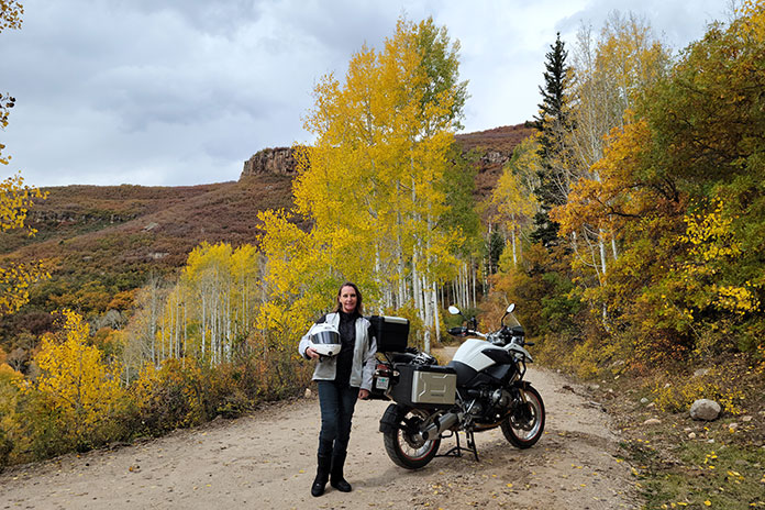
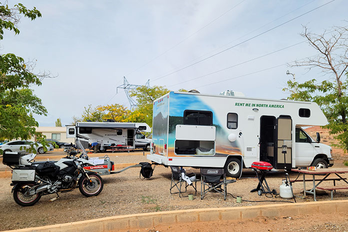
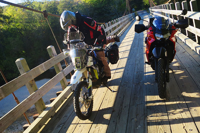
We were coming from California. Younger riders or those with iron butts may choose to endure the entire journey on two wheels, but we prefer burning the hundreds of interstate miles to get there and back in comfort, and we like to bring more for a two-week trip than can fit on a bike. We rented an RV and a trailer, loaded up my BMW R 1200 GS, stocked up on gear, food, beer, and wine, and hit the road from our home in Oxnard.
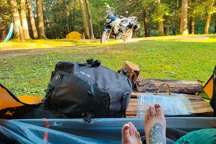
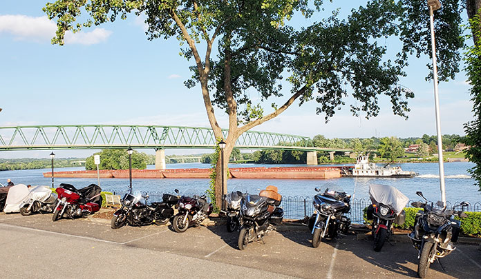
We “glamped” in RV parks, all of which had wide pull-through spots with plenty of trailer and bike parking. Once parked, we saddled up for scenic day rides. Being on a motorcycle made it easier to cruise through the national parks and slip into smaller parking spaces. At the end of each day, we returned to our campsite for a sundowner by the fire. For this trip, we purchased a National Parks and Federal Recreational Lands Pass for $80, which paid for itself upon entrance to our third park and gave us access to other parks for a full year.
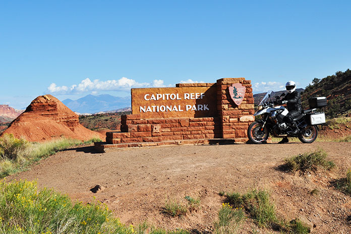
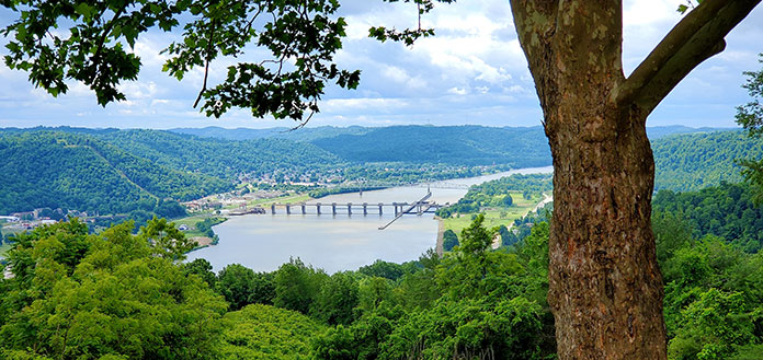
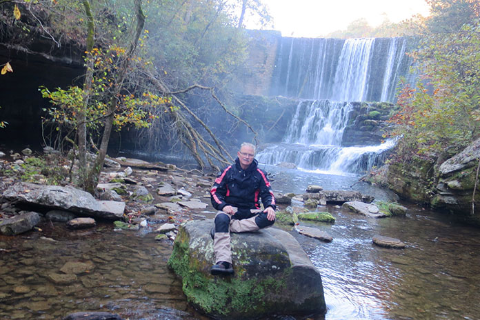
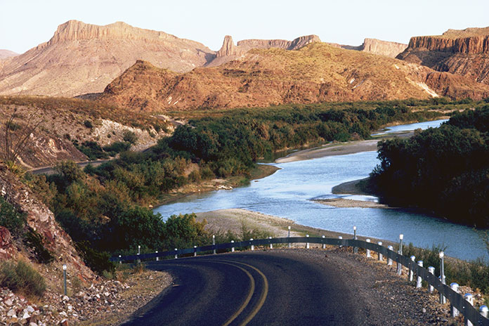
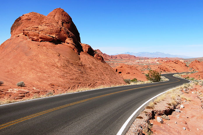
On a perfect 70-degree clear day, we mounted the GS, departed Thousand Lakes RV Park in Torrey, Utah, and rode into Capitol Reef National Park, known for its 100-mile wrinkle in the earth’s crust called the Waterpocket Fold. It was formed as rocks were pushed upward and erosion sliced and diced through the layers, creating deep, narrow canyons and towering monoliths.
Capitol Reef got its name because early settlers thought the Navajo sandstone resembled the U.S. Capitol.
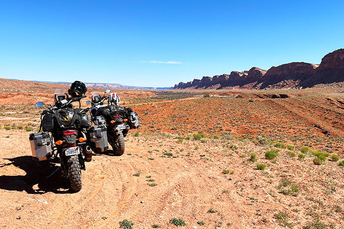
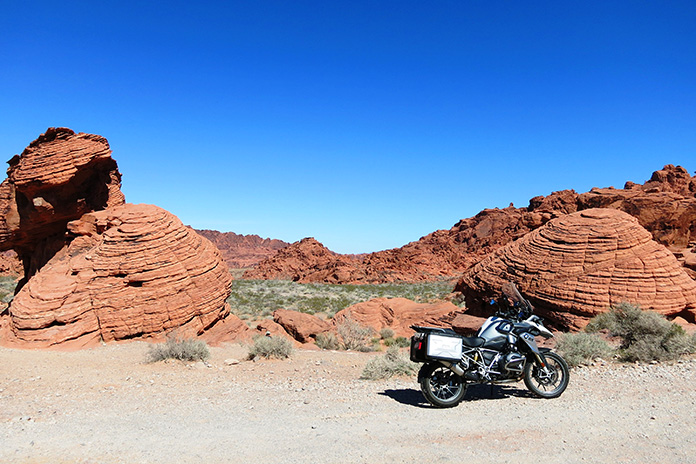
We rode past Panoramic Point down a short washboard dirt road to Goosenecks Overlook. I changed the GS’s suspension setting to Comfort mode and promptly received a “Thanks, Babe” from Nicole via our helmet comms. The view from Goosenecks Overlook of the river below and the slender S-curve it cut into the canyon was splendid.
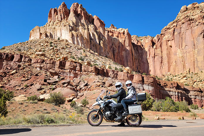
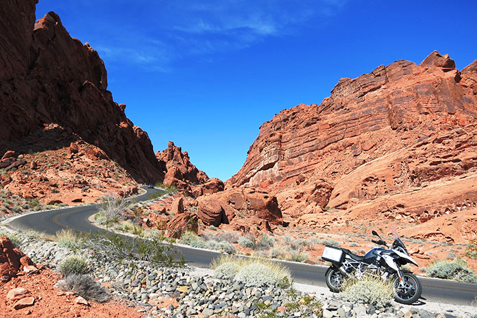
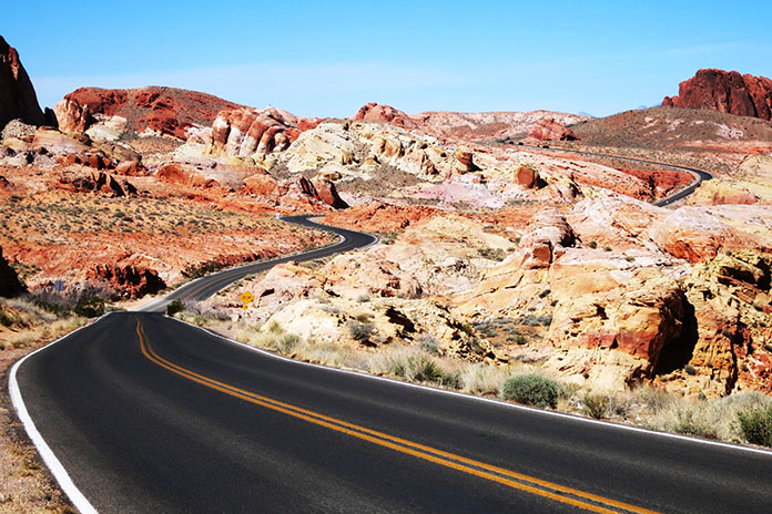
Continuing into the park, we turned right at the visitor center onto Capitol Reef Scenic Drive, a paved road that turns to dirt after 8 miles at the Capitol Gorge Road picnic area. There is so much to see in all directions that we poked along at about 20 mph. Coming back, we turned onto a bumpy 2-mile dirt road and rode through a couple dry washes to the Cassidy Arch trailhead and Grand Wash. I checked the horizon for storms, as even distant rain could quickly make those washes impassable. The scenery as we approached the trailhead changed dramatically, making the detour a must-do.
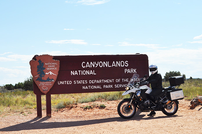
Utah National Parks on a Motorcycle: Canyonlands
From Grand View Point in Canyonlands, the Colorado River and Green River canyons look like a giant chicken footprint in the plateau.
Due to a late start from our campsite at the Sun Outdoors Arches Gateway in Moab, we were turned away from Arches because it was at capacity. Even in the “shoulder” season, high-traffic parks like Arches fill up early, so depending on when you go, plan ahead and reserve a timed entry ticket. Even though Canyonlands is only a few miles from Arches, it gets much less traffic, so we headed there instead.
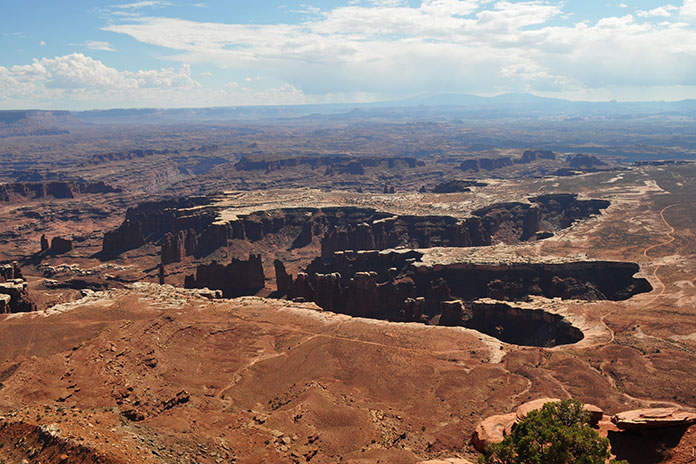
Canyonlands is made up of three districts: Island in the Sky (which we visited), The Needles, and The Maze.
We had to wait to get into Canyonlands too, but Nicole and I passed the time by chatting and digging into our bag of snacks. Following the requisite snapshot at the park entrance sign, we proceeded along the huge flat-topped Island in the Sky Mesa and the 34-mile roundtrip paved road that connects the panoramic viewpoints. These overlooks are 1,000 feet above the surrounding terrain, so the views are spectacular.
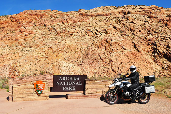
Utah National Parks on a Motorcycle: Arches
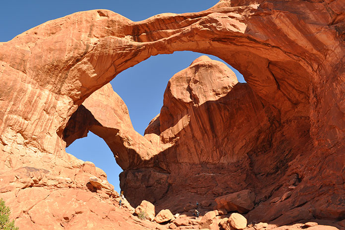
Double Arch in Arches National Park is a pothole arch formed by erosion from above.
A much earlier start the next day paid off. We began the tour of Arches at The Windows Section, home of Double Arch, the Parade of Elephants formation, North Window, and Turret Arch. We brought shorts and tennis shoes to comfortably walk amongst the sites, as well as a picnic lunch. My favorite was Double Arch, a pothole arch with a span that’s 144 feet wide and 112 feet high formed by water erosion from above rather than more typical erosion from the side.
A brisk 10-minute walk took us to North Window, standing 93 feet wide and 51 feet high, where we stumbled upon a group of local grade-schoolers with canvas and paintbrushes in hand, tapping into their inner artist. “Don’t get too focused on the sky, or you’ll end up with too much blue in your painting,” advised their teacher. We continued on and then enjoyed the solitude and scenery of the Windows Primitive Loop trail.
Arches fills up fast, so get there early.
Back on the bike, other highlights included the Garden of Eden, Balanced Rock, and Wolfe Ranch, which is located at the trailhead that leads to the famous Delicate Arch featured on Utah license plates.
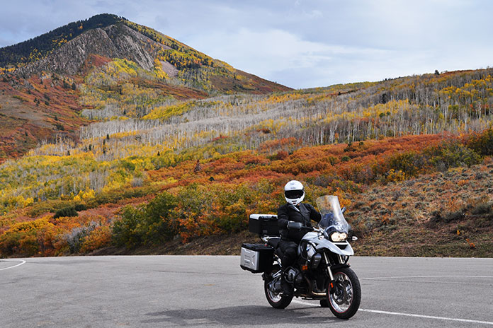
On a cloudy 62-degree morning, we followed U.S. Route 191 south out of Moab and made our way to La Sal Loop Road, a winding paved route that climbs up into the La Sal Mountains. The temperature dropped and it began to rain, but luckily the road turned away from the storm.
Moab serves as a great base for scenic day rides. After visiting Canyonlands and Arches, we climbed out of the valley on La Sal Loop Road, where we enjoyed the fall colors of the aspens.
“Are you warm enough?” I asked Nicole, and when she answered in the affirmative, we pressed on. Just beyond the parking area for Mill Creek, we turned right onto Forest Road 076 toward Oowah Lake. This bumpy, rutted dirt road challenged me with sharp corners, steep climbs, and wandering bovines, but we were rewarded with the fall colors of the aspens.
We took this dirt road of the main La Sal Loop Road in order to get to Oowah Lake.
We continued our counterclockwise ride on La Sal Loop Road. We stopped at La Sal Lookout Point, which provides sweeping views of Castle Valley and red rock formations that look like the inspiration for the old cartoons with the Road Runner and Wile E. Coyote. A steep descent with multiple switchbacks took us down to the warmer air of the valley floor. At State Route 128, we turned left (west) and followed the Colorado River on our way back to Moab.
RV camping allowed us to travel in comfort.
With so much great riding and scenery, we were reluctant to leave, but our allocated vacation time was coming to an end, so we packed up and headed home. Southern Utah is a stunning part of the country that should be on everyone’s must-see, must-ride list.
Babcock State Park, not far from New River Gorge, includes a lushly wooded campground with lots of shade.
Inspiration for a motorcycle trip can come from many avenues – perhaps by word of mouth about legendary riding destinations like the Tail of the Dragon or seeing iconic locations like national parks on television or in movies. Inspiration for this West Virginia motorcycle trip – including riding part of the Midland Trail – was internal; I wanted to challenge myself and get out of my comfort zone. But before I departed, I felt anxious.
Why the Hesitation to Take a West Virginia Motorcycle Trip?
I had been on previous solo moto camping trips, but a trip to central West Virginia from my home in northern Kentucky would be my longest trip, the farthest from home, and in a state I had never ridden. Doubts and insecurities were plaguing me, as I was still relatively new to motorcycle camping and riding long distances. I had also been raised in a town where women didn’t travel alone, and certainly not on a motorcycle. I couldn’t help but wonder if I was getting myself in over my head with a trip this ambitious.
While I yearned to travel to the New River Gorge area and ride the Midland Trail along U.S. Route 60, fear was holding me back. That is, until my husband encouragingly asked me, “You really want to go, don’t you?” When my answer was a sincere and wholehearted “Yes,” it was clear to both of us what I needed to do.
I decided to go the next weekend – I practically had the whole route planned already anyway – and began packing.
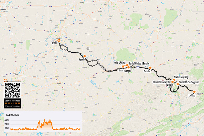
After heading out from my house in northern Kentucky with a full pack on my Kawasaki Versys-X 300, my first stop was Maysville, Kentucky. I wasn’t expecting the quaint, darling downtown with perfectly painted old brick buildings and well-maintained streets. Nor was I expecting the restaurant I chose online to be temporarily closed. Struggling to balance my helmet and gear while I looked for another restaurant on my phone, a man approached me with his small dog and asked if I needed help.
The author prepares for her West Virginia motorcycle trip.
After telling him of my plight, he eagerly offered to show me to “the best restaurant in Maysville” and escorted me down the street a couple of blocks, sharing history about the town as the three of us strolled. Delite’s Downtown had an antique sign befitting the diner’s ’60s-era interior decor, and you could tell it was all original. I ordered biscuits and gravy – a road trip favorite of mine – and while I couldn’t judge if it was indeed the best restaurant in town, I left satisfied.
A Sign from Strangers
Downtown Huntington, West Virginia (Photo by Sherman Cahal/Adobe Stock)
After a few hours of riding with only a stop for gas, I was relieved to arrive at a German restaurant in Huntington, West Virginia, called Bahnhof WVrsthaus & Biergarten. Stretching my legs as I walked into the restaurant, I was enthralled with the indoor/outdoor multiple-story dining area and the atmosphere of the place. I ordered the currywurst topped with a sweet raisin chutney and a side of buttery herbed spaetzle.
The food was delicious, but the real star of the experience was a rowdy group of men and a woman sitting at the bar. Their lively exchanges were impossible not to overhear, and they soon struck up a conversation with me.
Bahnhof WVrsthaus & Biergarten’s indoor/outdoor seating in Huntington was as unique as their gourmet house-made sausages.
They asked the usual questions – “Where are you from?” and “Where are you going?” – and when they heard I was headed to New River Gorge, they yelled out in unison, “Fayetteville!” All three began talking at the same time, gushing over the food, drinks, views, and roads in that area. I was able to make out “Kanawha Falls” and “Gauley Bridge,” two places I planned on visiting, as well as “hairpin turns” – that’s all I needed to hear. I felt a rush of encouragement, having received a clear sign that I was headed in the right direction for a great trip.
Riding the Midland Trail
As I left Charleston, I was right where I wanted to be – at the mouth of U.S. Route 60, also known as the Midland Trail National Scenic Byway. Route 60 runs from Kenova, near the Kentucky border, clear across West Virginia and east to the Virginia border. Offering a mix of mountain terrain, low-speed cruising through small towns, and rolling countryside, it’s a favorite motorcycle ride in West Virginia.
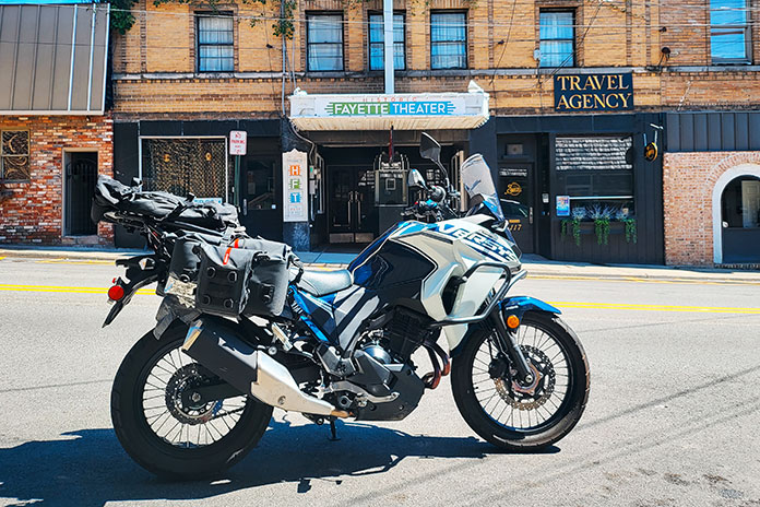
Fayetteville is a gem of the New River Gorge area, complete with its own small theater.
The route started out with easy, flowing curves, but once in the mountains, it was exhilarating hairpin after thrilling switchback for miles on end. After scraping my peg on a decreasing-radius right turn, I put more care into my body positioning and slowed it down a little. The turns rivaled some of my favorite curvy roads in the Great Smoky Mountains of Tennessee.
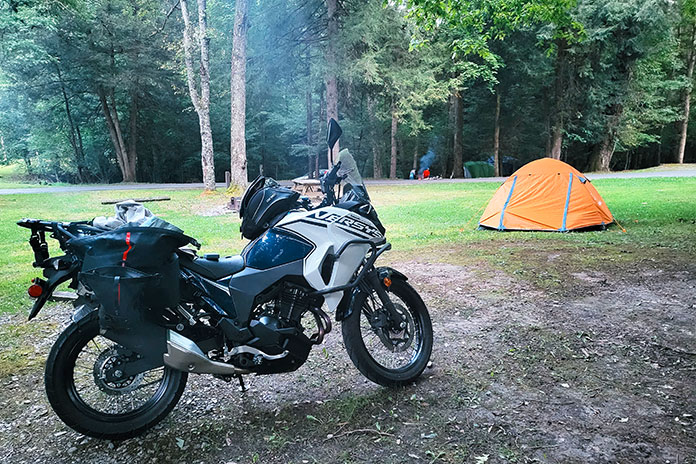
Pulling up to my campground at Babcock State Park, I was welcomed with a clean, pretty campsite not far from the bathhouse and some perfect trees from which to hang my hammock. I was exhausted after a full day of riding – the most miles I had ever ridden in one day – and it showed. I struggled to set up camp and prepare some dehydrated food for dinner. Fatigue is a serious concern on motorcycle trips, and I was relieved that I was safely at my home away from home.
While camping at Babcock, I was able to wake up to this delightful view every morning.
An Ethereal Glow and a Famous Bridge
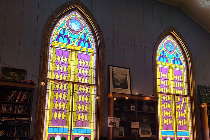
Waking up to a lovely view of my bike from my open tent, I was looking forward to eating some real food. I made my first stop at the Cathedral Cafe & Book Store in Fayetteville. A converted old church, it still has the gorgeous stained-glass windows intact, which glowed ethereal colors on the inside with the sunlight shining through. A breakfast of croissant French toast and locally made chorizo hit the spot, and I was ready to hit the hiking trails.
Of all the manmade constructions in the Midland Trail area, these stained-glass windows at Cathedral Cafe were the most stunning.
I hadn’t done much planning in terms of the trails I wanted to hike, so I stopped at the New River Gorge National Park & Preserve Welcome Center. It has an overlook of the New River Gorge Bridge, so I unexpectedly caught my first glimpse of its expansive form. Once inside the building, the friendly state park ranger suggested I head to Long Point Trail for the best view of the bridge, so I set out with their map, kindly marked up with my route.
The beginning of the Long Point Trail, which leads to the top of a cliff near the New River Gorge Bridge.
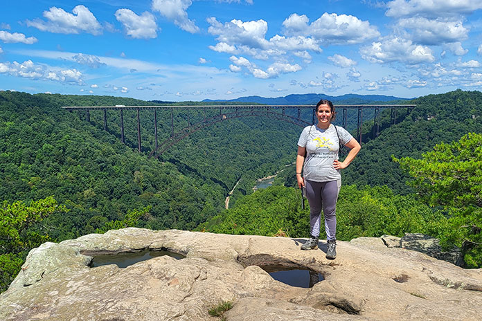
The Long Point Trail was a fine, moderately difficult hike, but the magic was at the top of the overlook. Sheer cliffs dropped off dramatically on all sides, while miles of forest extended out into the distance. The woods were only interrupted by the 3,030-foot-long, 876-foot-high New River Gorge Bridge, at one time the highest bridge in the country and still the highest east of the Mississippi. I once stood on the top of the 75-foot-tall Natural Bridge at the Red River Gorge in Kentucky, but this was even more magnificent.
There were two unspoken rules at the top: First, you take a picture for the next person in line on the edge of the cliff in front of the bridge, and second, no one puts anyone else in danger. When visiting treacherous natural wonders, I’m always amazed that people have so much trust in everyone around them – and themselves – to not fall off. After the photo exchange, I sat down on a rock near one side of the cliff and enjoyed a leisurely bagged lunch.
Standing mere inches away from the edge with the New River Gorge Bridge in the background.
More Exploration on My West Virginia Motorcycle Trip
Before heading to the attractions recommended to me the day before, I crossed the New River Gorge Bridge. I was able to steal some glances over the guardrail of the four-lane highway and was rewarded with views of the forest stretching as far as I could see and the winding New River hundreds of feet below me.
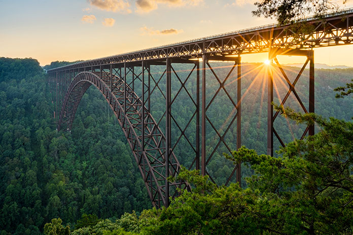
The New River Gorge Bridge towers 876 feet above the rushing waters below. It’s possible to ride on top of the bridge as well as on a road below it. (Photo by steheap/Adobe Stock)
Back on Route 60, I saw the sign for Kanawha Falls and pulled off. It is an impressively wide waterfall, as it spans the entire width of the Kanawha River. The viewing area is a bit far from the falls, so I felt disconnected from the powerful water. Cathedral Falls, just down the road, is much closer to the viewing area and is staggeringly tall, but the parking lot was so busy that I couldn’t pull over to get a closer look; I only caught glimpses as I rode past. Gauley Bridge also ran right alongside the road but was a little lackluster after viewing the New River Gorge Bridge.
It was getting late in the day, and I still wanted to visit Lewisburg. I left Gauley Bridge and headed out, feeling some anxiety about making it back to my campsite before nightfall. I was not looking forward to traversing mountainous roadways after dark, but I pressed on nonetheless.
Kanawha Falls, the largest waterfall in West Virginia, roars alongside the Midland Trail near Gauley Bridge.
Another rider on a large adventure bike, loaded down with hard cases, turned onto Route 60 behind me. It was fun to ride “together” for the rest of the way to Lewisburg. I zipped around curves through gorgeous scenery with this unknown motorcycle tourer. When I pulled into a parking spot just inside Lewisburg’s downtown strip, he gave me a wave over his shoulder as he passed. There’s nothing like the camaraderie of a fellow rider, especially when they’re also clearly on their own unique adventure.
After eating an overpriced (but still delicious) plate of lasagna at The Humble Tomato, an upscale-but-casual Italian restaurant right on the strip, I decided to walk downtown for a bit before heading back. I stopped in the Lewisburg Welcome Center to see if they had any worthy souvenirs and was greeted by a friendly older man. He was shocked, as many people are, to find a young woman on a solo motorcycle trip, and he had plenty of questions. After I purchased a few stickers, he began fumbling around the cash register and counter, mumbling that he had something special for me.
The quaint strip of downtown shops and restaurants along the main road in Lewisburg.
After a few awkward minutes, he finally found what he was looking for – a Route 39 pin and coin – and handed them over proudly. “I give these to all the Harley guys,” he said with a chuckle. I pocketed the trinkets, a little embarrassed as I hadn’t actually ridden Route 39 on my trip but thanked him nevertheless. Then I saddled up and headed back to my campsite at Babcock State Park.
A Unique Blend of Scenery
Having been distracted earlier by my adventure rider buddy on the way to Lewisburg, I had zipped past the beauty of the countryside along that section of the Midland Trail. On my return ride, it was the magical “golden hour,” and the scenery was lit with a warm glow. It was like a charming blend of scenery back home – the green rolling hills of eastern Kentucky rural farmland punctuated with the mountainous terrain and sharp corners of the Great Smoky Mountains of Tennessee.
Riding on the gentle slopes and curves of hills as green as a jewel, I could see Appalachian ridges seemingly on all sides. Peaks would loom straight ahead in the distance, growing closer and closer until I was on them, climbing switchbacks, only to descend minutes later and then do it again. It was a dream ride.
Returning Home from My West Virginia Motorcycle Trip
After a pleasant night at my campsite sitting by a roaring fire, I woke up and began grudgingly preparing for my return home. There was so much I didn’t get a chance to see.
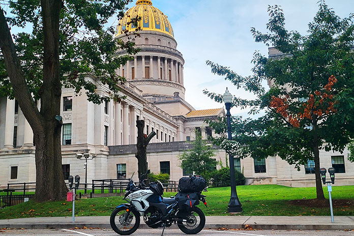
I hopped on the highway for a quicker return trip, and while I wasn’t planning on stopping in Charleston, the view of the 23-karat gold-leaf gilded top of the Capitol, with a dome 5 feet higher than the U.S. Capitol, lured me in.
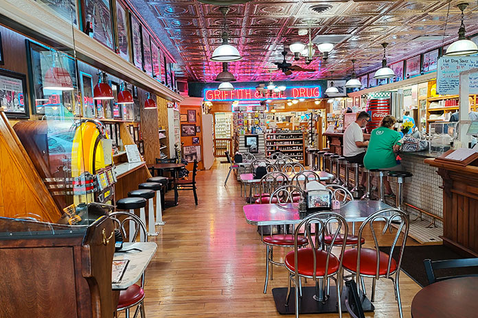
My last stop was the Griffith & Feil Drug and Soda Fountain in Kenova, West Virginia, literally the last exit before the Kentucky border. I enjoyed the bright and colorful neon lights inside and ordered a root beer float – the absolute best I’ve ever had, with unbelievably creamy vanilla ice cream and fizzy, sweet-and-spicy soda.
I enjoyed a root beer float in Kenova at a soda fountain reminiscent of the past.
Plans for the Future
While returning my wallet to my motorcycle jacket after paying for my treat, my fingers brushed against a metal object – the Route 39 coin the kind man in Lewisburg had given me the day before. Not only had I survived the trip I had been nervous about taking in the first place, I had also proven myself to be a capable motorcycle camper and tourer. Proud of my accomplishments, I pocketed the metal coin, thinking to myself, “I’ll come back to ride this mysterious Route 39.”
The West Virginia Capitol in Charleston is a sight to see with its gilded top.
I gathered up my things, excited at the prospect of arriving home after a successful solo journey. I was also looking forward to planning my next trip to West Virginia, inspired by a simple gift from a stranger – something I wouldn’t have received had I not taken that leap and just rode.
Chuck as a teenager in the ’70s, tinkering with his Suzuki X6 Hustler 2-stroke.
Retirement is underrated, which I discovered both too soon and too late. Fifteen years ago, my employer of 36 years eased me out their door. “If you can’t climb stairs,” they told me, “then you can’t work here.” I don’t like to use the word “handicapped,” but that’s what they called it. It’s actually muscular dystrophy, and I’ve lived with it since my 30s. After they let me go, I didn’t dwell on it, but what life held next was a mystery. I was looking for something to do when my buddy Scott suggested going to the Sturgis Rally. I thought, Why not? There would be 12 of us total, including a few wives and girlfriends riding pillion. They were all on Harleys; I was the only dissenter on my BMW R 1150 RT.
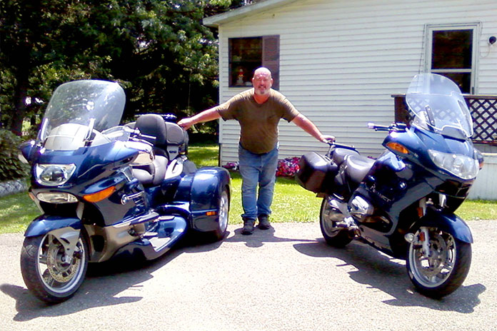
Chuck’s BMWs: an ’07 K 1200 LT Hannigan trike and ’04 R 1150 RT. Combined, he rode them for eight years and 193,000 miles.
From my place in Zanesville, Ohio, Sturgis is roughly 1,700 miles away, so I estimated the trip would take two days. We started on U.S. Route 40, a few miles from my home, and I knew after the first 5 miles it wasn’t going to be much fun. We were going 80 mph one minute, 60 the next, stopping every 75 miles to gas up, puff down two cigarettes, then talk for 20 minutes about the guy in the group who failed to use his turnsignal.
We rode for several hours this way. In Illinois, we ran into a light rain, with Scott and me bringing up the rear. I’ve ridden with friends forever, and we never rode side-by-side. Scott and I watched the bikes, riding tandem at 80 mph (then 60), waiting for a mistake that would surely bring the others down.
We got to Iowa City midafternoon. I thought we were stopping for gas (again), but no, they were already looking for a motel! There were still at least five more good hours of daylight. I’d had enough. “Hey guys, I’ll see you there,” I said and left.
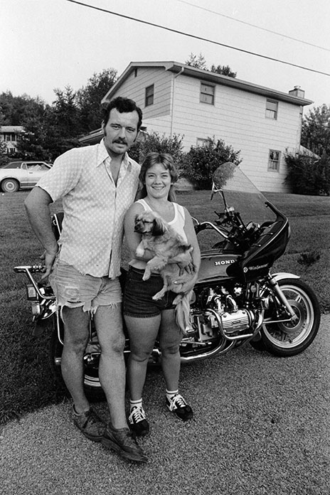
Chuck and his wife, Terry, holding Ginger during their more carefree years.
Several hours later, I found a mom-and-pop campground west of Des Moines. Even though the sign said “NO Vacancy,” I spotted a grassy area out back in a corner, nearly surrounded by corn, and the proprietors let me have it for half price. I went out for a ham-and-Swiss sub and a six-pack and rode back to my home for the night. I’d ridden 600 miles – not bad – and was ready for a beer.
There were land yachts all over and kids throwing a ball around. One of them saw me and walked over, followed by five or six others. “Hi, where ya from?” they asked. My bike was a kid magnet.
We chatted while I pitched my tent, hoping no one would be offended if I sipped a beer. When I mentioned that the site could use a picnic table, they scrambled off, and I saw them talking to a group of grownups. Four of the dads got together and grabbed an extra table, each holding a corner with one hand and a brew in the other. Suddenly I had my own personal dining table in front of my tent. I felt right at home. The day was ending a lot better than it had started. That’s life on the road on a good day, but aren’t they all good days?
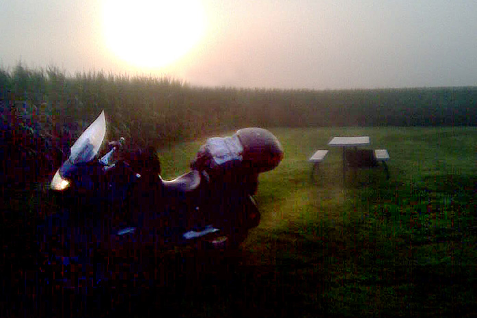
On his way to Sturgis, Chuck spent his first night alone in an Iowa cornfield.
I called Scott that night. He told me he had wanted to join me, but he was riding his brother’s Harley, so his brother called the shots. He said there was only one room with a single bed available at their motel. Eleven people in one bedroom! I thanked my lucky stars. Staying in a room with only one toilet, packed so close you could smell each other’s feet, drinking in the lounge with rows of quarters already on the pool table, sliding a $5 bill across the bar for a beer and getting 50 cents back. Sorry, not for me.
Chuck and his ’72 Honda 750, one of dozens of bikes he owned over the years.
After my new friends left, I sat at my picnic table until 1 a.m. I’d set up my tent facing the interstate and was mesmerized by traffic racing by, streaks of white light in one direction, red in the other, vehicles of all kinds. Sitting alone, soaking all this in, was like a lullaby. It was maybe the best night in a tent I’ve ever experienced. I slept like a baby.
The next day, I raced west to Nebraska. I made a gas stop and decided to call my cousin Matt, who was driving to Sturgis, hauling his homemade camper/trailer complete with a kitchenette with water, a bed, and clamps on the floor to secure motorcycles. After some conversation about our respective locations, I realized I should have turned north at Des Moines and was on the wrong interstate. What to do? I don’t carry maps, so I kept riding west, figuring there would be a highway north somewhere.
Decades ago, Chuck on his ’79 Honda Gold Wing with his mother, Florence, wishing him well. He rode that Wing for four years, reaching 93,000 miles.
I rode to North Platte, then went north on U.S. Route 83 until I saw a sign for Interstate 90. I could taste Sturgis, now only an hour away. I felt late for the party I’d been racing to get to.
When I hit Sturgis, I peeked at my odometer. I’d ridden 954 miles! I wanted to head out again to ride another 46 miles, but it wouldn’t have mattered to anyone but me, and I was parched. It was just Matt and me at the campsite. My friends, on bikes with gas tanks too small, didn’t arrive until the next day.
Brothers Chuck and Ken in the ’80s with new tires, a favorite Christmas gift.
Over the next two days, we rode all around the area, hitting the Badlands first. It was amazing, like another planet. Scott had never been out of Ohio before. His brother and Matt knew of a bar just beyond the Badlands. It turned out to be a dump of the first order with a dirt floor and no restroom; you just walked out back and let it flow – girls too. I definitely wasn’t in Ohio anymore. At least the beer was cold!
The next day we rode to Spearfish for a burnout contest. Matt entered his Harley and put on a great show – so much smoke you could barely see him. Everyone thought he was the favorite, but the last entry was a topless lady. She won.
After Spearfish, we went to see Mount Rushmore, the Crazy Horse Memorial, and finally to the Needles in Custer State Park. It was beautiful country, but I’d seen enough. This was a Harley universe, not mine. It was time for me to go. I asked Scott to come along with me, but he was leashed to his brother and declined again. That was okay. I was used to riding alone – nearly all my past riding friends had either died or moved to Florida.
I was out the next day at first light, unaware that the best five days of my riding life were in front of me. I rode west to Devils Tower, then north. My ride was untarnished, racing along, a world away from Ohio. I ended the day in Custer, Montana, at a great mom-and-pop campground. I pitched my tent and eased into the evening with a chilled six-pack. Seeing the Milky Way brought me back to my childhood. Never having been to the area, everything felt both so real and so unreal. The air felt different, and the smells were spectacular.
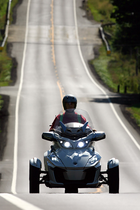
A few years back, riding his beloved Can-Am Spyder on backroads in eastern Ohio.
The next day, I rode east on U.S. Route 2, to this day my favorite road, wide and straight, with fields of wild sunflowers. The 75-mph speed limit meant I could go as fast as I wanted.
Chuck’s BMW R 1150 RT at Devils Tower, Wyoming, after leaving Sturgis.
I made it to Ross, North Dakota, a small town with a train terminal and several sets of tracks. I found a campsite, pitched my tent, and went looking for beer and a sandwich. I’ve camped at some very nice places, but I’ll remember this one forever because of the trains. In Ohio, I had only seen trains that were a few cars hauling coal, but these trains, with four engines pulling 200 cars, seemed a mile long. The tracks were maybe 500 yards away, and one train would come right after another, each one making its own unique sound, some with squeaky wheels, others with wheels that pounded the track like they were square. I sat at the picnic table until midnight, and to this day, I can still hear the sounds of all those trains.
Chuck’s old license plates, covering several decades and hundreds of thousands of miles.
The next morning, I called Scott. He wasn’t with his Harley group. He had been complaining about noise coming from the rear wheel of the Harley he was riding, which turned out to be a bearing. It let loose, the wheel locking for just a second, with the tire terminally resting against the swingarm. The Harley bit the dust. He was alone, and no one came back looking for him. His brother and the group simply abandoned him. There was, however, a friendly fellow nearby, and Scott spent a few hours drinking free beer on his front porch. Luckily, he had Matt’s phone number. Matt came to the rescue and loaded the broken bike in his camper.
The next morning, I left at first light, still riding east on Route 2. I rode at my own pace. Not many people live that far north, probably because of the brutal winters. I passed through towns about every 20 miles – no stop lights, just reduced speed limits. The sideroad signs with white numbering meant gravel; those printed with blue meant the roads were paved. White ones were more common, seemingly 10 to 1.
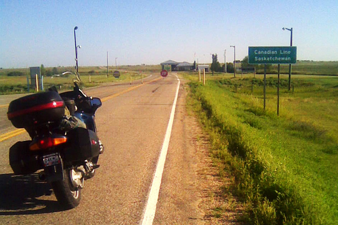
On his way home from Sturgis, Chuck made a brief detour over the border to visit Canada. Leaving the U.S. was easy, but getting back in was another matter.
Over the next two days, I passed through Minnesota, then Wisconsin. Lake Michigan is simply mesmerizing. Every few miles, I spotted a shanty and slowed to see what they were selling. One spot had fresh smoked fish. I never pass on seafood, so I bought two pounds of smoked trout and continued down Route 2 to a very nice campground.
The final day of my trip, I crossed the Mackinac Bridge connecting the Upper and Lower peninsulas of Michigan. I had been warned about the bridge, specifically the mesh steel surface which can lead to motorcycle tire wandering – more than a little unnerving. But one lane was paved.
By chance Chuck rode into view of brother Ken’s camera lens, just south of Wooster in north central Ohio. Chuck had been sent out to buy a quart of milk, ending up over a hundred miles from home.
When I hit Interstate 75, it started raining. But it was warm, so I didn’t bother to put on my rainsuit. I needed a shower anyway. When I hit Detroit, I was surprised by how clean and orderly the city appeared, contrary to the image I had of it being dirty and smoky. Also, there were never less than five lanes of roadway, so I cruised right through. Every big city should do it so well.
In Ohio, I got on U.S. Route 30, four lanes racing through miles of corn and soybeans, then I rode south on State Route 13 on my way home.
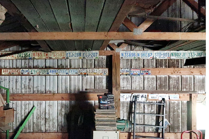
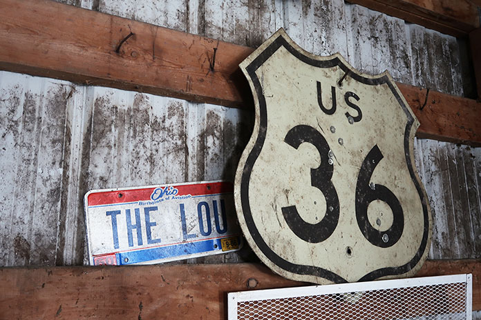
Much of Chuck’s riding history can be found in his garage, including the U.S. Route 36 highway sign given to him by Ken and an Ohio license plate personalized with “The Lou,” his youngest daughter’s nickname.
I made it home just before dark, our three dogs yapping up a storm. I settled in as my wife made me dinner, and in the shower, the water that dripped off me was cloudy with dirt. I was done, home after nine days and 4,800 miles. That night in bed, I cried, thinking it was probably my last long motorcycle ride. And it was.
Because of the muscular dystrophy, I had been having difficulty with my legs during the trip and was happy that I didn’t drop my bike or fall down. My brother Bill lives a similar life – our mother did too when she was still with us. Back then, my MD was an inconvenience. Now it’s a nuisance, controlling every part of my day.
But after Sturgis, I didn’t stop riding. I had two more motorcycles to wear out, saving the best for last. With my failing health, when I could no longer support myself on two wheels, I moved to three. My last bike was a Can-Am Spyder RT, which I dearly loved. In six years, I rode that bike 188,510 miles – until I couldn’t.
Chuck notched more than 100,000 miles on his 2014 Spyder in three years.
My mobility may have been stymied, but not my mind. I have more than enough memories to fill another lifetime. When I close my eyes, I can be anywhere, always picturing myself on one of my old bikes. When I slip out to my garage for a quick beer or two, I’m surrounded by reminders of my lifetime on two wheels, then three. On the wall are about 20 of my old license plates. Some aren’t especially notable, but there are a few that, if you ask me about them, I’ll talk to you for hours, many of my tales going back to the six or seven or eight special bikes I’ve owned.
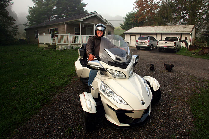
Chuck at home in rural Muskingum County, Ohio, ready to head out on his Can-Am Spyder RT.
There are also two sets of pistons – one from a Gold Wing, the other from an ’83 Honda CB1100F – and posters of concerts I’ve ridden to. There’s a drum skin I caught at a Scorpions concert after drummer James Kottak signed it and threw it into the crowd. And my tools are spread out everywhere from the days when wrenching on my bikes was a favorite pastime. On one of the walls is a newspaper clipping of a story by my brother Ken when he was on assignment covering the Indy 500. One of his pictures shows me, shirtless, leaning back on my cycle, soaking up the sun. He didn’t even realize that I was in his shot until later.
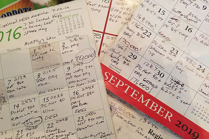
Chuck uses wall calendars to record his daily mileage and conditions.
My first 12 years of retirement were nearly perfect; the last three, not so much. Still, I see my glass as being half full. My most recent set of wheels is a powered wheelchair, and I can still get around in my custom golf cart. I sold my Spyder to Ken. He still calls it “Chuck’s bike.” I see it often when he stops by, giving me my needed motorcycling fix. It still looks new. To me it always will.
After decades of riding almost nonstop, with well over a million miles on my motorcycles, the one thing I’ve learned is: Never take tomorrow for granted. Live for today. Always, ride on.
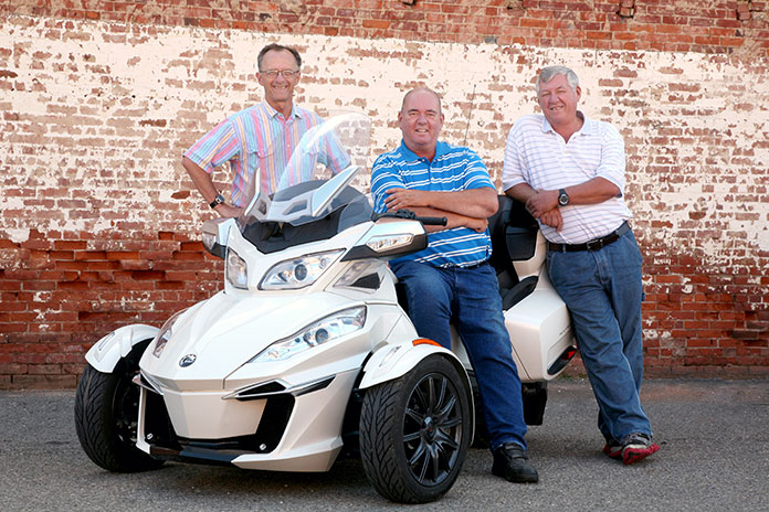
The Frick brothers (left to right): Ken, Chuck, and Bill.
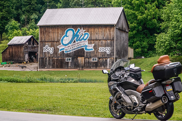
Contributor Scott A. Williams’ 2-day southeast Ohio motorcycle tour highlights some of the best Ohio motorcycle roads and includes a stay in the historic town of Marietta along the Ohio River. (Photos by the author and Greg Nebbia)
This Southeast Ohio motorcycle tour story, which highlights some of the best Ohio motorcycle roads and a stay in the historic town of Marietta on the Ohio River, first appeared in the March 2023 issue of Rider.
For riders who want to carve continual curves through forests, along rivers, and past farms, you won’t find better roads in so focused an area than in the southeast corner of Ohio. The landscape of constantly rising and falling hills results in roller coaster roads that will have you laughing with joy. The rush from blind rises, off-camber curves, and decreasing-radius corners is never-ending. Add abundant wildlife, farm vehicles, and the occasional Amish buggy to the equation and you quickly realize how crucial it is to stay laser-focused on the task at hand.
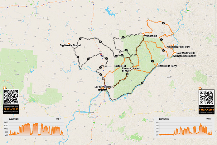
Scan the QR codes above or click here for Day 1 or here for Day 2
With the benefit of routes created and inspired by Ed Conde of New England Riders, many riders from the Northeast and Canada make the trek south to savor these roads. The small, historic city of Marietta on the bank of the Ohio River is an ideal base of operations for a tour of this region. We found multiple options for lodging, a lively downtown with a variety of great restaurants and pubs, and even a motorcycle shop that will come in handy if your tires lose tread faster than expected.
Our group of experienced sport-touring riders, including my good friends Steve Efthyvoulou, Randy Palmer, and Bob Holahan, confirmed a plan over breakfast and then began our day heading north and east of Marietta on Ohio State Route 821. Beyond Whipple, a right on Dalzell Road had us winding through forested hills. The constant elevation changes could be a cartographer’s worst nightmare, but they’re a motorcyclist’s dream come true. Our group was connected via bike-to-bike intercom, which enabled the lead rider to offer helpful warnings:
Wow, this curve tightens fast!
Watch for gravel in that right hander.
The road drops left after that blind rise … weeee!
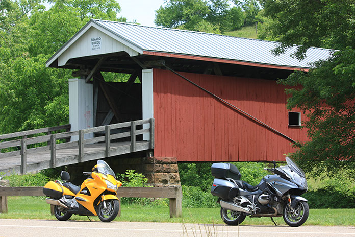
Rinard Covered Bridge along Ohio State Route 26 in Wayne National Forest is the third covered bridge built at this location, the original dating to 1875.
At State Route 565, we turned right, curved past Zwick Park, then headed south on State Route 260 through Quarry and to New Matamoras. The curves were incredible! At State Route 7, we turned left toward the township of Fly, then left on State Route 800 back up into the hills. Beyond Jackson Ridge Church, we turned right on State Route 255 to Laings, then stayed on 255 back to Sardis and Route 7.
Route 7 is designated the Ohio River Scenic Byway. Scenic, yes, but it’s mostly flat and lacks challenging curves. However, it was useful for taking us to the next incredibly curvy road up into the hills: State Route 536 in Hannibal. A short diversion onto Long Ridge Road and Short Ridge Road brought us up to Kiedaisch Point Park. From there we enjoyed the vista overlooking the Hannibal Locks and the bridge crossing the Ohio River to New Martinsville, West Virginia.
Hannibal Locks and the bridge over the Ohio River to New Martinsville, West Virginia, viewed from Kiedaisch Point Park in Clarington, Ohio.
With our stomachs signaling lunch, we decided to cross that bridge and found Quinet’s Restaurant. The buffet is extensive, and an impressive display of local history covers the walls of this New Martinsville institution. Appetites satisfied, we crossed back into Ohio and picked up State Route 536 all the way to State Route 78, where turning right put us on a parallel track with Sunfish Creek, which meanders and then widens before emptying into the Ohio River at Clarington. Route 7 sent us to State Route 556 where we turned to enjoy more curves all the way to Beallsville and State Route 145.
Morning breaks on the Ohio River in Marietta, Ohio.
At Jerusalem, a left pointed us south on State Route 26, the National Forest Covered Bridge Scenic Byway. For most of its length, the byway parallels the Little Muskingum River, and we happened upon Rinard Covered Bridge. It’s the third covered bridge to be constructed on this location, the original dating to 1875. On these winding southeastern Ohio roads, shoulders vary from narrow to nonexistent, so this stop was noteworthy because it was a chance to pull safely off the road to shoot photographs. Continuing on Route 26 provided us miles of smiles back to Marietta.
With constant curves and limited sight distances, places to stop safely along the roadside are few and far between in southeastern Ohio. One solution – just keep riding!
The mental focus required to follow all these curves, coupled with the physical demands of countersteering and shifting body position on heavy sport-tourers, had us feeling tired at the end of the day. After returning to Marietta, we walked to Tampico Mexican Restaurant and rehashed a fantastic day over a relaxed meal and a pitcher of margaritas.
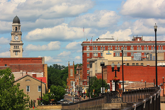
A beautiful June afternoon finds downtown Marietta looking its best. The charming little town served as an ideal base for our two days of sport-touring in the hills of southeastern Ohio.
Your humble scribe is an early riser, so the next morning as the sky began to lighten, I set out to explore more of downtown Marietta. Reading the many historical signs, I learned that pioneers established the town in 1788 as the first permanent white settlement of the United States Territory Northwest of the River Ohio. Many original settlers were Revolutionary War officers who were offered land grants as compensation for military service. Artisans from my native New England also settled here, bringing with them skills that helped Marietta quickly become a center for shipbuilding. Between 1800 and 1812, nearly 30 ocean-going vessels were built here in eight shipyards.
Commercial barge traffic is ubiquitous on the Ohio.
Another piece of riverfront history is the place where we stayed, the Lafayette Hotel (c. 1918). Inside, the hotel’s lobby feels like a formal parlor. Realtors might describe the rooms as “quaint” and “cozy,” with the period furnishings and fixtures including styles long forgotten by interior designers. Our tidy room overlooked the Ohio River, the Highland Avenue Bridge, and lovely riverside homes on the opposite riverbank in Williamstown, West Virginia. Even the parking area for our bikes overlooked the river. Modern-day riverboats still dock at that very spot, as one did during our stay, so it’s fitting that this lodging retains the feel of the riverboat era.
The historic Lafayette Hotel in Marietta overlooks the confluence of the Muskingum and Ohio rivers.
After breakfast at the hotel, our group was ready for another day behind the handlebars. Since any road is different in the opposite direction, we began by reversing course on one of our favorites from the day before, Route 26. The weather was perfect, and we enjoyed glimpses of the scenery when we could divert our attention briefly from the curvaceous road. In Woodsfield, we found Ida’s Lunchbox, which other riders had recommended, and enjoyed a light lunch and conversation, while a farmer at the next table listened attentively to the agriculture report on TV.
Ida’s Lunchbox in Woodsfield is a popular spot with riders. These BMWs were part of another group exploring the curve-rich environment.
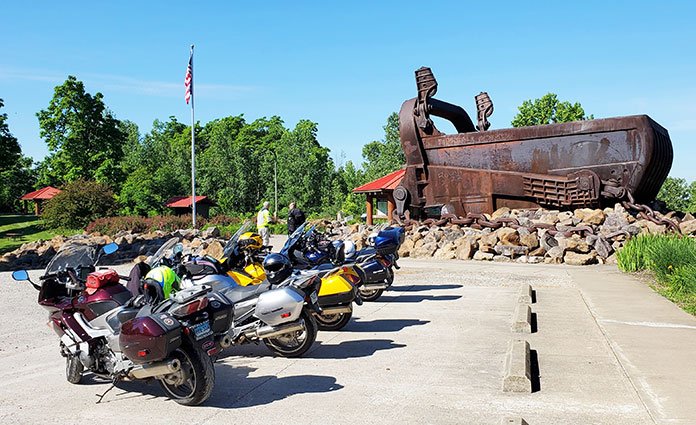
We continued on 26 to Jerusalem, turned west on State Route 145, kept twisting southwesterly along Duck Creek to Lewisville, and then took State Route 724 west to Carlisle. A different stretch of Route 260 wound us south along East Fork Duck Creek to Harriettsville. Just past town, we turned right on State Route 564 and began to follow Middle Fork Duck Creek to Caldwell. State Route 78 took us out of town and curved to a highlight of the day: Big Muskie Bucket, the business end of one of the largest machines ever to move on land.
Big Muskie was a walking dragline designed to remove earth and uncover a coal seam that lay 180 feet below the surface. This colossal machine was electric, powered by a 13,000-volt “extension cord,” and so enormous it’s hard to wrap your brain around the scale. It was 1.5 times longer than a football field, more than 222 feet tall, and weighed 12,000 tons. The bucket, which weighs 210 tons when empty, could grab 325 tons of earth in a single “bite” and hold 220 cubic yards. In 1969, the entire Morgan High School Marching Band, nearly 50 members strong, played inside the bucket at Big Muskie’s inaugural ceremonies. By 1991, more efficient mining methods and increasingly stringent environmental regulations sidelined Big Muskie. Now the bucket is all that remains, rusting away in a park on Route 78 near Bristol.
Pedestrians and a flagpole hint at the scale of the Big Muskie Bucket. It’s HUGE.
We briefly reversed course on 78 to State Route 83 and headed south for gentler curves down to Beverly. There, a left on State Route 339 moved us into farm country and past Crooked Tree. A right on State Route 821 had us paralleling Duck Creek through Macksburg, Elba, and Warner. A right on State Route 530 delivered the day’s last dose of twisties down to Lowell, where leisurely State Route 60 returned us to Marietta.
Bikes have an even better view of the Ohio River than we had from our hotel room.
One thing we had missed thus far was a ferry ride, so we made a quick run up Route 7 to the Sistersville Ferry, which has carried people across the Ohio River between Fly, Ohio, and Sistersville, West Virginia, for over two centuries. Several types of ferry have been used throughout the company’s history, and the one currently in use is a type none of us had seen before. Vehicles drive onto a ferry barge, which is propelled through the water by a tug. The barge is double-ended so it doesn’t have to change direction with each river crossing, but the tug needs to turn around after each landing. The tug’s bow is attached to the barge’s side via a pivoting mechanism that resembles an automotive trailer hitch. When the ferry reaches the other side, the captain simply pivots the tug 180 degrees to cross the other way. Pretty slick.
Bob, Randy, and Steve patiently await their arrival in Fly aboard the tug-driven Sistersville Ferry.
After the ferry, we made our way back to Marietta, where our dinner spot was a short stroll through Ohio Riverfront Park to Levee House Bistro for, of all things, lobster – prepared by a chef from Boston no less!
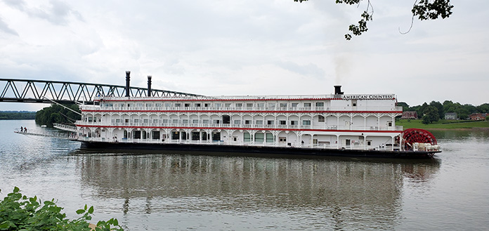
The riverboat American Countess prepares to dock by the Lafayette Hotel in Marietta.
Commitments back home had us heading east the next morning, but we plan to return to this region for more great riding. To the north is State Route 555, the renowned “Triple Nickel” (see Ken Frick’s story “Riding Ohio’s Triple Nickel”). To the west are gentler curves leading to Hocking Hills State Park, where riders can enjoy some of Ohio’s best scenery and stretch their legs on short hikes. The hilly landscape is much the same on the West Virginia side of the Ohio River, with roads such as West Virginia State Route 20 from New Martinsville to Mannington and U.S. Route 250 from Mannington to Moundsville, keeping riders on their toes and making joyful noises.
If you prefer roller coaster rides that you control, a motorcyclist’s amusement park awaits you in southeastern Ohio.
Our big Singles on a one-lane bridge over Little Piney Creek near Highway 123.
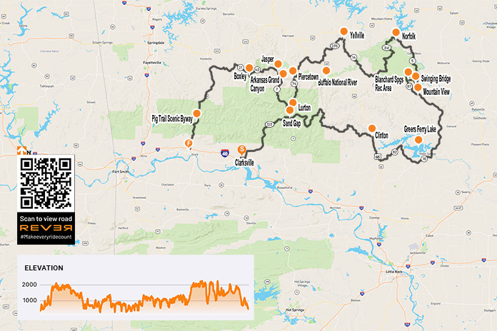
As the saying goes, it’s the journey and not the destination that makes the trip. But how does one describe a destination that is as good as it gets and an even better ride? With autumn upon us, it was the best time – and maybe our last chance – for riding the Ozarks before winter.
Big Singles are a great way to travel, especially if you’re not in a hurry. That made them perfect for our trip because the route I chose demands backing off the throttle to see the sights and make the corners.
Our counterclockwise route began in Clarksville, Arkansas, riding northbound briefly on Highway 21 and then turning east on Highway 292 to connect with Highway 123, a great road that climbs into the mountains through the Ozark-St. Francis National Forest. Highway 123 follows Little Piney Creek and then Hew Creek, and there are scenic waterfalls along the way.
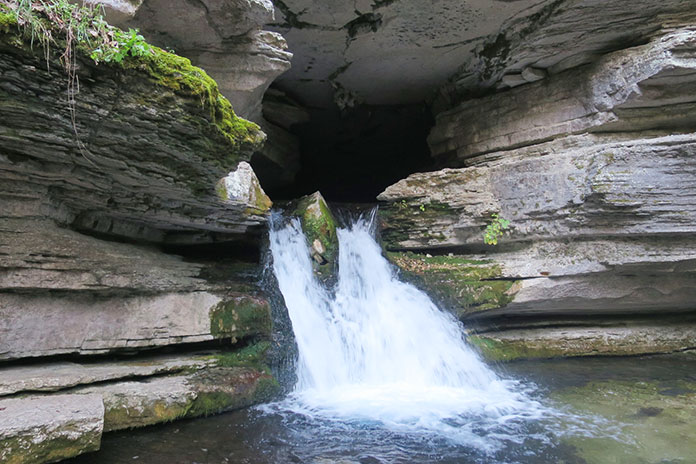
Water pouring out of Blanchard Springs Caverns near Mountain View, Arkansas, in the Ozark-St. Francis National Forest.
At Sand Gap, Highway 123 connects with Highways 7 and 16. We continued east on Highway 16, which is a pleasure to ride, with the kind of tarmac that offers confidence-inspiring traction in its many curves, even with our dual-sport tires.
At Clinton, we rode south on U.S. Route 65 and then followed Highways 92 and 16 around the south side of Greers Ferry Lake, turning north on Highway 5 near Heber Springs.
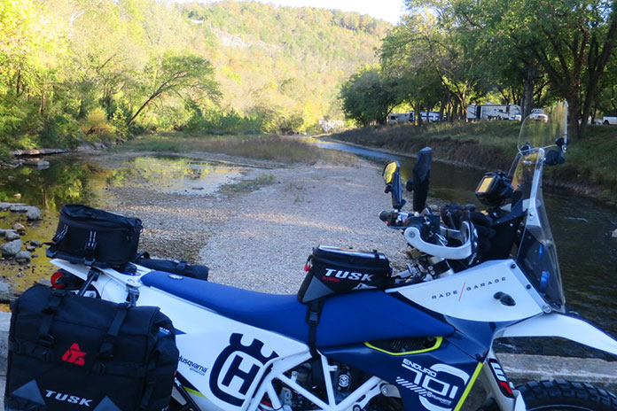
My adventure-kitted Husqvarna 701 Enduro near South Sylamore Creek, which is a popular trout-fishing stream.
Our first day’s destination was Mountain View, a small town of 2,900 people that’s surrounded by the Ozark Mountains and close to the gorgeous White River. It’s also known as the “Folk Music Capital of the World.” During the summer months, folk and country music groups gather in the city park, providing family entertainment well into the night, especially on Saturdays. In the spring and fall, when the nights are too cool for the musicians’ fingers to pluck their stringed instruments, they play in the afternoons. It’s a popular attraction, so make your hotel reservation well in advance. As you might expect, there’s not much pickin’ and grinnin’ in the winter.
From Mountain View, we rode north on Highway 5, and just before the junction with Highways 9 and 14, we turned left on Swinging Bridge Road, named after the cable-suspended wooden bridge over the crystal-clear South Sylamore Creek. Just west of the bridge, mountainous Highway 14 took us to the Blanchard Springs Recreation Area with its springs, caverns, and cliffside hiking trails. Mirror Lake, popular for its rainbow trout, is fed by the cold water from Blanchard Springs. Near the lake, one can hike a wooden walkway and down stone steps to where the spring comes out of the caverns. Pretty cool. Below the Mirror Lake dam, another trail takes you to the remains of a corn mill built in the early 1900s and the bottom of Mirror Lake Falls.
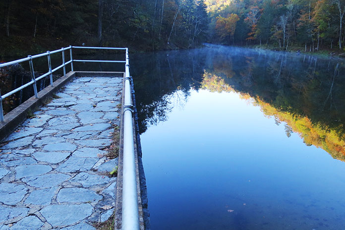
Mist rises off Mirror Lake at sunrise.
On the map, Highway 87 looked like it would be fun, so we rode it back to Mountain View. It was a good choice!
From Mountain View, we again rode north on Highway 5 along the lovely White River and through charming places like Calico Rock, Old Joe, and Norfork. A short hop west on Highway 201 took us to the sweeping curves of Highway 341 (Push Mountain Road) into the Leatherwood Wilderness area.
Swinging a leg over the tall Husky on the cable-suspended wooden Swinging Bridge, which spans South Sylamore Creek just north of Mountain View.
At Highway 14, we turned west again and crossed Big Creek and the Buffalo River. If you ride through here during hot weather, the Buffalo is a great place to cool off, with parking and access at Dillard’s Ferry.
Just south of Yellville (if you cross Crooked Creek, you’ve gone too far), we turned west on Highway 235 and rode south until it ended at U.S. Route 65. We continued west, turning onto Highway 123 again near Western Grove and riding south. We crossed the Buffalo River again just before we got to Piercetown.
Located in the Blanchard Springs Recreation Area, Mirror Lake Waterfall pours over a dam built by the Civilian Conservation Corps in the 1930s.
Rather than ride a short 10 miles west on Highway 74 to Jasper, we continued south on Highway 123 through what’s known as the Arkansas Grand Canyon, taking the long way to Jasper via Highway 7. After only a few miles on Highway 123, my Husky’s low-fuel light lit up, but we were still some 45 miles from “good” gas in Jasper. I asked myself, Should I stop at the one gas station on 123 and put low octane in my thumper or chance it and go for the good stuff? I chose the latter – and ran out of gas just 7 miles south of Jasper. Next time I’ll know: A gallon of cheap gas is better than none at all! Bill’s KLR had just enough fuel left to get him to Jasper, and after a short roadside nap, we were off again.
Jasper is a lovely little town, and just north of it, after crossing the Buffalo again, is Highway 74, an often overlooked but fantastic motorcycling route. We rode it west to Highway 43 – famous for elk sightings – and then west on Highway 21 and south on 74 again.
What looks like a portrait on a stone wall is Mirror Lake Waterfall as seen through a window.
Highway 74 connected us to the famous Pig Trail Scenic Byway (Highway 23). Feeling bolder than I should have, I tried to use the Husky’s superior power to pull away from Bill’s KLR, but he stretched the KLR’s throttle cable and hung with me. As fast as we dared go, some guy on a multi-cylinder crotch rocket blew by us and out of sight. One good thing about riding a thumper is that you feel like you’re going fast when you really aren’t.
The Buffalo River and an adventure bike go together nicely, don’t ya think?
Highway 23 dropped us down out of the Ozarks onto Interstate 40 and then back home to Oklahoma.
Riding big Singles for 650 miles in two days wasn’t bad at all. In fact, in the mountains of Arkansas, it was big fun.
It doesn’t get much better than a scenic ride with friends on a bluebird day. (Photos by Kathleen Currie and Corey Aultman)
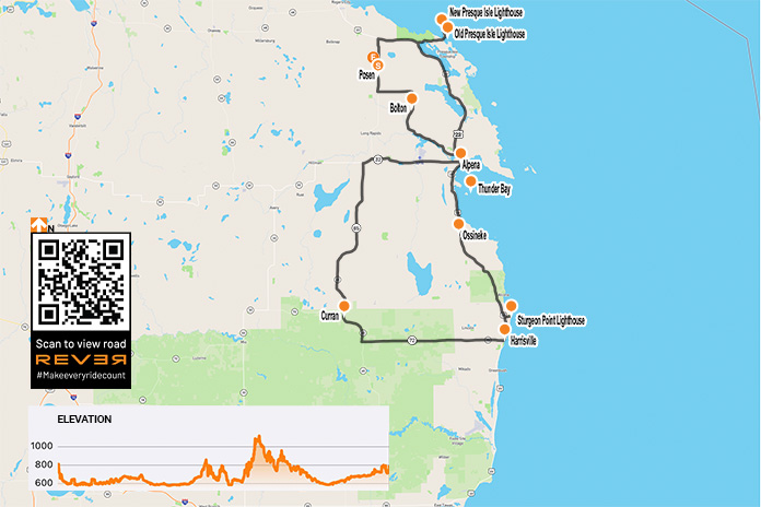
At first glance the small farming town of Posen, which is situated along State Route 65 in northeastern Michigan and hosts an annual Potato Festival, doesn’t appear to be a logical meet-up spot to kick off a daylong motorcycle tour. But the Route 65 Diner offers up classic breakfast and lunch fare, the nearby Posen EZ Mart is a convenient place to fill up, and the village is near Lake Huron, the second largest of the Great Lakes, so it’s perfect starting point for a Lake Huron lighthouses loop.
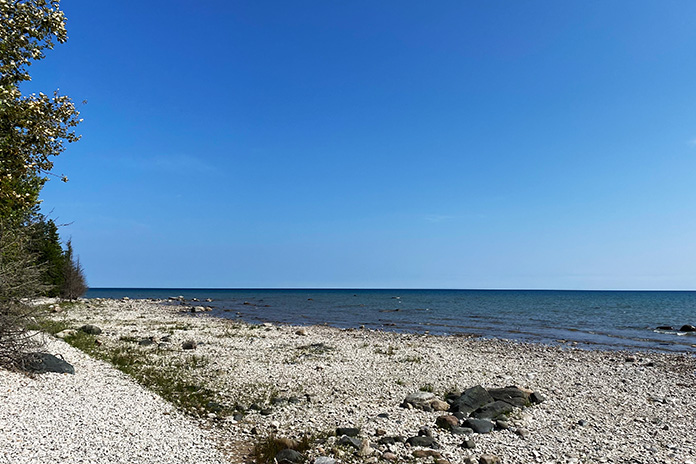
This scenic route through the northeast corner of Michigan’s Lower Peninsula is about 180 miles and provides a leisurely day of riding with stops for sightseeing and food. It offers unique historical sites, lighthouses, shipwrecks, wildlife sanctuaries, parks and beaches on Lake Huron, and paved roads through deep timber forests.
The ride is best done between Memorial Day and Labor Day but could be done earlier in the spring or later in the fall depending on the weather. We took our ride in September.
About 5 miles north of Posen, Route 65 dead-ends at U.S. Route 23, which runs along the edge of Lake Huron’s Michigan shore from Mackinaw City to Saginaw. We headed east on Route 23 and soon entered Thompson’s Harbor State Park. We turned onto Old State Road, followed it to the end, and went north on East Grand Lake Road, which took us onto a narrow peninsula that juts into Lake Huron between North Bay and Presque Isle Bay.
Covering just over 23,000 square miles, Lake Huron is the third largest freshwater lake in the world. Somewhere out in the distance is Canada.
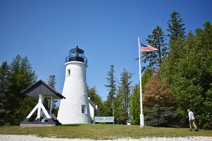
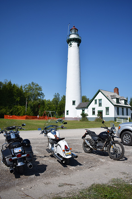
On the right, we saw the Old Presque Isle Lighthouse, which was built in 1840. Due to the harsh weather on Lake Huron, the original lighthouse deteriorated, and the New Presque Isle Lighthouse was built in 1870 farther north near the end of the peninsula. Standing 113.5 feet tall, it is one of the tallest lighthouses on the Great Lakes. Both lighthouses have been restored and are part of a 99-acre park that includes a playground, picnic area, pavilion, gift shop, museum, and nature trails.
The New Presque Isle Lighthouse and keeper’s house.
Adjacent to the New Presque Isle Lighthouse is a keeper’s house that was built in 1905 and is now a museum. Admission is free, but we paid $5 to climb the 130 steps to the top of the lighthouse for excellent views of Lake Huron and the Presque Isle area. The buildings and grounds are open to the public daily from mid-May through mid-October.
We returned to U.S. Route 23 and rode south, finding a few curves along the edges of Grand Lake and Long Lake, which are just inland from Lake Huron. We made our way to Alpena, a town of about 10,000 residents that sits on the northern shore of Thunder Bay. Nearby are two lighthouses, but they are out in the lake on islands and only accessible by boat.
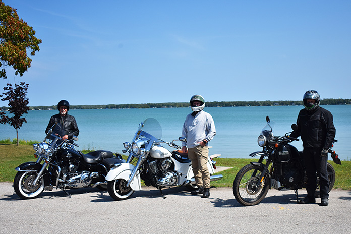
The Harley and Indian riders in our group searching for a lumberjack breakfast.
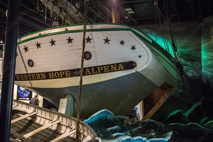
The Thunder Bay National Marine Sanctuary protects an area of Lake Huron known as “Shipwreck Alley” where there have been more than 100 historically significant shipwrecks. Some of the wrecks are close enough to the surface for sightseeing, which we did on a two-hour shipwreck tour on a glass-bottom boat called the Lady Michigan. We also visited the Great Lakes Maritime Heritage Center, a museum with exhibits and pieces of boats that washed ashore.
The Great Lakes Maritime Heritage Center in Alpena is a large museum that includes a shipwreck gallery, a theater, and an archeological lab. (Photo by ehrlif – stock.adobe.com)
When we left the museum, the Royal Enfield and Triumph riders in our group insisted we check out a British tavern in downtown Alpena called the Black Sheep Pub. It is decorated with British flags and memorabilia, and the menu includes rich and tasty pub grub like fish and chips, a pork burger drizzled with vinegar, Scotch eggs, and pickled chips.
After lunch, we continued south on Route 23 through parts of Thunder Bay River State Forest, Au Sable State Forest, and Huron National Forest. This is chainsaw country. In Ossineke, we passed colorful concrete statues of Paul Bunyan and Babe the Blue Ox built in the 1940s by Paul Domke, who also built the creatures in the nearby Dinosaur Gardens Prehistoric Zoo.
Cruising through some gentle curves in Huron National Forest.
South of Alcona, we visited Sturgeon Point Lighthouse, which was built in 1870. The 70-foot lighthouse is maintained by the U.S. Coast Guard and is open to the public. The keeper’s house is a maritime museum open from Memorial Day to mid-September.
At Harrisville, the Harley and Indian riders in our group made it known that it was time for some American food. We rode west on State Route 72 into the heart of Huron National Forest and then turned north on State Route 65 to Curran. Just north of town, we stopped at the Lunch Block and had a proper lumberjack breakfast.
Full from our hearty meal, we further compressed the suspension of our motorcycles and continued north on Route 65 through a section of forest so dense that no paved roads cross to the east. Werth Road finally appeared and provided a paved route with a few curves back to Alpena. Alternatively, you can continue north on 65 and turn east on State Route 32.
Just north of Alpena, past the wildlife sanctuary, we picked up Long Rapids Road, which meanders along the Thunder Bay River heading northwest to the town of Bolton. We continued north on Bolton Road, then west on Long Lake Highway, and finally back onto Route 65 for our return to Posen.
If Michigan is in your motorcycle travel plans, check out the northeastern part of the state near the Lake Huron shore. The roads provide scenic views of the lake and some mellow curves and hills, and the lighthouses and historic sites are a nice diversion when it’s time to stretch your legs.
Following the success of the first partnership between BMW Motorrad USA and Backcountry Discovery Routes in 2022 with the Wyoming BDR, the two groups have announced a second partnership for a route in Oregon. The new route will be officially launched Saturday, Feb. 4, at the premiere screening of the ORBDR Expedition documentary in Portland and other select locations around the nation. For more information, read the press release below from BMW Motorrad USA.
BMW Motorrad USA is excited to announce its second partnership with adventure motorcycling nonprofit, Backcountry Discovery Routes (BDR) on their newest route – Oregon. This is the second BDR route on which BMW Motorrad has collaborated, the first being the Wyoming BDR, released in 2022.
The ORBDR represents the organization’s 12th route for adventure and dual-sport motorcycle travel, with free GPS tracks, travel resources, and a Butler Motorcycle Map scheduled to accompany the film’s debut.
Luciana Francisco, BMW Motorrad USA head of brand and marketing, said BMW Motorrad is proud to partner with Backcountry Discovery Routes for the second time in two years.
“In 2023, BMW Motorrad celebrates its 100th year anniversary and also marks 43 years of BMW GS motorcycles,” Francisco said. “This is the perfect time to share our passion for the adventure and dual-sport riding communities and show our continued support for the BDR organization and what they stand for. We look forward to both new and experienced off-road enthusiasts being inspired by the scenic routes of the ORBDR.”
To launch of the new Oregon route, Backcountry Discovery Routes and BMW Motorrad will kick-off with a film premiere event in Portland, Oregon, and selected BMW Motorrad dealer events on Saturday, Feb. 4. Additionally, over 70 film screenings are planned through spring 2023, hosted by dealers and clubs around the country. More information on the film screening locations is available at the Backcountry Discovery Routes events webpage.
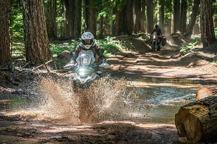
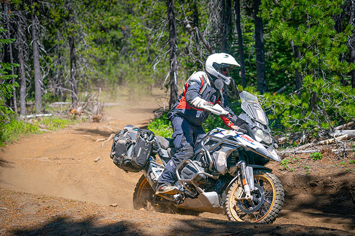
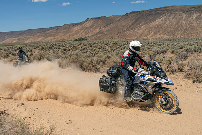
The ORBDR expedition film features members of the BDR team and special guests from BMW Motorrad USA, Mosko Moto, and Edelweiss Bike Travel as they take a first run on the all-new ORBDR. Starting in the high desert landscapes of Southeastern Oregon and exploring North into the Cascade Range, the crew tests their endurance, riding cross-state through 750 miles of lava rock, silt, sand, and steep mountain roads. Highlighting the state’s many natural wonders including hot springs, pyroducts, caverns, buttes, and glaciated volcanoes, the route and film showcases why traveling by motorcycle is one of the best ways to discover the backcountry of Oregon.
Story continues below trailer for ORBDR Expedition
Bryce Stevens, Oregon Route architect & BDR co-founder grew up in the Pacific Northwest and said he has “always been fascinated by volcanoes.”
“The ORBDR is a route filled with natural wonders of the volcanic kind. We designed the ORBDR to show off different regions of the state and keep the route ever-changing,” Stevens said. “Oregon has vast high desert in the southeast, sparse pine forests in the central part of the state, and densely forested mountains in the Cascade Range. It almost feels like three BDRs packed into one.”
Joining the expedition team in Oregon was Ricardo Rodriguez, lead motorcycle instructor at BMW’s U.S. Rider Academy in Greer, South Carolina. Ricardo is a graduate of BMW’s rigorous International Instructor’s Academy and has been teaching on-road street survival, adventure off-road, and authority riding skills since 2010.
“The BDR Team has set out on a fantastic mission, helping keep public lands accessible to the adventure community,” he said. “I am very proud and excited about the relationship between BDR, BMW Motorrad, and the BMW U.S. Rider Academy. Having the opportunity to be a part of the Oregon BDR has helped build my experience as a rider and a coach. Overcoming the challenges along the ORBDR reinforced to me the value of the skills we teach daily at the US Rider Academy.”
Rodriguez continued to say that Backcountry Discovery Routes offers properly trained riders an opportunity to put their skills to the test.
“The Oregon BDR is a challenge and reward riding adventure.”
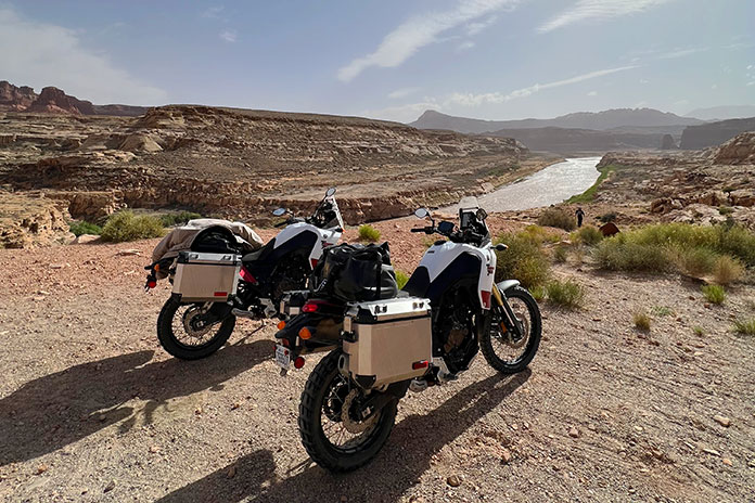
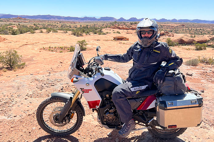
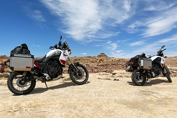
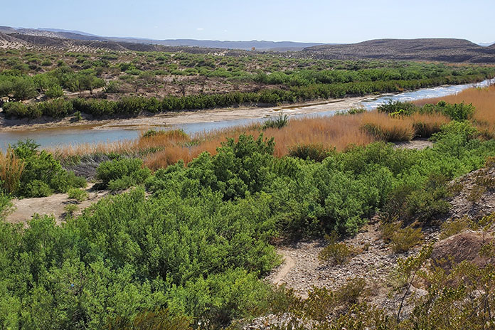
Taking a rehydration break along the Colorado River while our Yamaha Ténéré 700s waited patiently.
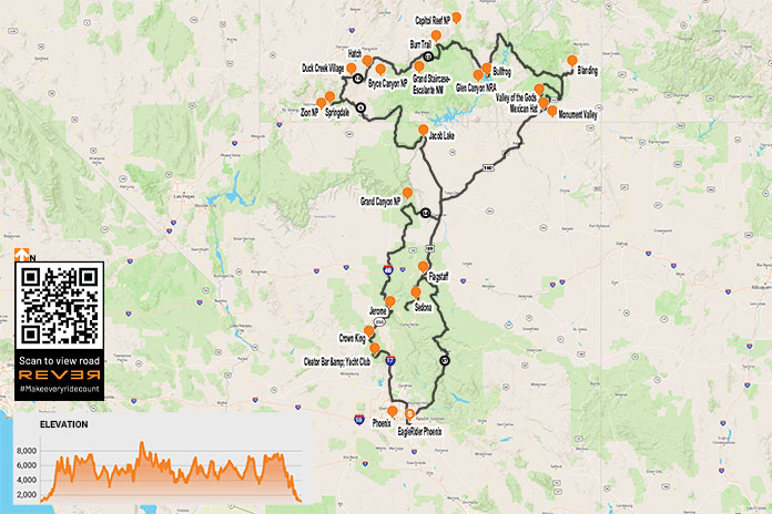
During the long, dark winter in Minnesota, when the ground is covered in snow and ice and our motorcycles are mothballed for months, dreaming about riding in a warm, dry place gives us hope. That’s when my friend Craig and I started planning an adventure ride out West. We sketched out a route that included a mix of backroads, parts of the Arizona and Utah Backcountry Discovery Routes, other off-road tracks, and interesting sights along the way.
In May, we flew into Phoenix and headed to EagleRider in nearby Mesa, where we were greeted by a friendly guy named Bob. After a quick paperwork checkout procedure, we packed our gear on two rented Yamaha Ténéré 700s and headed north on Interstate 17.
With temperatures in the triple digits, the frigid days of winter seemed like a distant memory, so we busted north to gain some elevation.
Even in full riding gear, we started to cool off as we rode farther north. Our bikes were unfamiliar to us, and they were stuffed to the gunwales with camping gear and other essentials. We soon grew accustomed to their added weight as we passed over the “Carefree Highway,” a 30-mile stretch of road made famous by Canadian singer Gordon Lightfoot that runs between I-17 and U.S. Route 60.
I have a lot of street miles under my belt, but this was my first adventure bike trip, so I wasn’t entirely prepared for the primitive roads where the gravel feels like marbles under your wheels. However, it didn’t take long for the combination of my ancient dirtbike experience and a few unplanned rear-wheel kickouts to provide a quick education on keeping the Ténéré upright. Enthusiasm tempered with caution was the order of the day.
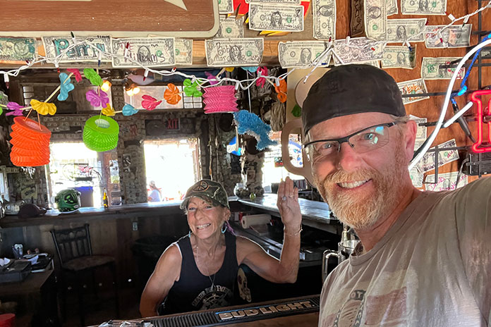
We took County Road 59/Bumble Bee Road off I-17 to check out the Cleator Bar and Yacht Club. The name of this welcoming 4×4 oasis run by Tina Barnhart is a bit tongue-in-cheek, as it is located hundreds of miles from open water. Barnhart is also in the vehicle delivery business to such faraway places as Africa and is active in the Global Rescue Project based in Scottsdale, Arizona, which works to end child slavery and reunite children with their families.
Boats in the Yacht Club’s “marina.”
The Cleator Bar is a must-stop location, complete with boats in the “marina” out back and a stage for live music. Interestingly, the entire town of Cleator, comprising 40 acres, a bar, a general store, a few other structures, and mineral rights, was put on the market by descendants of James P. Cleator in 2020 for $1.25 million, and it was sold at the bargain price of $956,000.
Hanging out with Tina Barnhart while we cooled off at the Cleator Bar and Yacht Club.
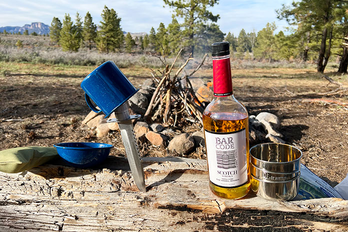
Our next stop was Crown King, located another 13 miles along CR 59 at an elevation of 5,771 feet. A high-clearance four-wheel-drive vehicle is recommended on the deteriorated roads. The Ténérés managed well, and we soon found ourselves taking a load off in the Crown King Saloon & Eatery, one of the oldest continuously operated saloons in the state. We enjoyed a cold drink and a hearty lunch, and the $5 bottle of scotch we bought there (on sale courtesy of Mother’s Day) served us well during the rest of the trip.
We were surprised to see so much green in the Bradshaw Mountains.
Like a lot of small towns in the Bradshaw Mountains of Arizona, Crown King used to be a thriving mining community. In 1904, a railroad was built to help mining operations, but due to a lack of water and high transportation costs to process the ore, it was abandoned in 1926. The old railroad bed is still used today as the main access road to Crown King.
While there, we met Chuck Hall, who is a great ambassador for the area – and a talented guitar picker to boot. He told us he’d lived there for over 30 years and recommended we check out the Senator Highway, on which he’d lost many an exhaust pipe from his old Dodge Neon. A former stagecoach route, the rutted road snakes 37 miles from Crown King to Prescott with many blind switchbacks, eroded surfaces, several water crossings, and spectacular scenery.
Craig takes a breather on part of the Utah Backcountry Discovery Route.
Hall recommended we visit Palace Station, a stage stop built in 1878 midway between Crown King and Prescott. Back in the day, the station had a bar and was a social meeting center for the miners who worked in the area.
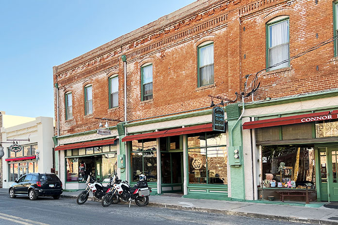
We targeted the town of Jerome for the night. This old copper mining town earned its nickname, “Wickedest Town in the West,” during its heyday in the early 20th century. After the mining bust, the town descended into desperation, greed, and crime. It was revived in the 1960s as a tourist destination, and many of its historic buildings are now filled with restaurants, shops, and hotels. Jerome is said to be a hotbed of paranormal activity, and we stayed at the Connor Hotel, which is reportedly haunted by the “Lady in Red.” We didn’t see any ghosts, so maybe she had the night off.
Downtown Jerome, the “Wickedest Town in the West.”
With a long day of off-roading ahead, we left Jerome and headed north toward the Grand Canyon on a series of unpaved national forest roads. We wound our way around the contours of Woodchute Mountain, crossed the Verde River, and ascended to the Colorado Plateau at more than 6,000 feet. We could see the volcanic San Francisco Peaks rising above the plateau to the east.
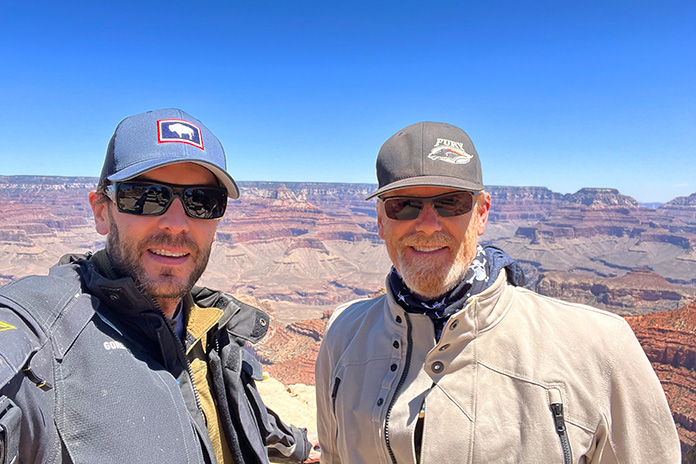
We crossed Interstate 40 near Williams, and after a few miles on State Route 64, we turned onto a national forest road to take an unpaved “back door” route into Grand Canyon National Park. We hooked up with Route 64 again where it’s known as East Rim Drive and enjoyed scenic views from the Grand Canyon’s South Rim.
Craig (on left) and me at the South Rim of the Grand Canyon – a million miles away from our home in Minnesota.
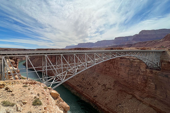
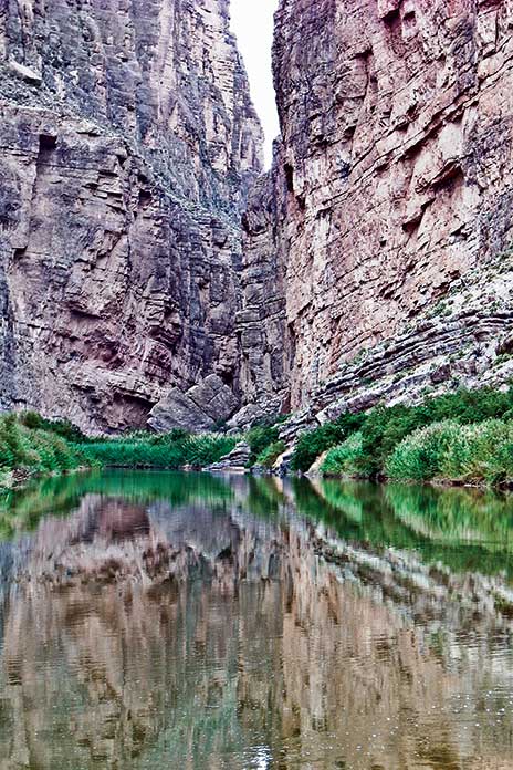
After leaving the park, we connected with U.S. Route 89 and refueled at Cameron, where the highway crosses the Little Colorado River. At Bitter Springs, U.S. 89 splits to the east toward Page, but we continued north on U.S. Route 89A, crossing the Colorado River at Marble Canyon via the Navajo Bridge and following 89A west into an area known as the Arizona Strip. We rode with the majestic Vermilion Cliffs to our right, crossed House Rock Valley, and then climbed out of the desert and into the evergreens of the Kaibab Plateau.
The Navajo Bridge crosses the Colorado River at Marble Canyon, and in the background is Vermilion Cliffs National Monument.
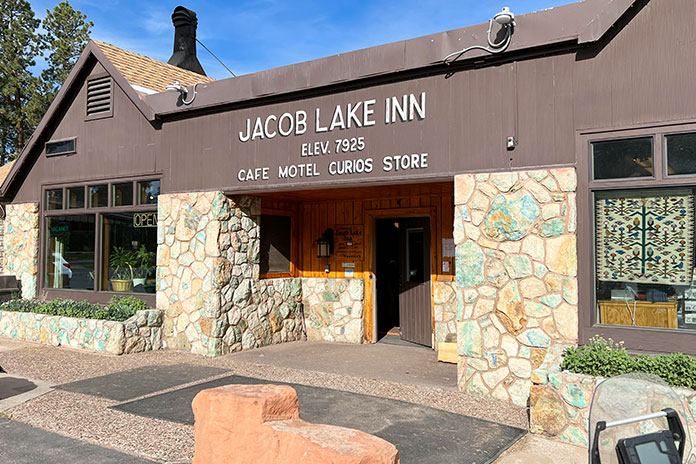
We stopped at Jacob Lake, a small crossroads that sits at 7,925 feet, and it was noticeably cooler at the higher elevation. Known as the gateway to the North Rim of the Grand Canyon, Jacob Lake has a gas station and a hotel with a restaurant and gift shop. The town was named after Jacob Hamblin, an early Mormon pioneer who was shown the location in the mid-1800s by the Kaibab band of Southern Paiutes. And according to the hotel staff, the lake is more of a pond.
Jacob Lake, Arizona, is near the North Rim of the Grand Canyon.
We continued west through Fredonia and crossed into Utah near Kanab, known locally as “Little Hollywood” because of its rich history in filmmaking – most notably Westerns, with more than 100 movies and television shows being filmed there.
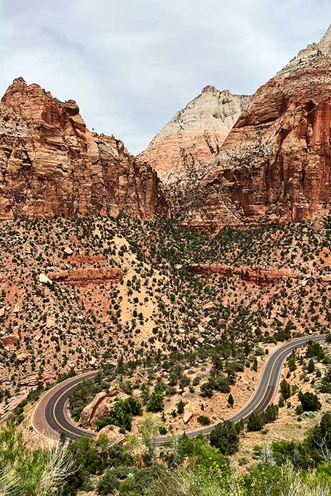
Thus far we had stayed at motels, so we weren’t exactly roughing it. We decided we needed to get some use out of the camping gear we’d been lugging around. After riding through Zion National Park, where we were blown away by the majesty of the cliff faces and rock formations, we traversed the Dixie National Forest through Duck Creek Village to Hatch, where we found suitable dispersed camping.
Utah State Route 9 winds through incomparable scenery in Zion National Park.
It had been about 20 years since my last camping experience. I narrowly avoided putting an eye out with the tent poles, and after the camp was set and the fire built, it felt good to relax with that $5 bottle of scotch. It was a clear night, and the 7,000-foot elevation yielded cool temperatures. With the fire all but gone, it was time to turn in for the night. I live in Minnesota and am no stranger to the cold, but I clocked 19 degrees overnight in that campsite and don’t think I have ever been so happy to see the sun start to rise. Note to self: Next time bring a sleeping bag rated below 30 degrees.
Around the campfire, we sampled the $5 bottle of scotch we bought at the Crown King Saloon. To paraphrase Mark Twain, the coldest night I ever spent camping was during May in Utah.
Once packed up, we put Hatch in the rear view and were soon heading east on Utah’s stunning State Route 12, known as one of the most scenic highways in the nation. We visited Bryce Canyon National Park and its many rock spires and hoodoos and rode through the vastness of Grand Staircase-Escalante National Monument.
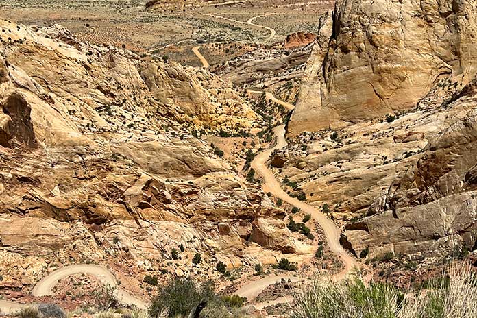
At Boulder, we left the pavement and took the Burr Trail, a well-known backcountry route that passes through Capitol Reef National Park on its way to the Bullfrog Basin in the Glen Canyon National Recreation Area. The trail was named for John Burr, a cattle rancher who developed the route to move his cattle between winter and summer ranges. The country was nearly impassable then and continues to be challenging to this day, with RVs and trailers “not recommended.” Southern Utah is one amazing vista after another, and this stretch featured outstanding scenery as well as many switchbacks on loose gravel that kept us on our toes.
Switchbacks and elevation changes as far as the eye can see on the Burr Trail in Utah.
Throughout the trip, we’d been battered by winds that were contributing to fire restrictions in Arizona and Utah. At this point, the wind was howling, with 50-mph gusts giving us a good sand blasting. After a quick stop in Bullfrog, we headed north on State Route 276 and then south on State Route 95 to Hite Crossing over the Colorado River.
We had violated our “never pass gas” top-off policy in Bullfrog, expecting to find a place to refuel in Fry Canyon. Given the time of year and possibly other reasons unknown, the gas pumps were closed in Fry, so we pushed on through some gorgeous country that might’ve been easier to appreciate if we weren’t worried about our dwindling fuel.
At one point, we pulled over to assess the situation. Craig had been smart enough to fill his reserve bottle, which he poured into his tank. My bike was still showing a couple bars of fuel left. I tip my cap to the Yamaha Ténéré 700. Even though my fuel gauge was blinking “empty” and both of us were expecting the pullover of shame, we made it all the way to Blanding. The Arch Canyon Inn was a welcome stop, but being informed that it’s a dry town put the “bland” in Blanding.
Travelers in a strange land. Parts of Utah felt like being on another planet.
Leaving Blanding and getting on the Utah BDR was like visiting another planet. The Butler and Comb washes, the Moki Dugway, and Valley of the Gods were some of our favorite parts of this trip. With all the distinct rock formations, it was a challenge to stay focused on the trail and not get distracted by the scenery. In most cases, one blown turn can mean disaster, but the rewards are more than worth the risks. Again, caution saved the day.
The southern terminus of the Utah BDR is in the town of Mexican Hat, which I assumed was named after a mountain resembling a sombrero. Turns out, it is a distinctive disc-shaped rock about 60 feet in diameter that’s perched atop a smaller base at the top of a mesa. I’ll always remember it as the site of my first involuntary dismount from the Yamaha during a charge up a softer-than-expected mound of sand.
At the southern terminus of the Utah BDR in Mexican Hat. Behind me is the town’s namesake rock and below me is softer-than-expected sand.
The area around Mexican Hat borders the northern section of the Navajo Nation into Monument Valley. This area is considered the sacred heart of Navajo country, and you can’t help but marvel at how iconic the straight-line stretch of road is as it leads into the horizon, framed with towering sandstone rock formations. Hiking in the park is highly restricted, with only one path that can be hiked without a guide. Monument Valley Trail Park had been previously closed after a movie crew was caught filming without a permit. It is now reopened at a reduced occupancy limit, but no motorcycles are permitted on the 17-mile loop due to deep sand dunes in the area.
Dispersed camping near Hatch, Utah.
Back in Arizona, we cruised paved highways to Flagstaff and then down into Sedona. Determined to camp at a lower (read: warmer) elevation, we found the Lo Lo Mai Springs Outdoor Resort. Lo lo mai is a Hopi Indian word that represents a greeting with many meanings, similar to the Hawaiian aloha. It also means “beautiful,” which the owners of Lo Lo Mai Springs say is where the resort’s name originated. The area borders spring-fed Oak Creek, which is a valuable and rare natural water source in this part of Arizona. The campground had some welcome amenities and was a lot warmer than the prior camping stop.
Monument Valley.
We spent our last day exploring some of the Arizona BDR tracks in the Coconino National Forest near Sedona and Flagstaff. With time running out, we finally hopped on State Route 87 and burned the final miles to Scottsdale, where the town was alive with nightlife.
Returning the bikes was bittersweet. Bob welcomed us back, relieved that the Ténérés had only a layer of dust and a bit less rubber on their tires after 1,591 on- and off-road miles. As we grabbed an Uber to the airport, I could not help but realize the vast additional riding world that adventure motorcycling opens up. Soon after getting home, I put one of my streetbikes up for sale, and an adventure bike could be in my future.
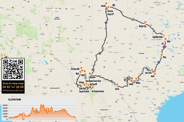
The seeds of this West Texas motorcycle ride were planted in December 2019 when my buddy Reed and I joined the EagleRider Club. Members pay monthly subscription fees for credits toward motorcycle rentals, which roll over month to month and offer significant discounts versus standalone rentals.
In addition to the discounts, being club members allows us to fly into a new area and rent motorcycles that are different from what we ride back home. We live in Connecticut, so flying into Dallas saved us a 3,200-mile roundtrip that would have taken several days on each end. Instead of grinding out miles just to get to Texas and back home, we spent that time leisurely exploring roads and sights.
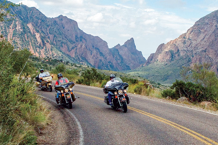
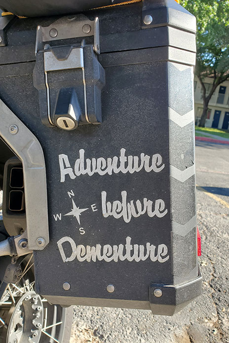
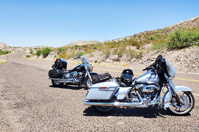
To beat the heat of the Texas summer, we planned our trip for mid-April. Reed and I are BMW riders, but for this trip we rented two late-model Harley-Davidsons: a Street Glide for me and a Heritage Softail Classic for him. There’s something special about riding the open road on a big American V-Twin. We’re older guys who were decked out in textile riding gear and modular helmets, so we’re hardly Easy Rider rebels. When we saw a BMW GS in a hotel parking lot with “Adventure Before Dementure” on one of its panniers, we could relate.
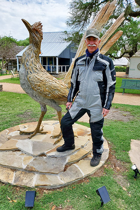
We did a clockwise loop of roughly 2,300 miles over nine days. From Dallas, we headed south to Texas’ funky state capital, Austin. The Harleys were stable and comfortable, the torque was intoxicating, and the horns were good and loud, but the transmissions were a bit clunky. After visiting the Texas Capitol, we rode east to Round Top, a small tourist town known for antiques. We were disappointed to find the antique markets closed when we got there, but I managed to get a photo with a roadrunner as tall as I am – things really are bigger in Texas!
West Texas is wide open.
The riding improved west of Austin when we entered the legendary Texas Hill Country, an area well-known among motorcyclists. Endless hills turn the many rural FM (Farm-to-Market) and RM (Ranch-to-Market) roads into paved rollercoasters. We enjoyed nice twisties, light traffic, and pretty views along the shore of Lake Travis and through Inks Lake State Park. After riding through Llano, we dropped the sidestands and stretched our legs at Enchanted Rock State Natural Area. In Fredericksburg, a charming historic town surrounded by vineyards, we ate sausages and enjoyed live music during a courtyard dinner at a German restaurant.
Less than an hour from Fredericksburg and west of Medina, we rode the renowned Twisted Sisters. The three RM roads (335, 336, and 337) are full of fun curves and whoop-de-doos and are worthy of their reputation. The Twisted Sisters are so popular among motorcyclists that there are two-wheeled tourist stops in the area, like the Lone Star Motorcycle Museum in Vanderpool and the Frio Canyon Motorcycle Stop and The Hog Pen in Leakey. We passed many ranches; two of my favorite names were Big Bucks Ranch and Middle Age Spread.
Enjoying rolling curves through Texas Hill Country, home of the famous Twisted Sisters.
After a night in Del Rio, we followed U.S. Route 90 west along the southwestern border of the Texas Pecos Trail region and within a stone’s throw of the Rio Grande. Although our bikes had the same 107 engines, the Softail’s tank holds 5 gallons while the Street Glide’s holds 6 gallons. That 1-gallon difference became evident when we hit an 86-mile stretch with no services thinking we had enough gas. We were wrong.
Reed enjoyed riding his rented Harley-Davidson Heritage Classic.
Reducing speed and tucking in behind the windshield for the last 20 miles did the trick, but headwinds meant the Softail was running on fumes when we pulled into Sanderson. At the gas station, a lady with a ’50s-style bouffant told us that pickle juice is good for combating dehydration. We were intrigued, but we wondered if she was having fun at the expense of us Yankees.
At Marathon, we turned south toward our next destination: Big Bend National Park. Situated in a pocket of West Texas where the Rio Grande’s southeasterly course makes a sharp bend to the north, Big Bend is enormous, covering more than 801,163 acres (1,252 square miles), making it the seventh largest national park outside of Alaska. In 1976, Big Bend was designated a UNESCO Biosphere Reserve. It contains the largest intact portion of the Chihuahuan Desert, one of the most biologically rich and diverse desert ecosystems in the world.
Located in West Texas where the Rio Grande turns sharply to the north, Big Bend National Park protects part of the Chihuahuan Desert.
Because Big Bend is far from major cities and the 118 miles of the Rio Grande along its southern boundary serves as the border between the U.S. and Mexico, it receives relatively few visitors compared to other national parks. That makes it the perfect destination for those who love wide-open spaces and don’t care for crowds.
Wildflowers were blooming during our April ride.
That afternoon we enjoyed Big Bend in all its glory. Mountain peaks topping 7,000 feet competed with colorful desert blooms for beautiful scenery. In Rio Grande Village, we learned of a tramway system that transported lead and silver from Mexico across the Rio Grande to eventually connect with the railroad in Marathon. For migrants, crossing the Rio Grande would have been a matter of simply wading the low waters, but passing the Border Patrol checkpoint some miles inland (in open desert) is another story.
The U.S.-Mexico border.
Highlights of Big Bend National Park include the winding road up to Chisos Basin, the Rio Grande Overlook, and Ross Maxwell Scenic Drive, which passes through Tuff Canyon on its way to Santa Elena Canyon Overlook. Of the 304 miles of roads in the park, 123 miles are paved, 45 miles are unpaved but improved, and 136 miles are unpaved and primitive, so there are plenty of miles to explore regardless of your preferred surface – or bike. That said, at our hotel in Alpine, located about 80 miles north of the park via State Route 118, another guest recounted how two Honda Africa Twins struggled in Big Bend’s sandy unpaved tracks, going down so often they gave up and had their bikes towed out.
The Rio Grande’s Santa Elena Canyon.
After spending the morning at Fort Davis, a national historic site north of Alpine with a well-preserved complex of buildings and visitor center, we embarked on our most challenging ride of the trip. We headed south on State Route 17 to Marfa and then took U.S. Route 67 to Presidio. From there, we rode east on FM 170, known as River Road. The 64 miles to Study Butte-Terlingua wind along the Rio Grande through Big Bend Ranch State Park. Except for the low water crossings, the road surface is generally good – and the views are fantastic – but riders need to stay frosty because there are sudden elevation changes, decreasing radius and off-camber blind curves, and sometimes wildlife on the road.
Fort Davis was a frontier military post from 1854-1891.
After getting our fill of mountains, canyons, rivers, and memorable Rio Grande scenery, we headed north through empty high desert to Fort Stockton, Odessa, Midland, and Lubbock, an area of Texas notable for the Permian Basin, an 86,000-square-mile area that’s home to some of the nation’s largest oil reserves. We rode for hours with oil wells scattered across the landscape in every direction. To our surprise, we also saw dozens of large wind turbines towering above some of the oil rigs, so some Texans are clearly hedging their bets.
Just south of Amarillo, we visited Palo Duro Canyon State Park, where we took in expansive views of America’s second largest canyon, which is 120 miles long, an average of 6 miles wide, and up to 1,000 feet deep. The sprawling canyon was the subject of paintings by Georgia O’Keefe, who lived nearby, and the site of a battle between Texas Rangers and Chief Kicking Wolf in Larry McMurtry’s novel Comanche Moon.
Located near Amarillo, Palo Duro Canyon is the second largest canyon in America.
Having completed much of our loop, we headed southeast toward Dallas. We took secondary roads through towns such as Turkey and Matador, the latter being the home of Bob’s Oil Well, a vestige of the days when bold roadside architecture attracted customers – in this case a wooden oil derrick towering above a gas station.
Everything is bigger in Texas. Words to live by.
The skies darkened as we rode east, and in Crowell, a lady pulled over to tell us there were tornados touching down near our next waypoint in Vernon. When an EMT reiterated the warning, we stayed put until the coast was clear. When we finally hit the road again that evening, it was a wet ride, but there was so much lightning arcing across the clouds in the distance that we had plenty of light to guide us. When we checked into our hotel in Wichita Falls, we learned they’d had heavy rain, wind, and golf ball-sized hail – one guest had a broken windshield to prove it.
FM 170, known as River Road, winds its way along the northern side of the Rio Grande between Presidio and Terlingua and forms the southern boundary of Big Bend Ranch State Park.
On our last day, we blasted along state highways to Dallas, and for long stretches, we enjoyed explosions of color from roadside wildflowers. Bluebonnet and Indian paintbrush were abundant, and mid-April was the perfect time to see them. We know better than to mess with Texas, but we sure do appreciate all the wonderful roads, sights, and beauty we experienced in the Lone Star State. And thanks, EagleRider, for renting us the Harleys – they were the perfect steeds for our journey.
The roads in Nevada’s Valley of Fire State Park cut through some of the world’s most stunning red rock formations.
Johnny Cash sang about fire, murder, heartbreak, and sin, and I think he would have appreciated the symbolism of this ride, given its route. Northeast of Las Vegas is one of the most visually stunning state parks in the Southwest. The added bonus for motorcyclists is that the park’s roads trace through the crimson landscape like slithering black mambas. A ride through Valley of Fire State Park and Lake Mead National Recreation Area makes for a fantastic motorized respite from the neon bustle of Vegas.
The Las Vegas Strip, with its massive themed casinos, sidewalk solicitations, and congestion, is not my cup of tea. That’s why my staging point for this ride was Fremont Street. While still over-the-top, this area has the feel of an older, more genuine version of Vegas.
The night before my ride, I watched a cover band play classic rock tunes under the lights and video canopy that spans Fremont and enjoyed a variety of street performers. The next day, I put a couple bottles of water and lunch in the saddlebags of my BMW R 1200 GS and mounted up.
Fremont Street is well north of the traffic and congestion of the Strip, so getting out of the city was much more convenient than it would have been if I had opted for lodging at one of the mega-casinos. On my way out of town, I rode past the Mob Museum and the Neon Museum – Vegas-themed tributes that were added to my post-ride entertainment schedule.
The Las Vegas Wash runs as a tributary to Lake Mead, adding yet another unique visual element to this great ride.
The cruise northeast on the Las Vegas Freeway (Interstate 15) was a nice warm-up to this loop ride. The muted hues and desert views were expansive as I climbed out of the neon valley. There were a few floating cotton balls in the otherwise intense blue of the mid-morning Nevada sky. The line where the horizon meets the sky was as crisp and sharp as I have ever seen.
After 30 miles of motoring on the freeway, I diverted the GS eastward onto the Valley of Fire Highway. The two-lane tarmac starts as a gently curving and undulating climb into the gray stone mountains that were part of the striking delineation I enjoyed just miles before. However, the monochromatic gray soon gives way to vibrant blotches of crimson. Contemplating the name of the Valley of Fire State Park, I couldn’t help but imagine those red spots as flare-ups caused by the wind-carried embers of an approaching wildfire.
The various hues of the desert landscape in the Valley of Fire make for a ride with an almost cinematic feel.
My first stop in the park was at the aptly named Beehives. There is little doubt what all the buzz is about. Cringe-worthy puns aside, the Beehives are a spectacular object lesson on the artistic creativity of erosion. The hives are stratified tributes to the power of wind, water, and time.
The Beehives are whimsical sentinels that add to the region’s other-worldly feel.
By the time I got to the turnoff for the park’s visitor center, I was fully engulfed in the figurative flames of the Valley of Fire. I live near Sedona, Arizona, and I have ridden extensively through the red rocks of southern Utah, so I have a solid base of reference for the hue of red sandstone. Valley of Fire is something different. The terrain carries a deeper, more blood-like patina in this region. It is stunning.
The smooth and well-maintained winding roads through the Valley of Fire are tailor-made for motorcycling.
I bought a $10 park pass at a self-serve kiosk and rode up Mouse’s Tank Road. The endgame of this beautiful ride was a short hike on The White Domes Trail, where I enjoyed a drink of water and a snack and took in the majesty.
I am not usually a fan of out-and-back routes; however, this ride, carving through the curvaceous rock formations of the park, is fantastic in both directions. It’s only about 6 miles from the visitor center to the end of Mouse’s Tank Road, so the ride through the heart of the park is short but very scenic.
The mix of elevation changes and a smorgasbord of turns makes the ride through the Valley of Fire very entertaining.
Back on the Valley of Fire Highway, I was awed at the beauty around me. The road follows the undulations and sinews of the red rocks. I made a final stop at Elephant Rock and meandered up the trail in my Sidi boots. It was well worth the wear on the soles of those expensive kicks. Elephant Rock is yet another of the park’s formations that is stunningly indicative of nature’s wonders.
If this were a full daytrip rather than a through-ride, I would have stopped and hiked several more of the park’s features, like Arch Rock and Atlatl Rock with its Native American petroglyphs. The park is deserving of more exploration than I was able to give it.
A fellow biker gives the universal salute as he rolls through Lake Mead National Recreation Area.
Back on the BMW, I made my way to the end of the park’s highway at its intersection with North Shore Road (State Route 167). The referenced shore is the bank of Lake Mead. The “shore road” moniker is a bit of a misnomer. The Southwest’s unprecedented drought has drawn the reservoir down to a record low, so I was quite some distance from the lake. While not a waterside trek, the ride in the Lake Mead National Recreation Area is entertaining and beautiful. I was back in that fringe environment where red outcroppings dot the gray landscape. The fire was to my back this time.
The terrain within Lake Mead National Recreation Area is stark, barren, and beautiful.
Farther west on my return toward Vegas, the flatter, muted desert landscape returned. Cactus, desert brush, and the occasional dwarf palm dotted the horizon, and the final leg was relaxing as I traveled back from the Valley of Fire to the valley of neon. With proper gear choices, this is a ride that can be made virtually year-round, and I will certainly be back. From the City of Sin to the Valley of Fire, it’s a heavenly ride indeed. The Man in Black would approve.