
The Los Angeles Aqueduct is an engineering marvel, a 233-mile channel that carries Sierra snow melt from California’s Owens Valley into the San Fernando Valley. Its five-year construction, completed in 1913, changed the face of Southern California. Without it, there would be no Los Angeles.
But because of it, there was tragedy. Draining the Owens Valley destroyed an entire farming region and turned to dust a lake once grand enough that steamboats crossed it. Building a dam to hold the stolen waters resulted in the second deadliest disaster ever to strike California when the dam collapsed.
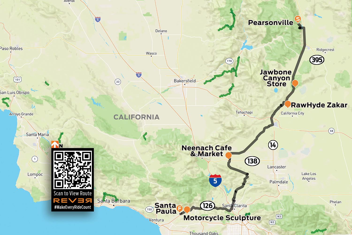
Click here to view the route above on the REVER app/website
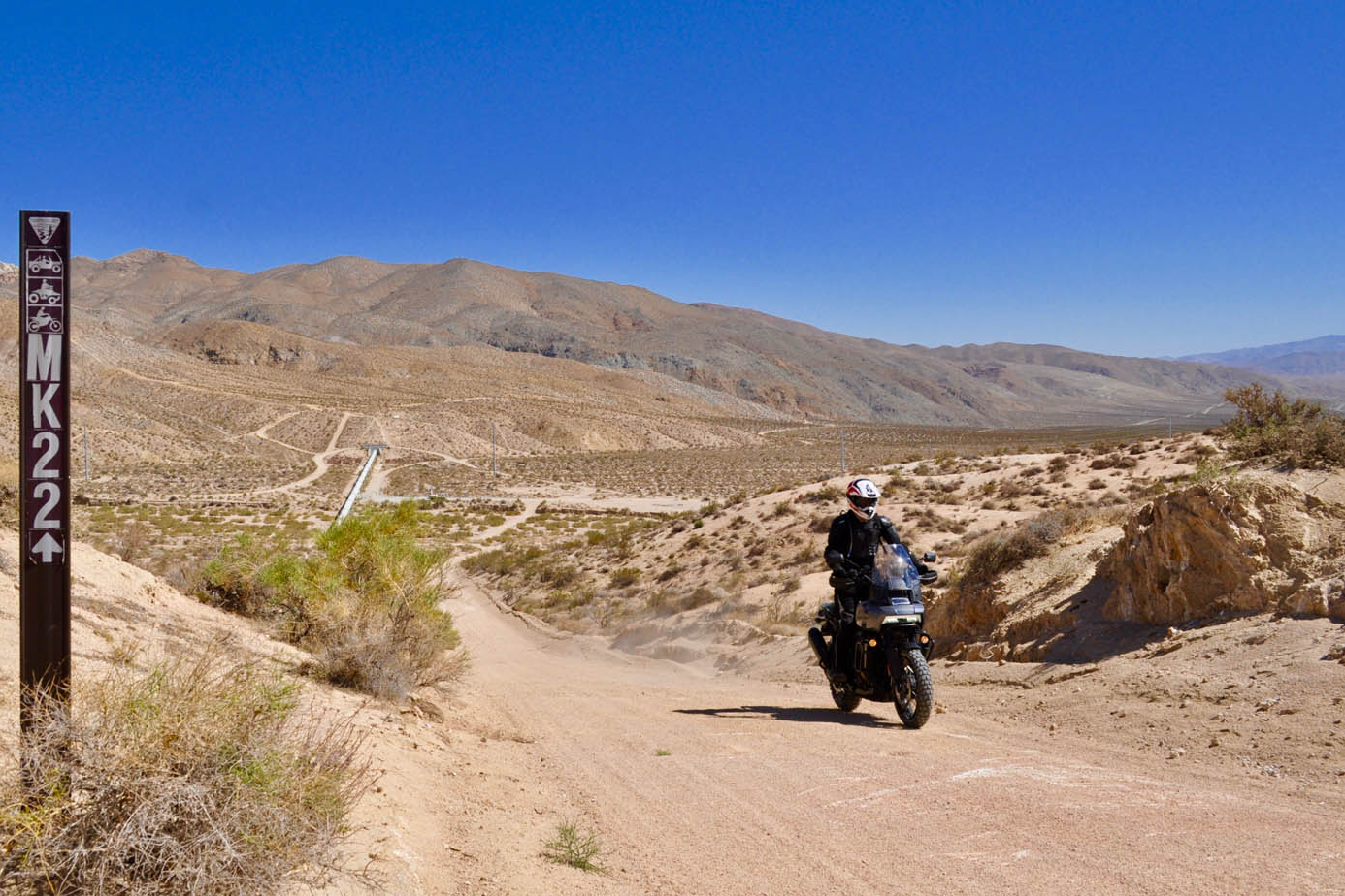
Much of the aqueduct is open waterway, but the rest is a covered concrete channel. And most of that channel functions as a public road. We took a trio of Harley-Davidson Pan Americas and tried to see how much of it we could ride.
It was a hot May morning when we set out from Zakar, a compound that serves as base camp for RawHyde’s adventure motorcycle training school in the Mojave Desert. We wanted to beat the worst of the heat, so shortly after dawn we dashed up State Route 14 to U.S. Route 395 and exited at 9 Mile Canyon Road to catch our first leg of the aqueduct.
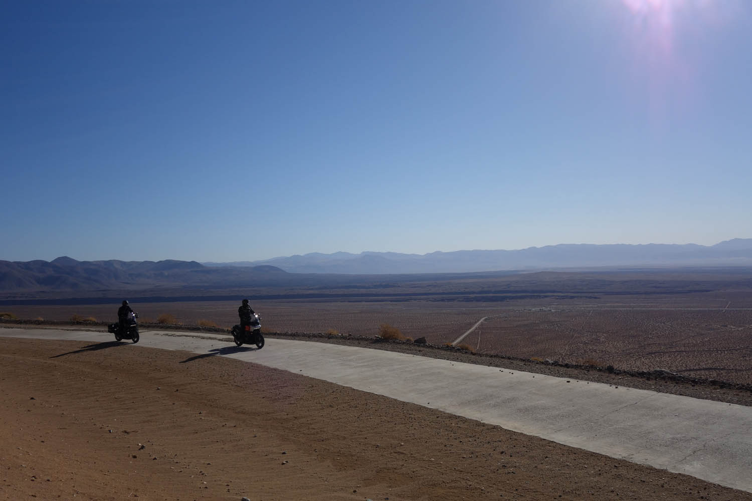
On maps, it’s called “Los Angeles Aqueduct.” Under our tires, it was a crunchy, crusty roadway, often covered entirely in sand and gravel, that followed the contours of the lowest reaches of the Sierra Nevada mountain range. We had to leave the hills after a few miles as the aqueduct went underground, running in tunnels through the foothills. (The aqueduct includes 142 such tunnels, comprising 52 miles of its total length.)
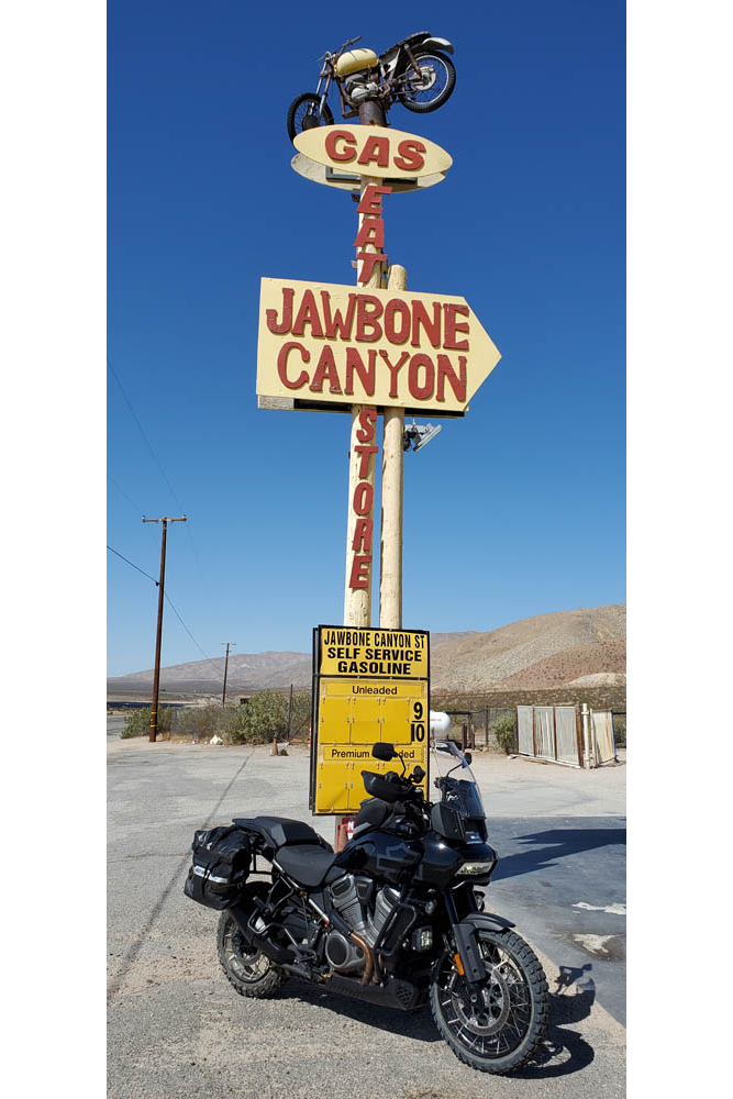
Back on the slab, we stopped for cold drinks at Robber’s Roost Ranch, and again at Jawbone Canyon Store, the “Mad Max” meets “Motocross Zombies from Hell” waystation popular with the off-road bike and buggy crowd. Further south, we were able to pick up the aqueduct again from Pine Tree Canyon Road. From there, we had a spirited 13-mile run of sand and concrete climbing high above the flat desert floor before dropping us down into the town of Mojave.
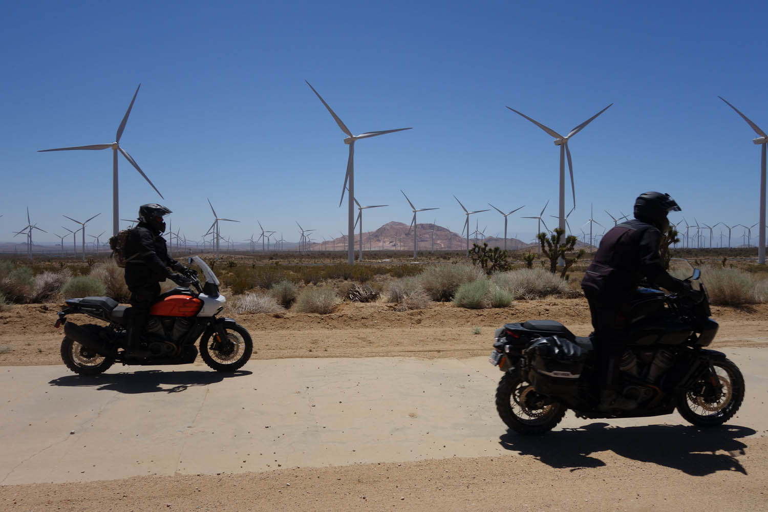
The aqueduct left the mountains, taking us with it for a higher-speed run across the Antelope Valley. From Oak Creek Road we accessed the aqueduct again, then barnstormed our way through wind farms, skirted past Willow Springs International Raceway, crossed Tehachapi Willow Springs Road, and ran across the desert for 30 miles of flat-out fun.
It was a good chance to test the new Harley-Davidson off-roader in a desert setting. I had been impressed on previous rides by the bike’s behavior, but in the sandy sections I came to admire it even more (especially with the optional knobby tires). So did my colleagues. By the end of this stretch, even those of us who own GS or GSA machines agreed the Pan America handled the sand better than our beloved BMWs.
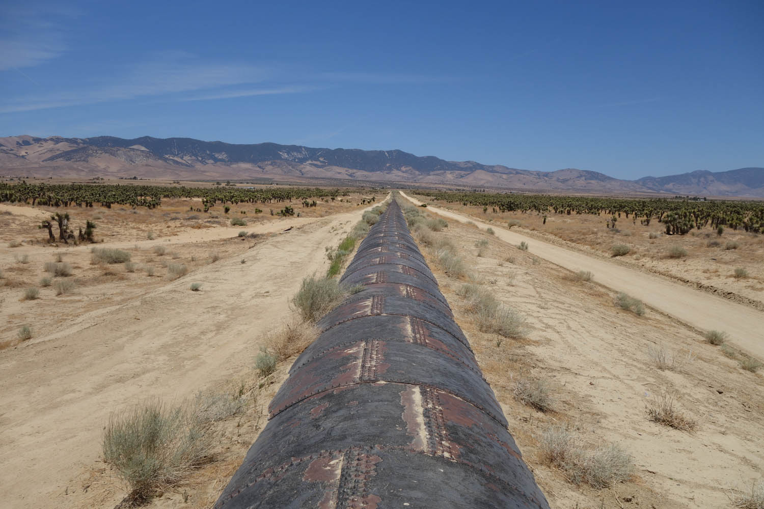
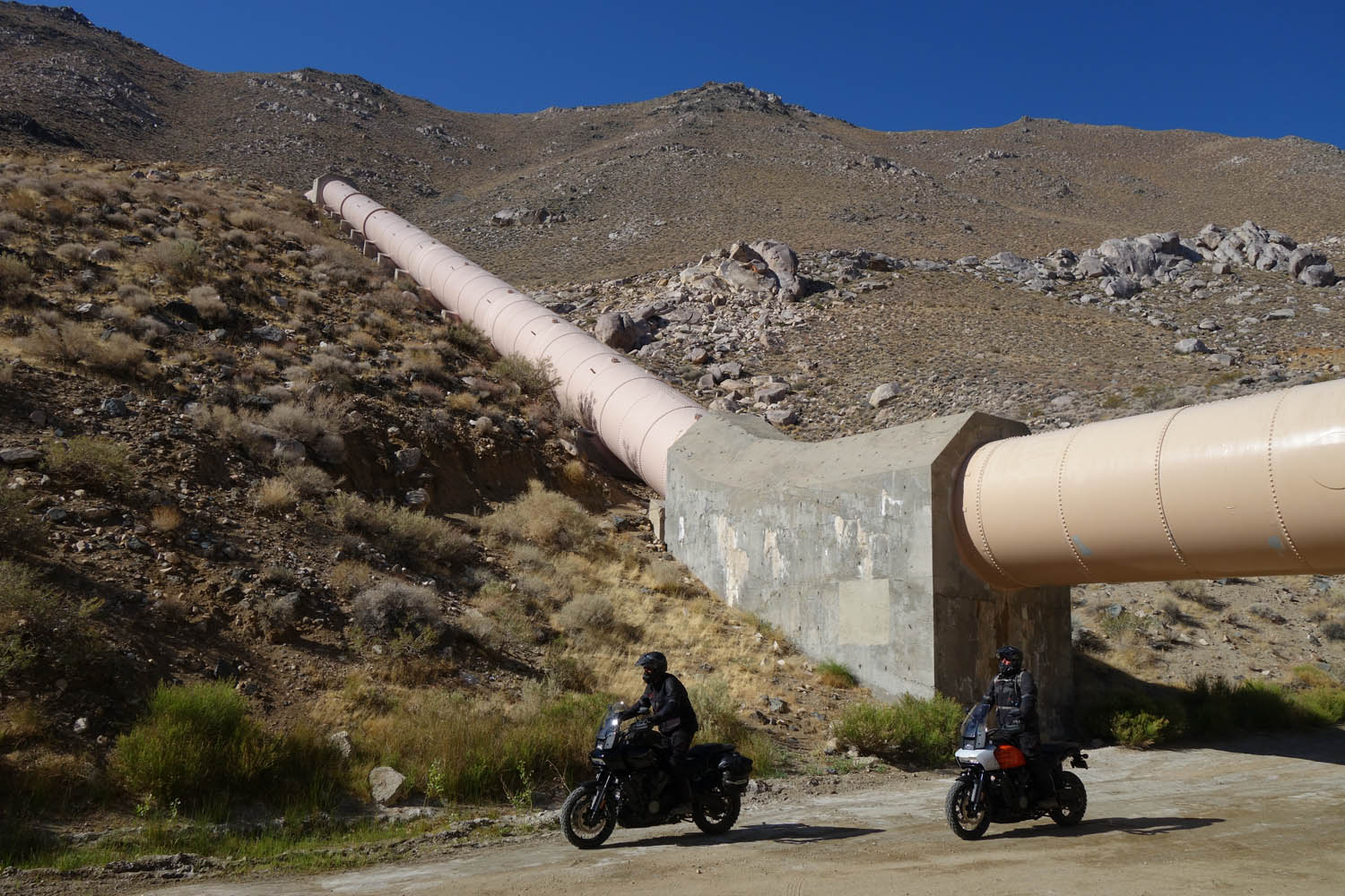
Along here we also got to see several different types of aqueducts. There were sections with a flat concrete top, older sections covered in curved concrete ribs –the standard before someone figured out you could use the top of the aqueduct as an access road if you flattened it –and even a mile-long section of above-ground pipe, built from massive 12-foot-diameter rounds brought in by mule teams.
At State Route 138, we stopped at the Neenach Cafe and Market for a cold drink. From there, we rode tarmac into the foothills, through the towns of Lake Hughes and Elizabeth Lake, past the legendary motorcycle stop The Rock Inn and into Green Valley and San Francisquito Canyon.

It was in this canyon that William Mulholland and the brain trust behind the mighty aqueduct decreed that Los Angeles’ water should be stored. A concrete gravity dam –virtually identical to the Mulholland Dam that still holds up Lake Hollywood –was constructed in a narrow section of the canyon. The St. Francis Dam was completed in 1926. Two years later, and only hours after Mulholland had inspected the dam and deemed it safe and stable, the structure gave way.
Just before midnight on March 12, 1928, a wall of water 180 feet high surged down the canyon. More than 12 billion gallons of water left the dam within the next hour. Entire communities were engulfed and swept away. At least 431 lives, and perhaps many more, were lost.
We rode our Pan Americas along a dirt path toward the original dam site. Beside the trail were massive chunks of concrete, some as big as a Winnebago, remnants of the fallen structure. Returning to the road, we continued down the canyon to Power Plant 2, where aqueduct water runs through turbines to create electricity. We’d only intended to admire the exterior of the building. But a building superintendent, noticing our bikes in the parking lot, let us in for an impromptu tour of the remarkable facility, which still uses the same turbines that were installed more than a hundred years ago –some of them recovered after the disaster from miles down the canyon.
Our interest wasn’t only in the disaster. There was a motorcycling purpose to our visit, too. The last person to see the dam before it blew was a motorcyclist named Ace Hopewell, who heard rumblings above the noise of his engine and stopped to listen before riding on.
There were motorcycle heroes, too. State Motorcycle Officer Thornton Edwards and Santa Paula Police Officer Stanley Baker were notified of the dam’s collapse, and at great risk to themselves raced from street to street in Santa Paula sounding the alarm. The two riders are credited with saving hundreds of lives, as the people they woke from sleep were able to escape being swept away by the rushing waters.

To pay tribute to these men, we rode south from Power Plant 2, across Castaic, past Magic Mountain, along the part of State Route 126 that was once home to the motocross track known as Indian Dunes, and into the town of Santa Paula. To fortify ourselves we stopped at Rabalais’ Bistro for strong coffee, hot beignets, and plates of gumbo, red beans and rice with andouille sausage, and shrimp and grits.
At sunset, we stood near the old Santa Paula train station and admired local artist Eric Richards’ metalwork statue entitled “The Warning.” It depicts the two valiant motorcycle officers, one astride an Indian and the other a Harley, as they made their rounds that deadly night. As dark began to suggest itself in Santa Paula, we headed back, making as quick a trip as possible on pavement to return to our starting point. We’d ridden 180 miles to get to the statue of the two heroes, 50 of that on sandy aqueduct. It took us 100 miles of high-speed pavement to get back to Zakar.
The post Favorite Ride: Los Angeles Aqueduct first appeared on Rider Magazine.
Source: RiderMagazine.com