Tag Archives: Other Features

Riding in Beautiful Circles: A Southern Oregon Motorcycle Ride

Southern Oregon Motorcycle Ride
A sunny June day is the perfect time to explore backroads through Oregon’s Rogue River-Siskiyou National Forest.

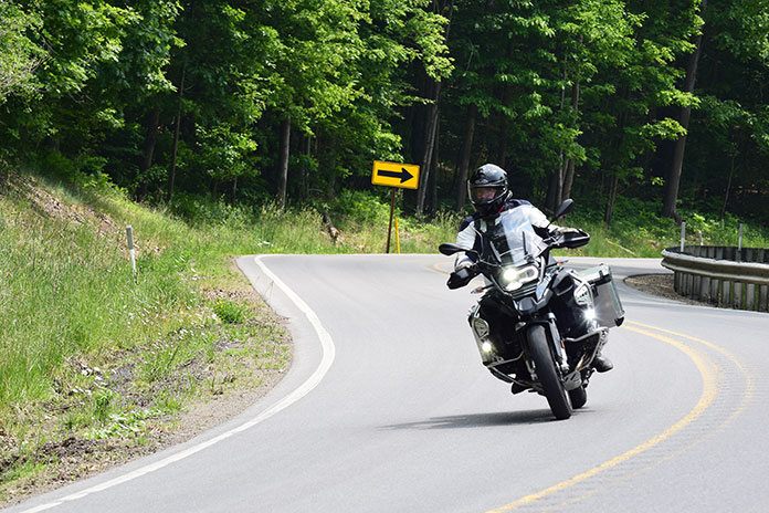
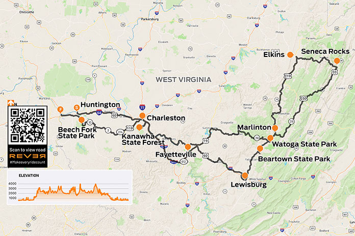
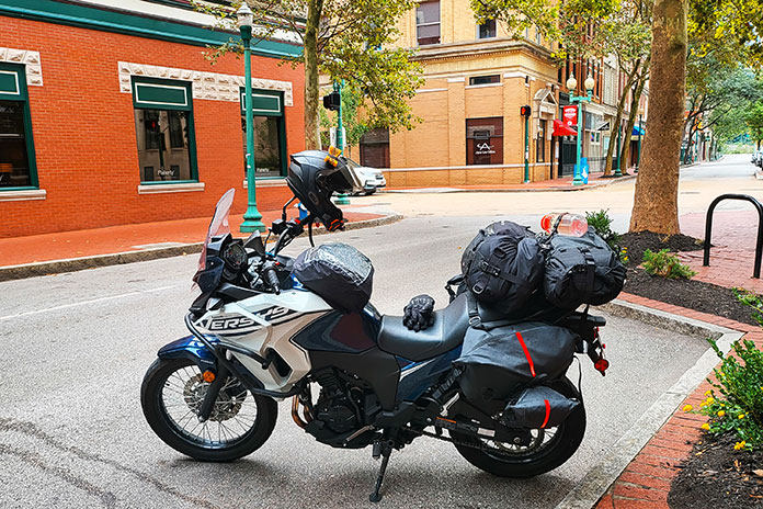
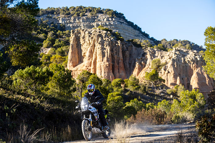
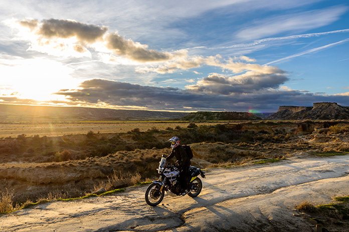
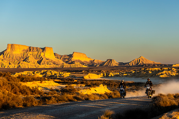
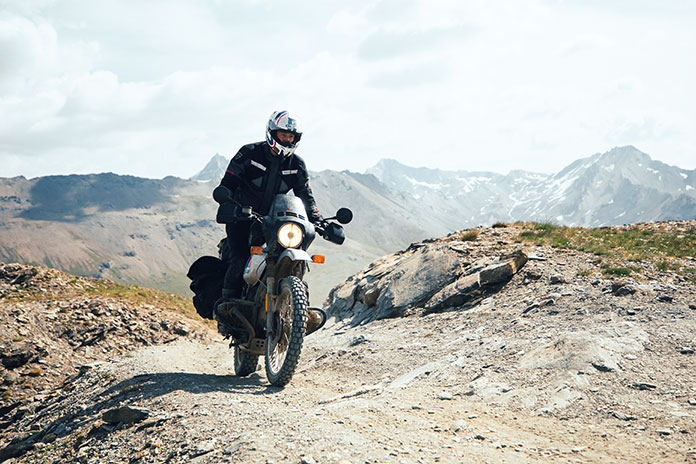
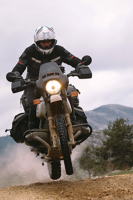
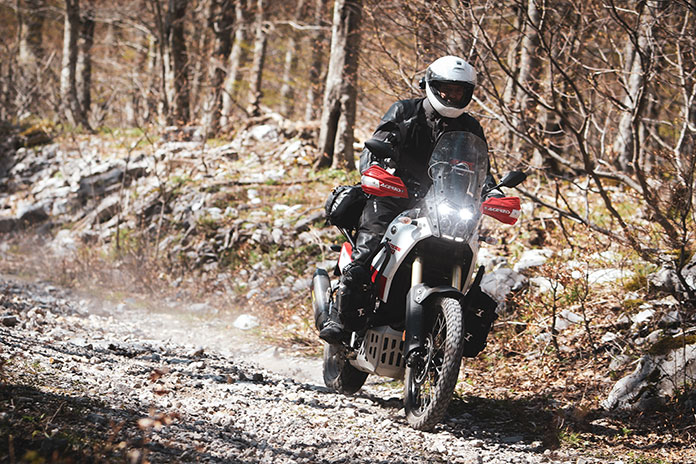
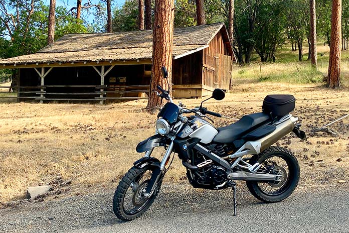
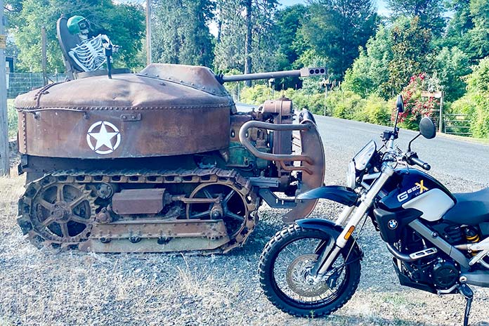
There is just something about southern Oregon. It can be difficult to choose between the area’s rolling grasslands, towering evergreens, high mountain lakes, quaint villages, and vibrant entertainment opportunities. In fact, it’s so hard to decide that I didn’t. To sample the cornucopia of Pacific Northwest treats, I spent a few early June days on an Oregon motorcycle ride aboard a BMW G 650 X Country, a scrambler-styled variant of the single-cylinder G 650 platform sold in the late 2000s.

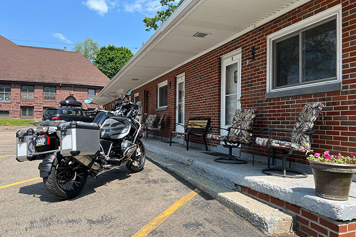
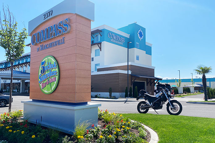
The largest city in southwestern Oregon, Medford, is geographically central to each of the riding loops and entertainment opportunities I had planned, and my lodging for the two-day exploration was the Compass Hotel by Margaritaville. While a tropically themed hotel by Jimmy Buffet may seem incongruous in the Pacific Northwest, it was an ideal home base – clean, colorful, comfortable, and fun.

(See RESOURCES at the end of the story for links to information about areas covered in this ride.)

Southern Oregon Motorcycle Ride
The Compass Hotel by Margaritaville in Medford was an ideal place to stay during my multi-day visit in southern Oregon.

Oregon Motorcycle Ride Day 1: Ashland, a Ghost Town, and Shakey Graves

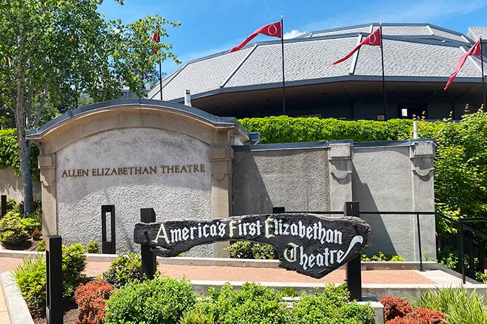
I packed the small tailbag on the BMW with water, my hat, and some snacks and headed southeast for the short jaunt to Ashland. Upon entering the lively, park-like city, I took a side ride past the theater compound of the Oregon Shakespeare Festival. While the festival was dark during this trip, I have been to several great Shakespearean performances at the OSF. One of these I highlighted for Rider back in 2016 in “Chasing Shakespeare: An Elizabethan Tour of the West.” If you can coordinate your visit to Ashland with an OSF performance, I highly recommend it.

Southern Oregon Motorcycle Ride
The Oregon Shakespeare Festival is located in Ashland.

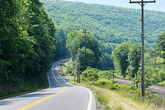
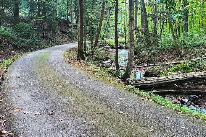
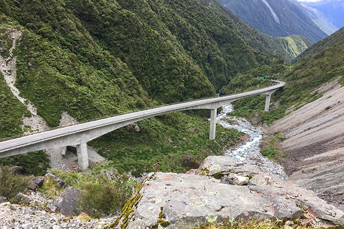
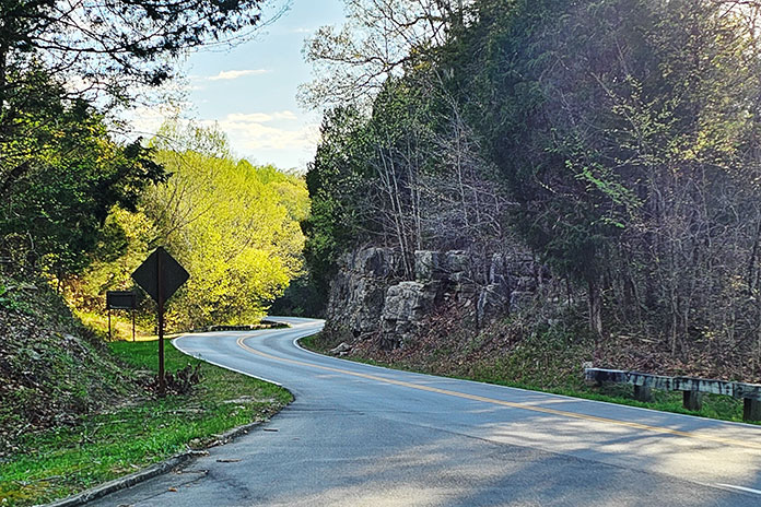
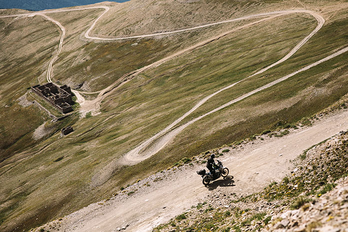
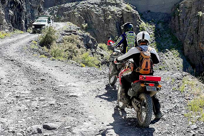
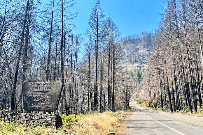
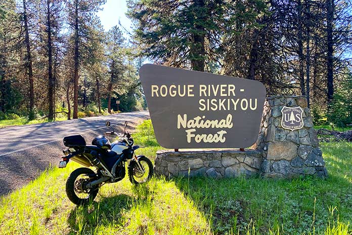
After my roll through the spotless little city, the real ride began. I headed out on Dead Indian Memorial Road, which began as one of the first trans-Cascade travel routes in southern Oregon. It connects Ashland and the Rogue River Valley with the Upper Klamath Basin. The somberly named road begins as a gentle sway through grasslands before morphing into an evergreen-lined serpentine climb into the Rogue River-Siskiyou National Forest. The temperature dropped and the road coiled on the steady climb. Sweeping corners in wide-open grasslands became tighter in the high chaparral and hairpins in the tall forest. The light and nimble BMW proved perfect for the tightest of the corners on the route.

Southern Oregon Motorcycle Ride

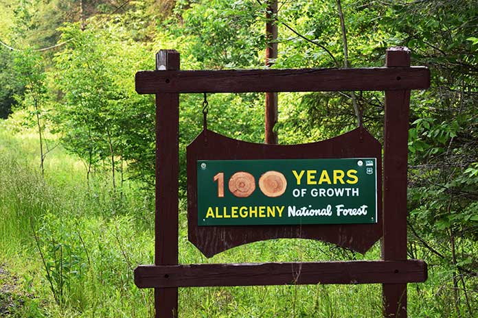
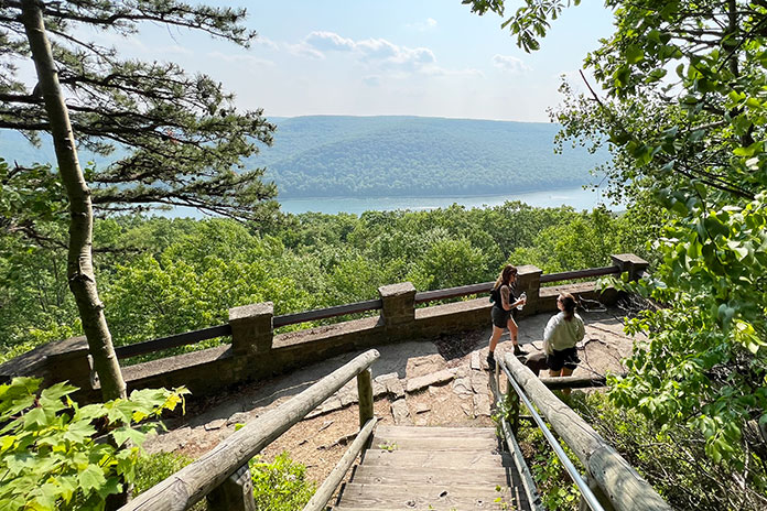
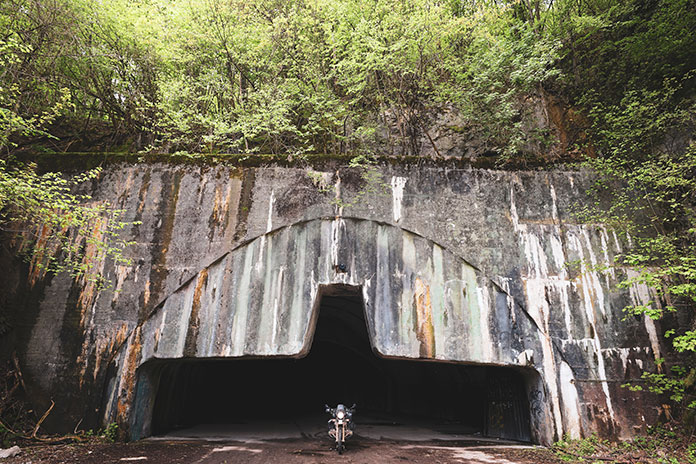
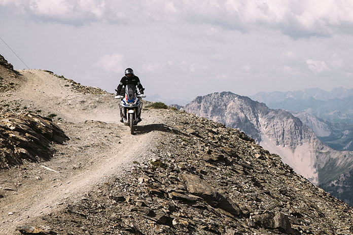
When I topped out into the dense forest, I took several jaunts onto the single-tracks and tight dirt roads that finger into the evergreen thickets. Again, the agile BMW was the perfect tool for the task. I came upon a sign indicating the crossing of the famed Pacific Crest Trail, a 2,650-mile hiking and horse trail that traverses the highest portions of the Cascade and Sierra Nevada ranges. The PCT was brought fully into the public lexicon through Cheryl Strayed’s self-discovery narrative Wild: From Lost to Found on the Pacific Crest Trail, which was later made into a Reese Witherspoon movie. Just a few miles later, the picturesque Howard Prairie Lake began to reveal itself intermittently as strips of deep blue through the stately emerald pines. I stopped at one of the lake’s boat ramps to take in the pristine waters fronting the snow-capped peaks in the distance.

Southern Oregon Motorcycle Ride

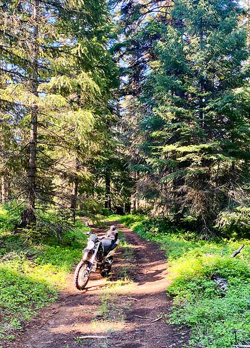
More great riding led me aside Hyatt Reservoir. While the southwestern forests near my home in Arizona are somewhat monochromatic, consisting of mostly one type of evergreen, the forests in this region offer up multiple hues of green from a wide array of tree varieties. I turned west onto the Green Springs Highway, also known as State Route 66, which proved to be a fantastic motorcycle road that winds back into Ashland. The first of my three Oregon loops was exactly as I had hoped it would be. After a bite of lunch in Ashland’s downtown, it was time for my afternoon loop.

See all of Rider‘s ‘Great Roads West’ touring stories here.

Just south of Medford, I turned on South Stage Road, which quickly brought me to the intersection of Griffin Creek Road, which becomes Poormans Creek Road, and then I turned onto Sterling Creek Road. Sense a theme here? These creek roads offered up wonderful stretches of entertaining tree-lined sweeping turns, often flanking – you guessed it – mountain streams.

Southern Oregon Motorcycle Ride
Buncom is a gold-rush ghost town.

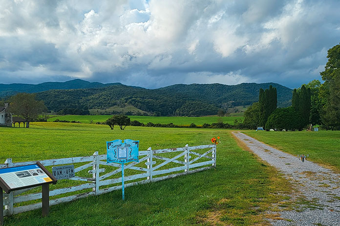
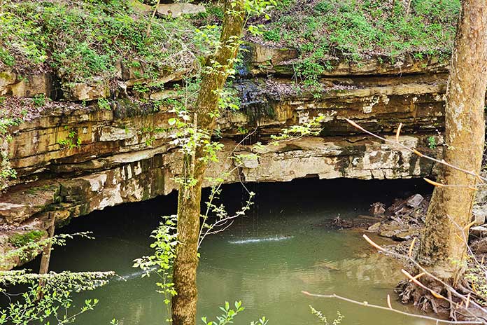
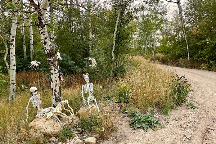
At the intersection of Sterling Creek Road and Little Applegate Road, I rolled into the major reason I plotted this portion of the ride. The tiny ghost town of Buncom sits directly at the intersection, and only three of the original structures remain of the once-thriving town that was established when gold was discovered on Sterling Creek in the mid-1800s. The weathered wooden buildings, which consist of the town post office, a wooden bunkhouse, and an old cookhouse, hearken back to a time of starry-eyed dreams of riches – and likely also of dashed hopes. After some moments imbibing the history, it was time for the last leg of the day.

Southern Oregon Motorcycle Ride

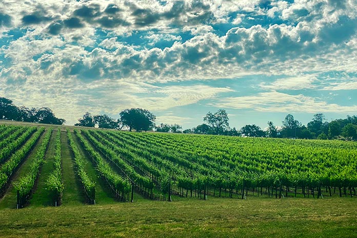
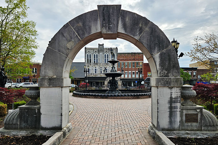
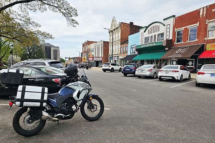
From Little Applegate Road, I turned onto Medford-Provolt Highway and rolled through farmland and thriving vineyards on the way to Jacksonville, which is a bit like a mini-Ashland with its historic brick buildings and homey atmosphere. It is also at the heart of Oregon’s prolific wine industry, so great local and regional examples are available everywhere. It was here that another highlight of the trip was planned.

Southern Oregon Motorcycle Ride
Jacksonville, Oregon

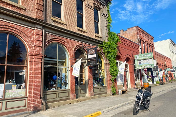
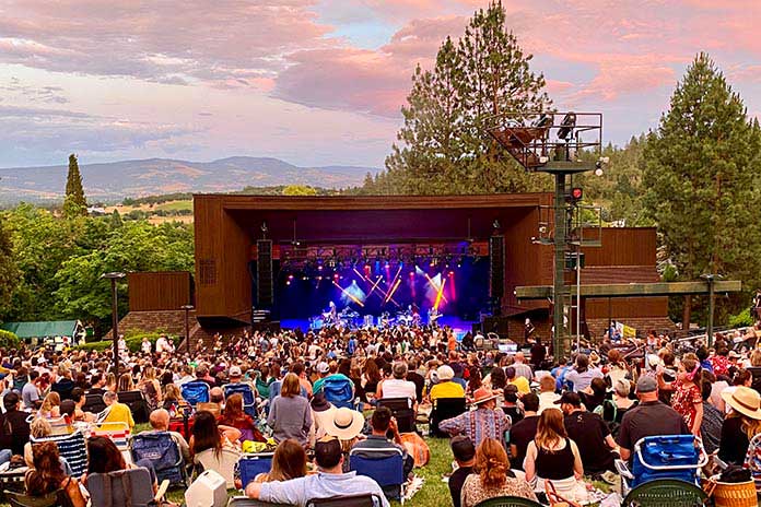
Jacksonville is home to the Britt Festival Pavilion, a beautiful, intimate outdoor music venue. The nonprofit amphitheater, which hosts several big-name acts throughout the year, is named for Peter Britt, who opened Oregon’s first official winery in the late 1800s. The attraction for me was a show by Shakey Graves, an inventive artist in the loosely defined Americana genre from Austin, Texas. As the sun set over the Jacksonville horizon, I sat in the grass, sipped a little red wine, and enjoyed the amazing show. It was the perfect culmination of a fantastic day of riding. After the show, it was a short ride back to Medford for some rest.

Southern Oregon Motorcycle Ride
Watching Shakey Graves at the Britt Festival Pavilion in Jacksonville.

Oregon Motorcycle Ride Day 2: A Longer Loop and Crater Lake

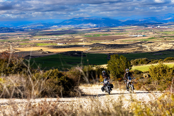
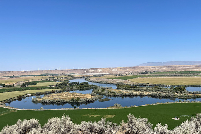
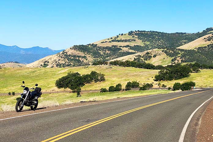
Having gotten my feet wet with some great riding on the first day, the next day was for adding miles. In southern Oregon, that means more miles of spectacular scenery. A short jaunt out of Medford on State Route 62 got me to a portion of the road fittingly named the Rogue-Umpqua Scenic Byway. The road sweeps through a wide variety of terrains, lakes, and rivers. Most notably, the tarmac clings to the bank of the Rogue River for long stretches.

Southern Oregon Motorcycle Ride
Crater Lake

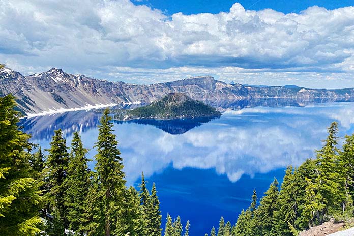
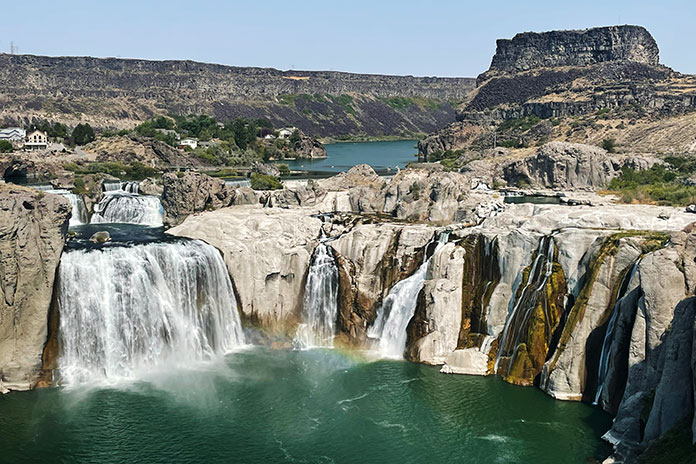
Just after the northernmost crest of this loop, I got in line to pay the fee for my first visit to the world-famous Crater Lake. While the early June snowpack still rendered much of the national park’s roadway closed, I got to sample the spectacular ride up to the lake and several different perspectives. I have seen some of the most iconic natural landforms this country has to offer, and Crater Lake is a singularly jaw-dropping place. It is the deepest lake in the United States, and the water beneath those sheer volcanic cliffs is as strikingly blue as I have ever seen. The clouds reflected on the surface of that glasslike, frigid water makes for a surreal beauty, while the mysteries of its 2,000-foot depth add a dash of intrigue.

Southern Oregon Motorcycle Ride
Even in June, snow was piled high around the visitor center at Crater Lake National Park.

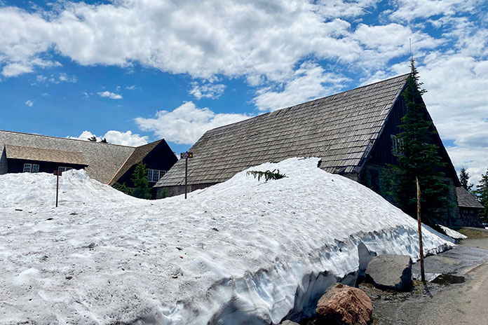
Massive melting snowdrifts still lined the roadway and made icy inclines to many roofs in the park at the time of my tour. Runoff made riding vigilance of utmost importance as mini rivers crossed the park’s roads and water and debris were intermittently part of my rolling adventure. These road conditions and the abundance of wildlife make the “head on a swivel” idiom important for more than just taking in the scenery.

After riding out of the national park, I continued my loop ride on Crater Lake Highway to the southeast. Just after Fort Klamath, I made a westward turn and continued on the Volcanic Legacy Scenic Highway. As the highway took a southern turn, the extreme variety of the natural palate continued in spades. Expansive grasslands, towering trees, and rugged mountains took turns delighting my senses as I rolled toward Medford.

Southern Oregon Motorcycle Ride

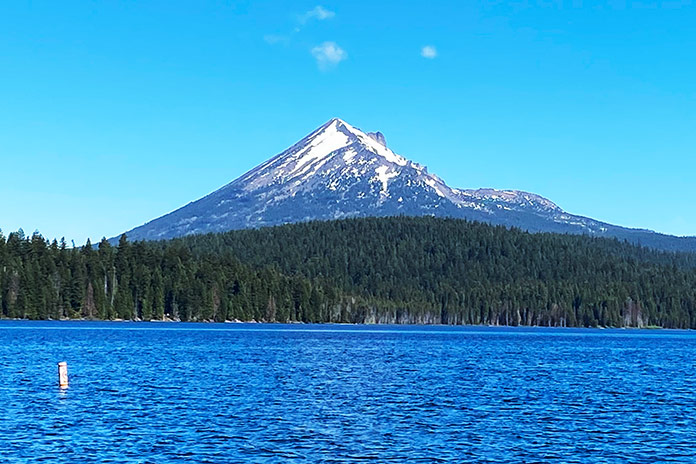
I motored past Upper Klamath Lake, which has the largest surface area of any freshwater lake in Oregon. In contrast to Crater Lake, Upper Klamath is shallow. On the final stretch of this loop, I rode through more majestic pines on the return to Medford. On State Route 140, I again crossed the path of the Pacific Crest Trail where it winds toward the base of the impressive Mount McLoughlin.

Just a month earlier, much of this ride would have been prohibitively cold and snowy. Even in June there were places, like portions of Crater Lake National Park, which were impassible. However, the mix of weather and topography was amazing on my three loops. I recommend this tour, or some variation of it, to any nature-loving moto-tourist. Extreme temperature variations are to be expected and should be reflected in what is packed in your panniers.

Southern Oregon Motorcycle Ride

I rolled back to the Compass Hotel in Medford with a sore tail and a mind brimming with memories. My days in southern Oregon were amazing. Hundreds of miles on that BMW 650 proved to be a much more raw and visceral experience than it would have been on my bigger touring bike. More vibration? Yes. More wind? Yes. And more memories? For sure.

RESOURCES

Southern Oregon Motorcycle Ride Tim Kessel

With 50 years of motorcycling and 30 years of teaching English under his belt, Tim Kessel has melded those two passions into a gig as a motojournalist. Maybe that’s why there is always a permanent, satisfied smile under his full-face helmet.

The post Riding in Beautiful Circles: A Southern Oregon Motorcycle Ride appeared first on Rider Magazine.

Source: RiderMagazine.com

Enlightenment in Pennsylvania: An Allegheny National Forest Motorcycle Ride

Allegheny National Forest motorcycle ride
Getting there is half the fun, especially on this Allegheny National Forest motorcycle ride. Motorcyclists can find plenty of enjoyment riding the byways that wind through and around this lush region in Pennsylvania.

My father‑in‑law had a thing for the Allegheny National Forest in northwestern Pennsylvania. George would regularly leave his home in Jeannette, an industrial town east of Pittsburgh, and make the two‑hour trek to the family’s hunting camp nestled at the edge of the state’s only national forest. 

Although he was raised a city boy, George longed for the quiet mountains. He loved to fish, canoe, and hike in the warmer months and hunt and cross‑country ski in the winter. He enjoyed meeting and talking with people year‑round.  

Allegheny National Forest motorcycle ride
Roads gently sweep through the forest, adding to the calming effect of the area.

George and I developed a friendship that went beyond the requisite in‑law geniality. We became close friends and confidants. As I began spending more time with George at camp, I discovered he not only loved the area but was also intimately familiar with nearly every small town, backroad, and beer garden across Clarion, Forest, Elk, and McKean counties. George seemed to know everyone, and everyone knew and loved George. As he introduced me to his old haunts and new friends, I became intrigued by what made this area so special to him. 

Although my wife’s beloved father and my dear friend is now gone, Amy and I find ourselves driving the 100 miles north from the city nearly every weekend to work on the old camp property and take in the mystique of the region he held so dear. In the beginning, it was a way to stay connected and aid the healing process. Then we developed our own growing attachment to the area.

No longer having the benefit of the informative and entertaining car rides with George, I began going solo on a motorcycle (my own happy place) to explore more of “George’s Country.” Carving out a long weekend, I straddled my GS and headed north to investigate local attractions and, as George would, invest the time to talk with people and make new friends along the way. 

Allegheny National Forest motorcycle ride

Scan QR code above or click here to view the route on REVER

(See RESOURCES at the end of the story for links to information about areas covered in this ride.)

George neither owned nor ever rode a motorcycle, although he did have a motorcycle endorsement. In Pennsylvania, there was a time when one could simply check boxes on the license renewal application to select endorsements. George chose car, motorcycle, commercial truck, and school bus. Fortunately, he stuck to cars. He said he thought he could make a motorcycle go but wasn’t confident he could get one to stop, which simply wouldn’t have fit his travel style since he enjoyed stopping often. 

The farther into the forest I rode, the more my stress slipped away. The gently sweeping, rising, and falling roads pleasantly transitioned me to a calmer mind. A patchwork of idyllic farms and homesteads stretched across the valleys as folks offered friendly waves. Up here, life is simpler, less frenetic, and more down to earth.  

Along the road, I saw a sign proclaiming “100 Years of Growth.” The 514,000‑acre Allegheny National Forest celebrates its centennial in 2023, but unlike cities and suburbs, this is slow growth – unhurried evolution that builds strength and deep roots. 

Allegheny National Forest motorcycle ride
Established Sept. 24, 1923, Allegheny National Forest celebrates its 100th anniversary this year – although the roots run much deeper.

Towns and attractions in the area have powerful stories and deep histories that are easy to miss when one rides through a town or past an attraction without stopping. And here is where I must make a confession: I have a habit of allowing the momentum of a ride to urge me to keep rolling, and I convince myself I will revisit later when I have more time (I rarely do). Taking a cue from George, this ride would be about using the time I now have at my disposal.  

See all of Rider‘s Pennsylvania touring stories here.

Citizens of Kane

Traveling north on State Route 66, I saw a sign that proclaimed I had arrived at the gateway town of Kane, “A Star in the Forest.” This is also the junction with U.S. Route 6, known locally as PA Route 6, a favorite road among motorcyclists that stretches east/west across the length of the state. 

Allegheny National Forest motorcycle ride Kane Pennsylvania
The town of Kane is an ideal hub for exploring the Allegheny National Forest. With abundant route options and plenty of local attractions of its own, it’s a natural destination for riders.

At the entrance to Kane is a railroad crossing and historic rail station set against the skyline of 19th century buildings. Built around 1871, the Kane Depot is now a museum dedicated to preserving the town’s heritage, which includes the role a Kane citizen (not Citizen Kane) played in saving the Mexican wolf from extinction. Who knew? A stone outcropping hosts a sculpted wolf and cubs and a plaque that toplines the story so that people do know, and the museum tells the story with vivid exhibits. 

I idled into town, and as I had committed to doing, I stopped, walked around the business district, and even picked up a tourist map of the area (available at nearly every establishment in the region and a great resource for finding “can’t miss” stops and favorite motorcycle routes; also see the Resources at the end of this article). 

See all of Rider’s Northeast U.S. touring stories here.

I love how these old towns are being revitalized with local businesses, restaurants, breweries, and shops – not the endless stretch of chains found near every city, suburb, and interstate exit. Here was Logyard Brewing, which specializes in sourcing ingredients native to the immediate Pensylvannia Wilds area. I was still on my ride so didn’t partake, but I did poke my head inside for a look. Very cool. Similarly cool is Table 105, located next door. I knew I had the right place for lunch when I spotted the ’72 Indian minibike hanging on the wall (I had one as a kid). The atmosphere was an ideal mix of vintage local architecture, modern brew pub, and northwestern PA kindness. Taking my server’s suggestion, I ordered a barbecue chicken pizza that was nothing short of amazing.  

Allegheny National Forest motorcycle ride
A throwback to a kinder, more social time. Connecting with the local folks and other travelers is what these small towns are (re)made for.

With a full belly and a few hours of sun left, I pointed the bike north for a loop up to Kinzua Point and back. A gentle ride along State Route 321 traced the western shore of the Allegheny River. At 321’s terminus, a left on State Route 59 took me deeper into the trees. Campsites, recreation areas, trails, and scenic overlooks abound, although one would never know if not for the signs since each is tucked away in the trees. Resisting my natural inclination to press on, I turned at the Rimrock Overlook sign. A narrow and winding well‑paved path through the trees is followed by a short, easy walk to a spot where the limited view dramatically opens to a majestic vista of forested mountains and the wide river below. I gave George a virtual high‑five.

Back on Route 59 heading west, the forest opens to spectacular views of pristine water. This is the Allegheny River where its expanse forms the roughly 10,000‑acre Allegheny Reservoir thanks to the Kinzua Dam – one of the largest dams east of the Mississippi. 

Allegheny National Forest motorcycle ride Allegheny Reservoir
Created by the Kinzua Dam, the immense Allegheny Reservoir is inviting for boaters, diners, and sightseers.

As the sun began its downward journey, I began my own, turning south on the Longhouse National Scenic Byway, where I was met with more of the twisting, rising, and falling terrain that makes me glad to be on a motorcycle. The path teased me with periodic peeks at the water to my left as I traced the opposite side of the river. 

I made an obligatory stop for ice cream at Bob’s Trading Post. I ordered a small cone, but the kid behind the counter kept piling on scoops until I finally asked him to stop, reminding him that I ordered a small. He informed me that a “small” at Bob’s has three giant scoops of ice cream and said what I wanted was a “baby” cone. Sheepishly, I said to make it a baby cone then. With big baby cone in hand, I proceeded past the line of regular patrons who were clearly enjoying our exchange. 

Allegheny National Forest motorcycle ride Kane Pennsylvania
The author enjoys a “baby” cone at Bob’s Trading Post in Kane.

With the loop complete, I wheeled into the Kane Tourist Home & Motor Inn. It’s a throwback to old‑time travel when tourists would stay in converted old mansions (a “tourist home”) or later, in one of a row of private rooms with parking spots at each front door. It would be the motor inn for me. Built in 1952, it doesn’t seem to have changed much. The rooms have wood‑paneled walls and vintage framed pictures. Pink tile adorns the bathroom. As it was back then, there’s no television, but the new owners do provide wi‑fi in case a traveler can’t go a night without streaming something. I chose to sit on a chair outside my room, sip good bourbon, and watch neighborhood kids play outside (a rare sight where I live). 

Allegheny National Forest motorcycle ride Kane Tourist Home & Motor Inn
The Kane Tourist Home & Motor Inn gives motorcycle travelers a taste of old-time lodging, including affordability and parking just outside your room.

The motor inn was just off the main drag, so I walked to a quaint little winery called Twisted Vine where a delightful and bright young lady was behind the bar and a youngish couple were seated to my left. Surprisingly, folks weren’t absorbed by their mobile devices; they were engaged in conversation. I was welcomed into a pleasant chat with all of them, during which I learned more about the area, about how the town of Kane has been making a comeback, about local musicians, and more. Because I stopped, I made new friends. This is one of the things I enjoy so much about traveling by motorcycle. It gives me the opportunity to escape and, at the same time, reconnect with life in a more meaningful way. Nothing fake. No agendas. Just engagement with good people in an atmosphere that is relaxed enough to invite conversation. More and more, I came to understand George’s fascination with this area.

Allegheny National Forest motorcycle ride Rimrock Overlook
Hidden down narrow lanes are gems like this spectacular view from the Rimrock Overlook.

One Becomes Two

My friend and fellow motorcycle safety expert Hal Deily joined me the next day for the rest of my Allegheny National Forest motorcycle ride. It was fun to see how Hal, a guy who has lived within the city limits of Pittsburgh his entire life, was enjoying the vast ancient forests, the well‑preserved countryside, and the hospitality of small‑town communities. Being naturally social, Hal immediately struck up conversations with wait staff, shop owners, and patrons. He and I got into our typical back‑and‑forth banter that entertained the locals (we think), and as I did several times on this journey, I thought back to how George and his brother‑in‑law Billy would often be the center of attention anywhere they went as they shared stories and told old jokes to new audiences. They were never obnoxious, just good spirited and lighthearted people who were fun to be around.  

Allegheny National Forest motorcycle ride
The author plugs into the local heritage.

After breakfast on PA Route 6 at the Barrel House, we continued toward the Kinzua Sky Walk, rated “One of the Top 10 Most Beautiful Skywalks and Viewpoints in the World,” at Kinzua Bridge State Park. Once the highest and longest railroad viaduct in the world, a direct tornado strike in 2003 wiped out more than half of its span. The mangled wreckage of steel towers rests in perpetuity on the valley floor more than 200 feet below what is now a prime viewing area at the far end of the surviving structure. This is a must‑see destination for any ride in the area, evidenced by the volume of motorcycles in the parking lot.

Allegheny National Forest motorcycle ride Kinzua Sky Walk
A must-see, the Kinzua Sky Walk takes visitors to the edge of what was once the world’s highest railroad viaduct (before it took a direct tornado hit).

In addition to delightfully laid‑back two‑lane riding, PA Route 6 presents many rewarding sights and significant historical areas of interest. Magnificent Victorian mansions line the way through downtown Smethport, evidence of a game of architectural one‑upmanship played by the area’s lumber barons during the 19th‑century timber boom. There, Hal and I stumbled upon Old Town Smethport, the home of “America’s First Christmas Store.” It’s also an eclectic collection of historical displays that includes old‑fashioned toys, an original stagecoach, a vintage delivery truck, a rustic log cabin, and even a Civil War cannon and artillery. I can’t help but think George would have loved this place. And I’m glad Hal and I took the time to stop, even though it meant shedding all our riding gear once again. 

Allegheny National Forest motorcycle ride Smethport Pennsylvania
Tree-lined streets and well-preserved Victorian-era mansions of the logging-baron days guide the way through Smethport.

Just west of Port Allegany is an eye‑catching structure along the road called Lynn Hall. Built in the Modernist style (think Frank Lloyd Wright), this stunning 1930s residence is an unexpected gem in the woods. But don’t blink or you’ll miss it!  

Port Allegany is surrounded by natural resources ideal for making glass. That’s what brought Pierce Glass to the town in 1917, followed later by Pittsburgh Corning, makers of architectural glass block distributed worldwide. That proud heritage is celebrated in the Serenity Glass Park, an art display in the heart of town. Murals and sculptures made of colored glass fill the garden. I wish we could have viewed it after dark when the garden is electrified by lights. It must be spectacular.  

Allegheny National Forest motorcycle ride Port Allegany’s Serenity Glass Park
Hal checks out the impressive glass sculptures in Port Allegany’s Serenity Glass Park.

Following a tip, Hal and I turned north onto State Route 155 and then 446 toward the town of Eldred to visit the Eldred World War II Museum. This small community nestled in quiet hills was the site of a munitions plant during the war, producing millions of bombs, shells, and fuses in support of America’s war effort. The museum features a fascinating collection of period artifacts, photos, vehicles, uniforms, weapons, and models. There is a stunning amount of history housed here (just be ready for a curator who is anxious to provide abundant historical – and editorial – commentary). 

Allegheny National Forest motorcycle ride World War II Museum Eldridge Pennsylvania
The extensive World War II Museum in Eldridge draws visitors from near and far.

No Allegheny National Forest motorcycle ride is complete without a stop in Bradford and the Zippo/Case Museum. This world‑class museum wraps the visitor in living history as they walk through the back stories of Zippo windproof lighters and Case knives. Photos, videos, vintage advertising, promotional vehicles, and prototype products bring the stories to life, cleverly showcasing how the products have become part of the fabric of American (and world) culture. I was fascinated by a display of destroyed lighters that had been returned for repair or replacement. (Zippo’s guarantee has always been, “It works, or we fix it for free.”) 

Allegheny National Forest motorcycle ride Zippo Case Museum and Flagship Store
The Zippo windproof lighter and Case cutlery museum is world-class. There’s plenty to keep visitors entertained for hours. Seeing this Zippo promotional car was worth the trip!

Hal and I then took a ride through downtown past the Marilyn Horne Museum, but we were too late to catch this tribute to Bradford’s big opera star, who was once described as “probably the greatest singer in the world” by Opera News. Instead, we wound our way to Bradford Brew Station for a late, nonalcoholic lunch. The brewery has a great reputation, but we still had to ride to our hotel across town. In contrast to the prior night in Kane, we grabbed rooms in a modern Holiday Inn Express that was both affordable and perfectly comfortable. A brisk walk through town to the Papa Scoop’s ice cream stand near Zippo corporate headquarters was the perfect nightcap. 

In the morning, Hal and I opted to ride from Bradford down through Emporium and into the Elk State Forest where we picked up the fabulous State Route 555 along Sinnemahoning Creek to Benezette. A little side loop on Winslow Hill Road rewarded us with fun two‑lane riding and spectacular elk viewing areas. 

A quick sprint up to St. Marys (home of Straub Brewery) was followed by a jaunt to the quaint town of Ridgeway for lunch where Hal and I channeled George and Billy once more, telling polite jokes and laughing with the server and other guests. You just can’t help but be jovial here. And maybe, in the end, I guess that’s what makes the forest so special: It brings out the best in people. By George…I think I’ve got it!

See all of Rider‘s touring stories here.

Allegheny National Forest motorcycle ride
Green as far and deep as the eye can see. Roads wind through 514,000 acres of Pennsylvania’s only national forest.

Allegheny National Forest Motorcycle Ride Resources:

The post Enlightenment in Pennsylvania: An Allegheny National Forest Motorcycle Ride appeared first on Rider Magazine.

Source: RiderMagazine.com

Lessons Learned on a Wandering West Virginia Motorcycle Ride

West Virginia Motorcycle Ride Kanawha Falls State Park Kawasaki Versys-X 300
My campsite at Kanawha Falls State Park on my West Virginia motorcycle ride.

We all have beliefs about what’s expected of a motorcycle camper, and sometimes it takes a certain situation to bring those expectations to the surface. For me, it took heavy rain on a mountain road during a West Virginia motorcycle ride to point out my principles on motorcycle travel and what type of person I thought I needed to be to do it. 

A Beautiful Beginning

Everything was going according to plan. I was on a solo motorcycle camping trip across central West Virginia along the Midland Trail National Scenic Byway (U.S. Route 60), and I spent my first night at the Kanawha State Forest campground. My campsite was pleasantly remote and on top of a bridge that crossed a scenic running creek. Waking up to the sound of gently flowing water was an energizing start to what would be an amazing day – or so I thought.

West Virginia Motorcycle Ride

Scan QR code above or click here to view the route on REVER

I packed up my gear and headed into Charleston for an early lunch. I chose Adelphia Sports Bar & Grille in the historic downtown area and enjoyed the best dish I’ve eaten on any of my dozen or so motorcycle camping trips to date: gyro macaroni and cheese, perfectly spiced gyro meat atop pasta shells and a creamy, cheesy sauce. I was in heaven.

West Virginia Motorcycle Ride Adelphia Sports Bar & Grille Charleston
I had never seen a gyro mac and cheese dish offered anywhere before I ordered it at Adelphia Sports Bar & Grille in Charleston, and it turned out to be one of the most comforting dishes I’ve had.

The First Rainstorm

Having thoroughly enjoyed my meal, I took off along the curvy Route 60 on my way to Lewisburg. Along the way, it started to drizzle, but my waterproof gear was doing its job. Then the rain intensified from a drizzle to a shower and eventually a torrential downpour. The road became curvier, with switchbacks and hairpins that would have been delightful on dry pavement but were treacherous when wet. Not trusting my tires as sheets of water ran across the corners, I was stiff and tense. Having nowhere to stop for cover, I had no choice but to press on.

West Virginia Motorcycle Ride Kanawha Falls State Park
Kanawha Falls State Park has campsites in a serene landscape covered in soft moss, which muffled surrounding noises and created a feeling of complete solitude.

Seeking relief, I consulted the navigation app on my phone and found a shortcut. To my dismay, the shortcut turned out to be a one‑­lane road with no shoulder – my least favorite type of road – and was no less treacherous in terms of cornering. I accidentally took a wrong turn onto a deserted side road, and then the navigation rerouted me to a sharp, steep downhill left turn that would lead to another side route. I froze, uncomfortable with such a tight turn on wet ground.

Deciding that I should go back to Route 60, which at least had lane lines and a shoulder, I suddenly noticed two giant German shepherds nearby, glaring and growling at me. As they both started running toward me, I quickly accelerated and turned down that steep incline to get out of there faster than they could run. That’s one way to initiate a turn you don’t want to take. 

I continued on the narrow, curvy road. My nerves were frayed by this point, and I even had a desperate thought that I should pull over and call my husband to come get me – a ridiculous notion, given that I was nearly eight hours away from home.

I finally made it through the not‑­so‑­shortcut and back onto Route 60, bitter that I could have just stayed on it the whole time. I started seeing signs for Lewisburg and have never been so relieved as when I pulled into Hill & Holler, the pizza place I had programmed into my phone. 

Carbohydrate Therapy

After taking off my soaking wet gear and ordering a 12‑­inch pizza all for myself, I settled in and let my frazzled nerves relax. I wasn’t sure what to do next. My reserved campsite was still an hour away – also along mountain roads. This time, the roads were ones that I had never ridden before, and on the map, they looked as curvy as where I had just been.

Deep down, I wanted to get a hotel. The thought of riding another hour or two in unrelenting heavy rain and setting up a soggy campsite sounded downright miserable. I messaged my husband and some of my riding friends; he supported the hotel idea, but they encouraged me to press on. They said it would be worth it, that I could do it, that there was no giving up or turning back. I felt guilty for thinking about giving up and getting a hotel, even though I knew it was the safest thing to do.

West Virginia Motorcycle Ride Charleston Kawasaki Versys-X 300
Charleston, West Virginia’s capital that’s bisected by the Kanawha River, has a charming historic downtown district.

Never one to back down from a challenge, I decided to continue, leaving the pizza place after cleaning up the massive puddles my dripping gear had left on their floor. Once outside, I discovered it was raining even harder. I hopped on and rode to the nearest gas station to fill up, and as my visor fogged up completely, I decided enough was enough. I found a hotel less than half a mile down the street and checked in. After carrying my luggage up the stairs and stripping off my water‑­logged gear, I collapsed onto the bed. 

At this point, I felt terrible about myself and my decision. I had given up, taken the easy way out, let down myself and everyone who was cheering me on. I realized I had high expectations of myself as a motorcycle camper – that I should be tough and resilient, but instead I was a wuss. Other female moto campers I had seen on social media portrayed themselves as “hardcore” as they slept sitting up or spent the night under a bridge. Why couldn’t I make it through a little rain?

After a hot shower and some takeout, I started feeling better about my decision. Staying in a hotel allowed me to regroup and relax, and it was nice to drift off to sleep in a dry, comfortable bed. 

Bears and Boulders on a West Virginia Motorcycle Ride

West Virginia Motorcycle Ride Seneca Rocks
Seneca Rocks is popular among visitors and rock climbers from all over. (Photo by Edward Bodnar – stock.adobe.com)

The next day, I awoke to sunny skies and headed north on U.S. Route 219, also known as the Seneca Trail and part of the Seneca Skyway loop route. The ride was thrilling. For a while, I forgot I was on my Kawasaki Versys‑­X 300 adventure bike since it was handling the curves like my Ninja 400.

After a thoroughly enjoyable half‑­hour of riding, I dropped my kickstand at Beartown State Park, a must‑­stop for an avid hiker like me. Beartown has one of the most unique hiking trails I’ve ever experienced, a half‑­mile stroll on wooden boardwalks that wind through imposing rock formations on all sides. I was one of the only people there, so walking through this “town” of large boulders was quiet, a little eerie, and the perfect reward after the trials I’d been through the previous day.

West Virginia Motorcycle Ride Beartown State Park
Beartown State Park was named because the pioneers thought it resembled a town for bears since the rocks are roughly the size and shape of buildings.

Route 219 took me all the way north to Elkins, a charming historic town that serves as the seat of Randolph County. Elkins was a coal and timber town in the late 19th and early 20th centuries. Its revitalized downtown has restaurants, bars, shops, lodging, and museums centered around the restored Elkins Depot, where you can take a scenic train ride on the Durban & Greenbrier Valley Railroad. Scottie’s of Elkins, full of locals and serving hearty, delicious comfort food, was the perfect place for lunch.

West Virginia Motorcycle Ride Elkins
West Virginia certainly lives up to its nickname, The Mountain State. Tucked between the rolling Appalachian peaks are cozy burgs like Elkins, which are great places to stay, eat, and enjoy other off-bike activities.

Riding east out of Elkins, U.S. Route 33 follows a winding path up and over the Allegheny Mountains, crossing several rivers along the way to Seneca Rocks, a scenic rock formation that’s popular among climbers. I stayed on Route 33 to Judy Gap, where I continued south on State Route 28, enjoying curves and sunshine all the way to Watoga State Park. 

After setting up my campsite, I walked to the bathhouse and was stopped by a man in his 70s who was in better shape than I am. He yelled out from across the yard, “Are you the biker lady?” I laughed and responded, “Yes sir, that’s me.”

He asked where I had come from and where I was going. When I mentioned I had planned to spend the previous night here but stayed in a hotel instead because of the rain, he exclaimed, “Oh, you sissy!” I was taken aback and momentarily hurt until he laughed and followed his insult with the remark, “Yea right. I’ve never even seen a female on a solo motorcycle trip here in 17 years of being a camp host.”

Point taken: I couldn’t possibly be a sissy given what I was out here doing. This realization and the external validation were a relief. 

West Virginia Motorcycle Ride Elkins Depot
Elkins Depot has a welcome center with information about the area. You can also board a train for a different sort of scenic ride through the mountains.

Return to Route 39 and Motorcycle Camaraderie

Rain started again in the evening, and while it had stopped by morning, my tent and tarp were still wet when I packed them up. My final campground of the trip was at Beech Fork State Park, but I had a few stops I wanted to make along the way. Plus, I wanted to ride State Route 39, which was the other reason I had come to this area – a man on a previous trip had given me a coin and pin commemorating this road (see “Along the Midland Trail: A West Virginia Motorcycle Trip”), but I didn’t get a chance to ride it at that time.

West Virginia Motorcycle Ride Seneca Trail
The landscape of the Seneca Trail (U.S. Route 219) is a remarkable mixture of rolling hills and mountains.

For this trip, I had taken a laissez‑­faire approach to planning: Pick a few destinations and the routes in between them and see what happens. This was different from my usual meticulous planning, and I ended up missing out on a few opportunities. I assumed that Route 39 would be a curvy road through towns and countryside like Route 60, but it runs through a national forest, isn’t particularly curvy, and has plenty of tourist stops along the way. Trying to beat the oncoming rain and knowing I had limited time to get to my next campsite, I didn’t stop at any of them, which I regret. 

I continued south on U.S. Route 19 back to Route 60 when I got stuck in yet another rainstorm, this time on a four‑­lane highway. Given the recent relinquishing of my harsh, self‑­imposed rules about pressing on in misery, it was an easy decision to stop in Fayetteville at Water Stone Outdoors – a befitting name for my situation.

West Virginia Motorcycle Ride Kawasaki Versys-X 300
My Kawasaki Versys-X 300 handled well in the rain, but I still felt tense and nervous on steep, winding roads.

The store had a cafe inside, and my weather app said the rain would pass in about an hour, so I settled in with a warm and comforting chai latte while perusing their clothing options, again dripping puddles all over the floor. 

A local woman approached me and said they didn’t see many motorcycle travelers around there. She asked if I was alone. When I replied that I was, she gave me a fist bump and said, “Wow, so you’re a badass!”

This woman didn’t know that I had stayed in a hotel to escape the rain nor did she care that I had ducked into a cafe to do it again. She just knew I was out here traveling on a bike, and that was enough in her book. It should be enough in my book as well. 

As the sun peeked out of the clouds and the rain stopped, I headed to Beech Fork State Park. On previous trips, I had gone to one homebase campground and then branched out on day trips from there. This time, I had planned an actual tour where I stopped at a new place each night and packed up camp in the morning.

West Virginia Motorcycle Ride Kawasaki Versys-X 300 Beech Fork Lake
My campsite at Beech Fork Lake was a beautiful retreat.

I found this to be exhausting, even with my hotel stay in the middle of it. After packing up my kit at Watoga, I had thought briefly about pushing through and riding the eight hours home just so I wouldn’t have to set up camp again. But I reminded myself that camping was half the reason I was on the trip and I would enjoy it once I was there, feeling the weight of my beloved camp equipment in my hands as I unpacked it. And for once, the weather looked clear for the next two days. 

Related: Motorcycle Camping Tips…From the Backyard?

I arrived at Beech Fork State Park and found a perfect campsite with a stunning view of a lake. I set up camp and enjoyed the quiet solitude until I heard the familiar sound of a motorcycle exhaust. A large BMW adventure bike loaded up with gear and piloted by a man in matching textile apparel pulled around the circle in front of my campsite.

“I heard there was another motorcyclist in the campground,” he said through his helmet. “I thought I might stop by and say hello.”

We chatted briefly about where we were from and where we were headed. “You’re the only other traveling motorcyclist I’ve talked to on one of my trips,” he told me, and I indicated that he was the same. I was reminded of my recent realizations thanks to the camp host at Watoga and the woman at Water Stone Outdoors. They had both taught me that being out on a bike was enough, regardless of whether you’re traveling across the world or just across a state, roughing it every night in the backcountry or sleeping in a campground with amenities, braving the elements or enjoying warm and safe shelter indoors.

Looking at this fellow adventurer, knowing we were both rare individuals among travelers, sealed the deal that my expectations of myself as a moto camper were unfair and unrealistic. I shrugged off the unnecessary emotional weight right there on the shore of Beech Fork Lake.

West Virginia Motorcycle Ride Beech Fork Lake
The sun rising above the mist on Beech Fork Lake was the perfect send-off on my final day in West Virginia.

If you need permission to ditch staunch expectations about what type of person you should be to travel on your motorcycle, take it from me: You are enough, just as you are.

See all of Rider‘s touring stories here.

West Virginia Motorcycle Ride Resources

The post Lessons Learned on a Wandering West Virginia Motorcycle Ride appeared first on Rider Magazine.

Source: RiderMagazine.com

Rally for Rangers | Ep. 65 Rider Magazine Insider Podcast

Our guest on Episode 65 of the Rider Magazine Insider Podcast is Tom Medema, co-founder of Rally for Rangers, a nonprofit organization whose mission is “to protect the world’s special places by empowering rangers around the world with new motorcycles and equipment.” Rally for Rangers has provided 160 motorcycles to rangers in 16 parks in Mongolia, Argentina, Nepal, Bhutan, Peru, and Namibia. Visit the Rally for Rangers website to learn more about the first U.S. event in the Black Hills of South Dakota in September and the sweepstakes fundraiser for an all-expenses-paid trip to the 2024 Mongolia event.

LINKS: RallyForRangers.org, @rallyforrangers on Instagram, rallyforrangers on Facebook

You can listen to Episode 64 on iTunesSpotify, and Podbean, or via the Rider Magazine Insider Podcast webpage. Please subscribe, leave us a 5-star rating, and tell your friends! Scroll down for a list of previous episodes.

Visit the Rider Magazine Insider Podcast webpage to check out previous episodes:

The post Rally for Rangers | Ep. 65 Rider Magazine Insider Podcast appeared first on Rider Magazine.

Source: RiderMagazine.com

A Yamaha Ténéré 700 Adventure from Biarritz, France, to the Bardenas Badlands

The following Yamaha Ténéré 700 adventure story about a trip to beat the winter blues in France came from a new contributor, Jean-François Muguet, and appeared in the July issue of Rider, our second Adventure Issue. – Ed.


Yamaha Tenere 700 Bardenas Reales
After being cold and wet in France, it was hard to believe we’d enjoy such good weather and conditions in January. That’s one of the many cool things about Spain’s Bardenas Reales Natural Park.

At some point, all motorcyclists must admit that winter sucks. Especially here in France. You can dress warmly and put on raingear to stay dry, but the roads will still be soaked, dirty, cold, and slippery. Not the best season for a road trip.

Fed up with yet another bleak winter, I called my friend Robin. He’s a great friend to have. He knows all the roads of the Basque Country and northern Spain, and he owns Rental Motorcycle Biarritz, just south of the coastal resort town in southwestern France. Biarritz is the home of Wheels & Waves, the annual festival that celebrates motorcycles, surfing, skateboarding, music, and art. But W&W is in June, at beach time, which was six months away.

Robin and I have known each other for a long time, and we both needed to get away from crowded places, preferably on motorcycles. We would be joined by another friend, Eric, and our busy schedules afforded us just three days, so we couldn’t go far. Robin suggested a trip to Bardenas Reales Natural Park, a desert badlands area in Navarre, an autonomous region in northern Spain.

Yamaha Tenere 700 Bardenas Reales
We just rode and rode. Almost no speaking, just enjoying.

See all of Rider‘s international touring stories here.

Yamaha Ténéré 700 or Royal Enfield Himalayan?

Since we’d be riding off-road, Robin’s rental fleet gave us two options: the Royal Enfield Himalayan or the Yamaha Ténéré 700. We would be logging road miles to get to Bardenas, including small, curvy roads through the Pyrenees, so we opted for the larger, twin-cylinder T7.

Yamaha Tenere 700 Bardenas Reales

We got an early start from RMB headquarters on a gray, rainy day. It was foggy and beautiful in the Pyrenees, the mountain chain separating Spain from France, dividing the Iberian Peninsula from the rest of Europe. We made our way south to Pamplona, the city known for the Running of the Bulls during the Feast of San Fermín. The sun decided to come out and warm us a little bit, right in time for us to hit the dirt.

Related: Yamaha Announces Updated Ténéré 700, Other Returning 2024 Models

Gas On, ABS Off

Yamaha Tenere 700 Bardenas Reales
Declared a biosphere reserve by UNESCO, Bardenas Reales is beautiful.

It was time to press the button to turn off the T7’s ABS, and it would stay off for a long time. After starting our day cold and wet, we welcomed the warm, dry, dusty conditions. We began on trails that were easy and wide, sometimes rocky, sometimes with ruts, but nothing too challenging. We floated through hills and among sandy dunes, and the landscape opened more and more.

Yamaha Tenere 700 Bardenas Reales
Near Pamplona, the landscape opened up as we climbed into the hills.

We’d been riding for hours, and our stomachs started making strange noises, so we left the trails and found a restaurant. We were in Spain, so everything was closed until 2 p.m. because of siesta. But the good news is, once the restaurants open, you can have a starter, a main course, dessert, wine, and coffee for about $12. Some might think it’s unwise to ride dirtbikes after a big meal, but we needed our strength for the rest of our trip.

Bienvenida a Las Bardenas

We continued our ride and entered a huge valley. From the plateau we were on, it looked like the ground had been torn apart. Welcome to Bardenas Reales. It was incredible, tremendous – all ocher, white, and yellow. It was late afternoon, and the sun was sinking low. Time for a picture, then many pictures. We parked the T7s in the grass, which was actually thyme. Each step we took shook the thyme and released a fragrant aroma to our noses.

Yamaha Tenere 700 Bardenas Reales
Robin treated Bardenas Reales Natural Park like his own personal playground.

From the cliff where we stood, we could see for miles. This incredible scenery was cut in two by a serpentine trail, and it was all ours. Our goal was to ride the trail and get to Tudela, where we would spend the night. For the next hour and a half, we chased the sunset through the desert, the yellow and white canyons, sandstone cliffs, and rocks slowly turning orange and then red. It was gorgeous – pure pleasure for the eyes and pure happiness for our hearts.

Yamaha Tenere 700 Bardenas Reales
Riding with friends at sunset in a big, empty desert. That’s the kind of stuff we live for, isn’t it?

It was getting dark, and fatigue was setting in as we finally reached a paved road. The lights of the city got closer as we approached Tudela. We had ridden 170 miles, but the day passed so quickly. Checking into the hotel, we looked at each other and realized we were filthy. We were dirty and tired but happy like little kids, which made the receptionist laugh. We needed a shower and dinner.

Yamaha Tenere 700 Bardenas Reales
Bardenas Reales is particularly beautiful in late-afternoon light.

Ride, Eat, Sleep, Repeat

Yamaha Tenere 700 Bardenas Reales
Our route through the desert offered glorious, endless views.

Day 2 started off slow as we were a little sore from the previous day. This ride would be about 125 miles, with 90% on dirt trails. The sun was shining, but it was still a bit cold in the morning. The first few miles of trail got our blood flowing and warmed us quickly, and we had splendid views of snowy mountains.

Yamaha Tenere 700 Bardenas Reales
Snowy in the mountains, perfect in the valley.

The T7s were roaring along, a pleasure to ride. Robin was leading with the GPS, and Eric and I were just enjoying ourselves. The trails were easy, but we still needed to stay focused. In some places, parts of the trail had collapsed, creating holes where you wouldn’t want to put your front wheel or else you’d learn how to fly.

Yamaha Tenere 700 Bardenas Reales
Robin is always happy to loft a nice wheelie for the camera.

The rest of the day was like riding through the set of a Spaghetti Western like The Good, the Bad and the Ugly. There were no cowboys, but a Spanish military base was nearby. Sometimes we came across soldiers in cars or trucks or saw signs warning that areas were off-limits. But the trails were fun, and the landscape was perfect. Once again, the sunset in the desert was an incredible show. We slept well with colorful dreams.

Yamaha Tenere 700 Bardenas Reales
There is a military base in the middle of the desert, so riding after dark is prohibited.

Ride to Eat, Eat to Ride

As French people, we love to eat. Oftentimes while eating a meal, we’ll talk about meals we’ve had in the past, both good and bad. It might seem strange to people from other countries, but that is what we do.

During the day, we’d found a cheap menú del día at a roadside eatery. At night in Tudela, we enjoyed going to an old-fashioned restaurant called Remigio. Locals recommended it, and it turned out to be great. Always trust the locals. Robin was a chef for many years before he started his motorcycle rental business, so he knows good food. Remigio served us traditional dishes like pig’s ear and snail stew with sausage. It was delicious, and so was the Riojà wine. Robin was like a kid in a candy store.

Yamaha Tenere 700 Bardenas Reales
Robin and Eric compare notes on the Yamaha Ténéré 700, which was perfect for this trip.

Taking the Yamaha Ténéré 700 Home

Helmets on for Day 3. It was time to go back north to Biarritz. Clouds followed us for the first few miles through the desert. We stopped at the spot where you must take a picture to show the world you have been to Bardenas: Castillo de Tierra, a natural column of sandstone that rises up to the sky and was formed by millions of years of erosion.

Yamaha Tenere 700 Bardenas Reales Castillo de Terra
Castillo de Terra is the most famous landmark in Bardenas Reales.

We squeezed as much trail time as we could out of our final day before finally returning to tarmac. We got back on the road near the medieval village of Olleta, continuing north to Pamplona. We summited many passes as we wound our way up and down through the Pyrenees. Before we knew it, we were back in Biarritz.

Yamaha Tenere 700 Bardenas Reales
We stopped often just to enjoy the view.

The trip was fun, and Robin made it easy by providing the bikes and planning the route. He was a great traveling companion, even if he ate more than his fair share of the pig’s ears. And Eric was our third musketeer. The T7s were fantastic on the road and on dirt. And Bardenas Reales was amazing, like a lunar park for motorcycles.

Yamaha Tenere 700 Bardenas Reales
There aren’t many desert areas in Europe, so this is an exotic experience for us.

Those three days passed like a colorful dream – a bubble of fresh air, sun, desert, and fun with motorcycles that provided relief from the doldrums of winter. Exactly what we were looking for.  From April to November, Rental Motorcycle Biarritz rents BMW, Ducati, Indian, Royal Enfield, and Yamaha motorcycles – including the Yamaha Ténéré 700 – with prices starting at 50 euros per day. RMB can provide GPS routes as well as guided tours. For information, visit the Rental Motorcycle Biarritz website.

See all of Rider‘s touring stories here.

The post A Yamaha Ténéré 700 Adventure from Biarritz, France, to the Bardenas Badlands appeared first on Rider Magazine.

Source: RiderMagazine.com

Tranz Alpine Scooter Safari: Cold Kiwi Cosplay For a Good Cause

Tranz Alpine Scooter Safari
A guy riding a vintage minibike wearing a gorilla costume, a Hawaiian shirt, a lei, and pineapple sunglasses is what the Tranz Alpine Scooter Safari is all about. (Photo by Cheeky Kea Photos.)

The biannual Tranz Alpine Scooter Safari is a test of endurance, with participants traveling 150 miles through near-freezing temperatures on city scooters. It crosses New Zealand’s South Island, from Christchurch to Hokitika, and goes over the stunning Southern Alps. The event supports a serious cause, but the organizers and riders have a good sense of humor about it.

The TASS was created in 2009 by Jayne and Mike Rattray after their friend Blair Newton was diagnosed with colorectal cancer. Newton’s mates decided to band together and create the greatest “pain in the ass” fundraiser they could devise to support his cancer journey. Newton, who passed away in 2014, loved pimping out his scooters and making his own costumes. He rode in two TASS events, dressed up as Top Gear’s The Stig for one and Elvis in the other.

Thirty-two riders participated in the first Tranz Alpine Scooter Safari, and together they raised $14,000 NZD for the Cancer Society. Since then, the event has snowballed, with more than 250 scooters taking part in 2022. Since the TASS began, it has raised more than $1.4 million NZD. 

Related: Benefiting Men’s Health – 2024 Bonneville T120 Black Distinguished Gentleman’s Ride Limited Edition

A steady stream of colorfully dressed riders arrived for the 2022 Scooter Safari in near darkness at the rural Canterbury Vintage Car Club, near the airport in Christchurch. Despite the cold, a positive vibe prevailed, with riders dressed in eclectic attire. A team dressed as bumblebees joked with a team of riders in shark costumes.

Tranz Alpine Scooter Safari
Team costumes are a popular choice for the Scooter Safari, like these chaps dressed as a shiver of sharks. (Or are they men eaten by sharks?)

Some wore playful onesies – zebras, tigers, unicorns – over their riding gear. Despite it being a chilly 36 F, one brave lad wore shorts and a sweatshirt, and two guys had on short-sleeved California Highway Patrol outfits.

Tranz Alpine Scooter Safari
The Tranz Alpine Scooter Safari happens in May – late autumn in New Zealand – which makes for a chilly ride through the Southern Alps. (Photo courtesy of TASS)

Scattered about were predominantly older Japanese scooters and minibikes, and some were towing sulky-type carts with toys attached to them. One scooter was fitted with handguards fashioned from plastic John Deere Hy-Gard oil containers.

Tranz Alpine Scooter Safari
With his light saber aloft, Darth Vader leads the charge on a Yamaha Maxam.

Once everyone was signed in and briefed, the sun appeared and cast a glow on the motley crew. The first leg of the journey went through the Canterbury Plains, past dairy and fruit farms, to Sheffield (pop. 192), where the punters stopped for their first hot drink and some of the village’s famous pie shop treats.

Tranz Alpine Scooter Safari
Cookie Monster in a striped onesie hits the road while Animal loads his scooter.

More colorful characters turned up. Cookie Monster and Batman made an appearance, both with matching scooters. A white terrier in a miniature military jeep sidecar attached to a scooter wondered what all the fuss was about. One guy tried to make the trip on a mobility scooter, followed closely by a guy on a vintage minibike in a gorilla suit and a Hawaiian shirt.

Tranz Alpine Scooter Safari
This cute pup rode as co-pilot in a custom military jeep sidecar.

After the break, the support vehicles vacated the location first, and the refreshed scootistas followed suit, traveling mostly on two-lane State Highway 73, with some single-lane bridges north of Springfield. Porters Pass (3,051 feet) soon appeared, and the steep incline presented challenges for many of the low-powered scooters.

Tranz Alpine Scooter Safari
The definition of “scooter” is left open to interpretation. Wearing a plush shark helmet and rubber fisherman’s boots, this rider is on a mobility scooter named “Greased Lightning.”

The second stop was Lake Lyndon, which provided an uninterrupted view of snowcapped Mount Torlesse and surrounding peaks. The route continued past Broken Hill toward Lake Pearson and several Canterbury ski areas and then alongside the Waimakariri River to Arthur’s Pass Village for lunch and fuel. The Rapid Relief Team provided the catering, churning out 500 meals outdoors in less than an hour.

Tranz Alpine Scooter Safari
In addition to scooters, there were plenty of Honda Trails and Super Cubs on the ride.

Arthur’s Pass, which is situated at 2,425 feet in a national park of the same name, is one of three alpine passes connecting the South Island’s East and West coasts, and it marks the boundary between the West Coast and Canterbury regions.

After riders and machines had a reprieve, the downhill section began, including the 1,440-foot-long, 131-foot-tall Otira Viaduct toward Jacksons on the Taramakau River. Prior to the viaduct’s opening in 1999, the road between Arthur’s Pass and Otira was among the most dangerous in New Zealand due to landslides from nearby scree slopes.

Tranz Alpine Scooter Safari Otira Viaduct
On their descent to the West Coast, the scooterists cruised down the Otira Viaduct, which has a 12% grade.

After a stop in Kumara, the scooterists continued along Highway 73 through undulating farmland, scrubland, and forest until they came upon the Tasman Sea on the West Coast. From there, the weary travelers rode the final 13 miles south on State Highway 6 to their destination: the Beachfront Hotel in Hokitika. 

Tranz Alpine Scooter Safari
Though dressed like the Pink Panther, this rider’s spirit animal is the unicorn.

Let’s meet a few members of the Tranz Alpine Scooter Safari menagerie…

Rodney Faulkner: Custom Stand-up Scooter

Faulkner only made it into this year’s event by luck. Demand was so high that the entry limit of 250 scooters was reached within 20 minutes. All riders who participate are required to raise a minimum of $250 NZD, and some raised as much as $10,000 NZD.

Faulkner fabricated a frame, an upright fuel tank, and all the gear for his stand-up scooter with 12-inch wheels, which is built around a 2-stroke TGB 50 scooter engine bored out to 70cc. How did his stand-up scooter, which has a 34-mph top speed, perform over the 150-mile course?

“I quite enjoyed the experience,” Faulkner said. “It was a big laugh all the way. Visibility is such that you look over the top of everybody, and the stand-up probably outhandled any other scooter since you are almost in a motocross riding position.”

Tranz Alpine Scooter Safari
Rodney Faulkner rode all but the last 6 miles of the TASS on his custom stand-up scooter. He’s trailed by a Star Wars X-wing starfighter pilot.

Faulkner’s fuel tank has a capacity of 1.3 gallons and a range of about 62 miles, so he used about 3.2 gallons during the Safari. Was he uncomfortable standing up for so long?

“No, because you can shift your legs backwards and forwards. The only pressure is on your feet, and you also use your knees as suspension. But you can get a bit of tingling feet due to the vibration of the engine coming through the floor.”

Unfortunately, about 6 miles away from Hokitika, Faulkner’s engine seized. But his support vehicle was carrying an earlier version of this scoot, which he calls the “Mk I,” as a backup, so he managed to finish after all.      

Karl Crossman: ‘Suzuski’

Crossman’s majestic jet ski on wheels was awarded Best Bike in the 2022 TASS. His custom-built conveyance came about after he saw a YouTube clip of someone riding a jet ski down the motorway. He thought it was the funniest thing he’d ever seen, prompting him to build one for the TASS. He remarked with a laugh, “I reckon if everyone would ride a jet ski on the road, the world would be a better place.”

Tranz Alpine Scooter Safari
Karl Crossman pilots his custom “Suzuski” – part Yamaha WaveRunner, part Suzuki SJ125 scooter. (Photo by Cheeky Kea Photos.)

Crossman runs a motorbike workshop on the South Island’s West Coast, servicing and selling ATVs, so this build offered no engineering challenge for him. In his cheeky words, the project was a top-secret collaboration between engineers at Space X and retired South Island mechanic Spanners Watson. They grafted an old 1998 Yamaha WaveRunner with some holes in the bottom onto a 2004 Suzuki SJ125 scooter. It took about two days, and the most time-consuming part was extending all the wires for the lights.

“The result was this exquisite piece of machinery,” said Crossman. “It rivals other engineering marvels such as the Chunnel, the large Hadron collider, the Springfield monorail, and the Escalator to Nowhere.” He christened his creation “Suzuski,” and it turned quite a few heads and made a lot of people smile along the way.

Crossman is 6 feet tall, so he had no problem getting his feet down to the ground. “It is a heavy scoot,” he said, “but the weight is nice and low, and it was a nice, comfortable ride at a 44-mph pace over the alpine environment. It does not ride like a jet ski; it just looks like one. At slower speeds, it takes a bit of getting used to, as you can’t see where the front wheel is. You tend to corner wider than you need to.”

When Crossman came over to Christchurch on Friday night for the start of the TASS, there was snow on the ground, but the weather for Saturday’s run was beautiful. That is, until it got a bit wet and cold on the section down to Otira on the West Coast side.

After the event, Crossman’s scoot was sold on NZ’s TradeMe buy-and-sell website, advertised in a humorous fashion: “Don’t bow to pier pressure to ride a traditional vehicle…the ‘Suzuski’ will create waves wherever you go. Canoe think of a better way to travel? Wave goodbye to your standard scooter and say hello to your new vessel.” Needless to say, it found a new home.

Nicola Garlick: Flintstone-Mobile

Teacher’s aide Nicola Garlick converted her 50cc Yamaha Jog scooter into a Fred Flintstone car for her third TASS attendance. The theme was inspired by her dad, who used to belong to the Lions Club in Westport and did a Flintstone conversion of an ATV with some mates for a Christmas parade some years ago.

Tranz Alpine Scooter Safari
It was a long, cold day for Nicola Garlick (in her Flintstone-mobile) and her son Jared (on his red rocket scooter), but they had fun.

Garlick lost both parents to cancer, and she always carries a photograph of her folks on the dashboard as a tribute to them. Despite all the colorful outfits on occasion, the Scooter Safari also has its serious side in raising money for the Cancer Society, and Garlick raised $2,800 NZD for the cause this year.

Her two-wheeled Flintstone “car” was fabricated out of foam, fiberglass, and curtain material for the sides, reinforced with plastic cardboard and old pillows and supported by 50mm downpipe rails. Garlick used lighter materials for this year’s conversion, having learned more fabrication skills since her previous Safari, for which she converted her scoot with the use of heavier plaster of paris into a two-wheeled chicken.

She was confident her Flintstone scoot would make it up Porters Pass, and it did. Others were not so lucky and had to push their scooters uphill on this section. But wind caught Garlick’s scooter on the last leg of the journey into Hokitika, so she had to reduce her speed to 15 mph to be on the safe side. Her son Jared encountered a similar fate with his 50cc Honda Today red rocket scooter, which was equipped with a nose cone up front and tassels at the back.

They both agreed that it was quite a cold ride, with a hard wind chill on the eastern side of the Alps following them. Scenery was spectacular, but a bitter cold rain chased them all the way from Arthur’s Pass to Hokitika.

“Arthur’s Pass is a bit of a geographical weather divide,” said Nicola. “Where I stood at the top of the Viaduct lookout, you could see blue sky towards the East and black sky down towards the West Coast.” The Garlicks left Christchurch at 9 a.m. and arrived in Hokitkia about 5 p.m.

When I asked riders at the end of their journey if they’d do it all again in May 2024, “Hell, yes!” was the usual response.

For more information, visit Tranz Alpine Scooter Safari website.

The post Tranz Alpine Scooter Safari: Cold Kiwi Cosplay For a Good Cause appeared first on Rider Magazine.

Source: RiderMagazine.com

Kentucky Motorcycle Ride: Exploring Mammoth Cave and Bowling Green

Kentucky Motorcycle Ride Mammoth Cave National Park Kawasaki Versys-X 300
My fully loaded Kawasaki Versys-X 300 was a trooper on this Kentucky motorcycle ride.

It’s funny how sometimes the best parts of a motorcycle trip have nothing to do with the destination or even the motorcycle. One such moment on a recent Kentucky motorcycle ride involved me relaxing in a hammock under the shade of a tarp, a little sunburnt and a lot exhausted, dozing off for a much-needed nap.

Why was I so exhausted? Hours of walking – first through the woods amidst sinkholes and springs, then deep underground at Mammoth Cave National Park. 

Kentucky Motorcycle Ride

Scan QR code above or click here to view the route on REVER

The Ride Down

From my home in northern Kentucky, I rode south to Frankfort, the state capital, which has a historic downtown reminiscent of many of the small Kentucky cities that punctuate the farmland and curvy roads in this area.

See all of Rider‘s Kentucky touring stories here.

To fortify myself for the ride to Mammoth Cave, I stopped at Main Street Diner, a ’50s-themed restaurant with checkered floors, colorful decor, and vinyl records in the jukebox. It serves a tasty and satisfying plate of biscuits and gravy, one of my favorite road foods. With historic buildings, colorful murals, and interesting shops and restaurants, Frankfort’s well-preserved downtown area is attractive and vibrant.

An hour and a half of riding through rolling hills landed me in Campbellsville. The day was quickly warming up, so I stopped at Harden Coffee to cool off with an iced chai latte and relax in the calm, quiet cafe.

After another hour of riding, I arrived at Mammoth Cave National Park’s visitor center – always my first stop on trips like this. I can’t count how many interesting trails, roads, and sightseeing opportunities I’ve discovered by speaking to the knowledgeable rangers at visitor centers in state and national parks. They know more than the internet and the brochures combined, and they’re more than happy to share their insights with curious travelers.

Kentucky Motorcycle Ride Mammoth Cave National Park
My campsite at Mammoth Cave National Park was surrounded by trees and felt pleasantly secluded.

With a marked-up map of treasures in hand, I arrived at my campsite and set up camp. My neighbor and his young daughter expressed their awe of how much gear I had fit in the 170-plus liters of storage space on my Kawasaki Versys-X 300. In campgrounds, people may stare, but they rarely talk to the odd solo woman on her motorcycle, so the conversation was welcome.

After the ride and setting up camp, I was too tired to venture far to find actual firewood. I purchased some compressed sawdust “logs” at the cute and convenient camp store nearby, allowing me to enjoy a campfire before bedtime.

Kentucky Motorcycle Ride
Rok Straps are indispensable for securing cargo, such as when I needed to transport compressed sawdust “logs” from the store to my campsite.

Hiking Through the Forest and Touring Underground

First on my agenda was to hike some of the trails in Mammoth Cave National Park. While the park is best known for its extensive underground cave system, I had to give the trails aboveground a chance too.

Kentucky Motorcycle Ride Mammoth Cave National Park
Descending to the entrance of Mammoth Cave takes visitors to another world that’s as massive as its name implies.

With names like Sinkhole, Green River Bluffs, and Echo Springs, I was looking forward to seeing what unique features would exist on the trails in this area. Most of them were paved or gravel, which aren’t my favorite surfaces to hike on, but they’re accessible to most walkers – a benefit to anyone looking for an easy hike. I was able to view rock formations, sinkholes, and a spring that arises from within the cave system itself. I saw wildflowers exploding in bloom and several different vantage points of the Green River, which runs into the cave system (and whose eroding properties ultimately created the cave itself). 

Soon after, I had the opportunity to take one of the many options for cave tours offered by the park. I chose the Extended Historic tour, a 2.25-hour hike through 2 miles of the main parts of Mammoth Cave. I’m glad I booked in advance because when I arrived, almost every tour for the day was sold out. 

Kentucky Motorcycle Ride Mammoth Cave National Park
The inside of the cave greets you with both wide and tall passageways.

A blissful 54 degrees underground felt great after my sweaty, sunny hike to the visitor center, where the cave tours begin. Learning about the cave was fascinating. Mammoth Cave is the longest cave system in the world, with over 400 miles mapped and possibly more than 600 miles yet to be explored. Scientists and researchers uncover new passages nearly every day. Over thousands of years, the cave has been used by Native Americans, soldiers in the War of 1812, slaves, and even a failed tuberculosis clinic. Now its main purpose is to entertain and educate tourists who travel through its dark recesses.

After the tour, I rode into nearby Cave City, past dozens of billboards for other caves and attractions in the area. There were many options to choose from, but I was hungry, so I stopped at a restaurant called 5 Broke Girls. I am not exaggerating that they make the best onion rings I’ve ever tasted – and a mean patty melt too. I’ll stop there again when I’m in the area.

Kentucky Motorcycle Ride 5 Broke Girls
The patty melt and onion rings at 5 Broke Girls were amazing.

My next stop was Market KY, a bright and colorful shop with a fun assortment of candies and treats, as well as a wall of stickers and a myriad of T-shirt options. A few boutique sweets might have found their way into my saddlebag.

Overburdened on My Kentucky Motorcycle Ride

Back at camp, I was struggling. I was once told that every item you bring on a motorcycle camping trip is a burden. I never really understood this. If the item is useful and offers you shelter or sleep or sustenance, how could it be a burden?

I learned my lesson on this trip. With my new Givi luggage, it was easy to pack my bike to the gills. This exhausted me in two ways. For one, my kit was heavy, and this meant all my low-speed maneuvers felt sluggish and I was easily thrown off-balance. I hate dreading the process of parking or making a U-turn, preferring to be as nimble and light as possible. 

Kentucky Motorcycle Ride
In hindsight, while many of my camping items were nice to have, some of them weren’t necessary.

Secondly, unpacking and sorting through a pile of gadgets and trinkets to find that one spatula I brought or that collapsible bowl that I ended up forgetting to use when I simply ate out of the dehydrated food package was frustrating and time-consuming.

Finally, I was tired of zippers! Moving my wallet or keys from a zippered pocket of a jacket to a different zippered pocket of my tankbag and back again was tiresome, and I had to repeatedly double check where things were. I hate that panicked moment when you reach into a pocket and the item isn’t there, only to find it in a different pocket moments later.

I ended up going through the trusty things I always use and setting them out front and center, while putting superfluous items aside. This helped ease my frustration, and now that I understand the idea of items burdening us more than I did before, I will be packing much lighter next time.

Kentucky Motorcycle Ride
This underground river has a small but beautiful dripping waterfall.

Back on the Road

It had been a minute since I had ridden more than just to a restaurant and back, and this was a Kentucky motorcycle ride after all. At the visitor center the day before, the ranger had shown me various roads on the map, so I set off to ride one of them: Mammoth Cave Parkway. The speed limit was only 35 mph, so there wasn’t a lot of opportunity to enthusiastically traverse the many curves. One thing I did enjoy, however, was the lovely drop in temperature in this area. It was a welcome reprieve from the hotter conditions elsewhere.

Kentucky Motorcycle Ride Mammoth Cave Parkway
The curves of Mammoth Cave Parkway are fun to ride, but the 35-mph speed limit reduces the thrill.

The next day, I rode to Bowling Green, a bustling small city about 30 miles from Mammoth Cave National Park. I stopped in the historic downtown and enjoyed views of Fountain Square Park, which was surrounded by boutiques, a theater, and the Meltdown ice cream shop. Resistance to frozen treats is futile.

Kentucky Motorcycle Ride Bowling Green
Fountain Square Park is in the heart of Bowling Green.

Meltdown offers house-made ice cream in unique flavors like brown sugar chocolate chip and dump cake (a Southern amalgamation of pineapple, cherries, yellow cake mix, and butter). I’ve had dump cake many times, and putting it in ice cream elevated it to new heights. I savored a sweet scoop on a bench near buzzing bumblebees that were enjoying their own treat of some purple flowers.

Kentucky Motorcycle Ride Bowling Green
The Capitol, a historic theater in downtown Bowling Green, is across the street from Fountain Square Park.

Bowling Green is where Chevrolet Corvettes are produced, and it’s home to the National Corvette Museum. Although I had been to the NCM Motorsports Park racetrack, which is located across Interstate 65 from the museum, for motorcycle track days, I had never been inside the museum. I spent over an hour looking at exhibits, such as a cross-section of the third Corvette ever created, powerful racecars, the iconic Batmobile, and even the remnants of a sinkhole that happened at the museum in 2014.

Kentucky Motorcycle Ride National Corvette Museum Bowling Green
The exterior of the National Corvette Museum in Bowling Green features a sculpture of a classic ’Vette.

This natural disaster damaged eight Corvettes, one of which was estimated to be worth $750,000. While the damage had been cleaned up, markings on the floor showed the vast size of the sinkhole – over 40 feet wide – and a plexiglass panel on the floor showed the bottom of the sinkhole, 30 feet below my feet. Standing there was both eerie and exhilarating.

Before leaving, I ate at the museum’s restaurant, the Stingray Grill. It wasn’t your usual cafeteria-style grill but rather a swanky eatery with nice decor and even better food. I can add “blackberry bacon grilled cheese” to the list of delicious foods I’ve tried. 

Kentucky Motorcycle Ride National Corvette Museum Bowling Green
Corvette fans will love the depth and breadth of the museum’s exhibits.

Finding a Lost River

The final thing on my list for Bowling Green was what initially drew me to this area in the first place: the Lost River Cave. Although much smaller than Mammoth Cave, as its name implies, Lost River Cave has a river leading into it, and the owners run an underground boat tour.

A lost river is a waterway that flows into a cave or underground passageway. I was fascinated by the idea of floating into a cave, so I hopped into the small pontoon boat and listened to my charming tour guide tell the history of this cave.

Kentucky Motorcycle Ride
The Lost Cave boat tour was a unique way to experience an underground river.

Having changed hands many times over the years, the cave’s worst fate was when it was filled with trash, and perhaps its best was when it was a secret nightclub during Prohibition. I was content with its current life as a touristy but fun and engaging tour. It was thrilling to duck under the low ceiling at the entrance to the cave and float along the dam inside that was built to keep the water in. 

The next day, it was that bittersweet time to pack up and leave, thus ending this particular Kentucky motorcycle ride. I had a great experience at the national park and exploring Cave City and Bowling Green. I also enjoyed the downtime, especially that nap in my hammock on the day I ventured into Mammoth Cave. Over the short span of just a few days, I had hiked at ground level in forests and museums, walked underground in cool and dark caves, floated along a lost river, and even hovered 30 feet above a sinkhole. This trip had a little bit of everything, and I look forward to coming back.

See all of Rider‘s touring stories here.

Kentucky Motorcycle Ride Bowling Green
Downtown Bowling Green is a charming blend of old and new.

Kentucky Motorcycle Ride Resources

The post Kentucky Motorcycle Ride: Exploring Mammoth Cave and Bowling Green appeared first on Rider Magazine.

Source: RiderMagazine.com

The Ride Home: A Trans Euro Trail Tale, Part 2

We published the first part of Owen Howells’ story and photos about riding the Trans Euro Trail in Albania in our Nov. 2022 Adventure Issue and on our website here. What follows is Part 2, which also appears in our July 2023 Adventure Issue. –Ed.


Trans Euro Trail Italian Alps
One of the last trails I rode on my way home was an old military road up to Fort Jafferau in the Italian Alps.

With the Albanian part of the Trans Euro Trail in my mirrors, there remained the small matter of getting my battle-hardened 1982 BMW R 80 G/ST back home to the U.K. Having ridden the Albanian TET from south to north, I ended up near the Montenegro border, and since the TET through Bosnia and Herzegovina and Croatia goes north, it was a viable option for the ride home. I had been traveling for four weeks, and I had two weeks left before I had to be back at work.

Bosnian and Croatian Trans Euro Trail

The trails through Bosnia and Herzegovina were smoother and less challenging than what I’d faced in Albania, so I was able to ride faster and cover more ground in a day.

My heavily laden Airhead was surprisingly adept at a bit of mischief in the corners, skidding the back end with a good jab on the drum brake on entry and getting sideways with low-end grunt on the way out. Humps and bumps allowed a bit of airtime, though somewhat limited by the short-travel suspension bottoming out as the bike returned to terra firma.

Trans Euro Trail
I have no idea why my rear rack broke!

Incredibly, after a month of riding, with most days spent on the Trans Euro Trail, I had yet to meet another adventure rider, so I was chuffed when I pulled into Mostar and was greeted by three Germans. 

“Are you also riding the TET?” they asked. I guess the shabby state of my bike, its knobby tires, and my overloaded luggage had given me away.

From then on, I encountered a steady stream of TET riders heading south – Germans, Austrians, Poles, and Estonians – on Honda Africa Twins, KTM 1190 Adventures, and BMW R 1250 GSs. But the flavor of the month was clearly the Yamaha Ténéré 700. It seemed every other bike on the trail was a T7, which is hardly a surprise. It’s a great looking, focused adventure bike with an engine capacity that makes a lot of sense for off-roading.

Related: Backcountry Discovery Routes: Two Buddies on Yamaha Ténéré 700s in Utah…

Buoyed by frequent chats with fellow trail enthusiasts, I rode at a spirited pace, but my 40-year-old BMW was a bit worse for wear. The top box hung awkwardly off the back after the rear rack had snapped in two places, and the rear brake was almost useless. I made a running repair on the rack with cable ties and duct tape and then limped to the beautiful Ramsko Lake for my overnight stop.

Repairs, Land Mines, and a Tit on the TET

I found a garage in the lakeside village, and while the mechanic took care of welding the rack, I investigated the rear wheel. The whole drum area was soaked in oil, caused by a few bolts in the bevel drive case working loose. I put thread locker on the bolts, retightened them, and cleaned the drum and shoes as well as I could.

After breakfast and coffee in Kupres, I rejoined the TET heading to Glamoc. A group of TET riders had warned me about impassable snow on this section, so I proceeded with caution. I rode for an hour into the hills before seeing the first patch of snow. Conditions seemed good, and I crested the highest point on the map with no problems.

Soft-arse Ténéré riders, I thought, remembering my challenges in Albania. They probably just rode off the showroom floor. They don’t know struggle!

Trans Euro Trail Yamaha Ténéré 700
After having the TET to myself in Albania, I met southbound riders in Bosnia and Herzegovia, many of whom were riding Yamaha Ténéré 700s.

As I began my descent, a wide blanket of snow covered the trail. It didn’t seem too bad, so I just eased off a little and prepared for less traction. Almost immediately the front wheel plunged into a foot of snow, abruptly halting my progress. The rear wheel dug a trench until it spun freely. I was facing downhill, but the bike wouldn’t budge.

I dismounted, surveyed the situation, and scouted ahead on foot. The impenetrable field of snow continued as far as I could be bothered to walk. It would be a long, arduous ride back the way I came, but pressing ahead was impossible.

My bike was impressively stuck, wedged in the deep snow. Retreating meant that I needed to get the BMW turned around. I tried pushing the bike to begin a three-point turn, but it held fast.

The advice on the TET website is clear: Never attempt the TET on your own. Of course, numpties like me disregard this advice, and moments like this demonstrate the folly of that decision. Considering my options, I shuddered at the thought of walking 10 miles back to civilization to get help to retrieve my bike, all the while hoping someone with strong friends wouldn’t steal it before I got back. 

Trans Euro Trail
Times like these made me question my decision to ride solo.

I remembered the times in Wales when I’d become equally stuck in mud. One approach is to lean the bike to its side and use the cylinder head as a fulcrum to lever the wheels off the ground. Then, with much grunting and cursing, you can drag the bike out of the problem area. The levering worked, but even with the luggage removed, the BMW was too heavy to drag uphill. At least I was able to spin it around so it was pointing the right way.

When I tried to ride out, the boxer Twin’s wide cylinders sank into the snow, and the rear wheel again spun helplessly. I donned my winter gloves, dug out the snow around the bike, and created a ramp that I covered with fallen branches and sticks to help keep the tires afloat. Though surrounded by snow, I was hot and sweaty from my efforts. I fired up the bike, pushed with all my might, and dropped the clutch. The rear wheel dug into the slushy mud just enough to climb onto the carpet of sticks, and I made my way back to dry land.

I was relieved to have gotten out of a bad spot, but it was my cavalier attitude that got me into that situation. I take it all back, Mr. Ténéré. You were right, and I was definitely wrong!

With my tail between my legs, I trundled back down the hill, having wasted four hours and made it no closer to home. I found an alternate trail on the map and decided that, although it appeared to be harder going, it was preferable to doubling all the way back to the road. Exhaustion was setting in, and I dropped my bike again.

Soon I came across a sign that filled me with dread: a skull and crossbones on a red background with MИHE! (mine!) in big, bold letters. Even though the Yugoslav Wars ended more than two decades ago, war-torn buildings and houses riddled with bullet holes are still a common sight in the Balkans. Efforts have been made to clear land mines, but they are still a danger in some remote areas. The TET website warns riders not to go off the trail where land mine signs are present, and I was happy to heed the advice. But the trail I was on, which wasn’t part of the official TET, wasn’t clearly defined. After a very careful 21-point turn, I finally headed back to the main road.

Trans Euro Trail
Translation: MINE!

A Drag Race at an Abandoned Airbase

After a few tough days on the TET in Bosnia and Herzegovina, I followed faster paved roads to reach Zeljava, an abandoned airbase on the Bosnia/Croatia border. I wasn’t sure what to expect upon arrival, but there were no signs or gates to block access. I rode past a rusting Douglas C-47 transport plane and right onto the massive runway.

Zeljava was constructed in the late 1940s to be an indestructible Soviet airbase, with a labyrinth of huge interconnecting tunnels buried deep into the mountain capable of housing hundreds of fighter jets and protecting them from a nuclear blast. The base was partially destroyed during the Yugoslav Wars in the ’90s, and it has been abandoned ever since. Though technically off-limits, the local police got so tired of kicking people out that they no longer bother. Today the huge blast doors sit permanently open, inviting investigation by the curious.

Trans Euro Trail Zeljava airbase
The door to the underground hangar at the abandoned Zeljava airbase is shaped to allow airplane wings and tail sections to pass through.

I wasn’t the only one at Zeljava that day. With a kilometer-long runway, there were scores of other bikers competing in run-what-ya-brung drag races. My Airhead got thoroughly embarrassed by a BMW F 800, a Honda VFR800, and a Ducati Multistrada. Even with my belly on the tank, I barely scratched the ton!

Trans Euro Trail
The former Soviet military facility had a post-apocalyptic look and feel.

From there onwards, the Croatian TET was glorious, with winding woodland trails culminating in elevated views of the Adriatic Sea near the Slovenian border.

See all of Rider‘s international touring stories here.

Altitude Sickness

Trans Euro Trail
A fellow TET rider on the road to Fort Jafferau.

After riding through Slovenia and attending a friend’s wedding in Italy, I had only three days until I needed to be back at work, so the final jaunt was mostly a road-going affair. But it would’ve been rude to cross the Alps without sampling at least one off-road trail. For bragging rights, I wanted to summit the highest unpaved pass in Europe, but I’d heard it was too snowy at the top, and I didn’t want to repeat that mistake.

Instead, I opted for an unpaved military road built in the late 1800s that climbs up a 9,200-foot mountain in the Cottian Alps in northwestern Italy, near the French border. Perched near the top of the mountain is Fort Jafferau, which was completed in 1898 and used in both world wars.

Trans Euro Trail
A run-what-ya-brung drag race at Zeljava.

Compared to what I’d faced in Albania, the trail wasn’t a challenge, but the altitude sure was. In the thin air, my old Beemer wheezed like an asthmatic, barely able to power itself up the hill and frequently dropping to one cylinder.

Bike issues aside, the trail up to the fort was one of the highlights of my multiweek journey, though riding in a pitch-black, 876-meter-long tunnel through the mountain jangled my nerves. A half day spent in the hills meant I had a tougher, faster ride to catch the ferry, but it was entirely worth it.

Trans Euro Trail
The high alpine road to the fort passes through a dark, 876-meter-long tunnel with no lights.

The Final Push on the Trans Euro Trail

Crossing France in a heatwave via toll roads was torture on my old R 80. All I could do was drone on, squinting at the bright sun made hazy through a graveyard of insects on my faceshield while being blasted by hot air and vibrated into numbness by the knobbies. Fuel stops allowed a few minutes in air conditioning, but I had to pay through the nose for crummy ethanol-laced petrol.

You don’t hear much about this part of road trips. It’s all about Instagram moments of unforgettable experiences, incredible roads, and friends made along the way. But unless you have unlimited time, there comes a point where you’ve got to munch some serious miles, and rarely is it fun. At times like these, I dream about being on a big, smooth, modern sport-tourer – or even better, in a car with the A/C on full blast, a plethora of snacks to graze on, and a good podcast to pass the time.

Trans Euro Trail
A last-minute valve adjustment on my old Airhead before taking a ferry back to the U.K.

I wanted to push harder to get it over with, but the R 80’s engine had other ideas. The heat took its toll, and the bike began running rough. The next morning, I checked the valve clearances when the engine was cold. The exhaust valve on the right cylinder was tight, which was not surprising given the 5,000 miles I’d ridden since leaving home – and the going had been rough.

Trans Euro Trail
Most of the unpaved road around Fort Jafferau is above the treeline.

Thanks to the simplicity of the Airhead’s pushrods and rocker arms, the valve adjustment took only a few minutes, and I was soon back on the road with the engine running smooth.

Read all of Rider‘s BMW coverage here.

Reflections on the R 80 G/ST

As I sat in a quiet cafe in Ouistreham, France, waiting for my ferry to the U.K., I admired my R 80 G/ST parked across the road, with its patina of dents, scratches, rust, and dirt accumulated during my six-week journey. When I finished my ST-to-GS conversion, I’d created a beautiful and unique bike, one worthy of keeping pristine for posing at a town square or bike meet. 

Trans Euro Trail Dinaric Alps
View of Mostar, Bosnia and Herzegovina, from the TET, which winds its way through the Dinaric Alps.

Has it lost potential resale value? Almost certainly, but the value of the memories is worth far more to me. Every scuff on the paint is a reminder of the adventures we’ve had together, and every scratch is a memento of the struggles we overcame on the trip of a lifetime.

See all of Rider‘s touring stories here.

The post The Ride Home: A Trans Euro Trail Tale, Part 2 appeared first on Rider Magazine.

Source: RiderMagazine.com

Quinn Redeker | Ep. 64 Rider Magazine Insider Podcast

Ep64 Rider Magazine Insider Podcast Quinn Redeker

Our guest on Episode 64 of the Rider Magazine Insider Podcast is Quinn Redeker, who is the BMW Authority Brand Ambassador for North America. Redeker spent nearly two decades in law enforcement and has competed in over 100 police motorcycle competitions, taking top honors in most. He’s an instructor with Total Control Training and owns PoliceMotorTraining.com. Rider magazine published a profile of Redeker in 2016, and two videos of him on Rider’s YouTube channel have a combined 16.8 million views. The September 2023 issue of Rider kicks off a new skills column called “Motor School with Quinn Redeker.”

LINKS: PoliceMotorTraining.comProfile of Quinn Redeker in RiderQuinn Redeker on YouTube

You can listen to Episode 64 on iTunesSpotify, and Podbean, or via the Rider Magazine Insider Podcast webpage. Please subscribe, leave us a 5-star rating, and tell your friends! Scroll down for a list of previous episodes.

Visit the Rider Magazine Insider Podcast webpage to check out previous episodes:

The post Quinn Redeker | Ep. 64 Rider Magazine Insider Podcast appeared first on Rider Magazine.

Source: RiderMagazine.com

How the West was Won: Finishing the TransAmerica Trail

We published Dave Scott’s story about riding the TransAmerica Trail from North Carolina to Colorado in our November 2022 Adventure Issue and on our website here, and it ended with an emergency evacuation at 13,000 feet in the San Juan Mountains. This is Part 2. –Ed.


TransAmerica Trail part 2
Before resuming the TAT, we did a shakedown run on Last Dollar Road near Telluride, Colorado.

Breaking my leg near 13,114-foot Imogene Pass was probably the best thing that happened to me on the TransAmerica Trail. Had I made it over the summit, I probably would have died falling down the other side. That was my thinking as I cruised into Telluride, Colorado, a year later to resume the TAT where I had left off.

TransAmerica Trail part 2

Back in the Saddle on the TransAmerica Trail

After my crash on the TAT, it took six months before I could walk without crutches or a cane. Even a year later, I still had a limp and took stairs slowly. During my convalescence, I had plenty of time to reflect on my TAT experience. Instead of a solo effort like before, I would have my buddy Nathen shadow me in my Jeep and pop-up trailer. We would stay in touch via satellite communicators, and he would be setting up camp and carrying spares, gas, gear, and beer. This would allow me to ride my KTM 500 EXC unencumbered by heavy, hard-to-balance gear.

Since I was laid up in the hospital after my crash with my leg put back together with metal screws and plates, I paid a local guy to recover my KTM from Imogene Pass.

TransAmerica Trail part 2 Imogene Pass
Imogene Pass – the highest point on the trail and the alpha and omega of my journey.

Nearly a year after my fateful tumble, I drove my Jeep and trailer to Grand Junction, where the bike had remained untouched in a friend’s garage. Nathen flew in from Philadelphia, and we loaded the bike into the trailer and drove down to Montrose, where the KTM got an overhaul. Near Telluride, Nathen and I did a shakedown run on Last Dollar Road, an unpaved scenic byway.

The next day, I resumed my TAT journey by riding up to Imogene Pass and a little beyond to the exact spot where I had fallen and ended my first attempt. I had been told that the hardest part of the route to the pass was the 20-mile eastern approach from Ouray. The western approach from Telluride was only about 6 miles; a guy told me his friend did it in a Subaru. I naively figured I’d head up and be back in time for lunch. However, about halfway up, near to the abandoned mining town of Tomboy, the route turned treacherous, and once more, I was pushed to ride beyond my capabilities.

TransAmerica Trail part 2
One of Colorado’s high-elevation off-road routes.

At the time of my crash a year earlier, I was in top TAT shape. I had been on the bike almost two months at that point, having traversed half the continent and crossed over the Great Divide. This time, I was carrying enough hardware in my legs that a hard fall would have it all poking through my skin like a porcupine. Moreover, last time, after surviving one trail atrocity or another, I could say to myself, “Well, I’ll never do that again.” This time I was burdened with the knowledge that I would have to go back down the same way I was going up. If I fell down and broke my leg again – and I almost did! – absolutely no one, not even my mother, would feel sorry for me. I took it all slowly and managed to make it back down to Telluride in one piece. 

All Downhill from Here

From Imogene Pass back down, I was on the TransAmerica Trail again. I followed GPSKevin’s route from Telluride to Utah, where I rejoined Sam Correro’s route. (See “TAT? Which TAT?” sidebar in the first installment of the TransAmerica Trail story.) The weather was great and the scenery was awesome.

TransAmerica Trail part 2
Utah is the most awesome – and most challenging – part of the TAT.

In Utah, just south of Monticello, wishing to avoid the long desert bits that would push the limits of my gas tank’s capacity, I switched over to the Backcountry Discovery Route (BDR), following it all the way through Moab and up the eastern edge of Utah into Wyoming. We set up a series of checkpoints where I would communicate to Nathen whenever I crossed a major road. That way, if I ran into trouble, he’d know where to start looking for me.

Our first night of camping was at Warner Lake State Campground, which sits at 9,400 feet in the La Sal Mountains near Moab. I was getting reacquainted with my KTM, enjoying its unladen lightness, and having Nathen waiting for me at a prepared campsite with steaks and beer was even better than I imagined it would be.

I had naively thought that once I left Colorado’s San Juan range, the rest of the TAT would be easier. Of course, I was wrong. Many of the BDR sections in Utah require serious enduro skills to get over and through sand, rocks, and steep ledges. Since hitting Moab, I was having three or four near-death experiences a day, and I was starting to get a little PTSD because of it.

TransAmerica Trail part 2 Bear Lake
Bear Lake, straddling Utah and Idaho, was a welcome place to catch our breath after days in the high country.

I don’t know what guys with those big ol’ Winnebago adventure bikes do when the trail gets so steep that you mostly see just sky out of your peripheral vision while you careen downhill, your gear riding on the small of your back, your feet pressing on the pegs to keep your crotch from shoving the tankbag into the handlebar, feeling that handlebar flex, moving faster than your engine can brake you, when even a glance at the front brake might tuck the front end and the only thing between you and oblivion is a little tap-tap-tap-tap on the rear brake, none of which slows you much when you hit one of those 14-foot switchback drops where you have to do a 180-degree slide turn right at the exact spot where water and gravel collect on that part of the bobsled run. 

And if the trail is not solid rock with smaller rocks piled on, it’s sandy shale with 10-inch water ruts running parallel and diagonally down the slope, overlooking a canyon with broken trees and whitewater rapids roaring hundreds of feet below. It’s not if but when you will fall. When you do, Mr. Adventure Bike, if you don’t die or wreck your bike, can you pick it all up and get back on? I’m not talking about lifting the 500-lb beast in your driveway first thing in the morning but rather picking it up on a steep slope of shale, nose-down, in the late afternoon, far from home, when darkness looms and every delay means further loss of light, when your arms feel like wet spaghetti and your knee or ankle is sprained and your ribs hurt when you breathe, which comes out as a gasping wheeze anyway because of the altitude. 

Then it’s another trick to get back on that tall-ass bike – and harder still to start it and get going again. Unlike that time in Colorado when I somehow entered a mystical fugue state and glided over some rough patches, in Utah I wasn’t picked up by Charon and ferried across the River Styx.

TransAmerica Trail part 2
Heavy traffic in the summer adds to the difficulty of Colorado’s high-elevation off-road routes.

Out of My Hands

After being so tense for so long, I finally numbed out, held on, and let the bike figure out how to get down the mountain on its own. I accepted that I was probably going to fall every day no matter what. Thankfully, I had good quality body armor, gloves, boots, and helmet, all of which had been tested and held up, even to the point when the bones beneath them gave way.

TransAmerica Trail part 2
Much of Utah and the Great Basin required careful navigation.

My denouement arrived when I came face-to-face with a downhill flume that appeared to be made entirely of bowling balls. Partway down the slope, my front tire got stuck between two boulders, leaving me holding everything upright on tippy toes on a third boulder, with the clutch pulled in and about 75 more yards of steep bowling balls to go.

Well, I did my part, was my last thought as I kicked the front tire loose. Gravity and the KTM took me up over a boulder and down into the bowling alley. I hit a big rock head-on, bounced backward, and rolled over it. Then another and another, like bumper cars on a slope, bouncing and hitting and banging my way downhill.

TransAmerica Trail part 2
It was a clear night when we free-camped on the prairie, and we saw millions of stars.

After a long day of nothing but rocks, it was dusk before I made it to camp. When I got there, the tent was set up but nothing else: no food on the barbecue, no cold beer, no smiling face to greet me. Nathen was curled up in his sleeping bag, unconscious. I was frustrated but figured he must have altitude sickness, so it was an MRE for dinner and an early campfire alone.

The next morning was freezing cold, and for the first time, I was not excited to greet the TAT. We were in the Uinta Mountains, in Utah’s panhandle east of Salt Lake City, among 10,000-feet-plus Bald Mountain and Hayden Peak, surrounded by alpine lakes. It was some of the most spectacular scenery I’ve seen anywhere in the world, the air perfumed by pine. I mostly remember that part of the trip like a dream.

TransAmerica Trail part 2
During the summer, some campgrounds – like this one in the La Sal Mountains near Moab, Utah – need to be booked well in advance.

The trail moved past towering ridges and undulating high prairie as I crisscrossed between the borders of Utah and Wyoming, ultimately popping down to Bear Lake, where Nathen had already prepared camp. We stayed there for two days to recharge, sleeping most of the second day. 

TransAmerica Trail part 2
Having a chase vehicle to haul gear and a companion to help out – and greet me with a frosty beer and grilled steak at the end of each day – was a game changer.
TransAmerica Trail part 2
Having a buddy along was a game changer, but it was a challenge to maintain communication and keep the Jeep – and Nathen – functioning.

Cousins to the Rescue

As luck would have it, the BDR folks blazed a connecting trail from Utah to its Idaho route that perfectly synched me back up with Correro’s TransAmerica Trail. At Balancing Rock, I left the TAT to follow the original Oregon Trail. One of the highlights of my cross-country journey was tracing the wagon-wheel ruts of America’s pioneers. I navigated my own dirt route to Three Island State Park – a major obstacle for covered wagons in those times – where I picked up Idaho’s state-run Main Oregon Trail Backcountry Byway, a 100-mile dirt route that ends at Bonneville Point.

TransAmerica Trail part 2
This 102-mile byway follows the wagon ruts of the pioneers on the Oregon Trail.

Nathen and I headed southwest to Melba, Idaho, where my cousins Calvin and Corrina live. We faced double jeopardy: Nathen, who had been listless for days, couldn’t get out of bed, and we had mechanical issues with the Jeep. We took Nathen to urgent care, where he was diagnosed with Lyme disease, usually contracted through a tick bite. I felt bad that I had pushed and prodded him to keep moving; I thought he was just malingering. Nathen flew home to Philly, and I left the Jeep with a mechanic and my trailer with Calvin and Corrina and reconfigured the KTM so I could finish the TAT how I started a year ago: solo and unassisted.

Through Fire and Brimstone to the Sea

The Pacific Ocean Spur of Correro’s TAT skirts the desolate Great Basin, which worried me because of my limited gas range. A full day’s riding took me the farthest I had gone without refueling since leaving Cape Hatteras, North Carolina. When my engine started to sputter dry, I discovered that my fuel bladder was empty after part of it melted on the KTM’s exhaust pipe – fortunately it hadn’t ignited! Luckily, I was already on blacktop coming down from the mountains, so I pulled in the clutch and coasted into a gas station in the little frontier town of Canyon City, Oregon.

TransAmerica Trail part 2
Some of the more remote areas were dead quiet.

With the desert behind me and milder mountains ahead, I faced an obstacle that almost ended my ride. The Devil’s Knob Complex Fire was raging uncontrolled and spreading, and the TAT ran right through the middle of it. I spent the night in a motel near the fire zone and plotted a route farther south toward Crater Lake. However, the fire shifted overnight, and I ended up needing a park ranger escort through a recently burned area. It was sobering to see the melted roadway and burned-up husks of what used to be a forest. The air smelled like charcoal.

TransAmerica Trail part 2
Forest fires have the potential to ruin a TAT journey. Stay connected to track forest fires.

The rest of the day was one frustration after another as I navigated my way around the fire. When I got back on pavement, it was dark, and I was almost out of gas. I hit a few miles of Interstate 5, the first freeway I had been on since I started the trip. The experience was surreal. I saw more people than I had in days, sharing three lanes with all sorts of vehicles, the wind from passing semis buffeting my laden dirtbike.

I spent my last night of the TAT at the Wolf Creek Inn. Built in 1883, it’s the oldest continuously operated hotel in the Pacific Northwest – and reputedly one of the most haunted places in Oregon. Arising early the next morning, I was full of energy, ready to embark on the final leg of my trip-of-a-lifetime, the culmination of a two-year journey that started on the edge of the Atlantic Ocean.

TransAmerica Trail part 2
Be careful when camping in bear-prone areas, especially if this guy is around.
TransAmerica Trail part 2
Many parts of the TAT pass through grazing areas and have gates to open and close.

A Great Last Day on the TransAmerica Trail

It was a beautiful day amidst magnificent scenery, and I wanted to savor every minute of every mile. I took a little country road excursion to Golden, a well-preserved ghost town, and farther along, after the road turned to dirt, I hoped to blaze a trail down to the TAT. What seemed like a good idea turned out to be a self-inflicted ordeal, and I ended up bushwhacking and nearly succumbing to a hostile blackberry bush.

It was almost noon when I got my last tank of gas. Throughout the entire trip, I had gotten only one flat tire, back in Tennessee. The experience had cost me an entire day, so when I had new tires mounted in Colorado, I had the shop install a bib mousse in the front tire instead of a tube. That puncture-proof doughnut of foam probably prevented multiple flats when I was bouncing from rock to rock like a pinball in Utah. However, at the end of the trail, it went from being merely squishy to downright flat with about 60 more miles to go.

TransAmerica Trail part 2 Three Island Crossing
Three Island Crossing was the make-or-break obstacle for many pioneers on the Oregon Trail. From there it’s due west to the Pacific.

I still needed to traverse the coastal Siskiyou Range, and the trail zigzagged from the treeline down to the Rogue River, then back up and down again, repeatedly. Because of the flat front tire, I kept my speed around 20 mph and took hundreds of turns as square as possible.

Still, it was a great day. The countryside was like a greatest hits album of the whole TAT. Along the Rogue River, the thick deciduous trees reminded me of Appalachia. Climbing into the mountains, the pines, chapparal, and vistas were emblematic of the West. In between were dank, moss-covered redwoods that heralded the Pacific. And I saw more wildlife than on any other stretch of the whole trip: elk, deer, a bear cub, a beaver, and an eagle.

TransAmerica Trail part 2 Shoshone Falls
Shoshone Falls on the Snake River near Twin Falls, Idaho, is not directly on the TAT, but it is a worthy detour.

At the rate I was going, it was going to be a stretch to make it to the coast before dark. But somewhere up in the mountains when the road forked, there was a sign in the direction I was going that said “COAST.” That recharged me, but it was hours later before I finally rounded a tree-lined corner and came upon U.S. Route 101. I was met with a cold blast of wind and the open ocean. Just like that the GPS route ended, and the TransAmerica Trail was over.

TransAmerica Trail part 2
It was heartening to see this sign on my last day of the TAT.

It was a few miles south on 101 to Port Orford, the most westerly town in the lower 48 states. I hugged the shoulder to ride slow enough to keep my tire together and not get run over. Orford is a fishing entrepot exposed to the rough sea. I found access down to the beach for the ritual dunking of my front wheel in the Pacific, as I had done in the Atlantic when I started my trip more than a year ago.

The wind was strong, the sand was soft, and the tide was coming in quickly. It was all I could do to take off my gloves for a selfie and keep my bike upright. About a foot and a half of water rushed over me, soaking my boots and burying my rims. It was tricky to get out of there, and with that flat front tire, I barely made it back up the eroded slippery cliff to the main road.

TransAmerica Trail part 2
It damn sure wasn’t easy, but I finally made it to the Pacific.

I rode back to a dock where there was a little shack that looked like a bar. The cranes were hauling up the last boats of the day as I pulled up to the fisherman’s tavern, leaned my bike against a post, and shut off the engine. That’s when the enormity of the whole thing washed over me.

Stuffing my gloves in my helmet, I pushed open the door, and yelled out the coolest thing ever emitted from my lips: “Hey everybody! I just rode across America on a dirtbike!”

TransAmerica Trail part 2 Port Orford
One of the best days of my life included celebratory beers and oysters at this fisherman’s bar in Port Orford.

I ordered a mug of beer, a dozen oysters, and a flounder sandwich. After a second beer, when I asked for the check, I was told that one of the other patrons had covered my tab. Later, I was the only guest in a little redwoods lodge, where I watched the sunset from a hot tub, with a bottle of champagne at my side.

Listen to Dave Scott’s unfiltered tale of his entire TAT adventure in Episodes 46, 48, and 50 of the Rider Magazine Insider Podcast.

The post How the West was Won: Finishing the TransAmerica Trail appeared first on Rider Magazine.

Source: RiderMagazine.com