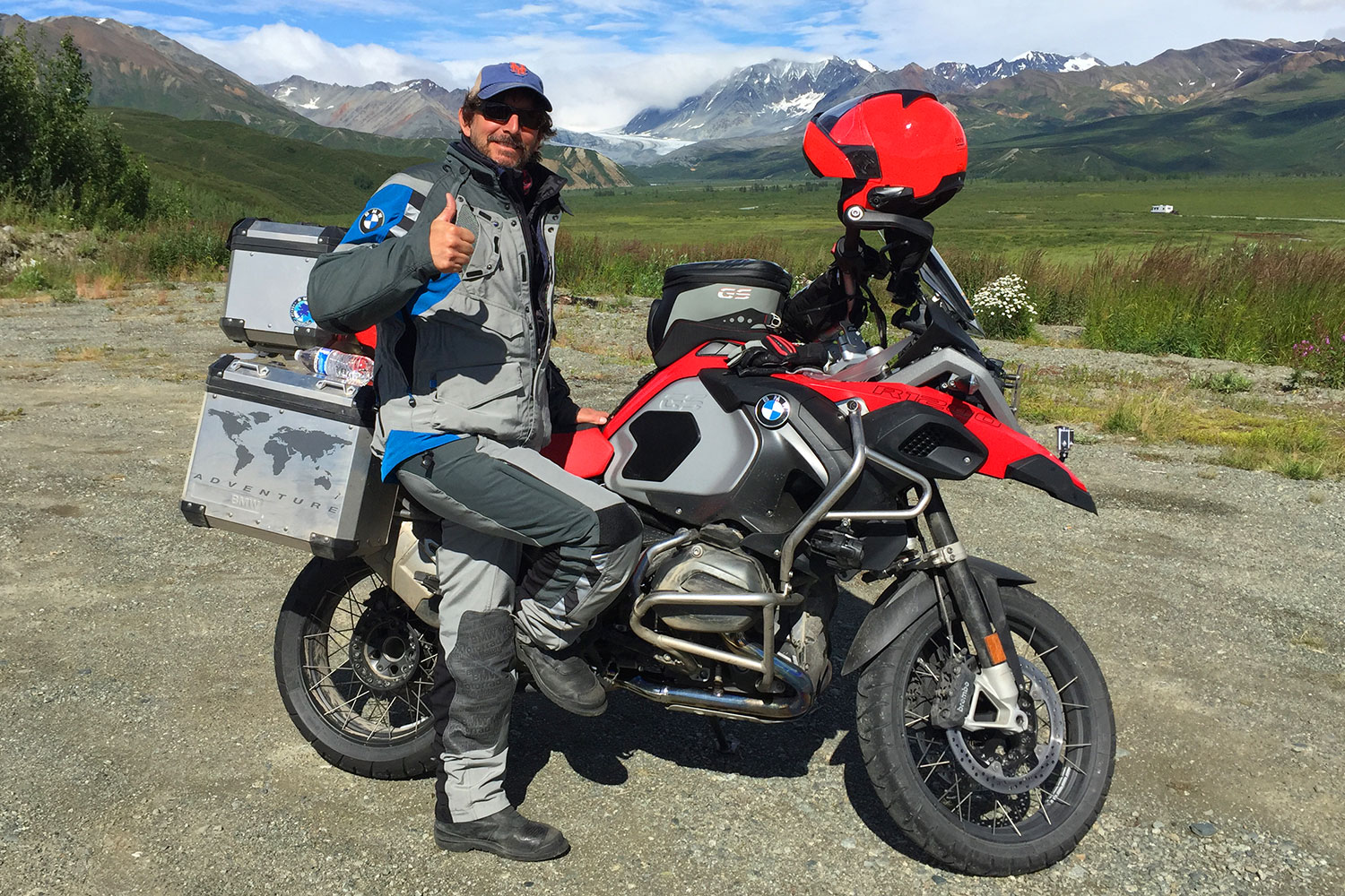
Our guest on Episode 30 of the Rider Magazine Insider Podcast is Scott Moreno, founder and owner of IMTBIKE Motorcycle Tours and Rentals. Scott was born in New York City, raised in northern New Jersey, and has lived in Spain for the past 30 years. Scott founded IMTBIKE 25 years ago in Madrid when he purchased 8 BMW motorcycles and ran the company from his 5th story walk-up apartment in the old section of the city. IMTBIKE has since grown to include five touring and rental centers in Barcelona, Bilbao, Madrid, Málaga, and Lisbon, and it now has a fleet of over 200 new BMW motorcycles and 30 employees. IMTBIKE rents motorcycles, designs and provides self-guided and guided tours, and will even store your personal motorcycle at one of its centers. IMTBIKE has earned a reputation as one of the world’s best motorcycle touring operations on the planet. IMTBIKE has an 85% repeat rate among tour clients, and in 2021 it received a Travelers Choice Best of the Best award from TripAdvisor. For more information, visit IMTBIKE.com or send an email to [email protected].
You can listen to Episode 30 on iTunes, Spotify, and SoundCloud, or via the Rider Magazine Insider webpage. Please subscribe, leave us a 5-star rating, and tell your friends! Scroll down for a list of previous episodes.
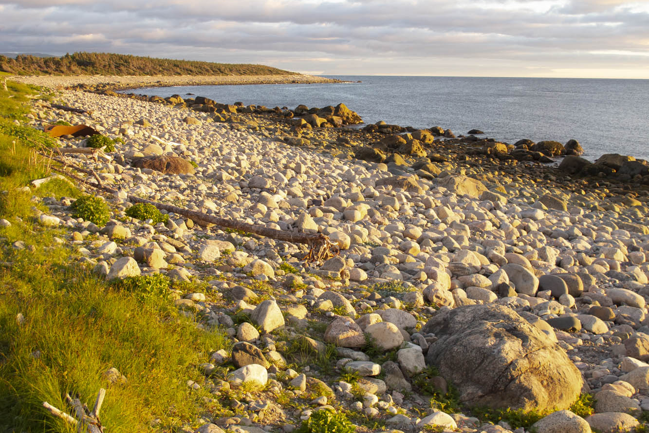
Newfoundland and Labrador, the easternmost province in Canada, fights a losing battle patching its roadways. Realizing it’s a lost cause, the province simply erects signs along the way warning “Potholes Ahead.” It’s a challenging slalom on a motorcycle, let alone in a car. I watch the suspension jolt on the van ahead carrying my wife and two teenage sons. New struts and an alignment are in order upon our return.
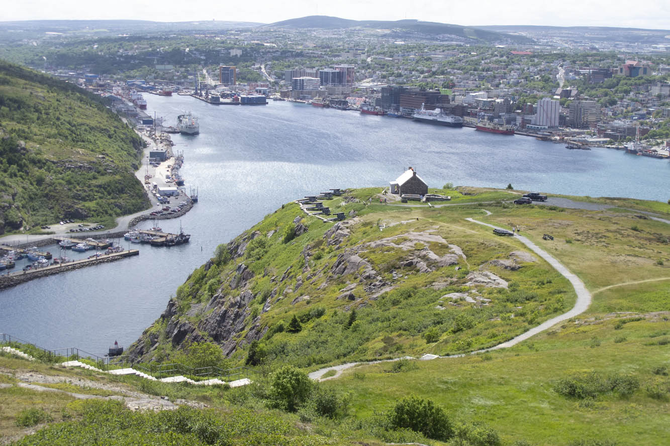
Signal Hill provides a panorama of St. John’s Harbour.
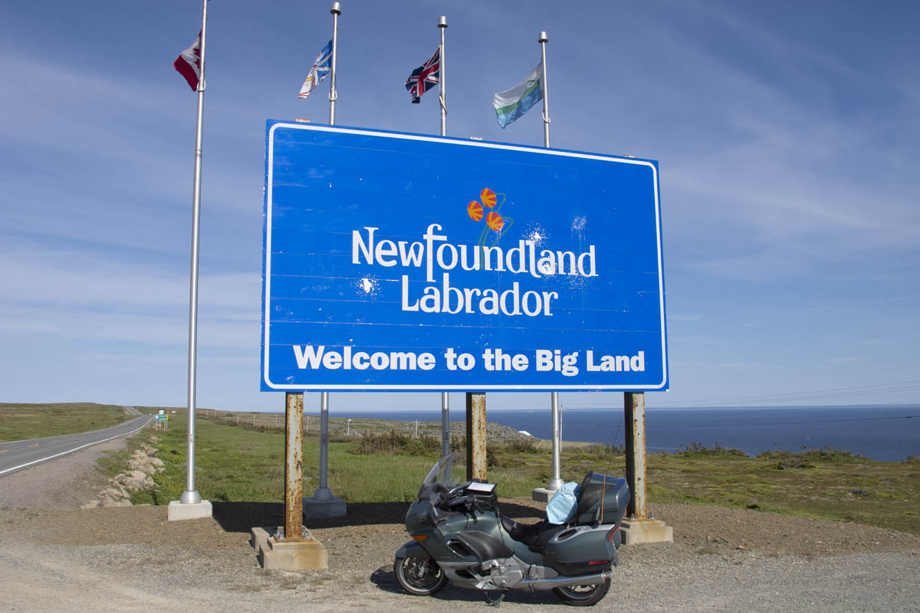
This is a cautionary tale about undertaking a “family vacation” when your family is in a van while you expect to experience the freedom of tagging along on your motorcycle. My wife, Nancy, has the notion of taking a ferry across the strait to coastal Labrador on the mainland to drive the mainly gravel Trans-Labrador Highway after we’ve finished our tour of Newfoundland. I, on the other hand, have serious reservations about adventure biking on my 850-pound beast of a BMW K1200LT, now with more than 200,000 miles on it. So, we will part ways after the ferry crossing to Labrador. And soon thereafter I would learn a bit of humility from some Canadian riders.
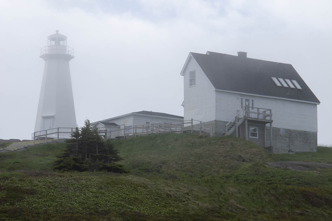
Fog shrouds a lighthouse at Cape Spear, the easternmost point in North America.
Meanwhile, we have arrived on Newfoundland’s Avalon Peninsula after a 16-hour ocean crossing from North Sydney, Nova Scotia. We enter fog and wind on our southern loop around the peninsula by way of Trepassey Bay, common weather features in this part of the country. But conditions improve at Lord Baltimore’s Colony of Avalon, the best preserved early English colonial site in North America. Archaeologists continue to dig as we tour the area. At the nearby Tetley Tea Room by the Sea, we sample our first Newfoundland cod and wild berry treats.
Nearly 100 lighthouses once peppered the shorelines of Newfoundland and coastal Labrador, and we encounter our first ones at Cape Spear, the easternmost point in North America. One, dating back to 1836, is the oldest surviving lighthouse in the province. The more modern one, erected in 1955, houses an adjacent museum. Here we learn there are 23 staffed lighthouses remaining in the area. In the distance we saw Signal Hill, our next destination.
Twilight gilds the rocky west coast of Newfoundland’s Northern Peninsula.
We negotiated the downtown minefield of St. John’s to reach a better perspective of the city from Signal Hill National Historic Site. The narrow harbor entrance drove many a sailing ship to peril. A colorful regiment of signal corps were practicing for their daily tattoo in front of Cabot Tower, a sandstone Gothic Revival structure begun in 1898 to commemorate the 400th anniversary of Italian John Cabot’s discovery of Newfoundland and the 60th anniversary of Queen Victoria’s reign. Marconi received the first wireless transatlantic transmission here in 1901.
The Canadian Signal Corps regiment practices at Cabot Tower on Signal Hill.
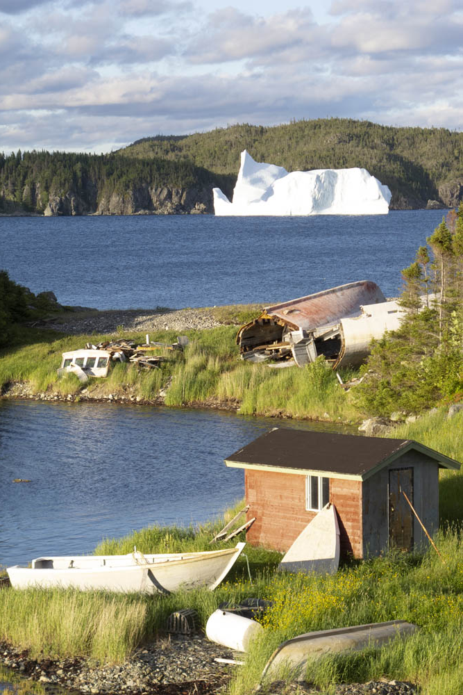
Icebergs like this one in Smith’s Harbour on the Baie Verte Peninsula float into coves and inlets aided by the wind and tide.
Nancy wanted to explore downtown St. John’s, while I desired to escape Newfoundland’s capital and largest city. Changed my mind at lunch in a rathskeller dive where we were served outstanding cod burgers and I discovered Iceberg Beer. St. John’s Quidi Vidi Brewery claims it is enhanced by pure 20,000-year-old iceberg water. I detect crispness in this pale lager that similar brews lack. Our two boys, both crew rowers, were excited to find out from our friendly waitress that the Royal St. John’s Regatta is North America’s oldest continuing sporting event. That’s appropriate, since St. John’s is the oldest English-founded city on the continent.
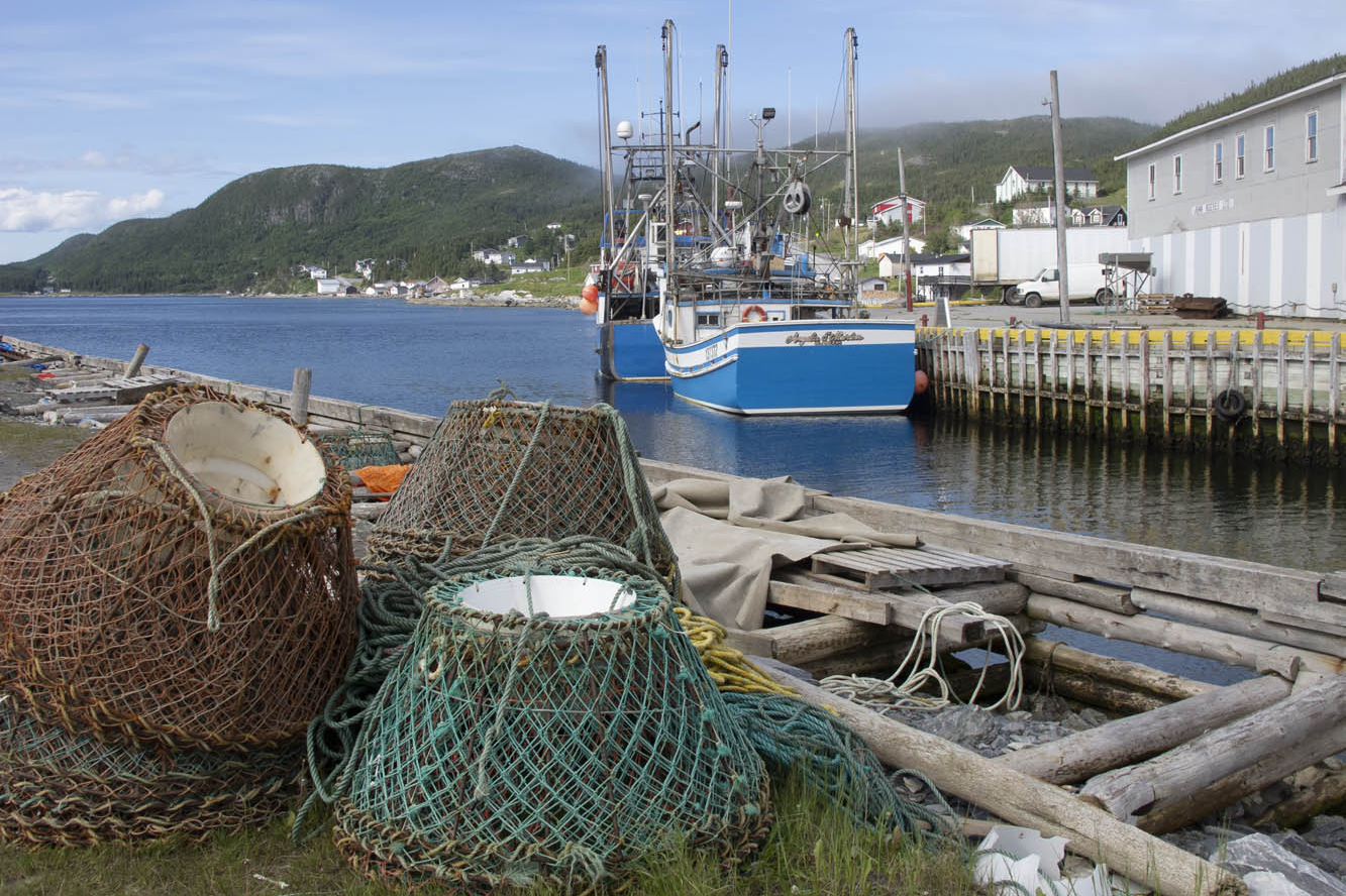
Crab pots and trawlers stand ready at Port au Choix along the Gulf of St. Lawrence.
The Trans-Canada Highway leads us inland through the Eastern Region. Insidious longitudinal potholes jar the unwary. Canadians whoosh by, heedless of the hazard. My shocks are taking a beating, and they were leaking even before this trip. We set up camp at Notre Dame Provincial Park in the Central Region, and I take to the van for exploration around Twillingate. At Boyd’s Cove, we visit the Beothuk Interpretation Centre to learn about the extinct native inhabitants of Newfoundland.
In a tiny outpost called Clarke’s Head, I backed the van into a local’s vehicle at a gas station. “See what trouble I get into when I’m off the bike?” I say to my wife. The Newfoundlander was almost apologetic for being in my way, and we parted in friendly fashion. I can’t imagine that happening back in New York.
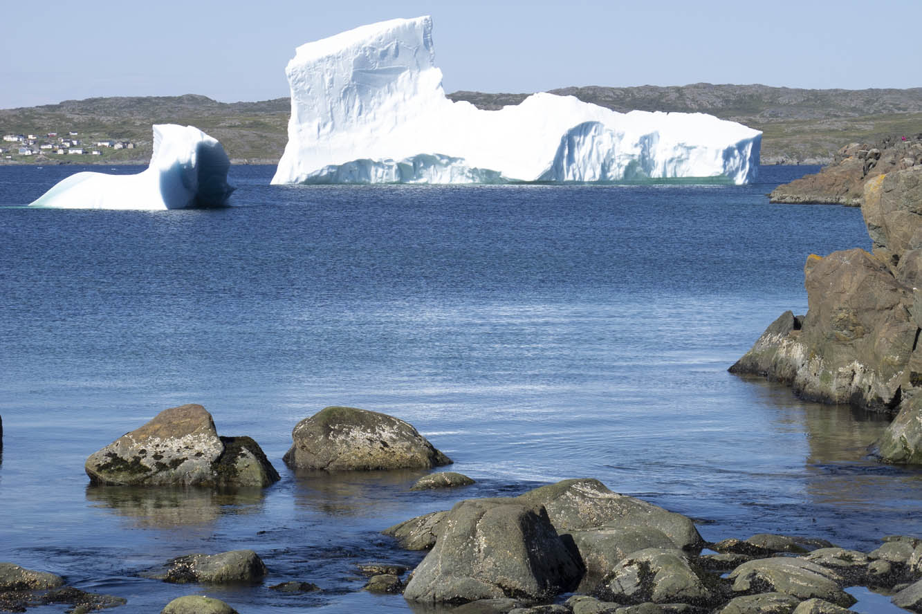
Iceberg Alley extends into the harbor at St. Anthony on the tip of the Northern Peninsula.
I mounted the bike for our next excursion up the Baie Verte Peninsula. The 50-foot skeleton of a humpback whale was worth scrutinizing at King’s Point. On the way to the tip of the peninsula at Fleur de Lys, we diverted to Smith’s Harbour, having learned that a huge iceberg had settled there. Indeed it had, and a picture perfect little place it was. These bergs drift off from the Labrador Current into nearby harbors, bays, and coves brought here by the wind and tide.
Back in the town of Baie Verte we learned about the peninsula’s rich mining history. Indeed, we passed a huge abandoned asbestos mine on the way to Fleur de Lys, where soapstone was quarried by the Dorset Paleo-Eskimo some 1,600 years ago. After reaching the end of the road, we were about to turn around when a pickup raced up and blocked our way.
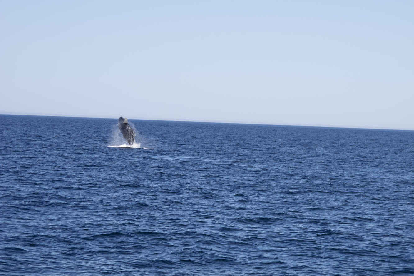
A humpback whale breaches in St. Anthony Harbour on the Northern Peninsula.
The driver turned out to be a friendly local resident who noticed our New York license plates and wanted to chat. Encounters like this were common for us throughout Newfoundland.
So far, our progress was slow. Stopping frequently and visiting the numerous outport villages didn’t accumulate the mileage. Many were the dead-end roads we explored. I reviewed my mileage log once we were in the Western Region: 70 miles one day, 105 miles the next, followed by 90 miles, 62 miles, then zero, zero. Aaaughh!
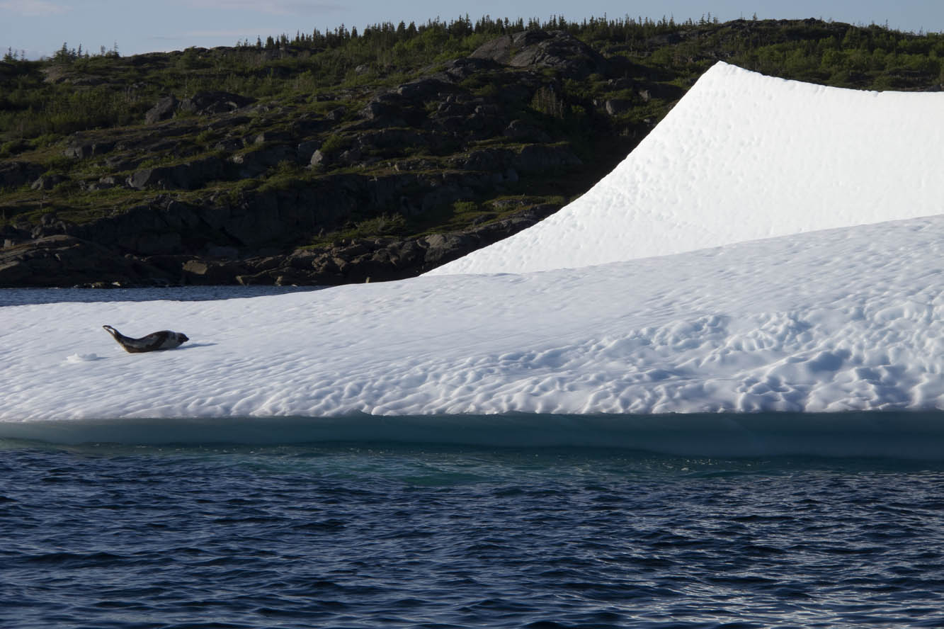
A seal basks on an ice floe.
I finally rode a 200-mile day from Baie Verte to Trout River campground in Gros Morne National Park. This area is a UNESCO World Heritage Site defined by ancient up-thrust landscape forming the tip of the Appalachian Mountains. The Tablelands region exposes examples of the earth’s mantle. Glaciers carved out a fjord at Western Brook Pond, where we took a boat ride beneath 2,000-foot cliffs. Ice fields cling to crags, offering summer habitat to the caribou and puffins.
If there was a central point to this wilderness, it would be picturesque Rocky Harbour, sheltered by a lighthouse promontory and twin Appalachian ridges dipping into the Gulf of St. Lawrence. The Gros Morne Wildlife Museum in town is worth a look. The Ocean View Hotel displays unique local artwork and hosts the Anchor Pub, where one can be “screeched in” as an official Newfoundlander. The boys were greatly disappointed they weren’t allowed to drink the rum and kiss a codfish. Earl’s restaurant offered moose burgers, moose soup, moose pizza, and any other variety you’d like. We left sated.
Norsemen landed here in 1,000 A.D.
I gave the BMW free reign on Route 430 up the western coast of the Northern Peninsula, a smooth-surfaced road flowing alongside the Gulf of St. Lawrence, with the Long Range Mountains framing the eastern horizon. Felt like being back on Highway 1 in California. This is the Viking Route that would lead us to the first established European settlement in North America at the very tip of the Northern Peninsula. It also has the largest density of moose on the continent, and we had already seen several.
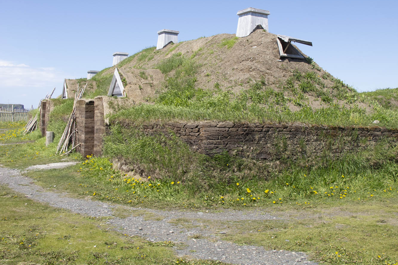
We had fun interacting with interpreters at L’Anse aux Meadows National Historic Site, location of the Viking presence here in 1,000 A.D. We walked through a reconstructed encampment of turf-walled longhouses while re-enactors stayed in character demonstrating the daily life of the Norsemen. Our tour continued at nearby Norstead, a living history site of additional costumed interpreters and a fully replicated Viking ship.
Reconstructed sod huts replicate the Viking village as it would have appeared 1,000 years ago at L’Anse aux Meadows.
We hit paydirt in St. Anthony, viewing a harbor filled with icebergs. A boat tour brought us up close to these ice cathedrals. A humpback whale breached for us several times. A pod of minkes came alongside the boat. A seal reclined upon his private ice floe. We absorbed the opportunity, because two days later the icebergs had broken up, which can happen quickly we were told. By mid-July any icebergs become a rare sight.
A ferry took us across the Strait of Belle Isle to coastal Labrador. A 50-mile ride brought me along the strait and over the mountains to Red Bay, a 16th-century Basque whaling port. Red Bay also offers access to the Trans-Labrador Highway, and this is where my family and I parted company. I had reservations aboard a supply ship that routinely sails upstream to replenish harbor towns with no connecting roads along the Quebec coast.
Around the promontory in the background of this coastal Labrador village rises Canada’s second tallest lighthouse and an ideal spot for whale watching.
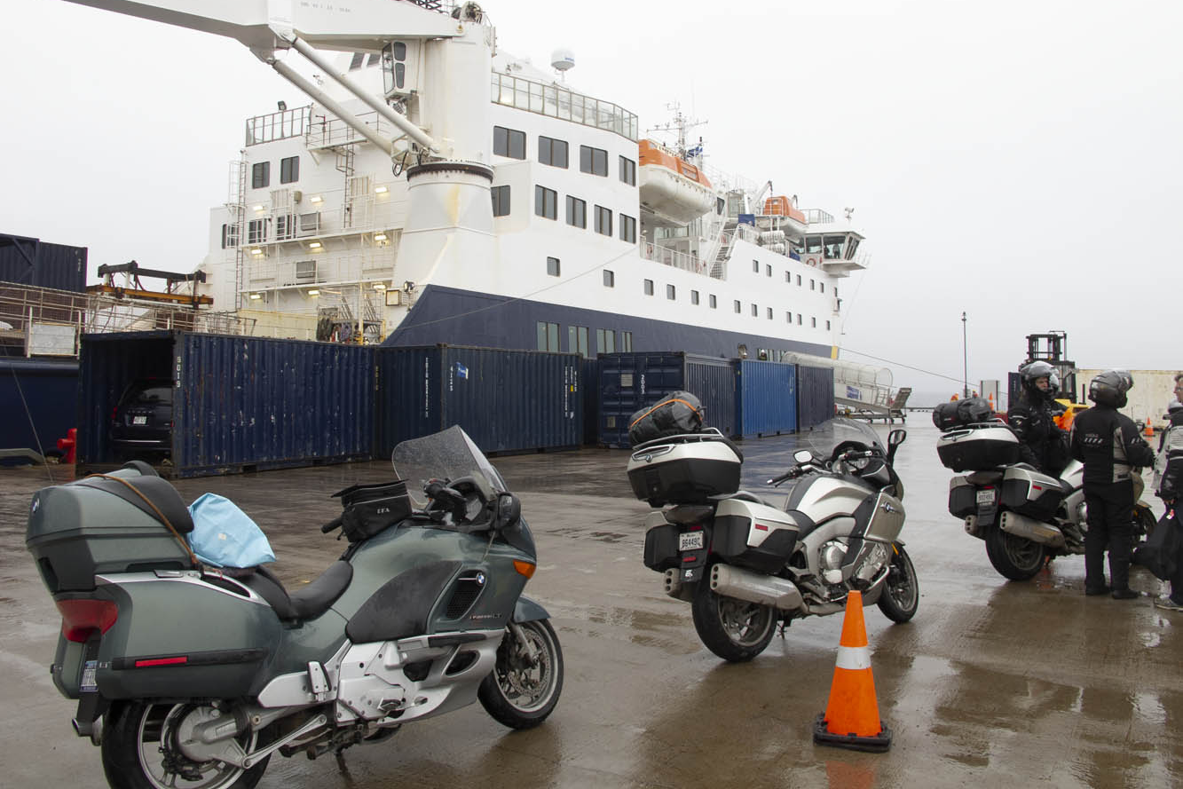
I returned to the ferry landing at Blanc-Sablon, Quebec, and lined up with other motorcyclists early on a rainy morning. The bikes were loaded two to a container, tied down, and hoisted by a mammoth boom crane into the vessel. Two Honda ST1300 riders humbled me because they had just completed the Trans-Labrador trek. We would disembark where the road begins anew in Natashquan. Or so we thought.
Circumstances changed upon reaching the village prior to Natashquan hours behind schedule. We all had reserved respective B&B inns in Natashquan, where we wouldn’t arrive now until the wee hours of the morning. We learned there was indeed a 20-mile road from the village to Natashquan, but it was all gravel. Nonetheless, all riders, except me, decided they would disembark here and risk the unfamiliar road in the midnight blackness.
Riders lined up for loading into the supply ship heading up the Gulf of St. Lawrence and coastal Quebec.
Now, I’ve ridden my share of gravel roads, I told them. Even did the 1,200 miles of Alaska Highway when it was unpaved. But I was much younger and more fearless. My concern today was dropping my precious K1200LT, resulting in thousands of dollars in cosmetic damage. But my bike shared a container with one of theirs, and all looked askance at my weak rationalization. To regain self-respect, I agreed to accompany them.
It turned out to be the most anxiety-inducing 20-mile ride of my life. Inky blackness and bunched gravel had me plowing from one side of the road to the other, trying to find a tractable groove. It didn’t help that I was reluctant to get the speed up. One of the Canadians on his Kawasaki Tengai remained behind me for assurance, urging me to stand on the pegs and go faster, while the rest shot ahead. Such humiliation, I thought. When we finally caught up, the group was parked at a pullout on the outskirts of town.
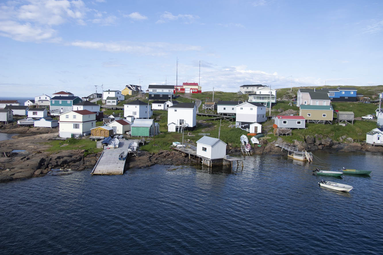
Harrington Harbour was one of our supply ship’s many stops to replenish ports along coastal Quebec not connected by any roads.
“How’d he do?” asked one of his Canadian co-riders.
After a slight pause and a sly smile directed at me, he replied, “Slow, but steady.”
And with that turn of phrase, my newfound Canadian friend preserved my dignity, eliciting congratulatory backslapping and an acknowledgment of a successful ride all-around by the French-Canadians in a language universally understood.
The next day, while imagining my wife and boys bouncing along the rutted Trans-Labrador – views blocked by boreal forest and swatting at clouds of black flies – I rode 390 blissful miles of coastal Quebec. Open-road freedom never felt so good.
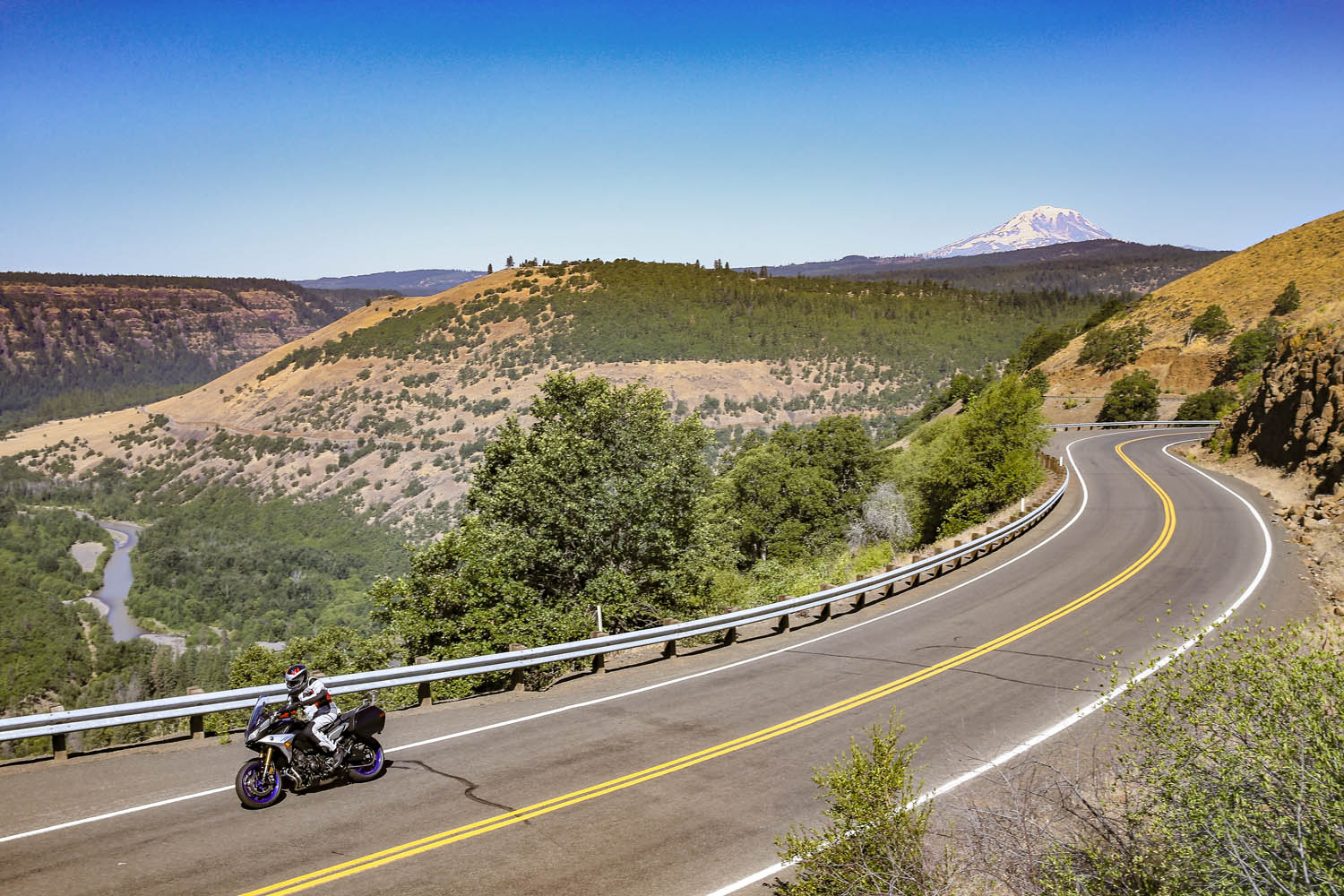
Road testing the 2019 Tracer 900 GT in Washington’s Klickitat River valley, with Mount Adams in the background. (Photos by the author & Brian J. Nelson)
Winding through a dark canopy of evergreens, the road played hide-and-seek with the Clackamas River, offering a glimpse here and there of clear water pouring over rocks as it made its way downstream to the Willamette, then the Columbia, and finally the Pacific. A break in the canopy was like popping out of a tunnel and I set my eyes on a patch of gravel next to the road, just a few feet from where the river made a sharp turn. Down went the Yamaha Tracer 900 GT kickstand, off went the ignition. I hadn’t seen a car for miles. It was just me and the trees and the river. Just what I was looking for.
Emerging from a dark tunnel of trees on the West Cascades Scenic Byway, I found the perfect sunny spot to enjoy the sights and sounds of the Clackamas River.
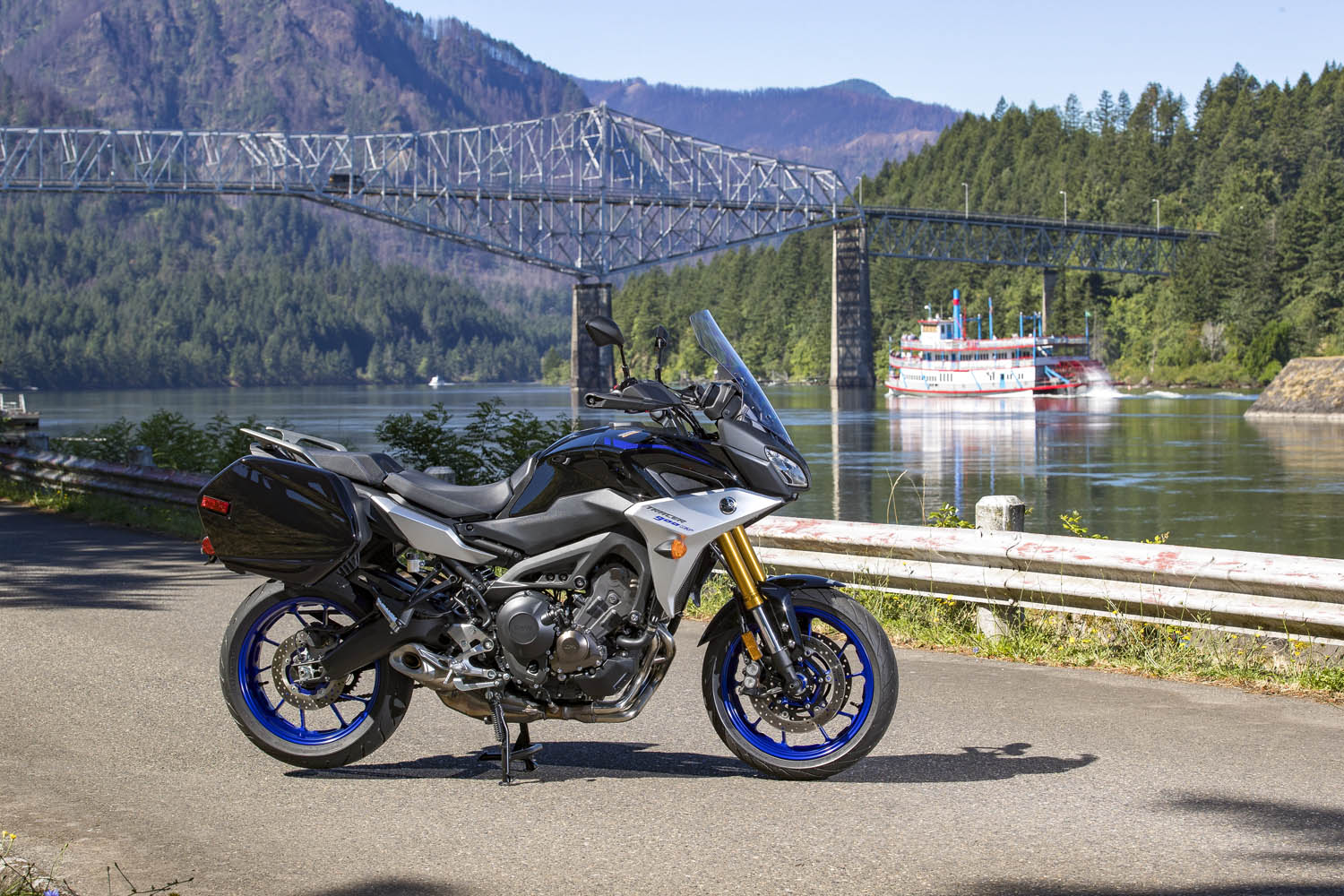
The previous day I logged 250 miles aboard the Yamaha at the bike’s press launch. The event was based in Stevenson, Washington, a small town in the heart of the Columbia River Gorge National Scenic Area, and I spent a long, hot day testing the GT on local backroads. Weighing just 500 pounds and packing a punch from its 847cc inline-Triple, the Tracer 900 GT is a light, agile, comfortable sport-tourer, perfect for a solo traveler. Yamaha entrusted me with the keys to one for the long ride home to Southern California.
With snow-capped volcanic peaks, wild and scenic rivers, dense evergreen forests, and countless roads that follow the contours of the land, the Cascade Range is a motorcyclist’s paradise.
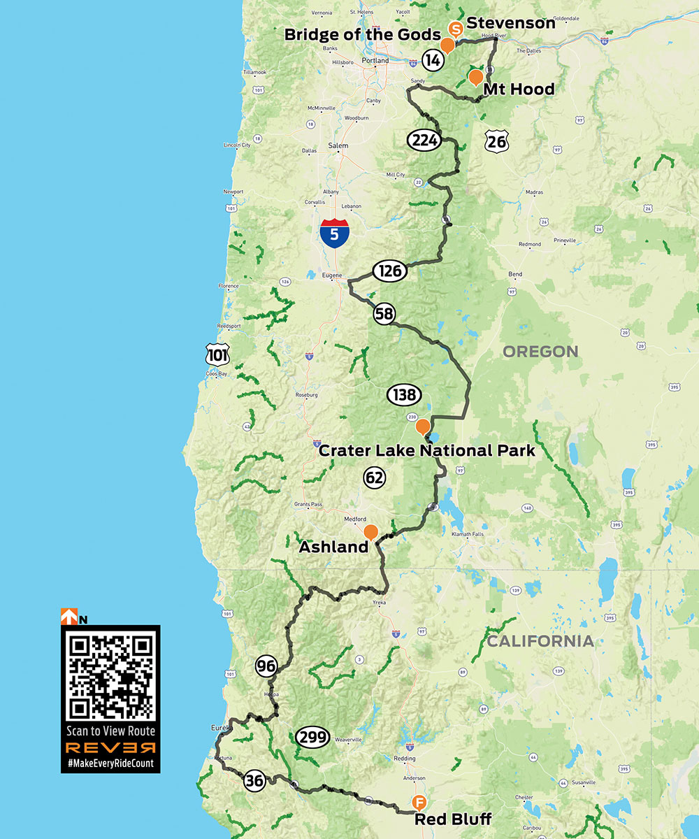
For years I’ve heard and read about how good the riding is in the Cascades, a mountain range that runs from British Columbia down through Washington and Oregon to Northern California. Whenever possible, I like to fill in the blank spots on my mental map –to experience first-hand what roads and scenery are really like. So I sketched out a route from the Columbia River to the California border that zigzags several times over the Cascades, winds its way through four national forests and one national park, and follows three designated scenic byways. Like any good motorcycle route, it would take at least twice as long as a more direct path.
The ride route from Stevenson, Washington, to Red Bluff, California.
With the GT’s saddlebags packed and a tailbag strapped to the passenger seat, I hit the road at 6 a.m., crossing the mighty Columbia – and into Oregon – on the Bridge of the Gods, a steel truss bridge named after a natural dam that was created by a landslide at the same location nearly 1,000 years ago. The narrow, 90-year-old bridge has no pedestrian walkway, but it’s where the Pacific Crest Trail crosses the river, so weary hikers with heavy packs must contend with cars and trucks.
The Bridge of the Gods spans the Columbia River, which forms the border between Washington and Oregon.
What makes the Cascades special is its many stratovolcanoes –the cone-shaped variety we learned about in grade school –that rise thousands of feet above the surrounding mountains. I’ve ridden along the eastern side of the Sierra Nevada in California dozens of times, and every time I pass through the town of Lone Pine, I struggle to pick out Mount Whitney – the tallest mountain in the lower 48 states – from the neighboring peaks that are nearly as tall. On the Tracer 900 GT press ride we saw several volcanic peaks, Mount Adams (12,281 feet) and Mount St. Helens (8,363 feet – before it blew its top in 1980, it was 1,300 feet taller) in Washington, and Mount Hood (11,249 feet) in Oregon, standing head and shoulders above the landscape, easily visible from miles away. They’re part of the Cascade Volcanic Arc, a series of 12 volcanoes stretching from Mount Silverthorne in British Columbia to Mount Lassen in California, which is part of the Pacific Ring of Fire –more than 450 volcanoes scattered along the outer edge of the Pacific Ocean.
When Washington’s Mount St. Helens erupted in 1980, it literally blew its top, erasing 1,300 feet from its peak. This view is from McClellan Overlook, off Curly Creek Road, in Gifford Pinchot National Forest.
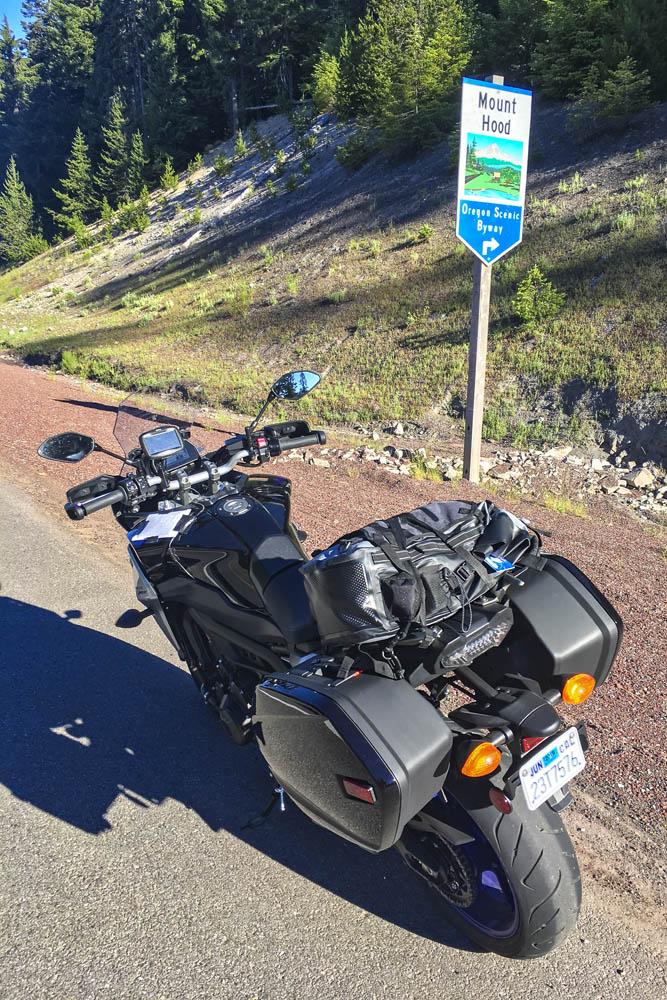
Like a good omen, snow-covered Mount Hood greeted me as I turned south on State Route 35, the beginning of Mount Hood Scenic Byway, where I rode through apple farms on a sunny, cloudless July morning. The previous day topped out at 105 degrees, and the heat wave wasn’t done with me, but early in the morning the byway along the East Fork Hood River was still in deep shadow and my teeth began to chatter. On went the heated grips, and I tried to hold onto the physical memory ofbeing cold, hoping to recall that feeling during theheat of the day (it never works). With graceful curves and smooth pavement, the byway is a pleasure to ride, especially when the screen of trees falls away and Mount Hood takes center stage, framed perfectly in brilliant blue.
Mount Hood Scenic Byway, one of many scenic byways that meander through the Cascades, cuts a wide arc around its namesake peak.
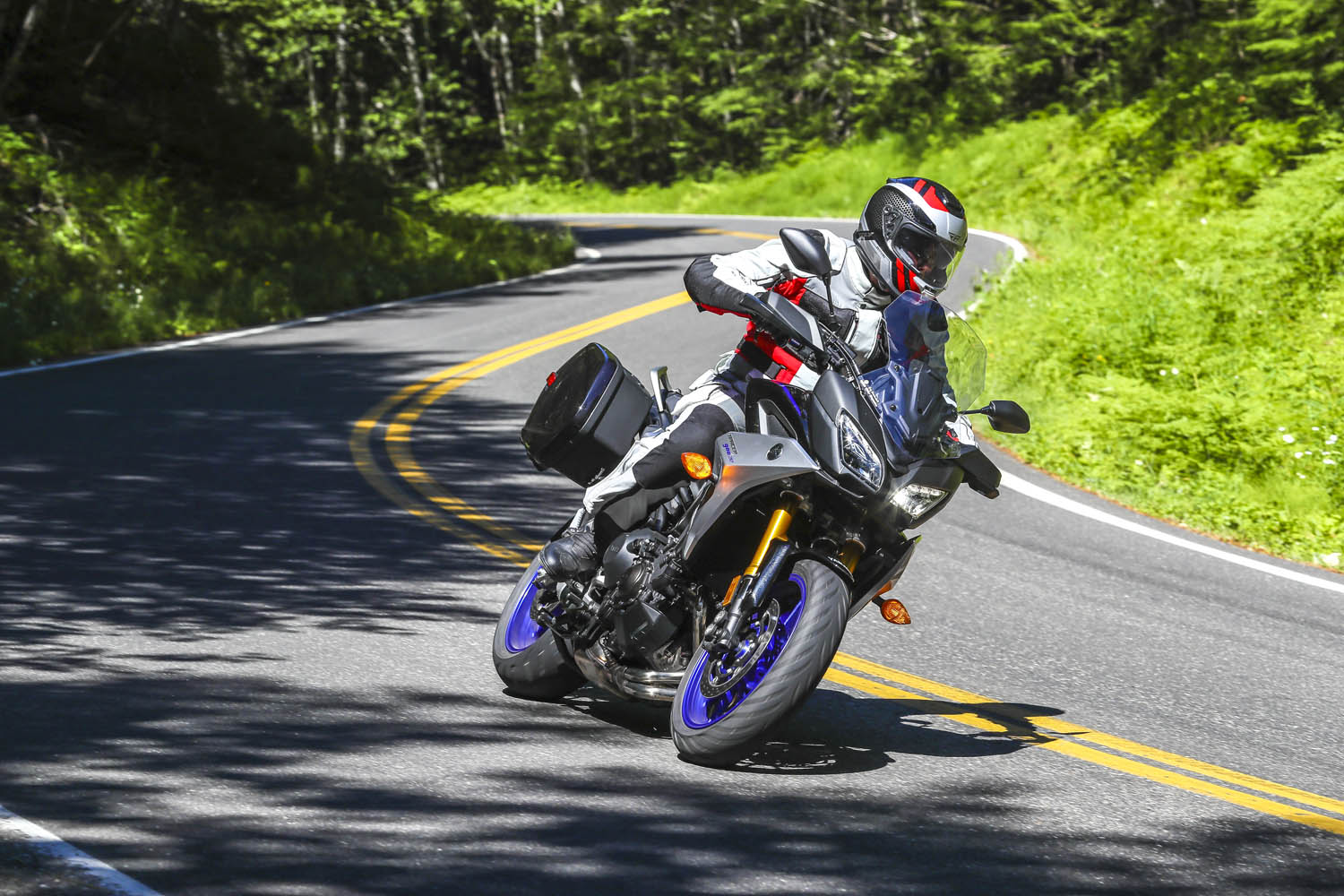
After cutting a wide arc around the eastern and southern sides of Mount Hood, my first crossing of the Cascades came to an end in Sandy. Turning south and then east on State Routes 211 and 224, I picked up the West Cascades Scenic Byway, heading southeast along Estacada Lake and North Fork Reservoir, two finger lakes created by dams on lower sections of the Clackamas River. As the byway crosses into Mount Hood National Forest, it enters a deep, narrow valley as it climbs up into the Cascades, where the Clackamas flows wild and free. The Tracer and I were in a groove, experiencing this road together for the first time –bends, kinks, dips, rises, bridges, blind corners, and fleeting views of the river, the contours of which give the road its character.
A postcard view of Oregon’s Mount Hood from Bennet Pass Trailhead, just off State Route 35 on the Mount Hood Scenic Byway.
With the low-fuel light on, I pulled into Detroit, a crossroads on the shore of Detroit Lake. Folks were starting their summer weekend early. Subarus laden with kayaks and pickups overflowing with camping gear were parked in lots, coolers were being filled with ice and beer. I refueled and scarfed an egg salad sandwich in the shadow of Rivers Run Deli, trying to stay cool while enjoying a view of the marina and the lake’s milky blue water. When traveling solo and covering a lot of miles in just a few days, I rarely stop for long. Just a few minutes here and there, then I’m back in the saddle, trying to cram 10 pounds of riding into a 5-pound sack.
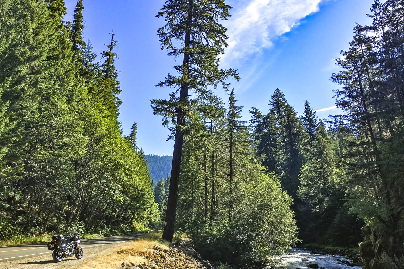
Roads in the Cascades often carve their way through lush forests, with the curving pavement winding in and out of shadows.
From Detroit to Chemult – south, zig west, zag east, back over the Cascades –all I remember are trees, and a cross-section of America. Stopping to use the bathroom at a McDonald’s, I had to negotiate my way through a crowd of boisterous kids wearing matching blue T-shirts bearing the name of their church summer camp, ready to fill their bellies with Happy Meals. Outside, two young women were sitting on the curb, holding a sign: Family in Need. And next door I topped off the Tracer’s tank after the flirtatious – not to mention bald and tattooed – gas station attendant handed me the nozzle. (In Oregon and New Jersey, you’re not allowed to pump your own gas, but attendants often let motorcyclists break the law.) I was just passing through, little more than an observer. Experiences like these give me something to mentally chew on while ticking off miles.
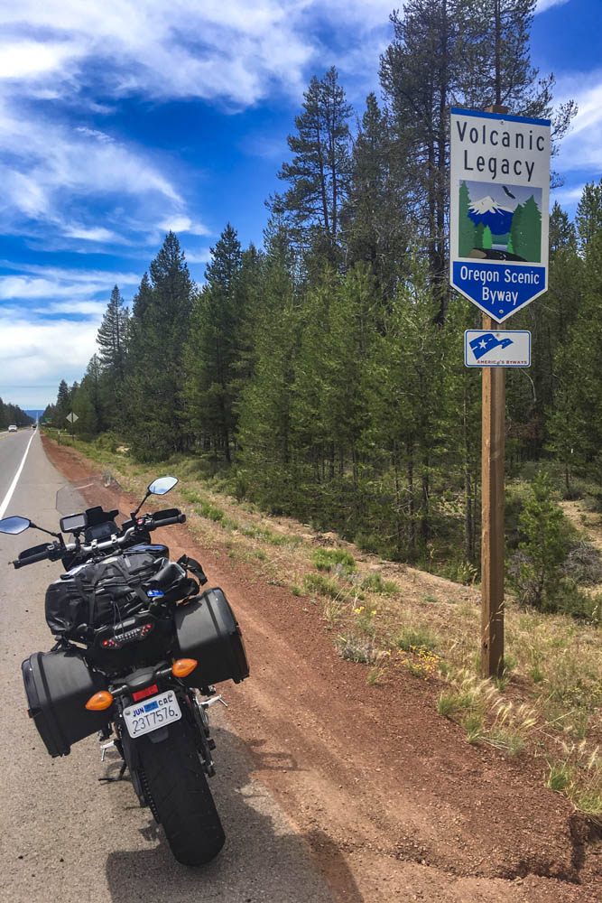
The 500-mile Volcanic Legacy Scenic Byway runs through Oregon and California, connecting volcanic peaks in the Cascades.
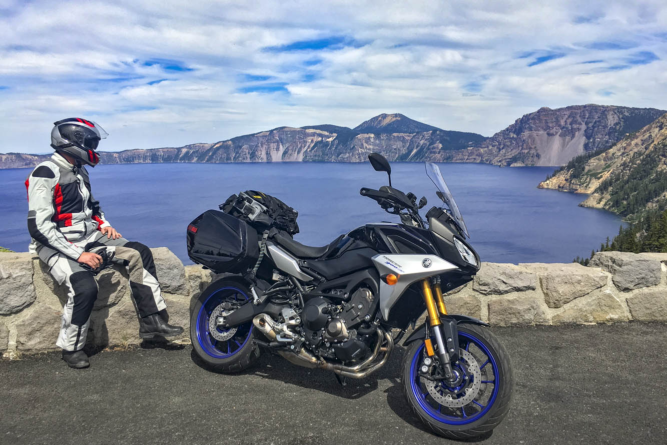
Passing through Chemult, a truck stop on U.S. Route 97 brought back memories of stopping there to refuel during my one and only SaddleSore 1000 ride back in 2013 – a very long day that I’m not likely to repeat. Turning west on State Route 138, the Volcanic Legacy Scenic Byway took me to Crater Lake National Park, where I queued up behind a rumbling Harley and a line of cars and RVs outside the northern gate, keeping my faceshield closed to prevent the army of mosquitos from waging war on my nose. Crater Lake was high on my list of must-see places, and it didn’t disappoint. Created thousands of years ago when a volcano collapsed, the caldera lake is nearly 2,000 feet deep – the deepest in the U.S. – and because it is filled only by rain and snow, the water is pure and a brilliant shade of blue. But I was pressed for time and there were construction delays on the East Rim Road, so I’ll have to go back to ride the full loop.
Taking in the brilliant blue of 2,000-foot-deep Crater Lake, a collapsed volcano filled with thousands of years’ worth of rain and snow.
On the not-politically-correct but wonderfully twisty Dead Indian Road, I descended from the green heaven of the Cascades into the dry, brown hell of Ashland. It’s actually a lovely little town, home to Southern Oregon University and the world-famous Oregon Shakespeare Festival, but it was over 100 degrees and I had been in the saddle for 12 hours. I was in desperate need of a cold shower, a colder beer, and some pizza.
The next day I left the Cascades, riding a few miles south on Interstate 5 into California, where I filled up at a Chevron in Hornbrook. On both sides of the interstate and all around the gas station, the ground and vegetation were charred black from the Klamathon Fire, which roared through just days earlier. It was one of many wildfires that would plague California and other western states in the weeks and months ahead.
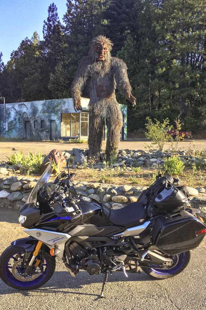
More blanks filled in on my mental map: State Route 96 along the Klamath and Trinity rivers, which cuts through rugged, remote country. In 1941, a group of armed men stopped traffic near the town of Yreka, handing out a Proclamation of Independence for the State of Jefferson, which was in “patriotic rebellion against the States of California and Oregon.” Although the new state never materialized, the movement is still active, and the State of Jefferson Scenic Byway runs along Route 96 from State Route 263 to Happy Camp. After that, 96 becomes the Bigfoot Scenic Byway. Regardless of one’s views on state politics or mythical forest dwellers, the riding along Route 96 is sublime and traffic is almost nonexistent.
Sasquatch sighting in Happy Camp, California, on State Route 96, where the State of Jefferson Scenic Byway turns into the Bigfoot Scenic Byway.
At Willow Creek, I turned west onto State Route 299, known as the Trinity Heritage Scenic Byway because it follows the path of 19th-century gold miners and pioneers. It snakes its way through the heavily wooded Trinity Alps and climbs over a pass before making a long descent to the coast. Even in mid-July, U.S. Route 101 through Arcata, Eureka, and Fortuna was socked in with chilly fog. At Alton, I turned east again, heading inland on State Route 36 –not a designated scenic byway, but known as Serpent to the Sea. Traveling west-to-east, it passes through a few rural communities before entering Grizzly Creek Redwoods State Park, where enormous coast redwoods rise hundreds of feet above the roadside.
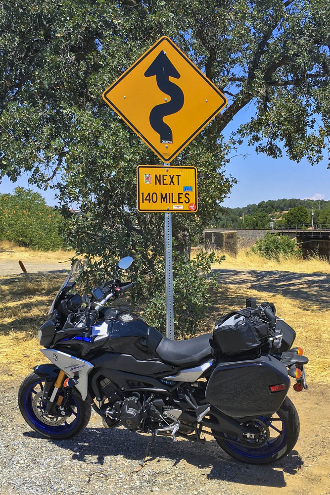
Beyond Bridgeville, Route 36 turns into a narrow goat path as it goes over a ridge, but it’s currently being straightened and widened to accommodate big trucks and RVs –an improvement for them but not for motorcyclists. East of Dinsmore, Route 36 was freshly paved, like having a racetrack all to myself, scraping the Tracer’s peg feelers in corner after corner. And on it goes, over more mountains with endless curves and finally roller-coastering its way through ranch land with blind crests and sudden drops and quick turns. As I approached the town of Red Bluff, just before Route 36 crosses I-5, I found the well-known sign that warns motorists and entices motorcyclists: curvy roads next 140 miles.
This sign tells motorcyclists everything they need to know. Good times ahead!
The thing about riding roads as good as these is that it becomes addictive. Now that I have experienced the Cascades and California Routes 96 and 36 for myself, all I want to do is go back for more.
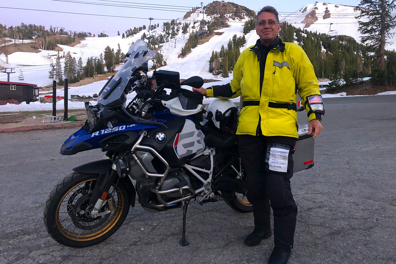
Our guest on Episode 29 of the Rider Magazine Insider Podcast is Greg Rice, a long-distance rider who has logged more than 783,000 miles on motorcycles. He’s a member of the Iron Butt Association and has completed nearly 200,000 miles on IBA-certified rides. Greg has ridden nearly 50,000 miles in Iron Butt Rallies, and he has completed 70 Bun Burner Gold rides – on each BBG he rode more than 1,500 miles in 24 hours. We talk about how he got into long-distance riding, how he plans and prepares for each ride, what motorcycles he has ridden, what modifications he makes to his bikes, and what gear and apparel he uses. If you’ve ever wanted to do an Iron Butt ride, listen to Greg’s advice on how to do so safely and successfully. Visit his website for useful tips and to find out “where’s Greg?” using his SpotWalla tracker.
You can listen to Episode 29 on iTunes, Spotify, and SoundCloud, or via the Rider Magazine Insider webpage. Please subscribe, leave us a 5-star rating, and tell your friends! Scroll down for a list of previous episodes.
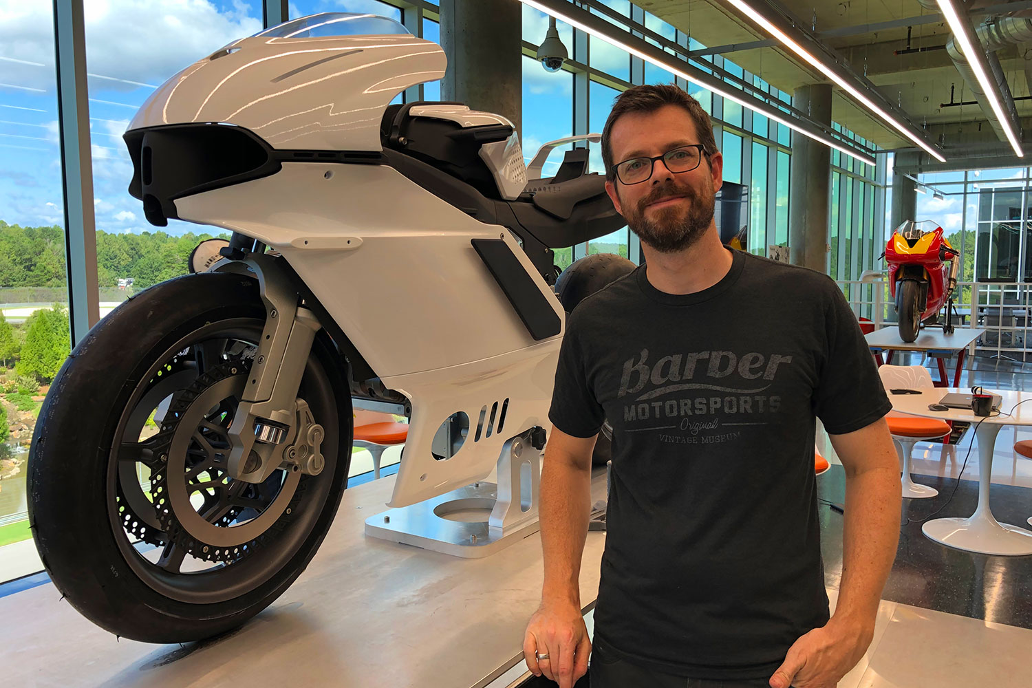
Our guest on Episode 28 of the Rider Magazine Insider Podcast is Brian Case. Brian is an industrial designer is the former Chief Designer for Confederate Motorcycles. From 2008 to 2018, he was Co-Founder and Design Director for Motus Motorcycles, where he led the design and development of the MST V-4 sport-tourer. Brian joined the Barber Vintage Motorsports Museum in 2019, and last year he became the Director of the new Barber Advanced Design Center. He and his team are working with Pierre Terblanche on the Mono Project, a reimagining of Terblanche’s iconic, ’90s-era Ducati Supermono racebike using state-of-the-art techniques such as 3D printing.
You can listen to Episode 28 on iTunes, Spotify, and SoundCloud, or via the Rider Magazine Insider webpage. Please subscribe, leave us a 5-star rating, and tell your friends! Scroll down for a list of previous episodes.
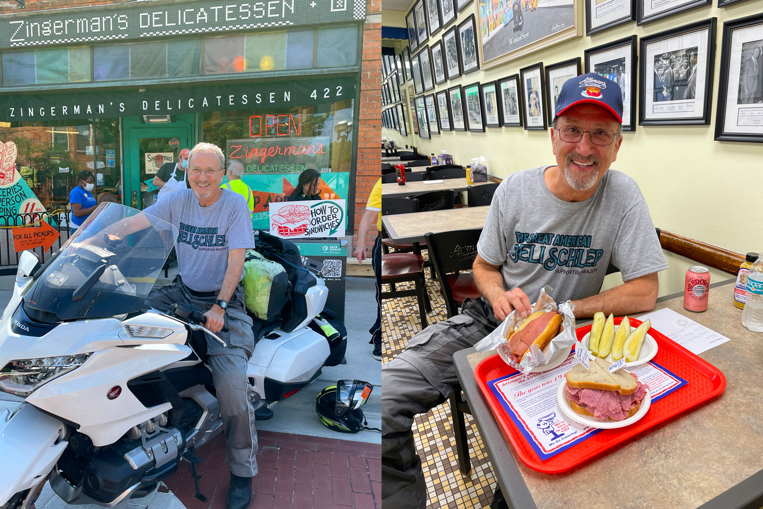
Our on Episode 27 of the Rider Magazine Insider podcast is Steven Goode, a lifelong motorcyclist who has a has completed impressive long-distance motorcycle tours. In recent years, Steven rode 14,000 miles to the four corners of the U.S., 11,500 miles to visit all the lower 48 states, and 17,000 miles to visit nearly every national park America (read his story “One Ride, 47 National Parks” in the July 2021 issue of Rider). This past summer, Steven embarked on a 75-day, 15,000-mile ride around the country to visit the best Jewish deli in nearly every state. His journey became known as the “Great American Deli Schlep” and he raised nearly $20,000 for MAZON, a nonprofit organization that fights hunger. You can read about Steven’s deli tour in the December 2021 issue of Rider and on his blog (greatamericandelischlep.medium.com). Even though Steven’s trip is over, MAZON’s mission is not. Please consider making a donation at mazon.org/delischlep.
You can listen to Episode 27 on iTunes, Spotify, and SoundCloud, or via the Rider Magazine Insider webpage. Please subscribe, leave us a 5-star rating, and tell your friends! Scroll down for a list of previous episodes.
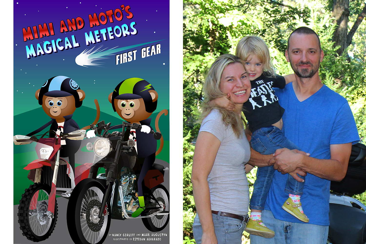
Our guests on Episode 26 of the Rider Magazine Insider Podcast are Nancy Gerloff and Mark Augustyn, the wife-and-husband team behind Mimi and Moto: The Motorcycle Monkeys, the children’s book series that introduces little kids to the world of motorcycles. Their first book, “The Adventures of Mimi and Moto: The Motorcycle Monkeys,” was published in 2016. In 2019, Nancy and Mark released their second book, “Mimi and Moto Ride the Alphabet.” That same year, Mimi and Moto took First Place at the Motorcycle Industry Council’s “Gas Tank” competition at AIMExpo in Columbus, Ohio. This year they have made available a pre-release, text-only version of their latest book in a new series, “Mimi and Moto’s Magical Meteors: First Gear,” and plan to release the hardcover early in 2022. All the Mimi and Moto books, as well as T-shirts, Snuggle Monkeys, Christmas ornaments, and stickers, are available at mimiandmoto.com.
You can listen to Episode 25 on iTunes, Spotify, and SoundCloud, or via the Rider Magazine Insider webpage. Please subscribe, leave us a 5-star rating, and tell your friends! Scroll down for a list of previous episodes.
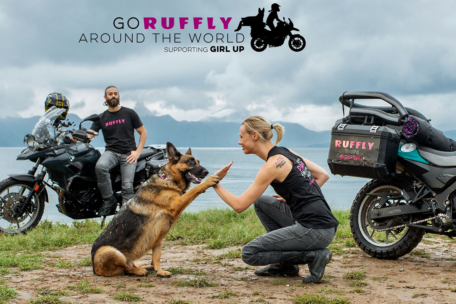
Our guest is Jess Stone, founder of Ruffly, a company that offers ethically made outdoor dog gear, such as collars, leashes, harnesses, and beds. Jess and her husband, Greg, started Ruffly after developing the K9 Moto Cockpit to carry their German Shepard, Moxie, on the back of Jess’ BMW G 650 GS. The K9 Moto Cockpit allowed Jess, Greg, and Moxie to enjoy motorcycle adventures throughout Mexico and Central America, and it is available through the Ruffly website. In 2022, Jess, Greg, and Moxie will travel around the world by motorcycle to raise funds for Girl Up, an organization that provides leadership development programs for girls in 130 countries and all 50 states. Their goal is to raise at least $100,000 to support girls’ empowerment. You can find out more and donate by visiting goruffly.com/world-adventure.
You can listen to Episode 25 on iTunes, Spotify, and SoundCloud, or via the Rider Magazine Insider webpage. Please subscribe, leave us a 5-star rating, and tell your friends! Scroll down for a list of previous episodes.
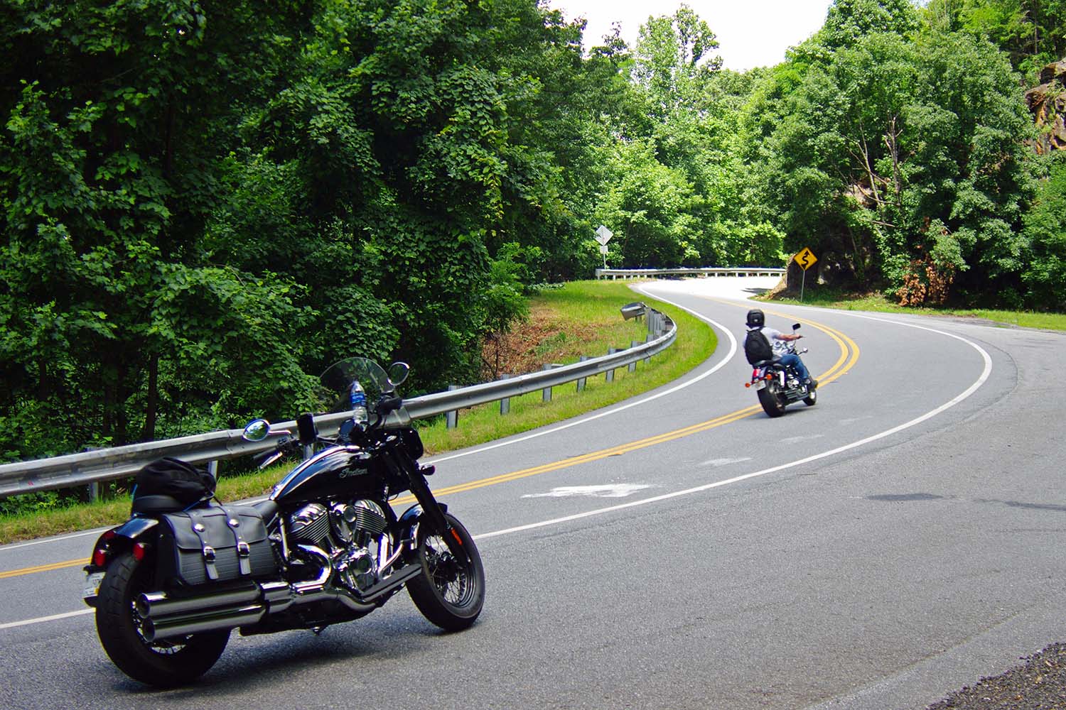
This rider is enjoying the curves along State Route 60 on his way to Two Wheels of Suches, which is an ideal spot to stop for a cool drink and to see cool motorcycles. (Photos by the author)
Formed roughly 480 million years ago, the Appalachians are a chain of mountains that stretch from Newfoundland, Canada, down to central Alabama. Eons of erosion have rounded and softened their edges, and rivers and creeks have cut deep creases within their slopes. The result is a nearly endless variety of roads that follow the contours of the land, attracting motorcyclists from far and wide like moths to a flame.
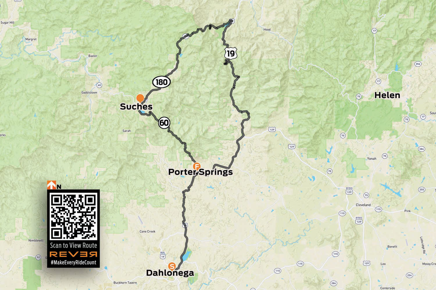
The Appalachian Trail begins in North Georgia, on Springer Mountain, not far from one of the best riding loops in the Southeast. The three sides of the Georgia Triangle are anything but straight. In fact, the triangular loop made up of U.S. Route 19 and Georgia State Routes 60 and 180 has some of the most challenging curves and best scenery in a region known for both.
The Georgia Triangle is located in the Blue Ridge Mountains just north of the charming, historic mountain town of Dahlonega. The three-road loop is located within the Chattahoochee National Forest, and there’s an abundance of streams, waterfalls, lush forests, and historic sites in the area. Add in numerous tourist attractions, activities, hotels, bed-and-breakfasts, campgrounds, and eateries, and you’ve got everything you need for a great day ride or a long weekend of exploration.
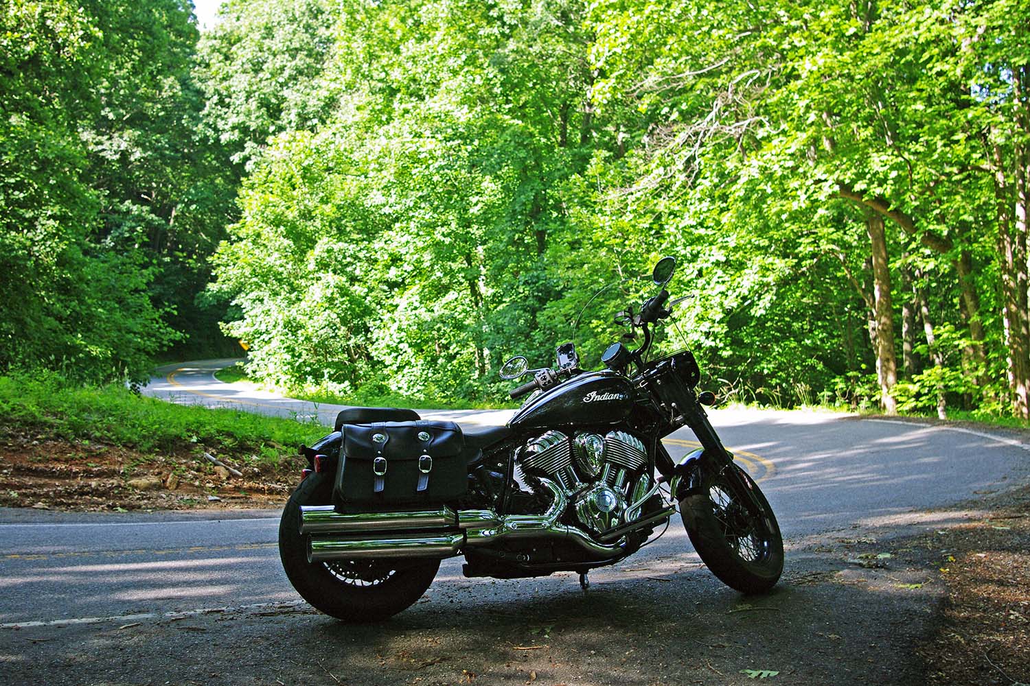
Plying the curves on State Route 180.
Six miles north of Dahlonega, the triangle begins where U.S. 19 meets State Route 60 at Stonepile Gap. Within the junction’s roundabout is a mound of stones that is said to mark the burial spot of Cherokee Princess Trahlyta. According to legend, Trahlyta was a beautiful princess kidnapped by a Cherokee warrior she refused to marry. Her dying wish was to be buried near her home on the mountain, though she probably didn’t imagine her grave would be surrounded by a ring of asphalt.
Riding north on Route 60 toward the town of Suches is the first leg of the triangle. If you have not been practicing your cornering skills, be cautious. These roads are not for the faint of heart. They can either be exhilarating or nerve-wracking, depending on your motorcycle’s cornering clearance and your comfort with tight S-curves and decreasing-radius turns. For the alert, confident rider, these roads offer an unforgettable riding experience, with gorgeous scenery and well-maintained pavement.
A shady spot on State Route 180.
About 5 miles up Route 60 is Woody Gap, and a look to the left reveals an expansive valley with Springer Mountain rising on the other side. The Appalachian Trail crosses the road nearby, and other stops on the road have signs and information about Civil War battles, gold mining sites, and hiking trails.
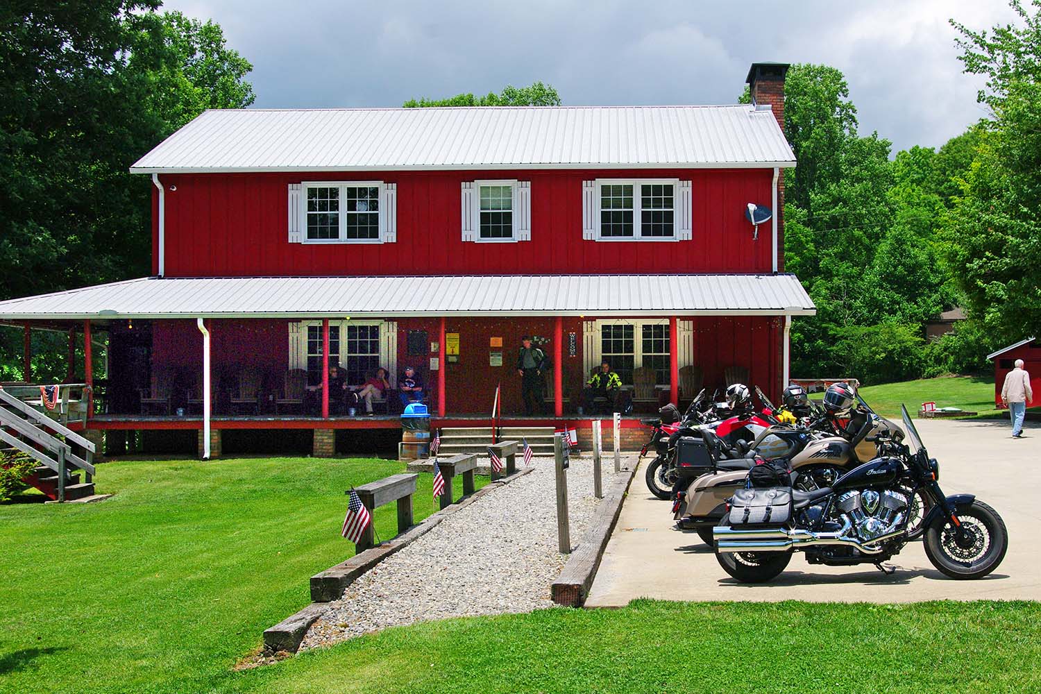
In the small town of Suches is a well-known motorcycle lodge and campground called Two Wheels of Suches, a popular meet-up spot. On weekends the parking lot is filled with bikes of all styles and vintages, and riders from all over. There’s an onsite restaurant that serves burgers, sandwiches, snacks, and drinks on Friday nights and weekends. The main lodge offers rooms for rent, and there are small cabins and campsites with a bathhouse on the property. A single-person campsite is $15/night, cabins are $65/night, and lodge rooms are $75/night.
Two Wheels of Suches is a motorcyclists’ oasis.
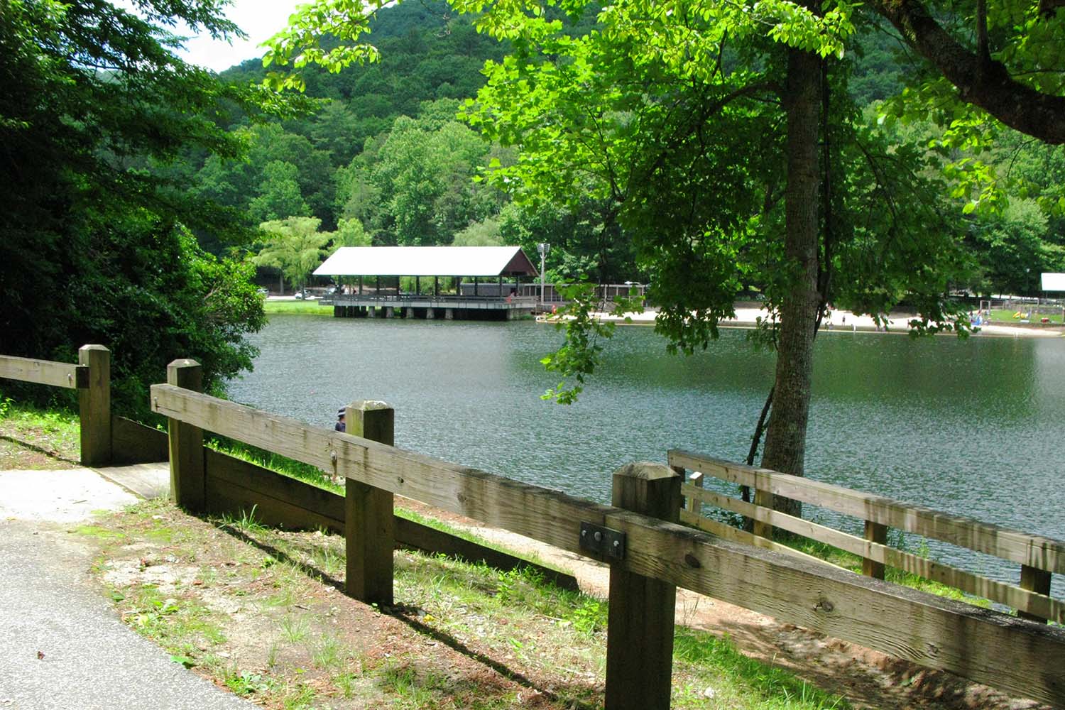
A stone’s throw from Two Wheels of Suches is the junction with State Route 180, also known as Wolf Pen Gap Road. This segment of the ride is without a doubt the most challenging leg of the triangle, with more tight curves and steep grades per mile than any other paved road in Georgia. The first few miles are a sedate and primarily straight two-lane blacktop leading to Lake Winfield Scott Recreation Area. When the lake’s emerald-green water is calm, it acts as a large reflecting pool for the mountains that surround it. And it is a particularly scenic spot in the fall when the leaves change color.
Once past the lake, the roller-coaster ride begins with a sign that says “Sharp Curves and Grades Next 5 Miles.” Route 180 snakes through the Sosebee Cove Scenic Area with speed limit signs on some curves reading as low as 10 mph, with nary a straight section of road. Stay sharp and heed the caution signs. The great thing about this section of the Georgia Triangle is that it’s only 11 miles long – the same length as the Tail of the Dragon in Tennessee – so you can ride it back and forth to your heart’s content.
Canada Creek passes through the Two Wheels of Suches property.
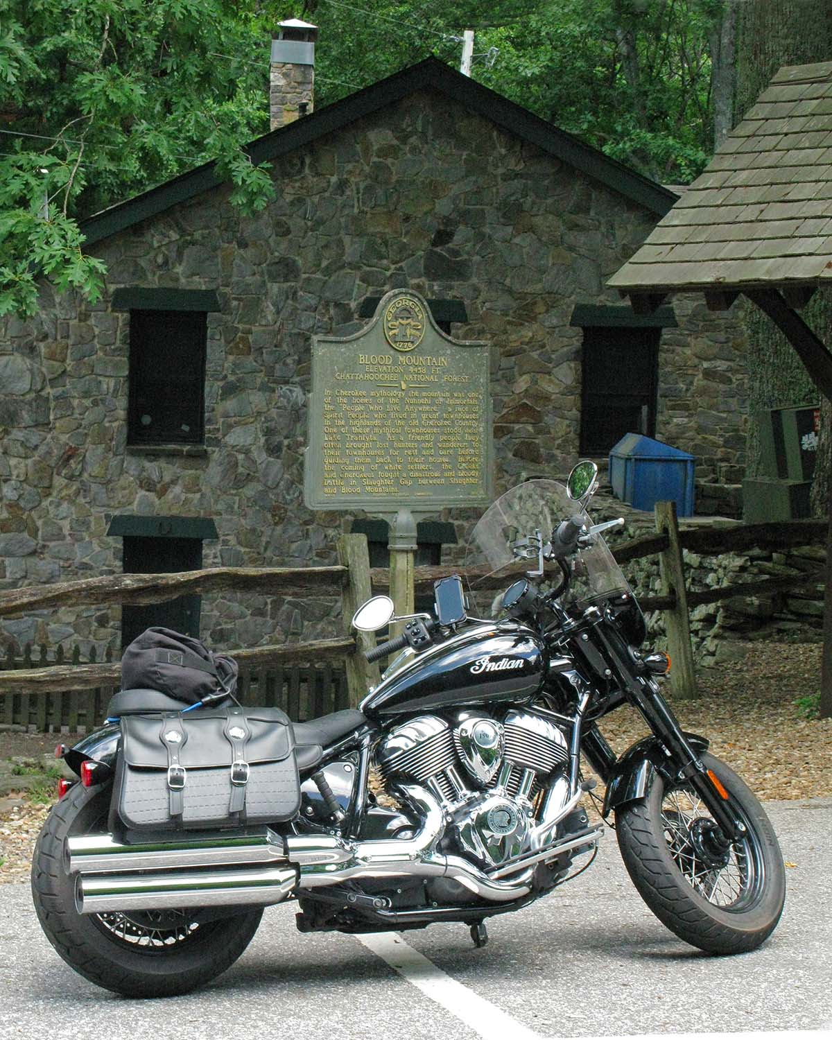
In Cherokee mythology, Blood Mountain, located within the Georgia Triangle, was home to the Nunnehi or Immortals. It was also the site of a fierce battle between the Cherokee and Creek tribes.
Just before Route 180 merges with U.S. Route 19, it passes by Lake Trahlyta, which is part of Vogel State Park. You can swim in the lake and stay in the park, which offers tent camping, RV sites, and rental cottages and yurts. Georgia is often hot and humid in the summer, even up in the mountains. I have stopped here on a hot day for a quick change and a swim, so pack your swimsuit.
Riding south on U.S. 19 is the last leg of the triangle. The road here is wider, with passing zones for easily and safely getting around slower traffic. Still, it has magnificent twisting sections of repeating S-curves and turns, great scenery, and worthwhile stops all the way back to the triangle’s starting point.
Lake Trahlyta is part of Vogel State Park, located in the northeastern corner of the triangle.
Continuing to the junction with Route 60 yields total mileage around the triangle of about 36 miles. The travel time for a nonstop ride is about 90 minutes at a reasonable rate of speed, but why hurry? The beautiful forest ride and options for stops make a leisurely pace worthwhile. Or, follow the lead of many motorcyclists and repeat the loop or run it in reverse. You won’t be bored, I promise.
Part of what makes the Georgia Triangle such a target-rich destination is that it’s a hub for other great rides in the area. Route 60 is a joy to ride not just to Suches but beyond, all the way to Route 76. From there, head east to Hiawassee, the scenic town on Lake Chatuge, or west to Route 515, which becomes I-575 and takes you to Atlanta.
A real estate investment opportunity on U.S. 19.
If you’re looking to explore further, taking Route 60S (also known as Murphy Highway) northeast at Mineral Bluff into North Carolina will lead you to U.S. Route 74 and the town of Murphy, North Carolina. Continuing east on U.S. Route 64 is a scenic ride through the Hiawassee River and Lake Chatuge areas, and several roads connect back to the Georgia Triangle area.
Continuing north on U.S. 19 past Vogel State Park, Route 180 breaks away again and continues east. A short hop on 180 takes you to State Route 348, also known as the Richard B. Russell Scenic Highway, another gem of a road. Or continue east on 180 to Brasstown Bald, the highest point in Georgia (4,784 feet), which on a clear day offers a 360-degree view of four states.
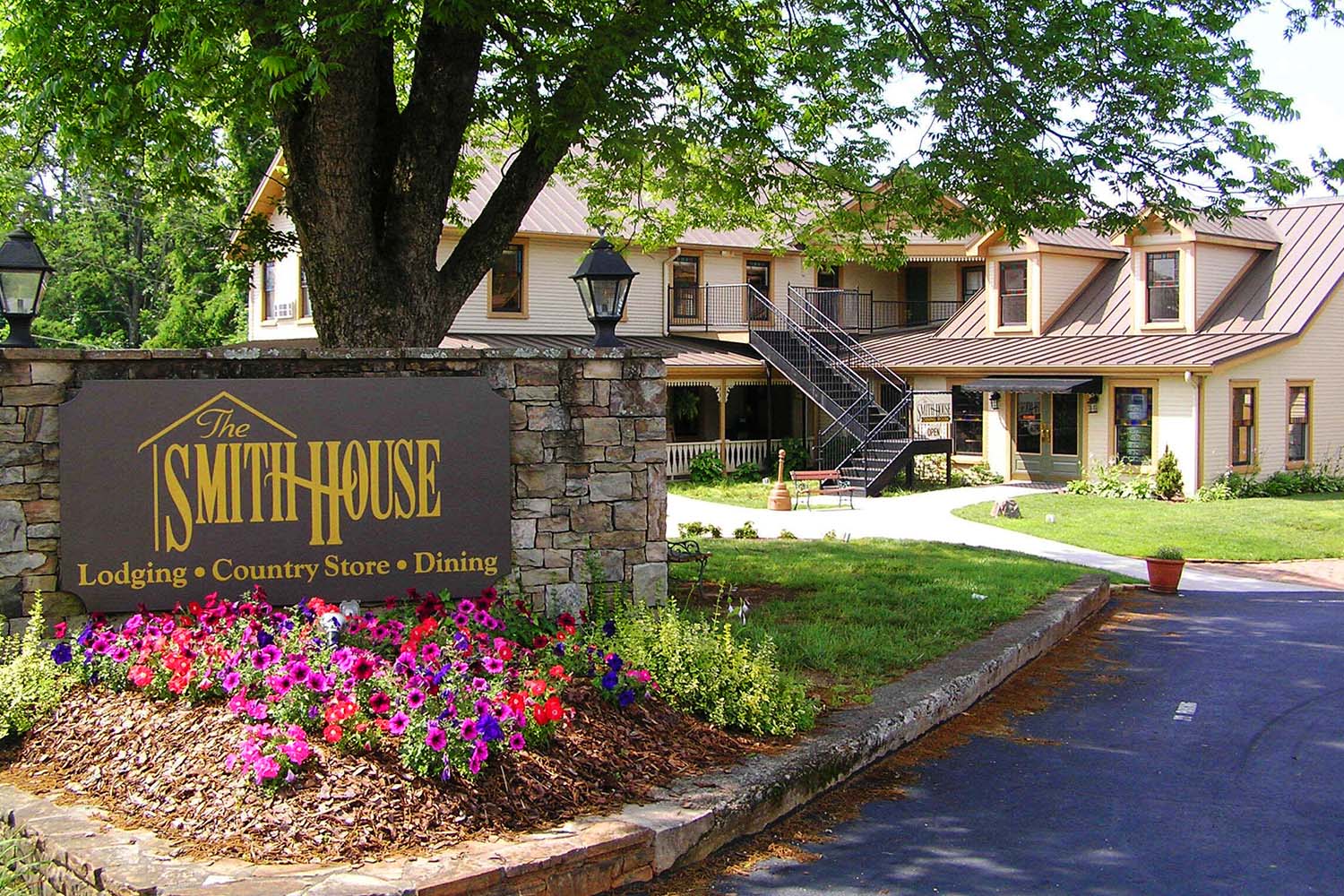
Ride to eat, eat to ride. The Smith House in Dahlonega serves some of the best country cooking in the region. Don’t wear tight pants.
If you are planning a stay in the area, Dahlonega is a charming, historic town known for its history of gold exploration and mining. Legend has it that in the 1540s, Spanish explorer Hernando DeSoto searched this area for El Dorado, the legendary lost city of gold. Dahlonega was the site of the second major U.S. gold rush in the early 1800s and still has active mines where visitors can pan for gold and gemstones. For lunch or dinner, I highly recommend the Smith House, which serves fried chicken, ham, sides, and desserts family-style, with platter after platter passed around long tables. Just to the east of Dahlonega is Helen, a quaint alpine-style village. Both towns offer many choices for lodging, dining, and shopping.
If you’re undecided about which road to ride first, throw a dart at the map – chances are wherever it lands, you’ll find a winner. North Georgia offers hundreds of miles of great roads to ride, and the Georgia Triangle is just the beginning.
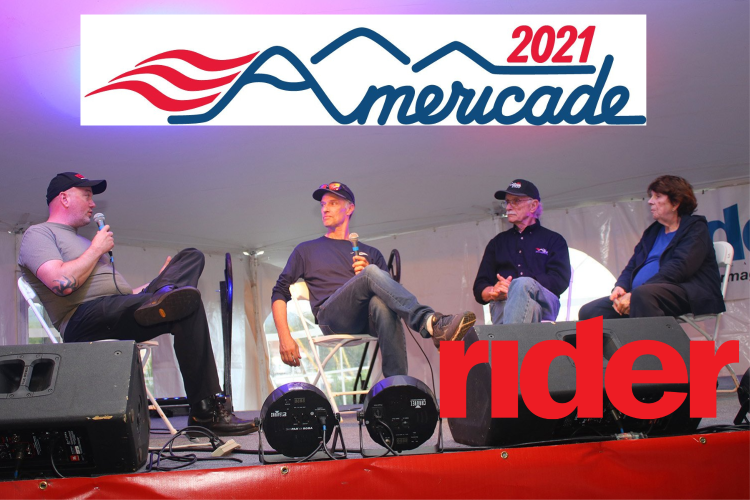
We conducted our latest podcast interview with a live audience at the Americade rally, held September 20-25, 2021, in Lake George, New York. Rider’s Editor-in-Chief Greg Drevenstedt interviewed the founders Bill and Gini Dutcher, and their son Christian, who is the Director of Americade, the Touratech DirtDaze Adventure Bike Rally, and Rolling Thru America. The first Americade rally, then called Aspencade East, was held in 1983 on the scenic shores of Lake George, nestled in the Adirondacks of upstate New York. The first event was a runaway success, and the event has grown steadily over the years to become the world’s largest touring rally. The Dutcher family talk about what the rally was like in the early days, and why motorcyclists from around the country return to Americade year after year. This is a special episode you don’t want to miss!
For more information about Americade, visit americade.com.